Farm and ranch photography from above offers a unique perspective that's essential for property owners and managers. You'll capture the true scale of your land, showcase boundaries, and highlight distinctive features. Aerial shots reveal seasonal changes, assess land health, and document conservation efforts. They're vital for enhancing property appraisals by accurately measuring size and revealing hidden features. You can visualize future development potential and create immersive virtual tours for potential buyers or investors. From crop monitoring to infrastructure planning, overhead imagery provides insights that ground-level photos simply can't match. Discover how this bird's-eye view can transform your understanding and management of agricultural properties.
Key Takeaways
- Aerial photography reveals the true scale and layout of farms and ranches, showcasing property boundaries and unique features.
- Drone imagery enables efficient virtual tours and marketing of agricultural real estate, streamlining the sales process.
- Overhead views aid in planning farm infrastructure, optimizing layouts, and improving land use efficiency.
- Aerial crop monitoring facilitates early detection of issues and supports data-driven management decisions for improved yields.
- Farm and ranch photography from above documents conservation efforts and enhances property appraisals with accurate assessments.
Capturing Scale and Scope
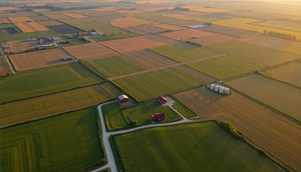
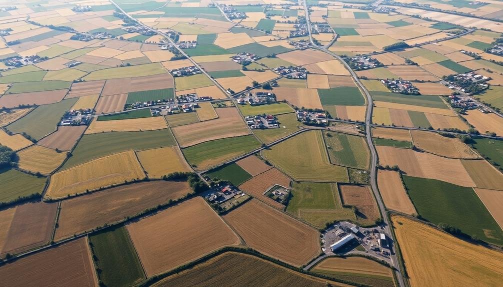
From high above, aerial photography reveals the true magnitude of farms and ranches. When you capture images from an elevated perspective, you're able to showcase the vast expanse of agricultural operations in a way that's simply impossible from the ground.
Aerial shots allow you to portray the sheer size of fields, pastures, and facilities, giving viewers a thorough understanding of the operation's scale.
You'll find that aerial photography is particularly effective for highlighting the layout and organization of large-scale farms and ranches. It enables you to capture the intricate patterns of crop rows, irrigation systems, and grazing areas.
You can also showcase the relationship between different elements of the property, such as barns, silos, and equipment yards.
Showcasing Property Boundaries

Aerial photography excels at showcasing property boundaries, a key aspect of farm and ranch documentation. You'll find that drone imagery provides a clear, thorough view of your land's perimeter, helping you visualize and communicate property lines effectively. This bird's-eye perspective allows you to identify potential encroachments, disputed areas, or natural boundaries that may not be apparent from ground level.
When capturing property boundaries from above, consider these factors:
| Technique | Equipment | Benefits |
|---|---|---|
| Orthomosaic mapping | High-resolution camera | Precise measurements |
| Thermal imaging | Infrared sensor | Detect fence line issues |
| 3D modeling | LiDAR scanner | Visualize terrain changes |
| GPS tracking | RTK-enabled drone | Accurate boundary marking |
| Multispectral imaging | Specialized sensors | Identify vegetation patterns |
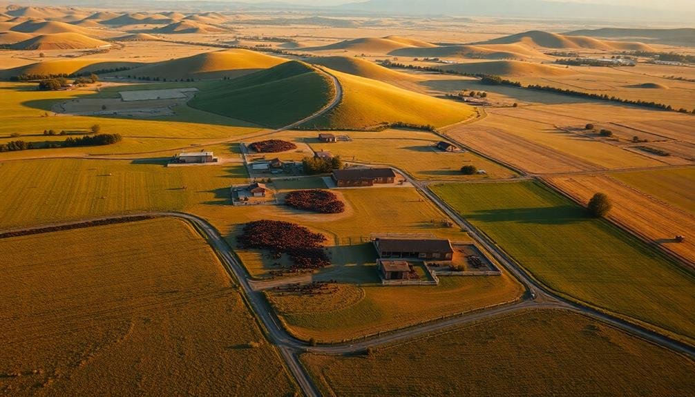
Highlighting Unique Landscape Features

Drone's-eye views offer unparalleled opportunities to showcase your farm or ranch's unique landscape features. From above, you can capture stunning images of rolling hills, winding rivers, or picturesque valleys that mightn't be visible from ground level.
These aerial shots highlight the natural beauty of your property, making it more appealing to potential buyers or visitors. You'll be able to emphasize distinctive elements like ponds, orchards, or rock formations that set your land apart.
Aerial photography can reveal hidden patterns in crop fields or pastures, showcasing your property's layout and agricultural practices. It's also an excellent way to capture seasonal changes, from blooming wildflowers in spring to vibrant fall foliage.
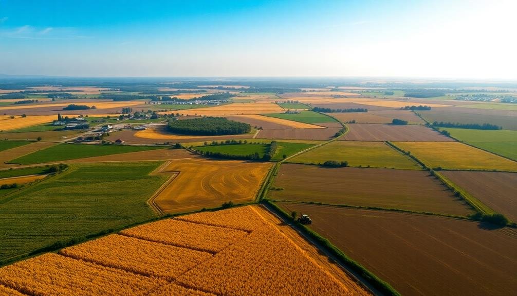
Seasonal Changes From Above

One of the most enchanting aspects of farm and ranch photography from above is the ability to document seasonal changes.
You'll capture the transformation of your land throughout the year, showcasing nature's dynamic palette. In spring, you'll witness the emergence of vibrant green fields and blooming orchards. Your aerial shots will reveal the intricate patterns of freshly planted crops and the first signs of new life.
As summer arrives, you'll see your fields transform into a patchwork of golden wheat and lush corn.
The aerial perspective will highlight the contrast between different crops and the orderly rows that stretch across your property. Fall brings a spectacular display of colors, with your camera capturing the rich hues of changing leaves and harvested fields.
Winter offers a unique opportunity to showcase your farm's stark beauty.
Snow-covered landscapes create a serene backdrop, emphasizing the structure of buildings and the layout of your land. You'll be able to track the progress of winter crops and observe how your property adapts to the colder months.
Assessing Land Health
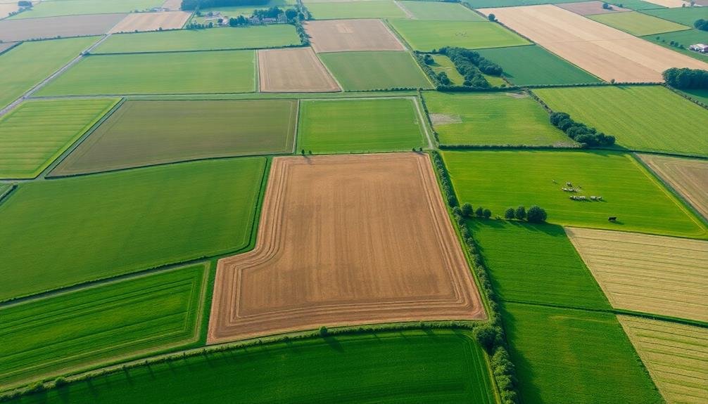
You'll find aerial photography invaluable for evaluating the health of your farm or ranch land.
By capturing images from above, you can analyze vegetation cover, detect areas of soil erosion, and map water resources across your property.
These insights allow you to make informed decisions about land management and conservation efforts, ensuring the long-term sustainability of your agricultural operations.
Vegetation Cover Analysis
Aerial photography offers a unique perspective for evaluating vegetation cover and land health on farms and ranches. When you analyze images taken from above, you'll gain valuable insights into the overall health of your land.
You can easily identify areas of dense vegetation, sparse growth, or bare soil, allowing you to make informed decisions about land management and conservation practices.
With aerial imagery, you'll be able to assess the distribution of different plant species across your property. This information helps you determine if invasive plants are spreading or if native species are thriving.
You can also track changes in vegetation cover over time by comparing images from different seasons or years.
Soil Erosion Detection
How can you spot soil erosion from the air? Aerial photography provides a unique vantage point to identify signs of soil degradation across your farm or ranch. Look for telltale patterns like gullies, rills, and bare patches that indicate active erosion.
You'll also notice changes in soil color, with lighter areas often revealing exposed subsoil where topsoil has been washed away. From above, you can detect sheet erosion by observing uniform soil color changes and the accumulation of sediment at the base of slopes.
Wind erosion becomes apparent through drifting soil patterns and the formation of small dunes. Pay attention to areas where vegetation is sparse or absent, as these are particularly vulnerable to erosion.
Aerial images allow you to track erosion progression over time by comparing current photos with historical ones. This temporal analysis helps you identify problem areas and assess the effectiveness of your conservation efforts.
Water Resource Mapping
Water resource mapping is a powerful tool for evaluating your land's health from above. By using aerial photography or drone imagery, you can gain valuable insights into the water resources on your farm or ranch. This technique allows you to identify and assess various water features, including ponds, streams, wetlands, and irrigation systems.
You'll be able to spot potential issues like water scarcity, drainage problems, or inefficient irrigation practices. Aerial imagery helps you visualize water flow patterns across your property, enabling you to make informed decisions about water management strategies.
You can easily detect areas prone to flooding or drought, and plan accordingly. Moreover, water resource mapping aids in monitoring the effectiveness of your conservation efforts.
You'll see how implemented practices, such as buffer strips or cover crops, impact water retention and quality. This information is essential for optimizing your water usage and improving overall land productivity.
Marketing Agricultural Real Estate
Showcasing agricultural real estate has been revolutionized by drone photography. When you're selling a farm or ranch, aerial images can make a significant impact on potential buyers. They provide a thorough view of the property's layout, boundaries, and features that ground-level photos simply can't capture.
With drone photography, you can highlight the full scope of the land, including fields, pastures, waterways, and structures. This bird's-eye perspective allows buyers to understand the property's topography and visualize its potential. You'll be able to showcase the relationship between different areas of the farm or ranch, emphasizing how they work together as a cohesive unit.
Aerial shots also help you stand out in a crowded real estate market. They're eye-catching and can pique interest, leading to more inquiries and potential sales. You can use these images in various marketing materials, from online listings to printed brochures.
Moreover, drone footage can provide virtual tours, allowing distant buyers to explore the property without an initial in-person visit. This can save time and resources for both you and potential buyers, streamlining the sales process.
Planning Farm Infrastructure
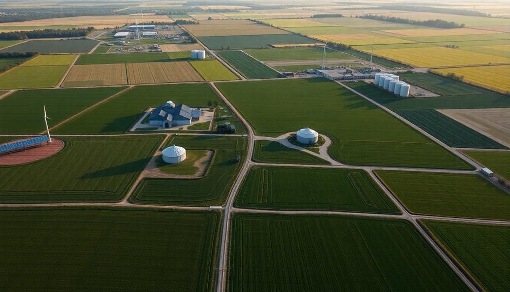
When you're planning farm infrastructure, aerial photography can be your best ally.
You'll gain a thorough view of your land, allowing you to visualize the ideal layout for buildings, roads, and equipment zones.
This bird's-eye perspective also aids in designing efficient irrigation systems and maximizing land use, ensuring every acre of your farm is utilized effectively.
Optimal Layout Visualization
Aerial photography offers farmers and ranchers an invaluable tool for visualizing their property's ideal layout.
You'll gain a thorough view of your land, allowing you to identify areas for improvement and optimize your farm's organization. From above, you can easily spot inefficiencies in field patterns, irrigation systems, and building placements that mightn't be apparent from ground level.
With aerial images, you can plan and implement changes to maximize your farm's productivity.
You'll be able to:
- Assess crop rotation patterns and adjust field boundaries
- Identify potential locations for new structures or equipment storage
- Optimize irrigation systems and water management
- Plan efficient transportation routes for equipment and livestock
- Evaluate the effectiveness of soil conservation measures
Irrigation System Planning
Building on the benefits of layout visualization, aerial photography plays a key role in planning efficient irrigation systems. When you're designing your farm's water management strategy, overhead images provide invaluable insights into topography, water sources, and existing infrastructure.
You'll be able to identify natural water flow patterns and low-lying areas that may need special attention. This bird's-eye view helps you determine the most effective placement for irrigation equipment, such as sprinklers, pivot systems, or drip lines. You can map out pipe routes that minimize disruption to your fields and maximize water distribution efficiency.
Aerial photos also reveal soil variations across your land, allowing you to tailor your irrigation plan to different crop needs. You'll spot areas prone to waterlogging or erosion, enabling you to implement preventive measures. By analyzing these images, you can design a system that conserves water and reduces energy costs.
Furthermore, you'll be able to plan for future expansion or changes to your irrigation setup. This foresight guarantees your system remains adaptable and scalable as your farm evolves.
Ultimately, using aerial photography for irrigation planning leads to more sustainable and cost-effective water management strategies.
Land Use Efficiency
Efficiency is the name of the game when it comes to planning farm infrastructure, and aerial photography is your secret weapon.
With a bird's-eye view, you'll be able to assess your land's potential and make informed decisions about where to place buildings, roads, and equipment. You can identify underutilized areas and maximize your farm's productivity by strategically positioning resources.
Aerial images allow you to:
- Analyze terrain features for ideal building placement
- Identify natural drainage patterns for water management
- Spot potential hazards or obstacles that may affect operations
- Plan efficient road networks for easy access to all areas
- Visualize crop rotation patterns and field boundaries
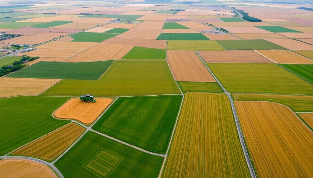
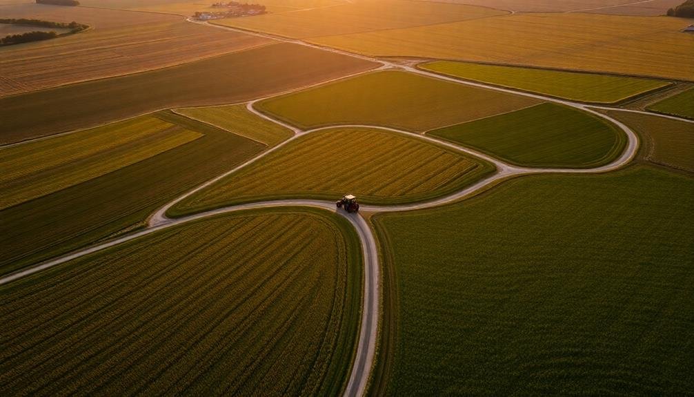
Crop Monitoring and Management
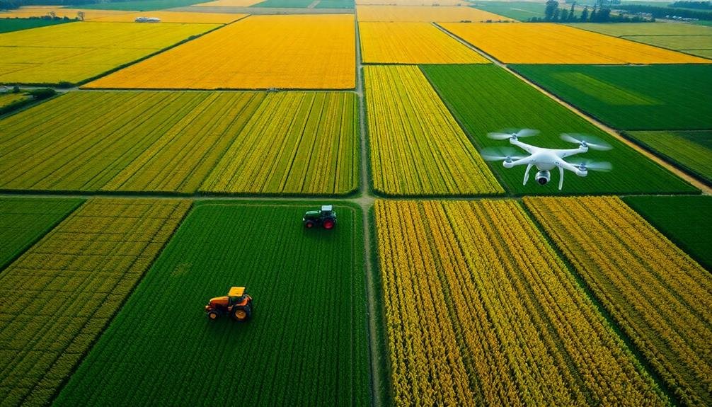
One of the most powerful applications of aerial farm photography is crop monitoring and management. You'll find that using drones or satellite imagery allows you to observe your crops from a unique perspective, revealing patterns and issues that aren't visible from the ground.
With aerial photography, you can quickly assess crop health across large areas. You'll spot signs of pest infestations, disease outbreaks, or nutrient deficiencies before they spread, enabling targeted interventions. This precision approach saves time, resources, and potentially your entire harvest.
You'll also benefit from tracking crop growth stages more accurately. By comparing aerial images over time, you can make informed decisions about irrigation, fertilization, and harvest timing. This data-driven approach optimizes your yield and product quality.
Moreover, you can use aerial imagery to create detailed vegetation index maps. These tools help you identify variations in crop vigor, allowing for variable-rate applications of inputs. You'll reduce waste, lower costs, and minimize environmental impact while maximizing productivity.
Ultimately, aerial farm photography empowers you to make smarter, more responsive management decisions, leading to improved efficiency and profitability in your agricultural operations.
Identifying Water Resources
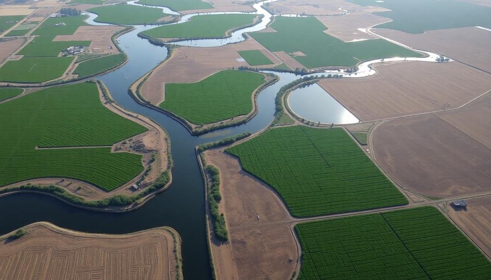
When it comes to identifying water resources, aerial farm photography proves invaluable. You'll gain a thorough view of your property's water sources, enabling better management and conservation efforts. From above, you can easily spot:
- Natural water bodies like ponds, streams, and wetlands
- Irrigation systems and their coverage areas
- Drainage patterns and potential problem areas
- Soil moisture variations across fields
- Water storage facilities and their conditions
Aerial imagery helps you assess the efficiency of your current water management practices. You'll be able to identify areas of overwatering or underwatering, allowing for targeted improvements.
This bird's-eye view also reveals how water moves across your land, helping you plan for erosion control and effective field layouts.
By regularly capturing aerial images, you can track changes in water resources over time. This information is essential for long-term planning and adapting to climate variations.
You'll also be better equipped to comply with water regulations and demonstrate sustainable practices to stakeholders.
In drought-prone regions, aerial photography becomes even more important. It helps you locate and protect crucial water sources, ensuring the resilience of your farm or ranch operations.
Documenting Conservation Efforts
Aerial photography offers five key benefits for documenting conservation efforts on farms and ranches.
First, you'll capture a thorough view of land management practices, showcasing how farmers implement erosion control, crop rotation, and sustainable grazing techniques.
Second, you can track changes over time by comparing aerial images from different seasons or years, allowing you to assess the effectiveness of conservation strategies.
Third, aerial shots help you identify areas that need improvement or additional conservation measures, such as buffer zones near water sources or wildlife corridors.
Fourth, you'll create compelling visual evidence of your farm's commitment to environmental stewardship, which can be used for marketing, grant applications, or regulatory compliance.
Enhancing Property Appraisals
Aerial photography can greatly enhance your farm or ranch property appraisal process.
You'll gain an accurate assessment of your property's size, including areas that might be difficult to measure from the ground.
Additionally, you'll uncover hidden land features like water sources, terrain variations, or unused parcels that could potentially increase your property's value.
Accurate Property Size Assessment
Drones' ability to capture extensive overhead imagery has revolutionized property size assessment for farms and ranches.
You can now obtain accurate measurements of your land without the need for time-consuming ground surveys. This technology allows you to precisely determine the boundaries of your property, including irregularly shaped fields or parcels that are difficult to measure on foot.
With aerial photography, you'll gain a thorough view of your entire property, enabling you to:
- Identify and measure hard-to-reach areas
- Calculate acreage for specific crops or pastures
- Detect encroachments or boundary disputes
- Plan efficient irrigation systems
- Optimize land use and resource allocation
Revealing Hidden Land Features
When you're looking to enhance your property's appraisal, revealing hidden land features through aerial photography can be a game-changer. Aerial images can uncover aspects of your land that aren't visible from the ground, providing valuable information to potential buyers or investors.
From above, you'll be able to spot natural water sources like small ponds, streams, or springs that may have gone unnoticed. These features can notably increase your property's value, especially for agricultural or recreational uses.
You'll also be able to identify unique topographical elements such as hills, valleys, or rock formations that could add character and appeal to your land.
Aerial photography can reveal the true extent of wooded areas, showcasing mature tree stands or highlighting potential for timber harvesting.
It can also uncover evidence of historical land use, such as old foundations, fence lines, or abandoned roads, which may add historical value or provide insights into the property's past.
Visualizing Future Development Potential
Visionaries in real estate and land development can leverage aerial farm and ranch photography to reveal hidden potential.
When you're looking at a property from above, you'll see the big picture that's often missed at ground level. Aerial photos help you visualize how the land could be transformed, whether it's for residential subdivisions, commercial developments, or recreational areas.
You'll be able to spot natural features that could enhance future projects, such as bodies of water, wooded areas, or unique topographical elements.
These images also allow you to assess the surrounding infrastructure and connectivity, giving you a clear idea of how your development could fit into the broader landscape.
Here are some key benefits of using aerial photography for visualizing development potential:
- Identify ideal building sites
- Plan efficient road layouts
- Locate potential utility corridors
- Assess drainage patterns and flood risks
- Determine the best use of existing natural features
Creating Immersive Virtual Tours
With aerial farm and ranch photography, you can create stunning virtual tours that transport potential buyers or investors into the heart of the property.
These immersive experiences allow viewers to explore the land from multiple angles, gaining a thorough understanding of its layout and features.
You'll start by capturing high-resolution aerial images and video footage using drones or helicopters.
Then, you'll stitch these visuals together to create a seamless 360-degree panorama.
Add interactive hotspots to highlight key areas like barns, pastures, or water sources.
Incorporate ground-level photos and videos to provide a more detailed look at specific features.
To enhance the tour's immersive quality, you can add audio narration, background music, or ambient sounds of farm life.
Consider including informational pop-ups with details about crop yields, livestock capacity, or property history.
For an extra layer of interactivity, implement virtual reality (VR) compatibility, allowing users to explore the property using VR headsets.
Frequently Asked Questions
What Equipment Is Needed for Aerial Farm and Ranch Photography?
You'll need a drone with a high-quality camera, extra batteries, and memory cards. Don't forget a reliable controller, smartphone or tablet for viewing, and protective gear. Consider filters and a landing pad for better shots.
How Much Does Professional Aerial Photography for Farms Typically Cost?
You'll typically pay between $200-$500 for professional aerial farm photography. Costs vary based on acreage, shoot duration, and equipment used. Drone services are often cheaper, while helicopter or plane shots can be pricier.
Are There Legal Restrictions on Flying Drones Over Agricultural Properties?
You'll need to be aware of legal restrictions for flying drones over farms. Check local and federal regulations, as they vary by location. You'll often need the landowner's permission and may face restrictions near airports or populated areas.
Can Aerial Photography Help With Insurance Claims for Crop Damage?
Yes, aerial photography can greatly help with insurance claims for crop damage. You'll have visual evidence of the extent and nature of the damage, which can strengthen your claim and potentially lead to faster, more accurate settlements.
How Often Should Aerial Photographs Be Updated for a Farm or Ranch?
You should update aerial photographs of your farm or ranch at least annually. However, it's best to capture images seasonally or after significant events like storms, floods, or major changes in land use for thorough documentation.
In Summary
You've seen how aerial farm and ranch photography offers unique perspectives and valuable insights. It's not just about pretty pictures—it's a powerful tool for showcasing your property, monitoring land health, and planning for the future. Whether you're selling, managing, or developing your land, these bird's-eye views can make a world of difference. Embrace this technology to tell your property's story and make informed decisions. The sky's the limit!
As educators and advocates for responsible drone use, we’re committed to sharing our knowledge and expertise with aspiring aerial photographers.


Leave a Reply