You'll revolutionize your industrial survey inspections with these three cutting-edge techniques. First, automated grid flight patterns guarantee systematic coverage and consistent data collection. You'll create virtual grids for precision and efficiency in large-scale inspections. Next, thermal imaging analysis detects hidden temperature variations, identifying potential issues like equipment overheating. You'll need to master factors such as emissivity and camera settings for effective results. Finally, 3D modeling and digital twins provide detailed virtual representations of facilities, enabling visualization and simulation of complex structures. These advanced methods will transform your inspection processes and decision-making capabilities. Dive deeper to release their full potential.
Key Takeaways
- Automated grid flight patterns ensure systematic coverage and consistent data collection for large-scale industrial inspections.
- Thermal imaging analysis detects hidden temperature anomalies, identifying potential equipment issues and energy inefficiencies.
- 3D modeling and digital twins create detailed virtual representations for comprehensive facility analysis and scenario simulations.
- Optimize drone altitude, camera settings, and flight line overlap for precise automated grid inspections.
- Utilize appropriate infrared camera resolution and temperature range for effective thermal imaging analysis.
Automated Grid Flight Patterns

Automated grid flight patterns have revolutionized industrial survey inspections. They've transformed the way you conduct aerial surveys, offering precision and efficiency that manual flights can't match. You'll find these patterns particularly useful for large-scale inspections of industrial sites, solar farms, and construction projects.
When you implement automated grid flights, you're fundamentally creating a virtual grid over the area you need to inspect. Your drone will systematically cover this grid, capturing high-resolution images or data at predetermined intervals. You can adjust the grid's size and density to match your specific inspection requirements.
You'll appreciate the consistency these patterns provide. Every flight covers the same area in the same way, ensuring you don't miss any spots. This consistency also makes it easier for you to compare data over time, tracking changes or degradation in your industrial assets.
To get the most out of automated grid flights, you'll need to take into account factors like altitude, camera settings, and overlap between flight lines. You can optimize these parameters based on the type of inspection you're conducting and the level of detail you need.
Thermal Imaging Analysis
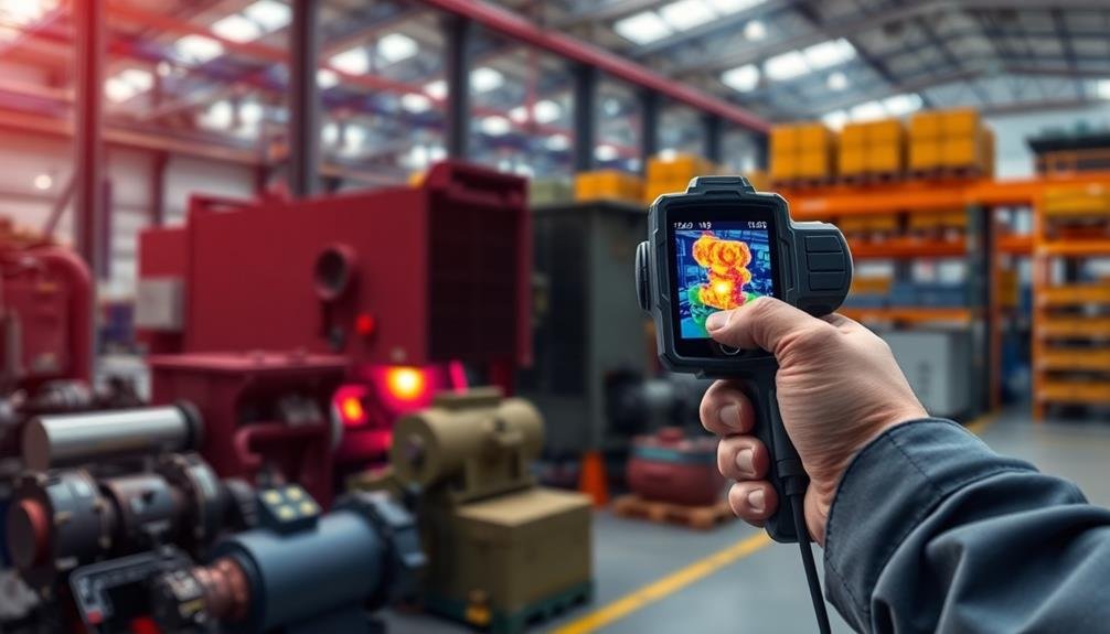
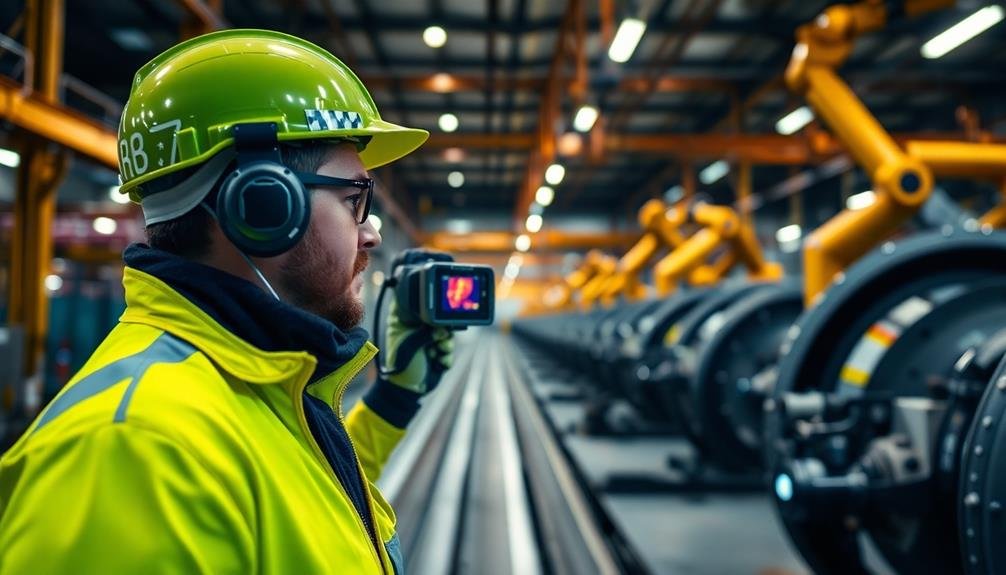
Thermal imaging analysis takes your industrial inspections to the next level. By using infrared cameras, you'll detect temperature variations that aren't visible to the naked eye. This technique allows you to identify potential issues like equipment overheating, insulation problems, or electrical faults before they cause costly breakdowns.
To conduct effective thermal imaging analysis, you'll need to understand how to interpret the images. Look for unexpected hot spots or cold areas that may indicate problems. You'll also need to take into account factors like emissivity, reflectivity, and ambient temperature when analyzing the results.
When performing thermal imaging inspections, it's essential to use the right equipment and settings. Choose a camera with appropriate resolution and temperature range for your specific application. You'll also want to make certain proper focus and adjust the temperature scale to highlight relevant details.
Remember to document your findings thoroughly. Capture both thermal and visible light images of problem areas, and record temperature readings. This documentation will be invaluable for comparing results over time and planning maintenance activities.
3D Modeling and Digital Twins
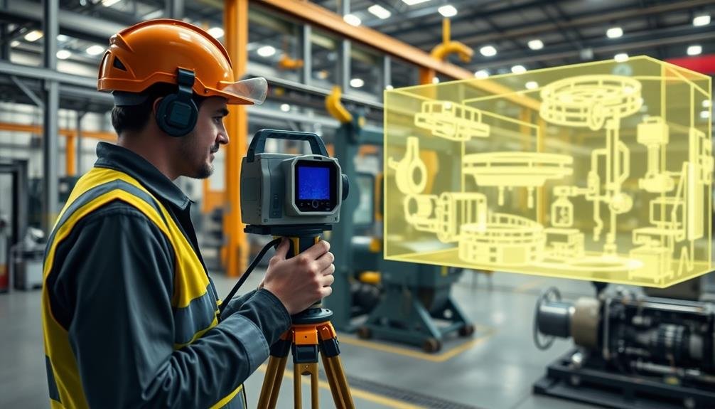
3D modeling and digital twins are increasingly becoming essential tools for industrial survey inspections. You'll find these technologies revolutionizing the way you conduct surveys, offering unprecedented accuracy and insights.
With 3D modeling, you're able to create detailed, three-dimensional representations of industrial facilities, equipment, and processes. This allows you to visualize complex structures from any angle and identify potential issues that might be missed in traditional 2D drawings.
Digital twins take this a step further by creating virtual replicas of physical assets. You can use these to simulate various scenarios, predict maintenance needs, and optimize performance without disrupting actual operations. They're particularly useful for remote inspections and ongoing monitoring.
You'll be able to track changes over time, compare current conditions to the ideal state, and make data-driven decisions.
To implement these techniques, you'll need specialized software and often laser scanning equipment. While there's an initial learning curve, the benefits regarding accuracy, efficiency, and risk reduction are substantial.
You'll find these tools especially valuable for large-scale facilities or those with complex geometries.
Frequently Asked Questions
How Often Should Industrial Surveys Be Conducted?
You should conduct industrial surveys regularly, but the frequency depends on your industry, regulations, and risk factors. Generally, aim for annual inspections, but high-risk facilities may need more frequent surveys. Consult industry standards for specific guidance.
What Safety Precautions Should Inspectors Take During Industrial Surveys?
You'll need proper PPE like hard hats, safety glasses, and steel-toed boots. Always follow site safety protocols, use fall protection when necessary, and be aware of potential hazards. Don't forget to carry emergency communication devices.
How Do Weather Conditions Affect the Accuracy of Industrial Survey Inspections?
Weather can markedly impact your survey accuracy. You'll face challenges with extreme temperatures, precipitation, and wind. They'll affect equipment performance, visibility, and your ability to take precise measurements. Always consider weather forecasts when planning inspections.
What Certifications or Qualifications Are Required for Industrial Survey Inspectors?
You'll need certifications like ASNT NDT, API, or AWS, depending on your specialty. You should also have relevant education, experience, and safety training. Don't forget to maintain your certifications through continuing education and renewals.
How Can Companies Ensure Data Security During Industrial Survey Inspections?
You should implement strict data encryption protocols, limit access to sensitive information, use secure communication channels, and train your staff on cybersecurity best practices. Don't forget to regularly update your security measures and conduct audits.
In Summary
You've now learned three powerful techniques to elevate your industrial survey inspections. By implementing automated grid flight patterns, you'll capture extensive data efficiently. With thermal imaging analysis, you're able to detect hidden issues and potential problems. Finally, creating 3D models and digital twins gives you a complete virtual representation of the site. Embrace these pro methods, and you'll revolutionize your inspection process, saving time and improving accuracy. Keep honing your skills and stay ahead in the industry.
As educators and advocates for responsible drone use, we’re committed to sharing our knowledge and expertise with aspiring aerial photographers.


Leave a Reply