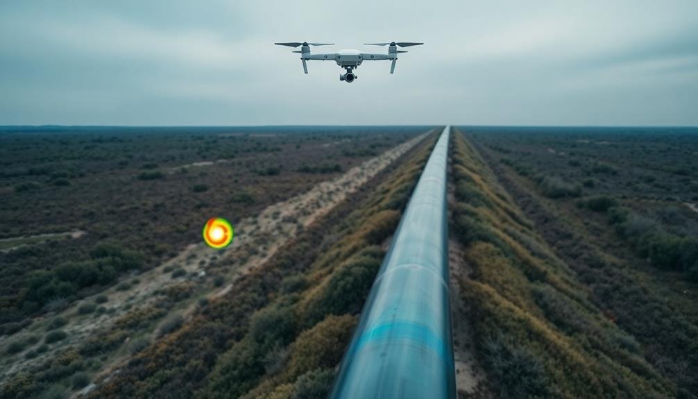
UAV inspections offer a game-changing approach to detecting pipeline leaks. You'll benefit from efficient, cost-effective monitoring of extensive networks using high-resolution imagery and thermal cameras. These drones can quickly identify visual cues like discolored vegetation, soil stains, and structural anomalies that signal potential leaks. To maximize effectiveness, plan your inspection routes carefully, considering terrain and prioritizing high-risk areas. After flights, analyze the data thoroughly to generate thorough reports detailing findings and recommendations. Don't forget to comply with FAA regulations for commercial drone operations. By mastering these essential aspects, you'll revolutionize your pipeline leak detection process.
Key Takeaways
- UAVs provide efficient, cost-effective pipeline inspections using high-resolution imagery and thermal cameras to detect leaks.
- Visual cues like discolored vegetation, soil stains, and structural anomalies indicate potential pipeline leaks.
- Thermal imaging detects temperature differences, often showing leaks as cooler spots on UAV-captured images.
- Effective inspection routes prioritize high-risk areas and consider terrain features for comprehensive pipeline coverage.
- Data analysis involves interpreting aerial imagery, generating detailed reports, and comparing findings with historical data.
UAV Technology for Pipeline Inspections
Numerous pipeline operators are turning to UAV technology for more efficient and cost-effective inspections.
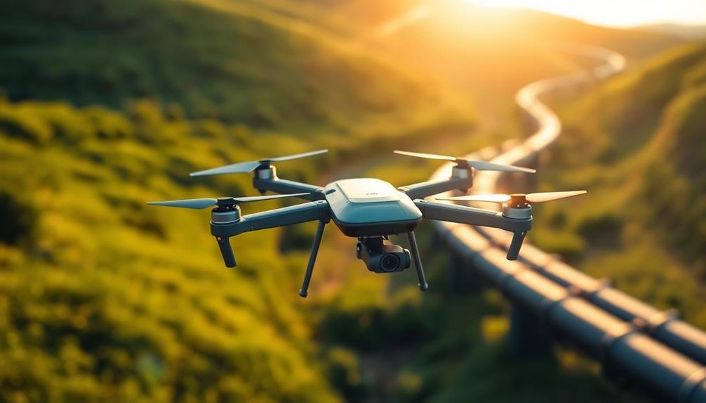
These unmanned aerial vehicles, commonly known as drones, offer a range of benefits for leak detection and pipeline monitoring. You'll find that UAVs can cover large areas quickly, access hard-to-reach locations, and provide high-resolution imagery and data.
When you're considering UAV technology for pipeline inspections, you'll need to choose the right type of drone.
Fixed-wing UAVs are ideal for covering long distances, while multi-rotor drones excel at hovering and inspecting specific areas in detail. You'll also want to equip your UAV with appropriate sensors, such as thermal cameras, gas detectors, or LiDAR systems, depending on your specific inspection needs.
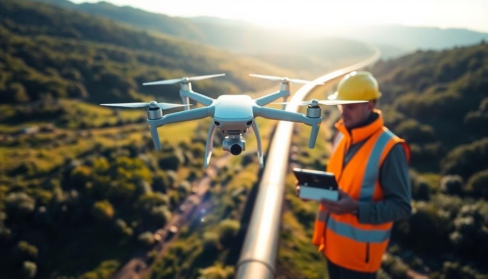
To maximize the effectiveness of your UAV inspections, you'll need to invest in training for your operators and develop standardized procedures.
You'll also want to guarantee compliance with local regulations governing drone use. By integrating UAV technology into your pipeline inspection program, you'll be able to detect leaks more efficiently, reduce costs, and improve overall safety.
Identifying Leak Indicators From Above
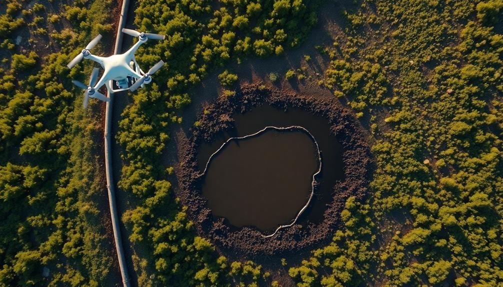
By means of aerial inspection, you can identify several key indicators of pipeline leaks. Look for visual cues such as discolored vegetation, which often appears as brown or dead patches in otherwise healthy areas. These spots may indicate contamination from leaking hydrocarbons or other substances.
Pay attention to unusual soil discoloration, particularly dark stains or wet patches that don't match surrounding terrain.
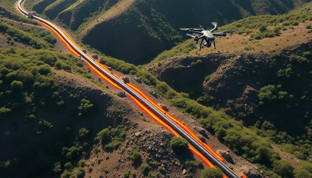
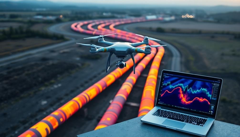
Monitor for unexpected temperature variations using thermal imaging cameras. Leaks can cause temperature differences detectable from above, especially in gas pipelines.
Watch for bubbling or foaming in water bodies near pipelines, as this could signal underwater leaks. Observe any unexpected vapor clouds or mists, which might indicate escaping gas.
Look out for structural anomalies like bulges, dents, or exposed sections of pipeline. These could lead to leaks if left unchecked.
Notice any recent excavation or construction activity near the pipeline route, as this might cause accidental damage.
Planning Effective Drone Inspection Routes
To plan effective drone inspection routes for pipeline leak detection, you'll need to map ideal flight paths that cover the entire pipeline network.
You should carefully consider terrain features and potential obstacles that could interfere with drone operations.
Establish a regular inspection schedule, taking into account factors like pipeline age, environmental conditions, and historical leak data to prioritize high-risk areas.
Mapping Optimal Flight Paths
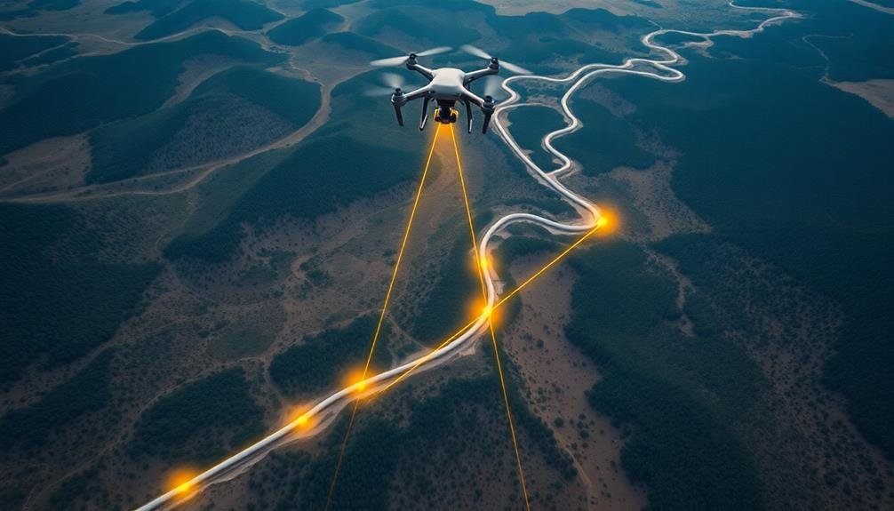
Planning effective drone inspection routes is vital for efficient pipeline leak detection. When mapping ideal flight paths, you'll need to take into account several key factors. First, assess the pipeline's length, terrain, and potential obstacles. This information will help you determine the most suitable flight altitude and speed for your drone.
Next, divide the pipeline into manageable segments, guaranteeing each section can be thoroughly inspected within the drone's battery life. You'll want to create a grid pattern that covers the entire pipeline, including buffer zones on either side. This approach helps guarantee thorough coverage and reduces the risk of missing potential leaks.
Incorporate waypoints into your flight plan to mark critical areas, such as valve stations or known vulnerable points. These waypoints will guide your drone and allow for more focused inspections at high-risk locations.
Don't forget to account for weather conditions and regulatory restrictions when planning your routes.
Utilize specialized software to enhance your flight paths, taking into account factors like battery consumption and image overlap. This will help you maximize efficiency while maintaining data quality.
Remember to include contingency plans for unexpected situations, such as sudden weather changes or technical issues.
Considering Terrain and Obstacles
The landscape surrounding a pipeline plays an essential role in planning effective drone inspection routes. You'll need to carefully consider terrain features and potential obstacles to guarantee safe and efficient UAV operations.
Start by analyzing topographical maps and satellite imagery to identify hills, valleys, dense forests, and bodies of water along the pipeline's path. These natural features can impact your drone's flight performance and line of sight.
Next, take note of man-made structures like buildings, power lines, and communication towers that could interfere with your drone's flight or signal. You'll want to plan routes that maintain a safe distance from these obstacles while still allowing for thorough pipeline inspection.
Don't forget to account for temporary obstructions like construction sites or mobile equipment that may be present during your inspection.
Wind patterns and weather conditions can also affect your drone's ability to navigate terrain and obstacles. Research local weather trends and plan your flights accordingly.
You might need to adjust your routes or flight altitudes to compensate for strong winds or to avoid areas prone to sudden weather changes.
Scheduling Regular Inspection Intervals
Once you've mapped out your drone routes, it's time to establish a regular inspection schedule. Consider the age and condition of your pipeline, environmental factors, and regulatory requirements when determining inspection frequency. Older or more vulnerable sections may need more frequent checks, while newer, well-maintained segments might require less attention.
Create a calendar that outlines inspection dates for each pipeline section. Factor in seasonal changes, as some areas may be more accessible during certain times of the year. Don't forget to account for maintenance windows and potential weather disruptions.
Incorporate flexibility into your schedule to accommodate unexpected issues or emergency inspections. Prioritize high-risk areas and guarantee they receive more frequent attention. Use data from previous inspections to inform your scheduling decisions, adjusting intervals based on observed trends or recurring problems.
Implement a system to track inspection results and maintain detailed records. This will help you identify patterns and optimize your schedule over time.
Remember to review and update your inspection intervals regularly, taking into account new technologies, changing regulations, and evolving best practices in the industry.
Thermal Imaging in Leak Detection
While traditional leak detection methods rely on visual inspections or pressure tests, thermal imaging has emerged as a powerful tool in identifying pipeline leaks. This technology allows you to detect temperature differences that may indicate the presence of leaks, even in hard-to-reach areas.
When you use thermal imaging cameras mounted on UAVs, you'll be able to cover large areas quickly and efficiently. These cameras detect infrared radiation emitted by objects, creating a heat map of the pipeline and its surroundings. Leaks often appear as cooler spots due to the escaping fluid or gas.
You'll find that thermal imaging is particularly effective at night or in low-light conditions when temperature differences are more pronounced. It's also useful for detecting small leaks that mightn't be visible to the naked eye. By analyzing thermal images, you can identify potential leak locations and prioritize areas for further inspection.
To maximize the effectiveness of thermal imaging, you should consider factors such as ambient temperature, time of day, and weather conditions.
You'll also need to guarantee your UAV operators are trained in interpreting thermal images correctly to avoid false positives or missed leaks.
Data Analysis and Reporting
You'll need to interpret aerial imagery carefully to identify potential leak locations along the pipeline.
Generate thorough inspection reports that detail your findings, including any anomalies or areas of concern.
These reports should include clear visual evidence, precise location data, and recommendations for further investigation or immediate action.
Interpreting Aerial Imagery
Three key steps are involved in interpreting aerial imagery for pipeline leak detection.
First, you'll need to identify anomalies in the images. Look for discoloration, vegetation changes, or unusual patterns that could indicate a leak. Pay close attention to areas around joints, valves, and other potential weak points in the pipeline.
Second, analyze the surrounding environment. Consider factors like recent weather conditions, soil type, and local flora. These can help you distinguish between natural occurrences and potential leaks. For example, a wet patch might be due to recent rainfall rather than a pipeline issue.
Finally, compare the current imagery with historical data. This allows you to spot changes over time and identify emerging problems. You'll want to look for gradual shifts in vegetation health, soil composition, or terrain that might suggest a slow leak.
To enhance your interpretation skills, use specialized software that can highlight subtle differences in temperature, moisture, or vegetation health.
Train your eye to recognize patterns associated with leaks, and don't hesitate to consult with experts when you're unsure about your findings.
Generating Comprehensive Inspection Reports
Compiling extensive inspection reports is an essential step in pipeline leak detection. After you've collected and analyzed data from your UAV inspections, you'll need to synthesize this information into a thorough report.
Start by organizing your findings into clear sections, such as flight details, anomalies detected, and recommended actions.
Include high-resolution images and videos captured during the inspection, annotating them to highlight areas of concern. You should also incorporate data from thermal imaging, spectral analysis, and other sensors used during the flight.
Provide detailed descriptions of any potential leaks, corrosion, or damage observed, along with their exact locations using GPS coordinates.
Your report should contain a summary of the pipeline's overall condition, comparing it to previous inspections to identify trends or recurring issues.
Include a prioritized list of maintenance tasks and repairs needed, along with estimated timelines and costs.
Don't forget to add any relevant environmental or safety considerations.
Regulatory Compliance for UAV Inspections
Steering through the regulatory landscape for UAV pipeline inspections can be complex. You'll need to comply with various federal, state, and local regulations to guarantee your operations are legal and safe. The Federal Aviation Administration (FAA) is the primary regulatory body for UAV operations in the United States, and you must adhere to their rules for commercial drone use.
To maintain regulatory compliance, you should:
- Obtain a Remote Pilot Certificate from the FAA
- Register your UAV with the FAA
- Follow Part 107 regulations for commercial drone operations
- Secure necessary waivers or authorizations for specific flight scenarios
It's vital to stay updated on changing regulations and local restrictions that may affect your pipeline inspection activities.
You'll also need to take into account privacy laws, as UAV inspections often involve flying over private property. Implement a robust system for maintaining flight logs, incident reports, and maintenance records to demonstrate compliance during audits.
Don't forget to check with pipeline operators and relevant industry organizations for any additional requirements or best practices specific to UAV pipeline inspections.
Frequently Asked Questions
How Do Weather Conditions Affect UAV Pipeline Inspections?
Weather conditions greatly impact your UAV pipeline inspections. You'll face challenges with wind, rain, and extreme temperatures. They can affect flight stability, visibility, and sensor performance. You'll need to plan carefully and choose appropriate equipment for different conditions.
What Are the Cost Savings of Using Drones Versus Traditional Inspection Methods?
You'll save considerably on costs by using drones for inspections. They're faster, require fewer personnel, and can access hard-to-reach areas easily. You'll reduce expenses related to equipment, labor, and potential shutdowns for manual inspections.
Can UAVS Detect Underground Pipeline Leaks?
Yes, UAVs can detect underground pipeline leaks. You'll find they're equipped with specialized sensors like thermal cameras and gas detectors. They can identify temperature changes, gas emissions, or vegetation anomalies that indicate hidden leaks beneath the surface.
How Often Should Pipeline Inspections Be Conducted Using Drones?
You'll want to conduct drone pipeline inspections quarterly for most operations. However, you should increase frequency in high-risk areas or after severe weather events. It's essential to tailor your schedule to your specific pipeline's needs and regulations.
What Training Is Required for Operators Conducting UAV Pipeline Inspections?
You'll need FAA certification, drone piloting skills, and pipeline inspection knowledge. Learn safety protocols, flight planning, and data analysis. Familiarize yourself with inspection software and regulations. Hands-on training with experienced operators is essential for proficiency.
In Summary
You've now got the essential knowledge to conduct UAV pipeline inspections effectively. By leveraging drone technology, thermal imaging, and data analysis, you'll detect leaks more efficiently than ever before. Remember to plan your routes carefully, stay compliant with regulations, and keep an eye out for key indicators. With these skills, you're well-equipped to enhance pipeline safety and minimize environmental impact. Keep refining your approach for even better results.
As educators and advocates for responsible drone use, we’re committed to sharing our knowledge and expertise with aspiring aerial photographers.


Leave a Reply