To conduct offshore platform surveys with UAVs, you'll need to select suitable drones with wind resistance, water protection, and high-resolution cameras. Comply with regulations, obtain necessary permits, and develop flight plans adhering to safety protocols. Conduct thorough pre-flight planning, including weather assessments and equipment checks. Optimize flight paths for extensive coverage and implement robust data collection methods. Process and analyze images to detect corrosion and assess structural integrity. Use standardized reporting templates and efficient data management systems to document findings. By following these steps, you'll revolutionize offshore inspections, enhancing safety and efficiency. Dive deeper to access the full potential of UAV-powered platform surveys.
Key Takeaways
- Select suitable UAVs with wind resistance, water resistance, and high-resolution cameras for offshore conditions.
- Obtain necessary permits, certifications, and comply with local and international UAV regulations for offshore operations.
- Conduct thorough pre-flight planning, including weather assessment, route mapping, and equipment checks.
- Implement safety protocols, including obtaining platform operator authorization and maintaining communication during surveys.
- Optimize flight paths using grid patterns and waypoint navigation for comprehensive platform coverage and efficient data collection.
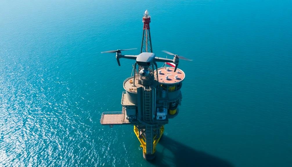
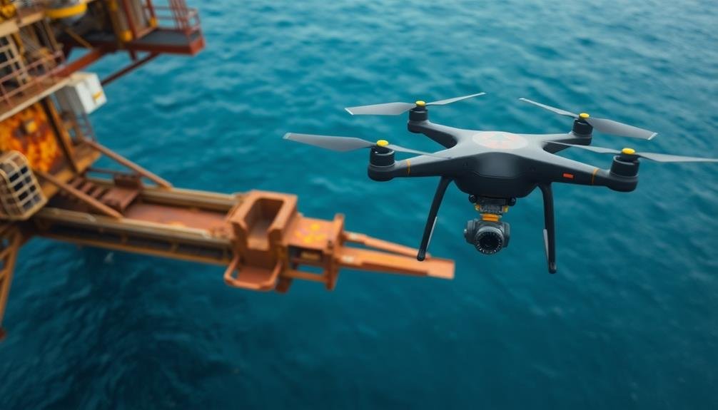
Selecting Suitable UAVs
Choosing the right UAV for offshore platform surveys is vital for success.
You'll need to evaluate several factors when selecting a suitable drone. First, opt for a UAV with robust wind resistance, as offshore environments often experience strong gusts. Look for models rated to withstand at least 20-25 mph winds.
Water resistance is important too. Choose a drone with an IP rating of at least IP54 to protect against saltwater spray.
Battery life is another significant factor. Select a UAV that can fly for at least 30 minutes on a single charge, allowing ample time for thorough inspections.
Examine the camera quality and payload capacity. A high-resolution camera (at least 12MP) with zoom capabilities will enable detailed inspections.
If you need to carry additional sensors or equipment, verify the drone can handle the extra weight.
Regulatory Compliance for Offshore Operations
Before you launch your drone for offshore platform surveys, you must assure full compliance with relevant regulations. Familiarize yourself with the local and international laws governing UAV operations in offshore environments.
Check with maritime authorities, aviation agencies, and oil and gas regulators for specific requirements. Obtain necessary permits and licenses for your offshore drone operations. This may include remote pilot certifications, airspace authorizations, and special waivers for beyond visual line of sight flights.
Confirm your UAV is properly registered and meets all safety standards. Develop an extensive flight plan that adheres to offshore safety protocols. Consider factors like restricted airspace, platform no-fly zones, and emergency procedures.
Implement robust communication systems to maintain contact with platform personnel and nearby vessels. Stay informed about weather conditions and platform activities that may affect your survey. Follow strict pre-flight checklists and equipment inspections.
Document all compliance measures and maintain detailed flight logs for each operation.
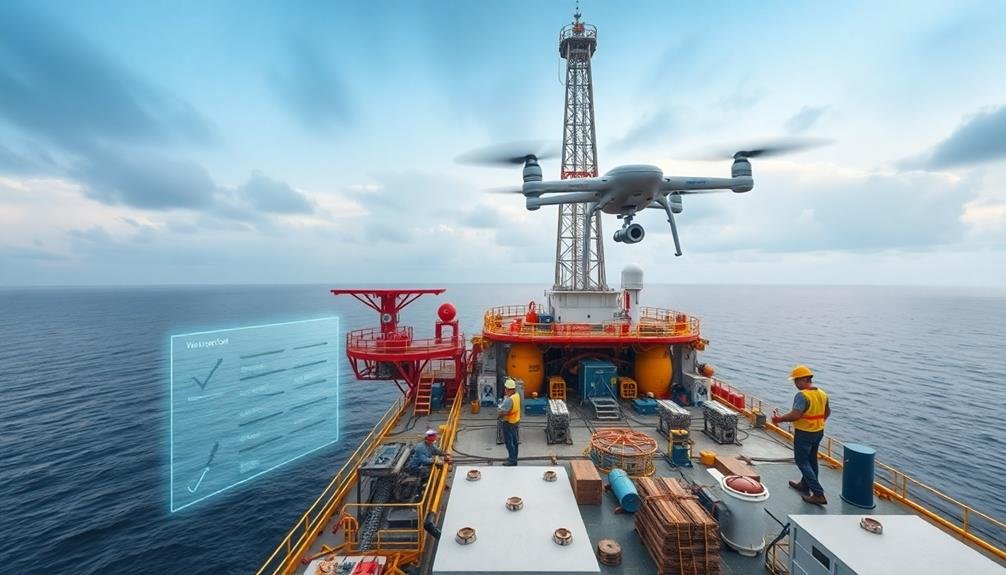
Pre-Flight Planning and Preparation

Thorough pre-flight planning and preparation are essential for successful offshore platform surveys. Before launching your UAV, you'll need to assess weather conditions, establish flight paths, and guarantee your equipment is in prime condition. Check wind speeds, visibility, and precipitation forecasts to determine if it's safe to fly. Map out your flight route, identifying potential obstacles and no-fly zones around the platform.
Inspect your drone, guaranteeing all components are secure and functioning properly. Charge batteries fully and pack spares. Don't forget to calibrate your sensors and test your camera settings for peak image quality. Familiarize yourself with platform-specific safety protocols and emergency procedures.
| Pre-Flight Checklist | Importance |
|---|---|
| Weather assessment | Critical |
| Flight path planning | High |
| Equipment check | Essential |
| Safety protocols | Mandatory |
Communication is key. Brief your team on the mission objectives and assign roles. Coordinate with platform personnel to guarantee they're aware of your operations. Verify that you have all necessary permits and authorizations in place. By meticulously preparing for your offshore platform survey, you'll maximize efficiency, minimize risks, and increase the likelihood of capturing high-quality data.
Safety Protocols for Platform Surveys

Safety protocols form the backbone of any offshore platform survey. You must prioritize these measures to guarantee a successful and incident-free operation.
First, always obtain proper authorization from platform operators and relevant authorities before launching your UAV. Familiarize yourself with the platform's layout, potential hazards, and no-fly zones.
Conduct a thorough pre-flight inspection of your UAV, checking for any damage or loose components. Ascertain your batteries are fully charged and bring spares. Wear appropriate personal protective equipment, including a hard hat, safety glasses, and high-visibility clothing.
Stay in constant communication with platform personnel throughout the survey. Be aware of weather conditions and don't fly in high winds, rain, or fog. Maintain visual line of sight with your UAV at all times and adhere to designated flight paths.
Keep a safe distance from personnel, equipment, and structures. If you encounter any unexpected obstacles or lose control, immediately activate the return-to-home function or perform a controlled landing.
After completing the survey, conduct a post-flight inspection of your UAV and securely store all equipment. Report any incidents or near-misses to the appropriate authorities for review and improvement of safety protocols.
Flight Path Optimization Techniques

Optimizing your flight path is essential for efficient and effective offshore platform surveys. Begin by creating a detailed 3D model of the platform using available blueprints or previous survey data. This will help you plan the most efficient route around the structure.
Use grid patterns to guarantee complete coverage of all platform surfaces. Start with a wide grid for overall inspection, then tighten it for areas requiring closer examination. Incorporate vertical ascents and descents to capture multi-level structures effectively.
Consider environmental factors like wind direction and speed when planning your flight path. Fly into the wind when possible to maintain stability and conserve battery life. Schedule flights during ideal weather conditions to maximize survey quality and safety.
Utilize waypoint navigation to automate your flight path, guaranteeing consistent coverage and reducing pilot fatigue. Program altitude changes and camera angles at each waypoint for thorough data collection. Include hover points at critical inspection areas to capture detailed imagery.
Implement adaptive flight paths that can be adjusted in real-time based on findings during the survey. This flexibility allows you to focus on areas of concern without compromising overall coverage.
Data Collection and Storage

Efficient data collection and storage are essential for successful offshore platform surveys. When conducting UAV inspections, you'll need to capture high-quality images and videos while ensuring secure data storage. Use a high-resolution camera with adjustable settings to capture detailed footage of the platform's structures. Implement a systematic approach to data collection, focusing on specific areas of interest and potential problem spots.
To organize your data effectively, consider the following table:
| Data Type | Storage Method | Backup Strategy |
|---|---|---|
| Images | Cloud storage | External HDD |
| Videos | NAS system | Cloud backup |
| 3D models | Local server | Offsite storage |
| Metadata | Database | Cloud sync |
Ensure you're using reliable storage solutions with ample capacity to handle large file sizes. Implement a robust backup system to protect against data loss. You'll want to establish a clear naming convention and folder structure to facilitate easy retrieval and analysis of collected data. Consider using data management software to streamline the organization and processing of your survey information. By following these practices, you'll maintain a thorough and accessible record of your offshore platform surveys.
Image Processing and Analysis
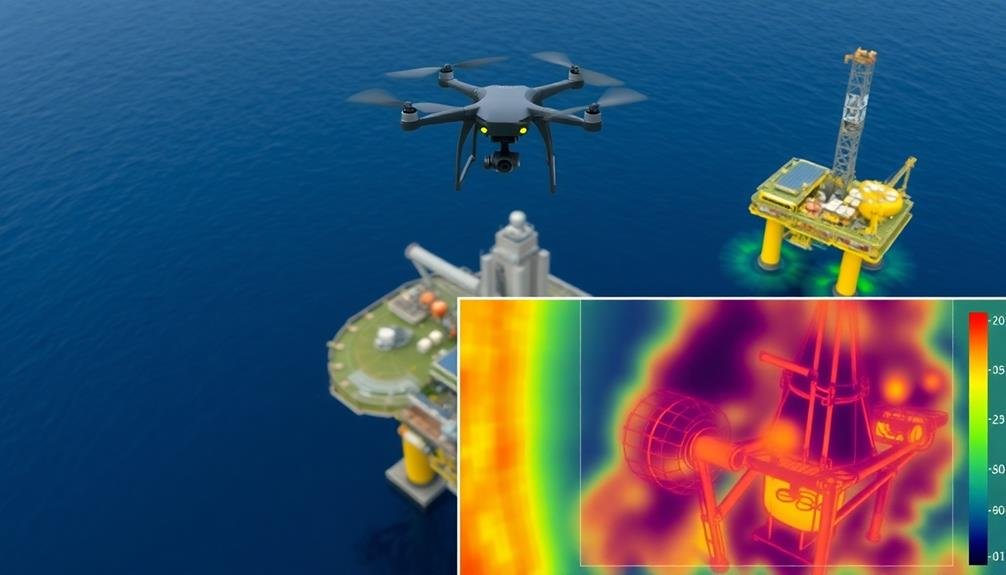
Image processing and analysis form the backbone of extracting valuable insights from your offshore platform survey data. Once you've collected the raw images and videos from your UAV, it's time to transform them into actionable information.
Start by organizing your data into categories based on the specific areas of the platform you've surveyed.
Next, use specialized software to enhance image quality, correct distortions, and stitch together panoramic views. This step is essential for creating an all-encompassing visual representation of the offshore platform.
Apply advanced algorithms to detect and highlight potential issues such as corrosion, cracks, or structural deformations.
To maximize the value of your survey data:
- Implement machine learning algorithms to automate defect detection
- Use 3D modeling techniques to create accurate digital twins of the platform
- Employ thermal imaging analysis to identify heat-related issues
- Utilize change detection algorithms to track structural changes over time
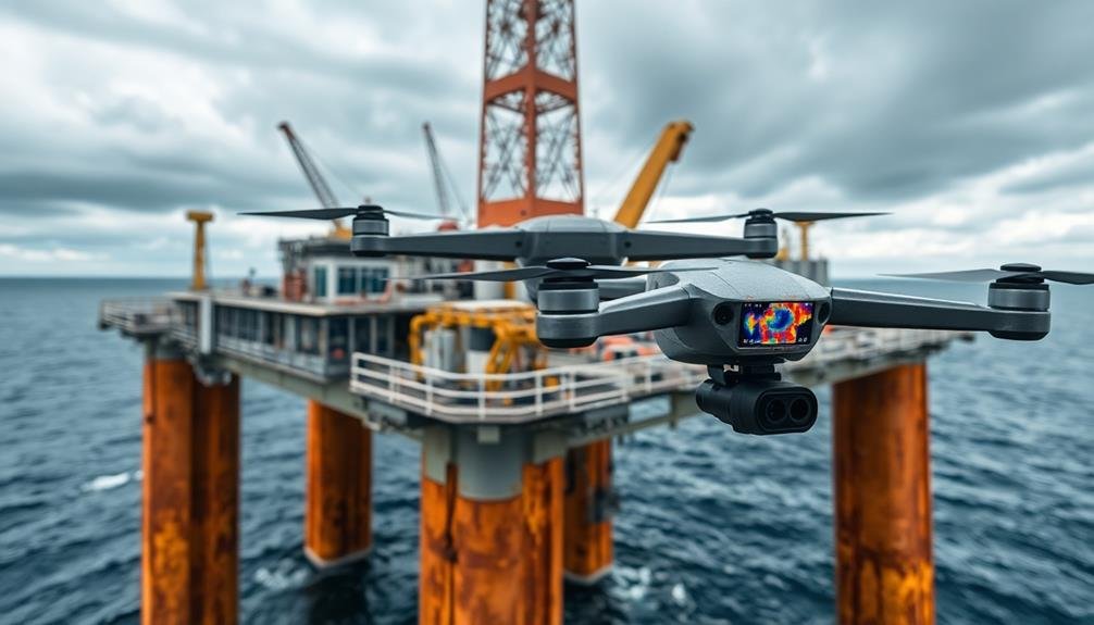
Corrosion Detection Using Drones
Corrosion detection is a key application of drone technology in offshore platform surveys. You'll find that drones equipped with high-resolution cameras and specialized sensors can efficiently identify and assess corrosion on hard-to-reach areas of offshore structures.
These UAVs can capture detailed images and data of rust, pitting, and other forms of deterioration that might be missed during traditional inspections.
To conduct corrosion detection using drones, you'll need to program flight paths that cover all critical areas of the platform. Verify your drone is equipped with thermal cameras to detect temperature variations that may indicate corrosion beneath surface coatings.
Use multispectral sensors to identify changes in material composition and thickness. As you fly the drone, it'll collect data on surface anomalies, which you can later analyze using specialized software.
During the survey, pay close attention to areas prone to corrosion, such as welded joints, support structures, and areas exposed to saltwater spray.
You'll want to compare the drone-collected data with previous inspection reports to track corrosion progression over time. This approach allows for more accurate maintenance planning and helps prevent costly structural failures.
Structural Integrity Assessment Methods
How do you guarantee an offshore platform remains safe and operational?
Structural integrity assessment methods are essential for ensuring the longevity and safety of these complex structures. You'll need to employ a combination of techniques to thoroughly evaluate the platform's condition.
To conduct a detailed structural integrity assessment, you should:
- Perform visual inspections using high-resolution cameras mounted on drones to identify visible defects, cracks, or deformations.
- Utilize ultrasonic testing to detect internal flaws and measure material thickness, especially in areas prone to corrosion.
- Implement vibration analysis to assess the platform's dynamic response and identify potential structural weaknesses.
- Apply finite element modeling to simulate various load conditions and predict the platform's behavior under different scenarios.
Reporting and Documentation Best Practices

You'll need to implement standardized reporting templates to guarantee consistency and completeness in your offshore platform survey documentation.
These templates should capture all critical data points and observations in a structured format that's easy to analyze and compare across surveys.
Additionally, you'll want to utilize robust data management systems to securely store, organize, and retrieve survey reports, allowing for efficient tracking of platform conditions over time.
Standardized Reporting Templates
Streamlining your offshore platform survey documentation begins with standardized reporting templates. These templates guarantee consistency across different surveys and make it easier to compare data over time. When creating your templates, focus on including all essential information while maintaining a clear, easy-to-read format.
To develop effective standardized reporting templates for your offshore platform surveys, consider the following key elements:
- Survey metadata: Include date, time, location, weather conditions, and surveyor information.
- Platform details: Specify the platform's name, type, and key structural components.
- UAV flight data: Record flight path, altitude, speed, and camera settings used during the survey.
- Observation categories: Create sections for different types of inspections, such as structural integrity, corrosion assessment, and equipment condition.
Incorporate checklists and rating scales within your templates to facilitate quick and consistent evaluations. Use dropdown menus or pre-defined options where possible to minimize data entry errors.
Don't forget to include space for additional notes, observations, and recommendations. By using standardized reporting templates, you'll improve the efficiency of your documentation process and enhance the overall quality of your offshore platform surveys.
Data Management Systems
Effective data management systems are the backbone of successful offshore platform survey reporting and documentation. When implementing a data management system for your UAV-based offshore surveys, prioritize cloud-based solutions that offer secure storage and easy access for authorized team members.
Choose a system that integrates well with your existing workflow and supports various file formats, including high-resolution images, videos, and 3D point clouds.
Confirm your data management system includes robust search and filtering capabilities, allowing you to quickly locate specific survey data based on date, platform location, or inspection type. Implement version control to track changes and maintain a clear audit trail of survey reports and documentation.
You'll want to set up automated backups to prevent data loss and consider implementing data encryption for sensitive information.
Incorporate metadata tagging for each survey dataset, including details such as weather conditions, UAV specifications, and inspector names. This will help streamline future analysis and reporting.
Frequently Asked Questions
How Do Weather Conditions Affect UAV Performance During Offshore Platform Surveys?
Weather conditions greatly impact your UAV's performance during offshore surveys. You'll face challenges from strong winds, rain, and fog. They'll affect flight stability, visibility, and battery life. Always check forecasts and adjust your plans accordingly.
What Are the Battery Life Limitations for Drones in Offshore Environments?
You'll find that battery life for drones in offshore environments is typically limited to 20-30 minutes. Factors like wind resistance and payload can further reduce flight time. It's essential to plan your mission accordingly and bring spare batteries.
Can UAVS Detect Gas Leaks on Offshore Platforms?
Yes, you can use UAVs to detect gas leaks on offshore platforms. They're equipped with specialized sensors that can identify methane and other gases. You'll get real-time data, improving safety and efficiency in leak detection operations.
How Do Operators Maintain Communication With Drones at Long Distances Offshore?
You'll use satellite communication systems to maintain long-range control of drones offshore. You can also employ relay stations on nearby vessels or platforms. Don't forget to use high-gain antennas for improved signal strength and reliability.
What Specialized Training Is Required for Drone Pilots in Offshore Operations?
You'll need specialized training in maritime safety, navigation, weather patterns, and offshore regulations. You should also master long-range drone operations, emergency procedures, and platform-specific protocols. Don't forget to obtain necessary certifications for offshore work.
In Summary
You've now got the tools to revolutionize your offshore platform surveys using UAVs. By selecting the right drones, following regulations, and optimizing your flight paths, you'll gather essential data efficiently and safely. Remember to process images carefully, focusing on corrosion detection and structural integrity. With these techniques, you'll produce thorough reports that enhance platform maintenance and safety. Keep refining your methods, and you'll stay at the forefront of offshore inspection technology.
As educators and advocates for responsible drone use, we’re committed to sharing our knowledge and expertise with aspiring aerial photographers.


Leave a Reply