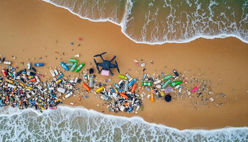
To map coastal plastic waste from above, you'll need the right drone with high-resolution cameras and weather resistance. Optimize your camera settings for clear imagery and plan your flight path carefully, considering tidal patterns for maximum debris exposure. Utilize multispectral imaging to enhance plastic detection and establish ground control points for accurate mapping. Regular equipment maintenance guarantees reliability, while processing data with GIS software aids in visualization. Collaborating with local authorities can provide valuable insights and access. Implement AI-powered detection for efficient analysis of large datasets. These strategies will markedly improve your coastal pollution mapping efforts. The following tips offer deeper insights into mastering this vital environmental monitoring technique.
Choose the Right Drone
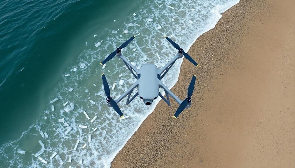
Selecting the appropriate drone is essential for effective coastal plastic waste mapping. You'll want to evaluate several factors when choosing your drone.
First, opt for a model with high-resolution cameras capable of capturing clear images of small plastic debris. Look for drones with at least 12-megapixel sensors and 4K video capabilities.
Weather resistance is fundamental, as coastal environments often experience strong winds and salt spray. Choose a drone rated for wind speeds up to 20-25 mph and with some level of water resistance.
Flight time is another significant factor; select a drone with at least 30 minutes of battery life to cover larger areas without frequent landings.
Examine the drone's range and transmission capabilities. You'll need a model that can maintain a stable connection over long distances, ideally up to 5-7 kilometers. GPS functionality is essential for accurate mapping and automated flight paths.
Lastly, verify your chosen drone is compatible with mapping software. Many professional-grade drones integrate seamlessly with photogrammetry and GIS applications, making data processing more efficient.
Optimize Camera Settings

Proper camera settings are essential for capturing high-quality images during coastal plastic waste mapping. You'll want to set your camera to manual mode for consistent results across multiple flights.
Adjust the ISO to the lowest possible setting, typically 100 or 200, to minimize image noise. Set your aperture between f/4 and f/8 for a good balance of depth of field and sharpness.
Choose a fast shutter speed, at least 1/500th of a second or faster, to prevent motion blur. If lighting conditions allow, aim for 1/1000th or quicker. Use RAW format to capture maximum image data for post-processing flexibility. Set your white balance manually based on the current lighting conditions.
For focus, switch to autofocus for the first shot, then lock it to maintain consistency. Adjust your camera's metering mode to matrix or evaluative for balanced exposure across varied coastal scenes.
Enable image stabilization if your camera offers it. Finally, configure your drone's camera to capture images with at least 60% frontal overlap and 40% side overlap to guarantee proper stitching during map creation.
Test these settings before your main flight to confirm best results.
Plan Your Flight Path
When planning your flight path for coastal plastic waste mapping, you'll need to optimize your drone's altitude and speed.
Adjust these parameters to guarantee clear imagery while covering the maximum area efficiently.
Don't forget to take into account tidal patterns, as they can greatly impact the visibility and distribution of plastic waste along the shoreline.
Optimize Altitude and Speed
To capture the best imagery for coastal plastic waste mapping, you'll need to carefully plan your drone's flight path. This includes enhancing your altitude and speed for ideal results. Generally, fly between 50-100 meters above ground level for a good balance between coverage and detail.
Lower altitudes provide higher resolution but cover less area, while higher altitudes offer broader coverage at the expense of detail.
Adjust your drone's speed based on your camera's capabilities and lighting conditions. Slower speeds (around 3-5 m/s) allow for clearer images but increase flight time. Faster speeds (up to 10 m/s) cover more ground quickly but may result in blurry images.
Consider using automated flight modes that maintain consistent speed and altitude for uniform data collection.
Factor in wind conditions when setting your altitude and speed. Strong winds at higher altitudes can affect image quality and drone stability. In coastal areas, wind speeds often increase with altitude, so you may need to fly lower on windy days.
Always prioritize safety and adhere to local regulations when determining your best flight parameters for coastal plastic waste mapping.
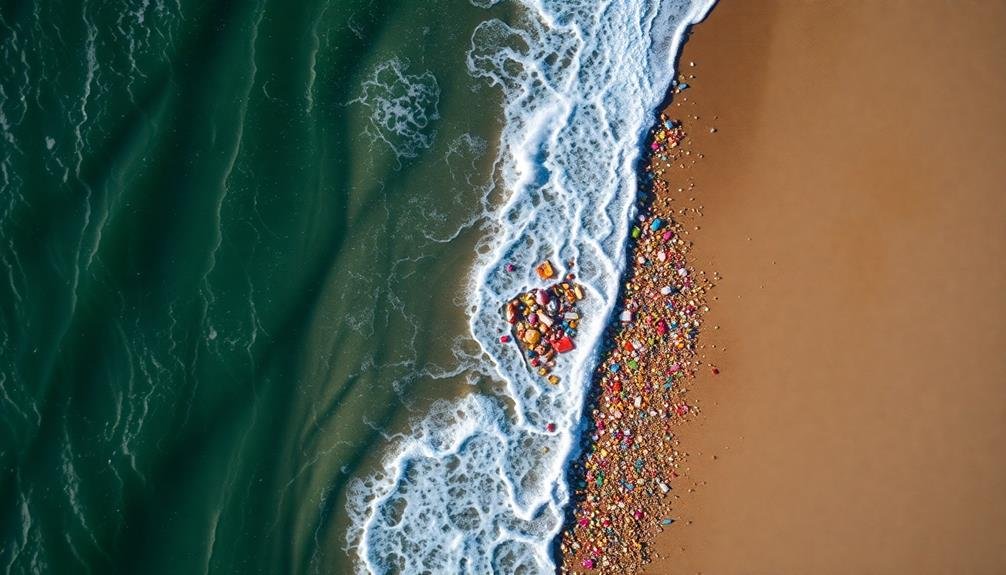
Consider Tidal Patterns
Understanding tidal patterns is essential for effective coastal plastic waste mapping. You'll want to plan your flight path to coincide with low tide, as this exposes more of the beach and intertidal areas where plastic waste often accumulates.
Check local tide tables and schedule your mapping sessions accordingly. Remember that tidal patterns vary greatly depending on location and time of year, so always consult up-to-date information for your specific area.
When considering tidal patterns for your mapping project, keep these key points in mind:
- Low tide exposure: Plan flights during the lowest tide possible to maximize visible beach area and reveal hidden debris.
- Tidal range impact: Areas with larger tidal ranges may require multiple flights at different tide levels to capture a thorough picture of plastic waste distribution.
- Seasonal variations: Be aware of seasonal changes in tidal patterns and adjust your mapping schedule accordingly throughout the year.
Consider Tidal Patterns
When planning your coastal plastic waste mapping, you'll need to account for tidal patterns.
Consider the differences between high and low tide, as these can greatly affect the visibility and distribution of debris.
Don't forget to factor in seasonal tidal variations, which may influence when and how often you should conduct your surveys.
High vs. Low Tide
During your plastic waste mapping efforts, tidal patterns play an essential role in data collection accuracy. When considering high vs. low tide, you'll need to account for significant differences in visible shoreline and debris exposure. High tide can conceal plastic waste beneath the water's surface, while low tide reveals a wider expanse of beach and potentially more debris.
To effectively map coastal plastic waste at different tidal stages:
- Plan your surveys to coincide with both high and low tides, ensuring a thorough dataset.
- Use tide tables to predict ideal mapping times and adjust your schedule accordingly.
- Mark the high tide line during your low tide survey to establish a consistent reference point.
You'll find that low tide surveys often yield more visible plastic waste, as the receding water exposes previously submerged debris. However, don't discount high tide surveys, as they can provide valuable information on floating debris and coastal circulation patterns.
Seasonal Tidal Variations
How do seasonal changes affect tidal patterns and plastic waste distribution?
Seasonal variations in tides can notably impact your coastal plastic waste mapping efforts. During spring and fall, you'll encounter more extreme tides due to the alignment of the sun and moon, resulting in higher high tides and lower low tides. These amplified tides can push plastic debris further inland or expose more waste on the shoreline.
In summer and winter, tidal ranges are generally less extreme. However, seasonal weather patterns like storms and hurricanes can cause storm surges, dramatically altering tidal patterns and redistributing plastic waste. You'll need to take these factors into account when planning your mapping schedule.
Seasonal changes in ocean currents and wind patterns can also affect plastic distribution. Summer months might bring more plastic to certain shores due to prevailing winds, while winter storms could scatter debris over wider areas.
To account for these variations, plan multiple mapping sessions throughout the year. This approach will give you a more thorough picture of plastic waste distribution and help you identify seasonal hotspots.
Remember to record weather conditions and any unusual tidal events during your mapping to provide context for your findings.
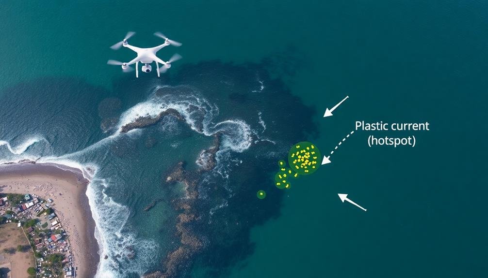
Utilize Multispectral Imaging
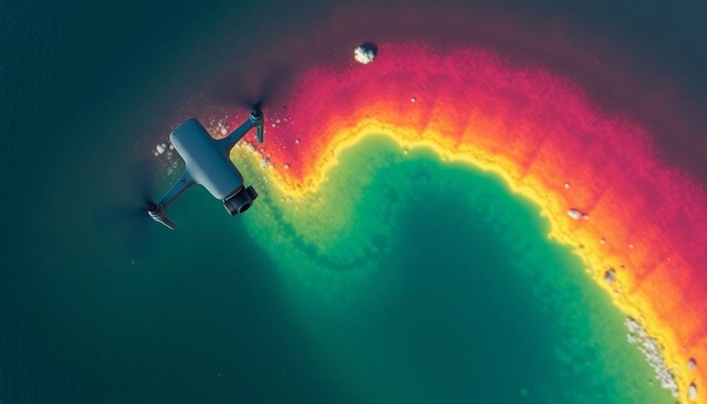
Numerous multispectral imaging techniques can greatly enhance your coastal plastic waste mapping efforts. By utilizing various spectral bands, you'll be able to detect and differentiate plastic debris from natural elements like sand, vegetation, and water. This approach allows for more accurate identification and quantification of plastic pollution along coastlines.
When implementing multispectral imaging for plastic waste mapping, consider these key techniques:
- Near-infrared (NIR) spectroscopy: Use NIR sensors to detect the unique spectral signatures of different plastic types, enabling you to classify and map various polymer categories.
- Shortwave infrared (SWIR) imaging: Employ SWIR cameras to penetrate through thin layers of sand or water, revealing hidden plastic debris that might be missed by visual inspection alone.
- Hyperspectral imaging: Leverage hyperspectral sensors to capture hundreds of narrow spectral bands, providing detailed information about the composition and degradation state of plastic waste.
Implement AI-Powered Detection
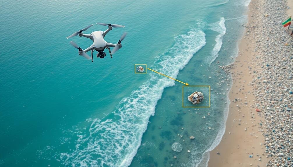
When mapping coastal plastic waste, you'll find AI-powered detection methods incredibly useful.
Machine learning algorithms can rapidly analyze vast amounts of imagery data, identifying plastic debris with high accuracy.
Machine Learning Algorithms
Through advanced machine learning algorithms, you can revolutionize coastal plastic waste detection. These sophisticated tools analyze satellite imagery and drone footage to identify plastic debris with unprecedented accuracy. By training your algorithms on vast datasets of coastal images, you'll enable them to distinguish between natural elements and man-made waste, even in complex environments.
To maximize the effectiveness of your machine learning algorithms, consider these key strategies:
- Utilize convolutional neural networks (CNNs) for image classification and object detection.
- Implement transfer learning to leverage pre-trained models and reduce training time.
- Employ data augmentation techniques to increase dataset diversity and improve model robustness.
As you refine your algorithms, you'll notice improved detection rates and reduced false positives. You can further enhance performance by incorporating multispectral imaging data, which allows for better differentiation between plastic waste and organic materials.
Don't forget to continuously update your training datasets with new, region-specific images to guarantee your algorithms remain effective across different coastal environments. By harnessing the power of machine learning, you'll markedly boost your ability to map and track coastal plastic waste, ultimately contributing to more effective cleanup and prevention efforts.
Automated Imagery Analysis
How can you streamline your coastal plastic waste mapping efforts? Implement automated imagery analysis to boost efficiency and accuracy. AI-powered detection systems can process vast amounts of aerial or satellite imagery quickly, identifying plastic waste hotspots along coastlines.
To get started, you'll need high-resolution images of your target areas. Use drones or access satellite imagery databases for extensive coverage.
Next, select an appropriate AI model for plastic detection. You can opt for pre-trained models or develop a custom solution tailored to your specific coastal environment.
Train your AI system using a diverse dataset of labeled images showing various types of plastic waste in different coastal settings. This will improve the model's accuracy across various conditions.
As you deploy the system, continuously refine it by incorporating feedback and new data. Integrate your automated analysis tool with GIS software to create detailed maps of plastic waste distribution.
This combination will allow you to visualize trends, track changes over time, and identify priority areas for cleanup efforts. Remember to validate AI results periodically with ground-truthing to verify reliability and make necessary adjustments to your detection algorithms.
Establish Ground Control Points
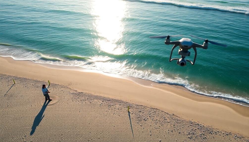
Establishing ground control points is a crucial step in accurately mapping coastal plastic waste. You'll need these points to georeference your aerial imagery and guarantee precise measurements. Select easily identifiable landmarks along the coastline, such as large rocks, distinctive trees, or man-made structures. These points should be evenly distributed across your study area to provide a balanced reference framework.
To set up your ground control points effectively:
- Use a high-precision GPS device to record the exact coordinates of each point.
- Take clear, close-up photographs of each location for easy identification in your aerial imagery.
- Create a detailed log with descriptions and sketches of each point's surroundings.
Once you've established your ground control points, you can use them to calibrate your drone or satellite imagery. This process involves matching the points in your aerial photos with their corresponding GPS coordinates. By doing so, you'll create a georeferenced map that accurately represents the spatial distribution of plastic waste along the coast.
Remember to revisit and update your ground control points periodically, as coastal environments can change rapidly due to erosion, storms, or human activities.
Conduct Regular Equipment Maintenance
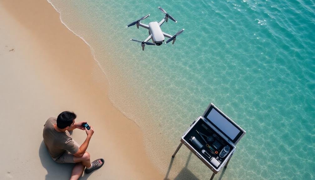
To guarantee accurate and reliable data collection, you'll need to maintain your mapping equipment properly. Start by creating a maintenance schedule for all your devices, including drones, cameras, GPS units, and data storage equipment.
Clean your equipment after each use, removing salt, sand, and moisture that can damage sensitive components. Regularly inspect drone propellers, motors, and batteries for wear and tear, replacing parts as needed.
Don't forget to update your equipment's firmware and software regularly. These updates often include bug fixes and performance improvements that can enhance your mapping accuracy.
Calibrate your cameras and sensors before each mapping session to confirm consistent results. Check and replace batteries in all devices, keeping spares on hand for longer missions.
Store your equipment in a cool, dry place when not in use, using waterproof cases for added protection.
Maintain a log of equipment usage, maintenance activities, and any issues encountered. This record will help you identify patterns and predict when components might need replacement.
Process Data With GIS Software
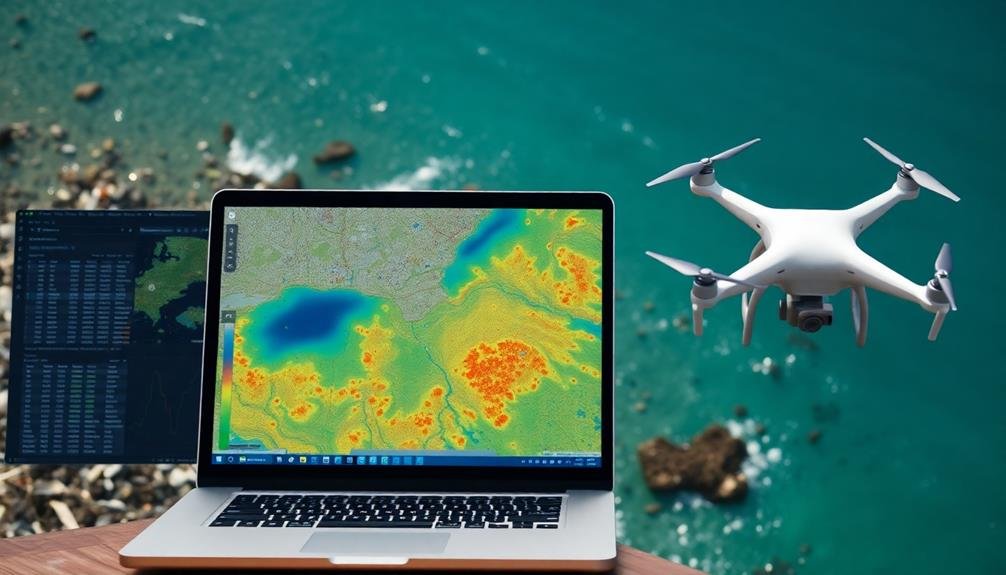
Once you've collected your coastal plastic waste data, what's the next essential step? It's time to process and analyze it using Geographic Information System (GIS) software. GIS tools allow you to visualize, manipulate, and interpret your spatial data effectively. You'll be able to create detailed maps, identify hotspots of plastic accumulation, and track changes over time.
Start by importing your data into your chosen GIS software, such as ArcGIS or QGIS. Verify that all your data points are correctly georeferenced and aligned with your base map.
Next, use the software's analysis tools to process your data. You can:
- Create density maps to highlight areas with high concentrations of plastic waste
- Perform spatial analysis to identify patterns or correlations with environmental factors
- Generate time-series animations to visualize changes in plastic distribution over multiple surveys
Don't forget to clean and validate your data before analysis. Remove any outliers or erroneous points that could skew your results.
As you work with GIS, you'll be able to produce compelling visual representations of your findings, which can be invaluable for communicating your research to stakeholders and the public.
Collaborate With Local Authorities
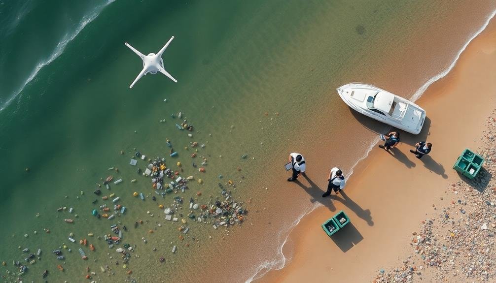
Collaboration with local authorities is essential for the success of your coastal plastic waste mapping project. You'll need their support and expertise to gain access to restricted areas, understand local regulations, and implement effective waste management strategies. Reach out to relevant departments such as environmental agencies, coastal management offices, and waste management authorities.
When approaching local authorities, be prepared to:
| Action | Purpose |
|---|---|
| Share your project goals | Align objectives |
| Present your methodology | Guarantee compliance |
| Discuss data sharing | Facilitate cooperation |
| Propose joint initiatives | Maximize impact |
By involving local authorities, you'll gain valuable insights into historical data, ongoing cleanup efforts, and local challenges. They can provide you with permits for drone flights and beach access, guaranteeing your mapping activities comply with regulations. You'll also benefit from their established networks and resources, which can help amplify your project's reach and impact.
Don't forget to keep local authorities updated on your findings. Regular communication will foster a strong partnership and increase the likelihood of your data being used to inform policy decisions and drive tangible change in coastal plastic waste management.
Frequently Asked Questions
How Does Weather Affect Drone Mapping of Coastal Plastic Waste?
Weather considerably impacts your drone mapping of coastal plastic waste. You'll face challenges with wind affecting stability, rain obscuring visibility, and sunlight causing glare. Cloud cover can alter image quality, while temperature extremes may affect drone performance.
What Safety Precautions Should Be Taken When Mapping Near Populated Beaches?
When mapping near populated beaches, you'll need to prioritize safety. Notify local authorities, maintain a safe altitude, avoid flying directly over people, and be aware of privacy concerns. Always follow local drone regulations and obtain necessary permits.
How Often Should Coastal Plastic Waste Mapping Be Conducted for Accuracy?
You should conduct coastal plastic waste mapping at least quarterly for accuracy. If possible, map monthly or after major storms. Frequent mapping helps track seasonal changes and sudden influxes of waste, ensuring you're capturing the most current data.
Can Underwater Plastic Waste Be Detected Using Drone Mapping Techniques?
You can't directly detect underwater plastic waste using drone mapping techniques. However, you'll find that drones equipped with specialized sensors or cameras might help identify surface indicators of submerged plastic, aiding in targeted underwater investigations.
What Are the Legal Requirements for Drone Mapping in Coastal Areas?
You'll need to check local regulations, as drone laws vary. Generally, you'll require a license, must register your drone, and follow altitude restrictions. Don't fly over people, and respect privacy and environmental protection zones.
In Summary
You've now got the tools to map coastal plastic waste effectively from above. Remember, success lies in careful planning and execution. Keep refining your techniques, stay up-to-date with technology, and don't forget to share your findings. Your efforts can make a real difference in combating plastic pollution. By continually improving your methods and collaborating with others, you'll contribute valuable data to help clean up our coastlines. Keep up the great work!
As educators and advocates for responsible drone use, we’re committed to sharing our knowledge and expertise with aspiring aerial photographers.


Leave a Reply