
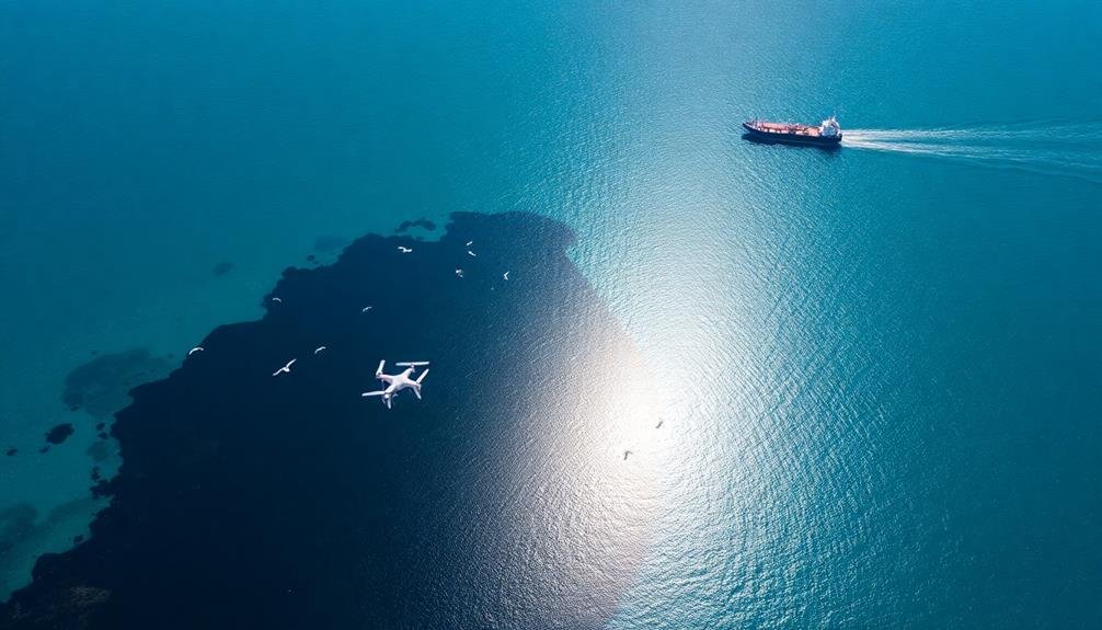
Aerial oil spill detection has revolutionized environmental monitoring, allowing you to spot and respond to marine disasters with unprecedented speed and accuracy. Using drones equipped with high-resolution cameras and advanced sensors, you can quickly survey vast ocean areas and identify potential spills. These unmanned aerial vehicles offer real-time data collection, enhancing decision-making and cleanup efficiency. They're more cost-effective than traditional methods, using less fuel and personnel. However, challenges like distinguishing oil from other substances and overcoming weather conditions persist. As technology evolves, you'll see improved imaging techniques, better data analysis, and more effective response coordination. The future of aerial oil detection promises even greater advancements in protecting our oceans.
The Rise of Drone Technology
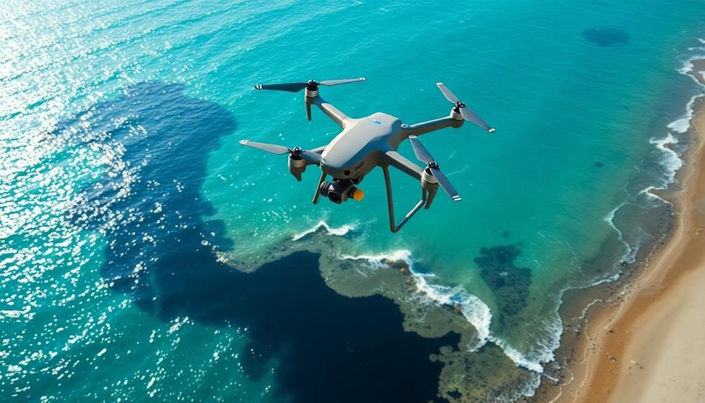
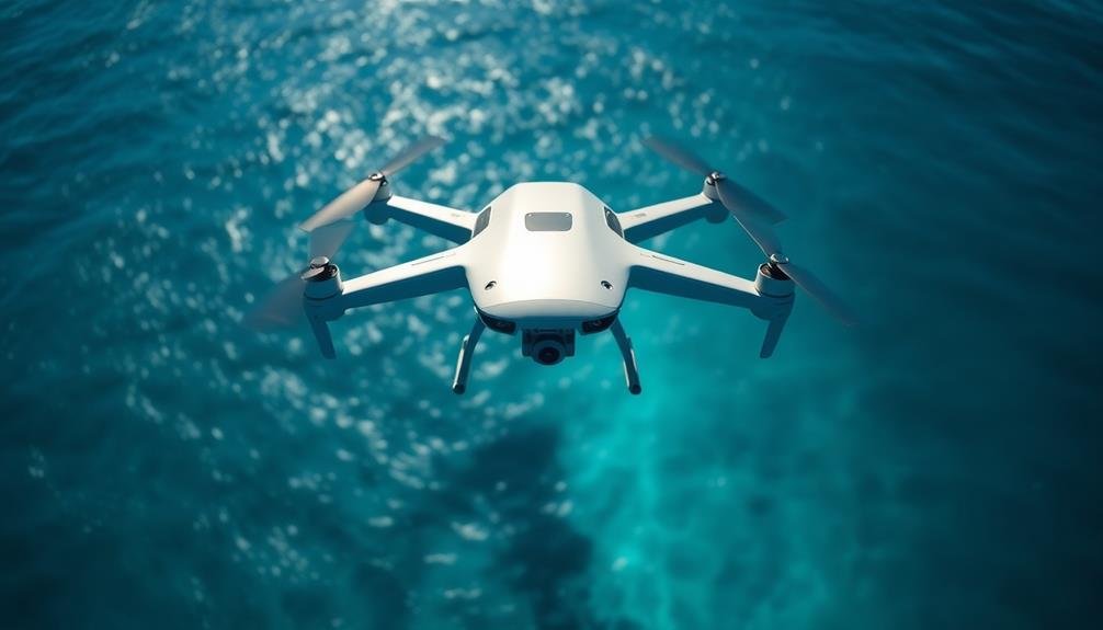
Drones have revolutionized the way we monitor and respond to environmental threats. These unmanned aerial vehicles have become increasingly sophisticated, affordable, and accessible in recent years. You'll find drones equipped with high-resolution cameras, thermal sensors, and even specialized oil detection equipment.
As drone technology advances, you're able to cover larger areas more efficiently than ever before. You can now deploy drones quickly and easily, allowing for rapid response times in case of oil spills. They're capable of reaching remote or dangerous locations that would be difficult for humans to access.
You'll appreciate the real-time data collection drones provide, enabling faster decision-making and more effective cleanup efforts. With their ability to fly at various altitudes, you can capture both broad overviews and detailed close-ups of affected areas.
Moreover, you'll find that drones are cost-effective compared to traditional aerial surveys. They require less fuel, fewer personnel, and can be operated more frequently.
As regulations evolve to accommodate drone use, you'll see their role in environmental monitoring and disaster response continue to expand.
Oil Spill Detection Challenges
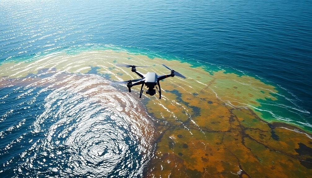
Despite the advancements in drone technology, you'll face several challenges when it comes to detecting oil spills from above. The first hurdle is distinguishing oil from other substances on the water's surface. Algae blooms, natural oil seeps, and even sunlight reflections can mimic the appearance of oil spills, leading to false positives.
Weather conditions pose another significant obstacle. Strong winds, heavy rain, or fog can obscure your drone's view and interfere with sensor readings. You'll need to take into account how these factors affect your detection accuracy and plan accordingly.
The size and spread of oil spills also present difficulties. Large spills may extend beyond your drone's flight range or camera field of view, requiring multiple flights or a fleet of drones to cover the entire affected area.
Lastly, you'll encounter technical limitations. Your drone's battery life may restrict flight duration, and data transmission speeds could slow down real-time analysis. You'll need to balance the quality of your sensors with the drone's payload capacity to guarantee peak performance.
Overcoming these challenges requires a combination of advanced technology, clever algorithms, and strategic planning.
Aerial Imaging Techniques
To overcome these detection challenges, you'll need to employ advanced aerial imaging techniques. These methods utilize various technologies to capture detailed images of potential oil spills from aircraft or satellites.
You'll find that multispectral and hyperspectral imaging are particularly effective, as they can detect subtle differences in light reflection and absorption across multiple wavelengths.
Synthetic Aperture Radar (SAR) is another powerful tool in your arsenal. It can penetrate cloud cover and operate in low-light conditions, making it ideal for monitoring vast ocean areas.
You'll also want to take into account thermal imaging, which can detect temperature differences between oil and water, helping you identify spills even in challenging environments.
When implementing these techniques, you'll need to use specialized sensors and cameras mounted on aircraft or drones. For satellite-based detection, you'll rely on high-resolution imaging satellites equipped with advanced sensors.
To maximize effectiveness, you should combine multiple imaging methods and use sophisticated algorithms to process and analyze the data. This approach will help you quickly identify and assess potential oil spills, enabling faster response times and more effective containment efforts.
Drone Sensors for Spill Identification
Cutting-edge sensors mounted on drones have revolutionized oil spill detection. You'll find that these unmanned aerial vehicles (UAVs) can carry a variety of specialized equipment to identify and analyze oil spills quickly and accurately.
Multispectral and hyperspectral cameras are among the most effective sensors for this task. They capture images across multiple wavelengths of light, allowing you to detect oil slicks that may be invisible to the naked eye.
Thermal imaging cameras can also be useful, as they detect temperature differences between oil and water.
Synthetic Aperture Radar (SAR) sensors are another powerful tool you can use. They emit radar signals and analyze the reflected waves, enabling you to detect oil spills even in low-visibility conditions or at night.
Some drones are equipped with laser fluorosensors, which use ultraviolet light to make oil fluoresce. This technique helps you distinguish between different types of oil and even estimate the thickness of the slick.
Data Analysis and Interpretation

You'll find that machine learning algorithms play an essential role in analyzing drone-collected data for oil spill detection.
These algorithms can quickly recognize spectral signatures unique to oil on water surfaces, enabling accurate identification of spills.
Real-time data processing allows for immediate alerts and response, making your monitoring efforts more efficient and effective.
Machine Learning Algorithms
Machine learning algorithms play an essential role in analyzing and interpreting satellite imagery for oil spill detection. These algorithms can process vast amounts of data quickly and accurately, identifying potential oil spills that might be missed by human observers.
You'll find that supervised learning techniques, such as Support Vector Machines (SVM) and Random Forests, are commonly used for oil spill classification. These methods learn from labeled training data to distinguish between oil slicks and look-alikes, such as algal blooms or natural film.
Deep learning approaches, particularly Convolutional Neural Networks (CNNs), have shown promising results in recent years. They can automatically extract relevant features from imagery, improving detection accuracy and reducing false positives.
To enhance performance, you can implement ensemble methods that combine multiple algorithms. This approach leverages the strengths of different models to achieve better overall results.
When developing your machine learning solution, it's vital to take into account factors like computational efficiency, real-time processing capabilities, and adaptability to different environmental conditions.
You'll also need to regularly update and retrain your models with new data to maintain their effectiveness in detecting oil spills across various scenarios.
Spectral Signature Recognition
Spectral signature recognition stands out as an essential technique in oil spill detection from satellite imagery. This method relies on the unique way oil interacts with light compared to water. When you analyze satellite images, you're looking for specific patterns of light absorption and reflection that indicate the presence of oil on the water's surface.
To use this technique effectively, you'll need to understand the spectral characteristics of both oil and water. Oil typically appears darker than water in visible light but brighter in near-infrared wavelengths. By examining these differences across multiple spectral bands, you can identify potential oil spills with greater accuracy.
You'll often use specialized software to process the satellite data and highlight areas with spectral signatures matching known oil patterns. This approach allows you to quickly scan large areas of ocean and pinpoint potential spill locations.
It's crucial to recognize that environmental factors like sun glint, algal blooms, and cloud cover can affect the spectral signatures, so you'll need to account for these variables in your analysis. By combining spectral signature recognition with other detection methods, you'll greatly enhance your ability to identify and respond to oil spills quickly and effectively.
Real-time Data Processing
Real-time data processing takes oil spill detection to the next level. As you collect aerial imagery and spectral data, sophisticated algorithms analyze the information instantly. This rapid analysis allows for immediate decision-making and response to potential oil spills.
You'll find that modern systems can process vast amounts of data in seconds, comparing incoming information with known oil spill signatures. Machine learning algorithms continuously improve detection accuracy, learning from each new incident. These systems can differentiate between oil slicks and similar-looking phenomena, such as algal blooms or natural seepage.
Real-time processing also enables you to track the spread and movement of oil spills as they occur. You'll receive updates on the spill's size, direction, and potential impact areas. This information is essential for coordinating cleanup efforts and protecting sensitive ecosystems.
Furthermore, you can integrate real-time data with other sources, such as weather forecasts and ocean current models. This integration provides a thorough view of the situation, allowing you to predict the spill's trajectory and plan accordingly.
With real-time processing, you're always one step ahead in managing and mitigating oil spill incidents.
Real-Time Monitoring Capabilities
You'll find that real-time monitoring capabilities have revolutionized oil spill detection.
With immediate spill detection systems, you can identify potential leaks or spills as they occur, allowing for swift action.
Immediate Spill Detection Systems
One of the most essential aspects of oil spill management is the ability to detect incidents as they happen. Immediate spill detection systems play a vital role in this process, allowing you to respond swiftly and minimize environmental damage. These systems utilize advanced sensors and imaging technologies to identify oil spills in real-time.
You'll find that modern detection systems often employ a combination of satellite imagery, aerial surveillance, and remote sensing techniques. Synthetic Aperture Radar (SAR) is particularly effective, as it can penetrate clouds and darkness to detect oil slicks on water surfaces.
Hyperspectral imaging is another powerful tool, enabling you to distinguish between different types of oil and even estimate spill thickness.
Automated alert systems are integrated into these detection platforms, notifying you and relevant authorities as soon as a spill is identified. This rapid communication allows for quick deployment of containment and cleanup resources.
You can also use machine learning algorithms to analyze historical data and predict potential spill locations, enhancing your preventive measures. By leveraging these immediate spill detection systems, you'll greatly improve your ability to protect marine ecosystems and coastal communities from the devastating effects of oil spills.
Satellite Data Integration
Satellite data integration enhances immediate spill detection systems by providing extensive, real-time monitoring capabilities. You'll find that this technology allows for continuous surveillance of vast ocean areas, detecting oil spills quickly and efficiently. By combining data from multiple satellites, you can create a thorough view of potential spill sites.
You'll use various types of satellite imagery, including optical and radar data. Optical sensors capture visible light reflections, helping you identify oil slicks by their distinctive sheen. Radar technology, particularly Synthetic Aperture Radar (SAR), penetrates clouds and darkness, giving you 24/7 monitoring ability.
When you integrate this satellite data with your existing detection systems, you'll greatly improve your response time. You can track spill movement, estimate its size, and predict its trajectory. This information is essential for coordinating cleanup efforts and minimizing environmental impact.
You'll also benefit from advanced algorithms that analyze satellite data automatically, alerting you to potential spills without constant human oversight. This automation allows you to cover more area and respond faster to emerging threats, making your oil spill detection and response more effective than ever before.
Rapid Response Coordination
Three key components form the backbone of rapid response coordination in oil spill detection: real-time monitoring, instant communication, and swift resource mobilization. You'll find that these elements work together seamlessly to guarantee a quick and effective response to potential oil spills.
Real-time monitoring allows you to track changes as they happen. You'll receive continuous updates from satellites, drones, and ground sensors, giving you a thorough view of the situation. Instant communication guarantees that all relevant parties are informed immediately. You'll be able to share critical information with cleanup crews, government agencies, and local communities without delay.
Swift resource mobilization is essential for containing spills quickly. You'll have the ability to deploy cleanup equipment, personnel, and protective measures at a moment's notice.
| Emotion | Before Rapid Response | After Rapid Response |
|---|---|---|
| Anxiety | High | Low |
| Confidence | Low | High |
| Preparedness | Minimal | Extensive |
| Control | Limited | Thorough |
| Hope | Diminished | Restored |
Environmental Impact Assessment
Evaluating the environmental impact of oil spills is a critical step in understanding their long-term consequences. When you're reviewing the damage, you'll need to take into account various factors, including the extent of contamination, affected ecosystems, and potential recovery timelines.
You'll start by analyzing satellite imagery and aerial photographs to map the spill's spread. This data helps you identify sensitive areas like wetlands, coral reefs, or bird nesting sites that require immediate attention. You'll also collect water and soil samples to determine the oil's composition and concentration.
Next, you'll evaluate the impact on marine life, coastal habitats, and local communities. This involves documenting affected species, estimating population declines, and assessing the damage to fisheries and tourism.
You'll work with ecologists to predict long-term effects on biodiversity and ecosystem functions. Your evaluation will include recommendations for cleanup methods and restoration efforts.
You'll take into account factors like the effectiveness of different techniques, potential secondary impacts, and the natural recovery rate of affected areas. This thorough evaluation will guide decision-makers in allocating resources and implementing appropriate remediation strategies to minimize long-term environmental damage.
Future of Aerial Oil Detection
Advances in aerial oil detection technology are set to revolutionize how we monitor and respond to spills. You'll soon see drones equipped with advanced sensors and AI algorithms patrolling vast ocean areas, detecting even the smallest oil slicks with unprecedented accuracy.
These autonomous flying machines will work tirelessly, day and night, in all weather conditions, providing real-time data to response teams.
Satellite technology is also evolving rapidly. You'll benefit from improved resolution and more frequent imaging, allowing for near-continuous monitoring of high-risk areas.
Machine learning algorithms will analyze these images, alerting you to potential spills faster than ever before.
The future of aerial oil detection will bring:
- Integration of multiple data sources, including drones, satellites, and sea-based sensors, for a thorough view of ocean conditions
- Predictive modeling capabilities to forecast spill trajectories and optimize response efforts
- Enhanced collaboration between international agencies, sharing data and resources for global oil spill prevention and mitigation
As these technologies mature, you'll see faster response times, reduced environmental impact, and improved safety for cleanup crews.
The future of aerial oil detection promises a cleaner, safer marine environment for generations to come.
Frequently Asked Questions
How Do Weather Conditions Affect Drone-Based Oil Spill Detection?
Weather conditions greatly impact your drone-based oil spill detection. Wind can disrupt flight stability, while rain or fog obscure visibility. Sunlight glare affects imaging quality, and extreme temperatures may interfere with drone performance. You'll need to adapt your approach accordingly.
What Are the Legal Restrictions for Using Drones in Oil Spill Monitoring?
You'll need to contemplate various legal restrictions when using drones for oil spill monitoring. These include obtaining proper permits, adhering to airspace regulations, respecting privacy laws, and following environmental protection guidelines. Don't forget to check local and federal rules.
Can Drones Detect Underwater Oil Spills or Only Surface-Level Contamination?
You'll find that drones primarily detect surface-level oil spills. They can't penetrate water to spot underwater contamination. However, they're useful for identifying surface slicks, sheens, and discoloration that indicate potential underwater leaks or spills.
How Do Costs Compare Between Drone-Based and Traditional Oil Spill Detection Methods?
You'll find drone-based oil spill detection is generally cheaper than traditional methods. It's more cost-effective for regular monitoring and can cover large areas quickly. However, initial setup costs for drone systems might be higher.
Are There Any Health Risks for Drone Operators During Oil Spill Missions?
You're generally safe operating drones for oil spill missions. You won't face direct health risks from the spill itself. However, you should be aware of potential fatigue from long flights and eye strain from monitoring screens.
In Summary
You've seen how drones are revolutionizing oil spill detection. They're offering faster, safer, and more accurate monitoring than ever before. With advanced sensors and real-time data analysis, you'll spot spills quickly and assess their impact efficiently. As technology evolves, you'll have even more powerful tools at your disposal. By embracing these aerial innovations, you're not just detecting spills – you're protecting our environment and saving precious resources. Keep your eyes on the skies!
As educators and advocates for responsible drone use, we’re committed to sharing our knowledge and expertise with aspiring aerial photographers.


Leave a Reply