
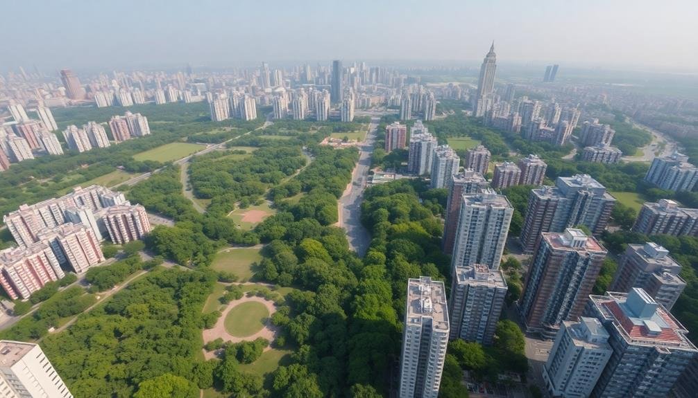
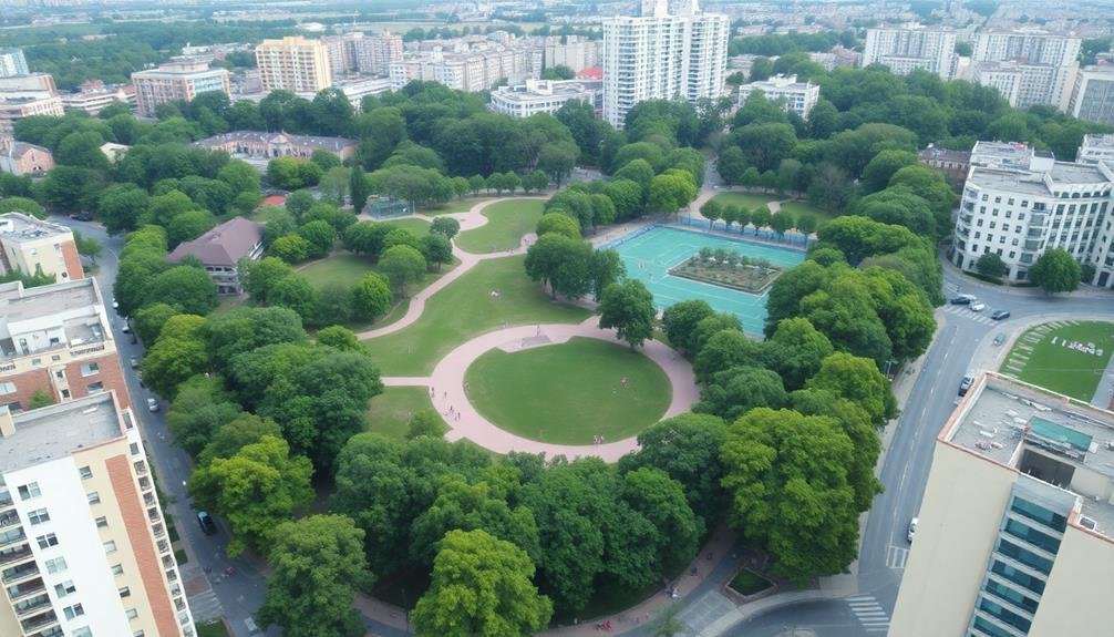
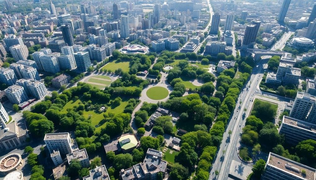
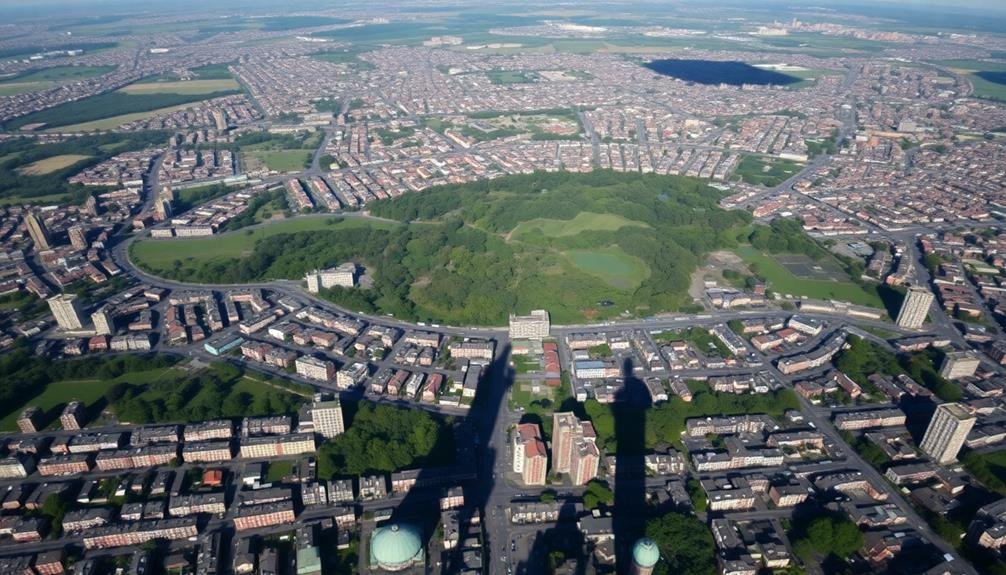
Mapping urban green spaces from above gives you a bird's-eye view of your city's environmental health. You'll gain insights into heat island mitigation, biodiversity, air quality, and stormwater management. It helps planners create equitable access to nature, optimize green infrastructure, and quantify ecosystem services. You can track public health benefits, assess climate change adaptation strategies, and evaluate environmental justice. This aerial perspective allows for better urban planning, ensuring green spaces are strategically placed for maximum impact. By understanding the layout of your city's green areas, you'll reveal the key to creating more sustainable, livable urban environments.
Urban Heat Island Mitigation
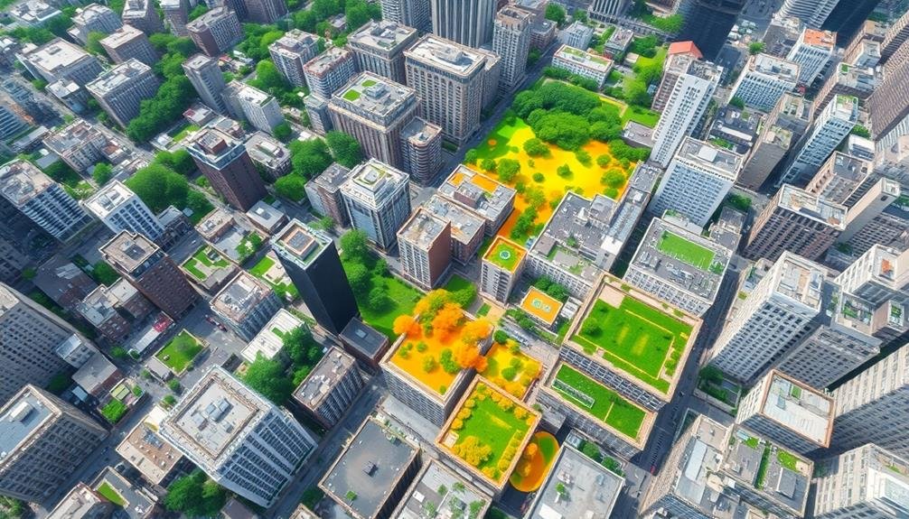
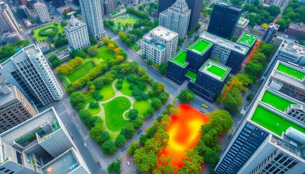
Combating the urban heat island effect, green spaces play an essential role in mitigating temperature extremes within cities. As you map urban greenery from above, you'll notice how these areas act as natural cooling agents. Trees and vegetation provide shade, reducing surface temperatures and absorbing heat through evapotranspiration.
You'll find that strategically placed green spaces can lower urban temperatures by up to 2-8°C. This cooling effect isn't limited to parks; it extends to green roofs, street trees, and even small pockets of vegetation. By mapping these areas, you're identifying significant temperature regulators within the urban fabric.
You'll also observe how green spaces impact air quality. They filter pollutants, trap particulate matter, and produce oxygen, creating healthier environments for city dwellers. Furthermore, you'll notice that well-distributed green areas can reduce energy consumption by lowering the need for air conditioning.
As you analyze urban heat patterns from above, you'll recognize the importance of connectivity between green spaces. Linked green corridors create cooling pathways, enhancing the overall temperature-regulating effect across the city. This information is essential for urban planners and policymakers in designing climate-resilient cities.
Biodiversity Assessment
Urban green spaces' role in supporting biodiversity is vital and complex. By mapping these areas from above, you'll gain valuable insights into the variety and distribution of plant and animal species within your city. Aerial surveys and satellite imagery allow you to identify different vegetation types, assess canopy cover, and spot potential wildlife habitats.
You can use this data to create biodiversity hotspot maps, highlighting areas with high species richness or rare ecosystems. These maps help you prioritize conservation efforts and make informed decisions about urban development.
You'll also be able to track changes in biodiversity over time, monitoring the impact of urbanization and climate change on local ecosystems.
Mapping green spaces from above enables you to identify ecological corridors and assess habitat connectivity. This information is essential for maintaining gene flow between populations and supporting species migration.
You can use it to plan green infrastructure projects that enhance biodiversity, such as creating wildlife-friendly corridors or restoring degraded habitats. By understanding the spatial distribution of biodiversity in your city, you'll be better equipped to develop effective strategies for preserving and enhancing urban ecosystems.
Air Quality Improvement Tracking
Visibility of air quality improvements becomes clearer when mapping urban green spaces from above.
You'll gain valuable insights into how vegetation affects local air quality by tracking changes over time. Aerial mapping allows you to monitor the expansion or reduction of green areas and correlate these changes with air quality data.
You can use this information to:
- Identify pollution hotspots and target areas for green space development
- Assess the effectiveness of tree-planting initiatives on reducing particulate matter
- Guide urban planning decisions to maximize air quality benefits
By analyzing high-resolution imagery, you'll detect subtle changes in vegetation cover that impact air quality.
You can measure the leaf area index and canopy density, which directly influence pollutant filtration. This data helps you quantify the air-purifying capacity of different green spaces and prioritize conservation efforts.
Mapping also reveals the distribution of green spaces in relation to pollution sources.
You'll identify areas where strategic planting can create natural barriers against pollutants. This approach enables you to optimize the placement of new green spaces for maximum air quality improvement.
Stormwater Management Planning
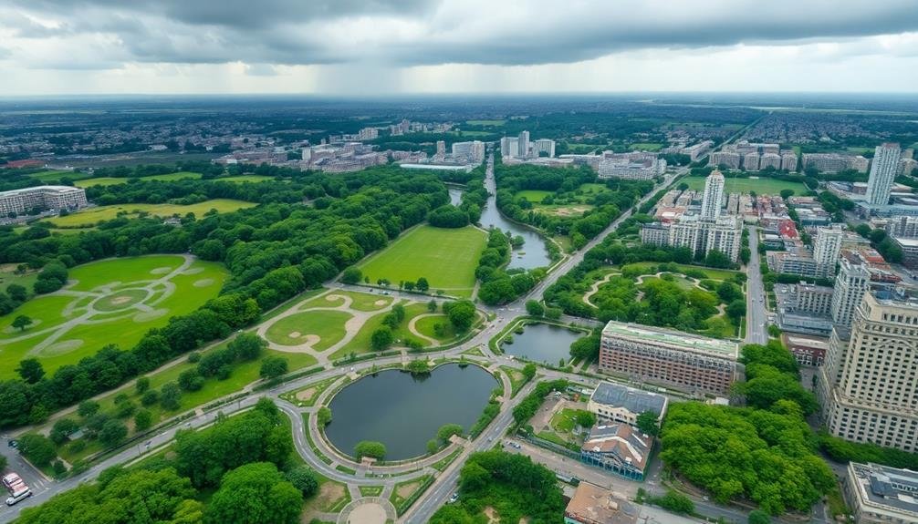
When mapping urban green spaces for stormwater management, you'll need to identify flood-prone areas within the city.
This information allows you to strategically place green infrastructure to mitigate flooding risks.
Identify Flood-Prone Areas
Floodplains and low-lying areas within cities are essential to identify when mapping urban green spaces for stormwater management planning.
By pinpointing these flood-prone zones, you'll gain valuable insights into areas that require special attention for water retention and drainage. This information allows you to strategically plan green infrastructure projects that can mitigate flood risks and improve overall urban resilience.
When identifying flood-prone areas, you'll want to take into account:
- Topographical data: Analyze elevation maps to locate natural depressions and low-lying regions
- Historical flood records: Review past flooding events to understand recurring problem areas
- Impervious surface coverage: Assess the extent of paved surfaces that contribute to increased runoff
Optimize Drainage Infrastructure
Optimizing drainage infrastructure stands at the heart of effective stormwater management planning. By mapping urban green spaces from above, you'll gain essential insights into your city's drainage patterns and potential problem areas. This aerial perspective allows you to identify natural water pathways, existing drainage systems, and areas prone to pooling or flooding.
With this information, you can strategically plan and implement improvements to your drainage infrastructure. You'll be able to locate ideal spots for rain gardens, bioswales, and permeable pavements that can naturally filter and absorb excess water. Additionally, you can pinpoint areas where traditional infrastructure like storm drains and pipes need upgrading or expansion.
| Drainage Solution | Benefits | Challenges | Effectiveness |
|---|---|---|---|
| Rain Gardens | Natural filtration | Limited capacity | High |
| Bioswales | Slows water flow | Requires maintenance | Medium |
| Permeable Pavement | Reduces runoff | Higher initial cost | High |
| Storm Drains | High capacity | Prone to clogging | Medium |
Public Health Benefits Analysis
When you analyze the public health benefits of urban green spaces, you'll find they play an essential role in promoting physical activity.
These areas provide accessible venues for exercise, encouraging residents to engage in regular outdoor activities like walking, jogging, or cycling.
Additionally, you'll discover that green spaces greatly enhance mental health by offering tranquil environments for relaxation and stress reduction, contributing to overall well-being in urban populations.
Physical Activity Promotion
Urban green spaces' role in promoting physical activity is a crucial aspect of public health. When you map these areas from above, you'll gain invaluable insights into how they can encourage residents to be more active. Aerial mapping allows you to assess the accessibility, distribution, and quality of green spaces, helping urban planners make informed decisions about where to create new parks or improve existing ones.
By analyzing mapped data, you can identify neighborhoods lacking adequate green spaces and prioritize development in those areas. This approach guarantees that more people have easy access to places where they can engage in physical activities like jogging, cycling, or playing sports.
Mapping urban green spaces from above offers several benefits for promoting physical activity:
- It helps you visualize connectivity between parks and residential areas, enabling the creation of better walking and cycling routes.
- You can assess the size and layout of green spaces to determine their suitability for various activities.
- It allows you to monitor changes in green space usage over time, helping you evaluate the success of initiatives aimed at increasing physical activity levels.
Mental Health Enhancement
Beyond physical health benefits, green spaces play an essential role in enhancing mental well-being. When you map urban green areas from above, you're not just identifying patches of vegetation; you're pinpointing potential mental health sanctuaries. These spaces offer respite from the hustle and bustle of city life, providing areas for relaxation, stress reduction, and improved cognitive function.
By analyzing the distribution and accessibility of green spaces, you can assess their potential impact on community mental health. You'll identify areas where residents have easy access to nature, which can lead to reduced anxiety and depression rates.
Additionally, you can spot gaps in green space availability, highlighting neighborhoods that may be at higher risk for mental health issues due to lack of nature exposure.
Mapping also allows you to evaluate the quality of green spaces. You can identify features like tree canopy density, water bodies, and open areas, which contribute differently to mental health benefits.
This information helps urban planners and health professionals tailor interventions and design spaces that maximize mental well-being for city dwellers.
Urban Planning and Development
Integrating green spaces into urban planning has become an essential aspect of modern city development. When you map urban green spaces from above, you're providing invaluable data for city planners and developers. This aerial perspective allows for a thorough view of existing green areas and potential sites for new ones.
You'll be able to identify underserved neighborhoods and strategically plan for equitable distribution of parks and green corridors.
By utilizing this bird's-eye view, you can:
- Assess the connectivity between green spaces, enabling the creation of wildlife corridors and pedestrian-friendly routes
- Identify areas prone to urban heat islands and plan for targeted greening initiatives
- Analyze the relationship between green spaces and urban infrastructure, optimizing land use and resource allocation
This approach to urban planning helps you create more sustainable, livable cities. You'll be able to balance development needs with environmental conservation, improve air quality, and enhance stormwater management.
Furthermore, by incorporating green spaces into your urban design, you're fostering community engagement and promoting public health. Ultimately, mapping urban green spaces from above empowers you to make informed decisions that shape the future of your city.
Climate Change Adaptation Strategies
As climate change intensifies, mapping urban green spaces becomes essential for developing effective adaptation strategies. You'll find that these maps help city planners identify areas vulnerable to climate-related risks like flooding, urban heat islands, and air pollution.
By pinpointing where green spaces are lacking, you can prioritize the creation of new parks, gardens, and tree-lined streets in these high-risk zones. You'll also use these maps to assess the potential for green infrastructure solutions.
For instance, you can identify suitable locations for rain gardens, green roofs, and permeable pavements to manage stormwater runoff and reduce flood risks. Additionally, you'll be able to plan strategic tree planting initiatives to combat the urban heat island effect and improve air quality.
Moreover, you can use these maps to monitor the health and resilience of existing green spaces over time. This information allows you to implement targeted maintenance and restoration efforts, ensuring that your urban forests and parks continue to provide vital ecosystem services in the face of changing climate conditions.
Ecosystem Services Quantification
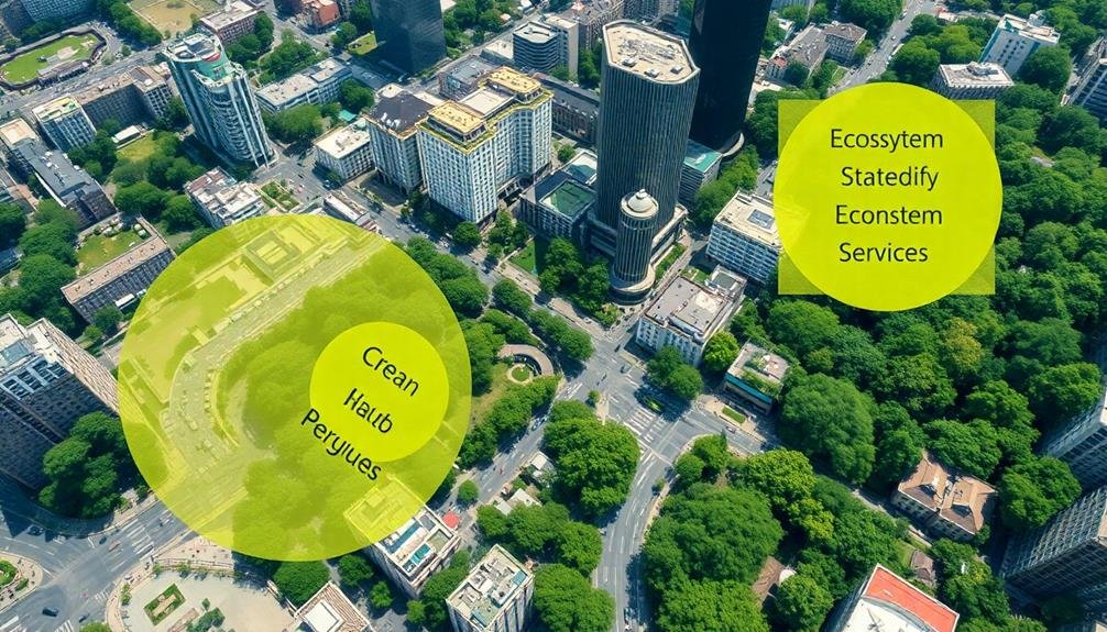
Mapping urban green spaces isn't just about planning for climate change adaptation; it's also a key step in quantifying ecosystem services. By analyzing aerial imagery and satellite data, you can assess the value these spaces provide to your city. This quantification helps you make informed decisions about urban planning and resource allocation.
When you map urban green spaces, you're able to measure:
- Carbon sequestration: Calculate how much CO2 your green areas absorb, contributing to climate change mitigation.
- Air quality improvement: Estimate the reduction in air pollutants like particulate matter and ozone.
- Stormwater management: Determine the volume of rainwater your green spaces can retain, reducing flood risks.
These measurements allow you to assign monetary values to ecosystem services, making it easier to justify investments in green infrastructure. You'll be able to compare the cost-effectiveness of natural solutions versus traditional gray infrastructure.
Additionally, quantifying ecosystem services helps you track changes over time, allowing you to assess the impact of urban development or conservation efforts. By understanding the full value of your urban green spaces, you can better advocate for their protection and expansion.
Environmental Justice Evaluation
While mapping urban green spaces provides valuable data on ecosystem services, it's equally vital to evaluate environmental justice aspects.
You'll want to assess the distribution of green spaces across different neighborhoods and socioeconomic groups to identify disparities in access and quality.
By analyzing your mapped data, you can determine if certain communities are underserved or disproportionately affected by a lack of green spaces. This evaluation helps you pinpoint areas where environmental injustices may exist, such as low-income neighborhoods with fewer parks or less tree cover.
You'll also want to take into account the quality and amenities of green spaces in different areas.
Are some communities only getting small, poorly maintained spaces while others enjoy large, well-equipped parks? This information is important for urban planners and policymakers to address inequities and guarantee fair distribution of environmental benefits.
Green Infrastructure Optimization
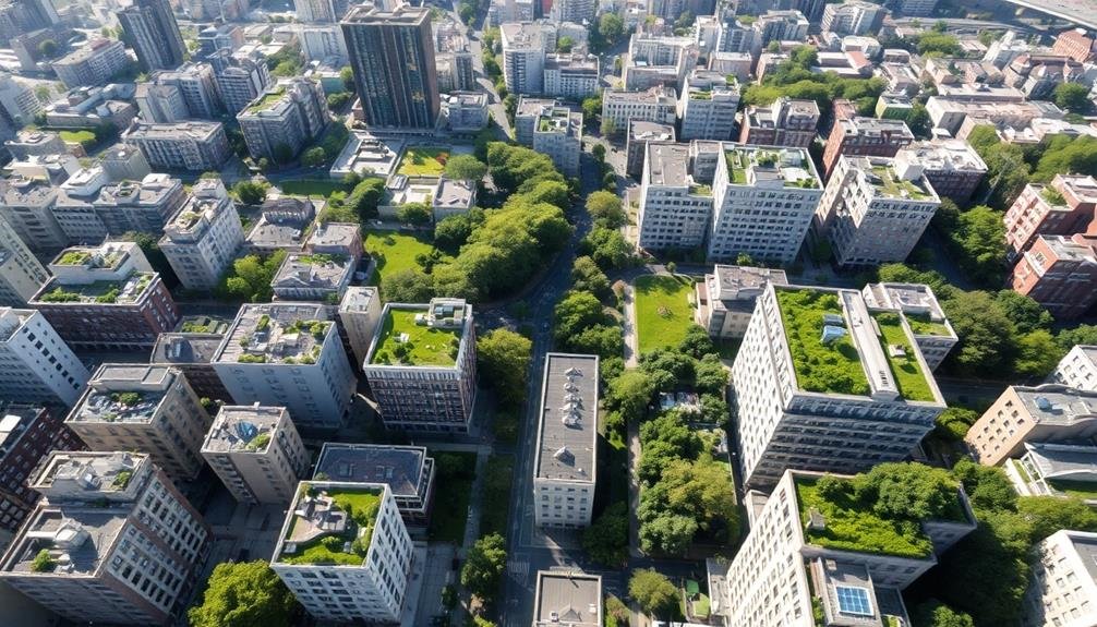
Building on the insights gained from environmental justice evaluations, it's time to focus on optimizing green infrastructure. By mapping urban green spaces from above, you'll gain a thorough view of your city's green assets, allowing you to make data-driven decisions for improvement.
You can identify areas lacking green spaces and prioritize new developments accordingly. Aerial mapping enables you to assess the quality and connectivity of existing green infrastructure. You'll spot opportunities to create green corridors, linking parks and natural areas to enhance biodiversity and improve ecosystem services.
This bird's-eye perspective also helps you optimize the placement of green roofs, urban gardens, and other innovative solutions. To maximize the benefits of green infrastructure optimization, consider these key steps:
- Analyze current green space distribution and identify gaps
- Evaluate potential sites for new green infrastructure projects
- Prioritize interventions based on environmental impact and cost-effectiveness
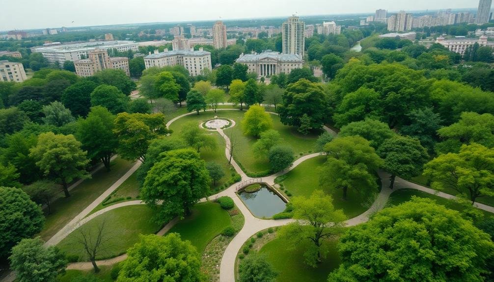
Recreation and Leisure Opportunities
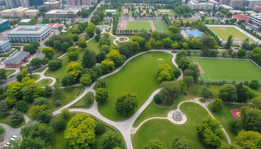
In addition to environmental benefits, urban green spaces offer essential recreation and leisure opportunities for city dwellers. These areas provide you with places to relax, exercise, and socialize, improving your overall well-being and quality of life. By mapping green spaces from above, you can easily identify and locate these recreational areas within your city.
Aerial mapping allows you to discover various types of green spaces, each offering unique opportunities:
| Type of Green Space | Recreational Activities | Health Benefits |
|---|---|---|
| Parks | Walking, picnicking | Stress reduction |
| Sports fields | Team sports, fitness | Physical health |
| Community gardens | Gardening, socializing | Mental well-being |
With accurate maps, you'll find it easier to plan your leisure activities and make the most of your city's green spaces. You can locate nearby parks for a quick jog, find community gardens to cultivate your green thumb, or discover sports fields to join local leagues. Mapping also helps city planners guarantee equitable access to these spaces, potentially leading to the development of new recreational areas in underserved neighborhoods. By understanding the distribution and types of green spaces available, you can better appreciate and utilize these valuable urban assets.
Frequently Asked Questions
How Accurate Are Satellite-Based Measurements of Urban Green Spaces?
You'll find satellite-based measurements of urban green spaces are quite accurate. They've improved considerably with high-resolution imagery and advanced algorithms. However, they're not perfect, as factors like cloud cover and seasonal changes can affect results.
What Are the Costs Associated With Mapping Urban Green Spaces From Above?
You'll find costs vary based on the method you choose. Satellite imagery can be expensive, while drone surveys are more affordable. Don't forget to factor in data processing and analysis expenses when budgeting for your urban green space mapping project.
How Often Should Aerial Mapping of Urban Green Spaces Be Updated?
You should update aerial mapping of urban green spaces every 1-3 years. It'll help you track changes, monitor growth, and assess the impact of urban development. Regular updates guarantee you're working with accurate, current data for planning purposes.
Can Aerial Mapping Detect the Health and Quality of Green Spaces?
Yes, aerial mapping can detect green space health and quality. You'll see it identifies vegetation density, stress levels, and species diversity. It'll also reveal signs of disease, pest infestations, and overall ecosystem robustness through spectral analysis.
Are There Privacy Concerns With High-Resolution Aerial Mapping of Urban Areas?
Yes, there are privacy concerns with high-resolution aerial mapping of urban areas. You'll find that it can potentially capture sensitive information about people's homes, activities, and personal spaces without their knowledge or consent. It's a contentious issue.
In Summary
You've seen how mapping urban green spaces from above offers incredible insights. It's not just about pretty parks; it's a powerful tool for tackling urban heat, boosting biodiversity, and improving air quality. You'll find it essential for managing stormwater, promoting public health, and ensuring environmental justice. By leveraging this bird's-eye view, you're optimizing green infrastructure and enhancing recreation opportunities. Remember, these aerial maps are your key to creating healthier, more sustainable cities for everyone.
As educators and advocates for responsible drone use, we’re committed to sharing our knowledge and expertise with aspiring aerial photographers.


Leave a Reply