Harness the power of drones for smarter city design with these key insights: Use aerial mapping to track urban growth and land use. Analyze traffic flow patterns from above to optimize congestion management. Assess green space distribution to guarantee equitable access. Evaluate building heights and density to inform zoning decisions. Monitor infrastructure conditions for proactive maintenance. Plan disaster response strategies with real-time aerial views. Optimize parking through usage pattern analysis. Study pedestrian movement to enhance walkability. Assess solar potential for renewable energy initiatives. Leverage 3D modeling for sunlight simulations and urban planning. These drone-driven strategies will revolutionize your approach to creating efficient, sustainable cities. Dive deeper to access the full potential of aerial insights.
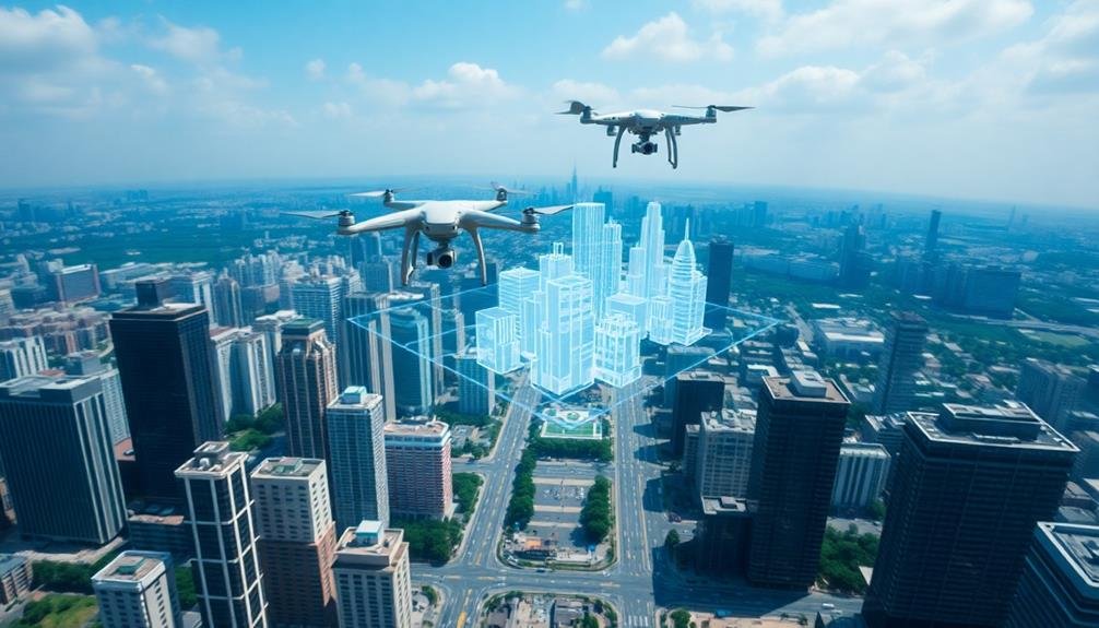
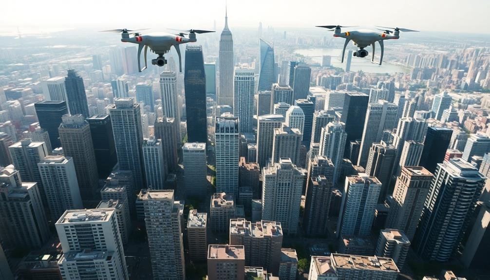
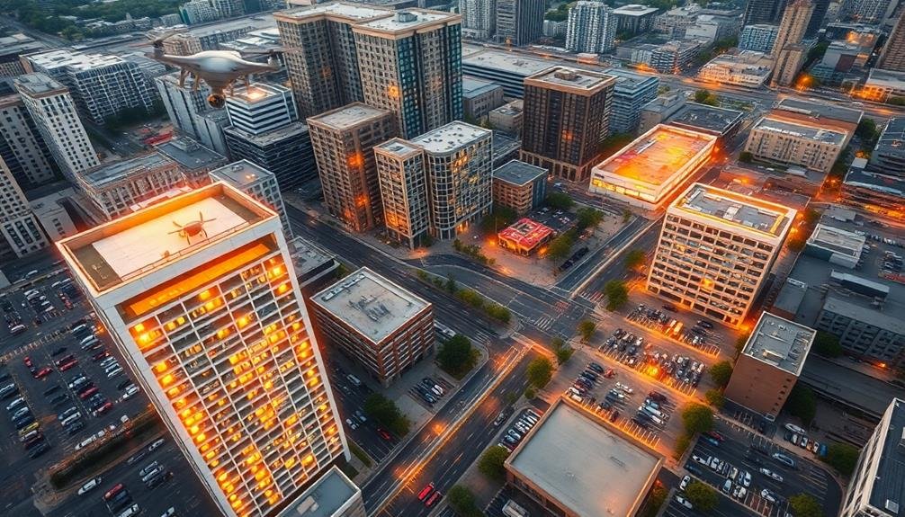
Aerial Mapping for Urban Growth
Soaring high above bustling metropolises, drones equipped with advanced imaging technology are revolutionizing urban planning. These aerial scouts capture detailed, up-to-date imagery that's invaluable for mapping urban growth patterns and informing city design decisions.
You'll find that drone-captured data offers unparalleled insights into land use, infrastructure development, and population density changes. By analyzing these high-resolution images, you can identify areas of rapid expansion, track encroachment on green spaces, and pinpoint potential locations for new developments.
Drones enable you to create 3D models of cityscapes, helping you visualize how proposed buildings will impact skylines and affect surrounding neighborhoods. You'll also be able to monitor construction progress, assess the condition of existing structures, and identify areas in need of renovation or redevelopment.
Moreover, drone mapping allows you to track changes in traffic patterns, pedestrian flows, and public space usage. This information is essential for optimizing transportation networks, designing walkable neighborhoods, and creating more livable urban environments.
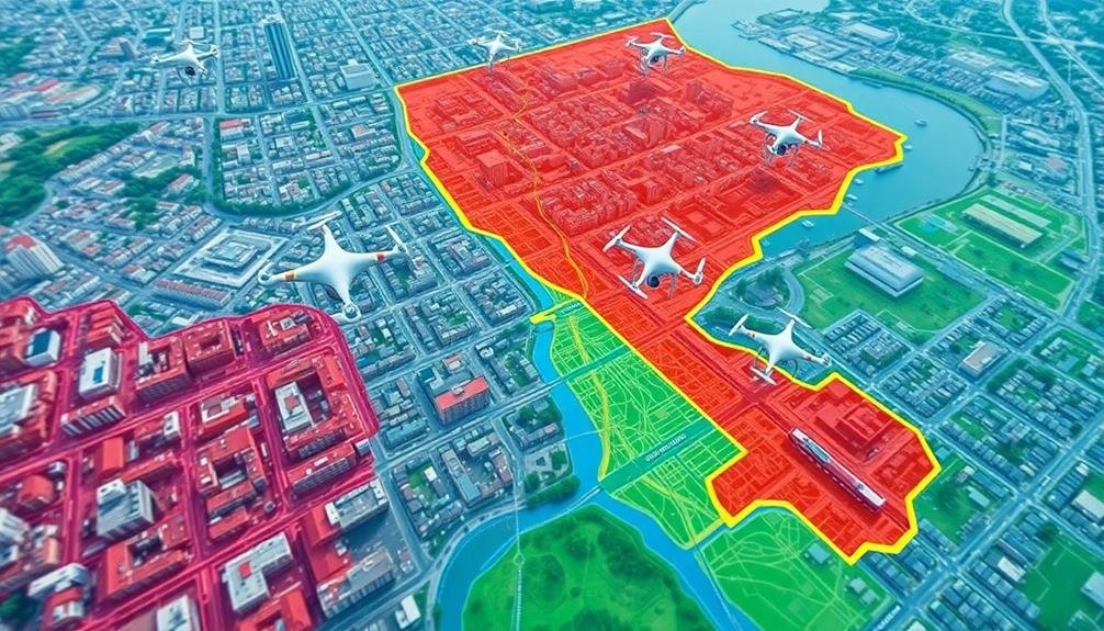
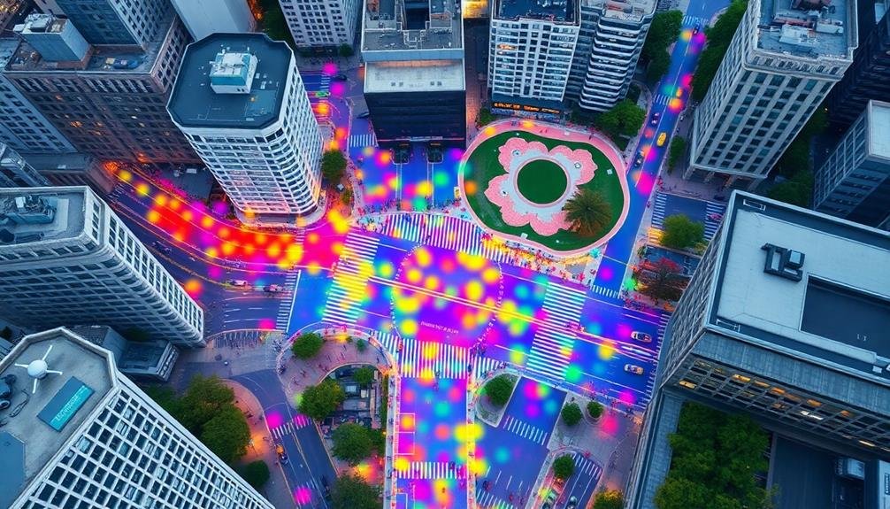
Traffic Flow Analysis From Above
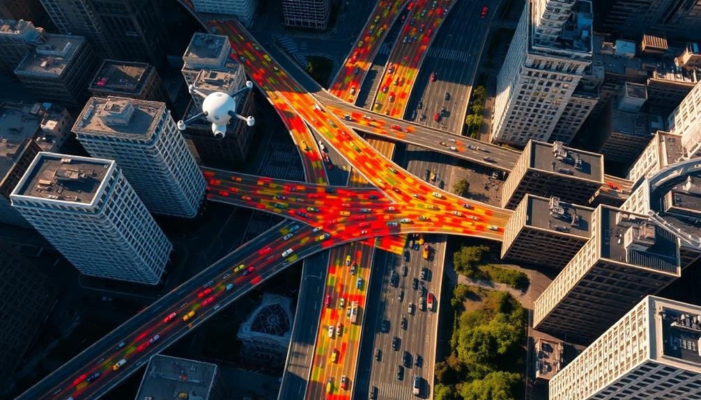
You'll find that drones offer unique perspectives for analyzing traffic flow in urban areas.
From above, you can easily identify congestion hotspots, allowing city planners to target problem areas more effectively.
You're also able to monitor intersection performance in real-time, providing valuable data for optimizing traffic signal timing and improving overall road network efficiency.
Aerial Congestion Hotspot Identification
Countless drones equipped with high-resolution cameras are revolutionizing traffic flow analysis in urban areas. You can now identify congestion hotspots with unprecedented accuracy and efficiency. By analyzing aerial footage, you'll pinpoint areas where traffic consistently slows down or comes to a standstill.
These aerial insights allow you to:
- Detect recurring bottlenecks at specific intersections or highway merges
- Identify time-based patterns in traffic congestion
- Assess the impact of road work or events on surrounding traffic flow
You'll gain a thorough view of how vehicles move through the city, enabling data-driven decisions for infrastructure improvements.
Drone footage helps you spot issues that might be missed from ground-level observations, such as inefficient lane merges or poorly timed traffic signals.
Real-Time Intersection Performance Monitoring
Drones equipped with advanced sensors and cameras now offer real-time monitoring of intersection performance. You can use these aerial devices to analyze traffic flow patterns, signal timing effectiveness, and vehicle queue lengths at busy intersections.
By capturing bird's-eye views, you'll gain valuable insights into how vehicles move through intersections and identify potential bottlenecks or inefficiencies.
With drone technology, you can track vehicle counts, speeds, and turning movements more accurately than traditional ground-based methods. This data helps you optimize signal timing plans and improve overall intersection efficiency.
You'll also be able to detect and respond to incidents or unusual traffic patterns more quickly, reducing congestion and enhancing safety.
Green Space Distribution Assessment
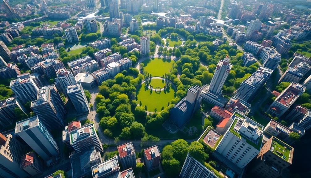
You'll find drones invaluable for evaluating green space distribution in urban areas.
Through vegetation density mapping, you can quickly identify areas lacking sufficient greenery and prioritize where to add new plants or trees.
Park accessibility analysis allows you to evaluate how easily residents can reach local green spaces, helping you plan for more equitable distribution of parks and recreational areas.
Vegetation Density Mapping
The verdant tapestry of a city reveals itself through vegetation density mapping. Using drones equipped with multispectral sensors, you'll capture detailed imagery of your urban landscape. This data allows you to analyze the distribution and health of vegetation across different neighborhoods, parks, and streetscapes.
By creating vegetation density maps, you'll gain valuable insights into your city's green infrastructure. These maps highlight areas with abundant foliage and those lacking in greenery, helping you identify urban heat islands and potential locations for new green spaces.
You'll also be able to monitor changes in vegetation cover over time, tracking the impact of urban development or climate change on your city's ecosystem.
To maximize the benefits of vegetation density mapping:
- Combine drone imagery with ground-level data for more accurate assessments
- Use normalized difference vegetation index (NDVI) to quantify plant health and density
- Integrate mapping results into your city's GIS for thorough urban planning
With this information at your fingertips, you can make data-driven decisions to enhance biodiversity, improve air quality, and create more livable urban environments.
Vegetation density mapping empowers you to strategically plan and maintain your city's green spaces for a healthier, more sustainable future.
Park Accessibility Analysis
Analyzing park accessibility and green space distribution is essential for creating equitable urban environments. With drones, you'll gain a thorough view of your city's parks and open spaces. You can use this aerial perspective to assess the distribution of green areas across different neighborhoods and identify underserved communities.
Start by mapping all parks and green spaces in your city. Then, analyze the distance between residential areas and these spaces. Look for gaps where residents must travel more than a 10-minute walk to reach a park. Use drone imagery to identify potential locations for new parks or green corridors in these underserved areas.
You can also assess the quality of existing parks using drone footage. Look for signs of neglect, such as overgrown vegetation or damaged facilities. This information will help you prioritize maintenance and upgrades.
Don't forget to take into account factors like population density and demographics when evaluating park accessibility. Use this data alongside your drone insights to guarantee equitable access to green spaces for all residents, regardless of their neighborhood or socioeconomic status.
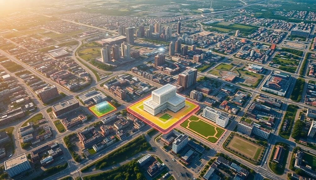
Building Height and Density Evaluation
Verticality and concentration form the backbone of urban skylines, and drone technology offers unprecedented insights into building height and density patterns.
You'll find that drones equipped with LiDAR sensors can accurately measure building heights and create 3D models of urban areas. This data helps you analyze the city's vertical growth, identify potential zoning violations, and assess the impact of tall structures on surrounding neighborhoods.
Using drone-captured imagery, you can evaluate building density across different areas of the city. This information is essential for urban planners to understand population distribution, infrastructure needs, and potential congestion hotspots.
You'll be able to identify areas that might benefit from increased density or where overdevelopment could lead to problems.
Here are three key benefits of using drones for building height and density evaluation:
- Rapid data collection covering large urban areas
- High-resolution 3D mapping for precise measurements
- Cost-effective alternative to traditional surveying methods
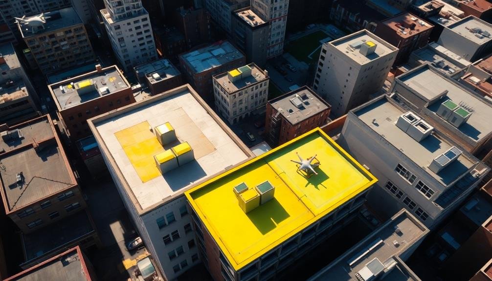
Infrastructure Condition Monitoring
Lifelines of urban centers, infrastructure systems require constant vigilance to maintain their integrity and functionality. Drones offer an efficient and cost-effective way to monitor these essential networks. You'll find that UAVs can quickly survey large areas, accessing hard-to-reach locations that would be dangerous or time-consuming for human inspectors.
Use drones to capture high-resolution images and videos of roads, bridges, railways, and utilities. You can detect cracks, corrosion, or other signs of wear before they become critical issues. Thermal imaging cameras on drones help you identify hidden problems like water leaks or electrical hotspots.
By combining this data with AI and machine learning algorithms, you'll create predictive maintenance models that optimize repair schedules and resource allocation.
Don't overlook the power of regular drone surveys to track infrastructure changes over time. You'll build a thorough database that aids in long-term planning and budgeting.
Remember to integrate drone-collected data with existing GIS and asset management systems for a holistic view of your city's infrastructure health. By leveraging drone technology, you'll enhance public safety, reduce maintenance costs, and extend the lifespan of critical urban systems.
Urban Heat Island Detection
You'll find drones invaluable for detecting urban heat islands through advanced thermal mapping techniques.
These airborne sensors can capture detailed temperature variations across city landscapes, highlighting areas of excessive heat retention.
Thermal Mapping Techniques
Thermal mapping techniques have revolutionized urban heat island detection, offering city planners essential insights into temperature variations across metropolitan areas.
You'll find that drones equipped with thermal cameras are now at the forefront of this technology, providing high-resolution temperature data with unprecedented accuracy and efficiency.
When you're using drones for thermal mapping, you'll want to follow these key steps:
- Plan your flight path carefully, ensuring complete coverage of the target area
- Conduct flights during ideal conditions, typically early morning or late evening
- Use specialized software to stitch together thermal images and create thorough heat maps
You'll notice that these heat maps reveal hot spots in urban environments, often correlating with areas of high energy consumption, poor ventilation, or excessive heat-absorbing surfaces.
By analyzing this data, you can identify areas that need attention, such as neighborhoods lacking green spaces or buildings with inefficient cooling systems.
Armed with this information, you're better equipped to make informed decisions about urban planning, energy efficiency initiatives, and climate resilience strategies.
You'll be able to target interventions more effectively, reducing the urban heat island effect and improving the quality of life for city residents.
Vegetation Coverage Analysis
Drones equipped with multispectral sensors are revolutionizing vegetation coverage analysis in urban areas. You'll find these aerial tools invaluable for evaluating the distribution and health of green spaces across your city. By capturing data across various spectral bands, drones can detect subtle differences in plant health, species composition, and overall vegetation density.
To maximize the benefits of drone-based vegetation analysis, focus on key metrics like the Normalized Difference Vegetation Index (NDVI). This index helps you quantify plant health and coverage, allowing for targeted interventions in areas lacking greenery. You can also use drones to monitor the effectiveness of urban greening initiatives over time, tracking changes in canopy cover and identifying areas prone to urban heat island effects.
When planning drone surveys, consider seasonal variations in vegetation. Conduct multiple flights throughout the year to capture changes in leaf cover and plant health.
Disaster Response Planning
Leveraging drone technology can revolutionize disaster response planning for urban areas. You'll find that drones provide invaluable data for creating thorough emergency strategies. They offer real-time aerial views of potentially hazardous areas, helping you identify evacuation routes and safe zones more effectively.
By integrating drone-captured imagery into your city's disaster response plan, you're equipping emergency services with essential information to act swiftly and efficiently.
Drones can assist you in:
- Mapping flood-prone areas and predicting water flow patterns
- Evaluating building structural integrity after earthquakes
- Monitoring wildfire spread and identifying at-risk neighborhoods
You'll also benefit from using drones to conduct regular infrastructure inspections, allowing you to spot potential weaknesses before disasters strike. This proactive approach helps you allocate resources more efficiently and prioritize maintenance efforts.
Parking Optimization Strategies
Through advanced drone technology, you can revolutionize parking optimization strategies for your city. Drones equipped with high-resolution cameras and AI-powered image recognition software can provide real-time data on parking availability and usage patterns.
You'll gain valuable insights into peak hours, underutilized areas, and illegal parking hotspots. Use this information to implement dynamic pricing models, adjusting rates based on demand to encourage more efficient use of parking spaces.
You can also identify areas where additional parking is needed or where existing spaces can be repurposed for other urban needs. Drones can help you monitor the effectiveness of new parking policies, such as time restrictions or permit zones.
Furthermore, you can integrate drone-collected data with smart parking systems, guiding drivers to available spots through mobile apps or digital signage. This reduces traffic congestion and emissions from circling vehicles.
You'll also be able to optimize parking enforcement by directing personnel to areas with frequent violations. By leveraging drone technology, you'll create a more efficient, user-friendly parking ecosystem that benefits both residents and city management.
Pedestrian Movement Pattern Analysis
Your city's pedestrian flow is a vital aspect of urban planning that drones can help you analyze with unprecedented detail. By capturing aerial footage of pedestrian movements, you'll gain valuable insights into how people navigate your urban spaces. This data allows you to identify bottlenecks, popular routes, and underutilized areas, enabling you to make informed decisions about infrastructure improvements and urban design.
With drone-captured pedestrian movement data, you can:
- Optimize sidewalk widths and placement to accommodate actual foot traffic patterns
- Strategically locate crosswalks, benches, and other street furniture for maximum utility
- Identify potential safety hazards and implement preventive measures
You'll also be able to track changes in pedestrian behavior over time, helping you assess the impact of urban interventions. By analyzing movement patterns during different times of day, weekdays versus weekends, and various weather conditions, you'll develop a thorough understanding of your city's pedestrian dynamics.
This information can guide decisions on public transportation routes, commercial zoning, and the placement of public amenities. Ultimately, drone-based pedestrian analysis empowers you to create more walkable, efficient, and enjoyable urban environments that cater to the actual needs and behaviors of your city's residents and visitors.
Solar Potential Assessment
Drones aren't just useful for understanding pedestrian movements; they're also powerful tools for evaluating your city's solar energy potential.
By utilizing drones equipped with high-resolution cameras and thermal imaging sensors, you can quickly assess large areas of rooftops and open spaces for their solar power generation capabilities.
You'll be able to identify the most suitable locations for solar panel installations by analyzing factors such as roof orientation, slope, and shading patterns.
Drones can capture detailed 3D models of buildings and surrounding structures, allowing you to simulate sunlight exposure throughout the day and year. This data helps you optimize panel placement and predict energy generation more accurately.
Additionally, thermal imaging from drones can detect existing solar installations that may be underperforming due to damage or inefficiencies.
You can use this information to prioritize maintenance and upgrades, maximizing the city's overall solar energy output.
Frequently Asked Questions
How Do Privacy Laws Affect Drone Usage for City Planning?
You'll need to navigate privacy laws carefully when using drones for city planning. They restrict where you can fly and what data you can collect. You must obtain consent and protect personal information to avoid legal issues.
What Qualifications Are Needed to Operate Drones for Urban Design Purposes?
You'll need a remote pilot certificate from the FAA, understanding of local regulations, and proficiency in drone operation. Expertise in urban planning, GIS, and data analysis is also essential. Specialized training in urban design applications may be beneficial.
How Accurate Are Drone Measurements Compared to Traditional Surveying Methods?
You'll find that drone measurements can be highly accurate, often within centimeters. They're comparable to traditional surveying methods and sometimes even more precise, especially in hard-to-reach areas. However, accuracy can vary depending on equipment quality and conditions.
Can Drones Be Used for Real-Time Urban Monitoring and Management?
Yes, you can use drones for real-time urban monitoring and management. They'll provide you with live data on traffic flow, air quality, infrastructure conditions, and crowd movements. You'll be able to respond quickly to urban issues as they arise.
What Are the Limitations of Drone Technology in Adverse Weather Conditions?
You'll find drones struggle in high winds, heavy rain, and snow. They can't fly in extreme temperatures or dense fog. Battery life decreases in cold weather, and ice can form on propellers, limiting flight time and stability.
In Summary
You've now got a powerful toolkit for leveraging drone technology in urban planning. By embracing these aerial insights, you'll make more informed decisions about your city's growth, sustainability, and livability. Remember, drones aren't just for pretty pictures; they're your eyes in the sky, offering unique perspectives on traffic, green spaces, infrastructure, and more. As you apply these tips, you'll create smarter, more efficient cities that better serve your residents.
As educators and advocates for responsible drone use, we’re committed to sharing our knowledge and expertise with aspiring aerial photographers.


Leave a Reply