You'll discover how cutting-edge technology is revolutionizing forest conservation as scientists explore the treetops. Drones equipped with high-resolution cameras and sensors map biodiversity, monitor wildlife, and assess forest health from above. AI-powered systems rapidly identify species and detect changes, while thermal imaging reveals hidden animals. Robotic arms collect samples with precision, minimizing environmental impact. Acoustic sensors analyze birdcalls, and specialized cameras study pollination processes. These high-tech tools enable researchers to track invasive species, observe primate behavior, and measure photosynthesis patterns in previously inaccessible canopies. The future of forest conservation is unfolding high above the ground, offering unprecedented insights into these essential ecosystems.
Drone Technology in Canopy Research
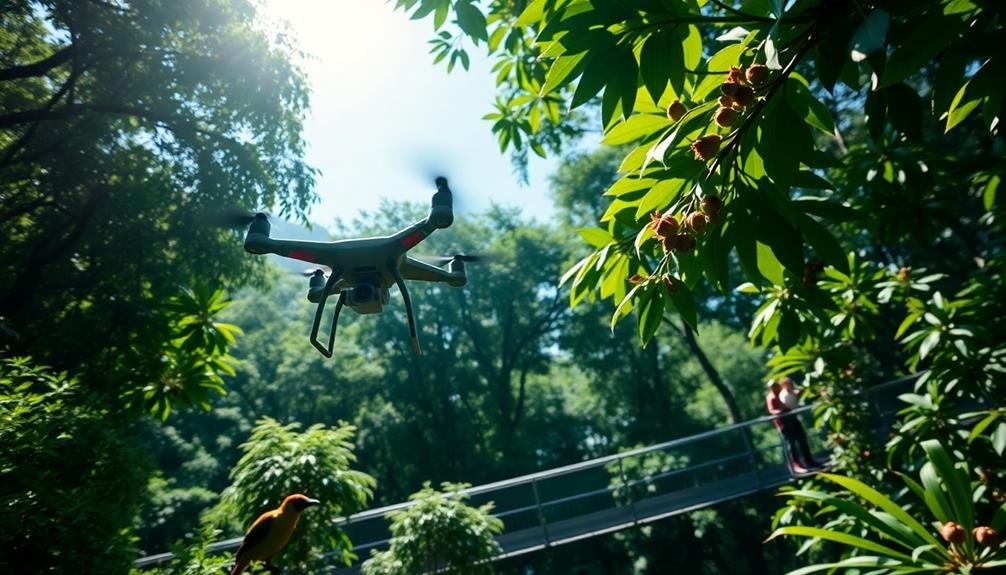
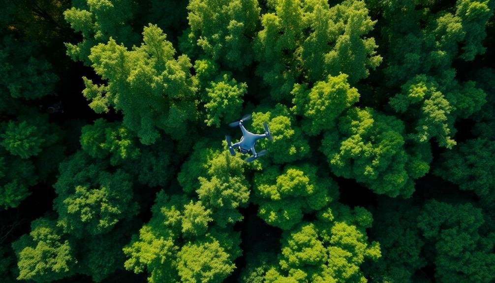
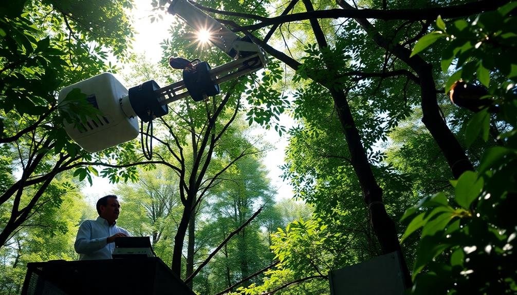
In light of recent technological advancements, drones have revolutionized forest canopy research. You'll find that these unmanned aerial vehicles now play a vital role in studying and conserving treetop ecosystems. Drones equipped with high-resolution cameras and sensors can capture detailed images and data from previously inaccessible areas of the forest canopy.
You can use drones to map forest structures, monitor tree health, and track wildlife populations without disturbing the delicate ecosystem. They're particularly useful for surveying large areas quickly and efficiently, providing researchers with a bird's-eye view of canopy dynamics. Drones can also collect samples and deploy sensors in hard-to-reach places, expanding the scope of scientific inquiry.
You'll appreciate how drone technology has improved safety for researchers, reducing the need for dangerous climbs and risky maneuvers in the treetops. It's also cost-effective, allowing for more frequent and thorough surveys.
As drone technology continues to advance, you can expect even more sophisticated applications in canopy research, including 3D modeling, thermal imaging, and real-time data transmission. These innovations are transforming our understanding of forest ecosystems and enhancing conservation efforts worldwide.
Mapping Forest Biodiversity From Above
Cutting-edge aerial mapping techniques have revolutionized how we study forest biodiversity. You'll find that these methods provide a thorough view of forest ecosystems, allowing researchers to analyze vast areas quickly and efficiently. By combining high-resolution imagery with advanced data processing, scientists can now identify individual tree species, assess canopy health, and track changes over time.
When you're exploring forest biodiversity from above, you'll encounter several key technologies:
- LiDAR (Light Detection and Ranging) sensors that create detailed 3D models of forest structure
- Hyperspectral cameras that capture data across a wide range of electromagnetic wavelengths
- Machine learning algorithms that process and interpret complex imagery
- GPS-enabled drones that can navigate precisely through forest canopies
These tools enable you to map biodiversity hotspots, monitor endangered species' habitats, and detect early signs of forest degradation.
You'll appreciate how this bird's-eye view complements traditional ground-based surveys, providing a more complete picture of forest ecosystems. As you explore aerial mapping, you'll discover its potential to inform conservation strategies, guide reforestation efforts, and enhance our understanding of global forest dynamics in the face of climate change.
Thermal Imaging for Wildlife Detection
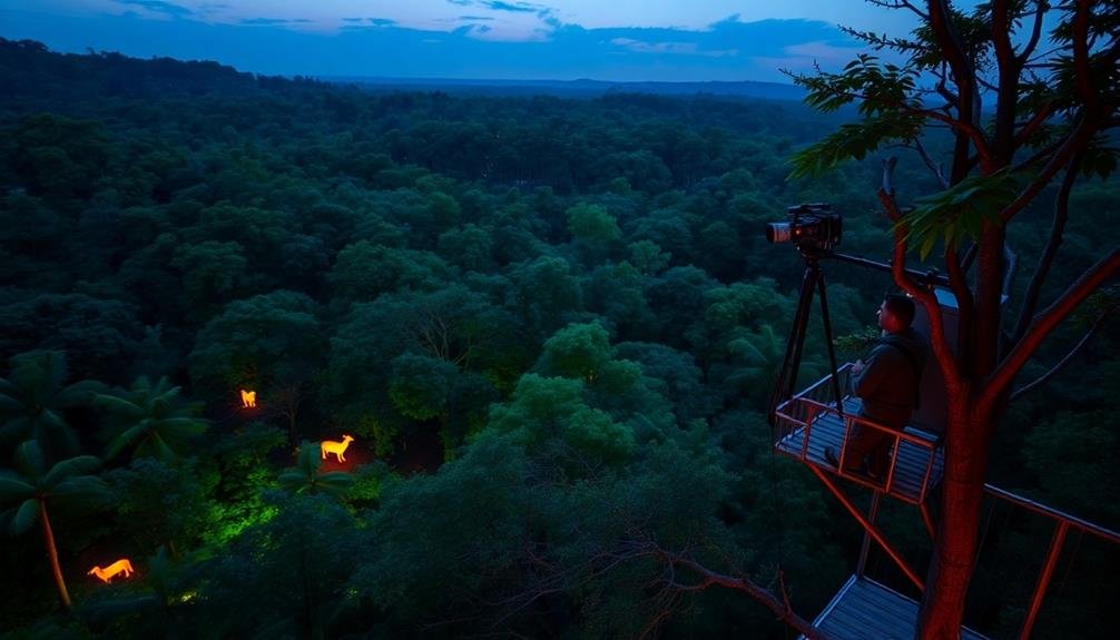
You'll find thermal imaging revolutionizing wildlife detection in forest canopies.
This technology allows you to identify nocturnal species that are typically elusive during daylight hours.
Nocturnal Species Identification
Identifying nocturnal species in dense forest canopies has long been a challenge for researchers. However, with the advent of high-tech tools, you're now able to uncover the secrets of these elusive creatures. Thermal imaging cameras, paired with advanced software, have revolutionized nocturnal species identification.
You'll find that these cutting-edge systems offer several advantages:
- Silent operation: They don't disturb the animals' natural behavior
- Long-range detection: You can identify species from a safe distance
- Species-specific heat signatures: Each animal has a unique thermal profile
- Real-time data collection: You'll gather information as it happens
By using thermal imaging, you're able to distinguish between different species based on their body heat patterns. This technology allows you to detect animals hidden in foliage or camouflaged against their surroundings.
You'll also track their movements and behaviors without the need for invasive tagging methods. As you explore the forest canopy at night, you'll uncover a world previously hidden from view.
This non-invasive approach to nocturnal species identification is transforming conservation efforts, providing valuable insights into ecosystem dynamics and helping protect vulnerable species.
Heat Signature Analysis
Building on the thermal imaging technology used for species identification, heat signature analysis takes wildlife detection to the next level. You'll find that this advanced technique allows researchers to spot animals hidden deep within the forest canopy, even when they're completely obscured by foliage.
Heat signature analysis works by detecting the unique thermal patterns emitted by different species. You can use specialized cameras to capture these heat signatures, which appear as distinct colors on a thermal image. This method is particularly effective for locating warm-blooded animals, such as mammals and birds, against the cooler background of the forest.
You'll appreciate how this technology enables non-invasive monitoring of endangered species, tracking their movements and behaviors without disturbing their natural habitats.
It's especially useful for studying nocturnal animals or those that are typically difficult to observe. By analyzing heat signatures, you can estimate population sizes, identify breeding sites, and even detect signs of illness or injury in individual animals.
This valuable data helps conservationists develop more effective strategies for protecting vulnerable species and maintaining biodiversity in forest ecosystems.
Canopy Sampling With Robotic Arms
You'll find robotic arms revolutionizing canopy sampling techniques in forest conservation.
These high-tech tools allow you to collect specimens with unprecedented precision, reaching areas previously inaccessible to researchers.
Precision Specimen Collection
In light of the challenges posed by traditional canopy sampling methods, researchers have developed robotic arms for precision specimen collection. These high-tech tools allow you to gather samples from the forest canopy with unprecedented accuracy and minimal disturbance to the ecosystem.
When you're using robotic arms for canopy sampling, you'll benefit from:
- Increased reach: You can access hard-to-reach areas of the canopy without risking personal safety or damaging the surrounding vegetation.
- Enhanced precision: The robotic arms' fine motor control allows you to collect delicate specimens, such as insects or small plant samples, without crushing or damaging them.
- Reduced environmental impact: You'll minimize disturbance to the canopy ecosystem by using targeted, non-invasive collection methods.
- Real-time data collection: Many robotic arms are equipped with sensors and cameras, enabling you to gather environmental data alongside physical specimens.
Minimizing Environmental Impact
A key advantage of robotic arms for canopy sampling is their ability to minimize environmental impact. These devices allow you to collect specimens and data without physically climbing trees or constructing intrusive platforms. You'll reduce damage to delicate branches and avoid disturbing wildlife habitats.
Robotic arms can reach areas that were previously inaccessible or too dangerous for human researchers. They're equipped with sensors and cameras, letting you observe and collect samples with precision. You won't need to cut down trees or clear large areas for access, preserving the forest's integrity.
These systems often use electric motors, which are quieter and produce fewer emissions than gas-powered alternatives. You'll minimize noise pollution and air contamination, vital factors in sensitive ecosystems.
The arms can be programmed to move slowly and carefully, reducing the risk of accidentally harming plants or animals.
AI-Powered Species Identification Systems

Precision meets innovation in the domain of AI-powered species identification systems. You'll find these cutting-edge tools revolutionizing canopy research, enabling scientists to quickly and accurately identify flora and fauna in the treetops.
These systems use advanced algorithms and machine learning to analyze images and sounds, providing real-time data on species composition and distribution.
Here's how AI-powered identification systems are enhancing canopy conservation efforts:
- Rapid biodiversity assessments: You can now survey vast areas of forest canopy in a fraction of the time it once took.
- Early detection of invasive species: The AI quickly flags non-native plants or animals, allowing for swift intervention.
- Tracking endangered species: You'll be able to monitor rare and elusive creatures with greater efficiency.
- Phenology studies: The systems can detect subtle changes in plant life cycles, aiding climate change research.
Treetop Pollination Studies Using Drones
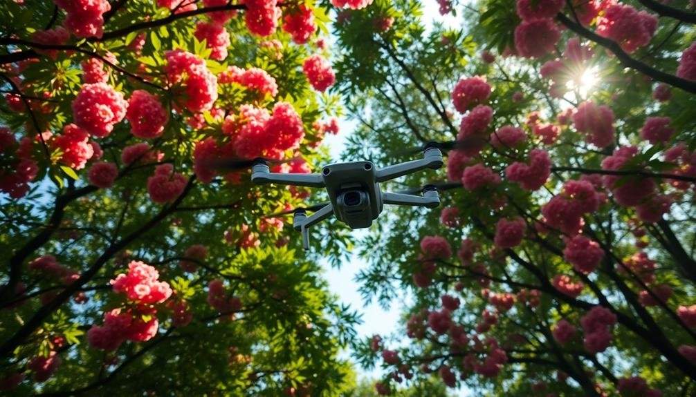
Drones have taken pollination studies to new heights, quite literally. You'll find researchers using these aerial devices to access treetops that were once nearly impossible to reach.
These unmanned aircraft now allow scientists to observe pollination processes in real-time, capture high-resolution images, and even collect pollen samples from the uppermost branches of tall trees.
You'll see drones equipped with specialized cameras that can detect ultraviolet patterns on flowers, invisible to the human eye but vital for attracting pollinators.
They're also fitted with sensors to measure environmental factors like temperature, humidity, and wind speed, which influence pollination activity.
Some advanced drones can mimic insect behavior, helping researchers study how different pollinators interact with specific tree species.
You might even encounter drones that can release pollen or place tiny sensors on flowers to track visitation rates.
This technology is revolutionizing our understanding of forest ecosystems.
It's helping scientists map pollination networks, identify keystone species, and develop targeted conservation strategies.
With drones, you're witnessing a new era in canopy research that's uncovering the intricate relationships between trees and their pollinators.
Monitoring Deforestation in Real-Time

You'll find that modern deforestation monitoring relies heavily on satellite imagery analysis.
Through advanced AI algorithms, you can detect changes in forest cover almost instantly.
This real-time monitoring allows for rapid response to illegal logging and other threats to forest ecosystems.
Satellite Imagery Analysis
Satellite imagery analysis has revolutionized our ability to monitor deforestation in real-time. You can now track forest changes across vast areas with unprecedented accuracy and speed. This technology utilizes high-resolution images from satellites orbiting Earth, capturing detailed views of forest cover and health.
When you're analyzing satellite imagery for deforestation, you'll typically follow these steps:
- Image acquisition: Collect satellite images of the target area over time
- Pre-processing: Correct for atmospheric effects and geometric distortions
- Classification: Use algorithms to categorize land cover types
- Change detection: Compare images from different dates to identify areas of forest loss
You'll find that this process allows for rapid identification of deforestation hotspots, enabling swift action to protect vulnerable areas. It's not just about detecting clear-cutting; you can also spot more subtle changes like selective logging or forest degradation.
With advancements in machine learning and artificial intelligence, you're able to automate much of this analysis, making it possible to monitor forests on a global scale continuously. This technology has become an indispensable tool in the fight against illegal logging and unsustainable forest management practices.
AI-Powered Change Detection
Building on the foundation of satellite imagery analysis, AI-powered change detection takes forest monitoring to the next level. This cutting-edge technology uses machine learning algorithms to automatically detect and alert conservationists to changes in forest cover almost in real-time.
You'll find that AI systems can process vast amounts of satellite data much faster than human analysts. They're trained to recognize patterns associated with deforestation, such as sudden clearings or gradual thinning of tree cover. When the AI detects these changes, it flags the area for further investigation.
What's more, these systems can learn and improve over time. As they process more data, they become better at distinguishing between natural changes and human-caused deforestation. This precision helps conservationists focus their efforts where they're most needed.
You can even set up customized alerts for specific regions of interest. This allows for rapid response to illegal logging or encroachment.
With AI-powered change detection, you're not just seeing the forest for the trees – you're seeing the minute-by-minute changes that could signal threats to biodiversity and ecosystem health.
Acoustic Sensors for Birdcall Analysis
Three key innovations have revolutionized birdcall analysis in forest canopies: acoustic sensors, machine learning algorithms, and cloud-based data processing. These technologies work together to provide unprecedented insights into bird populations and behaviors.
You'll find acoustic sensors strategically placed throughout the forest canopy, constantly listening for bird vocalizations. They're designed to withstand harsh environmental conditions and can operate for months on a single battery charge.
Once activated, these sensors capture high-quality audio recordings that are then transmitted to a central database for analysis.
Machine learning algorithms process the vast amounts of collected data, identifying and classifying individual bird species with remarkable accuracy. They can even detect subtle changes in call patterns that might indicate stress or habitat disturbances.
Here's what these algorithms can accomplish:
- Identify hundreds of bird species
- Estimate population densities
- Track migration patterns
- Detect the presence of rare or endangered species
Cloud-based data processing allows researchers from around the world to access and analyze this wealth of information.
You can now collaborate in real-time, sharing insights and refining conservation strategies based on the most up-to-date data available.
Capturing Canopy Photosynthesis Patterns

From the forest floor to the highest treetops, innovative technologies are revolutionizing how we study canopy photosynthesis patterns. You'll find researchers using advanced imaging techniques like hyperspectral cameras and LiDAR systems to capture detailed 3D models of forest canopies. These tools allow scientists to map photosynthetic activity across entire forest ecosystems with unprecedented accuracy.
Drones equipped with multispectral sensors now fly above the canopy, collecting data on leaf chlorophyll content, water stress, and overall plant health. This information helps track seasonal changes and identify areas of concern.
At ground level, you'll see tower-mounted sensors continuously monitoring CO2 flux, providing real-time insights into forest carbon dynamics.
Miniaturized sensors attached directly to leaves offer a tree's-eye view of photosynthesis. These devices measure light intensity, temperature, and gas exchange, giving researchers a detailed understanding of how individual leaves contribute to overall canopy function.
Drones in Primate Behavior Research
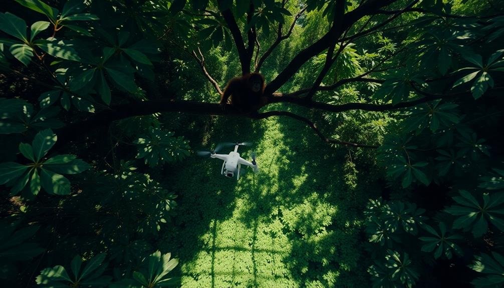
Soaring above the forest canopy, drones are revolutionizing primate behavior research. You'll find these unmanned aerial vehicles capturing footage that was once impossible to obtain, providing scientists with unprecedented insights into the lives of arboreal primates.
Drones equipped with high-resolution cameras allow researchers to observe behaviors without disturbing the animals or risking human safety in challenging terrain.
You can see how drones are transforming primate studies in several ways:
- Population surveys: Drones cover vast areas quickly, helping researchers estimate population sizes and distributions more accurately.
- Habitat mapping: They create detailed 3D maps of forest canopies, revealing primate travel routes and resource availability.
- Social behavior observation: Aerial footage captures group dynamics and interactions that are difficult to see from the ground.
- Health monitoring: Thermal imaging cameras on drones can detect sick or injured animals, aiding conservation efforts.
You'll notice that this technology isn't without challenges. Researchers must navigate strict regulations, minimize disturbance to wildlife, and manage large datasets.
However, the potential for drone-based research to advance our understanding of primate behavior and inform conservation strategies is immense.
Assessing Canopy Health With Multispectral

While drones have revolutionized primate research, they're also making waves in forest health monitoring. You'll find that multispectral imaging technology, when combined with drones, offers a powerful tool for evaluating canopy health. This method allows you to capture data across various light spectrums, including visible and near-infrared.
By analyzing these images, you can detect subtle changes in leaf color, moisture content, and overall tree vigor. You'll be able to identify stressed or diseased trees before visible symptoms appear, enabling early intervention. This technology also helps you map forest composition, track seasonal changes, and monitor the impact of climate change on canopy structure.
You can use multispectral data to calculate vegetation indices like NDVI (Normalized Difference Vegetation Index), which quantifies plant health and density. This information is essential for forest managers and conservationists in making informed decisions about resource allocation and conservation strategies.
As you implement this technology, you'll find it's particularly useful in remote or inaccessible areas where traditional ground-based surveys are challenging. It's revolutionizing how we monitor and protect our forests, providing a bird's-eye view of canopy health that was previously unattainable.
Tracking Invasive Species Spread

Invasive species' spread poses a significant threat to forest ecosystems, but high-tech solutions are now helping to combat this issue. You'll find that advanced tracking technologies are revolutionizing how we monitor and manage these harmful invaders in forest canopies.
Drones equipped with high-resolution cameras and AI-powered image recognition software are at the forefront of this battle. They can quickly survey vast areas of forest, identifying and mapping the spread of invasive plants or insects. You're now able to detect infestations earlier and respond more effectively.
Here's how these high-tech tools are enhancing invasive species management:
- Real-time monitoring: Continuous data collection allows for rapid response
- Precise mapping: Accurate location data helps target control efforts
- Early detection: Identifying new invasions before they become widespread
- Predictive modeling: Forecasting potential spread based on environmental factors
You'll also find that researchers are using remote sensing techniques, such as LiDAR and hyperspectral imaging, to detect subtle changes in canopy structure and composition.
These methods can reveal the presence of invasive species even before they're visible to the naked eye, giving you a vital advantage in preserving forest health.
Frequently Asked Questions
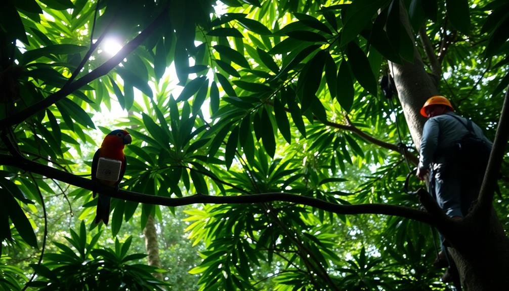
How Do Researchers Safely Access Treetops for Close-Up Observations?
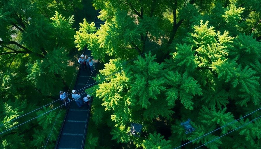
You'll find researchers accessing treetops using various methods. They'll climb with ropes and harnesses, use canopy walkways, or operate aerial lifts. Some even employ hot air balloons or drones for unique vantage points in their observations.
What Training Is Required to Operate High-Tech Equipment in Forest Canopies?
To operate high-tech equipment in forest canopies, you'll need specialized training. You'll learn safety protocols, equipment handling, data collection techniques, and tree climbing skills. It is crucial to master these areas before conducting research in treetop environments.
How Do Weather Conditions Affect Canopy Research Using Drones and Sensors?
You'll find weather greatly impacts canopy research with drones and sensors. Wind can disrupt flight paths, rain interferes with sensors, and extreme temperatures affect battery life. You'll need to plan carefully and adapt to changing conditions.
What Are the Ethical Considerations When Using Technology to Study Wildlife?
When you're using tech to study wildlife, you'll need to take into account animal welfare, habitat disturbance, and data privacy. You should minimize stress on animals, respect their natural behavior, and guarantee responsible use of collected information.
How Do Researchers Minimize Disturbance to Ecosystems During Canopy Studies?
You'll find researchers minimizing ecosystem disturbance by using non-invasive tools like drones and remote sensors. They'll limit human presence, conduct studies during low-impact seasons, and follow strict protocols to protect wildlife and habitats.
In Summary
You've seen how high-tech tools are revolutionizing canopy research. From drones mapping biodiversity to AI identifying species, these innovations are opening up new frontiers in forest conservation. As you consider the future, remember that these technologies aren't just gadgets – they're essential instruments in our quest to understand and protect Earth's precious forest ecosystems. By embracing these advancements, you're contributing to a more sustainable future for our planet's treetop habitats.
As educators and advocates for responsible drone use, we’re committed to sharing our knowledge and expertise with aspiring aerial photographers.


Leave a Reply