Elevate your habitat restoration projects with these sky-high imaging techniques. First, use aerial mapping for thorough site assessment, identifying key features and challenges from above. Next, employ vegetation analysis with multispectral sensors to gain insights into plant health and distribution using specialized indices. Finally, monitor progress efficiently with drones, capturing regular aerial views to track restoration success over time. These methods provide detailed, large-scale data that's impossible to gather from the ground. By incorporating these aerial imaging strategies, you'll revolutionize your approach to habitat restoration. Discover how these techniques can transform your projects and boost your environmental impact.
Aerial Mapping for Site Assessment

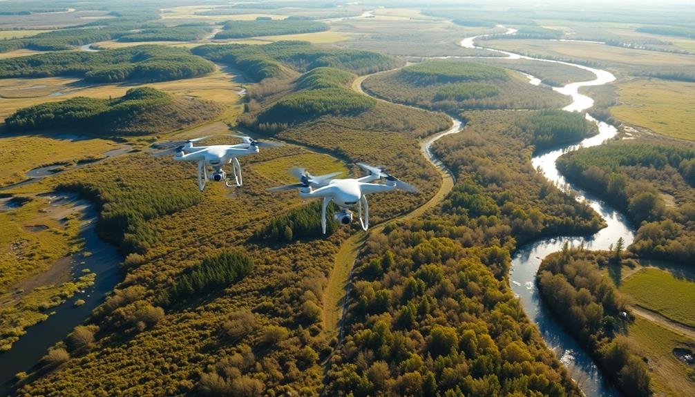
Aerial mapping stands out as a powerful tool for habitat restoration site assessment. It provides you with a detailed view of the landscape, allowing you to identify key features and potential challenges before setting foot on the ground. You'll gain valuable insights into terrain, vegetation cover, water bodies, and human-made structures that might impact your restoration efforts.
To get started, consider using drones or satellite imagery to capture high-resolution photos of your project area. These images can be stitched together to create detailed orthomosaic maps, which offer a precise, georeferenced representation of the site. You can then use Geographic Information System (GIS) software to analyze the data and create thematic maps highlighting specific features of interest.
Pay close attention to topography, soil types, and existing vegetation patterns. Look for signs of erosion, invasive species, or degraded habitats that need addressing. Identify potential corridors for wildlife movement and areas that could serve as natural buffers.
Vegetation Analysis From Above
Vegetation analysis from above is a key application of aerial imagery in habitat restoration. You'll gain valuable insights into plant health, distribution, and species composition without disturbing the environment. Using high-resolution cameras and multispectral sensors, you can capture detailed images that reveal patterns invisible to the naked eye.
To interpret aerial vegetation data effectively, you'll need to understand different indices and their applications:
| Index | Purpose | Calculation | Pros | Cons |
|---|---|---|---|---|
| NDVI | Plant health | (NIR-Red)/(NIR+Red) | Widely used, simple | Saturation in dense canopies |
| EVI | Improved NDVI | 2.5*(NIR-Red)/(NIR+6*Red-7.5*Blue+1) | Better in high biomass areas | More complex calculation |
| SAVI | Soil-adjusted vegetation | ((NIR-Red)/(NIR+Red+L))*(1+L) | Accounts for soil influence | Requires soil adjustment factor |
| NDRE | Chlorophyll content | (NIR-RedEdge)/(NIR+RedEdge) | Sensitive to leaf chlorophyll | Requires RedEdge band |
| NDWI | Water stress | (NIR-SWIR)/(NIR+SWIR) | Detects plant water content | Affected by atmospheric conditions |
Monitoring Progress With Drones

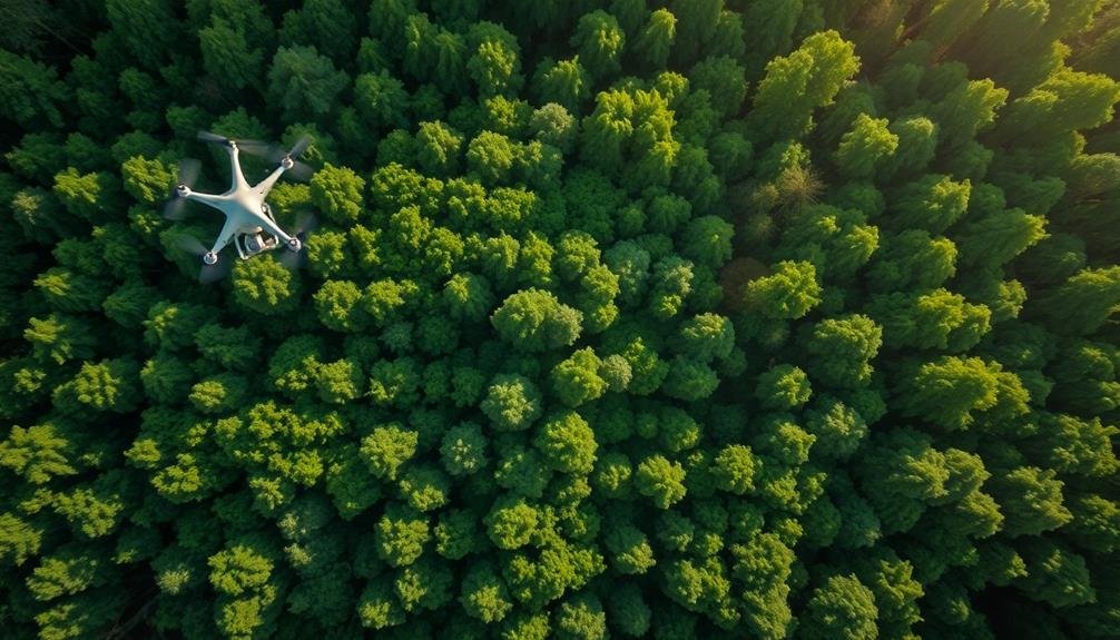
Drones have revolutionized the way we keep track of habitat restoration projects. These unmanned aerial vehicles allow you to monitor large areas quickly and efficiently, providing a bird's-eye view of your restoration efforts. You'll be able to capture high-resolution images and videos that reveal changes in vegetation cover, soil erosion, and wildlife activity over time.
To effectively use drones for progress monitoring, establish a regular flight schedule. Conduct surveys at consistent intervals, such as monthly or quarterly, to track changes accurately. Confirm you're using the same flight paths and altitudes each time to maintain consistency in your data collection.
When analyzing drone imagery, look for key indicators of restoration success. These may include increased vegetation density, reduced bare soil areas, or the presence of target plant species. You can use specialized software to process and analyze the imagery, creating vegetation indices or 3D models of the landscape.
Don't forget to comply with local regulations regarding drone usage. Obtain necessary permits and follow guidelines for flying in sensitive habitats.
Frequently Asked Questions
What Are the Legal Requirements for Using Drones in Habitat Restoration Projects?
You'll need to follow local drone regulations, obtain necessary permits, and adhere to privacy laws. Register your drone with the FAA, stay within visual line of sight, and avoid restricted airspace. Always prioritize safety and environmental protection.
How Cost-Effective Is Aerial Imagery Compared to Traditional Ground-Based Assessment Methods?
You'll find aerial imagery more cost-effective than ground-based methods in many cases. It's faster, covers larger areas, and requires less manpower. However, the initial investment in equipment can be high, so consider your project's scale.
Can Aerial Imagery Detect Invasive Species in Early Stages of Infestation?
You'll find aerial imagery can detect early-stage invasive species infestations. It's effective for spotting subtle changes in vegetation patterns, colors, and densities. You're able to identify potential problem areas before they become widespread.
What Weather Conditions Are Optimal for Capturing High-Quality Aerial Imagery?
You'll get the best aerial imagery on clear, calm days with minimal cloud cover. Avoid windy conditions or harsh sunlight. Early morning or late afternoon often provide soft, even lighting. Aim for low humidity to reduce haze.
How Frequently Should Aerial Surveys Be Conducted for Effective Habitat Restoration Monitoring?
You'll want to conduct aerial surveys at least annually for effective habitat restoration monitoring. However, you should increase frequency to quarterly or even monthly if you're tracking rapid changes or specific seasonal patterns in the landscape.
In Summary
You've now got powerful tools to revolutionize your habitat restoration projects. By embracing aerial mapping, vegetation analysis, and drone monitoring, you'll gain valuable insights and streamline your efforts. Don't hesitate to incorporate these high-tech solutions into your workflow. They'll save you time, provide extensive data, and help you make informed decisions. Remember, the bird's-eye view can be your secret weapon in creating thriving, sustainable ecosystems. Keep looking up!
As educators and advocates for responsible drone use, we’re committed to sharing our knowledge and expertise with aspiring aerial photographers.


Leave a Reply