
Citizen-led wildlife surveys from above involve community members using aerial observation techniques to collect data on animal populations and habitats. You'll participate in tasks like counting species, monitoring behavior, and evaluating environmental changes using drones or other aerial methods. These surveys cover large areas quickly, minimizing wildlife disturbance while providing unique perspectives. You'll need minimal training to get involved, and your contributions will support vital conservation efforts. By joining these projects, you'll help researchers track population trends and inform policy decisions. The combination of community engagement and advanced technology is revolutionizing wildlife monitoring and conservation strategies. Discover how you can make a significant impact on local ecosystems.
Defining Citizen-Led Wildlife Surveys
At its core, citizen-led wildlife surveys involve everyday people participating in the collection of data about local animal populations. These initiatives empower you, as a member of the community, to contribute to scientific research and conservation efforts. You'll be tasked with observing, counting, and recording information about various species in your area.
Citizen-led surveys can take many forms, from bird counts to butterfly monitoring. You might use simple tools like binoculars, field guides, and data sheets, or more advanced technology like smartphone apps and GPS devices. The data you collect is typically submitted to researchers or organizations who analyze it to track population trends, migration patterns, and habitat changes.
These surveys are designed to be accessible, requiring minimal training and equipment. You don't need to be a professional scientist to participate – just an interest in wildlife and a willingness to follow protocols.
Benefits of Aerial Observation
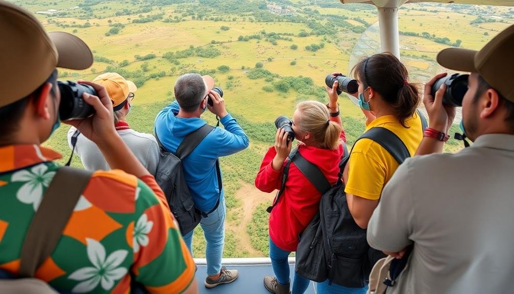
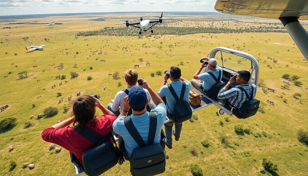
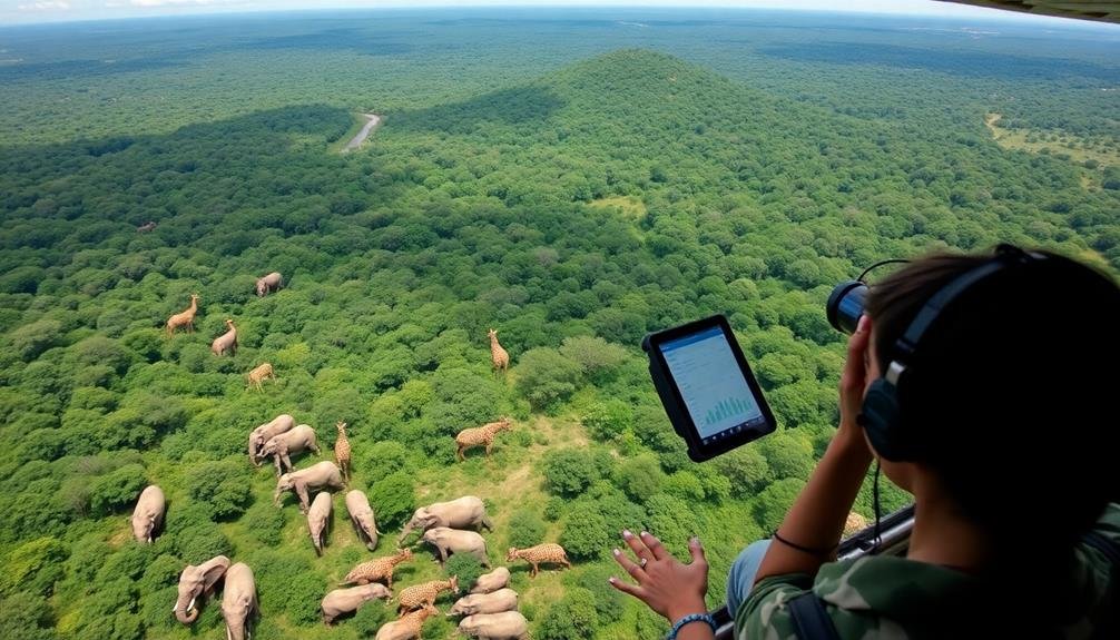
Aerial observation stands out as a powerful tool in citizen-led wildlife surveys. When you participate in these surveys from above, you'll gain several advantages over ground-based methods. You'll cover vast areas quickly, allowing for more thorough data collection in less time. This efficiency is particularly valuable when monitoring wide-ranging or migratory species.
From the air, you'll spot animals that might be hidden from ground level, especially in dense vegetation or rugged terrain. You'll also minimize disturbance to wildlife, as your presence won't directly interfere with their behavior. This leads to more accurate population counts and behavior observations.
Aerial surveys offer a unique perspective on habitat conditions and landscape changes. You'll easily identify habitat boundaries, detect signs of human encroachment, and assess the overall health of ecosystems. This bird's-eye view helps you understand the broader context of wildlife distribution and movement patterns.
Moreover, you'll capture high-quality imagery and video footage during flights. These visual records serve as valuable documentation for future analysis and comparison, enhancing the scientific value of your citizen-led efforts.
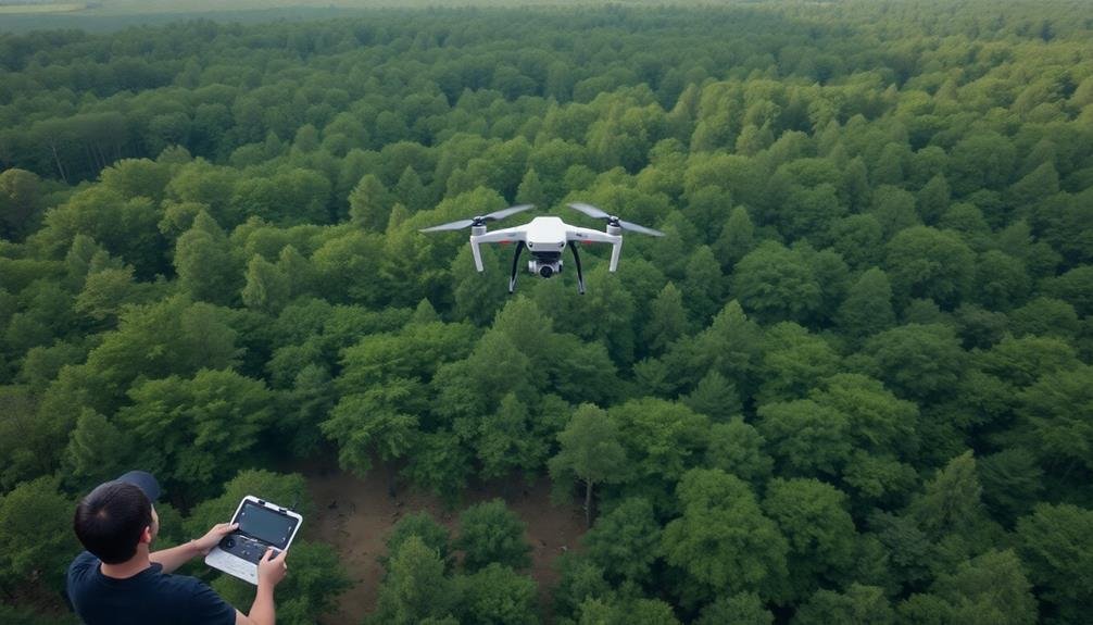
Drone Technology for Wildlife Monitoring
You'll find that drone technology offers powerful aerial imaging capabilities for wildlife monitoring.
Before deploying drones, you must familiarize yourself with local flight regulations to guarantee legal and responsible operation.
Your data collection methods can include capturing high-resolution photos, videos, or even thermal imagery to track and study wildlife populations effectively.
Aerial Imaging Capabilities
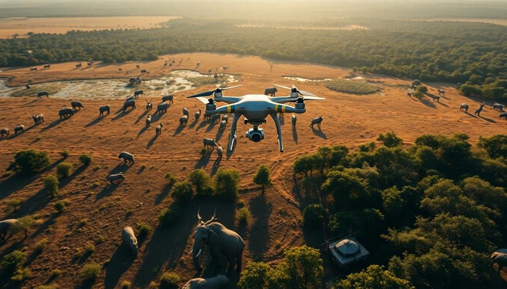
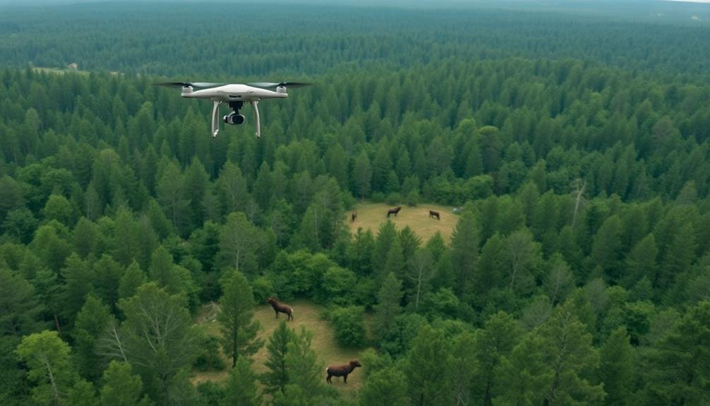
Drone technology's evolution has revolutionized wildlife monitoring, offering citizen scientists powerful aerial imaging capabilities. You'll find that modern drones come equipped with high-resolution cameras capable of capturing detailed photographs and videos from various altitudes.
These cameras often feature zoom functionality, allowing you to observe wildlife without disturbing their natural behaviors.
Many drones now incorporate thermal imaging technology, enabling you to detect animals' heat signatures even in dense vegetation or during nighttime surveys. This feature is particularly useful for locating nocturnal species or animals that are typically difficult to spot.
You can also utilize multispectral imaging sensors on some advanced drones. These sensors capture data across multiple light wavelengths, helping you identify different vegetation types and assess habitat health. This information is essential for understanding wildlife distribution and movement patterns.
Real-time transmission capabilities allow you to view and analyze footage instantly, making on-the-spot decisions about survey areas or follow-up observations.
Additionally, GPS tagging of images and videos provides precise location data, enhancing the accuracy of your wildlife population mapping efforts.
Drone Flight Regulations
Understanding drone flight regulations is essential for citizen scientists engaging in wildlife monitoring. You'll need to familiarize yourself with local, state, and federal laws governing drone use. In the United States, the Federal Aviation Administration (FAA) sets the primary rules for drone operation.
You must register your drone if it weighs more than 0.55 pounds. Keep your drone within visual line of sight and fly below 400 feet. Don't fly near airports, over people, or in restricted airspace.
Be aware of wildlife protection laws that may limit drone use in certain areas or during specific seasons. You'll need to obtain a Remote Pilot Certificate if you're flying for commercial purposes, which may apply to some citizen science projects. This involves passing an aeronautical knowledge test.
Even for recreational use, you must pass a free online safety test. Check local regulations, as some parks or conservation areas may have additional restrictions.
Always prioritize wildlife welfare and minimize disturbance. By following these regulations, you'll contribute to responsible drone use while collecting valuable data for wildlife surveys.
Data Collection Methods
With proper regulations in mind, let's explore how to effectively use drones for wildlife monitoring. You'll need to choose the right equipment and develop a systematic approach to data collection.
Select a drone with a high-resolution camera and adequate flight time for your survey area. Consider thermal imaging cameras for nocturnal species or dense vegetation.
Plan your flight path carefully, guaranteeing complete coverage of the target area while minimizing disturbance to wildlife. You'll typically fly in a grid pattern, maintaining a consistent altitude and speed. Use GPS waypoints to guarantee accurate and repeatable surveys.
When collecting data, focus on:
- Counting individuals or groups of animals
- Identifying species
- Documenting behavior patterns
- Mapping habitat features
Post-flight, you'll need to analyze the imagery using specialized software. This may involve manual counting, automated detection algorithms, or a combination of both.
Be sure to record metadata such as date, time, weather conditions, and flight parameters to guarantee the validity of your results.
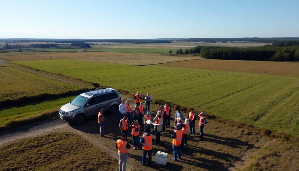
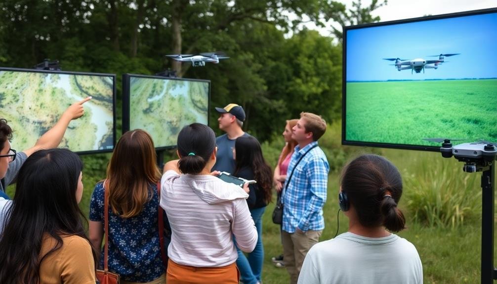
Organizing Community-Based Aerial Surveys
As technology becomes more accessible, community-based aerial surveys are gaining popularity among citizen scientists. You can now organize these surveys using drones or small aircraft to gather valuable wildlife data from above.
To start, you'll need to form a team of volunteers with diverse skills, including pilots, drone operators, and data analysts.
First, obtain necessary permits and permissions from local authorities. Then, create a detailed flight plan, considering factors like weather conditions, wildlife behavior patterns, and restricted airspace. You'll want to train your team on proper survey techniques, safety protocols, and data collection methods.
During the survey, you'll use high-resolution cameras and GPS technology to capture images and location data. It's essential to maintain consistent altitude and speed for accurate results.
After the flight, you'll need to process and analyze the collected data, often using specialized software to identify and count animals.
To guarantee the survey's success, you should collaborate with local wildlife experts and share your findings with relevant conservation organizations. By organizing community-based aerial surveys, you're contributing to important wildlife research and conservation efforts in your area.
Data Collection and Analysis Methods

Once you've completed your aerial survey, it's time to tackle the data you've collected. You'll need to organize and analyze the information to draw meaningful conclusions about wildlife populations and habitats. Start by compiling all your observations, including species counts, location data, and any notable behaviors or patterns you've witnessed.
Next, you'll want to input this data into a standardized format, such as a spreadsheet or specialized wildlife survey software. This step is essential for guaranteeing consistency and enabling easy analysis. Don't forget to include metadata like date, time, weather conditions, and survey route.
When analyzing your data, consider these key aspects:
- Population density estimates
- Species distribution patterns
- Habitat preferences
- Seasonal variations in wildlife presence
Use statistical methods to identify trends and draw conclusions from your observations. You may need to consult with wildlife experts or statisticians to ensure your analysis is reliable.
Remember to compare your findings with historical data and other relevant studies to provide context for your results. Finally, prepare a thorough report detailing your methods, findings, and recommendations for future surveys or conservation efforts.
Legal Considerations and Regulations
Before you commence on your citizen-led wildlife survey, it's vital to understand the legal landscape.
You'll need to familiarize yourself with local, state, and federal regulations governing wildlife observation and data collection. Many areas have specific rules about approaching or disturbing wildlife, especially endangered species. Make sure you're not inadvertently breaking any laws during your survey activities.
If you're using drones or other aerial equipment, you must comply with aviation regulations.
In the United States, the Federal Aviation Administration (FAA) has strict guidelines for drone usage, including registration requirements and flight restrictions. You'll need to obtain proper certifications if flying in certain areas or altitudes.
Privacy laws are another important consideration.
Be aware of property boundaries and avoid inadvertently surveying or photographing private land without permission. Some regions may require permits for conducting wildlife surveys, even as a citizen scientist. Check with local wildlife agencies or conservation organizations for guidance on necessary permissions.
Lastly, consider data sharing regulations.
Make sure you're following proper protocols for collecting and disseminating information about sensitive species or habitats to protect them from potential harm.
Ethical Concerns in Wildlife Observation
Observing wildlife ethically is essential for citizen scientists conducting surveys. You'll need to prioritize the well-being of animals and their habitats over your desire to collect data.
Remember that your presence can disrupt natural behaviors and cause stress to wildlife. Always maintain a safe distance and use appropriate equipment, such as binoculars or telephoto lenses, to minimize disturbance.
When conducting aerial surveys, be mindful of noise pollution and potential impacts on nesting sites or sensitive areas. You should familiarize yourself with species-specific guidelines and best practices for observation.
Consider the following ethical principles:
- Respect wildlife and their habitats
- Avoid altering animal behavior or causing stress
- Prioritize animal welfare over data collection
- Report any signs of distress or illegal activities
It's vital to obtain proper permits and authorizations before conducting surveys, especially in protected areas.
Be transparent about your activities and share your findings responsibly with relevant authorities and conservation organizations.
Training Citizen Scientists
To become an effective citizen scientist, you'll need to familiarize yourself with essential equipment and safety protocols for wildlife observation.
You'll learn how to use tools like binoculars, GPS devices, and field guides while adhering to guidelines that protect both you and the animals you're studying.
Additionally, you'll be trained in proper data collection techniques, including how to accurately record species information, population counts, and behavioral observations.
Equipment and Safety Protocols
In accordance with best practices, citizen scientists must be properly equipped and trained in safety protocols before participating in wildlife surveys. You'll need to familiarize yourself with the vital gear and safety measures to guarantee successful and secure observations.
First, you'll need appropriate clothing for the environment, including sturdy shoes, weather-resistant outerwear, and sun protection. Binoculars, field guides, and a camera are fundamental for wildlife identification and documentation.
Don't forget to bring water, snacks, and a first-aid kit for your comfort and safety.
Safety protocols are paramount. You'll learn:
- How to navigate terrain safely
- What to do in case of wildlife encounters
- Emergency procedures and communication methods
- Proper use of survey equipment
You'll also be trained in data collection techniques and how to use GPS devices for accurate location recording.
It's important to understand the significance of maintaining a safe distance from wildlife and respecting their habitats. By following these protocols, you'll contribute valuable data while safeguarding your safety and the well-being of the animals you're observing.
Data Collection Techniques
Data collection forms the backbone of any successful citizen science project. When conducting wildlife surveys from above, you'll need to master specific techniques to guarantee accurate and reliable data. First, familiarize yourself with the target species' identifying features, behaviors, and habitats. You'll need to quickly spot and count animals while maintaining a consistent survey speed and altitude.
Use standardized data sheets or mobile apps designed for aerial surveys. These tools often include GPS tracking to record your flight path and observation points. You'll typically record species, number of individuals, habitat type, and any notable behaviors or conditions.
Don't forget to note the date, time, weather conditions, and visibility, as these factors can affect survey results.
Practice estimating group sizes and distances from the air. It's essential to develop a consistent method for counting large herds or flocks. You might use techniques like block counting or photographing groups for later analysis.
Always follow the project's specific protocols for data collection and submission. Remember, your observations contribute to a larger dataset, so consistency and accuracy are key to producing valuable scientific information.
Case Studies of Successful Projects
Several notable citizen-led wildlife surveys have achieved remarkable success, demonstrating the power of community engagement in conservation efforts. One standout example is the Christmas Bird Count, an annual event organized by the National Audubon Society. Since 1900, thousands of volunteers across North America have contributed to this long-running census, providing valuable data on bird populations and migration patterns.
Another successful project is the Great Backyard Bird Count, which encourages participants to spend just 15 minutes observing and reporting birds in their local area. This global initiative has helped scientists track changes in bird distributions and abundance over time.
In marine environments, REEF's Volunteer Fish Survey Project has been instrumental in monitoring coral reef ecosystems. Recreational divers and snorkelers contribute data on fish populations, helping researchers better understand and protect these fragile habitats.
The success of these projects can be attributed to several factors:
- Easy-to-use data collection tools and platforms
- Clear instructions and training for volunteers
- Collaboration between citizens and professional scientists
- Regular feedback and sharing of results with participants
These case studies highlight the potential of citizen science to generate large-scale, long-term datasets that inform conservation strategies and policy decisions.
Future of Crowdsourced Conservation Efforts

As citizen-led wildlife surveys gain momentum, the future of crowdsourced conservation efforts looks promising.
You'll see an increase in the use of advanced technologies, such as drones and AI-powered image recognition, to enhance data collection and analysis. These tools will allow you to cover larger areas and identify species more accurately.
You can expect more collaboration between citizen scientists and professional researchers, leading to more thorough and reliable datasets. This partnership will help bridge the gap between local knowledge and scientific expertise, resulting in more effective conservation strategies.
In the coming years, you'll witness the expansion of citizen science projects to cover a wider range of species and ecosystems. You'll have opportunities to participate in surveys of lesser-known species and contribute to the discovery of new ones.
Education and training programs will become more sophisticated, equipping you with the skills to conduct high-quality surveys and interpret data.
You'll also see the development of user-friendly platforms for data sharing and analysis, making it easier for you to contribute to global conservation efforts from your local community.
Frequently Asked Questions
How Accurate Are Citizen-Led Wildlife Surveys Compared to Professional Scientific Studies?
You'll find citizen-led wildlife surveys can be surprisingly accurate, but they're often less precise than professional studies. They're valuable for covering large areas and spotting trends, but may miss subtle details that experts would catch.
What Safety Measures Are in Place for Volunteers During Aerial Surveys?
You'll undergo thorough safety training before any aerial surveys. You're required to wear protective gear, follow strict flight protocols, and work with experienced pilots. There's always a briefing on emergency procedures and communication systems before takeoff.
Can Citizen-Led Surveys Impact Animal Behavior or Migration Patterns?
Yes, your surveys can impact animal behavior. You'll need to maintain proper distance and minimize noise. It's essential you follow guidelines to reduce disturbance. Remember, even well-intentioned observation can stress wildlife if not done carefully.
How Are Survey Locations and Times Determined for Optimal Wildlife Observation?
You'll choose survey locations and times based on wildlife habits and seasonal patterns. You'll consult local experts, study migration routes, and consider breeding seasons. You'll also factor in weather conditions and accessibility for ideal observation opportunities.
What Funding Options Are Available for Communities Interested in Starting Aerial Surveys?
You can explore various funding options for aerial surveys, including government grants, conservation organization sponsorships, crowdfunding campaigns, local business partnerships, and community fundraising events. Don't forget to research wildlife-focused foundations that support citizen science initiatives.
In Summary
You've now explored the exciting world of citizen-led aerial wildlife surveys. By embracing drone technology and community participation, you're part of a growing movement in conservation. Remember to follow ethical guidelines and proper training protocols. As you contribute to data collection and analysis, you'll play an essential role in protecting wildlife. The future of crowdsourced conservation is bright, and you're at the forefront. Keep looking up—there's so much more to discover!
As educators and advocates for responsible drone use, we’re committed to sharing our knowledge and expertise with aspiring aerial photographers.


Leave a Reply