Mapping technologies can reveal essential information in disaster response efforts. You'll gain real-time insights into damage assessments, safe access routes, and survivor locations. These tools optimize resource allocation, detect environmental hazards, and plan evacuation routes. They're invaluable for selecting temporary shelter sites and guiding urban search and rescue operations. Advanced mapping aids in post-disaster recovery planning, helping prioritize rebuilding efforts and allocate resources efficiently. By integrating satellite imagery, drone footage, and ground reports, responders can create a thorough picture of the disaster zone. This technology continues to evolve, offering even more powerful ways to save lives and streamline recovery.
Real-Time Damage Assessment

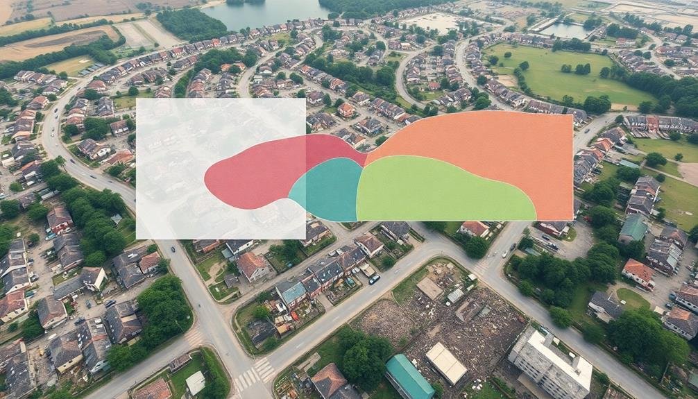
Two critical components of real-time damage assessment in disaster response are satellite imagery and drone surveillance.
These technologies allow you to quickly gather visual data on affected areas, helping to identify the extent of damage and prioritize rescue efforts.
Satellite imagery provides a broad overview of the disaster zone, letting you spot large-scale destruction, flooding, or landslides.
You can compare pre- and post-disaster images to quantify changes and assess infrastructure damage. This bird's-eye view helps you plan resource allocation and identify safe routes for first responders.
Drones offer more detailed, on-demand imagery.
You can deploy them to inspect specific areas of concern, capture high-resolution photos and videos, and even use thermal imaging to locate survivors.
Drones are particularly useful in hard-to-reach or dangerous locations where ground teams can't safely operate.
Identifying Safe Access Routes

Navigators in disaster response play an essential role in identifying safe access routes for emergency personnel and supplies. You'll find that these experts use a combination of real-time data, satellite imagery, and ground reports to create dynamic maps of accessible paths.
They'll consider factors like road conditions, bridge integrity, and potential hazards such as flooding or debris.
As you analyze these maps, you'll notice they're constantly updated to reflect changing conditions. You can use them to plan the most efficient routes for search and rescue teams, medical personnel, and supply convoys.
They'll help you avoid areas that are impassable or dangerous, saving vital time and resources.
You'll also find that these maps integrate information from various sources, including local authorities, eyewitness accounts, and drone footage. This extensive approach guarantees you have the most accurate and up-to-date information possible.
By identifying safe access routes, you're not only facilitating faster response times but also protecting the lives of those involved in relief efforts.
Locating Survivors and Victims

With safe access routes established, the focus shifts to locating survivors and victims. You'll find that mapping technologies play an essential role in this process.
Satellite imagery and aerial photography can provide a bird's-eye view of the affected area, helping you identify potential locations where people might be trapped or in need of assistance.
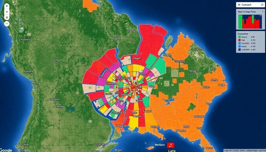
You can use Geographic Information Systems (GIS) to overlay various data layers, such as population density, building types, and damage assessments. This combination allows you to prioritize search areas and allocate resources more effectively.
Mobile apps and crowd-sourced information can also be invaluable, as survivors may use their phones to signal their location or report on others in distress.
Thermal imaging cameras mounted on drones or helicopters can detect heat signatures, helping you locate survivors in hard-to-reach areas or under debris.
You'll also want to incorporate data from search and rescue teams on the ground, updating your maps in real-time to track progress and avoid duplicate efforts.
Resource Allocation Optimization

You'll find that resource allocation optimization is essential for effective disaster response.
By using mapping technologies, you can efficiently distribute supplies to affected areas, ensuring aid reaches those who need it most.
You'll be able to prioritize critical locations, such as hospitals or densely populated regions, maximizing the impact of limited resources during the crisis.
Efficient Supply Distribution
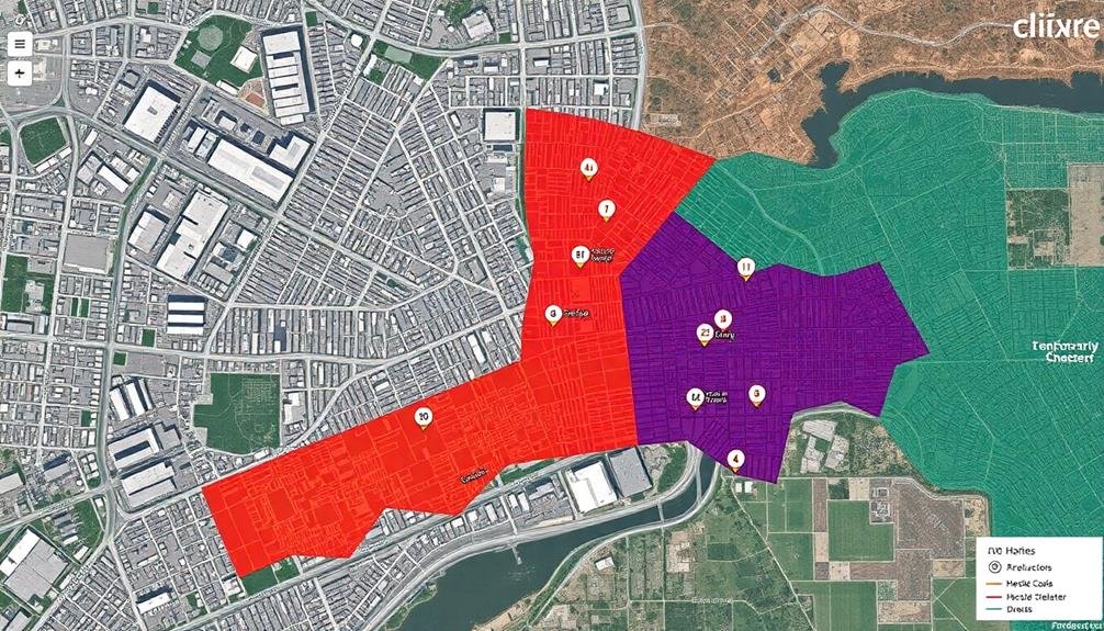
Efficient supply distribution is essential for effective disaster response. When you're coordinating relief efforts, you'll find that mapping can greatly improve your supply chain management. By visualizing the locations of affected areas, distribution centers, and available transportation routes, you can optimize the flow of vital resources.
You'll be able to identify bottlenecks and potential roadblocks in your distribution network, allowing you to develop alternative routes or transportation methods. Mapping also helps you prioritize areas with the greatest need, ensuring that limited supplies reach those who require them most urgently.
Real-time updates on road conditions, weather patterns, and population movements can inform your decisions on when and where to dispatch supplies. You can use this information to create dynamic distribution plans that adapt to changing circumstances on the ground.
Additionally, mapping enables you to track the movement of supplies from their origin to their final destination. This visibility helps you maintain accountability, reduce waste, and prevent duplication of efforts.
Prioritizing Critical Areas
Mapping plays an essential role in prioritizing vital areas during disaster response. By analyzing geospatial data, you can quickly identify the most affected regions and allocate resources efficiently.
You'll use layers of information, such as population density, infrastructure damage, and vulnerable groups, to create a thorough picture of the disaster's impact.
With these maps, you can pinpoint areas with the highest concentration of people in need, allowing you to direct immediate aid where it's most critical. You'll also be able to identify important facilities like hospitals, shelters, and emergency services that require priority attention.
By overlaying road network data, you can determine the most accessible routes for delivering supplies and evacuating residents.
Real-time updates to these maps help you adapt your response as the situation evolves. You'll track the spread of hazards, such as floods or fires, and adjust your priorities accordingly.
This dynamic approach guarantees that you're always focusing on the most urgent needs. By leveraging mapping technology, you'll optimize your resource allocation, potentially saving more lives and minimizing the disaster's overall impact.
Environmental Hazard Detection
You'll find that environmental hazard detection is essential in disaster response mapping.
Satellite imagery analysis allows you to quickly identify areas of concern, such as flooding, landslides, or fire spread.
Additionally, deploying sensor networks on the ground can provide real-time data on air quality, water contamination, and other potential dangers to responders and survivors.
Satellite Imagery Analysis
Satellite imagery's role in environmental hazard detection has become indispensable for disaster response efforts. You'll find that high-resolution satellite images provide an extensive view of affected areas, allowing you to identify and assess various environmental hazards quickly. These images can reveal flood extents, landslide risks, wildfire spread, and even chemical spills.
When analyzing satellite imagery, you'll use specialized software to process and interpret the data. You can detect changes in vegetation, water bodies, and terrain by comparing pre- and post-disaster images. This analysis helps you identify areas at risk of secondary hazards, such as dam failures or toxic releases.
You'll also use satellite imagery to monitor ongoing hazards, like the progression of wildfires or the spread of oil spills. By combining this data with other information sources, you can create detailed hazard maps to guide evacuation plans and resource allocation.
Remember that satellite imagery analysis requires expertise in remote sensing and image interpretation. You'll need to take into account factors like atmospheric conditions, sensor types, and temporal resolution to guarantee accurate hazard detection and assessment in disaster response scenarios.
Sensor Network Deployment
Beyond satellite imagery, sensor networks play a crucial role in detecting environmental hazards during disaster response. You'll find these networks deployed across affected areas, providing real-time data on various environmental factors.
These sensors can detect changes in air quality, water contamination, seismic activity, and other potential threats that might arise in the aftermath of a disaster.
When you're involved in disaster response, you'll appreciate how sensor networks enhance situational awareness. They'll help you:
- Identify toxic gas leaks or airborne pollutants quickly
- Monitor water quality in rivers and reservoirs for contamination
- Detect early signs of landslides or structural instabilities
By leveraging these sensor networks, you're able to make more informed decisions about resource allocation and evacuation plans.
You'll receive alerts when environmental conditions reach dangerous levels, allowing you to act swiftly to protect both response teams and affected populations.
Communication Network Planning

Communication network planning forms the backbone of effective disaster response mapping. You'll need to establish reliable channels for data transmission and information sharing among responders, command centers, and affected populations.
Start by evaluating existing infrastructure and identifying potential weak points or areas prone to failure during a disaster. You should consider redundancy in your network design, incorporating satellite, cellular, and radio technologies to guarantee continuous connectivity.
Plan for mobile communication units that can be rapidly deployed to disaster zones, providing temporary coverage where needed. Don't forget to account for power sources, as electricity may be disrupted. Include provisions for portable generators and solar-powered equipment in your planning.
Create a hierarchical communication structure that prioritizes critical information flow. You'll want to establish protocols for data compression and prioritization to maximize limited bandwidth.
Consider implementing mesh networks that allow devices to communicate directly with each other, reducing reliance on central infrastructure.
Remember to plan for interoperability between different agencies and organizations involved in the response effort. Standardize communication protocols and data formats to guarantee seamless information exchange.
Evacuation Route Mapping

Effective evacuation route mapping is vital for saving lives during disasters. When you're planning evacuation routes, you'll need to take into account multiple factors, including population density, road capacity, and potential hazards.
It's essential to create clear, easy-to-follow maps that can guide people to safety quickly and efficiently.
To develop effective evacuation route maps, you should:
- Analyze historical data and conduct risk assessments to identify high-risk areas and potential bottlenecks.
- Collaborate with local authorities and emergency services to incorporate their expertise and resources.
- Utilize GIS technology to create dynamic, real-time maps that can be updated as conditions change.
You'll want to make certain that your evacuation route maps are accessible to everyone, including those with disabilities or limited English proficiency.
Think about using visual aids, such as color-coded routes and simple icons, to make the maps easy to understand at a glance.
Don't forget to include information about emergency shelters, medical facilities, and other important resources along the routes.
Temporary Shelter Site Selection
When selecting temporary shelter sites, you'll need to identify ideal locations for camps that balance safety and accessibility.
You should analyze potential areas for hazards, proximity to resources, and ease of transportation.
GIS tools can help you evaluate multiple factors simultaneously, ensuring the best possible placement for displaced populations.
Optimal Locations for Camps
In the aftermath of a disaster, selecting ideal locations for temporary shelter camps is essential for effective relief efforts. You'll need to evaluate various factors when mapping out these optimal locations.
First, assess the terrain and environment to guarantee the camps are situated on stable ground, away from potential hazards like flooding or landslides.
Next, evaluate accessibility. The camps should be easily reachable by relief vehicles and have clear routes for supply distribution. Additionally, take into account proximity to existing infrastructure, such as water sources and sanitation facilities, to minimize the need for extensive new construction.
When mapping optimal camp locations, keep these key points in mind:
- Safety: Choose areas free from immediate and potential dangers
- Resources: Identify nearby natural resources and existing utilities
- Capacity: Calculate the space required to accommodate the affected population comfortably
Safety and Accessibility Analysis
Safety and accessibility form the bedrock of temporary shelter site selection. When you're analyzing potential shelter locations, you'll need to take into account various factors that impact the well-being of displaced populations.
Start by evaluating natural hazards in the area, such as flood zones, landslide risks, or seismic activity. You'll want to avoid areas prone to these dangers to guarantee long-term safety for shelter residents.
Next, evaluate the site's accessibility. Look for locations with multiple entry and exit points, well-maintained roads, and proximity to major transportation routes. This accessibility is essential for the efficient delivery of aid and supplies, as well as for medical evacuations if needed.
You'll also want to take into account the site's distance from essential services like hospitals, schools, and markets.
Don't forget to evaluate the availability of basic resources such as clean water, sanitation facilities, and electricity. You'll need to map out these resources and plan for their distribution or installation.
Additionally, take into account the site's potential for expansion and its environmental impact. By thoroughly analyzing these safety and accessibility factors, you'll be better equipped to select suitable temporary shelter locations that meet the needs of disaster-affected populations.
Urban Search and Rescue
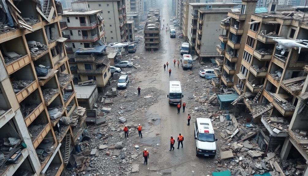
Urban search and rescue operations frequently rely on accurate mapping to navigate complex disaster zones. When you're part of a rescue team, you'll find that detailed maps can make the difference between life and death. These maps help you identify potential locations of survivors, plan efficient search routes, and avoid hazardous areas.
In urban environments, you'll encounter unique challenges that require specialized mapping techniques. You'll need to take into account:
- Building structural integrity
- Underground infrastructure
- Debris distribution patterns
By integrating real-time data from various sources, including satellite imagery, drones, and ground reports, you can create dynamic maps that evolve as the situation changes. These maps will guide your team's decision-making process, allowing you to prioritize search areas and allocate resources effectively.
You'll also use mapping tools to coordinate with other rescue teams and support personnel. By sharing a common operational picture, you can avoid duplication of efforts and guarantee thorough coverage of the affected area.
Post-Disaster Recovery Planning
Once the immediate search and rescue efforts wind down, you'll need to shift your focus to post-disaster recovery planning. Mapping plays an essential role in this phase, helping you visualize and analyze the extent of damage, prioritize resources, and plan for reconstruction.
You'll use mapping tools to:
| Purpose | Data Layers | Benefits |
|---|---|---|
| Damage assessment | Satellite imagery, drone footage | Identify severely affected areas |
| Infrastructure planning | Utility networks, transport routes | Prioritize repairs and upgrades |
| Resource allocation | Population density, vulnerable groups | Target aid distribution effectively |
| Land use planning | Zoning maps, hazard zones | Guide safer rebuilding efforts |
| Economic recovery | Business locations, economic data | Support local economy revival |
Frequently Asked Questions
How Does Satellite Imagery Contribute to Disaster Mapping Efforts?
You'll find satellite imagery essential for disaster mapping. It provides real-time visuals of affected areas, helps identify damage extent, guides resource allocation, and assists in planning evacuation routes. It's an invaluable tool for rapid, accurate assessments.
What Role Do Drones Play in Creating Accurate Disaster Response Maps?
You'll find drones invaluable for disaster mapping. They capture high-resolution aerial images quickly, accessing hard-to-reach areas. You can use them to create real-time maps, identify damage patterns, and guide responders effectively during emergencies.
How Can Crowdsourced Mapping Improve Disaster Response Capabilities?
You'll find crowdsourced mapping enhances disaster response by providing real-time updates. It's faster than official channels, offering local insights and identifying urgent needs. You'll see improved resource allocation and quicker aid delivery through this collaborative effort.
What Are the Challenges in Integrating Various Data Sources for Disaster Mapping?
You'll face challenges integrating data sources for disaster mapping. Data formats may be incompatible, quality can vary, and real-time updates are difficult. Privacy concerns, limited connectivity, and coordinating multiple agencies also complicate the process. It's a complex task.
How Does Historical Mapping Data Influence Current Disaster Response Strategies?
You'll find that historical mapping data considerably shapes current disaster response. It helps you identify patterns, anticipate vulnerabilities, and plan more effectively. You're able to learn from past events and refine your strategies accordingly.
In Summary
You've seen how mapping can revolutionize disaster response efforts. It's a powerful tool that'll help you assess damage, find safe routes, locate survivors, and optimize resources in real-time. You'll be able to detect hazards, plan evacuations, and select shelter sites more efficiently. With mapping, you're better equipped for urban search and rescue operations. Remember, it's not just for immediate response; you'll also use it for long-term recovery planning after the disaster.
As educators and advocates for responsible drone use, we’re committed to sharing our knowledge and expertise with aspiring aerial photographers.


Leave a Reply