UAV technology offers three powerful tactics for forest fire rescue operations. You'll benefit from thermal imaging for hotspot detection, allowing early identification of hidden fires and smoldering areas. Real-time mapping and navigation capabilities provide up-to-date information on fire spread and safe routes, enhancing resource allocation and coordination. Aerial supply delivery systems enable you to reach inaccessible areas with essential supplies, from medical kits to water containers. These advanced UAV techniques greatly improve the safety and efficiency of firefighting efforts. By exploring these innovative approaches, you'll gain deeper insights into how technology is transforming forest fire management and rescue operations.
Thermal Imaging for Hotspot Detection
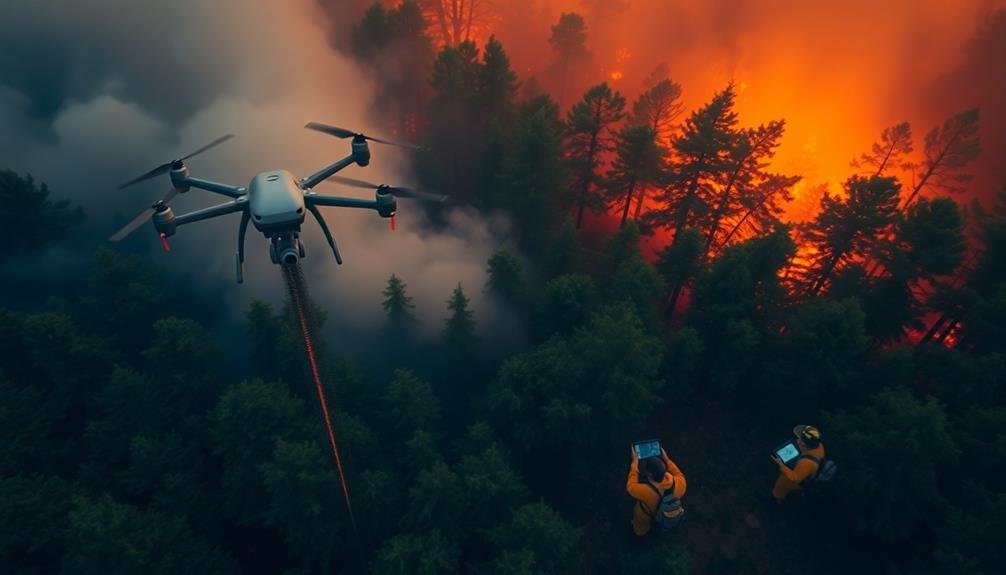
In light of advancing UAV technology, thermal imaging has become a game-changer for detecting forest fire hotspots. You'll find that drones equipped with thermal cameras can quickly scan large areas of forest, identifying heat signatures that aren't visible to the naked eye.
These UAVs can fly at various altitudes, providing both broad overviews and detailed close-ups of potential fire zones. You'll appreciate how thermal imaging allows you to detect hidden underground fires and smoldering areas that might reignite.
It's particularly useful for identifying fire perimeters and tracking the fire's spread. You can use this information to guide firefighting efforts more effectively, focusing resources where they're needed most.
When you're operating a thermal imaging UAV, you'll need to take into account factors like atmospheric conditions and time of day. Early morning or evening flights often yield the best results due to cooler ambient temperatures.
You'll also want to calibrate your equipment regularly to guarantee accurate readings. By integrating this technology into your forest fire management strategy, you're greatly enhancing your ability to respond quickly and efficiently to wildfire threats.
Real-Time Mapping and Navigation
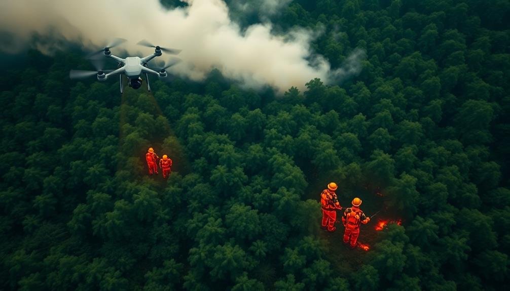
Real-time mapping capabilities of UAVs have revolutionized forest fire navigation and response strategies. You'll find that these drones can quickly create up-to-date maps of fire-affected areas, giving firefighters and rescue teams a vital advantage.
As you monitor the fire's spread, you'll receive instant updates on its trajectory and intensity, allowing for more effective resource allocation and evacuation planning.
UAVs equipped with GPS and advanced sensors can navigate through smoke and challenging terrain, providing you with accurate data on fire boundaries, safe routes, and potential hazards. You'll be able to identify escape routes and safe zones for both firefighters and civilians, considerably reducing the risk of entrapment.
These real-time maps also help you coordinate multi-agency responses more efficiently. You can share live footage and data with command centers, enabling better decision-making and improved communication between ground and air teams.
Aerial Supply Delivery Systems
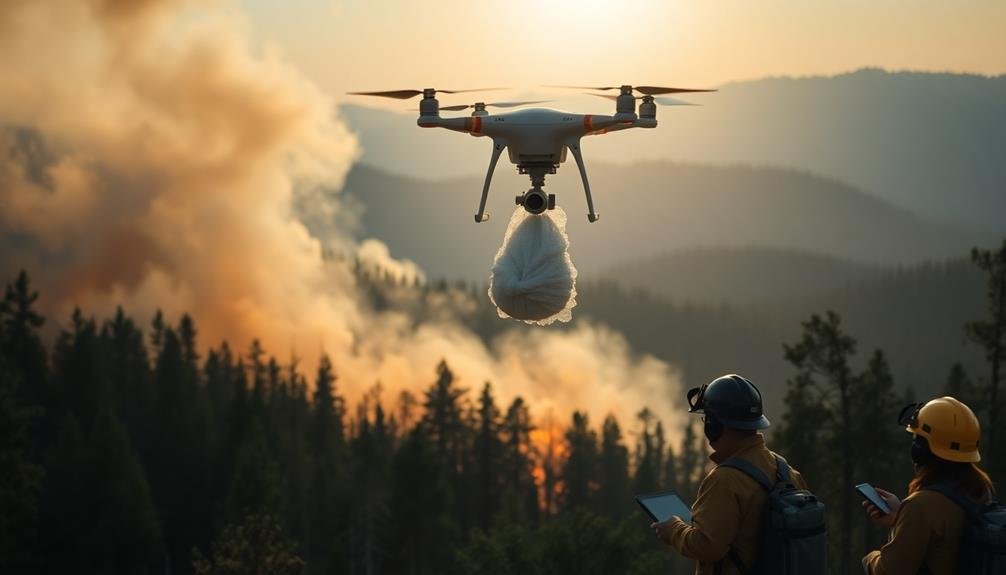
Aerial supply delivery systems have emerged as a game-changing application of UAV technology in forest fire rescue operations. These systems allow you to deliver essential supplies to firefighters and trapped individuals in areas that are difficult or dangerous to access by ground.
You'll find that modern UAVs can carry payloads of varying sizes, from small medical kits to larger water containers. They're equipped with precision drop mechanisms that guarantee accurate delivery to designated coordinates. You can program these drones to follow predetermined flight paths, avoiding obstacles and fire zones.
Some advanced systems feature temperature-resistant containers that protect supplies from extreme heat. You'll also see UAVs with infrared cameras that can locate safe drop zones amidst the smoke and flames.
When you're coordinating rescue efforts, you can use these aerial delivery systems to provide food, water, fire retardants, and communication devices to isolated teams. They're particularly useful for delivering time-sensitive items like emergency medications or specialized firefighting equipment.
Frequently Asked Questions
How Do UAVS Communicate With Ground Teams During Forest Fire Operations?
You'll find UAVs communicate with ground teams using radio frequencies, cellular networks, or satellite links. They're sending real-time video feeds, thermal imagery, and GPS data to help coordinate firefighting efforts and track fire spread.
What Are the Legal Regulations for Using UAVS in Forest Fire Management?
You'll need to follow FAA regulations for commercial drone use, including pilot certification and registration. You must obtain special waivers for flying in restricted airspace or beyond visual line of sight during fire operations.
How Long Can UAVS Operate Continuously During a Forest Fire Mission?
You'll find UAV flight times vary widely. Smaller drones might last 20-30 minutes, while larger ones can fly for hours. Battery life, payload, and weather conditions all impact duration. Always have backup batteries ready.
What Weather Conditions Limit the Effectiveness of UAVS in Fire Rescue Operations?
You'll find UAVs less effective in high winds, heavy rain, or extreme temperatures. They're also limited by thick smoke, which can obscure visibility. Lightning storms pose risks, and dense fog can interfere with sensors and navigation systems.
How Are UAV Operators Trained for Forest Fire Rescue Missions?
You'll undergo specialized training for UAV forest fire missions. You'll learn fire behavior, navigation, thermal imaging, and communication protocols. You'll practice flight simulations, emergency procedures, and coordination with ground teams. Regular drills keep your skills sharp.
In Summary
You've seen how UAV technology revolutionizes forest fire rescue operations. By utilizing thermal imaging, real-time mapping, and aerial supply delivery, you're now equipped to tackle wildfires more effectively. Remember, these drones aren't just tools; they're lifesavers. As you implement these tactics, you'll enhance your team's safety and efficiency. Stay updated on the latest UAV advancements, and don't hesitate to integrate them into your rescue strategies. Your quick action can make all the difference.
As educators and advocates for responsible drone use, we’re committed to sharing our knowledge and expertise with aspiring aerial photographers.


Leave a Reply