
Mapping services have transformed real estate marketing, offering you innovative ways to showcase properties. You'll find aerial property mapping providing high-resolution imagery and 3D models for thorough views. 3D virtual tours allow potential buyers to explore homes remotely, while interactive neighborhood maps highlight local amenities and demographics. Drone technology has revolutionized land surveying, offering quick and precise property data. Thermal imaging detects hidden issues, showcasing energy efficiency and recent upgrades. These cutting-edge tools not only enhance property presentations but also provide valuable insights for informed decision-making. Discover how these services can elevate your real estate marketing strategy.
Aerial Property Mapping
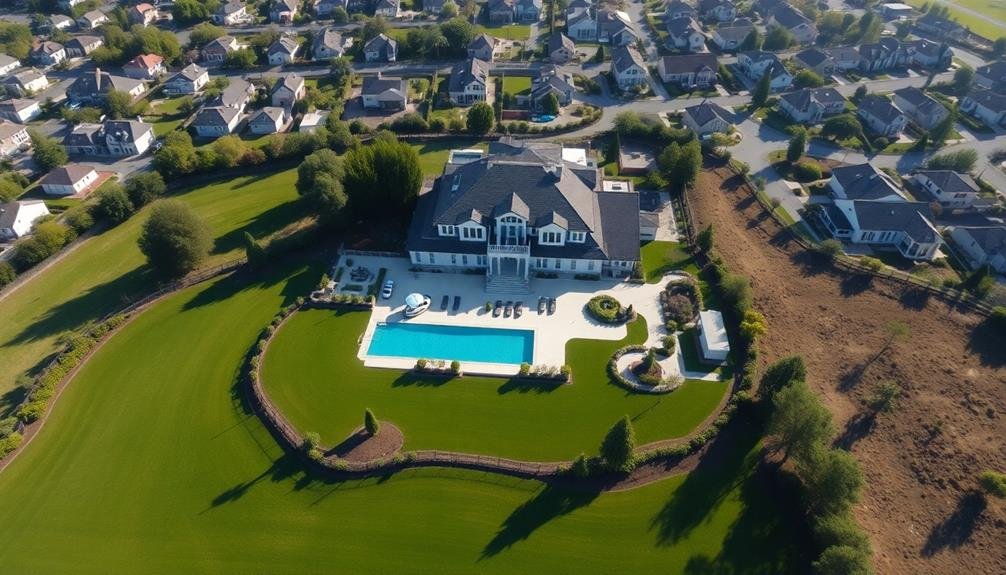
Aerial property mapping has revolutionized real estate marketing. You can now showcase properties from a whole new perspective, giving potential buyers a thorough view of the land and surrounding area.
With high-resolution aerial imagery, you'll provide clients with accurate, up-to-date visuals that highlight a property's best features.
These maps offer valuable information about lot sizes, boundaries, and topography. You can use them to showcase nearby amenities, such as parks, schools, or shopping centers, which can be major selling points.
Aerial maps also help buyers understand the property's location in relation to neighboring areas and local infrastructure.
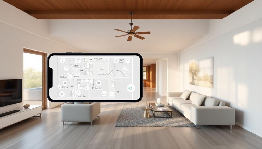
You'll find that aerial mapping services often include 3D modeling capabilities. This allows you to create immersive virtual tours, giving clients a realistic sense of the property's layout and surroundings.
You can even overlay property lines, zoning information, and other relevant data onto these maps for a more thorough presentation.
3D Virtual Tours
Innovation in real estate marketing continues with 3D virtual tours. These immersive experiences allow potential buyers to explore properties from the comfort of their own homes. You'll find that 3D tours offer a more thorough view of a property compared to traditional photos or videos.
With 3D virtual tours, you can navigate through rooms, examine details, and get a true sense of the property's layout. They're particularly useful for out-of-town buyers or those with busy schedules who can't attend in-person viewings. You'll appreciate the ability to revisit properties multiple times without scheduling appointments.
Real estate agents can use these tours to showcase properties 24/7, potentially increasing interest and reducing time on the market. You'll notice that 3D tours often include measurement tools, allowing you to check room dimensions and plan furniture placement.
When creating 3D tours, it's important to guarantee high-quality imagery and smooth navigation. You should also consider adding hotspots with additional information about key features.
Interactive Neighborhood Maps

Interactive neighborhood maps are becoming a game-changer in real estate marketing. They offer potential buyers a thorough view of the area surrounding a property, helping them visualize their future lifestyle.
These maps highlight key features like schools, parks, shopping centers, and public transportation, allowing clients to assess the neighborhood's amenities at a glance.
You can customize these maps to showcase specific selling points relevant to your target audience. For example, if you're marketing to young families, you might emphasize nearby playgrounds and highly-rated schools. For urban professionals, you could highlight trendy restaurants, fitness centers, and public transit options.
Many interactive maps also include demographic data, crime statistics, and property values, giving buyers a deeper understanding of the area.
Some advanced versions even offer virtual walkthroughs of the neighborhood, allowing users to explore streets and local landmarks from their devices.
Land Surveying With Drones
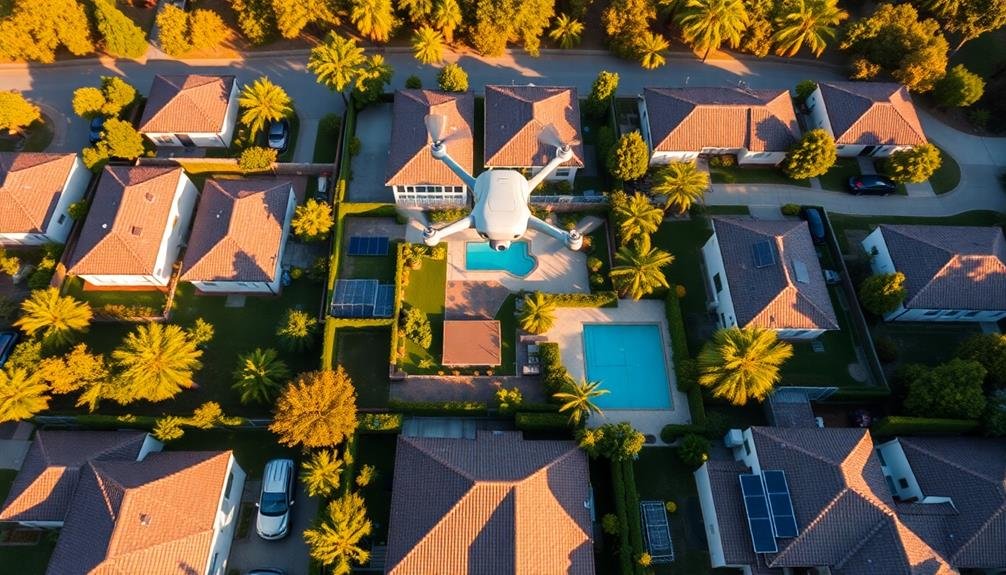
Drones have revolutionized land surveying for real estate marketing. You'll find that these unmanned aerial vehicles offer a cost-effective and efficient way to capture detailed property information. They're particularly useful for large plots of land or areas with challenging terrain.
When you use drones for land surveying, you'll benefit from:
- High-resolution imagery: Drones capture crisp, clear photos and videos from various angles, providing potential buyers with a thorough view of the property.
- Accurate measurements: Advanced sensors and GPS technology allow for precise mapping and measurement of property boundaries, topography, and structures.
- Quick turnaround: Drone surveys can be completed in a fraction of the time it takes for traditional ground-based methods, speeding up your marketing process.
You'll find that drone-generated data can be easily integrated into your existing mapping software, creating detailed 3D models and topographical maps. These visuals help you showcase a property's unique features and potential to prospective buyers.
Additionally, you can use drone footage to create virtual property tours, giving clients an immersive experience without leaving their homes. By incorporating drone technology into your real estate marketing strategy, you'll stay ahead of the competition and provide your clients with valuable, cutting-edge information.
Thermal Imaging for Properties
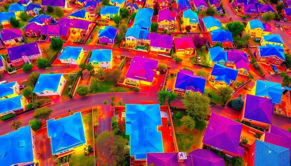
While drones offer aerial insights, thermal imaging takes property analysis to a new level. You'll find this technology invaluable for detecting hidden issues in properties. Thermal cameras capture heat signatures, revealing problems invisible to the naked eye. You can spot insulation deficiencies, moisture intrusion, and electrical hotspots without invasive inspections.
For real estate marketing, thermal imaging provides unique selling points. You'll showcase a property's energy efficiency or highlight recent upgrades. It's also a powerful tool for buyers, helping them make informed decisions and avoid costly surprises.
Here's a quick overview of thermal imaging applications in real estate:
| Application | Benefit | Marketing Angle |
|---|---|---|
| Insulation Check | Energy Efficiency | Lower Utility Costs |
| Moisture Detection | Prevent Mold Growth | Health and Safety |
| Electrical Issues | Fire Prevention | Peace of Mind |
Frequently Asked Questions
How Much Do Advanced Mapping Services Typically Cost for Real Estate Marketing?
You'll find advanced mapping services for real estate marketing typically cost between $50 to $500 per month. Prices vary based on features, data quality, and usage. Some offer pay-per-use options, while others require annual subscriptions.
Can Mapping Services Integrate With Existing Real Estate CRM Systems?
Yes, many mapping services can integrate with your existing real estate CRM systems. You'll find options that seamlessly connect, allowing you to visualize property data, track leads, and manage client interactions within a unified platform for enhanced efficiency.
What Training Is Required to Use These Mapping Technologies Effectively?
You'll need basic training in GIS software and data management. Learn to navigate mapping interfaces, import property data, and create custom layers. Familiarize yourself with geocoding, spatial analysis, and visualization techniques to effectively use these technologies in real estate.
Are There Legal Considerations When Using Drones for Property Mapping?
Yes, you'll need to take into account legal requirements when using drones for property mapping. You must follow FAA regulations, obtain necessary licenses, respect privacy laws, and secure property owner permissions before flying over private land.
How Do Mapping Services Impact the Average Time to Sell a Property?
You'll find that mapping services can considerably reduce your property's time on the market. They'll provide potential buyers with detailed visuals and information, increasing interest and speeding up decision-making. This efficiency often leads to quicker sales.
In Summary
You've seen how mapping services can revolutionize your real estate marketing. From aerial views to 3D tours, interactive maps to drone surveys, and even thermal imaging, these tools give you an edge. They'll help you showcase properties in unique ways, provide valuable information to buyers, and stand out from the competition. Embrace these technologies to elevate your listings, attract more interested buyers, and close deals faster. Don't get left behind – start incorporating these mapping services into your marketing strategy today.
As educators and advocates for responsible drone use, we’re committed to sharing our knowledge and expertise with aspiring aerial photographers.


Leave a Reply