
You'll find a wealth of powerful tools for aerial architectural site analysis that can revolutionize your project planning. Google Earth Pro offers high-resolution imagery and historical data, while DroneDeploy and Pix4D transform drone footage into detailed 3D models. ArcGIS provides extensive GIS capabilities, and SketchUp allows for intuitive 3D modeling. DJI Terra and Drone2Map for ArcGIS offer user-friendly interfaces for processing drone data, while Global Mapper excels in terrain analysis. Agisoft Metashape rounds out the list with its photogrammetry prowess. These tools provide unparalleled insights from above, enhancing your decision-making and design process. Explore further to reveal their full potential for your projects.
Google Earth Pro
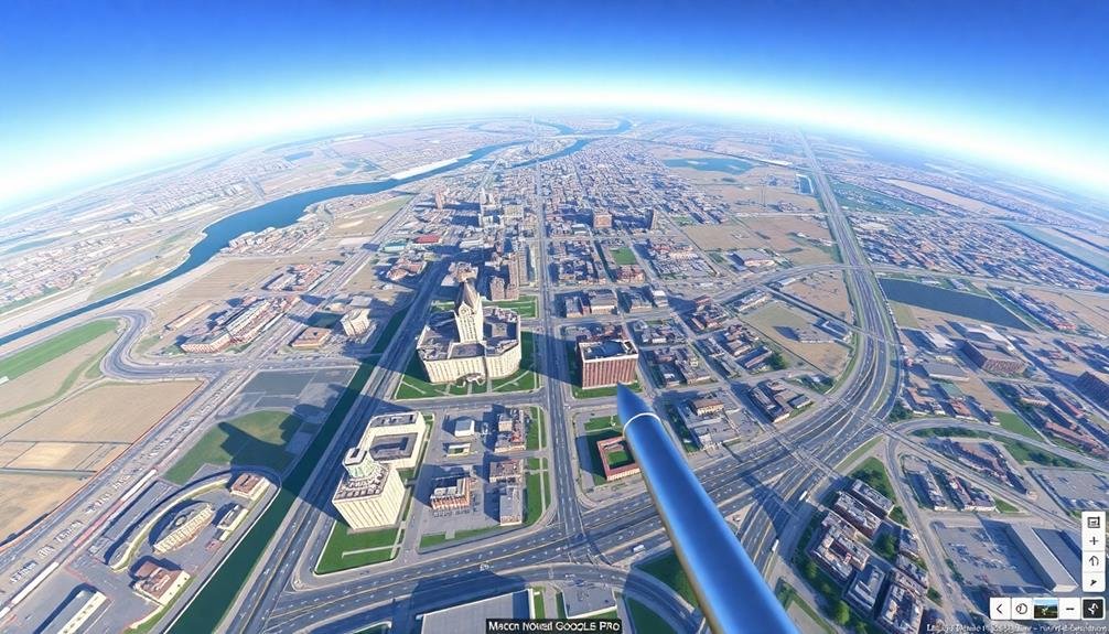
One of the most powerful tools for architectural site analysis is Google Earth Pro. This free software offers you a wealth of information about potential building sites from a bird's-eye view. You'll have access to high-resolution satellite imagery, allowing you to examine terrain, vegetation, and existing structures in detail.
Google Earth Pro's historical imagery feature lets you track site changes over time, helping you understand the area's development patterns. You can measure distances, areas, and elevations accurately, which is vital for initial site planning.
The 3D building feature provides context for your project within the existing urban fabric. The software's ability to create tours and flyovers is invaluable for client presentations and visualizing the site from different perspectives.
You can also import and overlay your own CAD drawings or GIS data onto the satellite imagery. Google Earth Pro integrates with other Google services, giving you access to Street View for ground-level site inspection and traffic data for understanding transportation patterns.
With its user-friendly interface and powerful analytical tools, Google Earth Pro is an essential resource for architects conducting thorough site analyses.
DroneDeploy

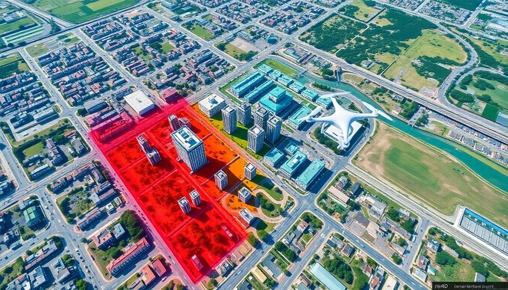
While Google Earth Pro offers a bird's-eye view, DroneDeploy takes site analysis to new heights with its drone-based mapping and 3D modeling capabilities. This cloud-based software platform allows you to plan, fly, and process aerial drone surveys with ease.
You'll capture high-resolution imagery and create accurate 3D models of your project site in a fraction of the time it would take using traditional methods.
DroneDeploy's user-friendly interface lets you automate flight paths and data collection, ensuring consistent results across multiple surveys. You can generate detailed topographic maps, measure distances and volumes, and even assess vegetation health using specialized sensors.
The platform's real-time processing capabilities mean you'll have access to your data almost immediately after your flight.
One of DroneDeploy's standout features is its ability to integrate with other design and analysis tools. You can export your 3D models and orthomosaic maps to CAD software or BIM platforms, streamlining your workflow and enhancing collaboration among team members.
With its extensive suite of tools and intuitive design, DroneDeploy empowers architects to make more informed decisions and create better-tailored designs for their project sites.
Pix4D
Pix4D offers powerful 3D modeling capabilities that can transform your architectural site analysis.
You'll be able to create detailed 3D models from drone-captured imagery, giving you an all-encompassing view of your project area.
3D Modeling Capabilities
The 3D modeling capabilities of Pix4D stand out as a game-changer for architectural site analysis. With this powerful feature, you can transform aerial imagery into highly detailed 3D models of your project site. These models provide an accurate representation of the terrain, existing structures, and vegetation, allowing you to visualize the site from multiple angles and perspectives.
You'll find that Pix4D's 3D modeling tools offer impressive precision, with the ability to generate models accurate to within a few centimeters. This level of detail is essential for making informed decisions about site layout, building placement, and landscape design.
The software also allows you to create textured mesh models, which add realistic surface details to your 3D representations.
One of the most valuable aspects of Pix4D's 3D modeling is its ability to generate digital elevation models (DEMs) and digital surface models (DSMs). These tools give you precise information about the site's topography, helping you plan for grading, drainage, and other site preparation tasks.
You can easily export these models to other CAD and GIS software, streamlining your workflow and ensuring consistency across different platforms.
Drone Data Integration
Seamless integration of drone data sets Pix4D apart in the domain of architectural site analysis. This powerful software allows you to import and process aerial imagery captured by drones, transforming it into detailed 3D models and orthomosaic maps.
You'll find Pix4D's ability to handle large datasets particularly useful when working on expansive architectural projects.
With Pix4D, you can:
- Generate high-resolution point clouds
- Create accurate digital surface models
- Produce orthorectified images for precise measurements
- Extract vectorized 3D models for CAD software
- Perform volumetric calculations for earthwork estimation
Pix4D's user-friendly interface makes it easy to process drone data, even if you're not a photogrammetry expert.
You'll appreciate the software's automatic calibration and georeferencing features, which save time and guarantee accuracy.
The tool's ability to integrate with other popular architectural software streamlines your workflow, allowing you to seamlessly transfer data between platforms.
ArcGIS
Industry leader ArcGIS offers an extensive suite of tools for architectural site analysis. You'll find powerful features for mapping, spatial analysis, and 3D visualization that can revolutionize your site planning process. With ArcGIS, you can integrate various data sources, including satellite imagery, topographic maps, and demographic information, to gain a thorough understanding of your project site.
ArcGIS allows you to create detailed terrain models, analyze slope and aspect, and perform viewshed analyses. You'll appreciate its ability to generate accurate contour maps and calculate cut-and-fill volumes for grading plans. The software's advanced spatial analysis tools help you identify ideal building locations, assess environmental impacts, and plan infrastructure efficiently.
| Feature | Benefit |
|---|---|
| 3D Visualization | Immersive site exploration |
| Spatial Analysis | Data-driven decision making |
| Multi-layer Integration | Thorough site understanding |
| Collaboration Tools | Streamlined team communication |
SketchUp

Architects and designers worldwide turn to SketchUp for its intuitive 3D modeling capabilities and versatility in site analysis. This user-friendly software allows you to quickly create 3D models of your project site, including terrain, buildings, and surrounding context. You can import aerial imagery and topographic data to enhance the accuracy of your site model.
SketchUp's strength lies in its ability to help you visualize and analyze various aspects of your site:
- Sun and shadow studies
- View corridors and sight lines
- Massing and scale relationships
- Terrain analysis and grading
- Vegetation and landscape planning
You can easily experiment with different design options and see how they interact with the existing site conditions. SketchUp's extensive library of plugins and extensions further enhances its capabilities for site analysis. You'll find tools for generating contour lines, calculating cut and fill volumes, and even simulating wind patterns.
While SketchUp may not offer the same level of GIS functionality as ArcGIS, it excels in providing a quick and intuitive platform for 3D site modeling and analysis. Its compatibility with other software and ease of use make it an invaluable tool for architects and designers in the early stages of site analysis and conceptual design.
Autodesk Civil 3D
Autodesk Civil 3D offers powerful terrain modeling capabilities that you'll find invaluable for site analysis.
You can create detailed digital elevation models, analyze slope gradients, and visualize topographic features with ease.
Additionally, Civil 3D's infrastructure design features allow you to integrate road layouts, drainage systems, and utilities directly into your site plans, providing a thorough view of the project's environmental impact.
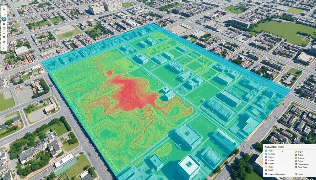
Terrain Modeling Capabilities
Terrain modeling forms the backbone of effective site analysis, and Autodesk Civil 3D excels in this area. You'll find its capabilities particularly useful when working with complex topographies. The software allows you to create accurate 3D representations of land surfaces using various data sources, including survey points, contour lines, and LiDAR data.
With Civil 3D, you can:
- Generate and manipulate surface models quickly
- Analyze slopes, aspects, and drainage patterns
- Calculate cut and fill volumes for earthwork estimation
- Create 3D visualizations for client presentations
- Export terrain data to other design software
You'll appreciate the software's ability to handle large datasets efficiently, making it ideal for both small-scale and expansive projects. Civil 3D's terrain modeling tools enable you to identify potential site challenges early in the design process, such as steep slopes or flood-prone areas.
This foresight can save you time and resources in the long run. Additionally, the software's integration with other Autodesk products guarantees a seamless workflow from site analysis to detailed design. By leveraging Civil 3D's terrain modeling capabilities, you'll be well-equipped to make informed decisions about site development and architectural design.
Infrastructure Design Features
Beyond terrain modeling, Civil 3D offers robust infrastructure design features that'll streamline your site planning process.
You'll find tools for designing roads, drainage systems, and utilities with precision and efficiency. The software allows you to create dynamic alignments and profiles for roadways, automatically adjusting to changes in your design parameters.
Civil 3D's pipe network design capabilities enable you to lay out complex water, sewer, and storm drain systems. You can easily model gravity and pressure pipe networks, complete with manholes, catch basins, and other structures.
The software's grading tools help you optimize cut and fill operations, ensuring proper site drainage and minimizing earthwork costs.
You'll appreciate the ability to generate detailed quantity takeoffs and construction documentation directly from your 3D model.
Civil 3D also offers powerful data exchange features, allowing you to seamlessly collaborate with other professionals using various file formats.
With its extensive set of infrastructure design tools, Civil 3D empowers you to create more accurate, efficient, and sustainable site plans while reducing the time and effort required for manual calculations and drafting.
DJI Terra

In recent years, DJI Terra has emerged as a powerful tool for architectural site analysis. This software platform enables you to create highly accurate 3D models and maps using drone-captured data.
With DJI Terra, you can effortlessly process aerial images and generate detailed terrain models, allowing you to visualize and analyze potential building sites with unprecedented precision.
DJI Terra's user-friendly interface makes it accessible to architects and planners of all skill levels. You'll find its features particularly useful for:
- Topographic mapping
- Volume calculations
- Elevation analysis
- Vegetation assessment
- Infrastructure planning
Drone2Map for ArcGIS

Drone2Map for ArcGIS offers powerful aerial mapping capabilities that can revolutionize your site analysis process.
You'll be able to quickly transform drone-captured imagery into detailed 2D and 3D maps, providing a thorough view of your project area.
The software's seamless integration with ArcGIS allows you to combine your aerial data with existing GIS information, enhancing your understanding of the site's context and facilitating more informed design decisions.
Aerial Mapping Capabilities
One of the most powerful features of Drone2Map for ArcGIS is its aerial mapping capability. You'll be able to create highly accurate 2D and 3D maps of your project sites quickly and efficiently. This tool processes drone-captured imagery to produce orthomosaics, point clouds, and digital surface models.
With Drone2Map's aerial mapping capabilities, you can:
- Generate high-resolution orthomosaic maps
- Create detailed 3D point clouds for volumetric analysis
- Produce digital elevation models (DEMs) for terrain analysis
- Extract building footprints and vegetation heights
- Calculate cut and fill volumes for earthwork planning
You'll find that these capabilities greatly enhance your site analysis process. By leveraging drone technology and Drone2Map's processing power, you're able to capture and analyze large areas in a fraction of the time it would take using traditional methods.
The tool's user-friendly interface allows you to easily import your drone imagery, process the data, and export the results in various formats compatible with other GIS software. This seamless integration guarantees that you can incorporate the aerial mapping data into your existing workflows, improving your decision-making process and project planning efficiency.
GIS Data Integration
A standout feature of Drone2Map for ArcGIS is its seamless GIS data integration capability. You'll find this tool invaluable for combining drone-captured imagery with existing GIS datasets. It allows you to overlay various layers of information, such as property boundaries, zoning regulations, and utility networks, onto your aerial imagery.
With Drone2Map, you can easily import shapefiles, feature classes, and other GIS data formats directly into your project. This integration enables you to perform extensive site analyses by considering multiple spatial factors simultaneously. You'll be able to identify potential conflicts, assess environmental impact, and make informed decisions about site development.
The software's ability to georeference your drone imagery guarantees that it aligns perfectly with your existing GIS data. This precision is essential for accurate measurements and spatial analysis.
You can also export your processed drone data as GIS-ready products, making it simple to incorporate your findings into larger GIS projects or share them with team members using other Esri software.
Global Mapper

Global Mapper stands out as a versatile GIS software that's particularly useful for architectural site analysis. You'll find it combines powerful terrain analysis tools with an intuitive interface, making it accessible for both beginners and experienced users.
With Global Mapper, you can quickly generate contour maps, calculate cut and fill volumes, and create 3D models of your site.
One of Global Mapper's key strengths is its ability to handle various data formats, allowing you to integrate information from multiple sources. You'll appreciate its extensive library of base maps and imagery, which you can use as a foundation for your site analysis.
The software also offers advanced LiDAR processing capabilities, enabling you to create highly accurate digital elevation models.
Here are five features that make Global Mapper invaluable for architectural site analysis:
- Terrain analysis tools for slope, aspect, and viewshed calculations
- 3D visualization and fly-through capabilities
- Watershed and drainage analysis
- Vector and raster data editing
- Customizable map layouts for presentation and reporting
Agisoft Metashape

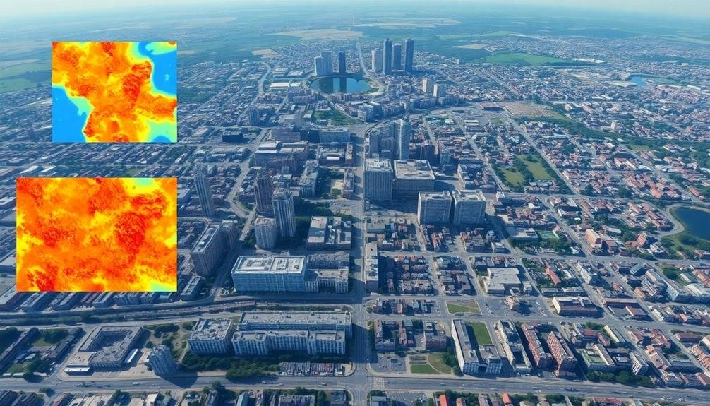
Agisoft Metashape's powerful photogrammetry capabilities make it an essential tool for architectural site analysis. This software allows you to create highly detailed 3D models and orthomosaic maps from aerial photographs, providing a thorough view of your project site.
You'll find Metashape particularly useful for generating accurate digital elevation models (DEMs) and point clouds. These features enable you to analyze terrain, measure distances, and calculate volumes with precision. The software's ability to process images from various sources, including drones and satellite imagery, gives you flexibility in data acquisition.
Metashape's user-friendly interface and automated workflows streamline the process of creating 3D models. You can easily align photos, build dense point clouds, and generate textured mesh models.
The software also offers advanced features like thermal mapping and multispectral imagery analysis, which can provide valuable insights into site conditions.
For collaborative projects, Metashape supports team workflows and cloud processing. You can export your models in various formats compatible with CAD and GIS software, ensuring seamless integration with your existing tools.
Frequently Asked Questions
How Do Weather Conditions Affect Aerial Site Analysis Tools?
Weather conditions considerably impact your aerial site analysis tools. You'll find that rain, fog, and strong winds can interfere with visibility and data collection. Sunlight glare may affect image quality, while extreme temperatures can impact equipment performance.
What Are the Legal Restrictions for Using Drones in Architectural Site Analysis?
You'll need to check local regulations, as drone laws vary widely. Generally, you'll need a license for commercial use, can't fly over people, and must keep your drone in sight. Height and airspace restrictions also apply.
Can These Tools Integrate With Building Information Modeling (Bim) Software?
You'll find many tools can integrate with BIM software. They often offer plugins or export options for popular BIM platforms. You're able to import aerial data, point clouds, and 3D models directly into your BIM workflow.
How Accurate Are Measurements Obtained From Aerial Site Analysis Tools?
You'll find aerial site analysis tools can provide highly accurate measurements, often within centimeters. They're reliable for initial assessments, but you'll want to verify critical dimensions on-site for the most precise results in your project.
What Training Is Required to Effectively Use These Site Analysis Tools?
You'll need training in GIS software, remote sensing techniques, and aerial photography interpretation. It's crucial to understand mapping principles, data analysis, and 3D modeling. Familiarity with drone operation and photogrammetry software is also beneficial for effective tool use.
In Summary
You've now got a powerful arsenal of tools for aerial site analysis. Whether you're using satellite imagery, drone data, or 3D modeling, these platforms will revolutionize your architectural planning process. Don't be afraid to experiment with different options to find what works best for your projects. Remember, each tool offers unique features, so you might find yourself combining multiple solutions. Embrace these technologies, and you'll gain invaluable insights for your designs from a bird's-eye perspective.
As educators and advocates for responsible drone use, we’re committed to sharing our knowledge and expertise with aspiring aerial photographers.


Leave a Reply