Airborne cameras offer innovative ways to showcase properties and captivate potential buyers. You can create aerial property overviews, capturing stunning images of the entire estate. 360-degree panoramic shots allow for immersive virtual tours, while cinematic flythrough videos provide a seamless journey from approach to interior. Thermal imaging highlights energy efficiency, appealing to eco-conscious buyers. Neighborhood highlights showcase nearby amenities and attractions. Seasonal comparisons of landscaping demonstrate year-round appeal. Virtual reality experiences offer interactive property exploration for remote buyers. These cutting-edge techniques not only engage viewers but also give you a competitive edge in the real estate market. Discover how these methods can transform your property listings.
Aerial Property Overviews

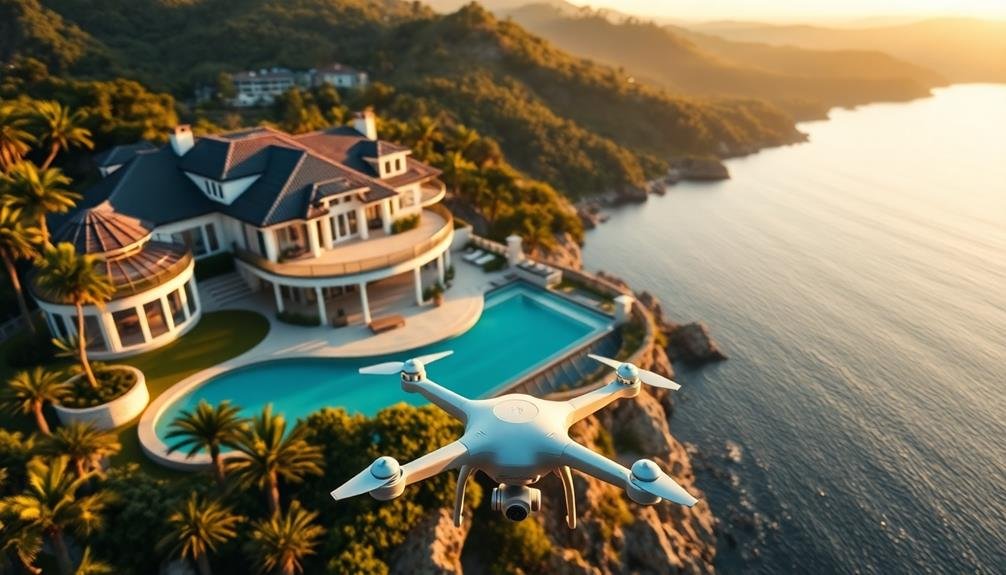
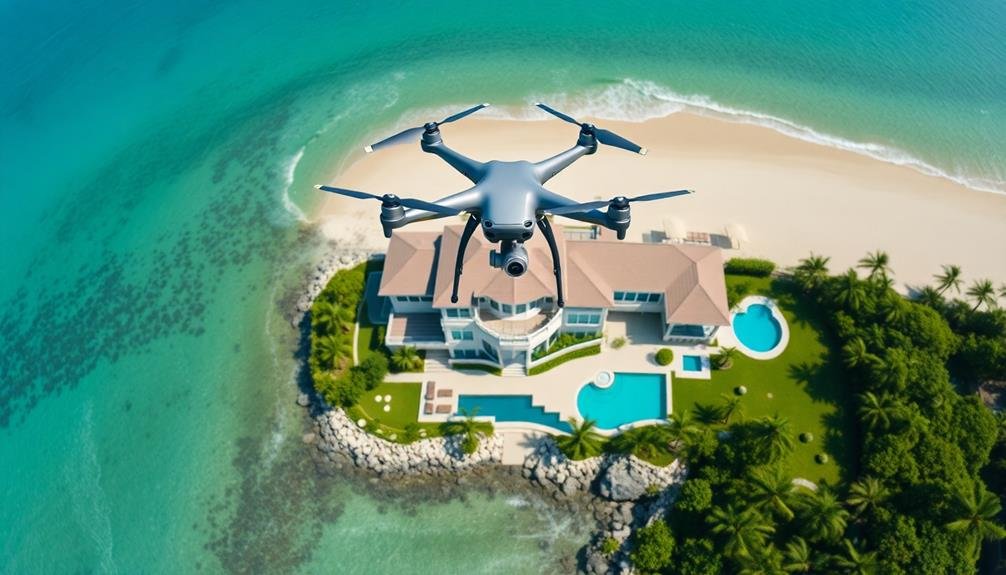
Increasingly, real estate professionals are turning to aerial photography to provide extensive property overviews. By using drones or other airborne cameras, you can capture stunning images and videos that showcase a property's full scope and surroundings.
These aerial shots offer potential buyers a unique perspective they can't get from ground-level photos or virtual tours. With aerial photography, you'll highlight features like the property's layout, landscaping, and proximity to amenities.
You can showcase large estates, acreage, or waterfront properties in their entirety, giving buyers a clear understanding of the land's boundaries and topography. For urban properties, you'll capture views of the neighborhood, nearby parks, and local attractions.
Aerial footage also allows you to create dynamic marketing materials. You can use these shots in listing presentations, property websites, and social media campaigns to grab attention and generate interest.
360-Degree Panoramic Shots
You can create immersive virtual property tours using 360-degree panoramic shots captured by airborne cameras.
These thorough views allow potential buyers to explore every angle of a property from the comfort of their homes.
Immersive Virtual Property Tours
Countless real estate professionals are embracing immersive virtual property tours featuring 360-degree panoramic shots. These tours allow potential buyers to explore properties from the comfort of their own homes, providing a thorough view of the space.
You'll find that these tours are particularly useful for out-of-town buyers or those with busy schedules.
To create these tours, you'll need to capture a series of 360-degree images throughout the property. You can use specialized cameras or even smartphone apps designed for this purpose.
Once you've collected the images, you'll stitch them together using software to create a seamless, interactive experience.
When setting up your virtual tour, you'll want to include hotspots that highlight key features of the property. These can be informational pop-ups or links to additional media.
You can also add floor plans, measurements, and even virtual staging to enhance the viewer's experience.
Highlight Unique Selling Points
When it comes to showcasing a property's unique selling points, 360-degree panoramic shots can be a game-changer. These immersive images allow potential buyers to fully appreciate a property's standout features from every angle. You'll capture breathtaking views, expansive landscapes, and architectural highlights that might be missed in traditional photography.
Use your airborne camera to hover at strategic heights, showcasing how the property fits into its surroundings. Highlight panoramic vistas, nearby amenities, or scenic natural features that add value to the location. For larger estates, you can emphasize the property's size and layout, giving viewers a true sense of scale.
Don't forget to showcase unique architectural elements or custom features. Capture sweeping shots of grand entrances, intricate rooflines, or impressive outdoor living spaces.
You can also use 360-degree panoramas to highlight premium finishes or high-end materials used throughout the property.
Remember to focus on elements that set the property apart from others in the market. Whether it's a stunning infinity pool, a meticulously landscaped garden, or a state-of-the-art smart home system, use your airborne camera to create compelling visuals that emphasize these unique selling points.
Cinematic Flythrough Videos

Through the lens of aerial cinematography, cinematic flythrough videos have revolutionized property showcasing. These dynamic visual experiences allow potential buyers to explore a property from angles previously unattainable, creating an immersive and engaging presentation.
You'll find that cinematic flythroughs offer a seamless journey through the property, starting with an aerial approach that captures the surrounding area and landscape. As the camera descends, you'll witness smooth shifts between exterior and interior spaces, highlighting the flow and layout of the home.
These videos often incorporate slow-motion effects, revealing intricate details of architectural features, custom finishes, and unique selling points. You can showcase expansive living areas, state-of-the-art kitchens, and luxurious master suites with sweeping camera movements that emphasize spaciousness and elegance.
By utilizing advanced stabilization technology and high-resolution cameras, you'll produce professional-quality footage that rivals Hollywood productions. This cinematic approach not only captivates viewers but also leaves a lasting impression, increasing the likelihood of inquiries and showings.
To maximize impact, consider adding subtle background music and on-screen text to provide key information about the property's features and amenities. This combination of visual storytelling and informative content creates a compelling narrative that resonates with potential buyers.
Thermal Imaging for Energy Efficiency

Thermal imaging technology has transformed the way we assess and showcase a property's energy efficiency. By utilizing drones equipped with thermal cameras, you can now capture detailed heat maps of buildings, revealing areas of energy loss and insulation deficiencies. These images provide potential buyers with valuable insights into a property's energy performance and maintenance needs.
You'll be able to identify hot spots on roofs, which may indicate poor ventilation or insulation issues. Cold spots around windows and doors can reveal air leaks, while inconsistent temperatures across walls might suggest inadequate insulation. This information allows you to highlight a property's energy-efficient features or propose targeted improvements to increase its value.
When showcasing properties, you can use these thermal images to demonstrate the effectiveness of recent energy upgrades or to differentiate well-insulated homes from less efficient ones. This data-driven approach not only appeals to environmentally conscious buyers but also helps clients understand potential energy costs and savings.
Neighborhood and Surrounding Area Highlights
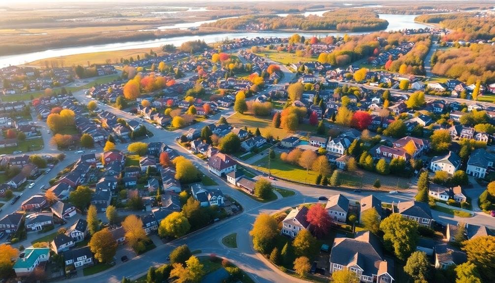
Drones equipped with high-resolution cameras offer a unique perspective for showcasing a property's neighborhood and surrounding areas. You can capture aerial footage that highlights key features and amenities within walking distance, giving potential buyers a thorough view of the community.
Use your drone to showcase nearby parks, schools, shopping centers, and recreational facilities. Capture the overall layout of the neighborhood, including tree-lined streets, community gardens, or local landmarks. You'll be able to demonstrate the property's proximity to these desirable features, which can be a significant selling point.
Don't forget to highlight transportation options. Showcase nearby highways, public transit stations, or bike paths to emphasize the area's connectivity. If there are scenic natural features like lakes, rivers, or mountains nearby, make sure to include them in your footage.
You can also use your drone to create a virtual tour of the neighborhood, allowing potential buyers to explore the area from the comfort of their homes. This approach is especially useful for out-of-town buyers who can't easily visit the property in person.
Seasonal Comparisons of Landscaping

During different seasons, a property's landscaping can undergo dramatic transformations, and airborne cameras are perfect for capturing these changes. You'll be able to showcase how a property evolves throughout the year, highlighting its versatility and appeal in various conditions.
Use drones to capture aerial footage of the property during spring, summer, fall, and winter. This will allow potential buyers to visualize the property's appearance year-round. You can highlight blooming gardens in spring, lush green lawns in summer, vibrant fall foliage, and pristine snow-covered landscapes in winter.
Here's a table summarizing key seasonal features to capture:
| Season | Landscaping Focus | Lighting Conditions | Unique Elements |
|---|---|---|---|
| Spring | Blooming flowers | Soft, warm light | New growth |
| Summer | Lush greenery | Bright, long days | Outdoor living |
| Fall | Colorful foliage | Golden hour glow | Harvest themes |
| Winter | Snow-covered | Cool, crisp light | Holiday decor |
Virtual Reality Property Experiences

Virtual reality (VR) property experiences take aerial photography to the next level, offering immersive tours that can transport potential buyers into a home without stepping foot on the property.
By combining drone footage with 3D modeling technology, you can create a fully interactive VR environment that allows clients to explore every nook and cranny of a home.
You'll find that these VR tours provide a more engaging and memorable experience than traditional photos or videos. Potential buyers can move through rooms, examine details, and even visualize furniture placements.
This technology is particularly useful for overseas or long-distance buyers who can't easily visit properties in person.
To create a VR property experience, you'll need to capture high-quality aerial footage of the exterior and surrounding area.
Then, combine this with interior 360-degree photos or videos. Use specialized software to stitch these elements together into a cohesive VR environment.
Don't forget to include hotspots that highlight key features or provide additional information about the property.
Frequently Asked Questions
What Licenses or Permits Are Required for Commercial Drone Use in Real Estate?
You'll need a Remote Pilot Certificate from the FAA for commercial drone use in real estate. You must also register your drone and follow local regulations. Don't forget to obtain property owner permission before flying.
How Much Does Professional Aerial Photography Typically Cost for a Property Listing?
You'll typically spend between $200 to $500 for professional aerial photography of a property listing. Prices vary based on your location, property size, and the photographer's experience. Don't forget to factor in editing costs too.
Can Drones Be Used for Interior Property Shots as Well?
You can use drones for interior property shots, but it's challenging. They're best for large, open spaces. You'll need a skilled pilot and small, agile drones. Consider safety and potential damage to the property.
Are There Privacy Concerns When Using Drones for Real Estate Photography?
Yes, there are privacy concerns when using drones for real estate photography. You'll need to be careful not to capture neighboring properties or people without consent. Always follow local regulations and respect privacy laws when operating drones.
How Long Does It Take to Produce a High-Quality Aerial Property Video?
You'll typically need 1-3 days to produce a high-quality aerial property video. This includes planning, filming, and editing. Factors like property size, weather conditions, and desired complexity of the final product can affect the timeline.
In Summary
You've now got a cutting-edge toolbox to elevate your property showcases. By embracing these airborne camera techniques, you'll captivate potential buyers and stand out in a competitive market. From stunning aerial overviews to immersive VR experiences, you're equipped to tell a property's full story. Don't hesitate to experiment with these innovative methods. They'll not only showcase homes more effectively but also demonstrate your commitment to staying ahead of the curve in real estate marketing.
As educators and advocates for responsible drone use, we’re committed to sharing our knowledge and expertise with aspiring aerial photographers.


Leave a Reply