When surveying disaster zones, you'll need to employ a range of advanced techniques for accurate damage assessment. Aerial mapping using drones and satellites provides vital bird's-eye views, while thermal imaging detects hidden structural issues. 3D modeling integrates various data sources to create detailed representations of affected areas. Real-time data transmission guarantees rapid information flow, and AI-powered systems automate damage classification for efficient resource allocation. You'll also want to integrate drone data with GIS for thorough analysis. These cutting-edge methods greatly enhance the speed and accuracy of disaster response efforts. Explore further to access the full potential of these essential assessment tools.
Aerial Mapping Techniques
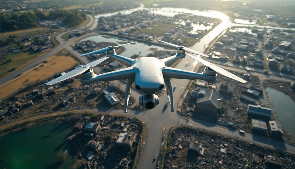
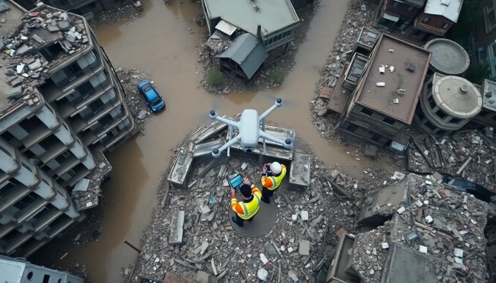
Aerial mapping techniques have revolutionized damage assessment in recent years. You'll find these methods invaluable when surveying large-scale disaster zones quickly and efficiently. Drones and satellite imagery are the primary tools you'll use for aerial mapping, providing high-resolution images and data from a bird's-eye view.
When using drones, you'll deploy them to capture detailed photos and videos of affected areas. They're particularly useful for accessing hard-to-reach locations or dangerous terrain. You'll equip these UAVs with specialized cameras and sensors to collect data on structural damage, debris fields, and environmental impacts.
Satellite imagery offers a broader perspective, allowing you to assess vast areas in a single image. You'll analyze these images to identify flood extents, fire damage, or earthquake impacts. By comparing pre- and post-disaster imagery, you can quickly quantify the scale of destruction.
Advanced software tools help you process and interpret the collected data. You'll use GIS platforms to create detailed maps, overlay various data layers, and generate 3D models of the affected landscape.
These visual representations are essential for coordinating relief efforts and planning reconstruction activities.
Thermal Imaging for Damage Detection

Heat signatures reveal hidden damage. Thermal imaging cameras detect infrared radiation emitted by objects, allowing you to see temperature differences invisible to the naked eye. In disaster zones, this technology becomes invaluable for identifying structural issues, water damage, and electrical problems.
You'll find thermal imaging especially useful for locating:
- Moisture intrusion in walls and roofs
- Electrical hotspots indicating potential fire hazards
- Heat loss in buildings, signaling insulation damage
- Underground utility leaks
- Overheating machinery or equipment
To use thermal imaging effectively, you'll need to understand how different materials emit heat and how environmental factors can affect readings. Conduct scans during ideal conditions, typically early morning or late evening, to minimize interference from solar radiation.
When interpreting thermal images, look for unexpected temperature variations and patterns. Hot spots may indicate electrical issues, while cool areas could suggest water damage or air leaks.
Always combine thermal data with visual inspections and other assessment methods for a thorough evaluation.
3D Modeling of Affected Areas
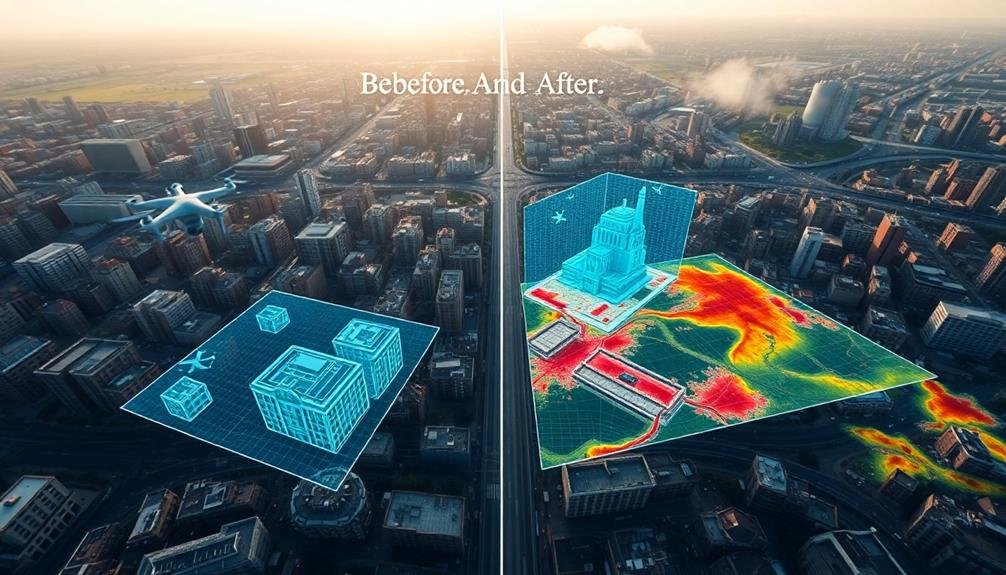
In recent years, 3D modeling has revolutionized damage assessment in affected areas. You'll find that this technology allows for a thorough and detailed analysis of disaster zones, providing essential information for recovery efforts.
To create a 3D model, you'll typically use data from various sources. These include aerial photography, LiDAR scans, and ground-based surveys. By combining these inputs, you can generate an accurate representation of the affected area's topography and structures.
Once you've built the 3D model, you can use it to quantify damage, identify structural weaknesses, and plan reconstruction efforts. You'll be able to measure distances, volumes, and areas with precision, helping you estimate repair costs and material requirements.
Furthermore, you can use these models to simulate potential hazards and test mitigation strategies. This allows you to better prepare for future disasters and improve the resilience of affected communities.
3D modeling also enhances communication between stakeholders. You can easily share and visualize complex spatial data, facilitating decision-making processes and ensuring all parties have a clear understanding of the situation on the ground.
Real-Time Data Transmission Methods
You'll find various real-time data transmission methods essential for effective damage assessment.
Satellite communication systems offer global coverage, while mobile network solutions provide rapid connectivity in urban areas.
For hard-to-reach locations, you can employ drone-based data relay systems to gather and transmit information quickly.
Satellite Communication Systems
Satellite communication systems have revolutionized real-time data transmission for damage assessment. These systems allow you to send and receive data from virtually anywhere on Earth, making them invaluable for surveying disaster zones.
You'll find that satellite communications are especially useful in areas where terrestrial networks have been damaged or destroyed.
When using satellite systems for damage assessment, you'll benefit from:
- Global coverage, even in remote or inaccessible areas
- High-speed data transmission for real-time updates
- Reliable communication during emergencies
You'll need to choose the right satellite system for your needs. Geostationary satellites offer wide coverage but may have higher latency, while low Earth orbit satellites provide faster speeds but require more satellites for continuous coverage.
Consider factors like data speed, equipment size, and cost when selecting a system.
To use satellite communications effectively, you'll need specialized equipment such as portable satellite phones or terminals. These devices can transmit voice, data, and even high-resolution images from the field.
You'll also need to account for potential challenges like signal interference from weather or terrain. By leveraging satellite technology, you'll enhance your ability to assess damage quickly and accurately in disaster zones.
Mobile Network Solutions
Mobile network solutions offer three key advantages for real-time data transmission in damage assessment: widespread coverage, high-speed connectivity, and versatile device compatibility. You'll find that these networks enable rapid data collection and sharing in disaster-affected areas, even when other communication systems fail.
To leverage mobile networks, you'll need devices like smartphones, tablets, or specialized mobile data terminals. These tools allow you to capture and transmit various data types, including photos, videos, GPS coordinates, and text reports. You can use dedicated apps or web-based platforms to streamline data entry and guarantee consistency across your assessment team.
When you're in the field, you'll benefit from 4G or 5G networks' high-speed capabilities, allowing for quick uploads of large files and real-time collaboration with remote team members.
If you're working in areas with limited coverage, consider using mobile hotspots or signal boosters to enhance connectivity.
Remember to implement robust security measures, such as encryption and secure authentication, to protect sensitive data transmitted over mobile networks.
Additionally, have a backup plan for areas where mobile coverage might be compromised due to disaster-related infrastructure damage.
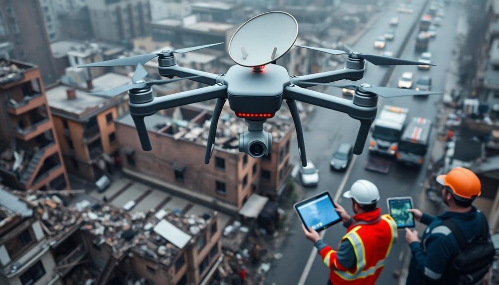
Drone-Based Data Relay
For rapid data transmission in challenging environments, drone-based data relay systems offer a versatile solution. You'll find these systems particularly useful when traditional communication networks are compromised or unavailable.
Drones can act as aerial relays, bridging gaps between ground teams and command centers, ensuring real-time data flow even in the most remote or devastated areas.
To implement a drone-based data relay system, you'll need to take into account the following components:
- High-altitude drones for extended coverage
- Powerful onboard transmitters and receivers
- Robust data encryption protocols
You'll want to program your drones to maintain ideal positioning for maximum signal strength and coverage. They can hover at strategic points, creating a mesh network that extends your communication range considerably.
This system allows you to transmit various types of data, including high-resolution images, video feeds, and sensor readings from the disaster zone.
AI-Powered Damage Classification Systems

AI-powered damage classification systems are revolutionizing disaster response with their ability to rapidly analyze and categorize damage.
You'll find machine learning algorithms at the heart of these systems, enabling automated image analysis of aerial and satellite imagery.
These technologies process real-time data, allowing emergency responders to quickly prioritize areas of greatest need and allocate resources more efficiently.
Machine Learning Algorithms
In recent years, machine learning algorithms have revolutionized damage assessment processes. These advanced AI systems can quickly analyze vast amounts of data from various sources, including satellite imagery, drone footage, and ground-level photos.
You'll find that machine learning algorithms can identify and classify different types of structural damage with remarkable accuracy, often surpassing human capabilities in both speed and precision.
When you're implementing machine learning for damage assessment, you'll typically use supervised learning techniques. This involves training the algorithm on a dataset of labeled images, where damage types are already identified. The algorithm then learns to recognize patterns and features associated with different damage categories.
Here are three key advantages of using machine learning for damage assessment:
- Rapid processing of large-scale disasters
- Consistent and objective analysis across multiple locations
- Ability to detect subtle patterns that might be missed by human observers
As you integrate machine learning into your damage assessment workflow, you'll notice significant improvements in efficiency and accuracy.
These algorithms can help prioritize response efforts, allocate resources more effectively, and provide valuable insights for long-term recovery planning.
Automated Image Analysis
Building on the foundation of machine learning algorithms, automated image analysis systems have become a cornerstone of AI-powered damage classification. These systems use sophisticated computer vision techniques to analyze satellite imagery, aerial photographs, and drone footage of disaster-affected areas.
You'll find that automated image analysis can quickly process vast amounts of visual data, identifying and categorizing different types of structural damage. It can detect collapsed buildings, flooded areas, debris fields, and infrastructure failures. The system's speed and accuracy surpass human capabilities, allowing for rapid and thorough damage assessments.
To implement this technology, you'll need to train the system on a diverse dataset of pre- and post-disaster images. This training enables the AI to recognize patterns and features associated with various damage types. As you use the system, it'll continue to learn and improve its accuracy over time.
You can integrate automated image analysis with other data sources, such as GPS coordinates and building information databases, to create detailed damage maps. These maps will help you prioritize response efforts and allocate resources more efficiently in the aftermath of a disaster.
Real-Time Data Processing
Real-time data processing takes damage assessment to the next level, allowing you to analyze information as it streams in from various sources.
AI-powered damage classification systems can rapidly categorize and quantify destruction across vast areas, providing essential insights for emergency responders and recovery teams.
These systems leverage machine learning algorithms to process data from satellites, drones, and ground-based sensors. You'll receive up-to-the-minute reports on the extent and severity of damage, enabling faster and more effective resource allocation.
The AI can identify specific types of structural damage, assess infrastructure integrity, and even predict potential hazards based on evolving conditions.
To maximize the benefits of real-time data processing, you should:
- Integrate multiple data sources for thorough coverage
- Implement robust error detection and correction mechanisms
- Utilize cloud computing for scalable processing power
Integrating Drone Data With GIS

Integrating drone data with Geographic Information Systems (GIS) has revolutionized damage assessment processes. You'll find that this combination allows for more accurate, thorough, and efficient evaluations of disaster-stricken areas.
By overlaying high-resolution drone imagery onto existing GIS maps, you can quickly identify and quantify structural damage, debris fields, and infrastructure disruptions.
To integrate drone data with GIS, you'll need to guarantee proper georeferencing of your aerial imagery. This process involves assigning real-world coordinates to each pixel in your drone-captured images.
Once georeferenced, you can import the data into your GIS software and align it with existing layers.
You'll benefit from creating custom layers for specific damage types, such as flood extent, building collapse, or road blockages. These layers can be easily updated as new drone data becomes available, providing a dynamic view of the disaster zone's evolution.
Frequently Asked Questions
How Can Surveyors Ensure Their Safety When Assessing Disaster-Affected Areas?
You should prioritize safety by wearing protective gear, working in teams, and following safety protocols. Stay alert to potential hazards, maintain communication with your base, and don't enter unstable structures. Always heed local authorities' warnings and guidelines.
What Are the Legal Considerations for Conducting Drone Surveys in Disaster Zones?
You'll need to check local and federal regulations for drone use in disaster zones. Get necessary permits, respect no-fly zones, and avoid interfering with emergency operations. Be aware of privacy laws when capturing imagery.
How Long Does a Typical Disaster Zone Survey and Assessment Process Take?
You'll find that disaster zone surveys can take anywhere from a few days to several weeks. It'll depend on the area's size, damage extent, and available resources. You're looking at a complex process with many variables.
What Training Is Required for Personnel Conducting Disaster Zone Damage Assessments?
You'll need training in disaster management, damage assessment techniques, safety protocols, and data collection methods. You should also learn about specific hazards, GIS mapping, and first aid. Certification in emergency management is often required.
How Do Surveyors Handle Sensitive or Classified Information During Damage Assessments?
You'll need to follow strict protocols for handling sensitive data. Use secure communication channels, limit access to classified info, and adhere to confidentiality agreements. Don't share details publicly and report only to authorized personnel.
In Summary
You've explored cutting-edge methods for evaluating disaster zones. By combining aerial mapping, thermal imaging, 3D modeling, and real-time data transmission, you're better equipped to assess damage quickly and accurately. Don't forget to leverage AI for efficient classification and integrate drone data with GIS. These tools will help you make informed decisions and coordinate relief efforts more effectively. Keep refining your approach as technology advances to stay at the forefront of disaster evaluation.
As educators and advocates for responsible drone use, we’re committed to sharing our knowledge and expertise with aspiring aerial photographers.


Leave a Reply