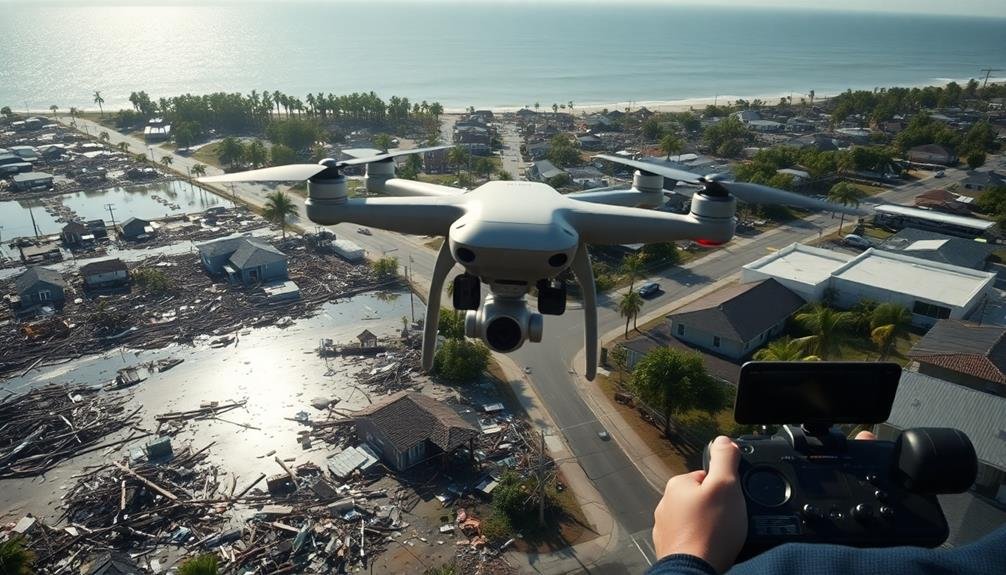
To conduct swift hurricane damage surveys with UAVs, you'll need to follow these key tips: First, create a thorough pre-flight equipment checklist to guarantee you're fully prepared. Next, optimize your flight path planning for efficient coverage of the affected area. Don't forget to make certain of regulatory compliance by obtaining necessary certifications and authorizations. Utilize automated image processing to quickly analyze and map damage. Finally, implement real-time data transmission to provide immediate insights to ground teams. By mastering these strategies, you'll dramatically improve the speed and effectiveness of your post-hurricane assessments. Dive deeper to access the full potential of UAV-powered disaster response.
Pre-Flight Equipment Checklist
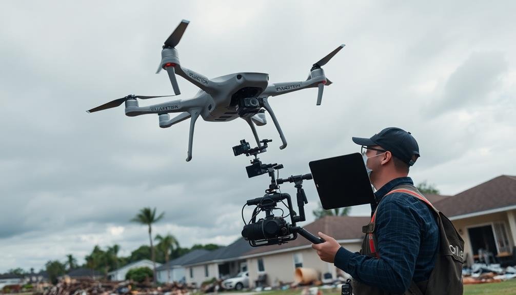
Preparation is key when conducting swift hurricane damage surveys with UAVs. Before you head out to assess the damage, make sure you've got all the essential equipment ready.
Start with your UAV, making sure it's fully charged and in good working condition. Don't forget spare batteries and a portable charger to keep your drone powered throughout the survey.
Pack your controller and verify its firmware is up to date. Include a tablet or smartphone with the necessary flight planning and control apps installed. Bring backup propellers, as they're prone to damage in challenging conditions. A first-aid kit is vital for personal safety in hazardous areas.
Don't overlook the importance of proper storage. Use a weather-resistant case to protect your gear from the elements. Include a GPS unit for accurate location tracking and a compass for orientation.
Pack high-visibility vests and hard hats for safety compliance. Finally, bring a notebook and pen for manual documentation, as well as a rugged camera for ground-level shots.
With this thorough checklist, you'll be well-prepared to conduct efficient and effective hurricane damage surveys using your UAV.
Optimize Flight Path Planning
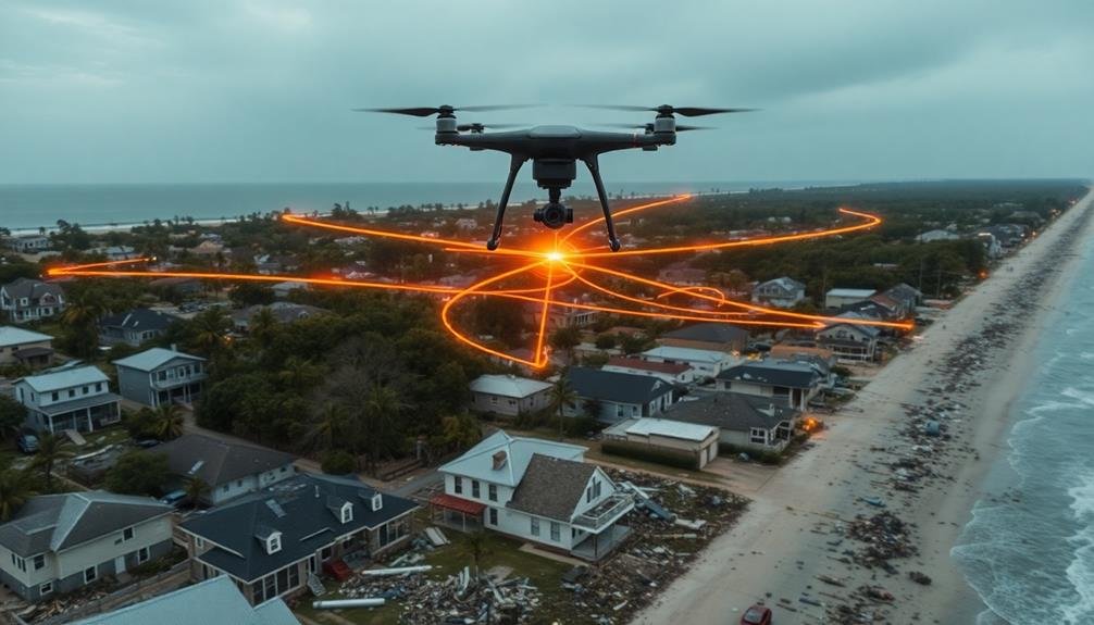
Three key factors shape effective flight path planning for hurricane damage surveys: safety, efficiency, and thorough coverage. You'll need to balance these elements while considering wind conditions, obstacles, and battery life.
Start by identifying your survey area's boundaries and critical points of interest. Map out a grid pattern that guarantees complete coverage, adjusting for the UAV's camera capabilities and desired image overlap.
Consider flying at different altitudes to capture both wide-area views and detailed close-ups. Remember to plan for potential landing zones in case of emergencies.
- Use software tools to calculate the most efficient route
- Plan for multiple battery changes and minimize unnecessary flight time
- Incorporate automated waypoints for consistent data collection
- Adjust your flight pattern to account for tall structures or debris fields
Always prioritize safety by maintaining visual line of sight with your UAV and adhering to local regulations.
Be prepared to modify your flight plan on-site if conditions change. By carefully optimizing your flight path, you'll maximize the effectiveness of your hurricane damage survey while minimizing risks and resource usage.
Ensure Regulatory Compliance
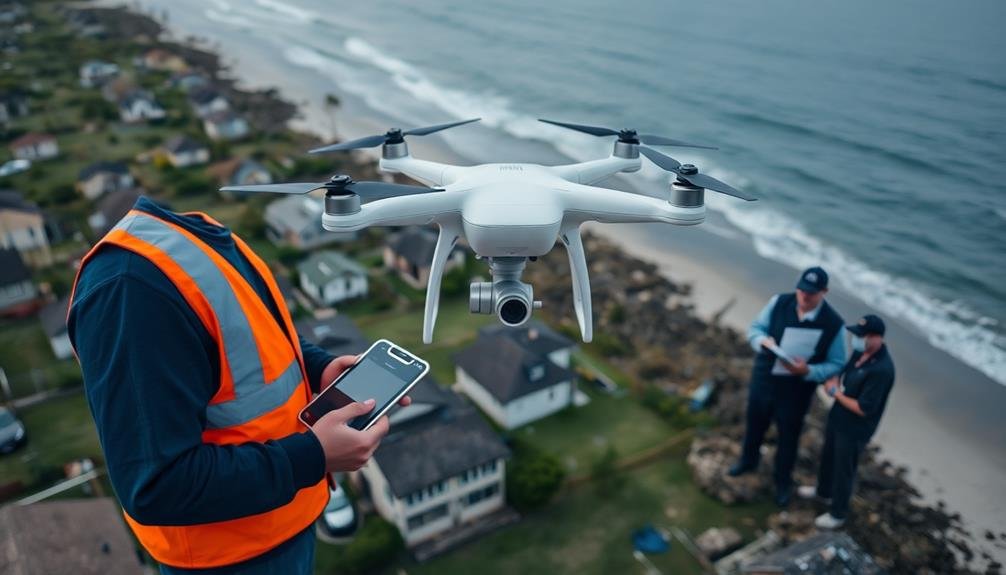
While optimizing flight paths is essential, it's equally important to navigate the complex landscape of UAV regulations. You'll need to guarantee your hurricane damage survey operations comply with local, state, and federal laws. Familiarize yourself with FAA regulations, including Part 107 for commercial drone operations. Obtain necessary certifications and register your UAV.
Before each flight, check for temporary flight restrictions (TFRs) in the area. In post-hurricane scenarios, these may be more common due to emergency operations. Use apps like B4UFLY to stay informed about airspace restrictions.
Here's a quick reference guide for regulatory compliance:
| Requirement | Description |
|---|---|
| Pilot Certification | Part 107 Remote Pilot Certificate |
| UAV Registration | Register with FAA if over 0.55 lbs |
| Flight Authorization | LAANC or manual request in controlled airspace |
| Insurance | Liability coverage for commercial operations |
| Privacy Laws | Respect property rights and privacy regulations |
Don't forget to maintain visual line of sight with your UAV and fly below 400 feet AGL unless you have a waiver. Keep detailed flight logs and maintenance records to demonstrate compliance. By adhering to these regulations, you'll guarantee your hurricane damage surveys are both effective and legal.
Utilize Automated Image Processing
Efficiency is key when processing the vast amount of imagery collected during hurricane damage surveys. You'll want to leverage automated image processing techniques to quickly analyze and categorize the data your UAVs gather. These tools can help you identify damaged structures, assess flood levels, and detect debris fields with remarkable speed and accuracy.
Implement machine learning algorithms to recognize specific types of hurricane damage. You'll find that these systems can rapidly sort through thousands of images, flagging areas that require immediate attention. They'll also help you:
- Detect roof damage and missing shingles
- Identify fallen trees and power lines
- Assess water levels in flooded areas
- Spot structural failures in buildings
By utilizing automated image processing, you'll dramatically reduce the time needed to analyze survey data. This means you can provide critical information to emergency responders and recovery teams much faster.
You'll also be able to create detailed damage maps and reports in a fraction of the time it would take using manual methods.
Remember to regularly update and refine your image processing algorithms to improve their accuracy and efficiency. As you gather more data from various hurricane events, you'll be able to train your systems to recognize increasingly subtle signs of damage.
Implement Real-Time Data Transmission
Real-time data transmission takes your UAV surveys to the next level. By implementing this technology, you'll enable immediate sharing of collected information with ground teams and decision-makers.
Set up a reliable communication link between your UAV and base station using 4G/5G cellular networks or dedicated radio frequencies. Verify your UAV is equipped with a compatible transmitter and antenna system to maintain a strong connection throughout the survey area.
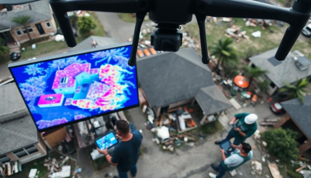
Configure your UAV's onboard computer to process and compress data before transmission, optimizing bandwidth usage. Prioritize critical information, such as high-resolution images of severely damaged areas or infrared scans revealing hidden structural issues.
Implement a secure data encryption protocol to protect sensitive information during transmission. Establish a centralized data hub where real-time information can be received, analyzed, and distributed to relevant parties.
Develop a user-friendly interface for ground teams to access live feeds and interact with the UAV operator if necessary. Integrate automated alerts to notify emergency responders of urgent situations detected during the survey.
Frequently Asked Questions
How Long Does a Typical UAV Battery Last During Hurricane Damage Surveys?
You'll typically get 20-30 minutes of flight time from a UAV battery during damage surveys. However, it's wise to carry spare batteries, as factors like wind conditions and payload can affect battery life considerably.
What Weather Conditions Are Unsafe for UAV Operations in Post-Hurricane Environments?
You shouldn't fly UAVs in strong winds, heavy rain, or lightning. Avoid flying in low visibility conditions, such as fog or darkness. Be cautious of debris carried by gusts. Always prioritize safety over data collection.
How Accurate Are Uav-Based Damage Assessments Compared to Traditional Ground Surveys?
You'll find UAV-based damage assessments are often highly accurate and efficient. They can provide a thorough overview faster than ground surveys, but may miss some nuanced details visible only up close. Both methods have their strengths.
Can UAVS Be Used for Search and Rescue Operations During Hurricane Aftermath?
You can definitely use UAVs for search and rescue after hurricanes. They'll help you scan large areas quickly, locate survivors, and guide rescue teams. They're especially useful in hard-to-reach places or when conditions are dangerous for humans.
What Type of Training Is Required for Pilots Conducting Hurricane Damage Surveys?
You'll need FAA certification, specialized training in disaster assessment, and proficiency with UAV operations. You should also learn about weather patterns, safety protocols, and data collection techniques specific to hurricane damage surveys.
In Summary
You've now got the tools to conduct swift and efficient hurricane damage surveys using UAVs. Remember to double-check your equipment, plan your flight path carefully, stay compliant with regulations, leverage automated image processing, and set up real-time data transmission. By following these tips, you'll maximize your UAV's potential, gather vital data quickly, and contribute to faster disaster response efforts. With practice, you'll become an expert in rapid post-hurricane assessments, helping communities recover more effectively.
As educators and advocates for responsible drone use, we’re committed to sharing our knowledge and expertise with aspiring aerial photographers.


Leave a Reply