Precision flood mapping with UAVs offers unparalleled accuracy in evaluating inundated areas. You'll need a high-quality drone, advanced imaging sensors, and data processing software to get started. Pre-flight planning is essential, including optimizing flight paths and checking equipment. During the survey, maintain consistent flight patterns and use proper data collection techniques. After capturing imagery, you'll process it to create detailed flood maps and integrate them with GIS systems. This allows for precise analysis of flood extent and depth. While challenges exist, such as weather conditions and regulatory compliance, the future of UAV-powered flood mapping is promising. Discover how this technology can revolutionize your disaster response and planning efforts.
Understanding UAV Flood Mapping Technology
Three key components form the foundation of UAV flood mapping technology: the unmanned aerial vehicle (UAV) itself, advanced imaging sensors, and sophisticated data processing software.
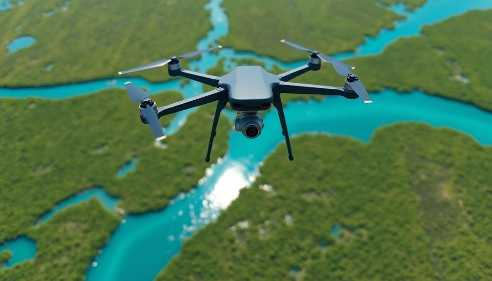
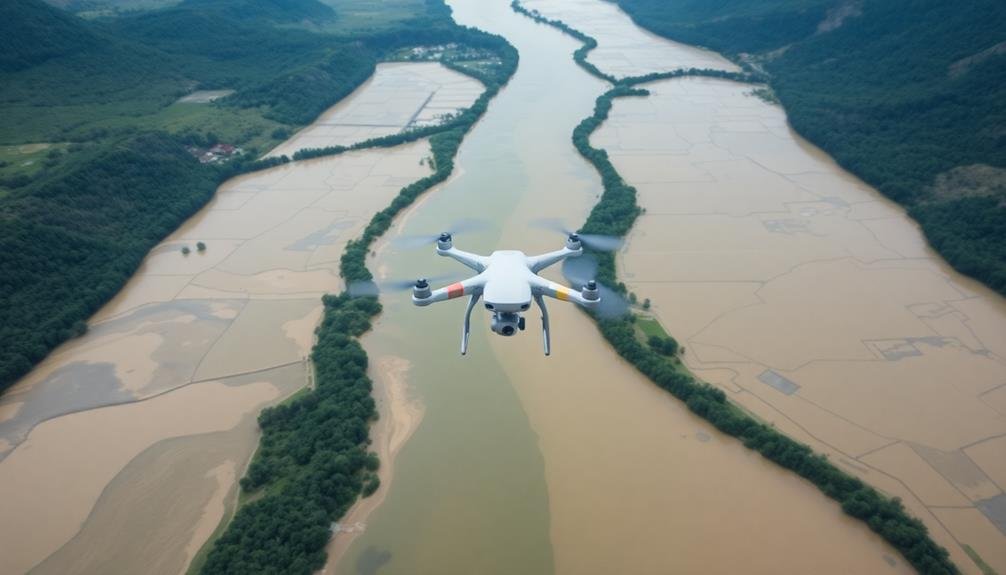
The UAV serves as the aerial platform, capable of accessing hard-to-reach areas and covering large expanses quickly. You'll find various types of UAVs used in flood mapping, including fixed-wing and multi-rotor drones, each with its own advantages.
The imaging sensors are vital for capturing high-resolution data. These typically include RGB cameras for visual imagery, thermal cameras for detecting temperature differences, and LiDAR sensors for creating detailed 3D models of the terrain.
You'll need to choose the right combination of sensors based on your specific mapping requirements.
Data processing software is where the magic happens. It transforms raw data into actionable flood maps. You'll use photogrammetry techniques to stitch together images, create digital elevation models, and identify water bodies.
Machine learning algorithms can help classify land cover types and detect changes over time. With this technology, you can generate accurate flood extent maps, assess damage, and predict future flood risks with unprecedented precision and speed.
Essential Equipment for Aerial Surveys
When conducting aerial surveys, you'll need a range of essential equipment to guarantee successful data collection and analysis.
First and foremost, you'll require a high-quality UAV or drone capable of carrying the necessary payload and withstanding various weather conditions. Choose a model with long flight times and stable flight characteristics.
Equip your drone with a high-resolution camera for capturing detailed imagery. For flood mapping, consider using multispectral or thermal cameras to detect water levels and temperature variations. A GPS module is vital for accurate georeferencing of collected data.
Don't forget about ground control equipment. You'll need a robust ground control station with a reliable remote controller and a monitor for real-time video feed. Invest in extra batteries and a portable charging station to extend your survey time.
For data processing, you'll want powerful computer hardware and specialized software for photogrammetry and GIS analysis. Consider cloud-based solutions for handling large datasets.
Safety equipment is essential. Pack visibility vests, first aid kits, and communication devices.
Pre-Flight Planning and Preparations
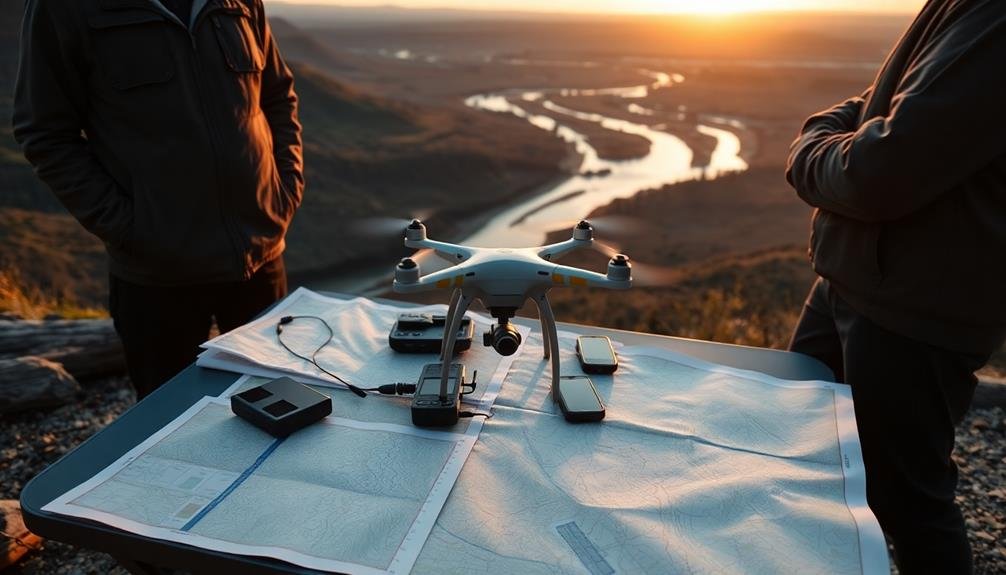
Before you take to the skies, optimize your flight path to guarantee efficient data collection and battery usage.
You'll need to perform thorough equipment checks, including drone functionality, camera settings, and battery levels.
Don't forget to review safety protocols and local regulations to guarantee a smooth and compliant aerial survey operation.
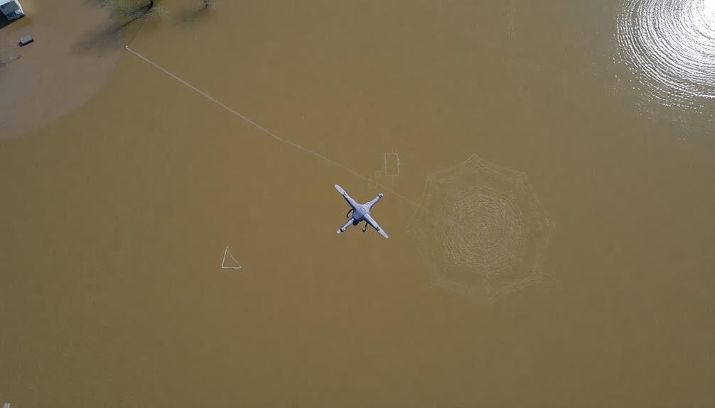
Flight Path Optimization
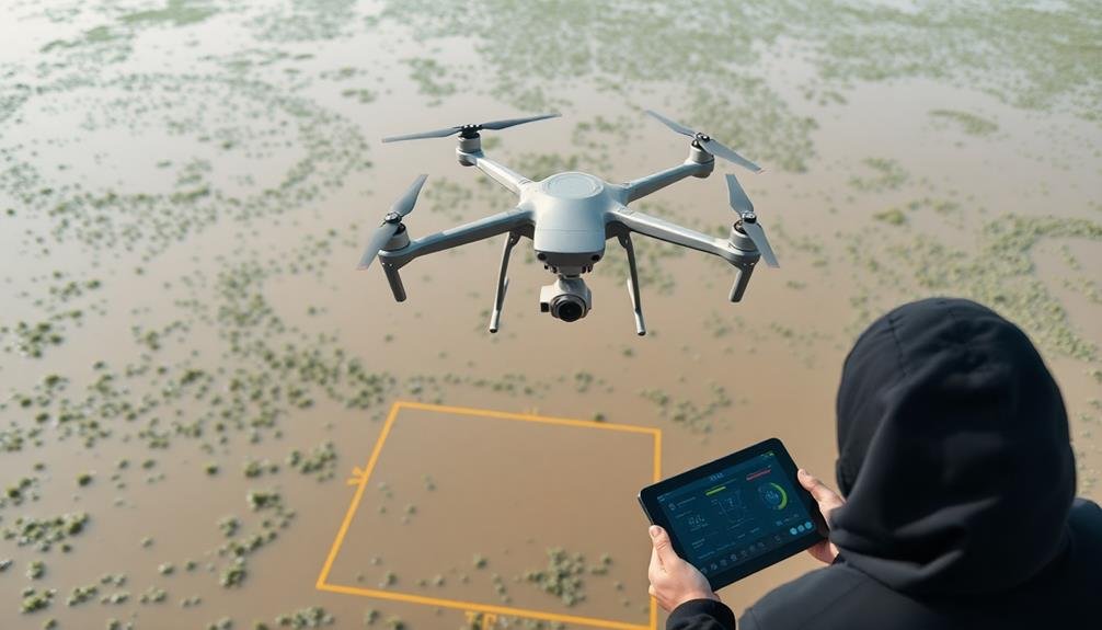
Optimizing your UAV's flight path is essential for conducting efficient and effective surveys. Start by defining your area of interest and setting appropriate boundaries.
Consider the terrain, obstacles, and weather conditions that may affect your drone's performance. Use software tools to plan your flight path, ensuring complete coverage of the target area while minimizing overlap and flight time.
Set your flight altitude based on the desired ground sampling distance and local regulations. Choose a suitable flight pattern, such as parallel lines or grid patterns, depending on your survey objectives.
Incorporate waypoints to guide your drone's movement and adjust its speed to maintain image quality. Factor in the UAV's battery life when planning longer surveys, and include strategic landing points for battery changes if necessary.
Consider the sun's position to minimize shadows and glare in your imagery. Implement automated obstacle avoidance features to protect your drone during flight.
Equipment and Safety Checks
A thorough pre-flight checklist is your best defense against equipment failures and safety hazards. Before launching your UAV for flood mapping, verify you've covered all essential equipment and safety checks. Start by inspecting your drone's physical condition, including propellers, motors, and frame. Check the battery's charge level and secure its connection. Verify that all sensors, cameras, and GPS modules are functioning correctly.
Next, review your flight plan and verify compliance with local regulations. Don't forget to check weather conditions and adjust your flight parameters accordingly. Here's a quick reference table for your pre-flight checks:
| Equipment Checks | Safety Checks |
|---|---|
| Drone body integrity | Weather conditions |
| Battery charge & connection | Airspace restrictions |
| Camera & sensor calibration | Emergency landing sites |
Lastly, prepare your ground control station and communication systems. Test the live feed and data transmission to verify seamless operations during the survey. By following these equipment and safety checks diligently, you'll minimize risks and maximize the efficiency of your UAV-powered flood mapping mission. Remember, a well-prepared flight is a successful flight.
Optimal Flight Patterns for Coverage
Flight patterns play an essential role in maximizing the efficiency and effectiveness of UAV-powered surveys. When conducting precision flood mapping, you'll want to choose the right pattern to guarantee complete coverage of the area while minimizing flight time and battery usage.
For most flood mapping scenarios, the grid pattern is your best bet. It involves flying parallel lines across the survey area, then crossing perpendicular to those lines. This creates a thorough grid that captures detailed imagery of the entire region. You'll want to set your flight altitude and speed based on the desired ground sampling distance and image overlap.
In areas with complex terrain or obstacles, consider using a terrain-following mode if your UAV supports it. This allows the drone to maintain a consistent height above the ground, guaranteeing uniform image quality.
For linear features like rivers or coastlines, a corridor mapping pattern might be more suitable. Here, you'll fly parallel to the feature, capturing multiple overlapping strips of imagery.
Remember to account for wind conditions when planning your flight pattern, as strong winds can affect your UAV's ability to maintain its course.
Data Collection Techniques and Protocols
Effective data collection is the cornerstone of successful UAV-powered flood mapping surveys. You'll need to employ robust techniques and protocols to guarantee high-quality data acquisition. Start by calibrating your UAV's sensors before each flight, including the camera, GPS, and altimeter. This guarantees accurate georeferencing and altitude measurements.
During the survey, maintain a consistent flight speed and altitude to capture uniform images. You'll want to set your camera to capture images with sufficient overlap, typically 60-80% front overlap and 20-40% side overlap. This redundancy allows for better 3D reconstruction and reduces the risk of data gaps.
To maximize the effectiveness of your flood mapping survey, follow these key protocols:
- Conduct pre-flight checks, including battery levels, weather conditions, and obstacle assessment.
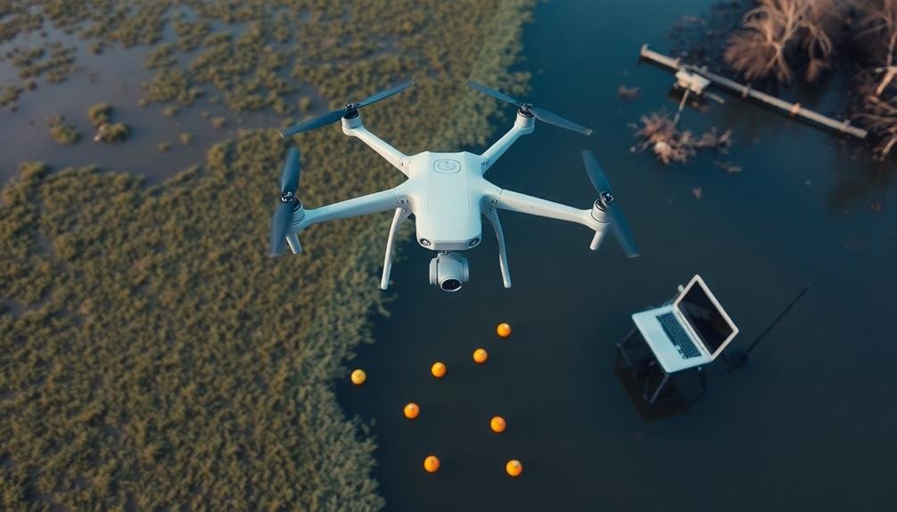
- Use ground control points (GCPs) for improved accuracy in georeferencing.
- Monitor real-time data feed to identify any issues during the flight.
Post-flight, immediately back up your collected data and perform a quick quality check. Look for any obvious errors or missing areas that may require a follow-up flight.
Processing Raw Aerial Imagery
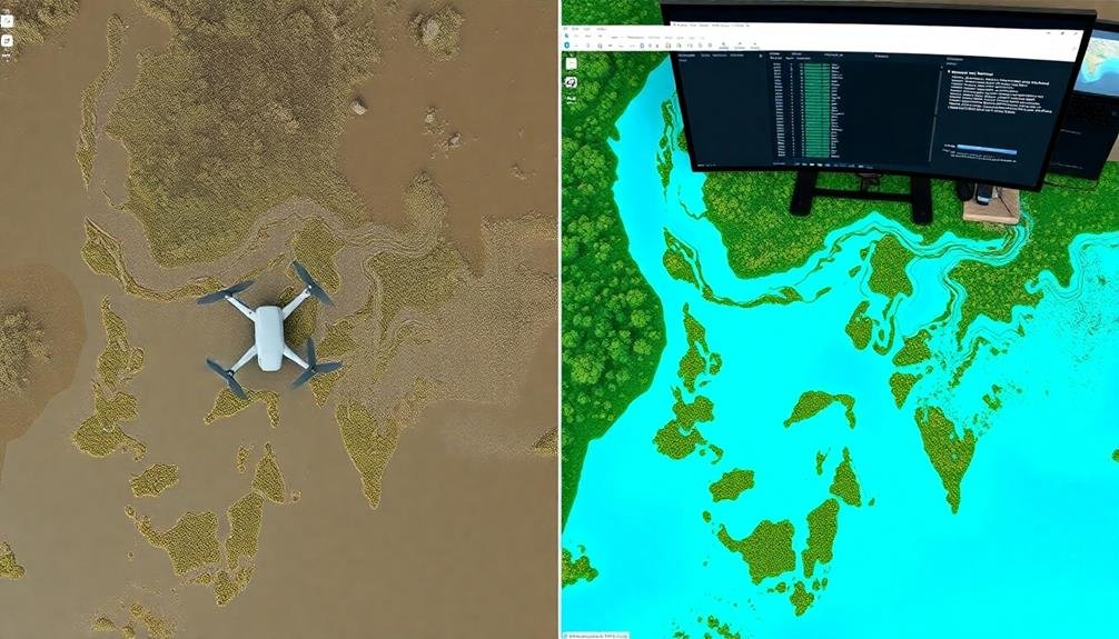
After collecting aerial imagery, you'll need to process the raw data to extract valuable insights.
You'll start by applying image stitching techniques to combine multiple overlapping images into a seamless mosaic.
From there, you can create digital elevation models and delineate flood extents, transforming your raw imagery into actionable information for flood management and response.
Image Stitching Techniques
Once your UAV has captured numerous aerial images, the next crucial step is stitching them together to create a detailed map or orthomosaic. This process involves aligning and merging overlapping images to form a seamless, high-resolution representation of the surveyed area. Modern image stitching techniques rely on advanced algorithms and software to automate much of this process.
To achieve ideal results in image stitching, you'll need to take into account several key factors:
- Image overlap: Confirm your UAV captures images with at least 60-80% overlap between adjacent shots. This redundancy helps the software accurately align and blend the images.
- Ground control points (GCPs): Use strategically placed GCPs to improve the accuracy of your final orthomosaic. These reference points help correct geometric distortions and enhance spatial precision.
- Processing power: Image stitching can be computationally intensive. Invest in powerful hardware or cloud-based solutions to handle large datasets efficiently.
When selecting image stitching software, look for options that offer features like automatic tie point detection, bundle adjustment, and blending algorithms. Popular choices include Pix4D, Agisoft Metashape, and DroneDeploy.
These tools can generate not only 2D orthomosaics but also 3D models and digital elevation maps, providing thorough data for flood mapping applications.
Digital Elevation Modeling
Digital Elevation Modeling (DEM) frequently serves as the cornerstone for flood mapping projects using UAV-captured imagery.
It's an essential step in processing raw aerial data to create accurate 3D representations of terrain. To generate a DEM, you'll need to use specialized photogrammetry software that analyzes overlapping images and calculates elevation points.
Start by importing your georeferenced, stitched imagery into your chosen DEM software. The program will identify common points across multiple images and use triangulation to determine their relative heights.
You'll need to set ground control points (GCPs) to improve accuracy and align the model with real-world coordinates.
Next, you'll generate a point cloud, which is a dense collection of 3D points representing the terrain's surface. From this, you can create a mesh or TIN (Triangulated Irregular Network) model.
Finally, interpolate the data to produce a raster DEM, which is a grid of cells with elevation values.
Pay attention to the resolution and vertical accuracy of your DEM, as these factors greatly impact flood modeling results.
You may need to filter out noise or unwanted features like vegetation or buildings to create a bare-earth model suitable for hydrological analysis.
Flood Extent Delineation
Flood extent delineation is a critical step in processing raw aerial imagery for flood mapping projects. It involves identifying and outlining the areas covered by water during a flood event. To accurately delineate flood extent, you'll need to process the raw aerial imagery collected by your UAV using specialized software and techniques.
Start by georeferencing your imagery to guarantee it aligns with real-world coordinates. Then, apply radiometric corrections to account for atmospheric effects and sensor variations.
Next, use image classification algorithms to distinguish water from land. Common methods include:
- Spectral index thresholding (e.g., Normalized Difference Water Index)
- Supervised classification using machine learning algorithms
- Object-based image analysis for complex urban environments
Once you've classified water bodies, refine the results by removing noise and filling gaps. You can use morphological operations or apply contextual rules based on elevation data.
Finally, vectorize the classified raster to create a polygon layer representing the flood extent.
Remember to validate your results using ground truth data or high-resolution satellite imagery. You may need to iterate and adjust your methods to achieve the desired accuracy for your flood mapping project.
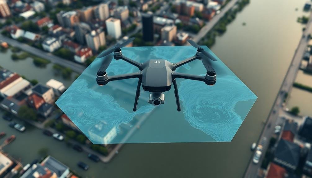
Generating Accurate Flood Maps
Three key components are essential for generating accurate flood maps using UAVs: high-resolution imagery, precise elevation data, and sophisticated image processing algorithms.
To capture high-resolution imagery, you'll need to equip your UAV with a quality camera and plan your flight path to guarantee complete coverage of the flooded area. Use overlapping flight lines to capture multiple angles of the same terrain.
For precise elevation data, incorporate LiDAR technology or photogrammetry techniques. LiDAR sensors can provide detailed 3D terrain models, while photogrammetry uses multiple overlapping images to create accurate digital elevation models (DEMs).
When processing your data, use specialized software to stitch together the collected images and create orthomosaics. Apply water detection algorithms to identify flood boundaries and calculate inundation depths.
You'll need to calibrate these algorithms using ground control points and field observations for maximum accuracy.
Combine the processed imagery with your elevation data to create thorough flood maps. These maps should clearly delineate flood extents, depth variations, and potential impact zones.
Remember to validate your results against on-ground measurements and historical flood data to guarantee reliability and accuracy in your final flood maps.
Integrating With GIS Systems
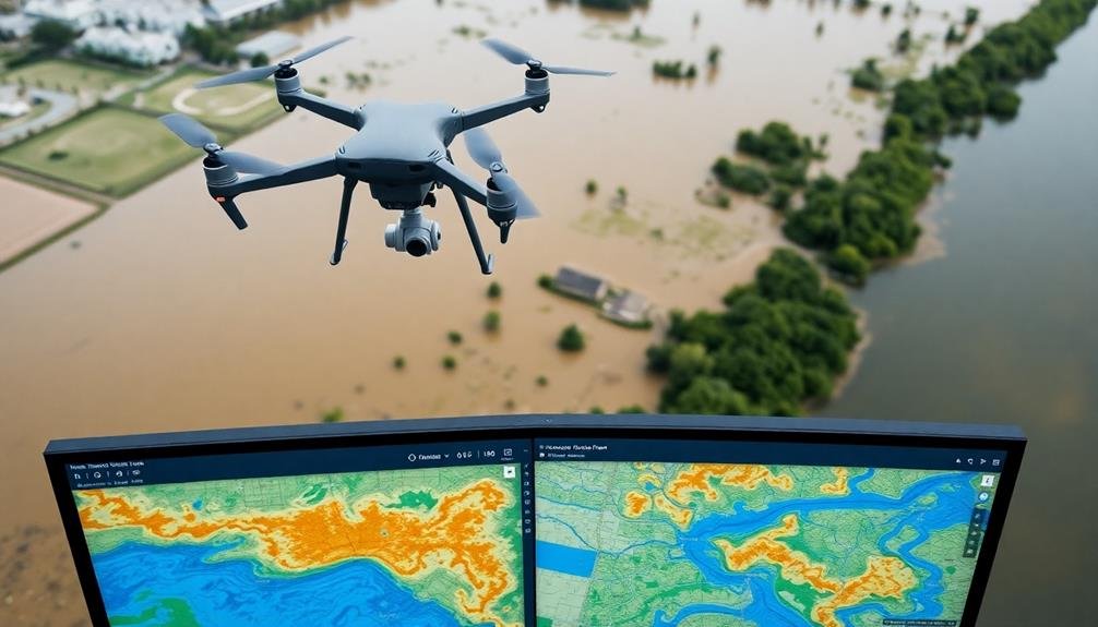
Seamlessly integrating UAV-generated flood maps with Geographic Information Systems (GIS) enhances their utility and accessibility. By combining these technologies, you'll create a powerful tool for flood management and analysis.
GIS platforms can process, store, and display the high-resolution data collected by UAVs, allowing for thorough spatial analysis and visualization.
To effectively integrate UAV flood maps with GIS systems:
- Verify data compatibility by using common file formats like GeoTIFF or shapefile
- Georeference your UAV imagery accurately using ground control points
- Develop a standardized workflow for data processing and import into your GIS software
Once integrated, you can overlay UAV-generated flood maps with existing GIS layers such as infrastructure, population density, and land use.
This combination enables you to perform advanced spatial analyses, including flood risk assessment, damage estimation, and evacuation planning.
You'll also be able to create interactive web maps and dashboards for stakeholders and the public, improving communication and decision-making during flood events.
Analyzing Flood Extent and Depth
You'll find UAV surveys invaluable for analyzing flood extent and depth.
To calculate inundation boundaries, you can process aerial imagery to identify water-land interfaces and create precise flood maps.
For estimating water depths, you'll combine UAV-collected data with pre-existing terrain models, allowing you to quantify flood severity and assess potential risks to infrastructure and populations.
Calculating Inundation Boundaries
Flood experts rely on accurate inundation boundaries to assess the extent and depth of flooding. UAV surveys provide valuable data to calculate these boundaries with precision. By processing high-resolution imagery and elevation data collected by drones, you can determine where floodwaters begin and end.
To calculate inundation boundaries effectively:
- Collect georeferenced aerial imagery and LiDAR data using your UAV
- Process the data to create a digital elevation model (DEM) of the flooded area
- Use GIS software to analyze the DEM and identify water surface elevations
Once you've completed these steps, you'll be able to delineate the flood's edge accurately. This boundary information is essential for emergency response, damage assessment, and future flood prevention planning.
You can further refine your calculations by incorporating ground control points and real-time water level data from nearby gauges. By combining multiple data sources, you'll produce a thorough flood map that clearly shows the inundation extent.
This information helps local authorities make informed decisions about evacuation zones, resource allocation, and infrastructure protection during flood events.
Estimating Water Depths
Estimating water depths is a crucial step in analyzing flood extent and impact. To accomplish this using UAV surveys, you'll need to combine data from your inundation boundary calculations with digital elevation models (DEMs) of the area.
Start by creating a water surface elevation model based on the flood extent you've mapped. Next, subtract the pre-flood DEM from the water surface elevation model. This difference represents the estimated water depth at each point. You can use GIS software to perform this calculation and generate a depth map.
Be aware that this method assumes a flat water surface, which may not always be accurate in complex flooding scenarios. For more precise depth estimates, you can employ photogrammetry techniques. By analyzing stereo imagery from your UAV, you can create a 3D model of the water surface. This approach accounts for variations in water levels across the flooded area.
Additionally, you might use multispectral or thermal imaging to detect subtle differences in water surface temperatures, which can indicate depth variations. Remember to validate your depth estimates with ground-based measurements where possible.
This will help you assess the accuracy of your UAV-derived depth maps and refine your methods for future surveys.
Challenges in UAV Flood Mapping
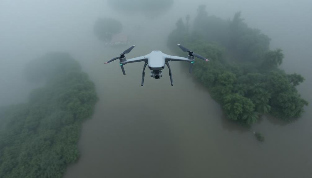
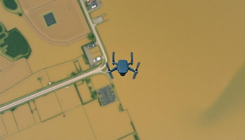
While UAV-based flood mapping offers numerous advantages, it's not without its challenges. You'll need to navigate various obstacles to guarantee accurate and reliable data collection. Weather conditions play a vital role in the success of your mission. Strong winds, heavy rain, or low visibility can compromise flight stability and image quality, potentially rendering your survey useless.
Another significant challenge is regulatory compliance. You must adhere to local aviation laws and obtain necessary permits before conducting UAV surveys. This process can be time-consuming and may delay your mapping efforts during critical flood events.
Data processing and interpretation also present hurdles. You'll need to:
- Handle large volumes of data efficiently
- Correct for distortions caused by water surface reflections
- Differentiate between temporary flood waters and permanent water bodies
Additionally, you'll face limitations in battery life and flight range, which can restrict the area you can cover in a single mission.
To overcome these challenges, you'll need to carefully plan your surveys, invest in robust equipment, and develop advanced data processing techniques to maximize the effectiveness of your UAV-based flood mapping efforts.
Future Trends in Disaster Assessment
In light of rapid technological advancements, disaster assessment is poised for considerable transformation.
You'll see an increased integration of artificial intelligence and machine learning algorithms in UAV-based flood mapping. These technologies will enhance image processing, automate feature detection, and improve the accuracy of flood extent delineation.
You can expect real-time data transmission capabilities to become standard, allowing for immediate analysis and decision-making during flood events. This will considerably reduce response times and improve resource allocation.
Additionally, you'll witness the development of more sophisticated sensors, enabling UAVs to capture multi-spectral and hyperspectral imagery for detailed flood impact assessments.
Swarm technology will revolutionize disaster assessment, allowing multiple UAVs to work collaboratively, covering larger areas more efficiently.
You'll also see advancements in battery technology and propulsion systems, extending flight times and expanding the operational range of UAVs.
As regulations evolve, you can anticipate the integration of UAVs with other emerging technologies like IoT devices and 5G networks.
This convergence will create a more thorough and interconnected disaster assessment ecosystem, providing you with unprecedented levels of situational awareness and predictive capabilities for flood management.
Frequently Asked Questions
How Does Weather Affect UAV Flood Mapping Accuracy?
Weather greatly impacts your UAV flood mapping accuracy. Wind can destabilize your drone, affecting image quality. Rain obscures visibility and may damage equipment. Cloud cover alters lighting conditions. Extreme temperatures can reduce battery life and flight time.
What Are the Legal Requirements for Conducting UAV Flood Surveys?
You'll need to obtain a drone pilot license, register your UAV, and follow local airspace regulations. You must also secure permissions for surveyed areas, comply with privacy laws, and adhere to any specific flood-related surveying requirements.
Can UAV Flood Mapping Be Used for Insurance Claim Assessments?
Yes, you can use UAV flood mapping for insurance claim assessments. It'll provide accurate, up-to-date imagery of flood damage, helping adjusters evaluate claims more efficiently. You'll get detailed data to support your assessment and expedite the claims process.
How Often Should Flood Maps Be Updated Using UAV Technology?
You should update flood maps using UAV technology annually, or after significant flooding events. It's essential to capture changes in terrain, development, and flood patterns. Don't wait too long, as outdated maps can be dangerous.
What Are the Cost Differences Between UAV and Traditional Flood Mapping Methods?
You'll find UAV flood mapping is generally more cost-effective than traditional methods. It's cheaper to operate drones, requires fewer personnel, and provides quicker results. However, initial equipment costs for UAVs can be higher.
In Summary
You've now got the tools to conduct precise UAV flood mapping surveys. Remember to prioritize safety, follow regulations, and continuously refine your techniques. As technology advances, you'll find new ways to improve your data collection and analysis. Stay updated on emerging trends and don't hesitate to collaborate with experts. With practice, you'll master this valuable skill, contributing essential information for flood management and disaster response efforts.
As educators and advocates for responsible drone use, we’re committed to sharing our knowledge and expertise with aspiring aerial photographers.


Leave a Reply