When using unmanned aircraft for disaster response, follow these three essential tips: First, conduct thorough pre-flight planning. Evaluate the disaster area conditions, check regulations, and inspect your equipment. Second, implement effective real-time data collection strategies. Capture high-quality imagery, utilize onboard sensors, and stream live video feeds for immediate decision-making. Third, perform extensive post-mission analysis and reporting. Organize collected data, create detailed maps and 3D models, and prepare actionable reports. By mastering these aspects, you'll greatly enhance your disaster response capabilities. Dive deeper into each tip to access the full potential of unmanned aircraft in emergency management.
Pre-Flight Planning and Preparation
Before launching your unmanned aircraft for disaster response, thorough pre-flight planning and preparation are essential. Start by evaluating the disaster area's conditions, including weather, terrain, and potential hazards. Check local regulations and obtain necessary permissions for flight operations in the affected zone.
Ensure your equipment is in prime condition. Inspect the aircraft, batteries, and camera systems for any damage or malfunctions. Pack spare parts and extra batteries to maintain operational readiness. Update your drone's firmware and calibrate its sensors to guarantee accurate data collection.
Plan your flight path carefully, considering the mission objectives and any no-fly zones. Identify safe takeoff and landing areas, as well as emergency landing spots. Prepare a detailed checklist covering pre-flight, in-flight, and post-flight procedures.
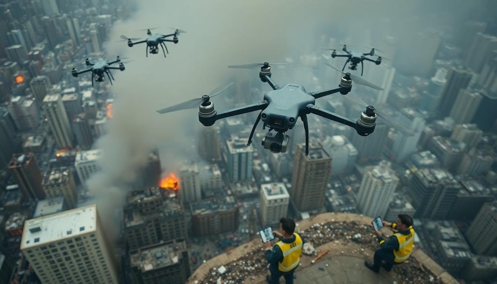
Brief your team on the mission goals, communication protocols, and safety measures. Assign specific roles and responsibilities to each member. Coordinate with other disaster response teams to avoid interference and maximize efficiency.
Lastly, establish a clear data management plan. Determine how you'll collect, process, and share the gathered information with relevant authorities and stakeholders to support effective disaster response efforts.
Real-Time Data Collection Strategies

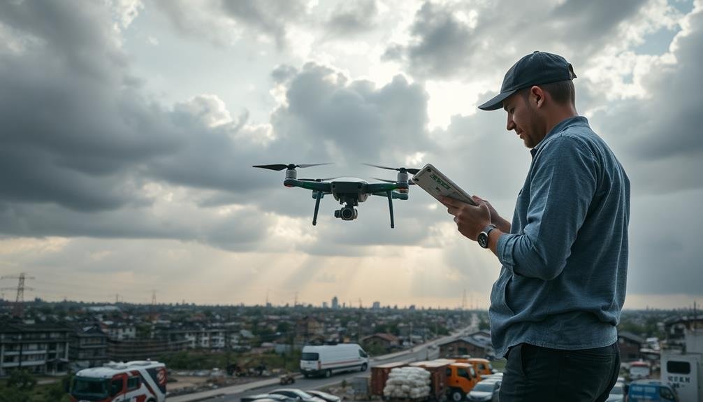
During disaster response operations, efficient real-time data collection is essential for making informed decisions. To maximize your unmanned aircraft's effectiveness, focus on capturing high-quality imagery and data that can be quickly analyzed and shared with incident commanders.
Use your drone's onboard sensors to gather multispectral imagery, thermal data, and high-resolution video footage. These tools can help you identify hot spots, assess structural damage, and locate survivors. Implement a systematic flight pattern to guarantee thorough coverage of the affected area, and don't forget to adjust your flight plans based on emerging priorities.
Utilize real-time data transmission capabilities to stream live video feeds and telemetry data to ground control stations. This allows for immediate analysis and decision-making.
Consider using artificial intelligence and machine learning algorithms to process data on-the-fly, helping to identify critical information faster.
Coordinate with other response teams to avoid duplicating efforts and guarantee data interoperability. Use standardized data formats and file-sharing protocols to facilitate seamless information exchange.
Remember to regularly back up your collected data to prevent loss and maintain a thorough record of the disaster response efforts.
Post-Mission Analysis and Reporting
After completing your unmanned aircraft mission, it's time to make sense of all the data you've gathered.
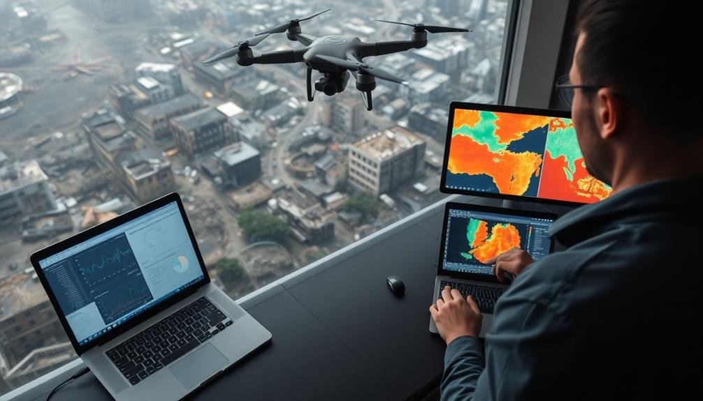
Begin by organizing and categorizing the collected information, including imagery, sensor data, and mission logs. Use specialized software to process and analyze the data, looking for patterns, anomalies, or critical information that could aid disaster response efforts.
Create detailed maps and 3D models of the affected areas, highlighting damage assessments, potential hazards, and areas requiring immediate attention.
Compare pre-disaster imagery with your newly acquired data to quantify the extent of destruction and identify changes in terrain or infrastructure.
Prepare a thorough report that summarizes your findings, including key observations, actionable insights, and recommendations for response teams.
Include visual aids such as annotated images, charts, and graphs to effectively communicate your analysis. Confirm your report is clear, concise, and tailored to the needs of different stakeholders, such as emergency managers, search and rescue teams, and local authorities.
Frequently Asked Questions
How Do Drones Communicate With Ground Control During Disaster Response Missions?
You'll find drones communicating with ground control through radio frequencies, cellular networks, or satellite links. They'll transmit real-time data, video feeds, and telemetry information. Some advanced drones use mesh networks for extended range and reliability during missions.
What Are the Legal Implications of Using Drones in Restricted Airspace?
You'll face serious legal consequences for flying drones in restricted airspace. It's illegal without proper authorization. You could be fined, have your drone confiscated, or even face criminal charges. Always check regulations before flying in sensitive areas.
How Can Drone Operators Maintain Battery Life in Extreme Weather Conditions?
You'll need to protect your drone's batteries from extreme temperatures. Keep them warm in cold weather and cool in hot conditions. Use insulated cases, avoid overcharging, and bring spare batteries. Don't forget to monitor battery levels closely.
What Training Is Required for Disaster Response Drone Pilots?
You'll need specialized training in disaster response protocols, flight regulations, and emergency procedures. You should also learn about search and rescue techniques, aerial photography, and data analysis. Don't forget to practice flying in challenging conditions regularly.
How Do Unmanned Aircraft Integrate With Other Emergency Response Technologies?
You'll find drones seamlessly integrate with other emergency tech. They'll feed real-time data to command centers, work alongside ground robots, and sync with GIS systems. They're also coordinated with manned aircraft for extensive disaster response.
In Summary
You've now got the key strategies for effective disaster response using unmanned aircraft. Remember to plan thoroughly, collect real-time data efficiently, and analyze your findings post-mission. By following these tips, you'll maximize your drone's potential in critical situations. Stay prepared, stay safe, and keep honing your skills. With practice, you'll become an invaluable asset in disaster response efforts, potentially saving lives and aiding communities when they need it most.
As educators and advocates for responsible drone use, we’re committed to sharing our knowledge and expertise with aspiring aerial photographers.


Leave a Reply