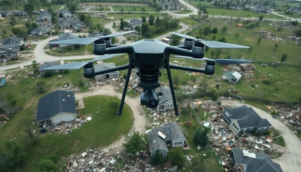
UAVs are transforming tornado damage assessment, offering unparalleled insights into destruction patterns. You'll see high-resolution imagery and 3D models that reveal precise tornado paths, intensities, and structural impacts. These drones access hard-to-reach areas safely, providing real-time data essential for rapid response. They're more efficient than traditional methods, covering vast areas quickly and accurately. With AI integration, UAVs can automatically detect and categorize damage, enhancing disaster management strategies. They're also improving our understanding of tornado behavior, potentially leading to better prediction models. The future of tornado research looks promising, with UAV technology at its forefront.
UAV Technology in Tornado Assessment

As tornadoes continue to wreak havoc across many regions, UAV technology has emerged as a game-changer in analyzing their destruction. You'll find that these unmanned aerial vehicles offer unprecedented access to storm-ravaged areas, providing essential data for meteorologists and emergency responders alike.
UAVs equipped with high-resolution cameras and thermal imaging sensors can quickly survey vast stretches of damaged terrain. They'll capture detailed imagery that's invaluable for evaluating the extent of destruction, identifying survivors, and planning rescue operations.
You'll appreciate how these drones can safely navigate hazardous areas where ground crews can't reach, offering real-time information to coordinate relief efforts effectively.
Advanced UAV models now feature AI-powered image recognition software, allowing them to automatically detect and classify different types of structural damage. You'll see how this technology speeds up the evaluation process, enabling faster response times and more efficient resource allocation.
Additionally, UAVs can create 3D maps of tornado paths, helping scientists better understand storm behavior and improve future prediction models. As UAV technology continues to evolve, you'll witness its growing importance in mitigating the impact of these destructive natural phenomena.
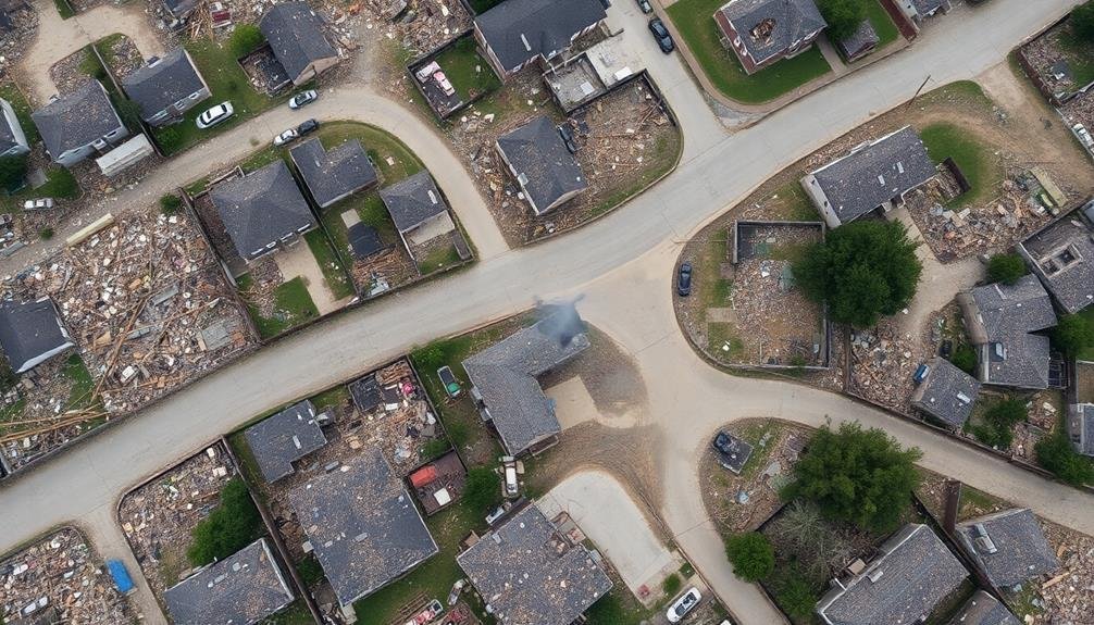
Aerial Mapping of Destruction Patterns
Aerial mapping of tornado destruction patterns has revolutionized our understanding of these devastating storms. Using UAVs equipped with high-resolution cameras and sensors, you can now capture detailed images of tornado-affected areas from above. This bird's-eye view allows you to identify and analyze destruction patterns that weren't visible from ground level.
You'll notice that tornado damage often creates distinctive swath patterns, revealing the storm's path and intensity variations. By mapping these patterns, you can determine the tornado's width, duration, and wind speeds at different points along its track. You'll also be able to identify debris patterns, which can provide essential information about the tornado's rotation and strength.
UAV-based aerial mapping enables you to create 3D models of the affected landscape, helping you visualize the extent of the damage and identify structural vulnerabilities. This data is invaluable for improving building codes and construction practices in tornado-prone areas.
Additionally, you can use these maps to aid in search and rescue operations, assess infrastructure damage, and plan recovery efforts more effectively.
Real-Time Data Collection Advantages
During tornado events, real-time data collection using UAVs offers significant advantages over traditional methods. You'll find that these unmanned aircraft can quickly survey large areas affected by tornadoes, providing immediate insights into the extent and patterns of destruction. This rapid assessment allows emergency responders to prioritize their efforts and allocate resources more effectively.
With UAVs, you're able to access hard-to-reach or dangerous areas that might be inaccessible to ground teams. They can capture high-resolution images and videos, giving you a thorough view of the damage from various angles. This real-time data helps you identify potential hazards, such as unstable structures or downed power lines, ensuring the safety of first responders and residents.
You'll also benefit from the ability to track the progression of damage over time. By repeatedly flying UAVs over the affected area, you can monitor changes in debris patterns, flooding, or ongoing structural collapses. This continuous stream of information enables you to make informed decisions about evacuation orders, search and rescue operations, and long-term recovery planning.
Real-time data from UAVs ultimately enhances your overall disaster response capabilities.
Precision in Damage Estimation

Accuracy is key when it comes to estimating tornado damage, and UAVs excel in this area. They provide a level of precision that's unmatched by traditional ground-based assessments.
You'll find that UAVs can capture high-resolution imagery and 3D models of affected areas, allowing for detailed analysis of structural damage.
With UAV technology, you're able to:
- Measure exact dimensions of debris fields
- Identify subtle signs of wind damage on rooftops
- Assess tree fall patterns to determine wind direction and intensity
- Quantify the volume of displaced soil or building materials
These capabilities translate into more accurate damage estimates, which are essential for insurance claims, disaster relief efforts, and scientific research.
You'll notice that UAVs can access areas that might be too dangerous or difficult for ground teams to reach, ensuring a thorough assessment of the entire affected area.
Safety Benefits for Survey Teams

While precision in damage assessment is paramount, the safety of survey teams remains a top priority. UAVs provide significant safety benefits for those tasked with surveying tornado destruction. You'll find that these aerial tools allow you to assess dangerous areas without putting personnel at risk.
When you use UAVs, you're able to:
| Benefits | Traditional Surveys | UAV Surveys |
|---|---|---|
| Avoid hazardous debris | High risk | Low risk |
| Access unstable terrain | Limited | Extensive |
| Reduce exposure time | Hours on-site | Minutes |
By deploying UAVs, you're keeping your team out of harm's way. You won't need to worry about unstable structures, downed power lines, or hazardous materials that often litter tornado-affected areas. Instead, you can gather vital data from a safe distance, reducing the potential for injuries or accidents.
Moreover, you'll find that UAVs allow for quicker assessments, minimizing the time your team spends in potentially dangerous environments. This efficiency not only enhances safety but also enables faster response and recovery efforts, ultimately benefiting the affected communities.
Enhancing Disaster Response Strategies

The integration of UAVs into disaster response strategies has revolutionized how emergency management teams approach tornado aftermath. You'll find that these aerial tools provide real-time data and imagery, allowing for faster and more efficient decision-making in critical situations. They've become invaluable assets in evaluating damage, locating survivors, and coordinating relief efforts.
UAVs enhance disaster response strategies by:
- Providing rapid aerial surveys of affected areas
- Identifying safe routes for ground teams to access disaster zones
- Detecting heat signatures to locate trapped survivors
- Delivering essential supplies to isolated areas
You'll notice that emergency responders can now prioritize their efforts more effectively, thanks to the extensive overview UAVs offer. They're able to quickly identify the most severely impacted areas and allocate resources accordingly. This technology has greatly reduced response times and improved the overall effectiveness of disaster relief operations.
Moreover, you'll find that UAVs equipped with specialized sensors can detect structural instabilities, gas leaks, and other potential hazards, ensuring the safety of both responders and survivors. They've become an essential tool in creating more robust, data-driven disaster response plans that can adapt to rapidly changing situations on the ground.
Comparing UAV Vs Traditional Surveys

You'll find UAVs offer significant efficiency and coverage advantages over traditional surveys in evaluating tornado damage.
With drones, you can quickly scan large areas and access hard-to-reach locations, providing a more thorough view of the destruction.
While traditional methods may excel in certain aspects, UAV surveys often deliver comparable or superior data accuracy, especially when equipped with high-resolution cameras and advanced sensors.
Efficiency and Coverage Advantages
In relation to efficiency and coverage, UAVs outshine traditional survey methods when evaluating tornado destruction. You'll find that drones can cover vast areas quickly, capturing high-resolution imagery and data in a fraction of the time it takes ground teams. This speed is essential in the aftermath of a tornado, where time is of the essence for search and rescue operations and damage assessment.
UAVs can access hard-to-reach or dangerous areas that might be off-limits to ground surveyors due to debris, structural instability, or other hazards. They provide a thorough aerial view, allowing you to see patterns and extent of destruction that mightn't be apparent from ground level.
Here's what you can expect from UAV tornado surveys:
- Rapid deployment and data collection within hours of the event
- Ability to cover hundreds of acres in a single flight
- High-resolution imagery for detailed damage analysis
- 3D mapping capabilities for volumetric assessments of debris
With UAVs, you'll get a more complete picture of the tornado's path and intensity variations. This extensive data helps emergency responders, insurers, and researchers better understand and respond to tornado events, ultimately improving disaster management and future preparedness efforts.
Data Accuracy Comparison
While efficiency and coverage are key advantages of UAV surveys, it's important to examine how their data accuracy compares to traditional survey methods. You'll find that UAVs often provide more precise and thorough data in tornado damage assessments.
UAVs can capture high-resolution imagery and 3D models, allowing for detailed analysis of structural damage. They're able to access areas that may be unsafe or difficult for ground surveyors, resulting in more complete datasets. However, traditional methods still have their place, especially for close-up inspections and gathering specific details.
Here's a comparison of data accuracy between UAV and traditional surveys:
| Aspect | UAV Surveys | Traditional Surveys |
|---|---|---|
| Spatial Resolution | High | Medium |
| Coverage Completeness | Extensive | Limited |
| 3D Modeling Capability | Advanced | Basic |
| Close-up Detail | Moderate | High |
You'll notice that UAVs excel in spatial resolution and coverage, while traditional surveys offer better close-up detail. By combining both methods, you can achieve the most thorough and accurate assessment of tornado destruction. This integrated approach allows you to leverage the strengths of each method, ensuring you don't miss critical information in your analysis.
Machine Learning in Damage Analysis

Machine learning algorithms are revolutionizing the way we analyze tornado damage using UAV imagery. These advanced systems can quickly process vast amounts of data collected by drones, identifying patterns and evaluating damage levels with unprecedented accuracy and speed.
You'll find that machine learning models can detect subtle signs of destruction that might escape the human eye, leading to more thorough damage evaluations.
When you implement machine learning in tornado damage analysis, you'll experience several key benefits:
- Faster processing times, allowing for quicker emergency response
- More consistent and objective evaluations across different locations
- Ability to detect hidden structural damage not visible from the ground
- Improved tracking of long-term recovery efforts in affected areas
As you integrate these AI-powered tools into your analysis workflow, you'll notice a significant improvement in the efficiency and accuracy of your evaluations.
Machine learning algorithms can be trained to recognize specific types of damage, such as roof destruction, collapsed walls, or debris patterns. This enables you to quickly prioritize areas that need immediate attention and allocate resources more effectively.
You'll also find that these systems can adapt and improve over time, learning from each new dataset to enhance their performance in future analyses.
Future of Tornado Research

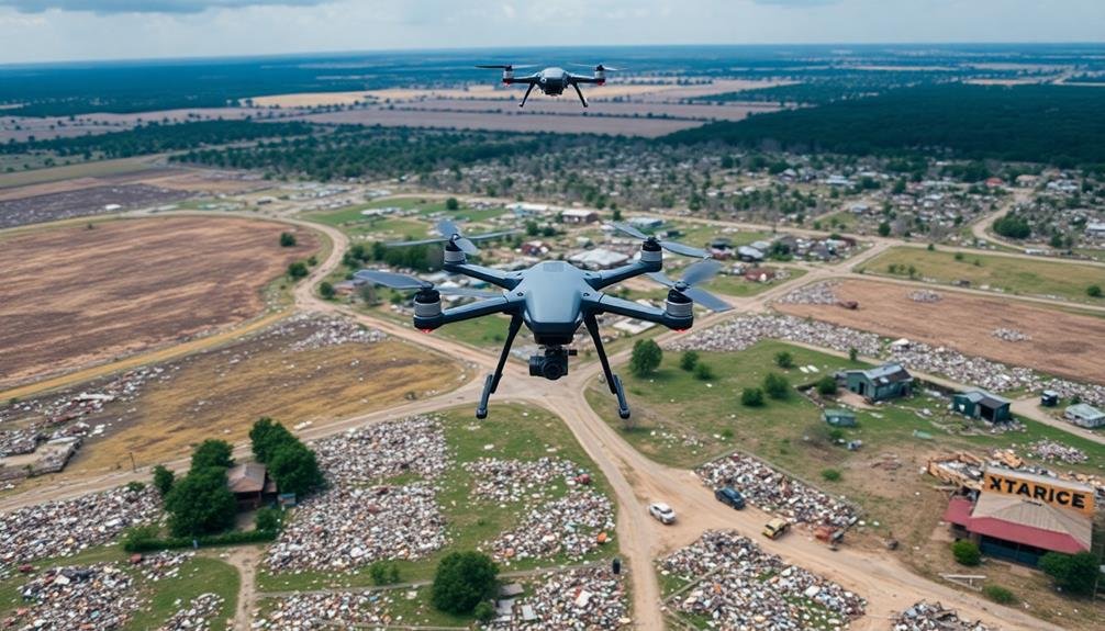
As we look ahead, the future of tornado research stands poised for groundbreaking advancements. You'll see a shift towards more integrated approaches, combining UAV technology with cutting-edge weather modeling and AI-driven analysis. This fusion will provide unprecedented insights into tornado formation, behavior, and impact.
You can expect real-time data collection to become the norm, with swarms of autonomous drones deployed before, during, and after tornado events. These UAVs will work in tandem with ground-based sensors and satellites, creating a thorough 3D picture of atmospheric conditions.
Here's a glimpse of what's to come:
| Technology | Impact | Emotion |
|---|---|---|
| AI Forecasting | Improved Warning Time | Hope |
| Nano-Drones | In-Tornado Data | Excitement |
| VR Simulations | Enhanced Training | Confidence |
| Debris Tracking | Better Risk Assessment | Security |
| Bio-Inspired Sensors | Precise Measurements | Wonder |
You'll witness a revolution in public safety as these advancements lead to more accurate predictions and targeted warnings. The future of tornado research isn't just about understanding these powerful storms—it's about saving lives and protecting communities with unprecedented precision.
Frequently Asked Questions
How Do UAVS Handle Strong Winds During Tornado Aftermath Surveys?
You'll find that UAVs are equipped with stabilizers and wind-resistant designs. They're often flown at lower altitudes to avoid stronger winds. Operators may also choose heavier models or wait for calmer conditions to guarantee safe surveys.
Can UAVS Detect Survivors Trapped in Debris After a Tornado?
You'll find that UAVs can detect survivors in tornado debris. They're equipped with thermal cameras to spot body heat and advanced sensors to pick up sounds or movements. These tools help rescue teams locate and save trapped individuals quickly.
What Privacy Concerns Arise From Using UAVS for Tornado Damage Assessment?
You'll face privacy concerns when UAVs capture images of your property or personal belongings. They might inadvertently record sensitive information or intrude on your space during a vulnerable time. Be aware of potential data misuse or unauthorized sharing.
How Quickly Can UAVS Be Deployed After a Tornado Strikes?
You'll find UAVs can be deployed rapidly after a tornado strikes. They're often in the air within hours, sometimes even minutes. You'll see them quickly evaluating damage and aiding emergency responders as soon as conditions allow.
Are There Regulations Limiting UAV Use in Disaster-Stricken Areas?
Yes, you'll find regulations restricting UAV use in disaster areas. You'll need FAA approval and must follow temporary flight restrictions. You can't interfere with emergency operations, and you must respect privacy and safety guidelines.
In Summary
You've seen how UAVs are revolutionizing tornado research and response. They're providing unprecedented aerial views, real-time data, and precise damage assessments. You're safer and more efficient using drones instead of ground surveys. As machine learning advances, you'll get even more insights from UAV footage. In the future, you'll rely on these flying tools to better understand, predict, and respond to tornadoes, potentially saving more lives and property.
As educators and advocates for responsible drone use, we’re committed to sharing our knowledge and expertise with aspiring aerial photographers.


Leave a Reply