
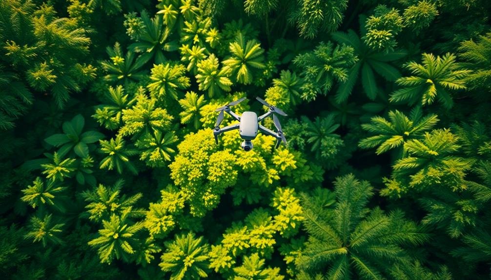
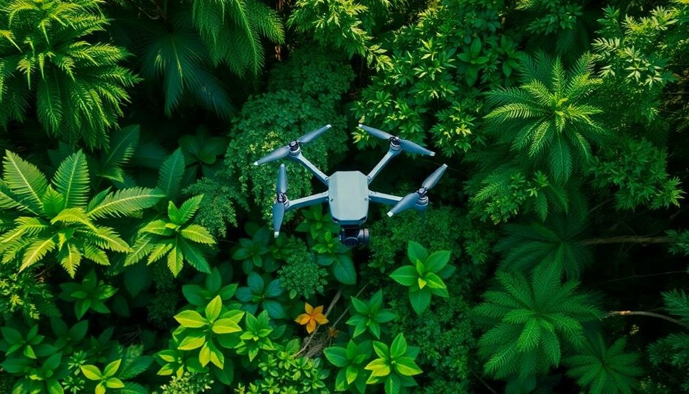
You'll witness a revolutionary shift in biodiversity monitoring as drones and advanced imaging technologies take to the skies. These eyes in the sky offer unprecedented insights into ecosystems and wildlife populations. Equipped with high-resolution cameras and thermal sensors, drones can access remote areas, track animal migrations, and identify plant species from above. They're cost-effective, minimally disruptive, and provide rapid data collection for ecological research. AI and machine learning quickly process vast aerial datasets, recognizing patterns and species. While challenges exist, like image resolution and weather conditions, the future promises longer flight times, improved imaging, and swarm technology. Explore further to uncover the full potential of this aerial revolution.
The Rise of Aerial Biodiversity Surveys

Drones soar over vast landscapes, revolutionizing the way we monitor biodiversity. You'll find these aerial marvels equipped with high-resolution cameras, thermal sensors, and even DNA collectors. They're transforming ecological research by accessing previously unreachable areas and collecting data at unprecedented speeds.
You can now survey large swaths of forest canopy, track animal migrations, and identify plant species from above. Drones capture detailed imagery that allows researchers to count individual animals, assess habitat health, and detect changes over time. They're particularly useful in monitoring endangered species and hard-to-reach ecosystems.
You'll see drones complementing traditional ground surveys, offering a more thorough view of biodiversity. They're cost-effective, reducing the need for extensive field teams and minimizing disturbance to wildlife.
With AI and machine learning, you can process vast amounts of aerial data quickly, identifying patterns and trends that might otherwise go unnoticed.
As technology advances, you'll witness drones becoming smaller, quieter, and more sophisticated. They'll play a vital role in conservation efforts, helping you understand and protect Earth's biodiversity more effectively than ever before.
Drone Technology for Wildlife Observation

You'll find that drone technology has revolutionized aerial wildlife tracking, allowing researchers to observe animals from a safe distance.
These unmanned aerial vehicles can cover vast areas quickly, capturing high-resolution images and videos of wildlife in their natural habitats.
Aerial Wildlife Tracking
With the advent of unmanned aerial vehicles, wildlife researchers have gained a powerful new tool for monitoring biodiversity. You'll find that aerial wildlife tracking using drones offers numerous advantages over traditional ground-based methods. These flying machines can cover vast areas quickly, access remote or dangerous locations, and minimize disturbance to animals.
You can equip drones with high-resolution cameras, thermal imaging sensors, and GPS technology to track and monitor wildlife populations. They're particularly useful for counting large herds, detecting poaching activities, and studying animal behavior patterns. You'll appreciate how drones can capture detailed imagery of nests, burrows, and other habitats without causing stress to the animals.
When you're tracking migratory species, drones can follow their routes across challenging terrains and water bodies. They're also invaluable for monitoring endangered species in hard-to-reach areas.
You'll find that aerial wildlife tracking is revolutionizing conservation efforts by providing real-time data on animal movements, habitat changes, and population dynamics. This technology allows you to make informed decisions about wildlife management and protection strategies, ultimately contributing to more effective biodiversity conservation.
Minimizing Habitat Disturbance
While aerial tracking offers numerous benefits, it's equally important to contemplate the impact of these technologies on wildlife habitats. Drones, in particular, can cause disturbance if not used responsibly. To minimize habitat disruption, you'll need to follow strict guidelines when deploying aerial monitoring systems.
First, choose the right equipment. Opt for drones with quiet electric motors and propellers designed to reduce noise. You should also select models with longer flight times to minimize the frequency of launches and landings.
When planning your flights, maintain a safe distance from animals and nesting sites. Adhere to local regulations and obtain necessary permits before operating in sensitive areas.
Timing is essential. Schedule your observations during periods when wildlife is least active or vulnerable. You'll want to avoid breeding seasons, migration periods, and times of day when animals are feeding or resting.
Additionally, limit the duration and frequency of flights to reduce stress on the observed species.
Advantages of Aerial Monitoring
Aerial monitoring offers significant advantages for biodiversity research.
You'll find that drones and other aerial platforms provide cost-effective data collection, allowing you to gather extensive information without the expense of traditional ground surveys.
These technologies also enable wide-area coverage capabilities, letting you observe and map large ecosystems or track migratory patterns across vast distances with unprecedented efficiency.
Cost-Effective Data Collection
Through the lens of cost-effective data collection, aerial monitoring stands out as a game-changer for biodiversity research. You'll find that drones and satellites can cover vast areas in a fraction of the time it'd take ground-based teams. This efficiency translates to significant cost savings, allowing you to gather more data with less investment.
You'll appreciate how aerial monitoring reduces the need for extensive field equipment and personnel. With a single drone or satellite image, you can capture information that would've required multiple ground surveys. This approach cuts down on transportation costs, accommodation expenses, and labor hours.
Moreover, you'll discover that aerial monitoring enables continuous data collection. You can program drones or schedule satellite passes to capture images at regular intervals, providing you with a consistent stream of information without the need for constant human presence. This automation not only saves money but also guarantees data continuity.
You'll also benefit from the versatility of aerial monitoring. It's adaptable to various ecosystems and terrains, eliminating the need for specialized equipment for different environments. This flexibility further enhances its cost-effectiveness, making it an invaluable tool in your biodiversity research arsenal.
Wide-Area Coverage Capabilities
When it comes to wide-area coverage, aerial monitoring truly shines in biodiversity research. You'll find that drones and satellites can survey vast ecosystems in a fraction of the time it takes for ground-based teams. These tools allow you to capture data on expansive forests, sprawling grasslands, and entire river systems in a single mission.
With aerial monitoring, you're able to track animal migrations across borders and observe landscape-level changes in vegetation. You can detect patterns that aren't visible from the ground, such as the spread of invasive species or the impact of climate change on habitats. High-resolution imagery lets you count wildlife populations over large areas, from herds of elephants to flocks of birds.
You'll appreciate how aerial methods complement ground surveys, filling in gaps and providing context to localized observations. They're particularly valuable in remote or inaccessible regions where traditional fieldwork is challenging or dangerous.
Challenges in Aerial Biodiversity Assessment

Conducting aerial biodiversity assessments presents unique challenges that researchers must overcome.
You'll find that image resolution is a major hurdle, as it's essential to identify species accurately from high altitudes. Even with advanced cameras, distinguishing between similar-looking animals or plants can be difficult.
Weather conditions can greatly impact your aerial surveys. Cloud cover, precipitation, and strong winds may limit visibility or prevent flights altogether. You'll need to plan carefully around these factors to guarantee consistent data collection.
Another challenge you'll face is the temporal nature of biodiversity. Many species have specific activity patterns or migration schedules, meaning you'll need to time your surveys precisely to capture an accurate representation of the ecosystem.
You'll also encounter issues with canopy cover in forested areas, which can obscure ground-dwelling species. This limitation may require you to combine aerial assessments with ground-based methods for a thorough survey.
Lastly, you must consider the potential disturbance to wildlife caused by your aerial vehicles. Noise and visual intrusion may alter animal behavior, potentially skewing your results and requiring careful interpretation of the data you collect.
Species Identification From Above
From high above, species identification presents unique challenges and opportunities for biodiversity monitoring. You'll find that certain species are easier to spot from aerial perspectives, particularly larger animals or those with distinctive features. For example, you can identify elephants, whales, or flamingo flocks with relative ease.
However, you'll face difficulties when trying to distinguish between similar-looking species or smaller organisms. That's where advanced imaging technology comes into play. You can use high-resolution cameras and multispectral sensors to capture detailed images that reveal subtle differences in color, shape, and behavior.
Machine learning algorithms can help you process vast amounts of data quickly, allowing for faster and more accurate species identification. You'll need to train these algorithms with extensive datasets of known species, but once perfected, they can revolutionize your biodiversity monitoring efforts.
You should also consider using thermal imaging for nocturnal species and LiDAR technology to create 3D models of habitats, which can help you infer the presence of certain species based on their preferred environments.
Habitat Mapping With Drones

You'll find that drones revolutionize habitat mapping through their ability to capture high-resolution aerial imagery.
With this detailed data, you can employ automated vegetation classification techniques to identify and categorize different plant communities.
Drones also allow you to map inaccessible terrain, providing extensive coverage of habitats that were previously challenging to survey.
High-Resolution Aerial Imagery
High-resolution aerial imagery has revolutionized habitat mapping, with drones emerging as a game-changing tool for biodiversity monitoring. You'll find that these unmanned aerial vehicles can capture incredibly detailed images of landscapes, allowing researchers to identify individual plant species, track animal movements, and evaluate ecosystem health with unprecedented accuracy.
When you're using drones for aerial imagery, you'll benefit from their ability to cover large areas quickly and efficiently. They can access remote or dangerous locations that were previously difficult to survey, providing a thorough view of diverse habitats.
You'll appreciate the flexibility of drones, as they can be equipped with various sensors, including multispectral and thermal cameras, to collect different types of data. The high-resolution images you obtain will enable you to create detailed 3D models of landscapes, measure canopy heights, and even count individual trees.
You'll find this data invaluable for monitoring changes in vegetation cover, detecting early signs of deforestation, and evaluating the impact of climate change on ecosystems. With this technology, you're better equipped to make informed decisions about conservation strategies and resource management.
Automated Vegetation Classification
Automated vegetation classification takes the power of high-resolution aerial imagery to the next level. It's a game-changer in biodiversity monitoring, allowing you to map habitats with unprecedented accuracy and efficiency. By combining drone-captured imagery with machine learning algorithms, you can quickly identify and categorize different plant species and vegetation types across vast landscapes.
You'll find this technology particularly useful in areas that are difficult to access on foot. It can detect subtle changes in vegetation patterns, helping you track the spread of invasive species or monitor the health of endangered plant populations. The process involves training AI models to recognize specific plant characteristics, such as leaf shape, color, and texture, from aerial images.
With automated vegetation classification, you're able to create detailed habitat maps that provide valuable insights into ecosystem dynamics. These maps can inform conservation strategies, land management decisions, and climate change impact assessments.
You'll also appreciate the time and cost savings compared to traditional field surveys, as well as the ability to conduct repeated monitoring over time with minimal disturbance to the environment.
Inaccessible Terrain Coverage
Many remote and treacherous landscapes that were once impossible to survey are now within reach, thanks to habitat mapping with drones.
You'll find these unmanned aerial vehicles (UAVs) maneuvering steep cliffs, dense forests, and even active volcanoes, capturing high-resolution imagery and data where human access is limited or dangerous.
Drones equipped with multispectral cameras and LiDAR sensors can create detailed 3D maps of inaccessible terrains. You're able to identify plant species, assess vegetation health, and monitor changes in landscape structure over time.
This technology's particularly valuable in tracking deforestation, coastal erosion, and the effects of climate change on remote ecosystems.
You can now survey vast areas quickly and efficiently, reducing the need for time-consuming ground surveys.
Drones' ability to fly at low altitudes and capture centimeter-level resolution provides unprecedented detail in habitat mapping.
They're also less disruptive to wildlife than traditional survey methods.
Thermal Imaging for Nocturnal Wildlife

Thermal imaging has revolutionized the way researchers observe and study nocturnal wildlife. You'll find this technology particularly useful for detecting animals that are active at night or hidden in dense vegetation. By capturing heat signatures, thermal cameras allow you to spot warm-blooded creatures even in complete darkness.
You can mount these cameras on drones or fixed positions to monitor large areas efficiently. They'll help you identify species, track movements, and estimate population sizes without disturbing the animals' natural behavior. You'll also be able to detect poaching activities and illegal hunting more effectively.
When you're using thermal imaging, you'll need to take into account factors like ambient temperature and animal body size. Larger animals are easier to detect, while smaller ones may require more sensitive equipment.
You'll also find that thermal imaging is particularly effective in cooler climates where the temperature difference between animals and their surroundings is more pronounced.
AI-Powered Image Analysis

Artificial intelligence is transforming image analysis in biodiversity monitoring. You'll find that AI algorithms can now process vast amounts of visual data from satellites, drones, and camera traps with unprecedented speed and accuracy.
These systems can identify and count individual animals, recognize different species, and even detect subtle changes in vegetation patterns.
AI-powered image analysis has greatly reduced the time and labor required for manual data processing. You can now analyze thousands of images in hours instead of weeks, allowing for more frequent and thorough biodiversity assessments.
Machine learning models are continuously improving, becoming adept at distinguishing between similar species and adapting to various environmental conditions.
You'll appreciate how AI can detect patterns and trends that might escape human observers. It can identify early signs of habitat degradation, track animal migration routes, and monitor the spread of invasive species.
This technology is particularly valuable in remote or inaccessible areas where traditional survey methods are challenging.
Conservation Applications of Aerial Data

Through aerial data collection, conservation efforts have taken a significant leap forward. You'll find that aerial data provides an extensive view of ecosystems, allowing you to track changes over time and identify areas of concern.
With drones and satellites, you can now monitor vast expanses of land and sea that were previously challenging to access. You can use this data to detect illegal activities like poaching or deforestation in real-time.
It's also invaluable for mapping habitats, evaluating the health of vegetation, and tracking animal migrations. By analyzing aerial imagery, you'll be able to identify invasive species and monitor their spread, enabling swift intervention.
Aerial data is essential for disaster response and recovery efforts. You can quickly evaluate the impact of wildfires, floods, or oil spills on ecosystems and endangered species. This information helps you prioritize conservation efforts and allocate resources effectively.
Moreover, you can use aerial data to monitor the effectiveness of conservation initiatives. By comparing before-and-after imagery, you'll be able to quantify the success of reforestation projects, wetland restoration, or coral reef recovery efforts, ensuring that your conservation strategies are truly making a difference.
Ethical Considerations in Drone Usage

While drones offer tremendous benefits for biodiversity monitoring, their use raises important ethical considerations you must address.
Privacy concerns are paramount, as drones can inadvertently capture images of people or private property. You'll need to establish clear protocols for data collection, storage, and usage to protect individuals' rights.
Wildlife disturbance is another important issue. Your drone operations may stress animals, disrupt breeding patterns, or alter natural behaviors. It's critical to research species-specific responses and adjust your flight plans accordingly.
You should also consider the broader environmental impact, including noise pollution and potential collisions with birds.
Legal compliance is imperative. You must adhere to local, national, and international regulations governing drone usage, which can vary considerably between jurisdictions. Obtain necessary permits and respect no-fly zones.
Lastly, consider the ethical implications of your data usage. Confirm that your findings are used responsibly and don't unintentionally harm the species or ecosystems you're trying to protect.
Transparency in your methods and results is significant for maintaining public trust and scientific integrity.
Future of Aerial Biodiversity Monitoring

As technology rapidly evolves, the future of aerial biodiversity monitoring looks increasingly promising. You'll see advancements in drone capabilities, including longer flight times, improved sensors, and AI-powered image analysis. These developments will enable more thorough and frequent surveys of ecosystems, providing researchers with unprecedented data on species distribution and habitat changes.
You can expect to see the integration of multispectral and hyperspectral imaging, allowing for more detailed analysis of vegetation health and species identification. Thermal imaging will become more prevalent, helping you track nocturnal animals and detect illegal activities like poaching. Machine learning algorithms will automate species recognition, greatly reducing the time needed for data processing.
In the coming years, you'll witness the emergence of swarm technology, where multiple drones work together to cover vast areas efficiently. This will revolutionize large-scale monitoring efforts, especially in remote or dangerous locations.
Additionally, you'll see increased collaboration between aerial platforms and ground-based sensors, creating a more holistic approach to biodiversity monitoring. These advancements will play a vital role in conservation efforts, helping you make informed decisions to protect our planet's diverse ecosystems.
Frequently Asked Questions
How Do Aerial Surveys Compare to Traditional Ground-Based Biodiversity Monitoring Methods?
You'll find aerial surveys cover larger areas faster than ground-based methods. They're less intrusive and can access remote locations. However, they may miss small or hidden species, and can't provide detailed, hands-on observations like traditional techniques.
What Training Is Required to Operate Drones for Wildlife Observation?
You'll need training in drone piloting, wildlife identification, and data collection. You should learn about local regulations, flight planning, and safety protocols. It's crucial to practice operating the drone and interpreting aerial imagery effectively.
How Do Weather Conditions Affect the Accuracy of Aerial Biodiversity Assessments?
You'll find that weather greatly impacts aerial biodiversity assessments. Wind can disrupt flight patterns, rain obscures visibility, and temperature affects animal behavior. Cloudy conditions may hinder image quality, while sunlight can cause glare on water surfaces.
Are There Any Legal Restrictions on Using Drones for Biodiversity Monitoring?
You'll face legal restrictions when using drones for biodiversity monitoring. You're often required to obtain permits, follow airspace regulations, and respect privacy laws. You can't fly over certain areas or at specific altitudes without authorization.
How Can Citizen Scientists Contribute to Aerial Biodiversity Monitoring Efforts?
You can contribute to aerial biodiversity monitoring as a citizen scientist by joining drone surveys, learning to operate drones, identifying species in aerial images, or sharing your own drone footage with research projects. It's an exciting way to help!
In Summary
You're witnessing a revolution in biodiversity monitoring. Drones and AI are transforming how we observe and protect wildlife. While challenges remain, the advantages are clear: wider coverage, less disturbance, and faster data collection. As technology improves, you'll see even more precise species identification and analysis. Remember to reflect on the ethical implications as you embrace these aerial tools. The future of conservation is looking up – literally.
As educators and advocates for responsible drone use, we’re committed to sharing our knowledge and expertise with aspiring aerial photographers.


Leave a Reply