
You can now expose hidden mining operations using cutting-edge aerial surveillance techniques. Drones equipped with high-resolution cameras and thermal sensors provide a bird's-eye view, quickly covering vast areas to detect terrain changes and heat signatures. AI algorithms analyze satellite imagery to identify potential mining sites and track their evolution over time. These "eyes in the sky" can access remote areas, bypassing ground limitations and providing thorough environmental impact assessments. While legal challenges regarding privacy and trespassing exist, these advanced technologies are revolutionizing environmental protection and law enforcement efforts. Discover how these aerial detectives are uncovering what lies beneath the surface.
Drones: Aerial Detectives
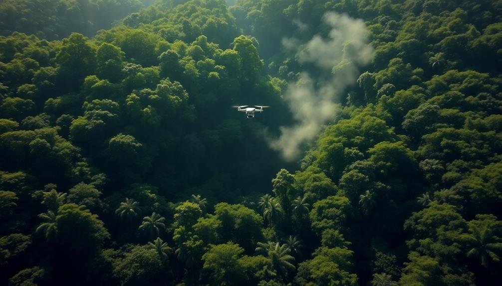
Out from the skies, drones have become indispensable tools for detecting hidden mining operations. These aerial detectives offer a bird's-eye view of vast landscapes, revealing telltale signs of illegal or undisclosed mining activities.
You'll find that drones equipped with high-resolution cameras and thermal imaging sensors can spot subtle changes in terrain, vegetation, and water bodies that might indicate mining operations.
When you deploy drones, you're leveraging their ability to cover large areas quickly and efficiently. They can capture detailed imagery of remote or hard-to-reach locations, exposing evidence of excavation, heavy machinery, or waste dumps.
You'll appreciate how drones can operate silently and at high altitudes, making them ideal for covert surveillance of suspected mining sites.
Moreover, you can program drones to conduct regular surveys, allowing you to monitor changes over time and detect new mining activities as they emerge.
Thermal Imaging Unveils Covert Operations
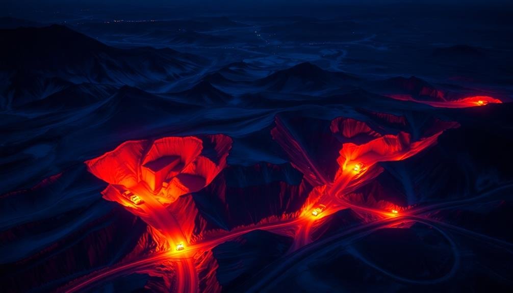
While drones offer an extensive aerial view, thermal imaging technology takes hidden mining detection to the next level. You'll find that thermal cameras can spot heat signatures from mining equipment, even when concealed underground or in dense vegetation. This technology allows you to identify active mining sites that might otherwise go unnoticed.
Here's how thermal imaging helps uncover covert mining operations:
| Heat Source | Detection Method | Significance |
|---|---|---|
| Machinery | High temperature spots | Indicates active equipment |
| Exhaust | Linear heat patterns | Reveals ventilation systems |
| Workers | Clustered heat signatures | Shows human activity |
You'll notice that thermal imaging can detect subtle temperature differences, making it invaluable for identifying hidden mining activities. It's especially useful at night or in areas with heavy cloud cover, where traditional visual inspection might fail. By analyzing thermal data, you can pinpoint the exact locations of mining operations, estimate their scale, and even determine the type of equipment being used. This information is essential for law enforcement and environmental agencies working to combat illegal mining and protect natural resources.
AI-Powered Analysis of Mining Sites
Artificial intelligence is revolutionizing the detection and analysis of hidden mining sites. You'll find that AI algorithms can now process vast amounts of satellite imagery and data to identify potential mining operations with unprecedented accuracy.
These systems can detect subtle changes in landscape, vegetation, and infrastructure that might indicate illicit mining activities.
AI-powered tools can analyze historical satellite images to track the evolution of mining sites over time, helping you understand their development and expansion patterns.
They're also capable of recognizing specific equipment and structures associated with mining operations, even when they're partially obscured or camouflaged.
You'll benefit from AI's ability to cross-reference multiple data sources, including thermal imaging, multispectral analysis, and radar data.
This thorough approach allows for a more nuanced understanding of mining activities and their environmental impact.
AI can also predict future mining hotspots by identifying areas with similar geological and topographical characteristics to known mining sites.
Legal Challenges in Aerial Surveillance
The use of aerial surveillance for detecting hidden mining operations raises significant legal questions. You'll find that privacy concerns are at the forefront of these challenges. While airspace is generally regarded as public, there's a gray area when it comes to using advanced imaging technologies to peer into private property.
You need to evaluate the Fourth Amendment implications, which protect against unreasonable searches. Courts have previously ruled on aerial surveillance, but the rapid advancement of technology complicates matters. You're likely to encounter debates over what constitutes a reasonable expectation of privacy in the age of drones and high-resolution satellite imagery.
Another legal hurdle you'll face is the potential for trespassing claims. Even if you're not physically entering a property, some argue that capturing detailed images from above could constitute a form of invasion.
You'll also need to navigate regulations surrounding drone usage, which vary by jurisdiction and can limit where and how you conduct aerial surveillance.
Lastly, you must assess international law when surveilling across borders, as sovereignty issues can arise.
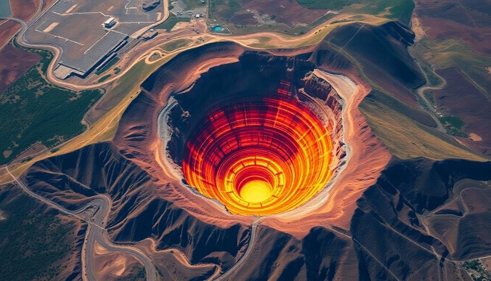
Environmental Impact Assessment From Above
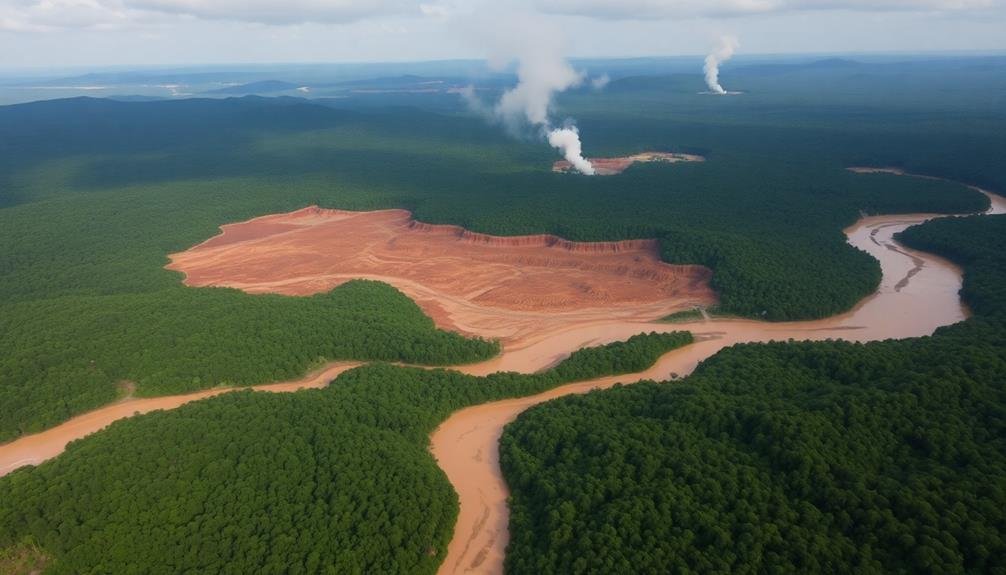
Aerial surveillance offers three key advantages for environmental impact assessments of hidden mining operations.
First, you'll gain a thorough view of the entire mining site and surrounding ecosystems. This bird's-eye perspective allows you to identify large-scale patterns and changes that might be missed from ground level.
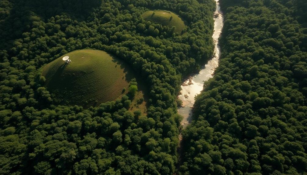
Second, you can track the progression of environmental damage over time. By comparing aerial images taken at different intervals, you'll detect changes in vegetation cover, water bodies, and land use patterns. This temporal analysis is essential for understanding the long-term impacts of mining activities.
Third, you'll have access to remote or hard-to-reach areas. Many illegal mining operations occur in dense forests or mountainous regions where ground access is limited. Aerial surveillance bypasses these obstacles, enabling you to assess even the most secluded sites.
Using high-resolution cameras and multispectral sensors, you can detect subtle changes in vegetation health, soil composition, and water quality.
These technologies allow you to identify potential contamination sources, assess the extent of deforestation, and monitor the effectiveness of any remediation efforts. With this wealth of data, you'll be better equipped to evaluate the true environmental cost of hidden mining operations.
Frequently Asked Questions
How Much Does It Cost to Implement Aerial Surveillance for Mining Detection?
You'll find costs vary widely for aerial mining detection. They depend on factors like area size, technology used, and frequency of flights. You're looking at anywhere from $10,000 to $100,000+ for an extensive surveillance program.
What Are the Privacy Concerns for Nearby Residents During Aerial Mining Surveys?
You might worry about drones or planes capturing images of your property during aerial mining surveys. They could inadvertently record your activities or personal spaces, raising concerns about privacy invasion and potential misuse of collected data.
Can These Technologies Detect Underground Mining Operations?
You can detect underground mining with certain technologies. Seismic sensors, ground-penetrating radar, and thermal imaging can reveal subsurface activity. Satellite imagery and aerial surveys also help identify surface changes indicating underground operations. These tools aren't foolproof but are increasingly effective.
How Often Should Aerial Surveys Be Conducted to Effectively Monitor Mining Activities?
You'll want to conduct aerial surveys at least quarterly to effectively monitor mining activities. However, if you suspect rapid changes or illegal operations, you should increase the frequency to monthly or even weekly surveys.
Are There International Agreements Governing the Use of Aerial Surveillance for Mining?
You'll find there aren't specific international agreements governing aerial surveillance for mining. However, general treaties on airspace and remote sensing may apply. It's essential to check local laws and regulations in the country you're monitoring.
In Summary
You've seen how aerial technology is revolutionizing the detection of hidden mining operations. With drones, thermal imaging, and AI analysis, you're now equipped to spot covert sites from above. But remember, you'll face legal hurdles in aerial surveillance. Don't forget the environmental angle – these tools can assess mining's impact too. As you move forward, you're at the forefront of a new era in mining oversight and accountability.
As educators and advocates for responsible drone use, we’re committed to sharing our knowledge and expertise with aspiring aerial photographers.


Leave a Reply