
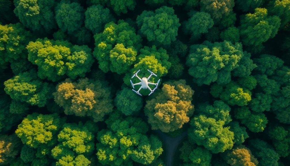
Unmanned Aircraft Systems (UAS) have revolutionized wildlife surveys with seven key techniques. You'll find thermal imaging for nocturnal species detection, high-resolution aerial photography for detailed population assessments, and LiDAR mapping for thorough habitat analysis. Acoustic monitoring with drone-mounted microphones captures wildlife vocalizations, while radio tracking locates tagged animals efficiently. Multispectral imaging analyzes vegetation health, essential for habitat evaluation. Finally, AI-powered automated detection streamlines wildlife identification in aerial footage. These methods offer unprecedented efficiency and minimal disturbance to wildlife. Exploring each technique further reveals their transformative impact on ecological research and conservation efforts.
Thermal Imaging for Nocturnal Species
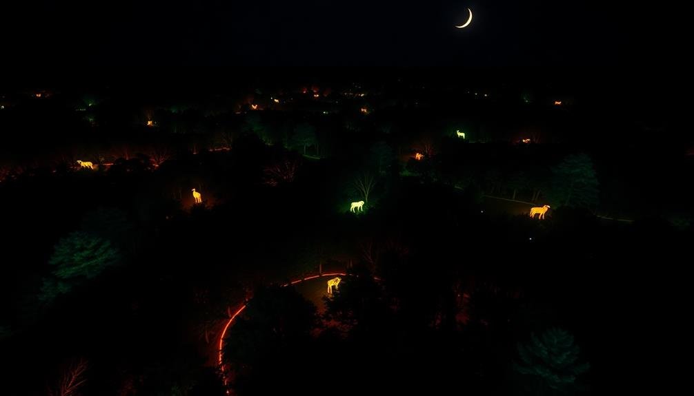
Three key advantages make thermal imaging an invaluable tool for surveying nocturnal species with unmanned aircraft systems (UAS).
First, it allows you to detect animals in complete darkness, making it ideal for studying creatures that are active at night. You'll be able to spot warm-blooded animals against cooler backgrounds, even in dense vegetation or urban environments.
Second, thermal imaging reduces disturbance to wildlife, as you won't need bright lights that could alter animal behavior or stress them unnecessarily.
Lastly, it enhances the efficiency of your surveys. You can cover large areas quickly and identify multiple animals simultaneously, saving time and resources compared to traditional ground-based methods.
When using thermal imaging with UAS, you'll need to take into account factors like flight altitude, camera resolution, and environmental conditions. Flying at the right height guarantees you capture enough detail without losing the broader context.
High-resolution thermal cameras will provide clearer images, allowing you to distinguish between species more accurately. Be aware that weather conditions, such as rain or fog, can affect thermal image quality.
High-Resolution Aerial Photography
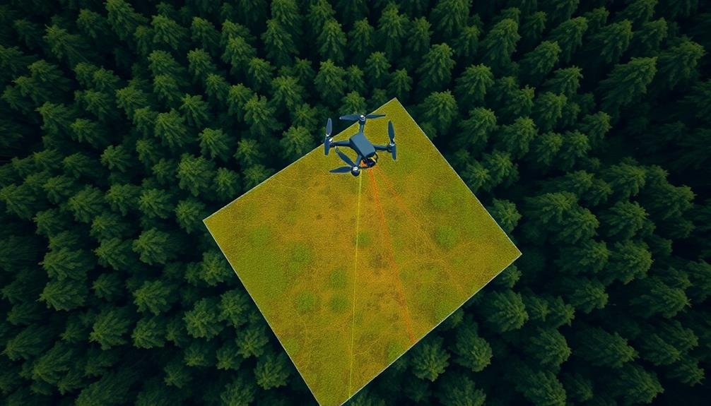
High-resolution aerial photography has revolutionized wildlife surveys, offering unprecedented detail and coverage. You'll find that unmanned aircraft systems (UAS) equipped with high-resolution cameras can capture images with a ground sampling distance of just a few centimeters. This level of detail allows you to identify individual animals, assess population sizes, and monitor habitat changes with remarkable accuracy.
When conducting aerial surveys, you'll want to take into account factors like flight altitude, camera resolution, and image overlap. Flying at lower altitudes provides higher resolution but covers less area, so you'll need to strike a balance based on your survey objectives. You can use specialized software to stitch together overlapping images, creating thorough orthomosaics of large areas.
One of the key advantages you'll notice is the ability to survey inaccessible or sensitive areas without disturbing wildlife. You can also revisit the same locations repeatedly, enabling long-term monitoring of population dynamics and habitat changes.
However, be aware of potential limitations such as weather conditions, battery life, and regulatory restrictions when planning your aerial photography missions.
LiDAR Mapping for Habitat Assessment
LiDAR technology mounted on unmanned aircraft systems offers powerful capabilities for wildlife habitat evaluation.
You'll find that LiDAR can generate high-resolution terrain models, revealing intricate landscape features essential for understanding species' habitats.
Additionally, you can use LiDAR data to analyze vegetation structure, providing insights into canopy height, density, and layering that are important for evaluating habitat quality and suitability for various wildlife species.
High-Resolution Terrain Modeling
While traditional surveying methods have long been used to assess wildlife habitats, the advent of unmanned aircraft systems (UAS) equipped with LiDAR technology has revolutionized terrain modeling. You'll find that UAS-based LiDAR can create incredibly detailed 3D models of landscapes, offering unprecedented insights into wildlife habitats.
With high-resolution terrain modeling, you're able to capture minute details of the land's surface, including vegetation structure, canopy height, and even small terrain features like animal burrows or nests. These models provide an extensive view of the habitat, allowing you to analyze topography, slope, and aspect with remarkable accuracy.
You'll appreciate how UAS-based terrain modeling saves time and reduces field work risks. It's especially useful in hard-to-reach or dangerous areas.
The data you collect can be used to track changes in habitat over time, assess the impact of environmental factors, and inform conservation strategies.
Vegetation Structure Analysis
Vegetation structure analysis takes LiDAR mapping to the next level for extensive habitat assessment. You'll find that UAS-mounted LiDAR sensors can create detailed 3D models of vegetation, revealing vital information about habitat quality and wildlife preferences.
These models help you understand canopy height, density, and layering, which are essential factors in determining suitable habitats for various species.
By analyzing vegetation structure, you're able to:
- Identify potential nesting sites for birds and arboreal mammals
- Assess understory density for ground-dwelling species
- Evaluate habitat connectivity and fragmentation
- Monitor changes in vegetation over time due to natural or human factors
You'll appreciate how this technology allows for non-invasive, repeatable surveys that can cover large areas quickly. It's particularly useful in difficult-to-access terrains where traditional ground-based surveys are impractical or dangerous.
With vegetation structure analysis, you're better equipped to make informed decisions about wildlife management, conservation efforts, and habitat restoration projects.
Acoustic Monitoring With Drone-Mounted Microphones
You'll find acoustic monitoring with drone-mounted microphones to be a powerful tool for species detection and identification.
By covering large areas efficiently, you can assess habitat use and population distributions more effectively than traditional ground-based methods.
This technology also allows you to evaluate noise pollution levels in wildlife habitats, providing valuable data for conservation efforts and urban planning.
Species Detection and Identification
The buzz of a drone's propellers mingles with the chorus of wildlife as it hovers above the treetops, its sensitive microphones poised to capture the sounds of nature.
You're now entering the domain of species detection and identification using acoustic monitoring with drone-mounted microphones. This cutting-edge technique allows you to survey vast areas quickly and efficiently, picking up on the unique vocalizations of various animals.
As you analyze the recorded audio, you'll be able to:
- Identify specific species based on their distinctive calls
- Estimate population densities in the surveyed area
- Detect rare or elusive animals that might be missed by visual surveys
- Monitor changes in biodiversity over time
You'll need specialized software to process the recordings, filtering out background noise and isolating individual animal calls.
Machine learning algorithms can help you automatically classify species, saving time and improving accuracy. By combining acoustic data with visual observations from drone-mounted cameras, you'll create a thorough picture of the ecosystem.
This non-invasive approach minimizes disturbance to wildlife while providing valuable insights into their behavior and distribution.
You're not just listening to nature; you're decoding its complex symphony to better understand and protect our planet's biodiversity.
Habitat Coverage Efficiency
Acoustic monitoring with drone-mounted microphones offers unparalleled habitat coverage efficiency.
You'll find that drones equipped with high-quality microphones can survey large areas quickly, capturing sounds from various wildlife species. This method allows you to cover terrain that's difficult or dangerous to access on foot, expanding your research capabilities.
You can program drones to follow specific flight paths, ensuring systematic coverage of your study area. They'll record vocalizations from birds, mammals, and amphibians, providing a thorough acoustic snapshot of the habitat.
You'll save time and resources compared to traditional ground-based surveys, as a single drone flight can cover the equivalent of multiple human-led transects.
Noise Pollution Assessment
Equipped with sensitive microphones, drones can effectively assess noise pollution in various environments. You'll find these aerial systems particularly useful for monitoring acoustic disturbances in wildlife habitats, urban areas, and industrial zones.
By flying at different altitudes and locations, you're able to create detailed noise maps that reveal sound patterns and hotspots.
When conducting noise pollution assessments with drones, you'll want to:
- Calibrate your microphones for accurate sound level measurements
- Plan flight paths to cover diverse acoustic environments
- Consider time of day and seasonal variations in noise levels
- Use noise-canceling technology to minimize drone-generated sounds
You'll appreciate the flexibility drones offer in accessing hard-to-reach areas and collecting data over large expanses. They're ideal for capturing sudden or intermittent noise events that might be missed by stationary monitoring stations.
You can also combine acoustic data with visual imagery to correlate noise sources with specific activities or landscape features. By analyzing the collected sound samples, you'll be able to identify potential impacts on wildlife behavior, human health, and overall ecosystem dynamics.
This information is invaluable for developing targeted noise mitigation strategies and informing urban planning decisions.
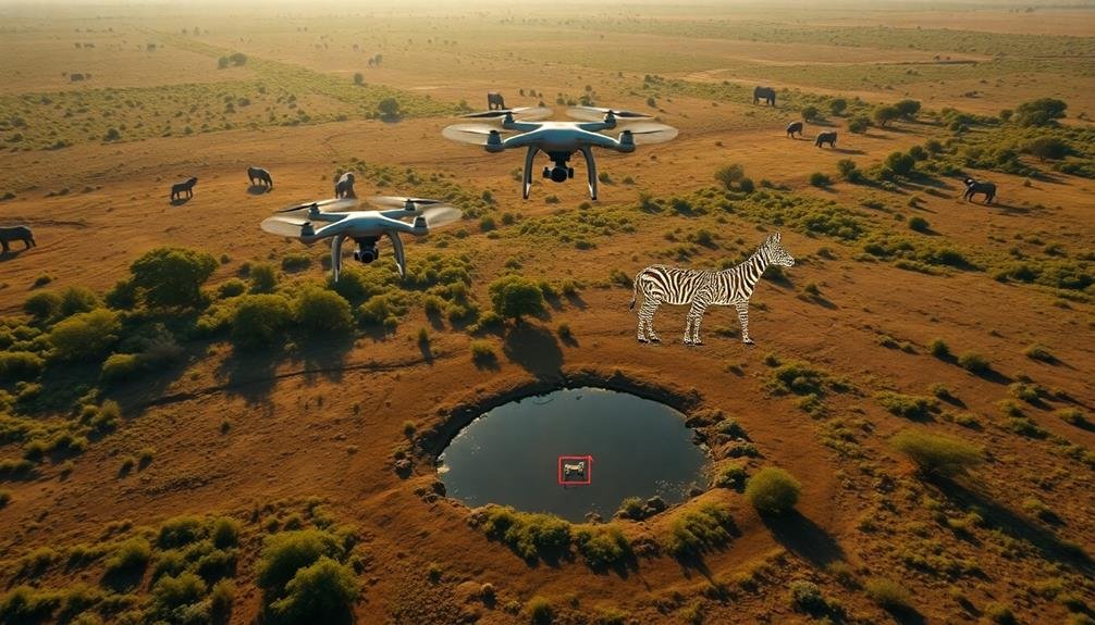
Radio Tracking of Tagged Animals
Through the integration of radio telemetry technology, unmanned aircraft systems (UAS) have revolutionized wildlife tracking methods. You can now use UAS equipped with radio receivers to locate and monitor tagged animals over vast areas with greater efficiency and reduced disturbance. These systems can detect signals from VHF transmitters attached to animals, allowing you to pinpoint their locations accurately.
When conducting radio tracking surveys with UAS, you'll fly predetermined search patterns at ideal altitudes to maximize signal reception. You can program the UAS to automatically log GPS coordinates when it detects a signal, creating a real-time map of animal movements. This method is particularly useful for tracking elusive or wide-ranging species in challenging terrains.
You'll find that UAS-based radio tracking offers several advantages over traditional ground-based methods. It reduces the need for extensive field personnel, minimizes habitat disturbance, and allows access to remote or dangerous areas. Additionally, you can cover larger areas in less time, increasing the frequency and accuracy of your data collection.
However, you must consider factors such as battery life, signal interference, and regulatory restrictions when planning your UAS radio tracking missions.
Multispectral Imaging for Vegetation Analysis
Leveraging multispectral imaging technology, UAS can provide valuable insights into vegetation health and distribution. You'll find that these systems capture data across multiple spectral bands, including visible light and near-infrared. This allows you to analyze plant health, stress levels, and species composition with unprecedented detail.
By using specialized sensors, you're able to detect subtle changes in chlorophyll content, leaf structure, and water stress that aren't visible to the naked eye.
When you're conducting vegetation surveys with UAS, you'll benefit from:
- Rapid data collection over large areas
- High-resolution imagery for precise plant identification
- Ability to detect early signs of disease or pest infestation
- Seasonal monitoring of vegetation changes
You can use this technology to create detailed vegetation maps, assess habitat quality for wildlife, and monitor the impact of climate change on ecosystems.
It's particularly useful in hard-to-reach areas where traditional ground surveys are impractical. By combining multispectral imaging with other UAS-based wildlife survey techniques, you'll gain a thorough understanding of habitat conditions and their influence on animal populations.
AI-Powered Automated Wildlife Detection
Artificial intelligence has revolutionized wildlife detection in UAS surveys. You'll find that machine learning algorithms can now analyze extensive amounts of aerial imagery and video footage in real-time, identifying and counting various animal species with remarkable accuracy.
These AI-powered systems can detect wildlife based on their shape, size, color, and movement patterns, even in complex environments. You can train these algorithms using large datasets of annotated images, enabling them to recognize specific species or groups of animals.
As you conduct surveys, the AI system processes the incoming data, flagging potential wildlife sightings for further investigation. This automated approach considerably reduces the time and effort required for manual image analysis, allowing you to cover larger areas more efficiently.
Advanced AI models can also account for environmental factors, such as vegetation cover or terrain type, to improve detection accuracy. You'll find that these systems can even learn to distinguish between different behaviors or life stages of animals, providing valuable insights into population dynamics and habitat use.
Frequently Asked Questions
How Do Drones Affect Wildlife Behavior During Surveys?
You'll find that drones can alter wildlife behavior during surveys. They may cause animals to flee, hide, or become stressed. Some species are more sensitive than others, so you'll need to contemplate the specific animals you're studying.
What Are the Regulatory Challenges of Using Drones for Wildlife Research?
You'll face regulatory hurdles when using drones for wildlife research. You'll need permits, follow airspace restrictions, and adhere to privacy laws. You must also comply with wildlife protection regulations and local drone operation rules.
How Does Weather Impact Drone-Based Wildlife Survey Accuracy?
You'll find that weather greatly impacts drone surveys. Wind can disrupt flight stability, rain obscures visibility, and extreme temperatures affect battery life. Cloud cover may alter image quality, while fog and mist can completely hinder operations.
What Training Is Required for Operating Drones in Wildlife Surveys?
You'll need training in drone piloting, wildlife behavior, and survey protocols. You should obtain necessary certifications, learn local regulations, and practice flight skills. Familiarize yourself with data collection methods and species identification techniques for accurate surveys.
How Do Researchers Ensure Data Privacy and Security in Drone Surveys?
You'll need to secure data by encrypting it, using secure storage systems, and limiting access. You should anonymize sensitive information, follow data protection regulations, and establish clear protocols for handling and sharing collected data.
In Summary
You've explored cutting-edge wildlife survey techniques using drones. From thermal imaging to AI detection, these methods are revolutionizing how you study and protect animals. They're giving you unprecedented access to habitats and behaviors that were once nearly impossible to observe. As drone technology advances, you'll find even more innovative ways to monitor wildlife populations and ecosystems. Embrace these tools to enhance your conservation efforts and deepen your understanding of the natural world.
As educators and advocates for responsible drone use, we’re committed to sharing our knowledge and expertise with aspiring aerial photographers.


Leave a Reply