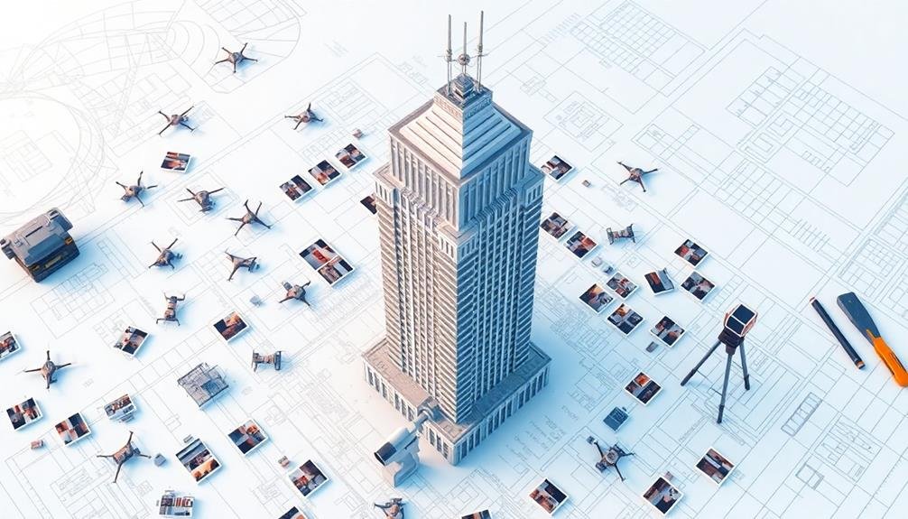
Photogrammetry plays a vital role in modern architecture by revolutionizing how buildings are designed, documented, and preserved. It allows you to create accurate 3D models from photographs, enhancing precision in measurements and spatial analysis. You'll find it's particularly useful for documenting historical structures and planning new constructions. With drone technology, you can now capture hard-to-reach areas, providing unprecedented access for data collection. Photogrammetry integrates seamlessly with Building Information Modeling (BIM), improving project accuracy and efficiency. It's a cost-effective solution for site analysis, reducing the need for on-site visits. As you explore further, you'll discover how this technology is shaping the future of architectural visualization.
Understanding Photogrammetry in Architecture

Photogrammetry is revolutionizing the field of architecture, offering a powerful tool for capturing and analyzing built environments. It's a technique that uses photographs to create accurate 3D models and measurements of structures.
In architecture, you'll find photogrammetry being used for various purposes, from documenting historical buildings to planning new constructions.
When you're working with photogrammetry in architecture, you're fundamentally creating a detailed digital twin of a physical space. This process involves taking multiple overlapping photos from different angles and using specialized software to stitch them together.
The result is a highly accurate 3D model that you can manipulate, measure, and analyze.
You'll find photogrammetry particularly useful for:
- Documenting existing structures
- Creating as-built models for renovations
- Preserving cultural heritage sites
- Conducting site surveys
- Generating realistic visualizations for design presentations
Drone Technology for Architectural Surveys
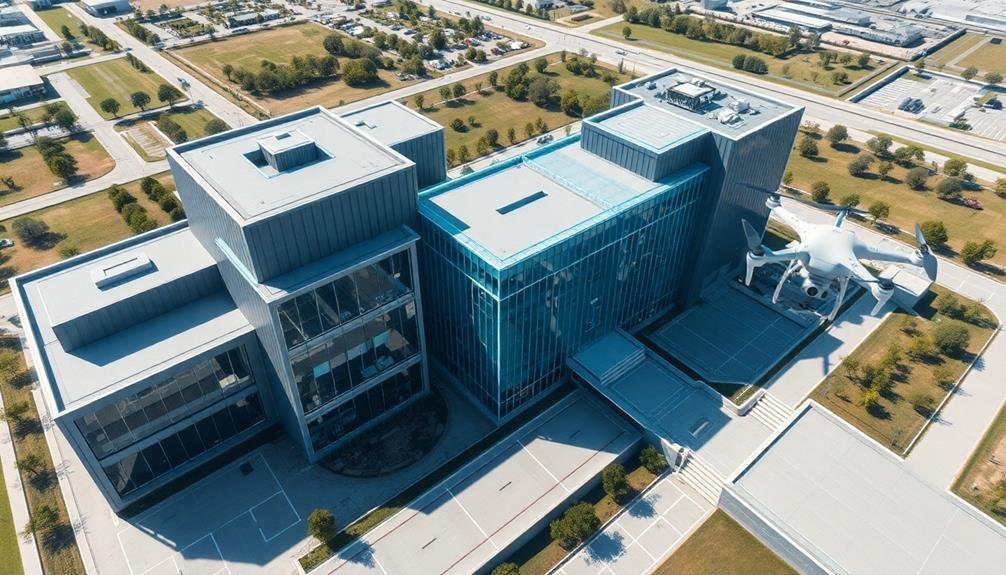
Drones have soared to the forefront of architectural surveying, revolutionizing how you can capture data for photogrammetric analysis. These unmanned aerial vehicles offer unprecedented access to hard-to-reach areas, allowing you to collect high-resolution images from various angles and elevations.
When you're using drones for architectural surveys, you'll benefit from their ability to capture detailed imagery of building facades, rooftops, and surrounding landscapes. You can program flight paths to guarantee consistent coverage and overlap, vital for accurate 3D modeling. Equipped with high-quality cameras and GPS systems, drones provide georeferenced data that's essential for precise measurements and spatial analysis.
You'll find that drone technology greatly reduces the time and cost associated with traditional surveying methods. It's safer too, eliminating the need for scaffolding or cherry pickers to access elevated areas. With drones, you can quickly survey large sites or complex structures, gathering data that would be impractical or impossible to obtain manually.
However, you must consider regulations and privacy concerns when operating drones in urban environments. Proper training and adherence to local laws are vital to guarantee safe and legal drone usage for architectural photogrammetry.
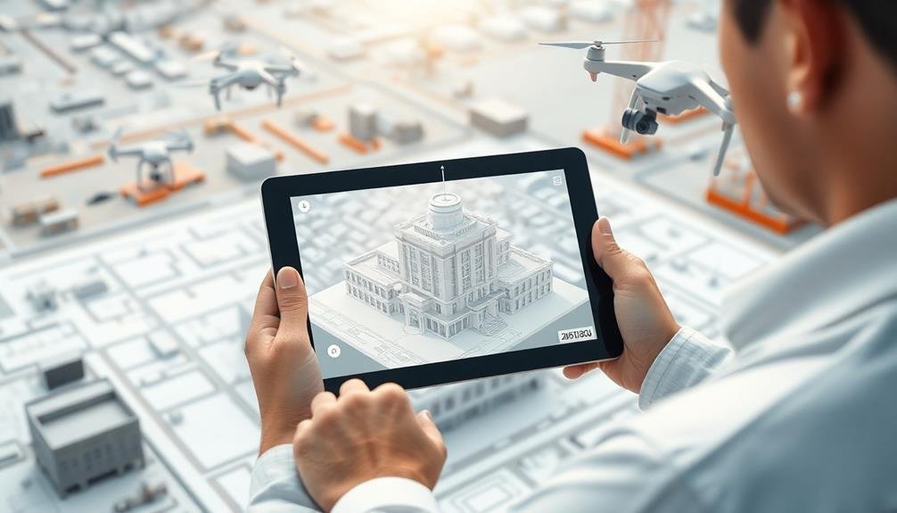
3D Modeling From Aerial Imagery

Leveraging the aerial imagery captured by drones, you can create highly detailed 3D models of architectural structures and landscapes. These models serve as invaluable tools for architects, urban planners, and construction teams.
By using photogrammetry software, you'll process the overlapping aerial photos to generate accurate 3D representations of buildings, cityscapes, and terrain. The process involves aligning the images, creating a dense point cloud, and then generating a textured mesh.
You'll find that this method produces models with exceptional accuracy, often within centimeters of the actual structure. These 3D models allow you to examine buildings from multiple angles, measure dimensions precisely, and even simulate lighting conditions at different times of day.
You can use these models for various purposes, such as pre-construction planning, heritage preservation, or creating virtual tours. They're particularly useful for evaluating hard-to-reach areas of buildings or analyzing large-scale urban developments.
With the right software, you can easily export these models into CAD programs for further design work or integrate them into VR environments for immersive presentations to clients or stakeholders.
Enhancing Precision in Building Design

You'll find that photogrammetry greatly enhances precision in building design through accurate 3D model creation.
By capturing detailed imagery from multiple angles, you're able to generate highly precise digital representations of existing structures or proposed designs.
These accurate 3D models allow you to improve spatial measurements, ensuring that your architectural plans are more reliable and true to real-world dimensions.
Accurate 3D Model Creation
In recent years, accurate 3D model creation has revolutionized architectural design, enhancing precision and efficiency like never before. Photogrammetry plays a vital role in this process, allowing you to capture detailed, real-world information and transform it into highly accurate digital models.
You'll find that photogrammetry software can process hundreds of overlapping photos to create precise 3D representations of buildings and environments. This technology enables you to generate models with millimeter-level accuracy, ensuring that every detail is faithfully reproduced. You can use these models to analyze existing structures, plan renovations, or design new buildings that seamlessly integrate with their surroundings.
Moreover, you'll appreciate how photogrammetry streamlines the design process. It reduces the need for manual measurements and on-site visits, saving you time and resources.
You can easily share these 3D models with clients, contractors, and team members, fostering better collaboration and communication. By incorporating photogrammetry into your workflow, you'll be able to make more informed decisions, detect potential issues early on, and ultimately create more sophisticated and well-integrated architectural designs.
Improving Spatial Measurements
By means of photogrammetry, architects can greatly enhance the precision of spatial measurements in building design.
You'll find that this technology allows for accurate measurements of distances, angles, and elevations without physically accessing every part of a structure. It's particularly useful when dealing with complex or hard-to-reach areas.
When you're working on renovations or additions to existing buildings, photogrammetry helps you capture precise dimensions and spatial relationships.
You can create detailed 3D models that highlight even the smallest architectural features, ensuring your new designs seamlessly integrate with the existing structure.
You'll also benefit from photogrammetry's ability to detect and measure structural deformations over time.
This enables you to identify potential issues early and implement preventive measures. Furthermore, you can use it to accurately document historical buildings, aiding in preservation efforts.
In urban planning, you'll find photogrammetry invaluable for evaluating how new structures will fit within the existing cityscape.
It allows you to visualize and measure sight lines, shadows, and spatial relationships between buildings, helping you make informed decisions about placement and design.
Documenting Historical Structures With Drones
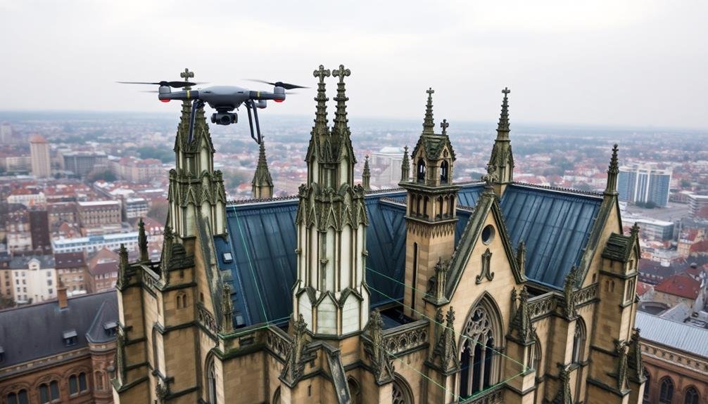
You'll find that drones have revolutionized the documentation of historical structures through advanced aerial mapping techniques.
By capturing high-resolution imagery from various angles, you're able to preserve intricate details of architectural heritage for future generations.
These unmanned aerial vehicles also allow you to document hard-to-reach areas of buildings, providing a thorough view that was previously impossible.
Aerial Mapping Techniques
Soaring above ancient ruins and historic landmarks, drones equipped with high-resolution cameras have revolutionized aerial mapping techniques for documenting historical structures. You'll find that these unmanned aerial vehicles (UAVs) offer unparalleled access to hard-to-reach areas, capturing detailed imagery from various angles and altitudes.
When you're using drones for aerial mapping, you'll typically follow these steps:
- Plan your flight path and altitude
- Launch the drone and capture overlapping images
- Process the data using photogrammetry software
- Generate 3D models and orthomosaic maps
Here's a comparison of common drone types used in aerial mapping:
| Feature | Multirotor | Fixed-wing | VTOL |
|---|---|---|---|
| Maneuverability | High | Low | Medium |
| Flight Time | Short | Long | Medium |
| Coverage Area | Small | Large | Medium |
| Takeoff/Landing | Vertical | Runway | Vertical |
| Cost | Low-Medium | High | Very High |
You'll find that each drone type has its strengths, depending on the project's scope and site conditions. By leveraging these aerial mapping techniques, you can create extensive documentation of historical structures, aiding in preservation efforts and architectural studies.
Preservation Through Imagery
Drones have become indispensable tools in the preservation of historical structures. You'll find these unmanned aerial vehicles capturing high-resolution images and videos of buildings, monuments, and archaeological sites that are otherwise difficult to access.
By using photogrammetry techniques, you can create detailed 3D models from these images, allowing for precise documentation and analysis of architectural features. This technology isn't just about creating pretty pictures; it's a crucial part of conservation efforts.
You're able to:
- Detect structural issues before they become critical
- Plan restoration projects with greater accuracy
- Create virtual tours for public engagement
- Archive detailed records for future generations
With drones, you're no longer limited by the constraints of traditional surveying methods. You can capture every nook and cranny of a building's exterior, from intricate carvings to weathered stonework.
This thorough documentation helps architects, conservationists, and historians better understand the structure's condition and make informed decisions about its preservation. As technology advances, you'll see even more sophisticated applications of drone-based photogrammetry in the field of architectural preservation.
Inaccessible Area Documentation
Hard-to-reach areas of historical structures are no longer off-limits thanks to drone technology. You can now capture detailed imagery of high spires, intricate rooftops, and precarious facades without risking human safety. Drones equipped with high-resolution cameras allow you to document these inaccessible areas with unprecedented precision.
When you're documenting historical structures, you'll find that drones offer unparalleled flexibility. They can maneuver into tight spaces, hover steadily for extended periods, and capture images from multiple angles. This versatility guarantees you get thorough coverage of even the most challenging architectural features.
You'll appreciate how drones streamline the documentation process. They're cost-effective, reducing the need for scaffolding or cherry pickers. You can quickly survey large areas or focus on specific details, adapting your approach as needed.
The resulting imagery provides a wealth of data for preservationists, architects, and researchers.
Cost-Effective Site Analysis Solutions

Budgetary constraints often drive architectural firms to seek innovative solutions for site analysis. Photogrammetry offers a cost-effective alternative to traditional methods, allowing you to gather detailed site information without breaking the bank. By using drones or even handheld cameras, you'll capture high-resolution images that can be transformed into accurate 3D models and orthomosaic maps.
With photogrammetry, you'll save time and resources while still obtaining thorough site data. Here's how it benefits your architectural projects:
- Reduced on-site visits: Capture all necessary information in a single session
- Lower equipment costs: Use affordable cameras instead of expensive laser scanners
- Faster data processing: Generate 3D models and maps within hours
- Scalability: Easily adjust the level of detail based on project requirements
You'll find that photogrammetry streamlines your workflow, enabling you to make informed design decisions earlier in the process. It's particularly valuable for large-scale projects or those with complex topography.
Integrating Photogrammetry With BIM
The convergence of photogrammetry and Building Information Modeling (BIM) is revolutionizing architectural workflows. You'll find that integrating these technologies enhances your project's accuracy, efficiency, and collaboration potential. By combining photogrammetry's detailed 3D models with BIM's data-rich environment, you're creating a powerful tool for design, analysis, and project management.
When you integrate photogrammetry with BIM, you'll experience benefits across various project stages:
| Project Stage | Photogrammetry Contribution | BIM Integration Benefit |
|---|---|---|
| Site Analysis | Accurate terrain modeling | Contextual design decisions |
| Design | Realistic existing conditions | Informed design iterations |
| Construction | As-built documentation | Clash detection and resolution |
| Facility Management | Detailed asset information | Streamlined maintenance planning |
You'll notice that this integration allows for more precise clash detection, improved stakeholder communication, and enhanced virtual reality experiences. It's essential to guarantee compatibility between your photogrammetry software and BIM platform. By doing so, you'll create a seamless workflow that leverages the strengths of both technologies, ultimately leading to more successful architectural projects and satisfied clients.
Future Trends in Architectural Visualization

As architectural visualization continues to evolve, you'll see groundbreaking trends shaping the future of the field. Photogrammetry will play a vital role in these advancements, enabling architects to create more immersive and accurate representations of their designs.
You'll witness the integration of artificial intelligence and machine learning algorithms that can analyze photogrammetric data to generate hyper-realistic 3D models automatically.
Virtual and augmented reality technologies will revolutionize how you experience architectural visualizations. You'll be able to walk through photorealistic virtual environments, interacting with design elements in real-time. This immersive experience will help clients and stakeholders better understand and provide feedback on proposed designs.
Here are four key trends to watch:
- AI-powered photogrammetric analysis and modeling
- Real-time rendering of complex, photorealistic environments
- Integration of haptic feedback in VR architectural walkthroughs
- Cloud-based collaborative visualization platforms
As these technologies mature, you'll see a shift towards more sustainable and efficient design processes.
Photogrammetry will enable architects to create digital twins of existing structures, facilitating better renovation and adaptive reuse projects. The future of architectural visualization will be characterized by seamless integration of real-world data and digital design, pushing the boundaries of creativity and functionality.
Frequently Asked Questions
How Does Weather Affect Photogrammetry Accuracy in Architectural Surveys?
Weather can considerably impact your photogrammetry accuracy in architectural surveys. You'll face challenges with lighting changes, shadows, and reflections on sunny days. Rain and snow can obscure details, while wind may cause motion blur in your images.
Can Photogrammetry Replace Traditional Manual Measurements in Architecture Completely?
You can't fully replace manual measurements with photogrammetry in architecture. While it's highly accurate and efficient, you'll still need some manual checks for complex details, inaccessible areas, and to verify critical dimensions on-site.
What Are the Legal Considerations When Using Drones for Architectural Photogrammetry?
You'll need to contemplate privacy laws, airspace regulations, and property rights when using drones for architectural photogrammetry. You must obtain necessary permits, follow FAA guidelines, and get consent from property owners before flying and capturing images.
How Does Photogrammetry Impact the Role of Architects in the Design Process?
You'll find photogrammetry enhances your role as an architect. It enables you to create accurate 3D models, streamline site analysis, and visualize designs more effectively. You're able to make informed decisions and collaborate better with clients.
Are There Any Limitations to Photogrammetry in Capturing Interior Architectural Details?
You'll find photogrammetry has limitations with interior details. It struggles with dark or reflective surfaces, complex textures, and hidden areas. Lighting challenges and occlusions can also impact accuracy. You'll need to supplement with other methods for complete interior capture.
In Summary
You've seen how photogrammetry's revolutionizing modern architecture. From drone surveys to 3D modeling, it's enhancing precision and efficiency in design. You're now equipped to leverage this technology for cost-effective site analysis and historical documentation. As you integrate photogrammetry with BIM, you'll stay ahead of the curve. Keep an eye on future trends – they'll shape architectural visualization. Embrace these tools, and you'll transform your approach to building design and documentation.
As educators and advocates for responsible drone use, we’re committed to sharing our knowledge and expertise with aspiring aerial photographers.


Leave a Reply