To start aerial mapping, you'll need the right tools. Begin with a beginner-friendly drone like the DJI Phantom 4 Pro V2.0 or Mavic 2 Pro, which offer high-quality cameras and good flight time. Install flight planning software such as DroneDeploy or Pix4Dcapture to automate your mapping missions. For processing, use image stitching software like Pix4Dmapper or Agisoft Metashape to create orthomosaic maps. Don't forget to set up ground control points for accuracy. As you progress, you can explore more advanced equipment like RTK GPS and LiDAR sensors. The world of aerial mapping is vast, with exciting possibilities awaiting your exploration.
Key Takeaways
- Choose a beginner-friendly drone like DJI Phantom 4 Pro V2.0 or Mavic 2 Pro with GPS and quality camera.
- Utilize flight planning software such as DroneDeploy or Pix4Dcapture for automated mapping missions.
- Set camera to manual mode, use fast shutter speeds, and adjust aperture for optimal aerial photography.
- Implement Ground Control Points (GCPs) to enhance mapping accuracy and precision.
- Process data using image stitching software and GIS integration platforms for analysis and visualization.
Understanding Aerial Mapping Fundamentals

Aerial mapping fundamentals form the backbone of modern geospatial data collection. To grasp these essentials, you'll need to understand the key components of aerial mapping: data acquisition, processing, and visualization.
Data acquisition involves capturing images or other data from aerial platforms like drones, aircraft, or satellites. You'll use specialized cameras or sensors to collect high-resolution imagery or 3D point clouds.
Processing is where you'll transform raw data into usable information. This step includes georeferencing, which assigns real-world coordinates to your imagery, and orthorectification, which corrects distortions caused by terrain and camera angles. You'll also perform mosaicking to stitch multiple images together seamlessly.
Visualization is the final stage, where you'll create maps, 3D models, or other visual representations of your data. You'll use Geographic Information System (GIS) software to analyze and present your findings effectively.
Understanding these fundamentals will help you choose the right tools and techniques for your aerial mapping projects. You'll need to evaluate factors like project scale, required accuracy, and budget constraints when selecting equipment and software.
Choosing the Right Drone

When it comes to aerial mapping, selecting the appropriate drone is a key decision that'll impact your project's success. Reflect on your specific needs, budget, and skill level before making a choice. For beginners, ready-to-fly (RTF) drones with built-in cameras are often the best option.
Look for drones with GPS capabilities, as they provide better stability and flight control. Battery life is essential; aim for at least 20-30 minutes of flight time to guarantee adequate coverage. Camera quality matters too – a minimum of 12 megapixels and 4K video resolution will yield good results for most mapping projects.
Don't overlook payload capacity if you plan to add additional sensors or cameras. Weather resistance is another factor to take into account, especially if you'll be operating in challenging conditions.
For more advanced users, custom-built drones offer greater flexibility and performance. These allow you to tailor the drone to your exact specifications, but they require more technical knowledge and maintenance.
Remember to check local regulations regarding drone usage and obtain necessary certifications before flying.
With the right drone, you'll be well-equipped to tackle your aerial mapping projects effectively.
Essential Features for Mapping Drones

Mapping drones require specific features to excel in their specialized role. When selecting a drone for aerial mapping, you'll want to prioritize certain essential capabilities.
First, look for a drone with a high-quality camera that offers at least 12 megapixels and 4K video resolution. This guarantees crisp, detailed imagery for accurate mapping.
Flight time is important, so opt for a drone with a minimum of 20 minutes of airtime per battery. Consider models with interchangeable batteries for extended missions.
GPS functionality is non-negotiable, as it enables precise flight paths and geotagging of images. Obstacle avoidance sensors are essential for traversing complex environments safely.
Choose a drone with autonomous flight modes, particularly those designed for mapping, such as grid or waypoint missions. These features allow for consistent, repeatable flight patterns.
A sturdy build quality is necessary to withstand various weather conditions. Finally, verify your drone is compatible with photogrammetry software for post-processing. This allows you to transform your aerial imagery into detailed 3D models and orthomosaic maps, maximizing the utility of your drone for mapping purposes.
Top Mapping Drones for Beginners

For beginners venturing into aerial mapping, selecting the right drone can make or break your experience. You'll want to focus on models that offer ease of use, stability, and reliable mapping features. The DJI Phantom 4 Pro V2.0 is an excellent starting point, providing a user-friendly interface and high-quality 20MP camera. If you're looking for something more compact, consider the DJI Mavic 2 Pro, which offers similar capabilities in a foldable design.
For those on a tighter budget, the Parrot Anafi USA is a solid choice, offering 4K HDR video and a 21MP camera at a lower price point. Here's a comparison of these top mapping drones for beginners:
| Drone Model | Flight Time | Camera Resolution |
|---|---|---|
| DJI Phantom 4 Pro | 30 minutes | 20MP |
| DJI Mavic 2 Pro | 31 minutes | 20MP |
| Parrot Anafi USA | 32 minutes | 21MP |
Professional-Grade Aerial Mapping Equipment

Precision is paramount when it comes to professional-grade aerial mapping equipment. As you advance in your aerial mapping journey, you'll need tools that offer higher accuracy, better image quality, and more sophisticated data processing capabilities.
Professional-grade drones often feature RTK (Real-Time Kinematic) GPS for centimeter-level accuracy. They're equipped with high-resolution cameras or multispectral sensors for detailed imagery. You'll also find LiDAR sensors for creating 3D point clouds and advanced flight planning software for complex mapping missions.
To create vivid imagery in your mind, consider these professional-grade tools:
- A sleek, carbon fiber drone with retractable landing gear
- A gimbal-mounted 100MP medium format camera
- A compact, yet powerful LiDAR sensor
- A rugged field laptop with specialized mapping software
- A portable ground control station with real-time data link
When selecting professional equipment, consider factors like flight time, payload capacity, and data processing requirements.
Flight Planning Software Options

Integral to successful aerial mapping missions, flight planning software plays an essential role in optimizing your drone's path and data collection. You'll find several options available, each with unique features to suit your specific needs.
DroneDeploy is a popular choice, offering an intuitive interface and automatic flight path generation. It's compatible with various drones and supports both 2D and 3D mapping.
Pix4Dcapture is another robust option, known for its precision and ability to handle complex terrain. It allows you to create custom flight patterns and adjust parameters like overlap and altitude.
For more advanced users, UgCS (Universal Ground Control Software) provides extensive customization options and supports a wide range of drones. It excels in creating complex flight paths and offers terrain-following capabilities.
DJI's GS Pro (Ground Station Pro) is an excellent choice if you're using DJI drones, offering seamless integration and easy-to-use features.
When selecting flight planning software, consider factors like ease of use, compatibility with your equipment, available features, and cost. Many platforms offer free trials, so you can test them before committing to guarantee they meet your specific aerial mapping requirements.
Camera Settings for Optimal Results

When setting up your camera for aerial mapping, you'll need to focus on achieving ideal exposure and maintaining sharp focus throughout your flight.
You should consider whether to shoot in RAW or JPEG format, as this choice will affect your image quality and post-processing options.
Adjusting your camera's settings for the specific lighting conditions and altitude of your flight will help guarantee you capture high-quality images for accurate mapping results.
Optimal Exposure and Focus
To achieve sharp, well-exposed aerial images, you'll need to refine your camera settings. Start by setting your camera to manual mode, which gives you full control over exposure and focus.
Use a fast shutter speed, typically 1/1000 second or faster, to freeze motion and minimize blur from aircraft vibrations. Set your aperture between f/5.6 and f/8 for a good balance of depth of field and sharpness. Adjust your ISO to maintain proper exposure, but keep it as low as possible to reduce noise.
For best focus, switch to manual focus and set it to infinity. Use your camera's live view mode to fine-tune focus on distant objects. Enable image stabilization if your camera or lens has this feature.
To guarantee consistent results, consider using auto exposure bracketing (AEB) to capture multiple exposures of each scene.
- A crisp aerial view of cityscapes with gleaming skyscrapers
- Lush, textured forests stretching to the horizon
- Winding rivers cutting through vibrant agricultural landscapes
- Intricate patterns of suburban neighborhoods from above
- Rugged mountainscapes with snow-capped peaks and deep valleys
Remember to check your camera's histogram frequently to verify proper exposure across your images.
RAW Vs JPEG Formats
With your camera settings optimized for aerial photography, it's time to contemplate file formats. The two main options you'll encounter are RAW and JPEG.
RAW files offer superior flexibility in post-processing, capturing all the data from your camera's sensor. This allows you to adjust exposure, white balance, and other settings without losing quality. However, RAW files are larger and require specialized software to edit.
JPEG, on the other hand, is a compressed format that's ready to use straight out of the camera. It takes up less storage space and can be easily shared or uploaded. The downside is that JPEGs have limited editing potential, as some data is discarded during compression.
For aerial mapping, RAW is often preferred due to its versatility. You can fine-tune images to bring out details essential for accurate mapping.
If storage isn't an issue, consider shooting in RAW+JPEG. This gives you the best of both worlds: a high-quality RAW file for editing and a JPEG for quick previews.
Ultimately, your choice depends on your project's requirements, post-processing workflow, and available storage capacity.
Ground Control Points Explained

Three essential components form the backbone of accurate aerial mapping: the drone, its camera, and ground control points (GCPs). GCPs are precise markers placed on the ground within your survey area. They're vital for enhancing the accuracy of your aerial maps and 3D models.
You'll typically use large, high-contrast targets as GCPs, which are easily visible in your aerial imagery. These points have known coordinates, measured using high-precision GPS equipment. When processing your drone footage, you'll align these visible markers with their exact real-world positions, greatly improving the overall accuracy of your map.
To effectively use GCPs in your aerial mapping projects:
- Distribute them evenly across your survey area
- Place them on stable, flat surfaces
- Use at least 5-10 GCPs for most projects
- Make sure they're visible and unobstructed
- Record their coordinates with centimeter-level accuracy
Data Processing and Analysis Tools

After capturing aerial imagery, you'll need robust software to process and analyze the data.
Image stitching tools allow you to combine multiple photos into seamless orthomosaics, while GIS integration platforms help you overlay and interpret geographic information.
For advanced 3D modeling and analysis, you can utilize point cloud processing software to work with LiDAR or photogrammetry-derived data.
Software for Image Stitching
Once you've captured aerial imagery, you'll need powerful software to stitch those images together into seamless maps or 3D models. Several options are available, ranging from user-friendly applications to more advanced professional tools. Popular choices include Pix4Dmapper, Agisoft Metashape, and DroneDeploy.
These software solutions use complex algorithms to align and merge individual images, creating detailed orthomosaics and digital elevation models. They can handle various data types, including RGB, multispectral, and thermal imagery.
When selecting image stitching software, consider factors such as:
- Ease of use and learning curve
- Processing speed and hardware requirements
- Supported file formats and camera types
- Accuracy of the final output
- Integration with other mapping and GIS tools
Many programs offer automated workflows, making it easier for beginners to produce high-quality results.
However, understanding the principles behind image stitching will help you optimize your outputs and troubleshoot any issues that arise.
As you gain experience, you'll develop preferences for specific software based on your project requirements and workflow.
Remember to regularly update your chosen software to access the latest features and improvements in stitching algorithms.
GIS Integration Platforms
With your aerial imagery stitched into cohesive maps, the next step is to process and analyze this data using Geographic Information System (GIS) integration platforms. These tools allow you to combine your aerial imagery with other geospatial data, creating powerful visualizations and enabling in-depth analysis.
Popular GIS platforms include QGIS, ArcGIS, and Global Mapper. QGIS is a free, open-source option that's great for beginners. It offers a wide range of plugins and supports various data formats. ArcGIS, while more expensive, provides a thorough suite of tools and excellent technical support. Global Mapper strikes a balance between functionality and affordability.
To get started, import your stitched imagery into your chosen GIS platform. You'll then be able to overlay additional layers, such as topographic data, property boundaries, or infrastructure information. Use the platform's analysis tools to extract valuable insights, such as calculating areas, measuring distances, or identifying changes over time.
Don't forget to explore each platform's unique features. QGIS excels in customization, ArcGIS offers advanced spatial analysis, and Global Mapper shines in 3D visualization. Choose the tool that best fits your specific needs and budget.
Point Cloud Processing
From aerial mapping to point cloud processing, the next step in your data analysis journey involves handling complex 3D datasets. Point cloud processing tools allow you to manipulate, analyze, and visualize the massive amount of data collected by LiDAR sensors and photogrammetry techniques. These tools are essential for extracting meaningful information from your aerial surveys.
When working with point cloud data, you'll encounter various processing tasks:
- Filtering out noise and outliers
- Classifying points based on their attributes
- Generating digital terrain models (DTMs)
- Creating 3D meshes and textures
- Extracting features like buildings, trees, and power lines
Popular point cloud processing software includes CloudCompare, LAStools, and Pix4D. These tools offer a range of functionalities, from basic editing to advanced analytics. You'll need to choose the right software based on your project requirements and data complexity.
As you enter into point cloud processing, you'll discover the power of transforming raw data into actionable insights. Whether you're creating accurate 3D models, performing volumetric calculations, or analyzing terrain features, mastering these tools will greatly enhance your aerial mapping capabilities.
Remember to invest time in learning the software's intricacies to maximize its potential in your projects.
Creating Orthomosaic Maps

Orthomosaic maps, created through advanced aerial mapping techniques, offer a thorough and accurate view of large areas from above. To create these maps, you'll need to follow a series of steps using specialized software.
First, import your aerial images into the mapping software. Confirm they've proper georeferencing information, including GPS coordinates and camera orientation data. The software will then align these images based on common features and overlapping areas.
Next, you'll generate a dense point cloud from the aligned images. This process creates a 3D representation of the mapped area. From this point cloud, you'll create a digital surface model (DSM) that represents the terrain and objects on it.
Using the DSM and the original images, the software will then produce the orthomosaic map. This involves projecting the images onto the DSM and blending them seamlessly. You can adjust various parameters to improve the quality and accuracy of the final product.
Once complete, you can export your orthomosaic map in various formats for use in GIS software or other applications. Remember to verify the map's accuracy and make any necessary corrections before finalizing it.
3D Modeling From Aerial Data

Building on the orthomosaic mapping process, 3D modeling from aerial data takes aerial mapping to the next level. This technique uses overlapping aerial images to create detailed, three-dimensional representations of landscapes and structures. You'll need specialized software to process the data and generate the 3D models.
To create 3D models from aerial data, you'll first collect high-quality images using a drone or aircraft. Verify there's sufficient overlap between photos for accurate reconstruction. Next, you'll import these images into 3D modeling software, which will use photogrammetry algorithms to analyze and match points across multiple images. The software then generates a point cloud, which forms the basis of your 3D model.
Here's what you can expect to see in a 3D model from aerial data:
- Realistic terrain contours and elevations
- Detailed building facades and rooftops
- Accurate representations of vegetation and trees
- Precise measurements of objects and structures
- Textured surfaces that closely resemble real-world materials
Once your 3D model is complete, you can use it for various applications, including urban planning, construction monitoring, and virtual site inspections.
You'll find that 3D models offer a more immersive and informative view of your mapped area compared to traditional 2D maps.
Interpreting Mapping Results

When interpreting aerial mapping results, you'll need to understand color-coded data that represents different features or conditions on the ground.
You'll also encounter elevation and contour lines, which provide essential information about the terrain's topography and height variations.
Recognizing land use patterns from these maps will help you identify residential, industrial, agricultural, and other zones, enabling more informed decision-making for various applications.
Understanding Color-Coded Data
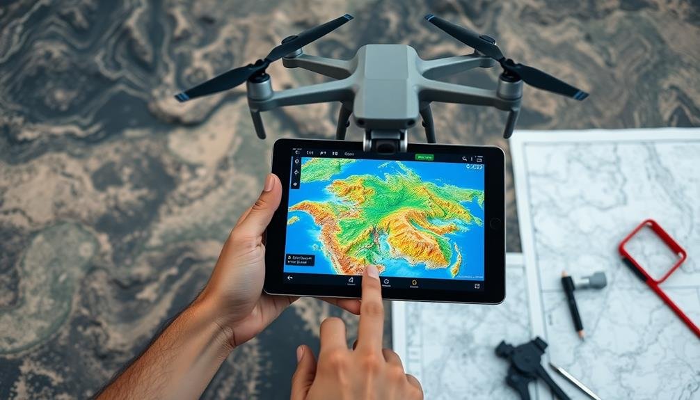
To access the full potential of aerial mapping data, understanding color-coded results is essential. These visual representations allow you to quickly interpret complex information about terrain, vegetation, and other features. Different colors typically represent specific characteristics or measurements, such as elevation, temperature, or land use. You'll need to familiarize yourself with common color schemes used in aerial mapping to effectively analyze the data.
When interpreting color-coded maps, always refer to the legend or key provided. It'll explain what each color represents and the range of values associated with it. Pay attention to gradients, as they often indicate shifts between different categories or intensity levels.
Don't forget to take into account the context of your mapping project, as color schemes may vary depending on the specific application or software used.
To help you visualize color-coded aerial mapping data, imagine:
- A lush forest represented by deep greens
- Barren areas depicted in shades of brown
- Water bodies shown in blues of varying intensity
- Urban areas highlighted in shades of gray or red
- Elevation changes illustrated through a rainbow spectrum
Elevation and Contour Lines
Frequently, elevation and contour lines form the backbone of aerial mapping interpretation. These essential elements help you visualize the terrain's three-dimensional shape on a two-dimensional map. Contour lines connect points of equal elevation, creating a pattern that reveals the landscape's topography.
To read contour lines effectively, remember that closely spaced lines indicate steep terrain, while widely spaced lines suggest gentler slopes. The contour interval, the vertical distance between adjacent lines, is vital for understanding the map's scale and terrain changes.
You'll often encounter index contours, which are thicker lines labeled with specific elevation values. Use these as reference points to quickly gauge height differences across the map. Pay attention to closed contours, which represent hills or depressions, depending on their elevation relative to surrounding areas.
When interpreting elevation data, look for patterns that indicate ridges, valleys, or plateaus. Ridges appear as V-shaped contours pointing downhill, while valleys show V-shaped contours pointing uphill. Plateaus are recognizable by widely spaced contours surrounded by more densely packed lines.
Identifying Land Use Patterns
Interpretation of aerial mapping results hinges on your ability to identify land use patterns. As you examine aerial imagery, you'll notice distinct areas that represent different types of land use. These patterns are vital for understanding urban development, environmental changes, and resource management.
To effectively identify land use patterns, you'll need to recognize key features and textures. Look for:
- Gridded streets and densely packed buildings in urban areas
- Large, rectangular shapes of agricultural fields
- Irregular patches of green indicating forests or parks
- Winding blue lines representing rivers and water bodies
- Industrial zones with large structures and parking lots
Practice analyzing various aerial images to improve your pattern recognition skills. Pay attention to color variations, shapes, and textures. Urban areas typically appear gray with geometric patterns, while rural areas show more organic shapes and varied colors.
Don't forget to take into account the scale of your imagery. Larger-scale maps provide more detail but cover less area, while smaller-scale maps offer a broader view but less detail.
As you become more proficient, you'll be able to quickly identify different land use types and make informed decisions based on your aerial mapping results.
Legal Considerations for Drone Mapping

As drone technology advances, the legal landscape surrounding aerial mapping has become increasingly complex. You'll need to navigate various regulations to guarantee your drone mapping activities are legal and ethical.
First, register your drone with the FAA if it weighs over 0.55 pounds. You'll also need to obtain a Remote Pilot Certificate by passing an aeronautical knowledge test. Be aware of airspace restrictions and always check for temporary flight restrictions before flying.
Respect privacy laws when mapping. Don't fly over private property without permission, and avoid capturing images of people without consent. Follow local regulations, as some areas have stricter drone laws than others.
Consider liability insurance to protect yourself from potential lawsuits. When collecting data, guarantee you're complying with data protection laws, especially if you're mapping for commercial purposes.
Be mindful of environmental regulations, particularly when flying in protected areas or near wildlife. Some locations may require special permits for drone operations.
Stay updated on changing laws, as drone regulations are evolving rapidly. Join professional organizations to stay informed and network with other drone mappers who can share their legal experiences.
Frequently Asked Questions
How Long Does It Take to Become Proficient in Aerial Mapping?
You'll typically need 3-6 months to become proficient in aerial mapping. It depends on your dedication, practice frequency, and previous experience with related technologies. Consistent hands-on training and learning from experts will speed up your progress.
Can Aerial Mapping Be Done in Extreme Weather Conditions?
You can perform aerial mapping in extreme weather, but it's risky. High winds, heavy rain, or snow can affect data quality and equipment safety. It's best to wait for suitable conditions to guarantee accurate results.
What Industries Benefit Most From Aerial Mapping Technology?
You'll find that aerial mapping benefits many industries. Construction, agriculture, urban planning, and real estate rely heavily on this technology. It's also essential for environmental monitoring, disaster response, and mining operations. Even archaeology uses it extensively.
How Often Should Aerial Mapping Equipment Be Calibrated or Serviced?
You should calibrate and service your aerial mapping equipment regularly, typically every 3-6 months. However, it's best to check the manufacturer's guidelines, as frequency can vary based on usage and environmental conditions you're operating in.
Are There Any Health Risks Associated With Prolonged Drone Operation for Mapping?
You should be aware of potential health risks from prolonged drone operation. Eye strain, neck pain, and repetitive stress injuries can occur. It's important to take regular breaks, maintain proper posture, and follow ergonomic practices while operating drones.
In Summary
You've now got the basics of aerial mapping under your belt. Remember, it's all about choosing the right tools, understanding the technology, and practicing your skills. Don't forget to stay updated on legal requirements as you explore this exciting field. With time and experience, you'll be creating professional-quality maps and 3D models. Keep learning, stay safe, and enjoy the unique perspective that aerial mapping offers!
As educators and advocates for responsible drone use, we’re committed to sharing our knowledge and expertise with aspiring aerial photographers.


Leave a Reply