
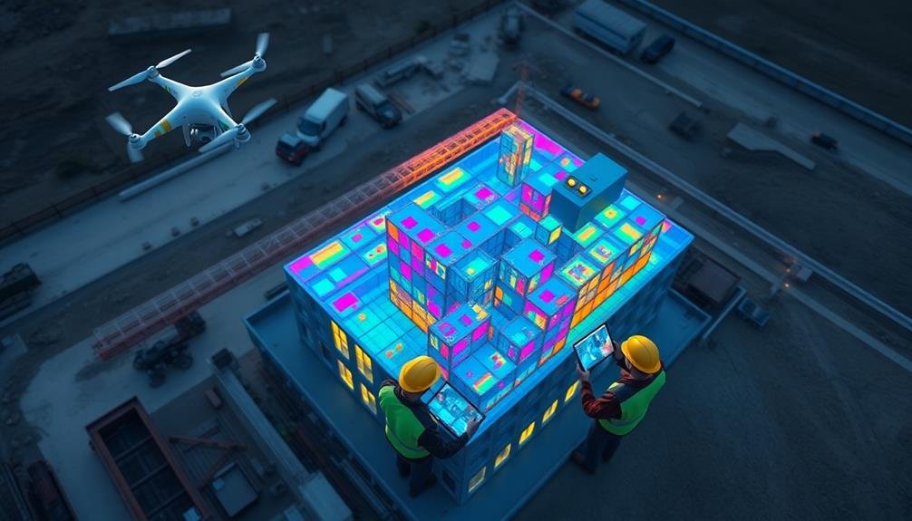
You'll revolutionize your construction project management by integrating drone data with Building Information Modeling (BIM). This powerful combination offers real-time monitoring, accurate as-built comparisons, and enhanced decision-making. By capturing high-resolution imagery and 3D point clouds, drones provide up-to-date site information that seamlessly aligns with your BIM models. You'll quickly identify discrepancies, track progress, and improve resource allocation throughout the project lifecycle. With specialized software, you can process drone imagery, generate point clouds, and integrate them into your BIM workflows. This approach enhances collaboration, reduces risks, and streamlines project tracking. Discover how this integration can transform your construction management practices.
BIM and Drone Data Overview
In the domain of modern construction, BIM and drone data have emerged as powerful tools for project tracking. Building Information Modeling (BIM) provides a thorough 3D digital representation of a construction project, encompassing all aspects from design to maintenance. It's a collaborative platform that allows stakeholders to visualize, plan, and manage projects efficiently.
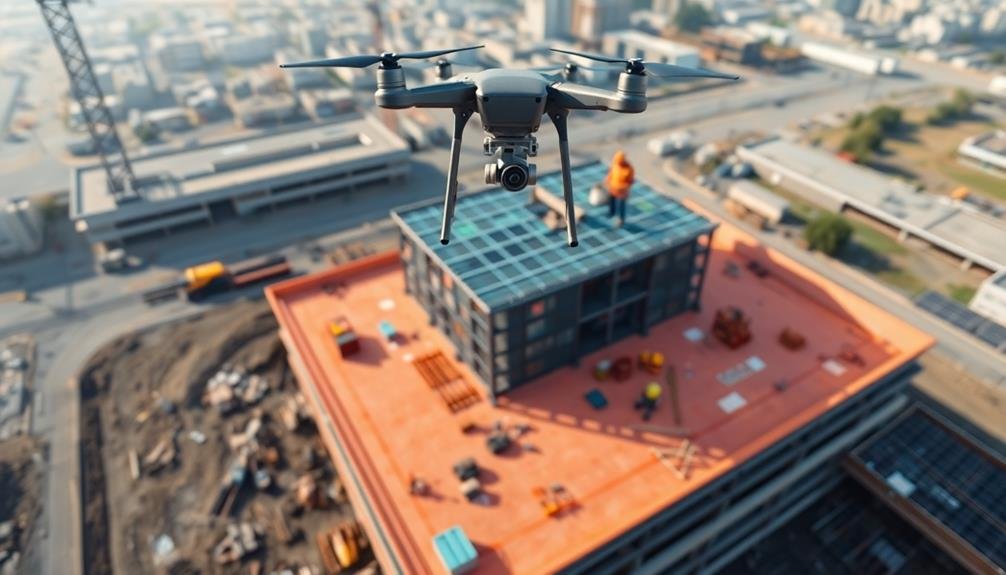
Drone data, on the other hand, offers real-time aerial imagery and mapping capabilities. You can use drones to capture high-resolution photos, videos, and 3D point clouds of construction sites. This data provides accurate, up-to-date information on project progress, site conditions, and potential issues.
When you integrate BIM and drone data, you create a powerful synergy. The combination allows you to compare as-built conditions with design models, detect discrepancies, and make informed decisions quickly.
You'll be able to track construction progress more accurately, identify potential conflicts before they become costly problems, and improve overall project communication. This integration also enhances safety monitoring, resource allocation, and schedule management.
Data Collection Using Drones
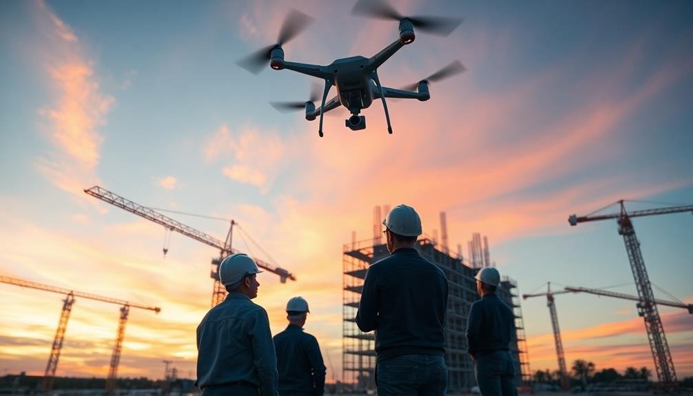
When using drones for construction tracking, you'll need to employ effective aerial imagery capture techniques.
You can choose from various flight patterns, including grid, circular, or oblique, to guarantee thorough site coverage.
Additionally, you'll want to take into account different sensor types for your drones, such as RGB cameras for visual data, thermal sensors for heat detection, or LiDAR for precise 3D mapping.
Aerial Imagery Capture Techniques
Aerial imagery capture techniques form the foundation of effective drone data collection for construction tracking. You'll need to master various methods to guarantee high-quality data acquisition.
Start by selecting the right flight pattern for your project. Grid patterns work well for mapping large areas, while circular patterns are ideal for 3D modeling of structures.
Take into account the best altitude for your drone flights. Lower altitudes provide higher resolution but require more flight time and battery power. Higher altitudes cover more ground but may sacrifice detail.
You'll also need to decide on the appropriate image overlap percentage, typically ranging from 60% to 80%, to guarantee accurate stitching and 3D reconstruction.
Choose the right camera settings for your environment. Adjust shutter speed, ISO, and aperture to capture clear, well-exposed images. Use manual settings to maintain consistency across all photos.
Don't forget to take into account lighting conditions and time of day when planning your flights.
Lastly, incorporate oblique imagery capture techniques to gather data from multiple angles. This approach enhances the accuracy of 3D models and helps identify potential issues in hard-to-reach areas of your construction site.
Sensor Types for Drones
Selecting the right sensor types for your drone is essential for effective data collection in construction tracking. You'll need to evaluate the specific data you want to capture and the level of detail required for your BIM integration.
Common sensor types include high-resolution cameras, thermal imaging sensors, and LiDAR scanners.
High-resolution cameras are versatile and can capture detailed visual data of your construction site. They're ideal for progress monitoring, site inspections, and creating orthomosaic maps.
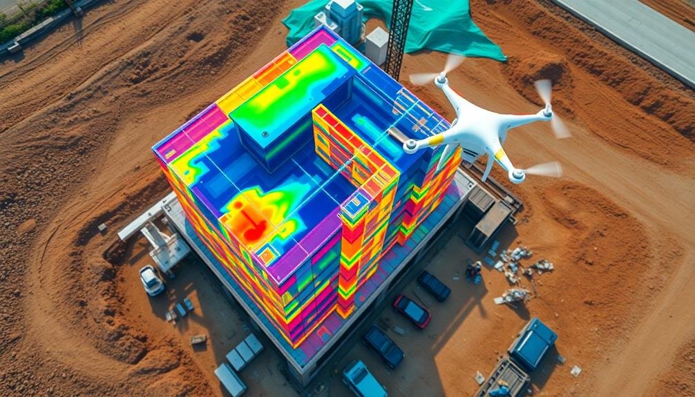
Thermal imaging sensors detect heat signatures, allowing you to identify potential issues with insulation, electrical systems, or HVAC units.
LiDAR scanners use laser pulses to create precise 3D point clouds, which are invaluable for accurate measurements and volumetric calculations.
When choosing sensors for your drone, assess these factors:
- Resolution and accuracy requirements
- Data processing capabilities and software compatibility
- Weight limitations of your drone platform
Processing Drone Imagery
You'll need to process the raw drone imagery through a photogrammetry workflow to extract useful data for construction tracking.
This process involves stitching together multiple overlapping images to create a thorough 3D model of the construction site.
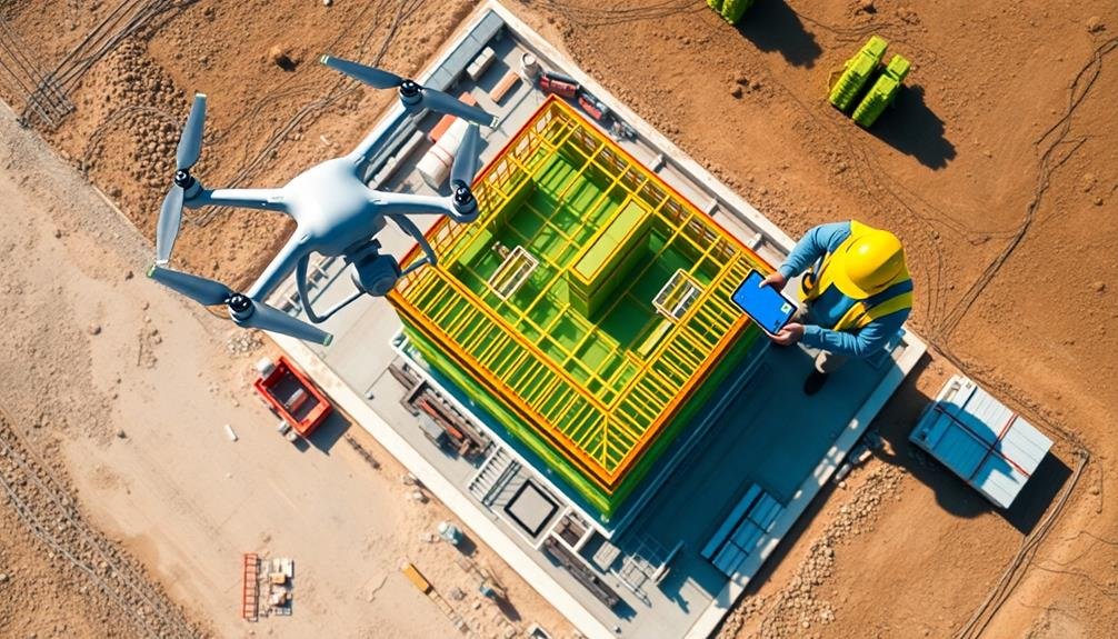
The resulting point cloud generation provides a detailed representation of the site's current state, enabling accurate measurements and comparisons with the planned BIM model.
Photogrammetry Workflow
The photogrammetry workflow's first step involves processing the raw drone imagery into usable 3D data. You'll need specialized software to stitch together the hundreds or thousands of images captured by your drone. This process creates a dense point cloud, which forms the basis for your 3D model.
Next, you'll generate a mesh from the point cloud. This step turns the scattered points into a continuous surface, representing the physical structure of your construction site. You'll then apply texture to the mesh, using the original images to create a photorealistic 3D model.
The final stages of the workflow include:
- Georeferencing: Aligning your model with real-world coordinates
- Scaling: verifying your model's dimensions are accurate
- Cleaning: Removing any artifacts or errors in the model
Once you've completed these steps, you'll have a high-quality 3D model ready for integration with your BIM system. This model will serve as a digital twin of your construction site, allowing for precise tracking of progress, identification of discrepancies, and improved decision-making throughout the project lifecycle.
Point Cloud Generation
Point clouds form the foundation of 3D model creation from drone imagery. They're dense collections of data points in three-dimensional space, each representing a specific location on the scanned surface. To generate point clouds from your drone images, you'll use specialized photogrammetry software that analyzes multiple overlapping photos to calculate the position of each point.
The process begins by aligning your drone images based on common features. The software then performs a dense reconstruction, creating a detailed point cloud.
You'll need to guarantee your drone captures high-quality, well-lit images with sufficient overlap for accurate results. Adjust flight parameters like altitude and speed to optimize data collection.
As you process the point cloud, you can filter out noise and unwanted data points. This step improves the overall quality and reduces file size. You may also need to georeference the point cloud using ground control points or GPS data from your drone.
Once generated, the point cloud serves as a highly accurate 3D representation of your construction site. You can use it for measurements, volume calculations, and as a basis for creating textured mesh models or BIM elements.
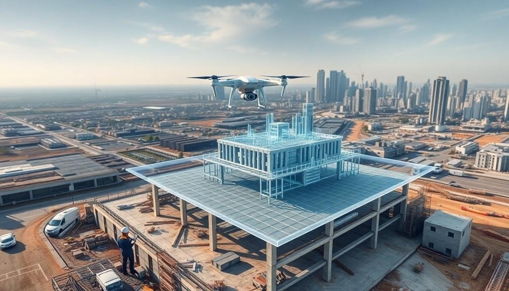
Integrating Drone Data With BIM
Integrating drone data with Building Information Modeling (BIM) creates a powerful synergy for construction tracking. You'll find that this combination enhances your ability to monitor progress, detect discrepancies, and make informed decisions throughout the construction process.
By aligning the point cloud data generated from drone surveys with your BIM model, you're able to create a thorough digital twin of your project site.
To effectively integrate drone data with BIM, you'll need to:
- Confirm proper georeferencing of both the drone data and BIM model
- Use specialized software that can handle large point cloud datasets and BIM formats
- Implement a standardized workflow for regular data collection and integration
This integration allows you to perform accurate as-built comparisons, identifying deviations between the planned design and actual construction.
You'll be able to visualize progress in 3D, measure volumes, and track changes over time. By leveraging this combined data, you can improve communication among stakeholders, streamline project management, and reduce the risk of costly errors or delays.
Benefits for Construction Tracking
By combining drone data with BIM, you'll reveal a wealth of benefits for construction tracking. This integration allows you to monitor progress in real-time, ensuring your project stays on schedule and within budget.
You'll quickly identify discrepancies between the planned design and actual construction, enabling prompt corrective actions. The enhanced visual data from drones provides an extensive overview of your site, allowing you to detect potential safety hazards and address them before accidents occur.
You'll also improve resource management by accurately tracking material usage and placement, reducing waste and optimizing logistics. This integration enhances communication among stakeholders, as you can share up-to-date visual information and progress reports easily.
You'll streamline decision-making processes by having access to accurate, current data at your fingertips. Additionally, you can create a detailed historical record of the construction process, which proves invaluable for future reference and dispute resolution.
Challenges and Future Developments
Despite the numerous benefits, integrating drone data with BIM for construction tracking isn't without its challenges. You'll face hurdles in data processing, software compatibility, and regulatory compliance. Overcoming these obstacles requires a strategic approach and continuous improvement of your systems.
To address these challenges and pave the way for future developments, you should focus on:
- Enhancing data processing capabilities: Invest in powerful hardware and machine learning algorithms to handle large volumes of drone-captured data efficiently.
- Improving interoperability: Work with software developers to create seamless integrations between drone data platforms and BIM software.
- Staying compliant: Keep up-to-date with evolving drone regulations and guarantee your operations adhere to local and national guidelines.
Looking ahead, you can expect advancements in AI-powered data analysis, real-time data streaming, and automated flight paths. These developments will further streamline the integration process and enhance the accuracy of construction tracking.
As technology continues to evolve, you'll need to adapt your workflows and invest in ongoing training to maximize the potential of drone data and BIM integration in your construction projects.
Frequently Asked Questions
What Software Is Recommended for Integrating Drone Data With BIM?
You'll find several software options for integrating drone data with BIM. Consider using DroneDeploy, Pix4D, or Autodesk ReCap for processing drone imagery. These can seamlessly connect with BIM platforms like Revit or Navisworks for thorough construction tracking.
How Often Should Drone Flights Be Conducted for Optimal Construction Tracking?
You'll want to conduct drone flights weekly or bi-weekly for ideal construction tracking. However, you should adjust this frequency based on your project's size, pace, and complexity. Don't forget to take into account weather conditions and site access.
What Are the Legal Requirements for Using Drones on Construction Sites?
You'll need to obtain a Part 107 license from the FAA, register your drone, and follow local regulations. Always get permission from the site owner, respect privacy laws, and avoid flying over people or restricted areas.
Can Drone Data Integration With BIM Be Automated for Real-Time Updates?
Yes, you can automate drone data integration with BIM for real-time updates. You'll need specialized software that processes drone imagery and syncs it with your BIM platform. This enables automatic progress tracking and issue detection on your construction site.
How Does Weather Affect the Accuracy of Drone Data Collection?
Weather considerably impacts your drone data collection accuracy. You'll face challenges in high winds, rain, and extreme temperatures. Poor visibility from fog or snow can distort imagery. Sunlight glare may affect camera sensors. Always check conditions before flying.
In Summary
You've seen how integrating drone data with BIM can revolutionize construction tracking. By leveraging these technologies, you'll enhance project monitoring, improve decision-making, and increase efficiency. While challenges exist, the benefits far outweigh them. As the industry evolves, you'll find more sophisticated solutions emerging. Embrace this integration to stay competitive and deliver projects more effectively. The future of construction tracking is here – it's time to take flight with drones and BIM.
As educators and advocates for responsible drone use, we’re committed to sharing our knowledge and expertise with aspiring aerial photographers.


Leave a Reply