
Utilize airborne imagery to revolutionize your urban crisis planning with these five tips: First, assess infrastructure vulnerabilities by identifying weak points in transportation networks and utility systems. Second, map evacuation routes using high-resolution images to spot potential obstacles and guarantee accessibility. Third, identify emergency response staging areas by locating large, open spaces with good accessibility. Fourth, monitor real-time population movements during crises using thermal imaging and AI-powered analysis. Finally, evaluate post-crisis damage by comparing before-and-after imagery to quantify destruction. These strategies will greatly enhance your city's preparedness and response capabilities. Discover how these techniques can transform your urban crisis management approach.
Assess Infrastructure Vulnerabilities
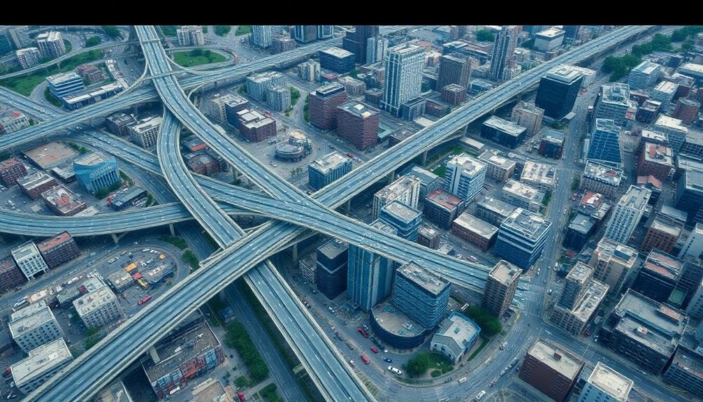
Vigilance in reviewing infrastructure vulnerabilities is essential for effective urban crisis planning. When using airborne imagery, you'll want to focus on key elements of urban infrastructure that are crucial during crises. Start by examining transportation networks, including roads, bridges, and railways. Look for potential weak points, such as aging structures or areas prone to flooding.
Next, evaluate utility systems like power grids, water supply lines, and communication networks. Identify substations, treatment plants, and cell towers that may be at risk during emergencies.
Don't forget to inspect emergency response facilities, including hospitals, fire stations, and police headquarters. These are essential for crisis management and should be prioritized.
Pay close attention to tall buildings and densely populated areas, as they're particularly vulnerable during disasters. Look for signs of structural weakness or potential hazards nearby.
You'll also want to examine flood-prone areas, landslide risks, and other natural disaster hotspots. By thoroughly reviewing these vulnerabilities using airborne imagery, you'll be better prepared to develop extensive crisis response plans and mitigate potential risks before emergencies occur.
Map Evacuation Routes

Routinely mapping evacuation routes is a critical component of urban crisis planning. With airborne imagery, you'll gain a thorough view of your city's layout, allowing you to design efficient and safe escape paths. You can identify potential bottlenecks, assess road conditions, and locate suitable assembly points.
When mapping evacuation routes using aerial data, focus on these key aspects:
- Capacity: Analyze road widths and potential choke points to guarantee routes can handle large volumes of people and vehicles.
- Accessibility: Identify routes that are accessible to all residents, including those with mobility challenges or in hard-to-reach areas.
- Alternatives: Plan multiple evacuation options to account for different emergency scenarios and potential route blockages.
Use high-resolution imagery to spot obstacles like construction sites, flood-prone areas, or unstable structures that might impede evacuation efforts.
Regularly update your maps to reflect changes in urban infrastructure and population density. By integrating this aerial data with other information sources, such as traffic patterns and public transportation networks, you'll create a solid evacuation plan.
Remember to clearly communicate these routes to the public and conduct regular drills to guarantee smooth execution during an actual crisis.
Identify Emergency Response Staging Areas
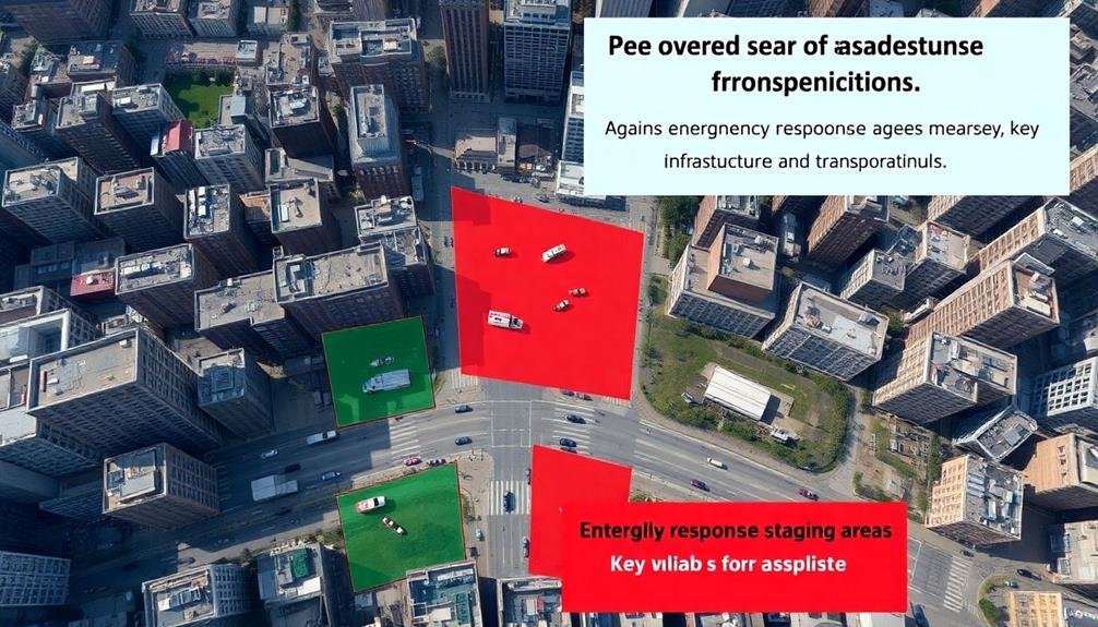
With evacuation routes mapped, your next priority is to identify emergency response staging areas using airborne imagery. Analyze aerial photos to locate large, open spaces that can serve as command centers, triage areas, and supply distribution points.
Look for parking lots, sports fields, and parks near major roads but away from potential hazards. Use high-resolution imagery to assess the terrain and accessibility of these areas. Verify they're flat, well-drained, and can accommodate large vehicles and temporary structures.
Consider proximity to hospitals, fire stations, and police departments for efficient coordination. Evaluate surrounding infrastructure, including power lines and communication towers, to guarantee reliable connectivity. Identify nearby water sources and potential helicopter landing zones.
Mark these staging areas on your crisis map and assign them priority levels based on size, location, and resources. Don't forget to assess secondary staging areas as backups.
Use 3D modeling to visualize how these spaces can be organized for maximum efficiency. Finally, share this information with all relevant emergency response agencies to facilitate coordinated planning and rapid deployment during a crisis.
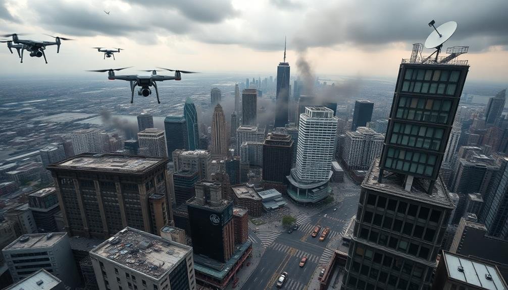
Monitor Real-Time Population Movements

Real-time population tracking is essential for effective crisis management.
You'll need to leverage airborne imagery to monitor crowd movements and identify potential bottlenecks or danger zones. Use high-resolution cameras and thermal imaging to detect large gatherings, even in low-light conditions. This data will help you make informed decisions about resource allocation and evacuation routes.
To maximize the effectiveness of real-time population monitoring:
- Establish a network of drones or fixed-wing aircraft to provide continuous coverage of the affected area
- Implement AI-powered image analysis software to quickly identify and track crowd movements
- Integrate this data with your emergency response system for immediate action
Evaluate Post-Crisis Damage
After the immediate crisis has passed, you'll need to shift your focus to evaluating the aftermath. Airborne imagery becomes invaluable for gauging post-crisis damage quickly and accurately. Use high-resolution aerial photographs or drone footage to survey affected areas, identifying structural damage, infrastructure failures, and potential hazards.
Compare pre-crisis imagery with current shots to quantify the extent of destruction. Look for collapsed buildings, damaged roads, downed power lines, and flooded areas. This bird's-eye view allows you to prioritize response efforts and allocate resources effectively.
Utilize thermal imaging to detect hidden issues like gas leaks or smoldering fires. Employ LiDAR technology to create 3D models of damaged structures, aiding in stability evaluations and reconstruction planning.
Don't forget to capture oblique imagery for a more thorough view of building facades and street-level damage.
Share your findings with emergency responders, city planners, and insurance adjusters to expedite recovery efforts. Remember to document everything thoroughly for future reference and analysis.
Frequently Asked Questions
How Often Should Urban Crisis Plans Be Updated Using Airborne Imagery?
You should update urban crisis plans using airborne imagery at least annually. However, it's best to reassess after major changes or events in your city. Don't wait too long – frequent updates guarantee your plans stay current and effective.
What Are the Legal Considerations for Using Drones in Urban Crisis Planning?
You'll need to take into account privacy laws, airspace regulations, and licensing requirements for drone operators. Obtain necessary permits, follow FAA guidelines, and respect no-fly zones. Ascertain data collection and storage comply with local and federal regulations.
How Can Airborne Imagery Be Integrated With Other Data Sources for Planning?
You can integrate airborne imagery with GIS data, ground-level photos, and sensor data. Combine these sources to create thorough 3D models and overlay real-time information for more effective urban planning and crisis response.
What Specialized Training Is Required for Interpreting Airborne Imagery in Crisis Planning?
You'll need training in remote sensing, image analysis, and GIS software. Learn to interpret different spectral bands, identify urban features, and detect changes over time. Familiarity with crisis management protocols is also essential for effective planning.
How Does Weather Affect the Reliability of Airborne Imagery for Crisis Planning?
Weather greatly impacts airborne imagery's reliability. You'll find cloud cover, rain, and fog can obscure ground details. Strong winds may affect image quality. Sunlight and shadows can alter visibility. Night conditions limit visual data collection.
In Summary
You've now got powerful tools for urban crisis planning using airborne imagery. Remember to regularly assess infrastructure, update evacuation routes, and identify staging areas. During a crisis, you'll be able to monitor population movements in real-time. After the event, you can quickly evaluate damage to guide recovery efforts. By incorporating these aerial insights, you're better prepared to protect your city and its residents when disaster strikes. Stay vigilant and keep your plans current.
As educators and advocates for responsible drone use, we’re committed to sharing our knowledge and expertise with aspiring aerial photographers.


Leave a Reply