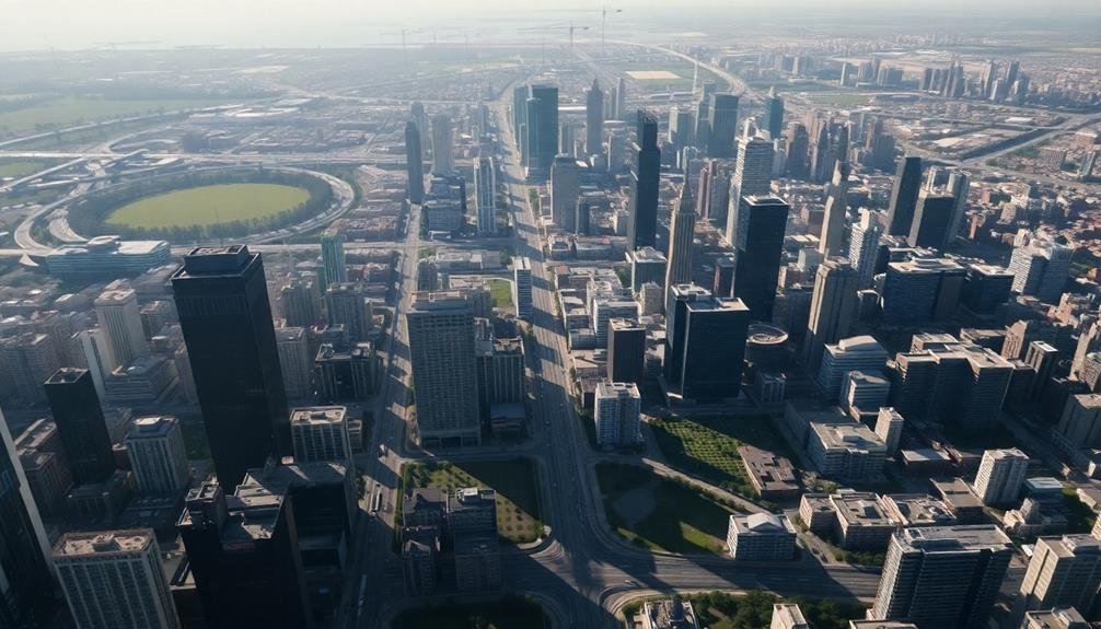
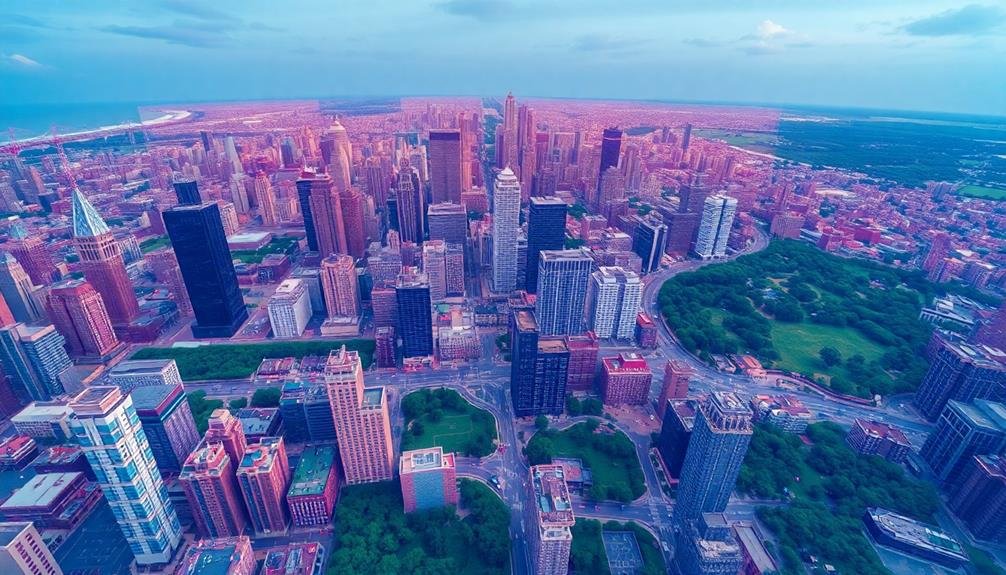
Modern cityscapes demand sky-high urban planning insights as cities grow vertically to accommodate booming populations and limited land. You'll find that vertical growth maximizes space through taller buildings and mid-rise structures, increasing density and promoting mixed-use developments. This approach reduces urban sprawl but presents challenges like traffic congestion and maintaining community cohesion. To address these issues, planners now utilize drone technology and 3D modeling for real-time skyline analysis, evaluating sunlight patterns, wind flow, and infrastructure needs. They're also integrating green spaces, rooftop gardens, and considering pedestrian comfort in their designs. The complexities of urban vertical expansion create a whole new dimension of planning considerations.
Vertical Growth and Urban Density
Two key strategies regarding modern urban planning are vertical growth and increased density. You'll notice these approaches in rapidly expanding cities worldwide.
Vertical growth involves constructing taller buildings, maximizing limited land use. It's not just about skyscrapers; mid-rise structures also contribute to this trend. By building upwards, you're creating more usable space without expanding the city's footprint.
Increased density goes hand-in-hand with vertical growth. It's about fitting more people and activities into a given area. You'll see this in mixed-use developments, where residential, commercial, and recreational spaces coexist. This approach reduces the need for long commutes and promotes walkability.
These strategies offer numerous benefits. They're more environmentally friendly, as they reduce urban sprawl and preserve surrounding natural areas. They're also more efficient regarding infrastructure and public services. You'll find that denser cities often have better public transportation systems and more vibrant street life.
However, challenges exist. You must consider issues like traffic congestion, adequate green spaces, and maintaining a sense of community.
Balancing these factors is essential for successful urban planning in the 21st century.
Drone-Assisted Skyline Mapping
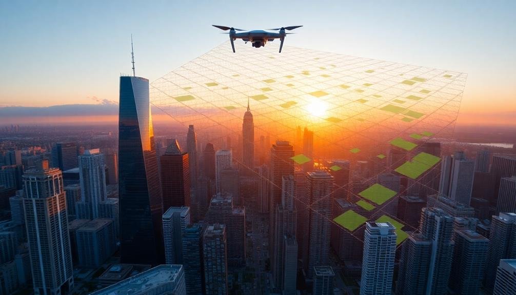
You'll find drone technology revolutionizing urban skyline mapping through aerial data collection.
These unmanned aircraft can capture high-resolution imagery and spatial information, enabling the creation of detailed 3D urban models.
With drones, you're able to conduct real-time skyline analysis, providing urban planners with up-to-date information for decision-making and monitoring city growth.
Aerial Data Collection
Drones have revolutionized urban planning by enabling efficient and accurate aerial data collection. You'll find that these unmanned aerial vehicles can capture high-resolution images and videos of cityscapes, providing a thorough view of urban environments.
They're equipped with various sensors, including LiDAR and thermal cameras, allowing you to gather diverse data types in a single flight.
When you use drones for aerial data collection, you'll benefit from their ability to access hard-to-reach areas and capture real-time information. This technology enables you to monitor construction progress, assess infrastructure conditions, and analyze traffic patterns with unprecedented ease.
You can also create 3D models and digital elevation maps, which are invaluable for urban planning and development projects.
Drone-collected data helps you make informed decisions about zoning, land use, and urban growth. You'll be able to identify potential environmental impacts, optimize resource allocation, and improve emergency response planning.
3D Urban Modeling
With drone-assisted skyline mapping, 3D urban modeling has reached new heights. You'll find that drones equipped with high-resolution cameras and LiDAR sensors can capture intricate details of buildings, infrastructure, and landscapes from various angles. This technology allows you to create accurate, up-to-date 3D models of entire cityscapes.
These models serve as powerful tools for urban planners, architects, and developers. You can use them to visualize proposed developments, assess their impact on the existing skyline, and make informed decisions about zoning and building regulations.
They're also invaluable for analyzing shadow patterns, view corridors, and wind flow between buildings. You'll appreciate how 3D urban models enhance public engagement. By presenting realistic visualizations of urban projects, you can better communicate plans to stakeholders and gather meaningful feedback.
These models also support sustainable urban design by helping you optimize energy efficiency, green spaces, and transportation networks. Moreover, you can integrate 3D urban models with other data sources like traffic patterns, population density, and environmental factors.
This thorough approach enables you to create smarter, more livable cities that adapt to changing needs and challenges.
Real-Time Skyline Analysis
Building on the foundation of 3D urban modeling, real-time skyline analysis takes urban planning to the next level. You'll find that drone-assisted skyline mapping has revolutionized how urban planners and architects visualize and analyze cityscapes. This technology allows you to capture high-resolution images and data of a city's skyline in real-time, providing unprecedented insights into urban development.
As you employ drones equipped with advanced sensors and cameras, you'll be able to create accurate 3D models of buildings, assess their impact on the overall cityscape, and identify potential issues such as shadowing or wind tunnels. You can also use this data to simulate proposed developments and their effects on the existing skyline, helping you make informed decisions about zoning regulations and building heights.
Real-time skyline analysis enables you to monitor construction progress, detect unauthorized modifications, and assess the visual impact of new structures on historical landmarks. You'll find this technology invaluable for preserving a city's character while accommodating growth.
Analyzing Sunlight and Shadow Patterns
Understanding how sunlight and shadows interact with urban environments is essential for effective city planning.
You'll need to take into account the impact of building heights, orientations, and spacing on natural light distribution throughout the day and across seasons. This analysis helps you create more livable, energy-efficient, and aesthetically pleasing urban spaces.
To analyze sunlight and shadow patterns effectively, you'll want to:
- Use 3D modeling software to simulate sun paths and shadow projections
- Take into account seasonal variations in sun angles and daylight hours
- Assess the impact of proposed buildings on existing structures and public spaces
- Evaluate potential glare issues from reflective surfaces
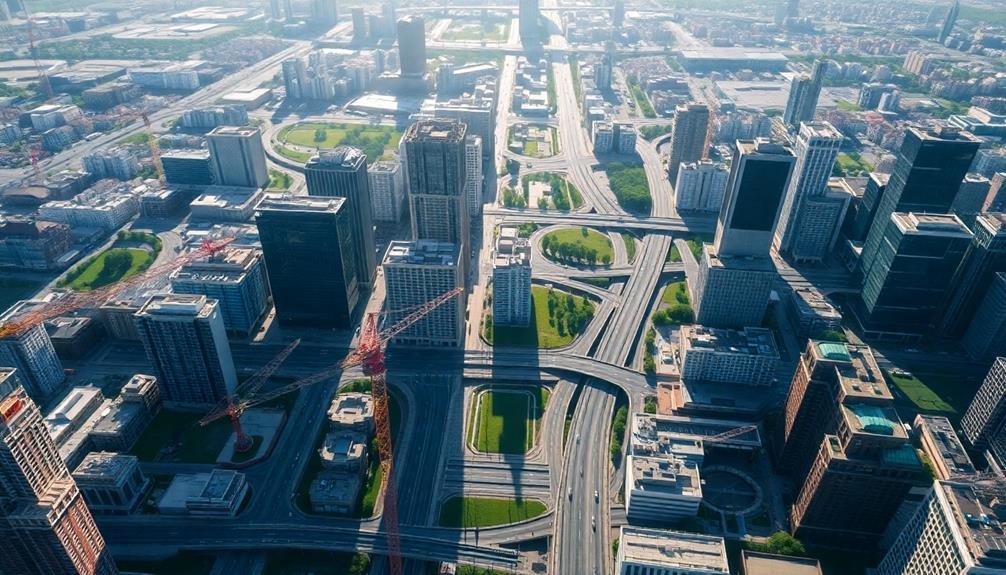
Traffic Flow in Three Dimensions
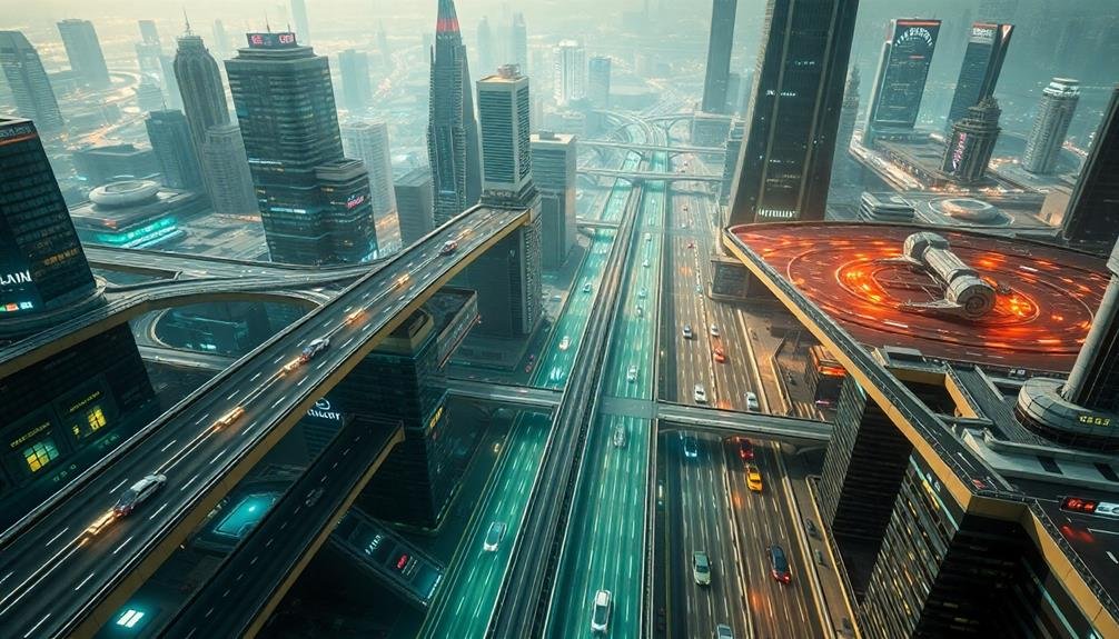
Traffic flow in urban environments isn't just a two-dimensional problem. You've got to take into account the vertical aspect too. As cities grow upward, you'll find traffic moving not only along streets but also through elevated highways, underground tunnels, and even between skyscrapers.
You'll need to think about how people and vehicles shift between these levels. Elevators, escalators, and ramps become vital connectors. Don't forget about pedestrian skywalks and underground passages that can ease congestion at street level.
You'll also have to think about the impact of tall buildings on wind patterns, which can affect air quality and the dispersion of vehicle emissions. Proper ventilation in underground spaces is essential to maintain air quality and safety.
When you're planning, remember that different levels can serve different purposes. Ground level might prioritize pedestrians and cyclists, while underground tunnels could be dedicated to public transit or freight delivery. Elevated roadways could be reserved for faster-moving traffic or emergency vehicles.
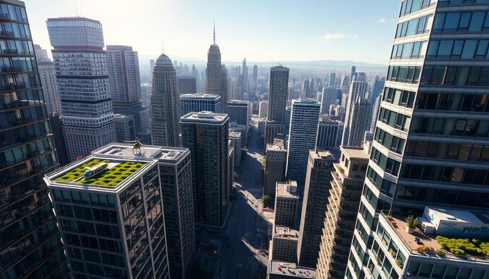
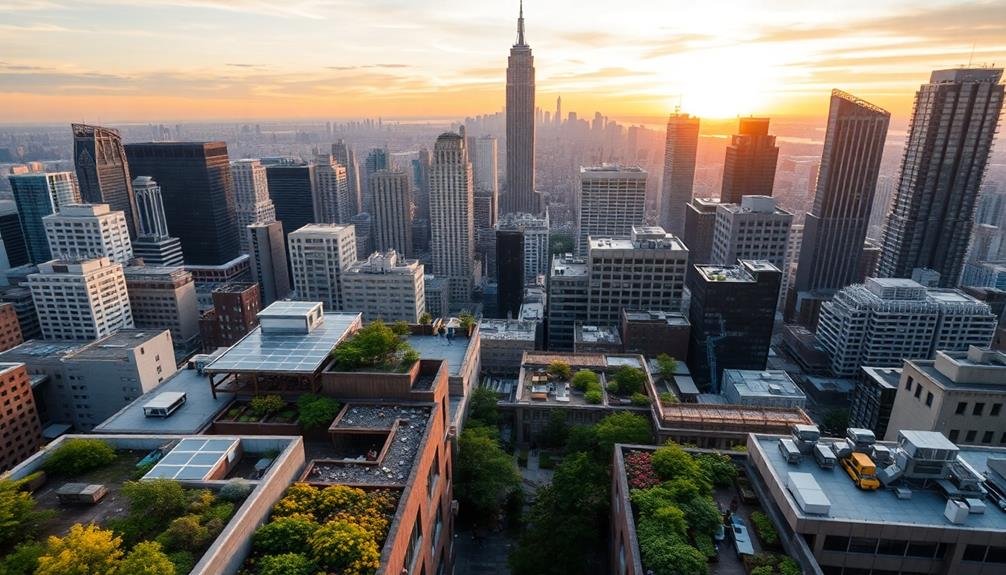
Green Spaces Among Skyscrapers
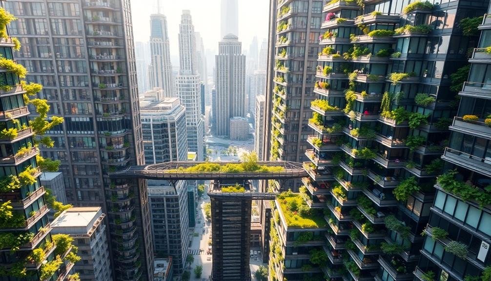
As you navigate the concrete jungle, you'll find unexpected pockets of nature amidst towering skyscrapers.
Rooftop gardens serve as urban oases, offering breathtaking views and a respite from the bustling streets below.
Meanwhile, pocket parks scattered throughout the city provide micro-retreats where you can pause, recharge, and reconnect with nature, even if just for a moment.
Rooftop Gardens: Urban Oases
In the midst of concrete jungles, rooftop gardens have emerged as vibrant oases, transforming barren urban spaces into lush, green retreats. These elevated havens offer a respite from the hustle and bustle of city life, providing numerous benefits to urban dwellers and the environment alike.
You'll find that rooftop gardens contribute greatly to sustainable urban development. They help reduce the urban heat island effect, improve air quality, and manage stormwater runoff. Additionally, these sky-high sanctuaries create opportunities for urban agriculture, fostering a sense of community and promoting food security.
When you explore rooftop gardens, you'll discover a world of possibilities:
- Relaxation spaces for employees to unwind during breaks
- Venues for social gatherings and events
- Educational areas for schools to teach about ecology and sustainability
- Habitats for local wildlife, including birds and insects
As cities continue to grow vertically, rooftop gardens offer a creative solution to the lack of green spaces at ground level.
Pocket Parks: Micro Retreats
While rooftop gardens bring nature to the sky, pocket parks carve out green havens at street level. These micro retreats offer urbanites a quick escape from the concrete jungle, providing a revitalizing atmosphere in densely packed neighborhoods.
You'll find these tiny oases tucked between buildings, often no larger than a tennis court.
Pocket parks serve multiple purposes in urban planning. They're not just pretty spaces; they're functional too. You'll see benches for rest, play areas for children, and sometimes even small performance spaces.
They help reduce the urban heat island effect, improve air quality, and manage stormwater runoff.
When you're designing a pocket park, you'll need to maximize every square foot. Consider vertical gardening to increase green space. Include native plants to support local ecosystems and reduce maintenance costs.
Don't forget about lighting for safety and extended use hours.
You'll find that pocket parks foster community connections. They're meeting spots for neighbors, lunch break destinations for office workers, and peaceful retreats for anyone needing a moment of calm amidst urban chaos.
Urban Heat Island Effect
Beneath the gleaming skylines of our cities lies a hidden phenomenon: the urban heat island effect.
You've likely felt it on sweltering summer days when the concrete jungle seems to amplify the heat. This effect occurs when urban areas experience higher temperatures than their rural surroundings due to human activities and infrastructure.
To understand the urban heat island effect, consider these key factors:
- Dark surfaces: Asphalt and dark roofs absorb more solar radiation
- Lack of vegetation: Fewer trees and green spaces mean less natural cooling
- Heat-generating activities: Traffic, air conditioning, and industrial processes contribute to rising temperatures
- Reduced airflow: Tall buildings can trap heat and limit air circulation
You can help mitigate this effect by supporting green initiatives in your city.
Encourage the implementation of cool roofs, green spaces, and reflective pavements. These strategies not only combat the heat island effect but also improve air quality and reduce energy consumption.
Wind Tunnels and Air Circulation
You'll notice that tall buildings can markedly alter wind patterns in urban areas, creating wind tunnels that affect both the local climate and pedestrian comfort.
These wind effects can be harnessed to mitigate the urban heat island effect by promoting air circulation and cooling.
When planning cityscapes, it's essential to take into account wind flow and create comfort zones for pedestrians, balancing the benefits of air movement with the need for shelter from strong gusts.
Skyscraper Wind Effects
Skyscrapers don't just shape city skylines; they also greatly impact urban wind patterns. As you walk through a city filled with towering structures, you'll notice how wind behaves differently compared to open spaces. Tall buildings create wind tunnels, channeling air through narrow passages and accelerating its speed. This phenomenon can lead to uncomfortable and potentially dangerous conditions for pedestrians.
Urban planners and architects must consider these effects when designing cityscapes. They use computer simulations and wind tunnel tests to predict and mitigate adverse wind conditions.
Some strategies they employ include:
- Incorporating setbacks and podiums to deflect wind
- Adding wind-breaking features like canopies and screens
- Designing rounded or tapered building corners to reduce turbulence
- Creating strategic gaps between buildings to allow air flow
You'll find that well-planned cities take these factors into account, resulting in more comfortable public spaces. By understanding skyscraper wind effects, urban designers can create safer, more enjoyable environments for city dwellers.
It's a vital aspect of modern urban planning that guarantees our growing cities remain livable despite their increasing density and height.
Urban Heat Island Mitigation
As cities grow denser and taller, they face a pressing challenge: the urban heat island effect. You've likely experienced this phenomenon firsthand, feeling the sweltering heat radiating from concrete and asphalt on a summer day.
To combat this, urban planners are turning to innovative solutions that leverage wind tunnels and air circulation.
You'll find that strategic building placement can create wind corridors, channeling cool breezes through urban canyons. These corridors act as natural air conditioners, reducing temperatures and improving air quality.
You might also notice an increase in green spaces and rooftop gardens in your city. These elements not only provide shade but also help cool the air through evapotranspiration.
Cool pavements and reflective surfaces are becoming more common, too. You'll see lighter-colored materials that reflect sunlight rather than absorbing it.
Water features, like fountains and mist systems, are being integrated into urban designs to provide localized cooling effects.
Pedestrian Comfort Zones
In urban planning, pedestrian comfort zones are vital for creating livable cities. You'll find that wind tunnels and air circulation play an important role in determining how comfortable pedestrians feel as they navigate urban spaces.
When tall buildings are placed close together, they can create wind tunnels that amplify wind speeds at street level, making it unpleasant or even dangerous for pedestrians.
To mitigate these effects and create comfortable pedestrian zones, urban planners must take into account:
- Building orientation and spacing
- Street width and layout
- Incorporation of wind breaks and barriers
- Use of vegetation and landscaping
By carefully analyzing wind patterns and implementing design strategies, you can greatly improve the pedestrian experience.
This might involve creating staggered building heights, adding podiums to tall structures, or incorporating canopies and awnings at street level.
You'll also want to bear in mind the placement of public spaces, ensuring they're sheltered from strong winds while still allowing for adequate air circulation.
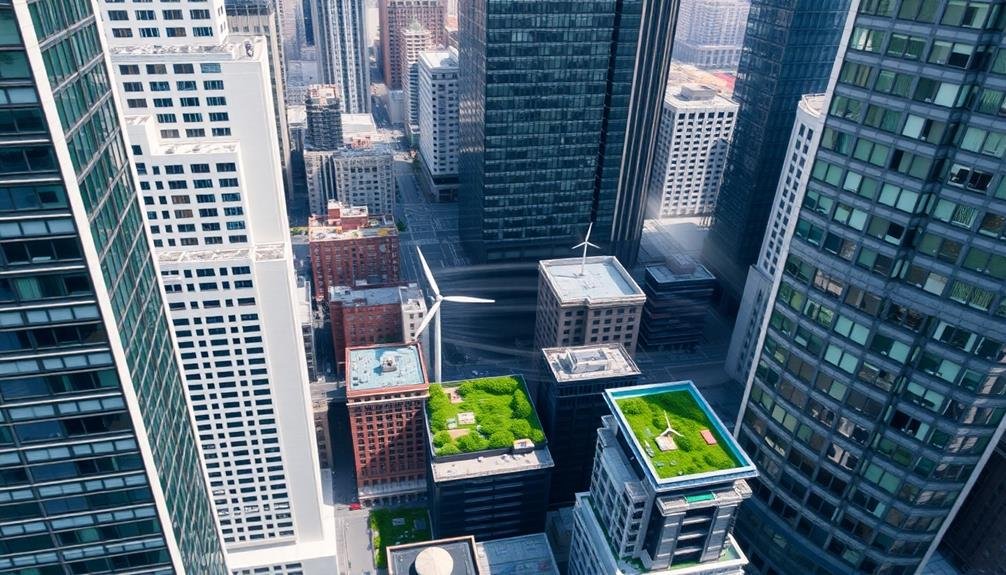
Rooftop Utilization Opportunities
Atop urban landscapes, a world of untapped potential awaits. You'll find that rooftops offer a treasure trove of opportunities for urban planners and developers. These often-overlooked spaces can be transformed into vibrant, functional areas that enhance city life and sustainability.
Consider the following rooftop utilization options:
| Purpose | Benefits | Challenges |
|---|---|---|
| Green spaces | Improved air quality, biodiversity | Structural integrity, maintenance |
| Solar panels | Renewable energy, reduced costs | Initial investment, weather impact |
| Urban farming | Local food production, community engagement | Water management, zoning regulations |
| Recreational areas | Increased property value, social interaction | Safety concerns, noise control |
By reimagining rooftops, you're not just maximizing space; you're creating new dimensions of urban living. You can turn barren concrete into lush gardens, energy-generating powerhouses, or social hubs. These adaptations don't just benefit building occupants; they contribute to the city's overall resilience and livability.
As you explore rooftop utilization, you'll need to address structural considerations, safety regulations, and maintenance requirements. But the payoff can be significant: reduced energy costs, improved stormwater management, and enhanced quality of life for city dwellers.
Infrastructure Planning From Above
While traditional urban planning often focuses on street-level perspectives, viewing infrastructure from above can revolutionize city development. You'll gain a thorough understanding of spatial relationships, traffic flow patterns, and potential bottlenecks that mightn't be apparent from the ground.
This bird's-eye view allows you to identify prime locations for new developments, optimize transportation networks, and plan for future growth more effectively.
By utilizing aerial imagery, satellite data, and advanced mapping technologies, you can:
- Assess existing land use and identify underutilized spaces
- Analyze urban sprawl and plan for sustainable expansion
- Detect environmental challenges and plan green corridors
- Evaluate the impact of proposed developments on surrounding areas
You'll also be able to spot opportunities for improving connectivity between different parts of the city.
This approach enables you to design more efficient public transportation routes, create better pedestrian and cycling networks, and enhance overall urban mobility.
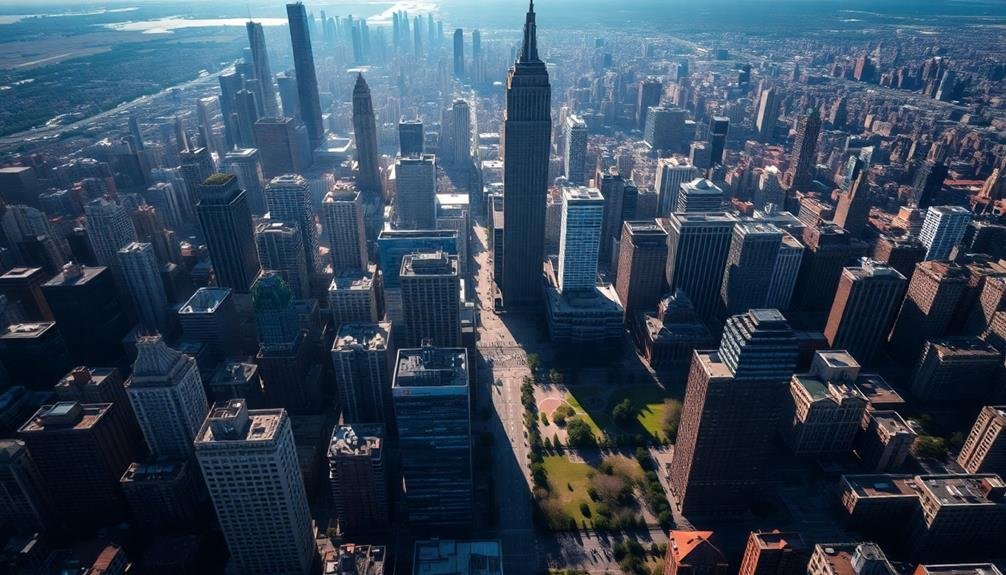
Preserving Historical Landmarks
As cities evolve and modernize, preserving historical landmarks becomes a vital aspect of urban planning. You'll find that these structures not only tell the story of a city's past but also contribute to its unique character and identity.
When you're tasked with urban development, it's essential to balance progress with preservation.
Start by identifying and cataloging significant historical sites within your city. You'll need to assess their condition, cultural importance, and potential for restoration.
Collaborate with local historians, architects, and community members to gather insights and build support for preservation efforts.
Implement zoning regulations that protect these landmarks from demolition or inappropriate alterations. You can create buffer zones around historical sites to maintain their context and visual impact.
Consider adaptive reuse strategies that give new life to old buildings while respecting their historical integrity.
Secure funding for restoration projects through grants, public-private partnerships, or tax incentives for property owners.
You'll also want to develop educational programs to raise awareness about the importance of these landmarks.
Frequently Asked Questions
How Do Skyscrapers Affect Local Bird Populations and Migration Patterns?
You'll find that skyscrapers greatly impact birds. They're deadly obstacles during migration, causing collisions. They also disrupt local habitats, altering nesting sites and food sources. However, some buildings now use bird-friendly designs to minimize these effects.
What Role Does Sky-High Urban Planning Play in Disaster Preparedness?
You'll find sky-high urban planning essential for disaster preparedness. It guarantees efficient evacuation routes, creates safe zones in tall buildings, and designs structures to withstand natural disasters. It's your safeguard against urban catastrophes.
How Are Privacy Concerns Addressed in High-Rise Residential Developments?
In high-rise living, you'll find privacy concerns addressed through smart design. Developers use sound-proofing materials, strategic window placement, and private balconies. They're also implementing advanced security systems and controlled access to common areas for residents' peace of mind.
What Impact Does Vertical Urbanism Have on Social Interactions and Community Building?
You'll find vertical urbanism can isolate residents, reducing chance encounters. However, it also creates opportunities for shared spaces like rooftop gardens and sky lobbies, which can foster community interaction if well-designed and actively programmed.
How Do Sky-High Urban Planners Account for Future Technological Advancements?
You'll find sky-high urban planners are always looking ahead. They're incorporating flexible designs, adaptable infrastructure, and smart technology integration. You'll see them planning for future innovations like autonomous vehicles, renewable energy systems, and advanced communication networks.
In Summary
You've seen how modern cityscapes require a whole new perspective on urban planning. From vertical growth to rooftop utilization, you're now aware of the complex challenges facing today's urban designers. As you look up at towering skyscrapers, remember the intricate balance of sunlight, wind, and green spaces they must consider. It's clear that sky-high insights aren't just useful – they're essential for creating livable, sustainable cities that work in three dimensions.
As educators and advocates for responsible drone use, we’re committed to sharing our knowledge and expertise with aspiring aerial photographers.


Leave a Reply