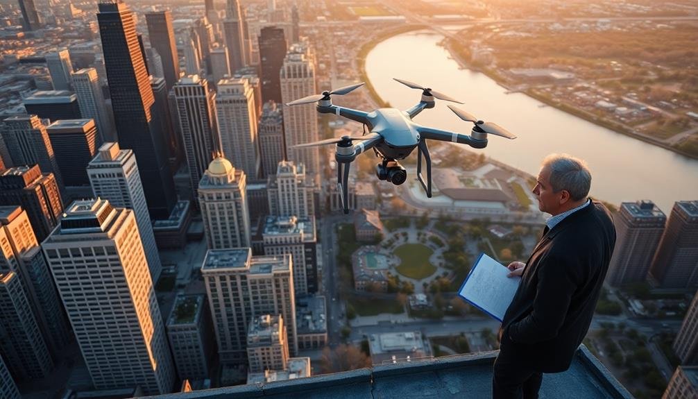
To legally operate a commercial aerial photography business, you'll need to navigate a complex web of regulations and permits. Start by obtaining your FAA Remote Pilot Certificate and registering your drone. Research local permit requirements and airspace classifications in your area. Secure adequate insurance coverage and familiarize yourself with privacy laws. Be aware of restricted areas and no-fly zones, and always check weather conditions before flight. Don't forget about post-processing legal considerations, including copyright and data protection. By following these steps and staying informed about changing regulations, you'll be well-prepared to launch your aerial photography venture. The sky's the limit for those who master the intricacies of this field.
Key Takeaways
- Obtain a Remote Pilot Certificate by passing the FAA Part 107 knowledge test for commercial drone operations.
- Register your drone with the FAA if it weighs over 0.55 pounds and mark it with the registration number.
- Check local regulations and apply for necessary permits, which may require proof of insurance and flight plans.
- Understand airspace classifications and obtain permissions for controlled airspace or special use areas when required.
- Maintain adequate insurance coverage, including general liability and equipment insurance for aerial photography operations.
Understanding FAA Regulations

Anyone looking to engage in aerial photography must first grasp the Federal Aviation Administration's (FAA) regulations. The FAA classifies most drones used for aerial photography as small unmanned aircraft systems (sUAS). To operate these commercially, you'll need to obtain a Remote Pilot Certificate by passing the Part 107 knowledge test.
You're required to register your drone if it weighs more than 0.55 pounds. Keep in mind that you must always maintain visual line of sight with your drone during operation. The FAA limits flights to daylight hours and restricts maximum altitude to 400 feet above ground level.
It's essential to understand airspace classifications. You can't fly in controlled airspace (Class B, C, D, and E) without prior authorization from air traffic control. The FAA's LAANC system provides near real-time processing for airspace authorizations in many locations.
You must also respect privacy and property rights. Don't fly over people without their consent or private property without permission.
Be aware of local laws, which may impose additional restrictions. Always prioritize safety and follow the FAA's guidelines to guarantee legal and responsible aerial photography operations.
Local Permit Requirements

While federal regulations provide an overarching framework, you'll often need to navigate local permit requirements for aerial photography. Many cities and municipalities have their own rules governing drone usage, especially for commercial purposes. These local laws can vary widely, so it's essential to research the specific requirements for each location where you plan to shoot.
Start by contacting the local government office or visiting their website to find information on drone permits. You may need to submit an application, provide proof of insurance, and pay a fee. Some areas might require additional documentation, such as a flight plan or safety protocol.
Here's a quick overview of common local permit considerations:
| Requirement | Purpose | Typical Timeframe |
|---|---|---|
| Application | Document intent | 2-4 weeks |
| Insurance | Liability coverage | Ongoing |
| Flight plan | Safety assurance | 1-2 weeks prior |
Airspace Classifications

Understanding airspace classifications is essential for aerial photographers.
You'll need to differentiate between controlled and uncontrolled airspace, as each has distinct rules and requirements.
Additionally, you should be aware of special use areas, which may have unique restrictions or prohibitions for drone operations.
Controlled vs. Uncontrolled Airspace
When you're planning aerial photography, it's crucial to know the type of airspace you'll be operating in. Airspace is divided into two main categories: controlled and uncontrolled.
Controlled airspace is actively managed by air traffic control (ATC). It's found around busy airports and at higher altitudes. You'll need to obtain clearance from ATC before flying in these areas. There are several classes of controlled airspace:
Class A: Above 18,000 feet
Class B: Major airports
Class C: Medium-sized airports
Class D: Smaller airports with control towers
Class E: Lower altitude controlled airspace
Uncontrolled airspace, also known as Class G, doesn't require ATC clearance. It's typically found in rural areas and at low altitudes. However, you still need to follow FAA regulations and maintain situational awareness.
When planning your aerial photography, check airspace maps and consult the FAA's resources. Remember that even in uncontrolled airspace, you must adhere to drone regulations, including altitude restrictions and visual line-of-sight requirements.
Always prioritize safety and be aware of temporary flight restrictions that may affect your planned operations.
Special Use Areas
Special Use Areas frequently complicate aerial photography planning. You'll need to be aware of these restricted zones to avoid legal issues and guarantee safe operations. These areas include military installations, national parks, and other sensitive locations where drone flights may be prohibited or heavily restricted.
When planning your aerial photography mission, consult aeronautical charts and the FAA's UAS facility maps to identify Special Use Areas in your vicinity. You'll often need to obtain specific permissions or adhere to strict guidelines when operating near or within these zones.
Here's a quick reference table for common Special Use Areas:
| Area Type | Restrictions | Permission Required | Typical Wait Time |
|---|---|---|---|
| Military | Strict | Yes | 4-6 weeks |
| National Parks | Variable | Often | 2-4 weeks |
| Airports | Radius-based | Sometimes | 24-72 hours |
| Wildlife Refuges | Seasonal | Usually | 1-2 weeks |
Insurance and Liability Coverage

In the domain of aerial photography, insurance and liability coverage are essential components you can't afford to overlook. Most permitting authorities require you to have adequate insurance before granting approval for aerial shoots.
You'll typically need to provide proof of general liability insurance, with coverage limits often ranging from $1 million to $5 million per occurrence.
Guarantee your policy specifically covers aerial photography activities and drone operations if applicable. You may also need to add the permitting authority as an additional insured party on your policy. Some locations might require specialized coverage, such as maritime insurance for coastal shoots.
Don't forget about equipment insurance to protect your valuable cameras and drones. Consider hull insurance for any aircraft you're using. If you're hiring a pilot, verify they've their own insurance and that it covers commercial operations.
Be aware that standard policies may not cover all potential risks. You might need to supplement with additional coverage for specific scenarios, such as invasion of privacy claims or property damage.
Always review your policy carefully and consult with an insurance professional familiar with aerial photography to guarantee you're fully protected.
Equipment Registration Process

Beyond insurance considerations, you'll need to tackle the equipment registration process for your aerial photography gear. This step is essential for legal compliance and operational safety. Start by cataloging all your equipment, including drones, cameras, and accessories. You'll need to register each drone with the FAA if it weighs over 0.55 pounds.
Here's a quick guide to the registration process:
| Step | Action | Timeframe |
|---|---|---|
| 1 | Create FAA DroneZone account | 5-10 minutes |
| 2 | Provide personal information | 5-15 minutes |
| 3 | List all drone models | 10-20 minutes |
| 4 | Pay registration fee | 5 minutes |
| 5 | Receive registration number | 24-48 hours |
Once you've completed the registration, mark each drone with its unique registration number. Keep documentation of your equipment and registrations readily available during operations. This helps streamline inspections and demonstrates your professionalism.
Commercial Operator Certification

For those seeking to monetize their aerial photography skills, commercial operator certification is a crucial step. You'll need to prove your competence and understanding of aviation regulations to operate legally as a commercial drone pilot. The process typically involves passing a knowledge test covering airspace rules, weather patterns, and drone operations.
You'll also need to demonstrate practical flying skills and familiarity with your equipment. Many countries require you to log a certain number of flight hours before applying for certification.
Once certified, you'll receive a license or permit that allows you to conduct commercial drone operations.
Keep in mind that certifications often have expiration dates, so you'll need to stay current with renewals and any changes in regulations. You may also need to obtain additional endorsements for specialized operations, such as night flying or operating in controlled airspace.
Don't forget to factor in the costs associated with certification, including exam fees, study materials, and potential training courses.
While the process can be rigorous, obtaining your commercial operator certification opens up numerous opportunities in the aerial photography industry.
Privacy and Property Considerations

While capturing stunning aerial shots is exciting, you must navigate the complex landscape of privacy and property laws.
You'll need to be aware of local regulations regarding privacy, as well as federal laws like the Fourth Amendment, which protects against unreasonable searches and seizures.
Always obtain permission before flying over private property. Even if you're not directly above it, you could still violate privacy rights by capturing images of areas not visible from public spaces.
Be cautious when photographing residential areas, schools, or other sensitive locations.
Consider using geofencing technology to restrict your drone's flight path and avoid unintended privacy breaches. You should also be mindful of noise pollution and potential disturbances to wildlife or livestock.
When photographing public spaces, be aware of expectations of privacy. Avoid capturing identifiable individuals without consent, especially in situations where they've a reasonable expectation of privacy.
Lastly, respect no-fly zones and restricted airspace. This includes areas near airports, military installations, and national parks.
Always check current regulations and obtain necessary permits before flying in these locations.
Flight Planning and Documentation

Before you take off for your aerial photography session, you'll need to complete a thorough pre-flight checklist.
This essential step guarantees your equipment is ready and all necessary permits are in order.
Don't forget to maintain a detailed logbook and keep accurate records of each flight, as this documentation can be vital for legal compliance and future reference.
Pre-Flight Checklist Essentials
In preparation for your aerial photography mission, an extensive pre-flight checklist is essential. Begin by verifying all necessary permits and authorizations are in order and readily accessible. Double-check your flight plan, confirming it complies with local regulations and airspace restrictions.
Inspect your drone thoroughly, including propellers, batteries, and camera equipment. Verify all firmware is up-to-date and memory cards have sufficient storage capacity.
Review weather conditions, including wind speed, visibility, and potential precipitation. Assess the location for potential hazards such as power lines, trees, or buildings that may interfere with your flight. Confirm your drone's GPS signal is strong and stable. Test your remote control's responsiveness and calibrate the compass if necessary.
Pack essential accessories like spare batteries, propellers, and lens cleaning supplies. Don't forget to bring your pilot's license, drone registration, and insurance documentation.
Set up a pre-flight briefing with your team, if applicable, to discuss roles, communication protocols, and emergency procedures. Finally, establish a clear takeoff and landing zone, confirming it's free from obstacles and bystanders.
Logbook and Record Keeping
Maintaining a detailed logbook and proper documentation is essential for any aerial photographer. Not only does it help you track your flights and experiences, but it's also often required by regulatory bodies. Your logbook should include flight dates, times, locations, and any notable events or observations.
Keep records of your drone's maintenance, firmware updates, and battery cycles to guarantee peak performance and safety.
Documentation extends beyond flight logs. You'll need to keep copies of your permits, licenses, and insurance policies readily available. Store digital backups of these documents on your mobile device for easy access during inspections.
Additionally, maintain a record of your pre-flight checklists and risk assessments for each job.
Here's why meticulous record-keeping matters:
- It demonstrates your professionalism and commitment to safety.
- It protects you legally in case of incidents or disputes.
- It helps you identify patterns and improve your skills over time.
- It provides valuable data for insurance purposes and business growth.
Safety Protocols for Aerial Photography

Safety protocols form the backbone of responsible aerial photography. You'll need to prioritize these measures to guarantee your operations remain safe and compliant. Start by thoroughly inspecting your equipment before each flight, checking for any damage or wear that could compromise safety.
Don't forget to calibrate your sensors and verify all software is up-to-date.
Always conduct a pre-flight briefing with your team, discussing weather conditions, flight plans, and potential hazards. You must maintain visual line of sight with your drone at all times and adhere to altitude restrictions.
Be aware of no-fly zones and respect privacy laws when capturing images.
In case of emergencies, have a clear plan in place. This should include procedures for equipment malfunctions, loss of control, or unexpected obstacles. You'll want to carry a first-aid kit and fire extinguisher on-site as precautionary measures.
Lastly, stay current with evolving regulations and best practices in the industry. Regularly attend safety workshops and participate in online forums to keep your knowledge fresh.
Restricted Areas and No-Fly Zones

Before taking flight, you'll need to familiarize yourself with restricted areas and no-fly zones. These areas are off-limits for aerial photography due to security concerns, privacy issues, or safety reasons. Common restricted areas include military installations, government buildings, airports, and national parks.
It's essential to research and identify these zones before planning your shoot. To guarantee compliance, use official aeronautical charts and consult the FAA's B4UFLY app or website. These resources provide up-to-date information on temporary flight restrictions and permanent no-fly zones.
Remember, violating these restrictions can result in severe penalties, including fines and legal consequences. When encountering a restricted area or no-fly zone, always respect the boundaries and find alternative locations for your aerial photography.
If you're unsure about a specific area, contact local authorities or the FAA for clarification. By adhering to these regulations, you'll protect yourself and maintain the integrity of the aerial photography industry.
- The thrill of capturing breathtaking aerial shots
- The excitement of exploring new perspectives from above
- The satisfaction of creating unique, eye-catching imagery
- The pride in conducting professional, law-abiding operations
Weather Conditions and Limitations

While aerial photography can yield stunning results, weather conditions play an essential role in determining the success and safety of your shoot. You'll need to take into account factors like wind speed, visibility, and precipitation when planning your aerial photography session.
Most permits will specify weather-related limitations. You're typically restricted from flying in winds exceeding 20-25 mph, as strong gusts can affect your drone's stability and control.
Visibility is another significant factor; you'll need at least 3 miles of clear visibility to operate safely. Avoid flying in fog, heavy rain, or snow, as these conditions can interfere with your drone's sensors and camera equipment.
Temperature extremes can also impact your flight. Very hot or cold weather may affect battery performance and reduce flight time. You'll need to be aware of potential icing conditions in colder climates, which can form on your drone's propellers and compromise flight stability.
Always check the forecast before your shoot and have a backup plan. Remember, weather conditions can change rapidly, so you must be prepared to abort the mission if conditions deteriorate.
Your safety and compliance with regulations should always take precedence over getting the perfect shot.
Post-Processing Legal Considerations
After capturing your aerial images, you'll need to contemplate several legal aspects during post-processing.
Guarantee you comply with copyright laws and maintain clear ownership of your work.
You must also adhere to privacy regulations and data protection rules, especially when processing images that include identifiable individuals or sensitive locations.
Copyright and Ownership Issues
Who owns the rights to aerial photographs once they've been taken and processed? This question is vital for commercial aerial photographers. Generally, the photographer retains copyright unless they're working under a work-for-hire agreement. However, permits and location agreements can complicate matters.
When shooting in public spaces, you'll typically maintain full ownership of your images. But for private property or restricted areas, property owners may stipulate partial rights or require approval before publication. It's important to clarify these terms before shooting.
Consider these emotional aspects of copyright ownership:
- Pride in creating unique, breathtaking views
- Frustration when others use your work without permission
- Anxiety over potential legal disputes
- Excitement about monetizing your aerial photography
Remember, even if you own the copyright, you may need additional permissions to use images commercially. This is especially true for recognizable landmarks or private properties. Always obtain proper releases and consult local laws regarding aerial imagery use.
To protect your work, register your copyrights with the appropriate authorities. This step provides additional legal recourse if infringement occurs.
Stay informed about evolving drone regulations and copyright laws to guarantee you're always operating within legal boundaries.
Privacy Law Compliance
Privacy concerns loom large in the world of aerial photography. You must be aware of and comply with privacy laws to avoid legal issues. When capturing images from above, you're likely to inadvertently photograph private property and individuals who haven't consented to be photographed.
To stay compliant, familiarize yourself with local and national privacy regulations. In the US, you'll need to take into account laws like the Fourth Amendment, which protects against unreasonable searches, and various state-specific privacy statutes.
Internationally, regulations like the EU's General Data Protection Regulation (GDPR) may apply.
Take steps to protect individuals' privacy in your images. Avoid focusing on private residences or areas where people have a reasonable expectation of privacy. If you've captured identifiable individuals, think about blurring faces or obtaining consent before publishing.
Be particularly cautious when photographing sensitive locations like schools or government buildings.
Implement a robust data protection strategy for storing and sharing your aerial photographs. Encrypt files, use secure transfer methods, and establish clear policies for data retention and deletion.
Data Protection Regulations
Data protection regulations cast a long shadow over aerial photography post-processing. You'll need to be vigilant about how you handle, store, and use the data captured during your flights. Familiarize yourself with applicable laws like GDPR in Europe or CCPA in California, as they may impact your operations even if you're based elsewhere.
Ensure you have a robust data management system in place. This includes secure storage, controlled access, and a clear data retention policy. You're responsible for protecting any personal information that may be inadvertently captured in your images, such as faces or license plates.
Implement techniques like blurring or pixelation to anonymize such data before publication or distribution.
Be transparent about your data practices. Inform your clients and subjects about how their data will be used and obtain necessary consents. You'll also need to be prepared to respond to data access or deletion requests promptly.
Consider these emotional aspects of data protection:
- Fear of privacy breaches
- Trust in your professionalism
- Respect for individual rights
- Confidence in data security measures
Permit Application Tips

When applying for aerial photography permits, preparation is key. Start by researching the specific requirements for your location and type of operation. You'll need to gather all necessary documentation, including your drone registration, pilot certification, and insurance information.
Be sure to provide a detailed flight plan, including dates, times, and exact locations. Include information about your equipment, such as the drone model and camera specifications. Clearly explain the purpose of your aerial photography project and how you'll guarantee safety during operations.
Don't forget to address potential concerns like privacy and environmental impact. Outline your mitigation strategies for these issues. If you're operating near sensitive areas like airports or government buildings, you'll need to provide additional information and safety protocols.
Submit your application well in advance of your planned shoot date. Some agencies may require weeks or even months to process permits. Be prepared to pay any associated fees promptly.
If your initial application is rejected, don't get discouraged. Ask for specific feedback and address any concerns in a revised application. Persistence and attention to detail will increase your chances of success.
Frequently Asked Questions
How Long Does It Typically Take to Receive Approval for a Permit?
You'll typically wait 2-4 weeks for permit approval, but it can vary depending on the location and complexity of your request. Some agencies offer expedited processing for an additional fee if you're in a hurry.
Are There Age Restrictions for Commercial Drone Pilots?
You must be at least 16 years old to become a commercial drone pilot. You'll need to pass the FAA's Part 107 exam and obtain a Remote Pilot Certificate. Don't forget to renew it every 24 months.
Can I Use Footage Captured During Recreational Flights for Commercial Purposes?
You shouldn't use recreational drone footage for commercial purposes. It's typically not allowed and can lead to legal issues. If you want to use footage commercially, you'll need to follow proper commercial drone regulations and licensing.
How Often Do I Need to Renew My Commercial Aerial Photography Permit?
You'll need to renew your commercial aerial photography permit annually in most cases. However, renewal frequency can vary depending on your location and specific regulations. It's best to check with your local aviation authority for exact requirements.
Are There Restrictions on Using Drones for Night-Time Aerial Photography?
Yes, there are restrictions on night-time drone photography. You'll need special FAA approval and equipment like anti-collision lights. You must also follow local regulations and avoid disturbing wildlife or residents during nighttime operations.
In Summary
You've now got a solid grasp of commercial aerial photography permits. Remember, it's your responsibility to stay up-to-date with changing regulations. Always double-check local requirements before each shoot. Don't forget to maintain proper insurance and equipment registration. Be mindful of restricted areas and weather conditions. By following these guidelines, you'll guarantee your aerial photography business operates legally and safely. Keep learning, stay compliant, and enjoy capturing stunning aerial views!
As educators and advocates for responsible drone use, we’re committed to sharing our knowledge and expertise with aspiring aerial photographers.


Leave a Reply