
You'll find these five remote surveillance techniques transforming wildlife rescue operations: thermal imaging for nocturnal rescues, GPS tracking of endangered species, aerial surveys for habitat assessment, drone-delivered emergency aid packages, and AI-powered animal behavior analysis. These advanced methods allow you to detect heat signatures in darkness, monitor animal movements over time, assess vast ecosystems, provide rapid assistance to remote locations, and analyze distress patterns. By leveraging technology, you can locate, monitor, and assist animals in need with unprecedented efficiency and accuracy. Exploring these innovative approaches will reveal how they're revolutionizing conservation efforts worldwide.
Thermal Imaging for Nocturnal Rescues
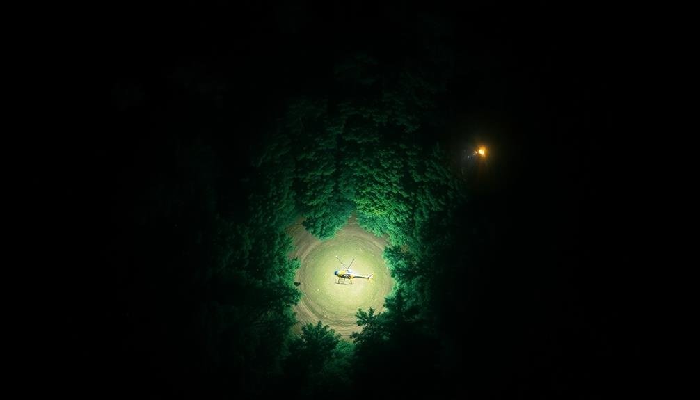
How can rescuers locate and save wildlife in the dark? Thermal imaging technology has revolutionized nocturnal wildlife rescue operations. This powerful tool detects heat signatures, allowing you to spot animals in complete darkness, dense vegetation, or challenging terrain.
You'll use a thermal camera to scan the area, identifying warm-blooded creatures as bright spots against cooler backgrounds. This technique is particularly effective for finding injured or trapped animals that might otherwise go unnoticed.
It's also useful for tracking elusive nocturnal species without disturbing their natural behavior.
When using thermal imaging, you'll need to take into account factors like ambient temperature and animal size. Smaller animals may be harder to detect, while larger ones stand out more clearly.
You'll also want to familiarize yourself with the thermal signatures of different species to accurately identify and locate your target.
Thermal imaging isn't just for locating animals; it's also invaluable for planning safe rescue routes and avoiding potential hazards in low-light conditions.
GPS Tracking of Endangered Species

While thermal imaging excels at locating animals in the dark, GPS tracking offers a different advantage for wildlife rescue. You'll find that GPS collars and tags allow you to monitor endangered species' movements over extended periods. This technology provides essential data on migration patterns, habitat use, and potential threats.
When you're implementing GPS tracking, consider these key factors:
| Factor | Importance |
|---|---|
| Battery life | Critical |
| Size and weight | Species-specific |
| Data transmission | Regular updates |
| Durability | Environment-dependent |
| Cost | Budget considerations |
You'll need to choose the right GPS device for each species, ensuring it doesn't impede the animal's natural behavior. By analyzing the collected data, you can identify areas where animals are most vulnerable and focus your rescue efforts accordingly.
GPS tracking also helps you detect sudden changes in an animal's movement, which could indicate injury or distress. You'll be able to respond quickly to these situations, potentially saving the animal's life. Additionally, the data you gather can inform conservation strategies and habitat protection efforts, contributing to the long-term survival of endangered species.
Aerial Surveys for Habitat Assessment
When it comes to evaluating wildlife habitats on a large scale, aerial surveys are an invaluable tool. You'll find that these surveys provide a thorough view of ecosystems, allowing you to assess vegetation patterns, water sources, and landscape features essential for wildlife survival.
To conduct an aerial survey, you'll typically use aircraft or drones equipped with high-resolution cameras and sensors. You can capture detailed imagery and data on terrain, forest cover, and even animal populations. This method is particularly useful for monitoring hard-to-reach areas or vast territories that would be impractical to survey on foot.
You'll want to plan your surveys during ideal weather conditions and seasons when visibility is best. As you analyze the collected data, you can identify changes in habitat quality, detect signs of human encroachment, and spot potential threats to wildlife.
Drone-Delivered Emergency Aid Packages
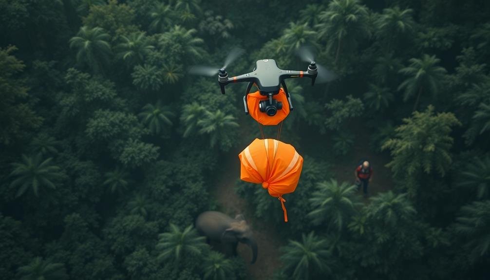
Numerous wildlife rescue operations have embraced drone technology for delivering emergency aid packages. You'll find these unmanned aerial vehicles playing a vital role in providing rapid assistance to animals in distress. Drones can reach remote or dangerous locations quickly, bypassing obstacles that might hinder ground-based rescue efforts.
When you're planning a drone-delivered aid mission, you'll need to take into account the following:
- Payload capacity: Verify your drone can carry the necessary supplies without compromising flight performance.
- Flight range: Calculate the distance to the target area and choose a drone with sufficient battery life.
- Environmental factors: Account for wind, temperature, and terrain that may affect the drone's operation.
You'll find drones particularly useful for delivering food, water, and medical supplies to injured or stranded animals. They're also effective for dropping tracking devices on larger animals to monitor their movements and health.
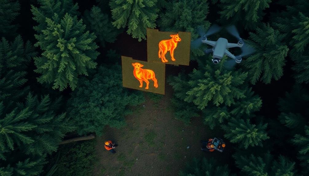
AI-Powered Animal Behavior Analysis
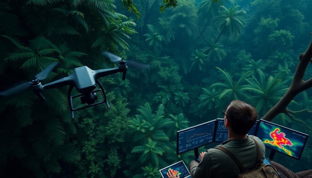
Through AI-powered animal behavior analysis, wildlife rescuers can gain unprecedented insights into the patterns and needs of distressed animals. You'll find that this technology utilizes machine learning algorithms to process vast amounts of video footage from remote cameras and drones.
These systems can identify individual animals, track their movements, and detect unusual behaviors that may indicate distress or injury.
You can rely on AI to alert you to potential emergencies in real-time. For instance, it can detect when an animal is limping, showing signs of illness, or trapped in a dangerous situation. This early warning system allows you to respond quickly and effectively, potentially saving more lives.
AI analysis also helps you understand long-term behavioral changes in wildlife populations. You'll be able to identify shifts in migration patterns, feeding habits, or social interactions that may signal broader environmental issues.
This information is essential for developing proactive conservation strategies and preventing future rescue scenarios.
Frequently Asked Questions
How Are Wildlife Rescuers Trained to Use Remote Surveillance Technology?
You'll learn to operate drones, thermal cameras, and GPS tracking devices. You're trained in data analysis, wildlife behavior, and ethical guidelines. You'll practice simulations and field exercises to master remote monitoring techniques for effective animal rescue operations.
What Are the Legal Restrictions on Using Drones for Wildlife Rescue?
You'll need to check local laws, as drone use for wildlife rescue is often restricted. You can't fly in national parks or near airports. Always obtain proper permits and follow FAA regulations for commercial drone operations.
How Do Rescue Teams Coordinate With Local Authorities During Remote Operations?
You'll need to establish clear communication channels with local authorities. Set up briefings, share real-time data, and designate liaison officers. Coordinate on permits, airspace restrictions, and emergency protocols. Keep them updated on your team's movements and findings.
What Are the Costs Associated With Implementing These High-Tech Rescue Techniques?
You'll find implementing high-tech rescue techniques can be costly. You're looking at expenses for equipment like drones, thermal cameras, and tracking devices. You'll also need to budget for training personnel and maintaining the technology.
How Do Rescuers Minimize Stress on Animals During Remote Surveillance and Intervention?
You'll minimize stress by keeping your distance, using quiet drones, and employing thermal cameras for nighttime operations. You should limit intervention to critical situations, use sedation when necessary, and work quickly to reduce animal exposure.
In Summary
You've now explored cutting-edge wildlife rescue techniques using remote surveillance. From thermal imaging to AI-powered behavior analysis, these methods are revolutionizing conservation efforts. By embracing these technologies, you're not just observing wildlife; you're actively participating in their protection. Remember, it's not about replacing human involvement, but enhancing it. As you move forward, consider how you can incorporate these tools into your own conservation work. The future of wildlife rescue is in your hands.
As educators and advocates for responsible drone use, we’re committed to sharing our knowledge and expertise with aspiring aerial photographers.


Leave a Reply