
Five cutting-edge property measurement services are transforming real estate imagery. You'll find aerial mapping solutions using drones for detailed property views, 3D scanning services creating virtual walkthroughs, and AI-powered technologies enhancing measurement accuracy. LiDAR-enhanced surveys offer precise 3D models, capturing intricate details even in complex properties. Photogrammetry techniques produce accurate floor plans and volumetric measurements from multiple photographs. These innovative services reduce costs, minimize human error, and provide thorough property analysis. They're integrating seamlessly with existing real estate software, streamlining workflows for professionals. Discover how these technologies are reshaping the way you view, measure, and market properties.
Key Takeaways
- Aerial mapping solutions use drones and high-resolution cameras for detailed property imagery and precise measurements.
- 3D property scanning services create digital replicas, enabling virtual walkthroughs and accurate measurements.
- AI-powered measurement technologies analyze data to generate detailed floor plans and 3D models with minimal human input.
- LiDAR-enhanced property surveys capture intricate details rapidly, creating highly precise 3D models of properties.
- Photogrammetry uses multiple photographs to produce accurate 3D models, floor plans, and volumetric measurements for properties.
Aerial Mapping Solutions
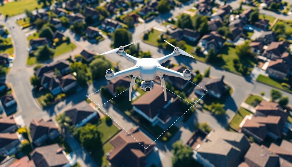
Aerial mapping solutions have revolutionized property measurement in real estate. You'll find that these cutting-edge technologies offer unprecedented accuracy and efficiency in surveying properties. By utilizing drones and high-resolution cameras, aerial mapping captures detailed images and data from above, providing a thorough view of the property's layout and features.
With aerial mapping, you can quickly obtain precise measurements of land boundaries, building footprints, and topographical features. This technology eliminates the need for time-consuming on-site surveys, reducing costs and minimizing potential human errors.
You'll appreciate how aerial mapping solutions generate 3D models and orthomosaic maps, allowing for in-depth analysis of property characteristics. These advanced tools enable you to assess hard-to-reach areas, such as steep terrains or large estates, with ease.
You'll find that aerial mapping is particularly useful for evaluating agricultural land, commercial properties, and residential developments. The data collected can be seamlessly integrated into Geographic Information Systems (GIS) for further analysis and planning.
3D Property Scanning Services
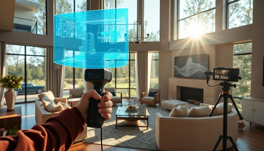
While aerial mapping provides a thorough view from above, 3D property scanning services offer an in-depth look at a property's interior and exterior details. You'll find these scans incredibly useful for creating accurate floor plans, measuring spaces, and showcasing properties virtually.
3D scanners use laser technology to capture millions of data points, creating a detailed digital replica of the property. You can navigate through this virtual model as if you're walking through the actual space. It's an invaluable tool for real estate professionals, architects, and potential buyers.
With 3D scans, you'll get precise measurements of rooms, walls, windows, and doors. This eliminates the need for manual measurements and reduces human error. You can also generate 2D floor plans from the 3D model, saving time and ensuring accuracy.
These scans are particularly beneficial for remote property viewings. Potential buyers can explore the property in detail without physically being there. You can even integrate these scans with virtual reality technology for an immersive experience.
3D property scanning services are revolutionizing how you measure, showcase, and sell properties in the digital age.
AI-Powered Measurement Technologies

In light of recent technological advancements, AI-powered measurement technologies are transforming property measurement services. These cutting-edge solutions leverage artificial intelligence to streamline and enhance the accuracy of property measurements, saving you time and money.
You'll find that AI-powered tools can quickly analyze data from various sources, including 3D scans, photographs, and satellite imagery. They can automatically detect and measure room dimensions, calculate square footage, and even identify architectural features. This technology greatly reduces human error and guarantees consistent results across multiple properties.
AI algorithms can also generate detailed floor plans and 3D models with minimal human intervention. You'll appreciate how these tools can identify potential issues or discrepancies in property measurements, flagging areas that may require further inspection.
As a real estate professional, you'll benefit from the speed and efficiency of AI-powered measurements. You can provide clients with more accurate property information, make better-informed decisions, and improve your overall service quality.
Additionally, these technologies often integrate seamlessly with existing real estate software, making it easy to incorporate them into your workflow and stay ahead of the competition.
LiDAR-Enhanced Property Surveys
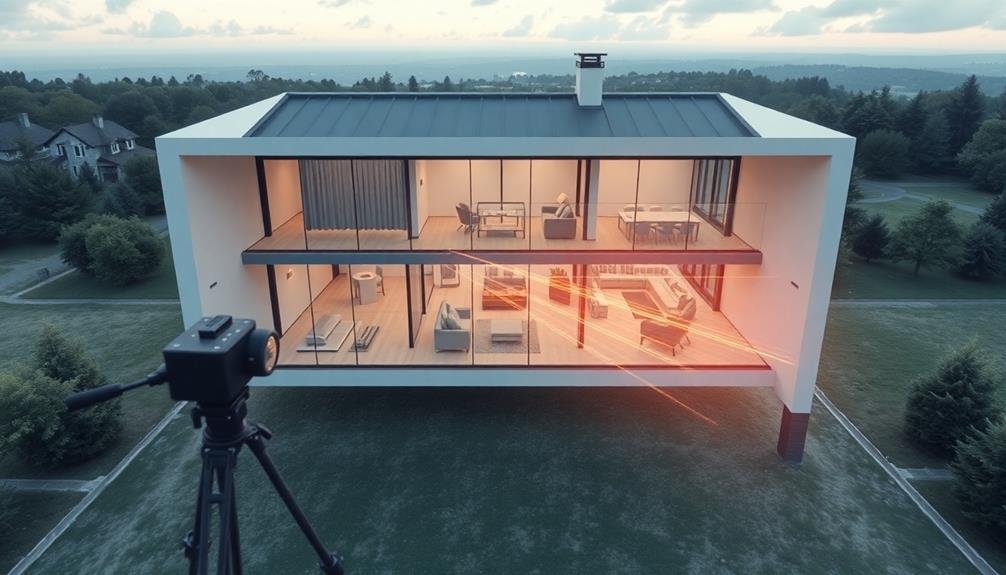
Recently, LiDAR technology has revolutionized property surveys in the real estate industry. You'll find that LiDAR-enhanced surveys provide unprecedented accuracy and detail in property measurements. This cutting-edge technology uses laser pulses to create highly precise 3D models of buildings and landscapes.
When you opt for a LiDAR survey, you're getting an extensive view of the property. It captures intricate details like roof pitches, wall heights, and even minor surface irregularities. You'll appreciate how quickly these surveys can be completed, often in a fraction of the time traditional methods require.
LiDAR's ability to penetrate vegetation is particularly valuable for large or heavily wooded properties. You can now get accurate measurements of land contours and structures that were previously obscured. This technology also excels in capturing hard-to-reach areas, eliminating the need for dangerous manual measurements.
For real estate professionals, LiDAR surveys offer a competitive edge. You can provide clients with detailed, immersive property visualizations and precise measurements. This technology is especially useful for complex properties or those with unique features, ensuring you have the most accurate information for valuations and marketing materials.
Photogrammetry for Real Estate

Photogrammetry's applications in real estate have expanded significantly in recent years. This technique uses multiple photographs to create accurate 3D models and measurements of properties. You'll find it increasingly useful for both interior and exterior property assessments.
When you're selling or buying a property, photogrammetry can provide precise floor plans and volumetric measurements. It's particularly valuable for complex structures or properties with unique features. You can use these detailed models to showcase a property's layout, calculate square footage, or plan renovations.
Real estate professionals are adopting photogrammetry for virtual tours and immersive property presentations. You'll be able to offer potential buyers a more engaging experience, allowing them to explore properties remotely. This technology also helps in creating accurate property inventories and condition reports.
For appraisers and surveyors, photogrammetry offers a time-efficient method to gather detailed property data. You can use drone-based photogrammetry for large properties or difficult-to-access areas. It's becoming an essential tool in property valuation, zoning compliance, and urban planning.
As the technology advances, you'll see photogrammetry integrating with other digital tools, enhancing the overall real estate measurement and visualization process.
Frequently Asked Questions
How Much Does Property Measurement Service Cost for an Average-Sized Home?
You'll typically spend between $150 to $500 for property measurement services on an average-sized home. Costs vary depending on the property's complexity, location, and the level of detail required in the measurements and reports.
Are These Technologies Legal to Use for Residential Property Assessments?
You'll find that these technologies are generally legal for residential property assessments. However, you should always check local regulations, as some areas may have restrictions on drone usage or specific imaging techniques for privacy concerns.
Can Property Owners Request Specific Measurement Services for Insurance Purposes?
You can request specific measurement services for insurance purposes. Many companies offer tailored assessments to meet your needs. It's a good idea to contact your insurance provider first to guarantee they'll accept the measurements you're planning to obtain.
How Long Does It Typically Take to Complete a Comprehensive Property Measurement?
You'll find that thorough property measurements typically take 1-3 hours, depending on the size and complexity of your property. For larger or more intricate spaces, it might extend to a full day's work.
Are There Privacy Concerns Associated With Using Advanced Property Measurement Technologies?
Yes, you should be aware of privacy concerns with advanced property measurement tech. It can capture detailed interior layouts and personal information. You'll want to guarantee data protection measures are in place and consent is obtained from property owners.
In Summary
You've seen how these five innovative measurement services are transforming real estate imagery. From aerial mapping to AI-powered tech, they're making property assessment faster and more accurate than ever. As you explore these options, you'll find they're not just changing how we view properties, but also how we buy, sell, and develop them. Embrace these tools to stay ahead in the competitive real estate market. They're the future of property visualization and analysis.
As educators and advocates for responsible drone use, we’re committed to sharing our knowledge and expertise with aspiring aerial photographers.


Leave a Reply