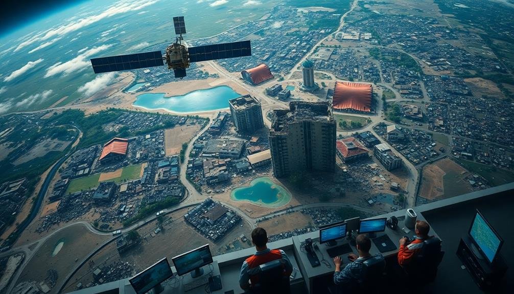
Satellite imagery falls short in disaster analysis due to several key limitations. You'll find that resolution constraints make it difficult to detect small-scale damage, while infrequent update cycles can miss critical moments. Cloud cover often interferes with image clarity, leading to misinterpretation. Urban environments pose challenges with shadows and reflective surfaces distorting data. The high costs of satellite operations can restrict access for smaller organizations. Real-time capabilities are limited, causing delays in vital information delivery. These shortcomings highlight the need for integrating satellite data with other technologies for thorough disaster assessment. Exploring these limitations further reveals the complexities of relying solely on satellite imagery in emergency situations.
Limited Resolution and Detail
Peering into satellite imagery can sometimes feel like looking through a foggy window. You're trying to assess the damage after a natural disaster, but the images aren't as clear as you'd hoped. Even with advanced technology, satellite resolution often falls short of providing the detail you need for accurate disaster analysis.
You'll find that most publicly available satellite imagery has a resolution of 10 to 30 meters per pixel. This means small-scale damage, like individual building collapses or localized flooding, can be easily missed. You're left with a broad overview rather than the fine-grained details essential for effective disaster response.
The limitations become even more apparent when you're dealing with urban areas. Dense cityscapes can blur into indistinguishable blocks, making it challenging to identify specific structures or assess their condition. You'll struggle to differentiate between rubble and intact buildings, or to spot signs of trapped survivors.
Weather conditions further complicate matters. Cloud cover, smoke, or atmospheric haze can obscure large portions of the affected area, leaving you with incomplete data. You're forced to make decisions based on partial information, potentially compromising the effectiveness of relief efforts.
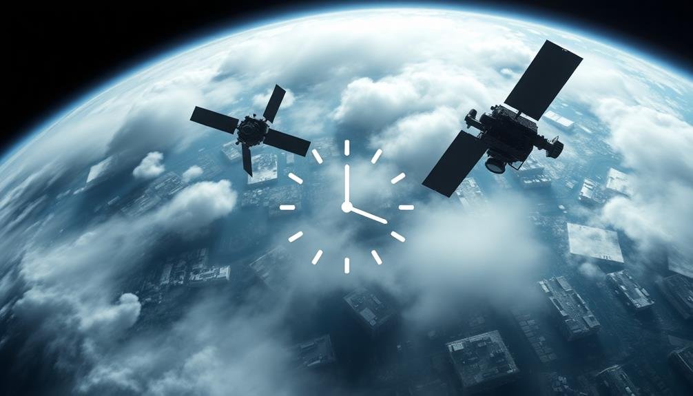
Infrequent Update Cycles
You'll find that satellite imagery often suffers from infrequent update cycles, leading to limited temporal resolution.
This means you might miss vital moments during a disaster event, as the satellite may not capture images at the most essential times.
Consequently, you're left with potentially outdated damage assessments, which can hinder effective disaster response and recovery efforts.
Limited Temporal Resolution
Satellite imagery often suffers from limited temporal resolution, which can hinder its effectiveness in disaster analysis. You'll find that most satellites don't capture images of the same location frequently enough to provide real-time or near-real-time information during rapidly evolving disasters. This limitation can leave you with outdated information when you need it most.
For example, if you're tracking a wildfire, you might only receive updated imagery every few days or even weeks. By then, the fire's boundaries could have drastically changed, rendering your analysis less useful for emergency responders.
Similarly, in flood situations, water levels can rise and recede quickly, but infrequent satellite passes might miss significant stages of the event.
You'll also face challenges when trying to assess immediate damage after earthquakes or hurricanes. The time gap between the disaster's occurrence and the next available satellite image can be vital for rescue and relief efforts.
This delay can lead to missed opportunities for timely interventions and potentially cost lives. To overcome this limitation, you'll need to complement satellite data with other sources of information for more effective disaster management.
Missed Critical Event Moments
Significant event moments often slip through the cracks due to infrequent satellite update cycles. You'd expect satellites to capture every vital development during a disaster, but that's not always the case. Most commercial satellites only revisit the same location every few days or weeks, leaving substantial gaps in coverage. This means you might miss the exact moment a levee breaks, a wildfire spreads, or a landslide occurs.
These missed moments can have serious consequences for disaster response and analysis. You'll find it difficult to pinpoint the exact timing of events, which is essential for understanding how disasters unfold and for planning future mitigation strategies. Without capturing these significant moments, you're left with an incomplete picture of the disaster's progression.
To overcome this limitation, you'd need a constellation of satellites providing near-continuous coverage. However, this is expensive and technologically challenging.
Alternatively, you could combine satellite imagery with other data sources like ground sensors or social media reports. This approach helps fill in the gaps and provides a more thorough view of disaster events, ensuring you don't miss those pivotal moments that can make all the difference in disaster analysis and response.
Outdated Damage Assessments
Disaster response teams' efforts can be hampered by outdated damage assessments due to infrequent satellite update cycles. You'll find that most commercial satellites only capture images of a specific area every few days or weeks. This means the data you're relying on mightn't reflect the current situation on the ground, especially in rapidly evolving disasters.
During floods, fires, or earthquakes, conditions can change dramatically within hours. By the time you receive updated imagery, it may already be obsolete. This lag can lead to misallocation of resources or delayed responses to critical areas. You might send teams to locations that no longer need assistance while overlooking newly affected zones.
To combat this issue, you'd need more frequent passes over disaster-prone areas, which is costly and technologically challenging. Some organizations are exploring alternatives like drone imagery or crowdsourced data to fill the gaps between satellite updates. However, these methods have their own limitations in scale and reliability.
Until satellite technology advances to provide near-real-time updates, you'll need to supplement imagery with other data sources to guarantee your damage assessments remain as current as possible.
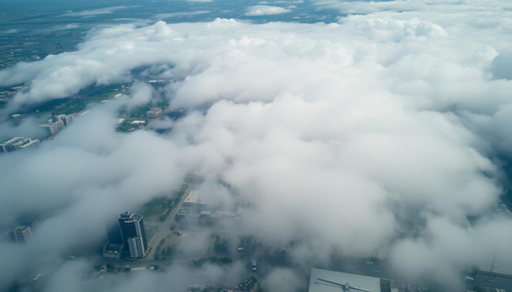
Cloud Cover Interference

When analyzing satellite imagery for disaster response, you'll often encounter cloud cover interference.
This obstruction can obscure essential ground features, making it challenging to assess the full extent of damage or identify areas in urgent need of aid.
You'll find that cloud cover not only delays timely disaster assessment but can also lead to misinterpretation of data, potentially misdirecting relief efforts or underestimating the severity of the situation.
Obscured Ground Features
Despite its many advantages, satellite imagery faces a significant challenge in the form of cloud cover interference. When you're analyzing disaster-affected areas, clouds can obscure vital ground features, making it difficult to assess the full extent of damage or identify areas in need of immediate assistance.
Cloud cover doesn't just block your view; it can also cast shadows that alter the appearance of the landscape, potentially leading to misinterpretation of data. In some cases, you might mistake cloud shadows for flooded areas or debris fields. This interference can delay essential decision-making processes and hinder relief efforts.
Even when clouds don't completely obstruct your view, they can still impact image quality. Thin clouds or haze can reduce contrast and blur important details, making it harder for you to distinguish between different types of terrain or structures. In rapidly evolving disaster situations, this loss of clarity can be vital.
To overcome these challenges, you'll often need to rely on multiple images taken over time or use advanced processing techniques to remove cloud interference. However, these solutions aren't always feasible in time-sensitive disaster response scenarios.
Delayed Disaster Assessment
Due to persistent cloud cover, satellite imagery often faces significant delays in providing timely disaster assessments. You'll find that this interference can hinder essential decision-making processes during emergency response efforts.
Cloud cover can obscure the affected areas for days or even weeks, preventing satellites from capturing clear images of the disaster's impact.
These delays can have serious consequences:
- Rescue teams may struggle to identify hard-hit areas quickly
- Aid distribution efforts might be misdirected or inefficient
- Damage assessments could be inaccurate or outdated
You'll notice that this problem is particularly acute in regions prone to frequent cloud cover, such as tropical or coastal areas. In these locations, it's not uncommon for satellite imagery to be unavailable for extended periods during critical post-disaster phases.
This limitation forces emergency responders to rely on alternative, often less thorough, sources of information.
To mitigate this issue, you might consider complementing satellite imagery with other remote sensing technologies, such as radar or LiDAR, which can penetrate cloud cover.
However, these alternatives may not always be readily available or cost-effective, especially in resource-constrained environments.
Misinterpretation of Data
Cloud cover interference doesn't just delay disaster assessments; it can also lead to significant misinterpretation of satellite imagery data. When clouds obstruct the view of the Earth's surface, you're left with incomplete or distorted information about the extent of a disaster. This can result in underestimating or overestimating the damage, potentially affecting resource allocation and response efforts.
You'll find that cloud cover can create false positives or negatives in your analysis. For instance, shadows cast by clouds might be mistaken for flooded areas, or cloud formations could be misinterpreted as smoke from wildfires. These errors can lead to misguided decisions and inefficient use of resources during critical response times.
Moreover, you'll need to take into account that cloud interference can vary across different satellite sensors and imaging techniques. Optical sensors are particularly vulnerable to cloud obstruction, while radar-based systems can penetrate clouds but may introduce their own set of interpretation challenges.
To mitigate these issues, you should combine multiple data sources, use advanced image processing techniques, and rely on expert analysis to validate your findings and avoid potentially costly misinterpretations in disaster response scenarios.
Restricted Viewing Angles
Satellites' limited viewing angles pose a considerable challenge in disaster analysis. When you're relying on satellite imagery to evaluate the impact of natural disasters, you're often constrained by the fixed orbits and predetermined paths of these space-based sensors. This restriction means you can't always capture images from the most advantageous angles or at the most critical moments during a disaster event.
The limitations of restricted viewing angles include:
- Obstructed views of affected areas due to cloud cover or smoke
- Inability to capture rapidly changing conditions in real-time
- Difficulty in evaluating damage to vertical structures like buildings
You'll find that these constraints can greatly hinder your ability to gather thorough data about a disaster's impact. For instance, satellite imagery mightn't reveal the full extent of flooding in urban areas where tall buildings obstruct the view.
Similarly, you can't always rely on satellites to provide up-to-the-minute information during fast-moving events like wildfires or hurricanes. To overcome these limitations, you'll need to supplement satellite data with other sources, such as aerial photography or ground-based observations, to get a more complete picture of the disaster's effects.
High Operational Costs

Substantial financial resources are required to operate and maintain satellite systems for disaster analysis. You'll find that the costs associated with satellite imagery are prohibitively high for many organizations. The expenses include launching satellites, maintaining them in orbit, and replacing them when they become obsolete or malfunction. These costs can run into billions of dollars over the lifetime of a satellite system.
You'll also need to evaluate the ongoing operational expenses. These include ground station maintenance, data processing, and the salaries of highly skilled personnel to interpret the imagery. Additionally, you'll face significant costs for specialized software and hardware required to analyze and store vast amounts of satellite data.
The high price tag often limits access to satellite imagery for smaller organizations and developing countries. You might find that this creates a disparity in disaster preparedness and response capabilities worldwide.
Moreover, the expense can lead to difficult decisions about allocating resources between satellite imagery and other critical disaster management tools. You'll need to carefully weigh the benefits against the substantial financial commitment required to effectively utilize satellite imagery in disaster analysis.
Delayed Data Processing
While the financial burden of satellite systems is significant, you'll find that time constraints present another challenge in disaster analysis. When disaster strikes, you need information quickly, but satellite data processing often lags behind. This delay can severely impact response efforts and decision-making during critical periods.
The time-consuming nature of satellite data processing stems from several factors:
- Raw data must be downloaded from satellites, which can take hours depending on their orbital position.
- Complex algorithms are required to correct for atmospheric distortions and georeference images.
- High-resolution imagery produces massive datasets that require substantial computing power to process.
You'll face additional delays if cloud cover obscures the affected area, necessitating multiple satellite passes. Even with expedited processing, it can take 24 to 48 hours to receive usable imagery. In rapidly evolving disaster situations, this lag can render the data obsolete by the time it reaches decision-makers.
To mitigate these delays, you might consider complementing satellite imagery with other rapid-response tools like drones or ground-based sensors. However, the challenge of timely satellite data processing remains a significant hurdle in effective disaster analysis and response.
Limited Spectral Information
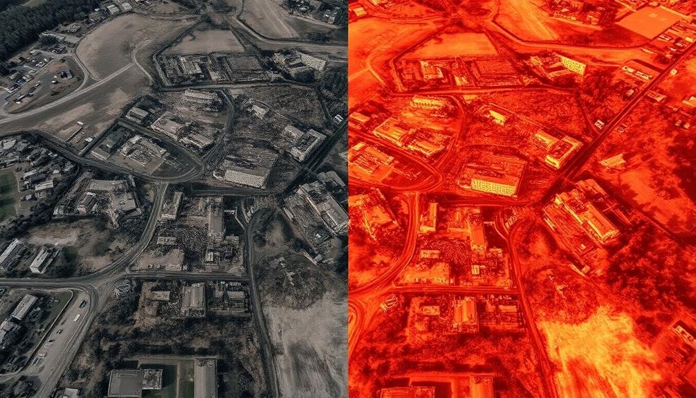
You'll find that satellite imagery often captures a narrow wavelength range, limiting the spectral information available for disaster analysis.
This restriction can make it challenging to distinguish between different types of materials or surfaces in the affected areas.
Additionally, you'll encounter spectral mixing challenges, where multiple elements within a single pixel can complicate accurate interpretation of the image data.
Narrow Wavelength Range
Despite its many advantages, satellite imagery for disaster analysis often faces a significant limitation: a narrow wavelength range. This constraint means you're restricted to a small portion of the electromagnetic spectrum, typically visible light and near-infrared. While these wavelengths can provide valuable information, they don't tell the whole story.
You'll find that this narrow range limits your ability to detect and analyze certain disaster-related phenomena. For instance, you might miss thermal anomalies, soil moisture changes, or atmospheric composition shifts that could be vital in understanding the full scope of a disaster. Additionally, you'll struggle to penetrate cloud cover or dense vegetation, which can obscure important ground-level details.
To illustrate the impact of this limitation, consider these scenarios:
- You can't detect underground heat from an impending volcanic eruption.
- You're unable to identify chemical pollutants in flood waters.
- You miss early signs of drought stress in vegetation before visible symptoms appear.
To overcome these challenges, you'll need to complement satellite imagery with other remote sensing technologies or ground-based observations. By integrating multiple data sources, you'll gain a more thorough understanding of disaster situations and improve your analysis capabilities.
Spectral Mixing Challenges
Grappling with spectral mixing challenges presents another significant hurdle in satellite imagery analysis for disaster assessment. When you're analyzing satellite images, you're often dealing with pixels that contain a mix of different surface materials. This spectral mixing can make it difficult to accurately identify and classify specific features or changes in the aftermath of a disaster.
You'll encounter situations where multiple materials contribute to the spectral signature of a single pixel, leading to potential misinterpretations. For example, in urban areas affected by flooding, a pixel might contain a mix of water, vegetation, and building materials. This complexity can obscure important details and hinder your ability to accurately assess damage or plan relief efforts.
| Material | Spectral Signature | Potential Confusion |
|---|---|---|
| Water | Low reflectance | Shadows, dark roofs |
| Vegetation | High NIR reflectance | Algae-covered water |
| Concrete | High reflectance | Dry soil, sand |
| Debris | Mixed reflectance | Varied surfaces |
| Mud | Low-mid reflectance | Shallow water |
To overcome these challenges, you'll need to employ advanced techniques like spectral unmixing algorithms or use higher resolution imagery. However, these solutions often come with increased costs and processing time, potentially delaying essential disaster response efforts.
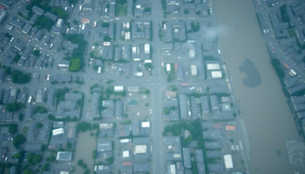
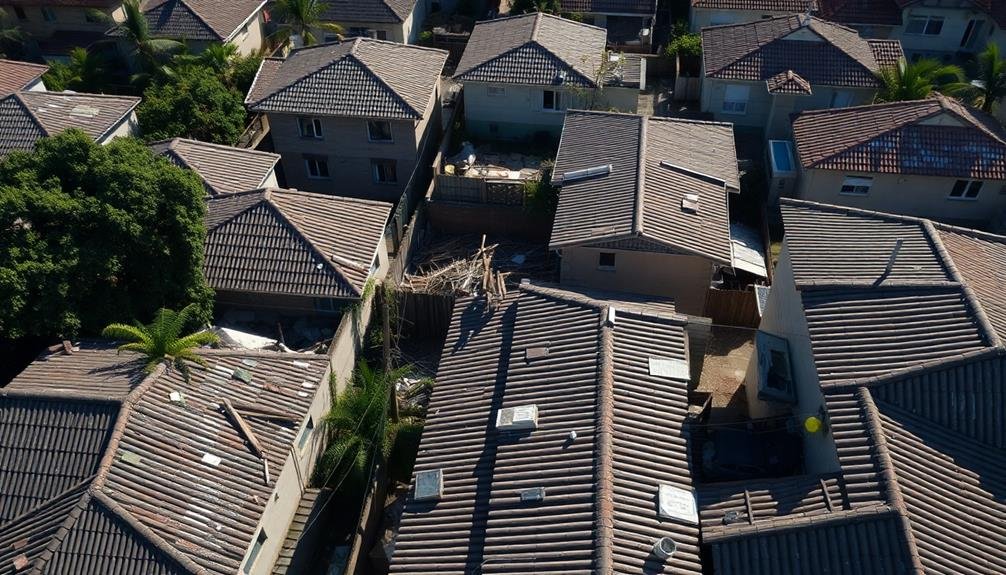
Difficulties in Urban Environments
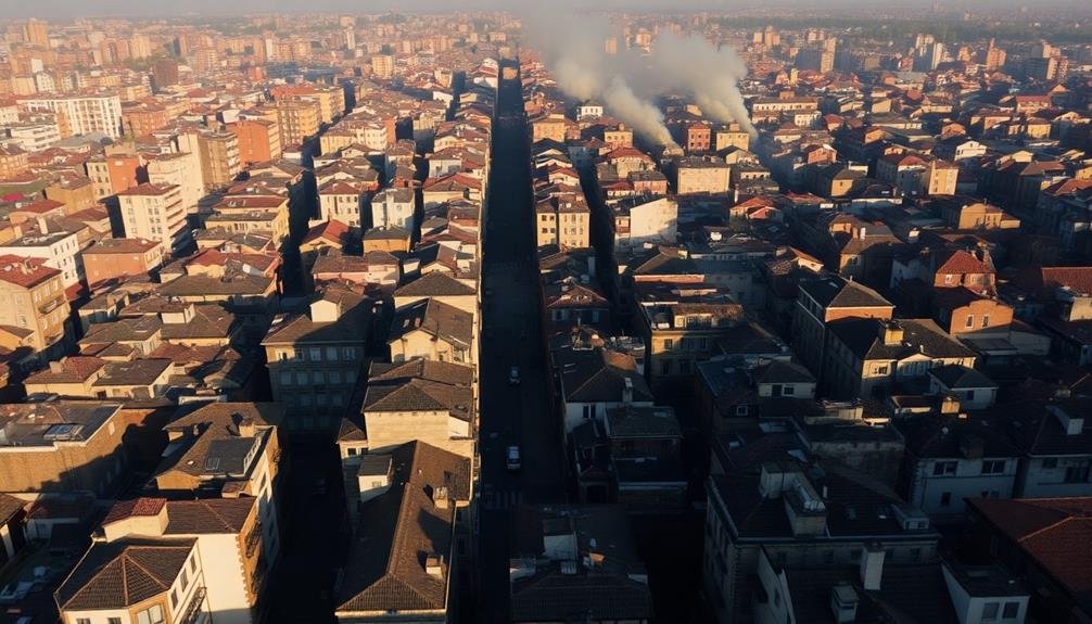
Numerous challenges arise when using satellite imagery for disaster analysis in urban environments.
You'll find that the complex layout of cities, with their tall buildings, narrow streets, and densely packed structures, can obstruct the view from above. This makes it difficult to accurately assess damage or identify areas in need of immediate assistance.
Urban areas also present a unique problem of rapid change. Cities are constantly evolving, with new construction and demolition occurring regularly. This means that your satellite imagery may quickly become outdated, leading to potential errors in disaster analysis.
Another significant hurdle you'll face is the presence of mixed pixels. In urban settings, a single pixel can contain multiple objects or materials, making it challenging to interpret the data accurately. This spectral mixing can lead to misclassification of damage or misidentification of critical infrastructure.
- Tall buildings casting shadows on streets and smaller structures
- Complex networks of underground utilities invisible from above
- Reflective surfaces like glass and metal distorting imagery
You'll need to combine satellite imagery with other data sources and employ advanced processing techniques to overcome these urban-specific challenges and improve the accuracy of your disaster analysis.
Lack of Real-Time Capabilities
While urban environments pose unique challenges, the lack of real-time capabilities in satellite imagery presents another significant hurdle in disaster analysis.
You'll find that most satellite imagery isn't instantly available, often taking hours or even days to reach analysts. This delay can be critical in rapidly evolving disaster situations, where conditions on the ground change quickly.
You're limited by orbital paths and revisit times of satellites, which may not align with when you need the data most. Cloud cover can further hinder timely image acquisition.
Even when images are captured, the processing and analysis required to extract useful information takes additional time.
You'll notice that this lag severely impacts your ability to make quick, informed decisions during disaster response. It's particularly problematic for evaluating immediate damage, coordinating rescue efforts, or planning evacuation routes.
While some near-real-time systems exist, they often sacrifice image quality or coverage area for speed. You're left with a trade-off between timeliness and detail, which can compromise the effectiveness of your disaster analysis and response efforts.
Inadequate Small-Scale Damage Detection
Many satellite imagery systems struggle to detect small-scale damage effectively. While these systems excel at capturing large-scale destruction, they often miss vital details that can greatly impact disaster response efforts.
You'll find that the resolution of most satellite images isn't high enough to identify smaller structural damages or localized flooding accurately. This limitation becomes particularly problematic in densely populated urban areas or regions with complex infrastructure.
You're likely to encounter situations where:
- Individual building damage goes unnoticed
- Small-scale landslides or erosion are overlooked
- Minor road obstructions remain undetected
As a result, you may underestimate the extent of damage in affected areas, leading to inadequate resource allocation and delayed response times. This shortcoming can have serious consequences for vulnerable populations who require immediate assistance.
To overcome this challenge, you'll need to supplement satellite imagery with other data sources. Ground-level assessments, drone footage, and social media reports can provide valuable insights into small-scale damage.
Frequently Asked Questions
How Does Satellite Imagery Compare to Drone Footage for Disaster Analysis?
You'll find that drone footage often provides more detailed, real-time visuals for disaster analysis compared to satellite imagery. It's more flexible, allowing for lower altitude captures and quicker deployment, especially in rapidly changing situations.
Can Artificial Intelligence Improve the Accuracy of Satellite Disaster Assessments?
Yes, AI can greatly improve satellite disaster assessments. You'll find that machine learning algorithms can quickly analyze vast amounts of imagery, detecting subtle changes and patterns that humans might miss. This enhances accuracy and speeds up response times.
What Are the Legal Implications of Using Satellite Imagery in Disaster Response?
You'll face legal challenges when using satellite imagery for disaster response. Privacy concerns, data ownership issues, and potential liability for inaccurate assessments are key considerations. Always guarantee you're complying with local and international laws governing satellite data use.
How Do Different Types of Disasters Affect Satellite Imagery Effectiveness?
You'll find that satellite imagery effectiveness varies by disaster type. Floods and wildfires are easily visible, while earthquakes and tsunamis may be harder to detect. Cloud cover can obscure imagery for hurricanes and volcanic eruptions.
Are There Any Alternatives to Satellite Imagery for Large-Scale Disaster Assessment?
You can use aerial photography, drone surveys, LiDAR scanning, and ground-based sensor networks as alternatives to satellite imagery. Social media analysis and crowdsourcing platforms also provide valuable real-time data for large-scale disaster assessment and response efforts.
In Summary
You've seen how satellite imagery, while valuable, has significant limitations for disaster analysis. You're faced with resolution constraints, infrequent updates, and weather interference. You can't always get the angles you need, and costs are high. You're missing out on real-time data and struggle with urban areas. Remember, it's tough to spot small-scale damage. To improve disaster response, you'll need to complement satellite data with other information sources.
As educators and advocates for responsible drone use, we’re committed to sharing our knowledge and expertise with aspiring aerial photographers.


Leave a Reply