
Revolutionize your construction projects with drone data analytics. You'll gain unparalleled visibility into project progress, enabling real-time monitoring and quick decision-making. Leverage automated flight planning and appropriate sensors to capture high-quality data across your site. Transform this data into accurate 3D models for precise measurements and clash detection. Enhance safety through regular aerial inspections and risk assessments. Communicate effectively with stakeholders using clear, visually appealing reports tailored to their needs. By embracing drone technology, you'll optimize construction progress, reduce costs, and improve overall project outcomes. Discover how this powerful tool can transform your construction management approach.
Drone Data Collection Techniques
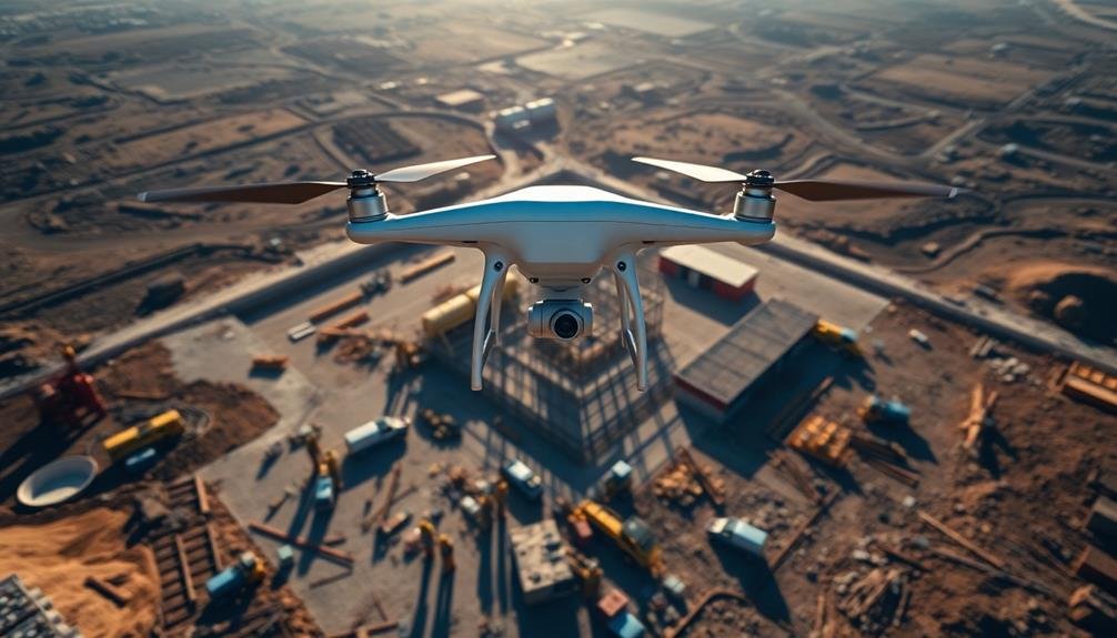
Eyes in the sky, drones have revolutionized data collection across various industries. In construction, they're invaluable for monitoring progress and identifying potential issues. To enhance your drone data collection, focus on these key techniques:
First, plan your flight path carefully. Map out the entire construction site and determine the best routes to capture thorough data. Use automated flight planning software to guarantee consistent coverage and reduce human error.
Next, consider the ideal altitude and speed for your drone. Lower altitudes provide higher resolution images but may require more flights to cover the area.
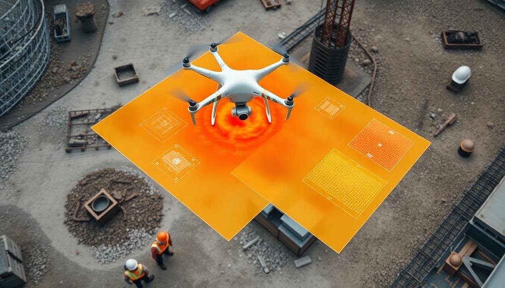
Choose the right sensors for your needs. RGB cameras are great for visual inspections, while thermal cameras can detect heat anomalies. LiDAR sensors offer precise 3D mapping capabilities. Capture data at regular intervals to track progress over time. This consistency allows for accurate comparisons and trend analysis.
Guarantee proper georeferencing by using ground control points. These markers help align your drone data with real-world coordinates, improving accuracy.
Real-Time Progress Monitoring
Through the lens of real-time progress monitoring, drones have become indispensable tools for construction managers. They offer unprecedented visibility into project progress, allowing you to track developments as they happen. By deploying drones regularly, you'll capture up-to-date imagery and data that reflect the current state of your construction site.
You can use this real-time information to make informed decisions quickly. Are there delays in specific areas? You'll spot them immediately. Is work progressing faster than expected? You'll know right away. This timely insight enables you to adjust resources, schedules, and strategies on the fly, optimizing your project's efficiency.
Moreover, real-time monitoring helps you identify potential issues before they escalate. You'll detect safety hazards, quality concerns, or deviations from plans early on, allowing for swift corrective action.
This proactive approach can save time, money, and prevent costly rework.
3D Modeling and Mapping

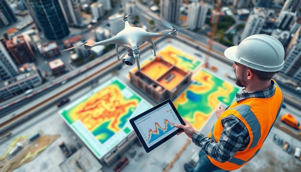
Building on the real-time insights drones provide, 3D modeling and mapping take your project visualization to the next level. These advanced techniques transform raw drone data into detailed, interactive models of your construction site.
You'll create accurate 3D representations of your project using photogrammetry software. This process stitches together thousands of drone-captured images to generate a thorough model. You can then use this model to measure distances, calculate volumes, and analyze terrain features with precision.
3D modeling enables you to detect design clashes early, saving time and resources. You'll spot potential issues before they become costly problems on-site. Additionally, you can use these models for virtual walkthroughs, allowing stakeholders to experience the project in an immersive way.
Mapping capabilities let you generate orthomosaic maps and digital elevation models. These tools provide valuable insights into site topography, drainage patterns, and earthwork calculations.
You'll optimize cut-and-fill operations, plan material placement, and track progress against design plans more effectively.
Safety and Risk Assessment
Drones equipped with advanced sensors and cameras offer unprecedented capabilities for safety monitoring and risk assessment on construction sites. You can use them to conduct regular aerial inspections, identifying potential hazards before they become critical issues.
By analyzing drone-captured data, you'll spot safety violations, unstable structures, or dangerous working conditions that might go unnoticed from ground level.
You'll enhance your ability to assess risks by creating high-resolution maps and 3D models of your construction site. These detailed representations allow you to plan safer work zones, optimize traffic flow, and identify areas prone to accidents.
You can also use thermal imaging to detect overheating equipment or electrical issues, preventing potential fires or equipment failures.
Reporting and Stakeholder Communication
Effective reporting and stakeholder communication are essential for maximizing the value of drone data analytics in construction projects. You'll need to create clear, concise reports that highlight key findings and actionable insights from your drone data analysis.
Focus on presenting information visually through charts, graphs, and annotated imagery to make complex data more accessible to stakeholders. Tailor your reports to different audiences, considering their specific needs and level of technical expertise.
For project managers, emphasize progress tracking, timeline updates, and risk assessments. For executives, highlight cost savings, efficiency gains, and overall project health. Include regular updates on safety metrics and compliance issues for regulatory bodies.
Establish a consistent reporting schedule and format to keep stakeholders informed and engaged. Use cloud-based platforms to share real-time data and collaborate with team members across locations.
Don't forget to incorporate feedback mechanisms to guarantee your reports meet stakeholders' evolving needs. When communicating findings, be prepared to explain your data collection methods, analysis techniques, and any limitations or uncertainties in your results.
This transparency will build trust and credibility with your stakeholders, leading to more effective decision-making and project outcomes.
Frequently Asked Questions
How Much Does Implementing Drone Technology in Construction Typically Cost?
You'll find drone technology costs for construction vary widely. You're looking at $1,000-$10,000 for basic setups, while advanced systems can run $20,000-$100,000+. Don't forget ongoing expenses like software, training, and maintenance.
What Certifications or Licenses Are Required to Operate Drones on Construction Sites?
You'll need a Remote Pilot Certificate from the FAA to operate drones commercially. Additionally, you must register your drone and comply with local regulations. Some construction sites may require specific safety certifications or permissions.
Can Drones Be Used Effectively in Adverse Weather Conditions?
You can use drones in some adverse weather, but they're limited. Wind, rain, and extreme temperatures can affect performance and safety. It's best to avoid flying in harsh conditions to protect your equipment and guarantee accurate data.
How Does Drone Data Integration Affect Existing Construction Management Software Systems?
You'll find that drone data integration enhances existing construction management software. It'll add real-time aerial insights, improving site monitoring and decision-making. You can expect better project visualization, progress tracking, and resource allocation with this integration.
What Are the Potential Legal Implications of Using Drones for Construction Monitoring?
You'll need to take into account privacy laws, airspace regulations, and liability issues when using drones for construction monitoring. It's essential to obtain proper permits, follow FAA guidelines, and make sure you're not infringing on neighboring properties' rights.
In Summary
You've now got the tools to revolutionize your construction projects with drone data analytics. By implementing these techniques, you'll streamline progress monitoring, enhance safety, and improve communication. Don't hesitate to embrace this technology – it's transforming the industry. Remember, the key is to start small, learn from each flight, and gradually expand your drone program. With practice, you'll soon be leveraging drone data to optimize your construction processes like never before.
As educators and advocates for responsible drone use, we’re committed to sharing our knowledge and expertise with aspiring aerial photographers.


Leave a Reply