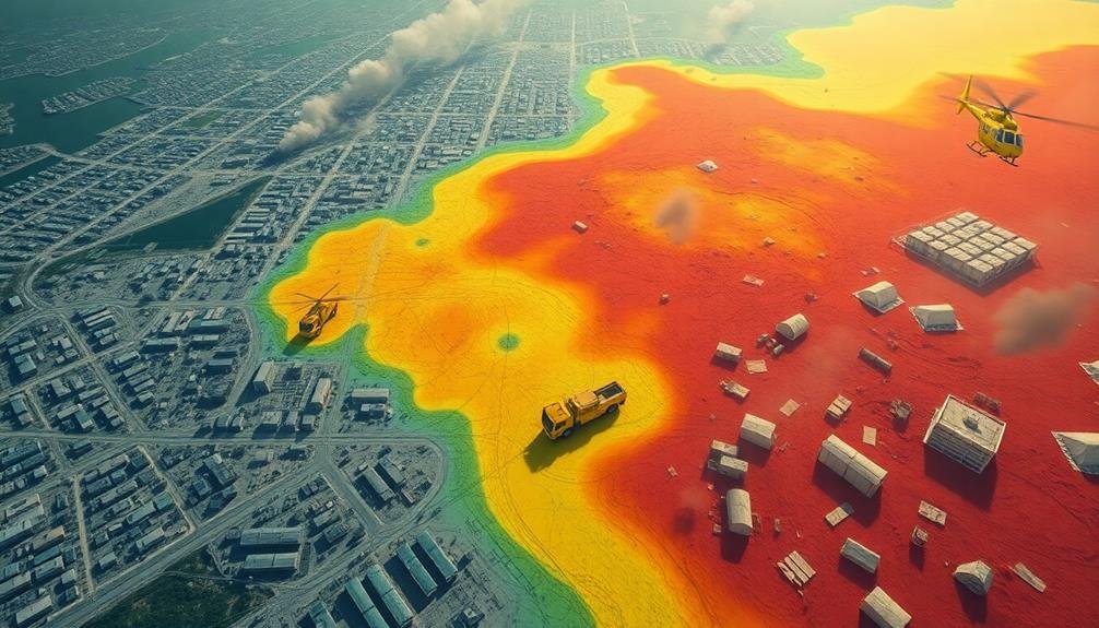
Imagery can reveal critical information about catastrophe aftermath, helping you understand the full impact and guide response efforts. You'll see the extent of structural damage, from collapsed buildings to compromised infrastructure. Environmental changes become apparent, including shifts in vegetation and wildlife habitats. Search and rescue operations use imagery to prioritize areas and plan safe routes. As recovery begins, you can monitor progress, track debris removal, and assess reconstruction. Imagery also aids in optimizing resource allocation by identifying areas of greatest need. This visual data provides invaluable insights for disaster management, offering a thorough view of the situation's evolution.
Extent of Structural Damage
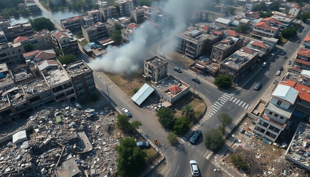
While the full scope of devastation isn't immediately clear, initial assessments reveal widespread structural damage across the affected area. You'll notice collapsed buildings, crumbled infrastructure, and extensive debris scattered throughout the region.
Aerial imagery allows you to quickly identify areas with the most severe destruction, highlighting neighborhoods where entire blocks have been leveled.
As you analyze the images, you'll see varying degrees of damage. Some structures may appear intact from above but have suffered significant internal damage. Look for telltale signs like missing roofs, exposed interiors, or shifted foundations.
Pay attention to vital infrastructure such as bridges, roads, and power lines. You'll often spot downed power lines, buckled roadways, and compromised bridges that hinder rescue and recovery efforts.
Satellite imagery enables you to compare before-and-after shots, helping you quantify the extent of structural damage. You can use this data to estimate the percentage of buildings affected, prioritize areas for immediate assistance, and plan long-term reconstruction efforts.
Environmental Impact Assessment
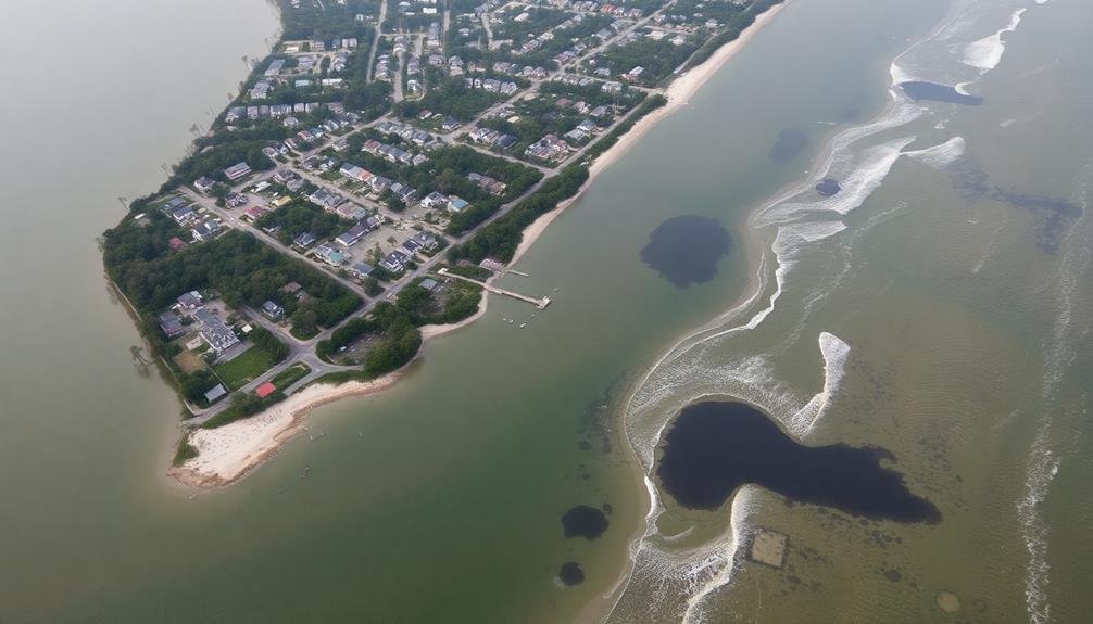
Evaluating the environmental impact reveals the catastrophe's far-reaching consequences on the natural world.
You'll need to analyze satellite imagery and aerial photographs to assess the extent of ecological damage. Look for changes in vegetation patterns, water bodies, and land use. You can identify areas of deforestation, soil erosion, or contamination by comparing pre- and post-disaster images.
Remote sensing techniques allow you to detect:
- Changes in water quality and shoreline alterations
- Shifts in wildlife habitats and migration patterns
- Air pollution plumes and their dispersal
- Impacts on agricultural lands and crop health
Search and Rescue Operations
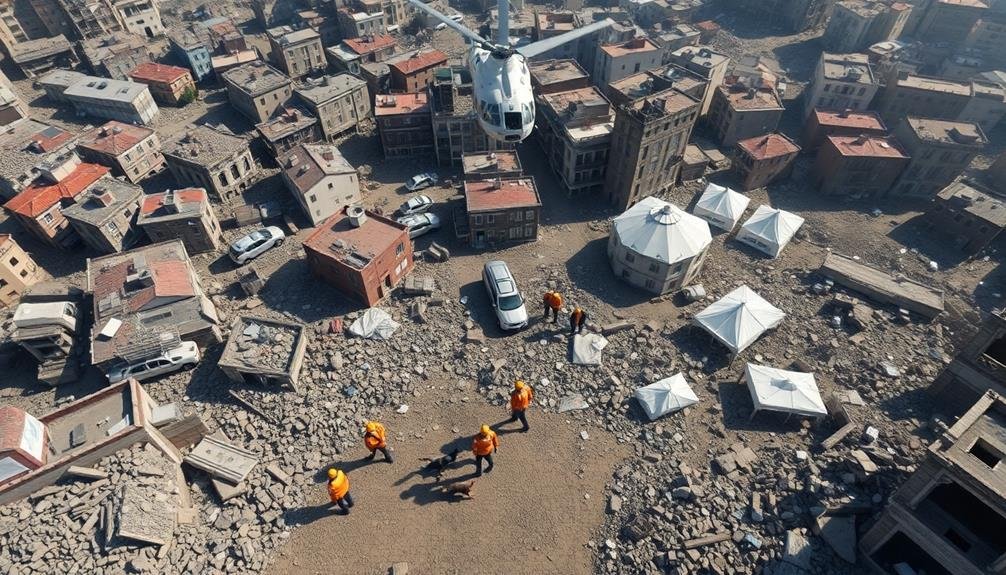
Three essential phases define search and rescue operations in the aftermath of a catastrophe.
First, you'll observe the initial response, where teams rapidly assess the situation using aerial imagery and ground surveys. They'll identify high-priority areas and potential survivor locations, often relying on thermal imaging to detect heat signatures.
Next, you'll see the deployment phase. Rescue teams will mobilize to these priority zones, equipped with specialized gear like listening devices and search cameras. They'll use imagery to navigate debris fields and collapsed structures, maximizing efficiency in their search patterns.
Finally, you'll witness the extraction phase. Here, rescuers will employ imagery to plan safe routes for removing survivors and to guide heavy machinery for debris clearance. They'll also use it to identify potential hazards like unstable buildings or chemical spills.
Throughout these phases, you'll notice how imagery plays a vital role in coordinating efforts. It helps incident commanders make informed decisions, allocate resources effectively, and monitor progress in real-time.
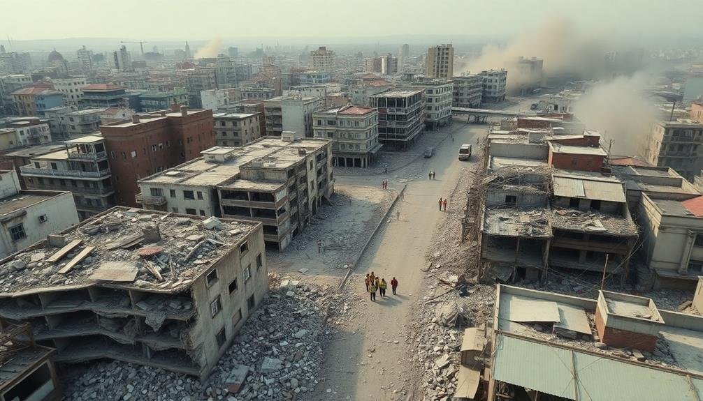
Recovery Progress Monitoring
As search and rescue operations wind down, the focus shifts to monitoring recovery progress. You'll find that satellite imagery and aerial photography play vital roles in this phase. These tools allow you to track rebuilding efforts, assess infrastructure repairs, and monitor environmental recovery over time.
You can use high-resolution imagery to:
- Measure debris removal progress
- Identify areas of successful reconstruction
- Detect potential hazards or setbacks
- Track changes in vegetation and land use
By comparing pre-disaster images with current ones, you're able to quantify the extent of damage and evaluate the effectiveness of recovery initiatives. This data helps you allocate resources more efficiently and adjust recovery plans as needed.
You'll also find that imagery aids in communicating progress to stakeholders and the public. Visual representations of recovery efforts can boost morale and demonstrate tangible improvements.
Additionally, you can use this information to identify areas that may require additional support or intervention.
Resource Allocation Optimization
Imagery analysis forms the backbone of effective resource allocation optimization in disaster recovery. By examining aerial and satellite images, you can identify areas most in need of immediate assistance. This allows you to prioritize the distribution of limited resources, guaranteeing they reach the hardest-hit regions first.
You'll use these images to assess damage to critical infrastructure like roads, bridges, and power lines. This information helps you determine which repair efforts will have the greatest impact on restoring essential services. You can also spot potential hazards, such as unstable buildings or flooding risks, enabling you to allocate resources for preventive measures.
By analyzing before-and-after imagery, you'll identify changes in population distribution and movement patterns. This insight helps you optimize the placement of temporary shelters, medical facilities, and food distribution centers.
You'll also use imagery to track the progress of recovery efforts over time, allowing you to adjust resource allocation strategies as needs change.
Ultimately, imagery-based resource allocation optimization guarantees that you're making data-driven decisions, maximizing the impact of every dollar and hour spent on disaster recovery efforts.
Frequently Asked Questions
How Does Satellite Imagery Compare to Drone Footage in Disaster Assessment?
You'll find satellite imagery offers wider coverage but less detail, while drone footage provides high-resolution closeups of specific areas. Both are valuable, but drones can access hard-to-reach locations and capture real-time data more easily.
What Are the Ethical Considerations When Using Imagery of Disaster-Affected Areas?
You should consider privacy concerns, cultural sensitivities, and potential trauma to survivors. It's essential you obtain consent, avoid exploiting victims, and respect local customs. You'll need to balance public interest with ethical responsibility when sharing disaster imagery.
How Can AI and Machine Learning Improve Catastrophe Imagery Analysis?
You'll find AI and machine learning can drastically improve catastrophe imagery analysis. They'll quickly process vast amounts of data, detect patterns, and identify critical areas. You'll get faster, more accurate assessments to guide relief efforts effectively.
What Role Does Social Media Imagery Play in Understanding Disaster Impacts?
Social media imagery gives you real-time insights into disaster impacts. You'll see firsthand accounts, damage assessments, and immediate needs. It's a valuable tool for understanding the scope and severity of catastrophes as they unfold.
How Do Privacy Laws Affect the Collection and Use of Post-Disaster Imagery?
You'll find privacy laws restrict collecting and using post-disaster imagery. They limit what you can capture, share, and analyze. You've got to contemplate consent, data protection, and ethical use when working with such sensitive visual information.
In Summary
You've seen how imagery can be a powerful tool in understanding catastrophe aftermath. It'll show you the full scope of destruction, help you assess environmental impacts, and guide search and rescue efforts. You'll be able to monitor recovery progress and optimize resource allocation. By leveraging this visual data, you're better equipped to respond effectively, save lives, and rebuild communities. Remember, a clear picture is worth more than a thousand words in disaster response.
As educators and advocates for responsible drone use, we’re committed to sharing our knowledge and expertise with aspiring aerial photographers.


Leave a Reply