
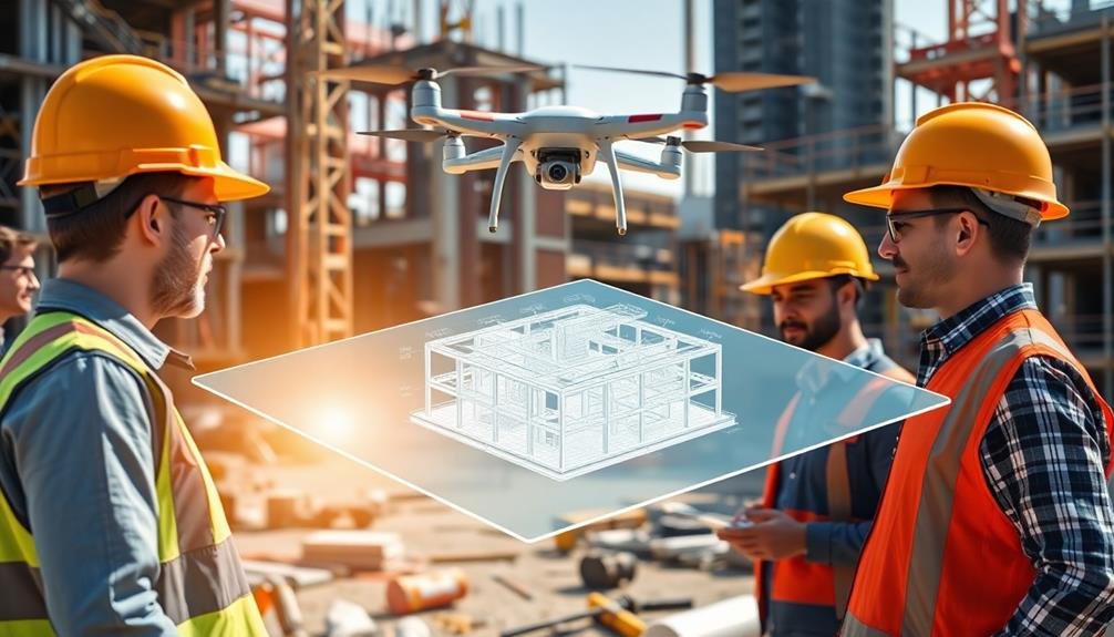
You'll revolutionize your construction management by integrating UAVs with platforms. These aerial tools provide real-time site monitoring, enhancing safety and progress tracking. They collect vast amounts of data quickly, enabling informed decision-making and streamlined reporting. UAVs offer cost-effective aerial surveying, reducing time and expenses compared to traditional methods. They improve quality control through early defect detection and optimize resource allocation. With increased stakeholder transparency and extensive risk mitigation strategies, you'll boost project efficiency and success. The benefits of UAV integration extend far beyond simple aerial photography, transforming every aspect of construction management.
Enhanced Site Monitoring

Numerous construction sites are now leveraging UAVs for enhanced monitoring capabilities.
You'll find that these aerial devices offer a bird's-eye view of your entire project, allowing you to spot potential issues quickly and efficiently. With high-resolution cameras and real-time video feeds, you can inspect hard-to-reach areas without putting workers at risk.
UAVs enable you to conduct regular site surveys, tracking progress and comparing it to your project timeline.
You'll be able to identify delays or deviations from the plan early on, giving you the opportunity to make timely adjustments. These drones can also help you monitor material usage and stockpiles, ensuring you're always aware of your resource levels.
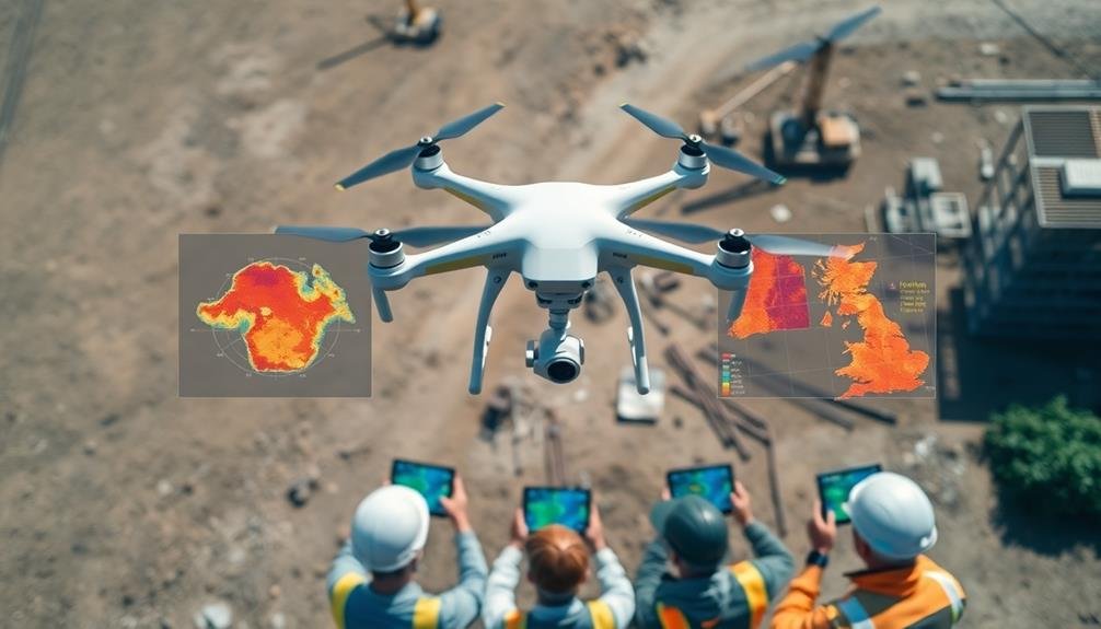
Real-Time Data Collection

Real-time data collection is revolutionizing construction management through UAV integration. You'll find that drones equipped with advanced sensors and cameras can gather vast amounts of data quickly and efficiently.
As you fly UAVs over your construction site, they'll capture high-resolution images, videos, and 3D scans, providing you with up-to-date information on project progress, material inventory, and site conditions.
You can use this real-time data to make informed decisions and address issues promptly. For example, you'll be able to track earthwork volumes, measure stockpiles, and monitor excavation progress without manual surveys.
You'll also detect potential safety hazards or quality issues before they escalate, allowing you to take immediate corrective action.
Improved Safety Measures

Safety is paramount in construction, and UAVs are enhancing site security like never before. You'll find that integrating drones with your construction management platform can greatly improve safety measures on your job sites.
UAVs can access hard-to-reach or dangerous areas, reducing the need for workers to put themselves at risk. They're also excellent for conducting regular safety inspections, identifying potential hazards before they become serious issues.
By incorporating UAVs into your safety protocols, you'll benefit from:
- Real-time monitoring of worker compliance with safety regulations
- Quick detection of equipment malfunctions or structural weaknesses
- Rapid response to emergencies or accidents on-site
You'll also appreciate the ability to create detailed safety reports using the high-resolution imagery and data collected by drones. These reports can help you identify trends, implement targeted safety improvements, and demonstrate compliance with regulatory requirements.
Additionally, UAVs can be used for worker training, providing aerial footage of best practices and potential hazards. By leveraging drone technology, you're not only protecting your workforce but also improving overall project efficiency and reducing the likelihood of costly accidents or delays.
Accurate Progress Tracking

UAVs revolutionize construction progress tracking through real-time site monitoring, giving you instant insights into project status.
You'll benefit from automated data collection, eliminating manual errors and saving valuable time.
These aerial tools enhance your reporting capabilities, providing accurate, detailed updates to stakeholders with ease.
Real-Time Site Monitoring
One of the most powerful applications of drones in construction is their ability to provide accurate, up-to-the-minute progress tracking. By integrating UAVs with your construction management platform, you'll gain real-time insights into your project's status. This allows you to make informed decisions quickly and address issues before they escalate.
With drone-based site monitoring, you can:
- Capture high-resolution aerial imagery and video footage of your entire site
- Generate accurate 3D models and topographic maps for better visualization
- Identify potential safety hazards or construction errors immediately
You'll be able to monitor multiple areas of your project simultaneously, saving time and resources. By comparing current site conditions with previous data, you can track changes over time and ascertain your project stays on schedule.
This level of oversight allows you to optimize resource allocation, reduce downtime, and improve overall project efficiency.
Real-time site monitoring also enhances communication between stakeholders. You can easily share up-to-date information with clients, subcontractors, and team members, keeping everyone aligned on project progress and potential challenges.
This transparency fosters better collaboration and helps maintain trust throughout the construction process.
Automated Data Collection
Building on the benefits of real-time site monitoring, automated data collection takes progress tracking to the next level. By integrating UAVs with your construction management platform, you'll gain access to highly accurate and consistent data collection methods.
These drones can capture detailed imagery and measurements of your construction site, allowing you to track progress with unprecedented precision. You'll no longer need to rely solely on manual observations or time-consuming surveys.
UAVs equipped with advanced sensors and cameras can quickly gather data on stockpile volumes, earthwork quantities, and structural dimensions. This information is then automatically processed and integrated into your project management software, providing you with up-to-date progress reports and comparisons against your planned schedule.
With automated data collection, you'll identify potential delays or issues earlier, enabling proactive decision-making. You can easily spot discrepancies between actual and planned progress, adjust resources accordingly, and keep your project on track.
This level of accuracy and efficiency in progress tracking not only saves time and reduces human error but also enhances your ability to communicate project status to stakeholders, ensuring transparency and accountability throughout the construction process.
Enhanced Reporting Capabilities
Thanks to the integration of UAVs, your construction management reporting capabilities will skyrocket. You'll gain access to accurate, real-time data that transforms your project tracking and reporting processes. UAVs capture high-resolution imagery and precise measurements, allowing you to generate detailed reports on various aspects of your construction site.
With enhanced reporting capabilities, you'll be able to:
- Track progress more accurately: Compare aerial imagery over time to visualize changes and measure advancement against project timelines.
- Identify potential issues early: Detect discrepancies between plans and actual construction, enabling prompt corrective actions.
- Improve stakeholder communication: Share visually compelling reports with clients, investors, and team members, enhancing transparency and trust.
You'll also benefit from automated report generation, saving time and reducing human error. These reports can include 3D models, volumetric calculations, and site maps, providing a thorough overview of your project's status.
Cost-Effective Aerial Surveying

Aerial surveying has traditionally been an expensive and time-consuming process in construction management. However, integrating UAVs with your management platforms can greatly reduce costs and increase efficiency. You'll find that drones can quickly capture high-resolution imagery and data, allowing for rapid site assessments and progress monitoring.
By using UAVs, you're able to:
| Benefit | Traditional Method | UAV Method |
|---|---|---|
| Time | Days or weeks | Hours |
| Cost | $$$$ | $$ |
| Frequency | Monthly or quarterly | Weekly or daily |
| Accuracy | Variable | Highly accurate |
These cost-effective aerial surveys provide you with up-to-date information on site conditions, stockpile volumes, and earthwork progress. You'll be able to make informed decisions faster, reducing delays and potential costly errors. Additionally, the data collected can be seamlessly integrated into your existing management platforms, creating an all-encompassing digital twin of your project.
With UAVs, you're not just saving money on surveying costs; you're also improving overall project efficiency and reducing the need for on-site personnel in potentially hazardous areas. This technology allows you to allocate resources more effectively and focus on critical aspects of your construction project.
Streamlined Communication

In today's fast-paced construction industry, effective communication is essential for project success. By integrating UAVs with construction management platforms, you'll streamline communication across your entire project team. These aerial tools provide real-time data and visual insights that can be instantly shared with stakeholders, managers, and workers on-site.
You'll benefit from enhanced communication in several ways:
- Immediate visual updates: Share aerial footage and 3D models with team members, allowing everyone to stay informed about project progress and potential issues.
- Faster decision-making: Access up-to-date information quickly, enabling you to make informed decisions and address problems promptly.
- Improved collaboration: Foster better teamwork by providing a common visual reference point for discussions and planning.
With UAV integration, you'll reduce miscommunication and delays caused by outdated information. You can easily annotate aerial images and share them with specific team members, ensuring everyone's on the same page.
This streamlined approach minimizes the need for time-consuming site visits and lengthy meetings, allowing you to focus on critical tasks. By leveraging UAV technology, you'll create a more efficient and responsive communication system that keeps your projects running smoothly and on schedule.
Efficient Resource Allocation

Efficient resource allocation is a key benefit of integrating UAVs with construction management. With aerial data and insights, you'll optimize the distribution of materials, equipment, and personnel across your construction site.
UAVs provide real-time visual information, allowing you to identify underutilized resources or areas that need additional support. You can use UAV-captured imagery to track inventory levels, ensuring you have the right materials in the right place at the right time. This reduces waste and prevents costly delays due to shortages.
By monitoring equipment usage patterns, you'll make informed decisions about when to move machinery between different areas of the site, maximizing productivity.
UAVs also help you assess workforce distribution. You'll spot areas where teams are overcrowded or understaffed, enabling you to reassign workers more effectively. This improves overall site efficiency and helps you meet project deadlines.
Advanced 3D Modeling Capabilities
UAVs revolutionize construction management with their advanced 3D modeling capabilities. These aerial devices capture high-resolution images and data, which can be processed into detailed 3D models of construction sites. You'll find that these models offer unprecedented accuracy and detail, allowing you to visualize and analyze your project from every angle.
With UAV-generated 3D models, you can:
- Perform virtual walkthroughs of your site, identifying potential issues before they become costly problems.
- Compare as-built conditions to design plans, ensuring construction accuracy and compliance.
- Create precise volumetric measurements for earthwork and material calculations.
By integrating UAVs into your construction management platform, you'll enhance your decision-making process with up-to-date, thorough site information. You can track progress, detect deviations from plans, and communicate more effectively with stakeholders using these detailed 3D models.
They'll also serve as valuable historical records for future reference and project analysis.
Advanced 3D modeling capabilities of UAVs streamline your workflow, reduce errors, and improve overall project efficiency. You'll find that this technology integration provides a competitive edge in the construction industry, allowing you to deliver projects with greater precision and confidence.
Environmental Impact Assessment
Environmental impact assessments frequently benefit from the integration of UAVs in construction management. You'll find that drones can provide valuable data for evaluating a project's environmental footprint. By capturing high-resolution aerial imagery and video, UAVs allow you to assess vegetation cover, identify sensitive habitats, and monitor wildlife patterns in and around construction sites.
You can use UAVs to conduct regular site surveys, tracking changes in topography, drainage patterns, and erosion control measures. This real-time data helps you make informed decisions about environmental mitigation strategies.
Drones equipped with thermal cameras can detect heat signatures, enabling you to identify potential pollution sources or energy inefficiencies.
You'll also appreciate how UAVs can help you monitor air quality and dust levels around construction sites. By attaching specialized sensors to drones, you can collect data on particulate matter and other pollutants, ensuring compliance with environmental regulations.
Additionally, you can use UAVs to inspect hard-to-reach areas for potential environmental hazards or to assess the effectiveness of implemented green technologies. This thorough approach to environmental impact assessment enhances your ability to minimize ecological disruption and promote sustainable construction practices.
Automated Reporting and Documentation

Numerous aspects of automated reporting and documentation are revolutionized by integrating UAVs into construction management. You'll find that drones can capture vast amounts of data quickly and accurately, streamlining the reporting process. They're able to provide real-time updates on project progress, site conditions, and potential issues, allowing you to make informed decisions promptly.
By integrating UAVs with your construction management platform, you'll benefit from:
- Automated progress reports: Drones can capture site imagery and data regularly, automatically generating progress reports without manual input.
- Enhanced safety documentation: UAVs can access hard-to-reach areas, documenting safety hazards and compliance issues more thoroughly.
- Improved as-built documentation: Drones can create accurate 3D models and point clouds, providing precise as-built documentation for future reference.
You'll notice a significant reduction in the time and effort required for reporting and documentation tasks. UAVs can collect data that would typically take days to gather manually in just a few hours.
This efficiency allows you to focus on analyzing the information and making strategic decisions rather than spending time on data collection and report creation. The result is more thorough, accurate, and timely documentation throughout your construction projects.
Increased Stakeholder Transparency

Through the lens of transparency, stakeholder engagement reaches new heights with the integration of UAVs in construction management. You'll find that drones provide real-time, high-resolution visual data that's easily shareable with all project stakeholders. This immediate access to up-to-date site information fosters trust and improves communication among team members, clients, and investors.
You can use UAV-captured imagery and video to create virtual site tours, allowing off-site stakeholders to visualize progress without physical visits. This saves time and reduces travel costs while keeping everyone informed. Additionally, you'll be able to quickly address concerns or questions by referencing specific aerial footage or 3D models generated from drone data.
UAVs also enable you to showcase project milestones more effectively. You can create compelling visual presentations that highlight achievements, demonstrating your team's progress and professionalism.
This increased transparency leads to better decision-making, as all parties have access to the same accurate, current information. Ultimately, integrating UAVs into your construction management processes will strengthen relationships with stakeholders and boost your project's overall success.
Quality Control Optimization

UAVs revolutionize quality control in construction through real-time defect detection and precision measurement capabilities.
You'll spot issues immediately, allowing for swift corrections and minimizing costly rework.
These aerial tools provide accurate measurements of structures, materials, and site conditions, enhancing your ability to maintain high standards throughout the project lifecycle.
Real-Time Defect Detection
Real-time defect detection stands out as a game-changing application of UAVs in construction quality control. By integrating drones with your construction management platform, you'll gain the ability to identify and address issues as they arise, rather than discovering them during later inspections. This proactive approach can save you time, money, and potential rework.
UAVs equipped with high-resolution cameras and advanced imaging technologies can capture detailed visuals of your construction site. These images are then processed and analyzed in real-time, allowing you to:
- Identify structural defects, such as cracks or misalignments
- Detect material irregularities or inconsistencies
- Spot safety hazards or non-compliance issues
With this information at your fingertips, you can make immediate decisions and take corrective actions. You'll be able to address problems before they escalate, ensuring that your project stays on track and meets quality standards.
Additionally, the data collected by UAVs can be stored and used for future reference, creating an extensive record of your project's progress and quality control measures. This integration of UAVs with your construction management platform ultimately leads to improved efficiency, reduced costs, and enhanced overall project quality.
Precision Measurement Capabilities
The precision measurement capabilities of UAVs take quality control to the next level. You'll be able to capture highly accurate measurements of your construction site, structures, and materials with ease. UAVs equipped with advanced sensors and imaging technology can provide you with detailed data for analysis and decision-making.
Here's how UAVs enhance precision measurement in construction:
| Measurement Type | Benefits | Applications |
|---|---|---|
| Volumetric | Accurate material estimates | Stockpile management |
| Linear | Precise distance calculations | Site layout planning |
| Thermal | Energy efficiency assessment | Building insulation |
| Elevation | Detailed topographic mapping | Earthwork calculations |
Risk Mitigation Strategies

Frequently, integrating new technologies into established workflows comes with inherent risks. However, when it comes to incorporating UAVs into construction management platforms, you'll find that the benefits far outweigh the potential drawbacks.
By implementing proper risk mitigation strategies, you can guarantee a smooth changeover and maximize the advantages of this innovative technology.
To effectively mitigate risks associated with UAV integration, consider the following strategies:
- Extensive training programs: Invest in thorough training for your team members who'll be operating UAVs and managing the data they collect. This will reduce the likelihood of accidents and guarantee proper data interpretation.
- Clear communication protocols: Establish well-defined communication channels between UAV operators, project managers, and other stakeholders to minimize misunderstandings and potential conflicts.
- Regular safety audits: Conduct frequent safety assessments to identify and address potential hazards associated with UAV operations on construction sites.
Frequently Asked Questions
What Certifications Are Required for Operating UAVS in Construction Projects?
You'll need a Remote Pilot Certificate from the FAA to operate UAVs in construction projects. You should also complete safety training and obtain any local permits required. It's essential to stay updated on changing regulations.
How Do Weather Conditions Affect UAV Performance in Construction Site Monitoring?
You'll find that weather greatly impacts UAV performance. Wind can affect stability and flight paths. Rain or snow may interfere with sensors. Extreme temperatures can reduce battery life. Always check conditions before flying for ideal results.
What Are the Data Privacy Concerns When Using UAVS for Construction Management?
You'll face several data privacy concerns when using UAVs in construction management. You're dealing with sensitive site information, potential unauthorized surveillance, and data security risks. You'll need to implement strict protocols to protect personal and project data.
Can UAVS Be Integrated With Existing Construction Management Software Platforms?
Yes, you can integrate UAVs with existing construction management software platforms. They'll seamlessly connect to your current systems, allowing you to import drone data, analyze it, and incorporate it into your project management workflows for enhanced decision-making.
What Is the Average Lifespan of a UAV Used in Construction Projects?
You'll find that UAVs used in construction typically last 2-3 years with regular use. However, their lifespan can vary based on maintenance, usage frequency, and environmental conditions. You should plan for replacements within this timeframe.
In Summary
You've seen how integrating UAVs with construction management platforms can revolutionize your projects. By embracing this technology, you'll enhance site monitoring, improve safety, and track progress more accurately. You're not just saving time and money; you're optimizing quality control and mitigating risks. With real-time data at your fingertips and increased transparency for stakeholders, you're setting yourself up for success. Don't wait – start leveraging UAVs in your construction management today and stay ahead of the curve.
As educators and advocates for responsible drone use, we’re committed to sharing our knowledge and expertise with aspiring aerial photographers.


Leave a Reply