Drone survey precision depends on various interconnected factors. You'll need to take into account weather conditions, as strong winds or rain can disrupt flights and data quality. The quality of your drone's hardware, including its camera and GPS system, plays a vital role. Camera resolution, flight altitude, and the use of ground control points all impact accuracy. Careful flight planning, proper image overlap, and skilled post-processing are essential. Your expertise as an operator also greatly influences results. By understanding and optimizing these elements, you'll achieve higher precision in your drone surveys. The following sections will unpack each factor in detail.
Weather Conditions

Buffeted by wind and rain, drones face significant challenges when conducting aerial surveys in adverse weather conditions. Strong winds can destabilize your drone, affecting its ability to maintain a steady flight path and capture accurate data. Gusts may cause sudden movements, leading to blurry images or inconsistent survey coverage.
Rain poses risks to your drone's electronic components and can interfere with sensor readings, potentially compromising the quality of collected data.
Temperature extremes also impact drone performance. In cold weather, battery life decreases rapidly, limiting flight time and survey range. Hot conditions can cause overheating, affecting both the drone's motors and onboard computers.
Humidity levels influence air density, which affects lift and power consumption, potentially altering your drone's flight characteristics and survey precision.
Atmospheric pressure changes with altitude and weather patterns, affecting your drone's altimeter readings and GPS accuracy. Low visibility conditions, such as fog or haze, can obstruct camera and LiDAR sensors, reducing the quality and completeness of survey data.
To guarantee ideal survey precision, you'll need to carefully consider these weather factors and plan your drone operations accordingly.
Drone Hardware Quality

At the heart of survey precision lies the quality of your drone's hardware. The components that make up your drone directly impact its ability to capture accurate data.
Start with the camera: a high-resolution sensor with a quality lens will provide clearer, more detailed images. This clarity is essential for creating precise 3D models and orthomosaics.
Consider the drone's GPS system. A more advanced GPS module will offer better positional accuracy, guaranteeing your survey points are correctly georeferenced.
The drone's stability is another key factor. High-quality motors, propellers, and a well-designed frame contribute to smoother flight, reducing motion blur in captured images.
Don't overlook the importance of the drone's onboard computer. A powerful processor can handle complex flight algorithms and real-time data processing, improving overall survey accuracy.
The quality of your drone's telemetry system also plays a role, as it affects the precision of flight path execution and data logging.
Lastly, remember that battery quality impacts flight time and stability. A reliable, high-capacity battery guarantees you can complete your survey without interruptions, maintaining consistent data quality throughout the mission.
Camera Resolution

When considering camera resolution for drone surveys, you'll find that pixel count plays a vital role in capturing detailed imagery.
Higher pixel counts allow you to discern finer details and produce more accurate maps or 3D models.
However, don't overlook sensor size, as larger sensors can improve image quality and low-light performance, potentially enhancing your survey results in various conditions.
Pixel Count Matters
The camera's resolution plays an essential role in determining the quality and accuracy of drone survey data. When it comes to pixel count, more is generally better. Higher pixel counts allow you to capture more detailed images, which translates to greater precision in your survey results.
You'll want to evaluate the ground sample distance (GSD) when selecting a camera. GSD represents the distance between pixel centers measured on the ground. A lower GSD means higher resolution and more accurate data. For example, a 20-megapixel camera will provide better GSD than a 12-megapixel camera at the same altitude.
However, don't solely focus on pixel count. Sensor size also matters. A larger sensor can capture more light, resulting in better image quality, especially in challenging lighting conditions.
It's about finding the right balance between pixel count and sensor size for your specific survey needs.
Sensor Size Implications
Sensor size's impact on drone survey precision can't be overstated. When you're choosing a drone for surveying, you'll want to evaluate the camera's sensor size carefully.
Larger sensors generally produce higher-quality images with better resolution and less noise, especially in challenging lighting conditions.
A bigger sensor allows for:
- Improved light gathering capability
- Better dynamic range
- Enhanced low-light performance
- Reduced image noise
- More detailed imagery
You'll find that drones with larger sensors often deliver superior results in various surveying applications. They're particularly effective when you need to capture fine details or work in less-than-ideal lighting situations.
However, it's important to balance sensor size with other factors like drone weight and flight time.
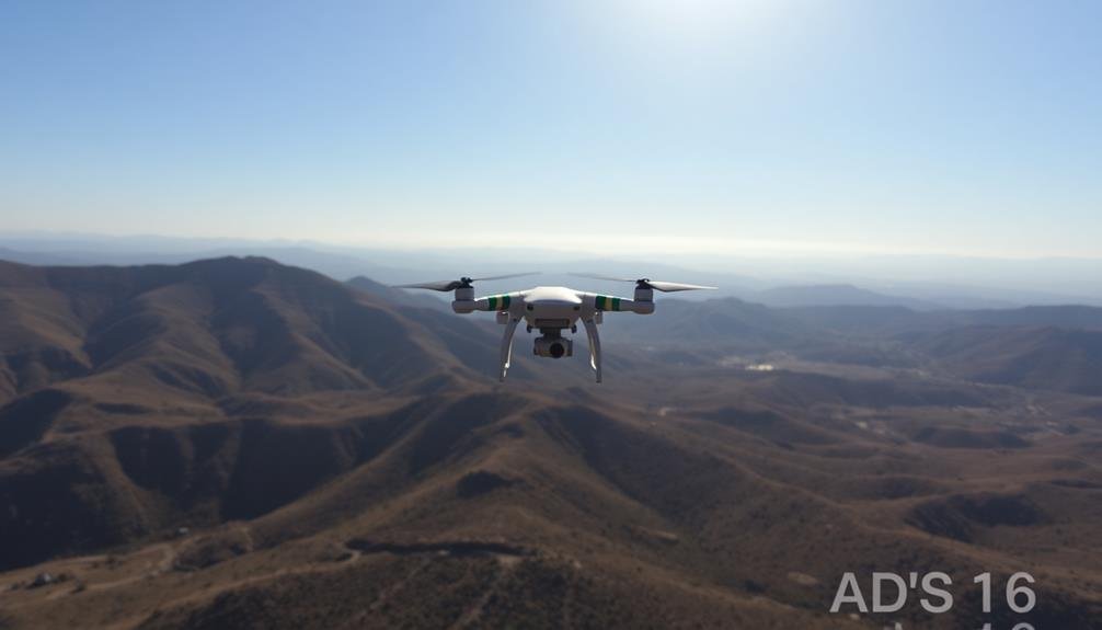
Flight Altitude

Soaring above the terrain, flight altitude plays an essential role in determining the precision of drone surveys. As you increase your drone's altitude, you'll cover a larger area in each image, but you'll sacrifice ground sampling distance (GSD) and overall detail.
Lower altitudes yield higher resolution data but require more flight time and battery consumption to cover the same area.
You'll need to strike a balance between coverage and precision based on your project's requirements. For example, if you're mapping large agricultural fields, you might fly higher to cover more ground quickly. However, for detailed inspections of infrastructure or archaeological sites, you'll want to fly lower for maximum detail.
Keep in mind that higher altitudes can introduce more atmospheric interference, potentially affecting image quality. Wind speed also typically increases with altitude, which can impact your drone's stability and the resulting data quality.
Additionally, local regulations often dictate maximum flight altitudes, so you'll need to factor these restrictions into your survey planning. By carefully considering your flight altitude, you'll optimize your drone survey's precision and efficiency.
Ground Control Points

After establishing your flight parameters, it's vital to take into account ground control points (GCPs) for your drone survey. GCPs are precisely surveyed markers on the ground that provide known coordinates to enhance the accuracy of your aerial mapping. By incorporating GCPs, you'll greatly improve the precision of your survey results.
When setting up GCPs, consider these key factors:
- Number of GCPs: More points generally yield better accuracy
- Distribution: Spread GCPs evenly across the survey area
- Visibility: Confirm GCPs are easily identifiable in aerial images
- Stability: Place markers on stable, flat surfaces
- Accessibility: Choose locations you can safely reach for surveying
The placement and number of GCPs depend on your project's size and required accuracy. For small areas, you might need only a few points, while larger or more complex surveys may require dozens.
Remember that each GCP must be surveyed using high-precision GPS equipment or traditional surveying methods. This process can be time-consuming, but it's vital for achieving ideal results.
GPS Accuracy
GPS accuracy plays an essential role in drone survey precision, and you'll want to take into account several key factors.
You should pay attention to satellite signal strength, which can greatly impact the quality of your GPS data.
To enhance accuracy further, you can utilize multi-constellation GNSS receivers and implement Real-Time Kinematic (RTK) positioning techniques in your drone surveys.
Satellite Signal Strength
Satellite signal strength plays an essential role in determining the precision of drone surveys. You'll find that stronger signals lead to more accurate positioning and better overall survey results.
When conducting a drone survey, you'll want to guarantee ideal satellite signal strength to minimize errors and improve data quality.
Several factors can affect satellite signal strength during your drone survey:
- Number of visible satellites
- Obstructions like buildings, trees, or mountains
- Atmospheric conditions
- Time of day
- Ionospheric activity
To maximize signal strength, you should plan your flights during periods with good satellite coverage and minimal obstructions.
You'll also want to take into account using dual-frequency GNSS receivers, which can improve accuracy by reducing ionospheric errors.
Remember that weak satellite signals can lead to poor GPS positioning, affecting your drone's ability to maintain a stable flight path and accurately geotag captured images.
This can result in gaps in your survey data or misaligned imagery, compromising the overall quality of your final product.
Multi-Constellation GNSS Receivers
Building on the importance of satellite signal strength, multi-constellation GNSS receivers offer a considerable advantage in drone survey precision.
These advanced receivers can simultaneously access multiple satellite systems, such as GPS, GLONASS, Galileo, and BeiDou. By tapping into multiple constellations, you'll increase the number of available satellites, improving positioning accuracy and reliability.
You'll experience better coverage in challenging environments, like urban canyons or areas with obstructed sky views. Multi-constellation receivers also enhance the time-to-first-fix, allowing your drone to start surveying more quickly. They're particularly useful in high-latitude regions where traditional GPS coverage may be limited.
When selecting a drone for precision surveys, prioritize those equipped with multi-constellation GNSS receivers. You'll benefit from improved accuracy, often achieving centimeter-level precision in ideal conditions.
These receivers also provide redundancy, guaranteeing continued operation if one satellite system experiences issues.
To maximize the benefits of multi-constellation receivers, you should use survey-grade antennas and confirm proper calibration.
Remember that while multi-constellation receivers greatly improve precision, they're just one part of an extensive drone survey setup. Combine them with other precision-enhancing techniques for best results.
Real-Time Kinematic Positioning
Elevating drone survey precision to new heights, Real-Time Kinematic (RTK) positioning stands out as a game-changing technology. It's a satellite navigation technique that enhances the accuracy of position data derived from GNSS satellites.
With RTK, you'll achieve centimeter-level precision in real-time, a significant improvement over standard GPS.
RTK works by using a base station at a known location and a rover (your drone) that communicates with this station. The base station sends correction data to the rover, allowing it to fix ambiguities in satellite signals and calculate its position with extreme accuracy.
This technology is particularly valuable for:
- Topographic surveys
- Precision agriculture
- Construction site monitoring
- Infrastructure inspection
- Volumetric calculations
To implement RTK in your drone surveys, you'll need compatible hardware and software. Most modern professional drones come equipped with RTK capabilities, but you'll also need a base station or access to a network of RTK stations.
When setting up, verify you've got a clear view of the sky and minimal obstructions. Remember, RTK's effectiveness can be impacted by factors like atmospheric conditions and multipath errors, so always confirm your results.
Flight Planning and Execution

When it comes to drone surveys, careful flight planning and execution are vital for achieving high-precision results. You'll need to take into account several factors to enhance your flight plan.
First, determine the ideal flight altitude based on your desired ground sampling distance and camera specifications. Lower altitudes generally yield higher precision but require more flight time and battery power.
Next, plan your flight path to guarantee adequate image overlap, typically 70-80% front overlap and 60-70% side overlap. This redundancy helps with image stitching and improves overall accuracy. You should also factor in terrain variations and obstacles, adjusting your flight plan accordingly.
Weather conditions play a significant role in flight execution. Wind speed, temperature, and lighting can all affect your drone's performance and image quality. Schedule your flights during the best weather windows and be prepared to abort if conditions deteriorate.
During the flight, maintain consistent speed and altitude to assure uniform image quality. Use automated flight modes when possible to reduce human error.
Monitor your drone's battery levels and plan for multiple flights if necessary to cover large areas without compromising data quality.
Image Overlap Percentage

When planning your drone survey, you'll need to evaluate image overlap percentages.
Generally, you should aim for 75-80% front overlap and 60-70% side overlap for most mapping applications.
Higher overlap percentages will improve data quality and reduce the risk of gaps, but they'll also increase flight time and data processing requirements.
Recommended Overlap Percentages
Determining the ideal image overlap percentage is crucial for achieving high-quality drone survey results. While specific requirements may vary depending on your project's needs, there are generally accepted recommendations for maximum overlap percentages.
For most drone surveys, you'll want to aim for:
- 75-80% forward overlap
- 60-70% side overlap
- 80-85% overlap for 3D modeling projects
- 85-90% overlap for detailed inspections
- 60-65% overlap for large-scale mapping projects
These recommended percentages guarantee sufficient data redundancy and help compensate for potential errors or image distortions. Higher overlap percentages typically result in better data quality but also increase flight time and data processing requirements.
You'll need to balance precision needs with time and resource constraints. When planning your drone survey, consider factors such as terrain complexity, desired output resolution, and the specific software you'll be using for data processing.
Some photogrammetry software may have specific overlap recommendations, so it's worth checking their guidelines. By following these recommended overlap percentages and adjusting as needed for your unique project requirements, you'll be well on your way to capturing high-quality drone survey data.
Impact on Data Quality
Regarding data quality, image overlap percentage plays a significant role in drone surveys. Higher overlap percentages generally result in better data quality, as they provide more information for processing software to work with. You'll find that increased overlap leads to improved accuracy in point cloud generation, digital elevation models, and orthomosaics.
When you choose a higher overlap percentage, you're fundamentally capturing each point on the ground from multiple angles. This redundancy helps compensate for potential issues like camera shake, lighting variations, or slight GPS inaccuracies. It's particularly important in areas with complex terrain or dense vegetation.
Here's a quick overview of how different overlap percentages affect data quality:
| Overlap % | Point Cloud Density | DEM Accuracy | Orthomosaic Quality |
|---|---|---|---|
| 60% | Moderate | Good | Acceptable |
| 70% | High | Very Good | Good |
| 80% | Very High | Excellent | Very Good |
| 90% | Extremely High | Outstanding | Excellent |
| 95% | Ultra-High | Exceptional | Outstanding |
Post-Processing Software

Post-processing software plays an essential role in achieving high-precision results from drone surveys. You'll find that the quality of your software can greatly impact the accuracy and usability of your final data.
When selecting post-processing software, consider its compatibility with your drone and sensor types, as well as its ability to handle large datasets efficiently.
Look for software that offers:
- Automated georeferencing and orthorectification
- Advanced point cloud generation and filtering
- Seamless integration with GIS and CAD systems
- Robust error detection and correction algorithms
- Customizable reporting and visualization tools
You'll want to verify your chosen software can handle various data formats and provide reliable outputs.
It should also offer features like automatic tie point generation, bundle adjustment, and dense image matching to enhance the accuracy of your 3D models and orthomosaics.
Operator Skill and Experience

While software plays a notable role, the human element remains a key factor in drone survey precision. As an operator, your skill and experience can greatly impact the quality of data collected and the overall accuracy of your survey results.
Your ability to plan efficient flight paths, adjust for environmental conditions, and make real-time decisions during the survey is vital. You'll need to understand how factors like wind speed, lighting conditions, and terrain can affect your drone's performance and adjust accordingly.
Your expertise in selecting appropriate flight altitudes, speeds, and overlap percentages will directly influence the resolution and accuracy of your survey data.
Moreover, your proficiency in piloting the drone safely and maintaining visual line of sight is essential for capturing consistent, high-quality imagery. You'll also need to be adept at troubleshooting technical issues that may arise during the survey, ensuring minimal disruptions to data collection.
Your knowledge of regulatory requirements and best practices in drone operations will help you conduct surveys safely and legally.
As you gain experience, you'll develop an intuitive understanding of how to optimize your surveys for precision, leading to more reliable and actionable results.
Frequently Asked Questions
How Do Different Types of Terrain Affect Drone Survey Precision?
You'll find that terrain complexity impacts drone survey precision. Flat areas yield better results, while dense forests, steep slopes, and urban environments pose challenges. Water bodies and reflective surfaces can also affect data accuracy.
What Legal Considerations Are Involved in Conducting Drone Surveys?
You'll need to contemplate airspace regulations, privacy laws, and licensing requirements. Obtain necessary permits, respect no-fly zones, and follow altitude restrictions. Be aware of property rights and data protection laws when capturing and storing imagery.
Can Drone Surveys Be Conducted at Night or in Low-Light Conditions?
You can conduct drone surveys at night or in low-light conditions, but you'll need specialized equipment. Night-vision cameras, thermal imaging, and powerful lighting systems can help. Always check local regulations, as night flights often have additional restrictions.
How Does Battery Life Impact the Accuracy of Drone Survey Results?
Battery life directly affects your drone survey accuracy. You'll have limited flight time, potentially rushing data collection or cutting surveys short. This can lead to incomplete coverage, reduced overlap, and less precise measurements in your results.
Are There Any Environmental Concerns Associated With Using Drones for Surveys?
Yes, there are environmental concerns with drone surveys. You'll need to take into account noise pollution, wildlife disturbance, and potential habitat disruption. Additionally, you should be aware of local regulations regarding drone use in sensitive ecosystems or protected areas.
In Summary
You've seen that many factors influence drone survey precision. From weather and hardware to flight planning and post-processing, each element plays a vital role. Don't overlook the importance of your skill as an operator. By considering all these aspects and continuously improving your techniques, you'll enhance the accuracy of your drone surveys. Remember, precision isn't just about one factor; it's the result of optimizing every step in the process.
As educators and advocates for responsible drone use, we’re committed to sharing our knowledge and expertise with aspiring aerial photographers.


Leave a Reply