You'll uncover ancient mysteries with these cutting-edge mapping techniques. LiDAR scanning creates detailed 3D maps, even through dense vegetation. Multispectral imaging reveals hidden structures and faded writings. Ground-penetrating radar detects subsurface features without digging. Aerial photogrammetry captures high-resolution images for large-scale analysis. Thermal imaging spots buried structures through temperature differences. Magnetometry surveys detect magnetic anomalies from archaeological features. 3D modeling reconstructs ancient sites virtually. Underwater sonar mapping explores submerged landscapes. Digital elevation models identify hidden features through terrain analysis. These innovative methods are transforming archaeology, offering new insights into our past. Explore further to reveal the secrets of ancient civilizations.
Key Takeaways
- LiDAR scanning creates detailed 3D maps, penetrating dense vegetation to reveal hidden ancient structures and landscapes.
- Satellite remote sensing detects subtle changes in vegetation and soil, indicating buried archaeological features over large areas.
- Ground-penetrating radar (GPR) emits radio waves to create 3D images of subsurface structures without excavation.
- Aerial photogrammetry captures high-resolution images for large-scale terrain analysis, revealing subtle topographic changes indicating buried ruins.
- 3D modeling and reconstruction techniques enable virtual exploration and detailed digital recreations of ancient sites and artifacts.
LiDAR Scanning
While archaeologists have long relied on traditional surveying methods, LiDAR scanning has revolutionized the field of archaeological mapping. This cutting-edge technology uses laser pulses to create detailed 3D maps of landscapes, revealing hidden structures and features that might otherwise go unnoticed.
You'll find that LiDAR can penetrate dense vegetation, allowing you to discover ancient sites in heavily forested areas. It's particularly useful in regions like the Amazon rainforest or Southeast Asian jungles, where traditional methods often fall short. LiDAR's ability to detect subtle changes in elevation helps you identify man-made structures, such as building foundations, roads, and agricultural terraces.
When you're using LiDAR, you'll collect millions of data points that can be processed to create high-resolution digital elevation models. These models enable you to visualize the landscape in ways that weren't possible before. You can strip away vegetation layers, adjust lighting conditions, and enhance subtle features to reveal patterns that might indicate human activity.
LiDAR's efficiency and accuracy have led to numerous groundbreaking discoveries, including the mapping of entire lost cities and the identification of previously unknown archaeological sites on a massive scale.
Multispectral Imaging
Another powerful tool in the archaeologist's arsenal is multispectral imaging. This technique allows you to capture and analyze light from various parts of the electromagnetic spectrum, including visible light, infrared, and ultraviolet. By using specialized cameras and sensors, you can detect features that aren't visible to the naked eye.
Multispectral imaging is particularly useful for revealing hidden structures, ancient writing, and faded pigments. You'll find it invaluable when examining manuscripts, paintings, and even landscapes. The technology can help you identify different materials, detect changes in vegetation that might indicate buried structures, and even spot traces of ancient pathways or field systems.
When you're using multispectral imaging, you'll typically capture multiple images of the same area using different wavelengths of light. These images are then combined and processed to create a composite that highlights specific features.
You can adjust the settings to emphasize different aspects of the site or artifact you're studying. This flexibility makes multispectral imaging a versatile tool for uncovering archaeological secrets across various environments and time periods.
Ground-Penetrating Radar
Ground-penetrating radar (GPR) stands as one of the most revolutionary non-invasive techniques in modern archaeology. You'll find it's particularly useful for detecting subsurface structures and artifacts without disturbing the soil. GPR works by emitting high-frequency radio waves into the ground and analyzing the reflected signals.
When you're using GPR, you'll notice it can penetrate various materials, including soil, rock, and even ice. It's effective at depths ranging from a few centimeters to several meters, depending on the soil conditions and the frequency of the radar waves. You'll appreciate its ability to create detailed 3D images of buried features, helping you identify walls, floors, and other structures.
You'll find GPR especially valuable in urban archaeology, where excavation might be impractical or prohibited. It's also useful in surveying large areas quickly, allowing you to pinpoint potential dig sites efficiently.
However, you should be aware that GPR has limitations. It's less effective in clay-rich or highly conductive soils, and interpreting the data requires expertise. Despite these challenges, GPR remains an indispensable tool in your archaeological mapping arsenal.
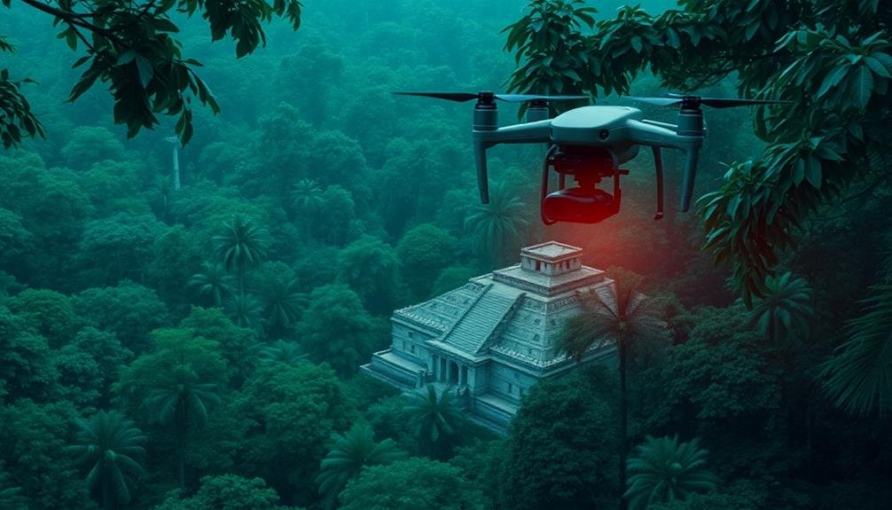
Aerial Photogrammetry
Aerial photogrammetry offers you a bird's-eye view of archaeological sites, capturing high-resolution images that reveal hidden structures and features.
You'll find this technique particularly useful for large-scale terrain analysis, allowing you to identify subtle changes in topography that might indicate buried ruins.
Additionally, you can detect vegetation patterns from above, which often provide clues about underground archaeological remains that aren't visible at ground level.
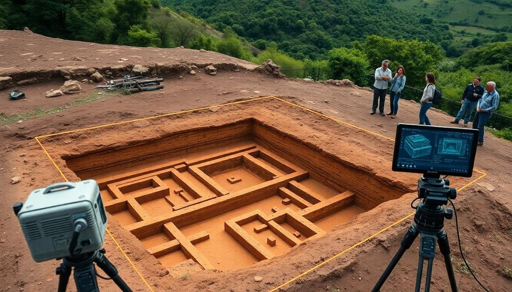
High-Resolution Site Imaging
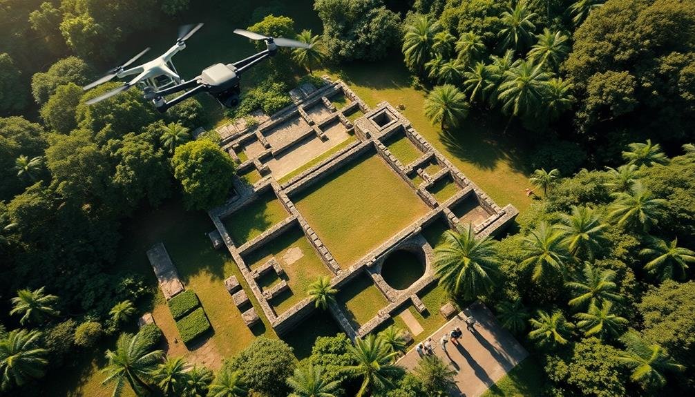
Three key advancements have revolutionized high-resolution site imaging in archaeology: drones, high-quality cameras, and photogrammetry software. These technologies allow you to capture detailed, accurate images of archaeological sites from various angles and elevations.
Drones equipped with high-resolution cameras can fly over sites, capturing thousands of overlapping images. You'll find that these unmanned aerial vehicles are particularly useful for surveying large areas or accessing hard-to-reach locations.
The cameras used in archaeological imaging have greatly improved, offering higher megapixel counts, better low-light performance, and enhanced color accuracy. You can now capture minute details of artifacts, structures, and landscapes with unprecedented clarity.
Photogrammetry software processes these images, stitching them together to create highly detailed 3D models and orthomosaic maps. You'll be able to analyze these models on your computer, measuring distances, identifying features, and even creating virtual fly-throughs of the site.
This combination of technologies enables you to document sites more thoroughly and efficiently than ever before. You can now preserve digital records of archaeological sites, track changes over time, and share findings with colleagues worldwide.
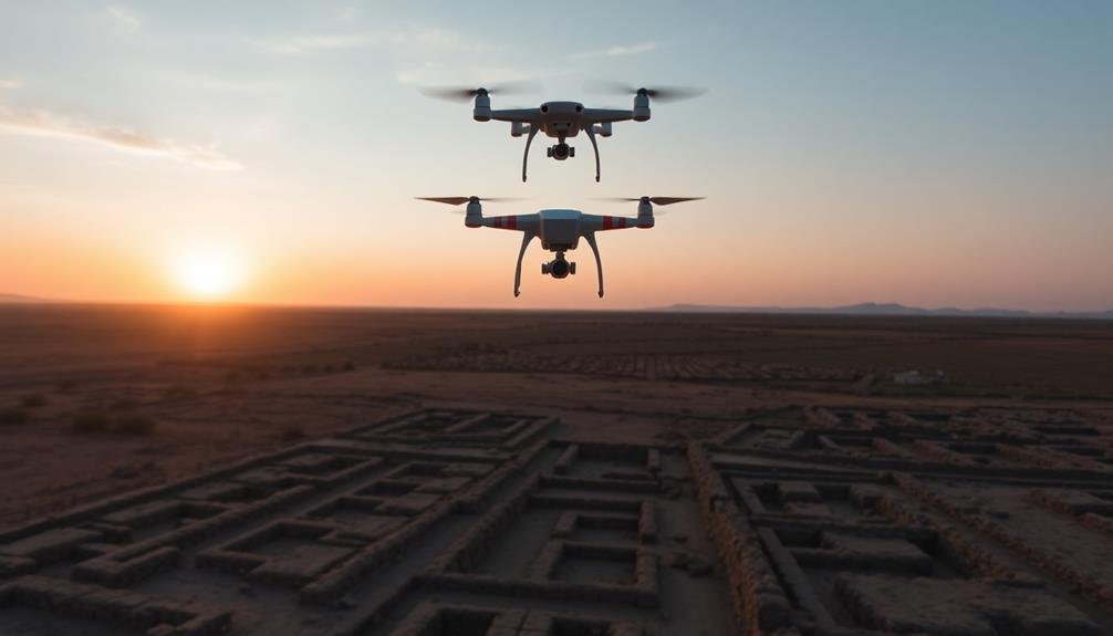
Large-Scale Terrain Analysis
Archaeologists have stepped up their game with large-scale terrain analysis using aerial photogrammetry. This technique allows you to capture detailed 3D models of vast landscapes, revealing hidden archaeological features invisible from the ground.
You'll use drones or aircraft equipped with high-resolution cameras to take overlapping aerial photographs. These images are then processed with specialized software that stitches them together and creates a precise 3D model of the terrain. This method can cover hundreds of square kilometers in a single survey, making it ideal for mapping entire archaeological regions.
With aerial photogrammetry, you can detect subtle changes in elevation, vegetation patterns, and soil marks that might indicate buried structures or ancient land use. You'll spot linear features like old roads, field boundaries, or defensive walls. Circular patterns could reveal hidden burial mounds or prehistoric settlements.
The resulting 3D models provide a wealth of data for analysis. You can manipulate lighting conditions, exaggerate elevation differences, or apply various filters to enhance visibility of archaeological features.
This technique is particularly useful in forested areas or regions where ground-based surveys are difficult or time-consuming.
Vegetation Pattern Detection
When examining aerial photogrammetry data, you'll find that vegetation patterns can reveal hidden archaeological secrets. Plants growing above buried structures often display distinct growth patterns, colors, or densities compared to surrounding vegetation. These differences are caused by variations in soil composition, moisture retention, and nutrient availability above archaeological features.
To effectively detect vegetation patterns, you'll need to:
- Analyze multi-spectral imagery, including near-infrared bands
- Compare seasonal images to identify crop marks
- Use vegetation indices like NDVI to highlight subtle differences
- Apply image enhancement techniques to accentuate patterns
By studying these patterns, you can identify potential archaeological sites without disturbing the ground. Look for geometric shapes, linear features, or circular formations that don't align with natural landscape patterns or modern land use.
Pay attention to slight color variations or changes in plant height and density. These indicators often correspond to buried walls, ditches, or other ancient structures.
Remember that vegetation pattern detection works best in agricultural areas or grasslands where plant growth is relatively uniform. In forested regions, you'll need to rely more on other remote sensing techniques to uncover hidden archaeological features.
Thermal Imaging

Thermal imaging can reveal hidden archaeological features by capturing temperature differences in the ground.
You'll find this technique particularly useful for detecting buried structures that retain heat differently from the surrounding soil.
Detecting Buried Structures
Invisibility yields to heat in the world of archaeological discovery. You've seen how thermal imaging can reveal hidden structures beneath the earth's surface. This technology detects temperature differences between buried objects and the surrounding soil, making it an invaluable tool for archaeologists.
When you're searching for buried structures, thermal imaging offers several advantages:
- It's non-invasive, preserving the site's integrity
- It covers large areas quickly and efficiently
- It works in various terrains and environments
- It can detect features invisible to the naked eye
You'll find that thermal cameras are most effective at dawn or dusk when temperature contrasts are greatest. As the sun heats the ground during the day, buried objects absorb and retain heat differently than the surrounding soil.
At night, they cool at different rates, creating detectable temperature variations. You can use this technique to locate walls, foundations, and even entire buildings hidden beneath the surface.
It's particularly useful in areas where excavation is impractical or prohibited. By combining thermal imaging with other mapping techniques, you'll uncover a wealth of archaeological information without disturbing the site.
Identifying Hidden Features
The hidden world beneath our feet teems with archaeological treasures waiting to be discovered. Thermal imaging has emerged as a powerful tool for identifying hidden features that aren't visible to the naked eye. You'll find this technology particularly useful when searching for buried structures, ancient pathways, and even long-forgotten graves.
Thermal cameras detect subtle temperature differences in the ground, revealing patterns that indicate the presence of buried objects or structures. You can use these cameras from ground level or mount them on drones for aerial surveys. As you scan an area, you'll see cooler spots where buried stones or walls retain less heat than the surrounding soil.
You'll also notice warmer areas where disturbed earth or organic materials affect the ground's thermal properties. This technique works best at dawn or dusk when temperature contrasts are most pronounced.
Satellite Remote Sensing

Harnessing the power of orbiting technology, satellite remote sensing has revolutionized archaeological exploration. You can now reveal hidden archaeological features from the comfort of your office, using high-resolution imagery and advanced data processing techniques. This method allows you to survey vast areas quickly and efficiently, identifying potential sites for further investigation.
Satellite remote sensing offers several advantages for archaeologists:
- Detects subtle changes in vegetation and soil that may indicate buried structures
- Provides a bird's-eye view of large-scale landscape patterns
- Allows access to remote or dangerous areas without physical presence
- Enables monitoring of sites over time to track changes and potential threats
You'll find that different types of satellite sensors can reveal various aspects of archaeological sites. Multispectral imagery can highlight vegetation differences, while thermal sensors can detect underground structures based on temperature variations. Radar technology can even penetrate dense vegetation or sand to reveal buried features.
To make the most of satellite remote sensing, you'll need to combine it with other mapping techniques and ground-truthing. By integrating this powerful tool into your archaeological toolkit, you'll discover new possibilities for uncovering and preserving ancient secrets.
Magnetometry Surveys

Magnetic anomalies beneath the earth's surface can reveal hidden archaeological treasures through magnetometry surveys. You'll find that this non-invasive technique uses sensitive magnetometers to detect subtle variations in the earth's magnetic field caused by buried features. As you walk across a site, the equipment records these variations, creating a detailed map of subsurface structures.
You'll notice that magnetometry is particularly effective for locating fired materials like kilns, hearths, and burned structures. It's also useful for identifying ditches, pits, and walls. The method works best on sites with magnetically contrasting soils and features.
When you're conducting a magnetometry survey, you'll typically use a grid system to guarantee thorough coverage. You'll need to be aware of potential interference from metal objects, power lines, or geological formations. Data processing software helps you interpret the results, often producing grayscale or color-coded maps that highlight anomalies.
Magnetometry's speed and efficiency make it an invaluable tool for large-scale archaeological prospection. You can quickly survey vast areas, identifying potential excavation sites without disturbing the ground.
This technique has revolutionized archaeological research, allowing you to "see" beneath the surface and prioritize areas for further investigation.
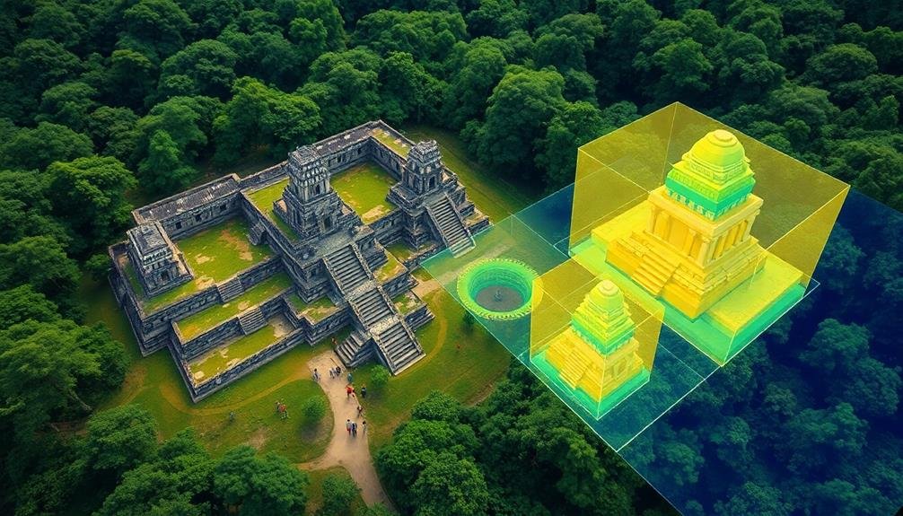
3D Modeling and Reconstruction

You'll find 3D modeling and reconstruction revolutionizing archaeological research through virtual site exploration.
These digital tools allow you to walk through ancient structures and landscapes as they once appeared, providing unprecedented access to historical environments.
You can also examine detailed digital reconstructions of artifacts, enabling close study of fragile or damaged objects without risking their integrity.
Virtual Site Exploration
Step into the past with virtual site exploration, a cutting-edge technique that brings ancient ruins to life through 3D modeling and reconstruction. You'll experience archaeological sites like never before, immersing yourself in digitally recreated environments that showcase how these places might've looked in their prime.
Virtual site exploration offers numerous benefits for both researchers and the public:
- Accessibility: Visit remote or fragile sites without physical travel
- Preservation: Study and explore without risking damage to actual ruins
- Hypothesis testing: Visualize different reconstruction theories in real-time
- Education: Engage students and the public with interactive, visual learning
As you navigate these virtual spaces, you'll gain insights into ancient architecture, daily life, and cultural practices. You can examine artifacts in detail, walk through reconstructed buildings, and even witness simulated historical events.
This technology allows you to toggle between the site's current state and its reconstructed version, helping you understand the excavation process and archaeological interpretations.
Virtual site exploration isn't just about visualization; it's a powerful tool for analysis and discovery. You can use it to identify patterns, test theories, and uncover hidden relationships between different parts of a site.
Artifact Reconstruction Techniques
Building on the concept of virtual exploration, artifact reconstruction techniques take archaeological discovery to the next level. You'll find that these methods allow for the digital recreation of fragmented or degraded artifacts, providing invaluable insights into ancient cultures and technologies.
Using 3D scanning and photogrammetry, you can capture high-resolution images of artifact fragments. These scans are then processed using specialized software to create detailed digital models. By analyzing these models, you're able to identify matching pieces and reconstruct the original object virtually.
You'll also employ AI and machine learning algorithms to assist in the reconstruction process. These tools can predict missing sections based on existing patterns and historical data, considerably speeding up the process.
Once you've created a complete digital model, you can use 3D printing to produce physical replicas. This allows for hands-on examination without risking damage to the original artifacts.
Additionally, you can create virtual reality experiences, enabling researchers and the public to interact with reconstructed artifacts in immersive environments.
These techniques not only preserve fragile artifacts but also democratize access to archaeological discoveries, making them available to a global audience.
Underwater Sonar Mapping

How does one uncover the secrets hidden beneath the waves? Underwater sonar mapping has revolutionized marine archaeology, allowing you to explore submerged sites without disturbing them. This non-invasive technique uses sound waves to create detailed images of the seafloor and objects beneath it.
You'll find that sonar mapping offers several advantages:
- High-resolution imaging of large areas
- Ability to penetrate sediment and reveal buried structures
- Rapid data collection compared to traditional methods
- Reduced risk to divers and artifacts
To conduct underwater sonar mapping, you'll typically use either side-scan or multibeam sonar systems. Side-scan sonar provides a wide swath of seafloor imagery, ideal for locating shipwrecks or submerged structures.
Multibeam sonar, on the other hand, creates precise 3D models of the underwater landscape.
When analyzing sonar data, you'll look for anomalies that might indicate archaeological features. Advanced software can help you enhance images and create detailed maps.
Digital Elevation Models
From the air to underground, Digital Elevation Models (DEMs) provide a powerful tool for archaeologists to visualize and analyze landscapes. You'll find that DEMs are 3D representations of terrain surfaces, created using data from various sources like satellite imagery, LiDAR, or ground surveys.
When you're working with DEMs, you can uncover hidden archaeological features by analyzing subtle changes in elevation. You'll detect ancient structures, roads, and even agricultural patterns that aren't visible to the naked eye. DEMs also allow you to simulate different lighting conditions, revealing shadows that might indicate buried structures.
Here's a breakdown of DEM applications in archaeology:
| Application | Benefit | Example |
|---|---|---|
| Site Detection | Reveals hidden structures | Identifying buried buildings |
| Landscape Analysis | Understand past land use | Mapping ancient field systems |
| Predictive Modeling | Forecast potential sites | Locating probable settlement areas |
| Erosion Monitoring | Track site degradation | evaluating coastal site vulnerability |
You'll find that DEMs are particularly useful when combined with other mapping techniques. By integrating DEMs with geophysical data or historical maps, you can create a thorough understanding of archaeological sites and their surrounding landscapes.
Frequently Asked Questions
How Do Archaeologists Determine Which Mapping Technique to Use for a Specific Site?
You'll choose your mapping technique based on the site's characteristics, research goals, and available resources. Consider factors like terrain, vegetation, size, and depth of remains. You'll also weigh each method's accuracy, cost, and time requirements.
What Are the Costs Associated With Implementing These Advanced Mapping Technologies?
You'll find costs vary widely depending on the technology. You're looking at expenses for equipment, software, skilled personnel, and data processing. Don't forget travel and logistics if you're working in remote areas. It's often a significant investment.
How Do Environmental Factors Affect the Accuracy of Different Mapping Techniques?
Environmental factors can greatly impact your mapping accuracy. You'll find that weather, vegetation, and terrain affect different techniques. LiDAR's effective in dense forests, while aerial photography's best in clear conditions. Ground-penetrating radar's accuracy varies with soil composition.
Can These Mapping Techniques Be Combined for More Comprehensive Archaeological Insights?
You can combine various mapping techniques to gain deeper archaeological insights. By integrating methods like LiDAR, GPR, and aerial photography, you'll create a more complete picture of ancient sites, revealing hidden structures and patterns.
What Training Is Required for Archaeologists to Effectively Use These Mapping Technologies?
You'll need specialized training in geospatial technologies, remote sensing, and data analysis. You should learn to use GIS software, interpret satellite imagery, and operate ground-penetrating radar. It's also essential to understand archaeological methods and site interpretation.
In Summary
You've now explored ten cutting-edge mapping techniques that are revolutionizing archaeology. These methods allow you to see beneath the earth, through dense vegetation, and even underwater. They're giving you unprecedented access to hidden ancient secrets. As technology continues to advance, you'll likely discover even more innovative ways to reveal the past. Keep an eye on these evolving techniques – they're your key to unearthing history's mysteries and piecing together our collective human story.
As educators and advocates for responsible drone use, we’re committed to sharing our knowledge and expertise with aspiring aerial photographers.


Leave a Reply