
When disaster strikes, you'll need to quickly assess the situation using advanced mapping strategies. Combine aerial imagery capture with multi-spectral mapping to get a thorough view. Use 3D terrain modeling to visualize landscapes and identify high-risk zones. Implement real-time data transmission to guarantee seamless information flow. Apply thermal imaging analysis to detect heat signatures and locate survivors. Integrate artificial intelligence to process vast amounts of data and identify patterns. Utilize collaborative mapping platforms for rapid generation and sharing of maps. These cutting-edge techniques will revolutionize your disaster assessment capabilities, providing vital insights for effective response and recovery efforts.
Aerial Imagery Capture

Numerous disaster assessment teams rely heavily on aerial imagery capture as an important first step in mapping affected areas.
You'll find that this technique provides a rapid, all-encompassing overview of the disaster zone, allowing for efficient resource allocation and response planning.
To capture aerial imagery, you'll typically use aircraft, drones, or satellites.
Each method has its advantages: aircraft offer high-resolution images over large areas, drones provide flexibility for targeted coverage, and satellites can quickly capture wide-scale data.
When planning your aerial survey, you'll need to take into account factors like weather conditions, flight restrictions, and image resolution requirements.
You'll want to coordinate with local authorities to guarantee safe and legal operations.
Once you've captured the imagery, you'll process it using specialized software to create orthomosaic maps and 3D models.
These products will help you identify damaged structures, assess infrastructure impacts, and map debris fields.
You'll find that timely aerial imagery capture is vital for effective disaster response.
It'll enable you to quickly assess the extent of damage, prioritize rescue efforts, and plan recovery operations with greater accuracy and efficiency.
Multi-Spectral Mapping
Multi-spectral mapping enhances your disaster assessment capabilities beyond visible light.
You'll find thermal imaging particularly useful for detecting heat signatures from survivors or identifying potential fire hotspots.
Additionally, you can employ vegetation health analysis to assess the extent of damage to crops and natural ecosystems, providing essential information for recovery efforts.
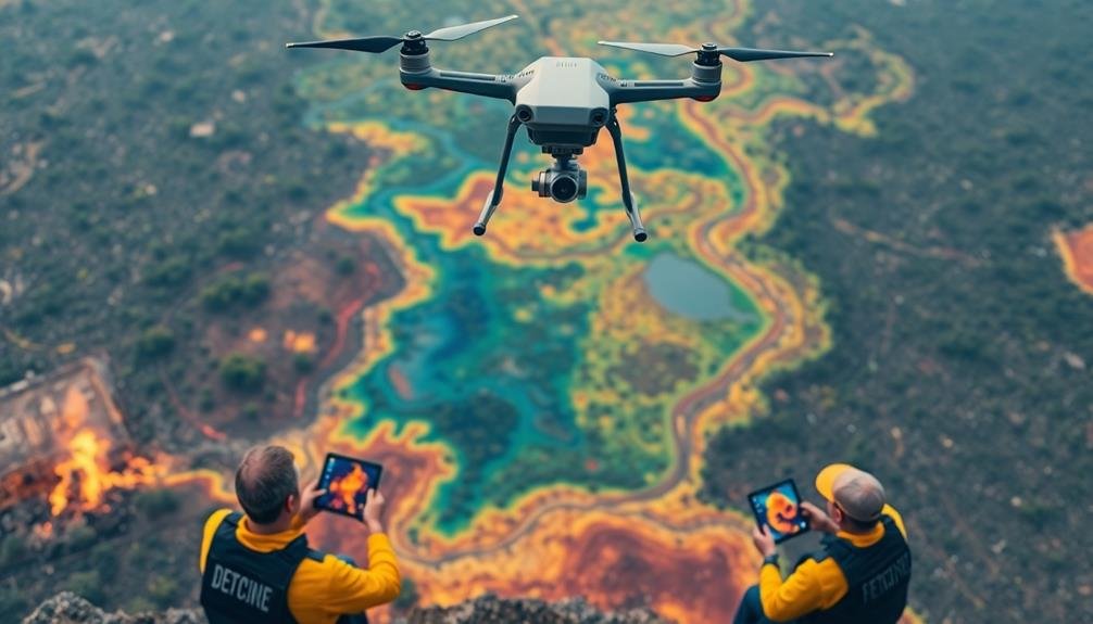
Thermal Imaging Applications
Through the lens of thermal imaging, disaster assessment takes on a new dimension. You'll find this technology invaluable for detecting heat signatures that aren't visible to the naked eye or traditional cameras.
In disaster scenarios, thermal imaging can help you locate survivors trapped under rubble, identify active fire hotspots, and assess structural damage to buildings.
When you're conducting search and rescue operations, thermal cameras can quickly scan large areas to detect body heat, even in low visibility conditions. You'll be able to prioritize search efforts and potentially save more lives.
For fire management, you can use thermal imaging to map the extent of wildfires, identify hidden fire pockets, and monitor the effectiveness of firefighting efforts.
In flood situations, thermal imaging allows you to detect water temperature differences, helping you identify areas of potential contamination or sewage leaks.
You can also use it to assess damage to infrastructure by detecting heat anomalies in power lines, pipelines, or industrial facilities.
Vegetation Health Analysis
When evaluating disaster impacts on vegetation, multi-spectral mapping proves to be an invaluable tool. You'll find it particularly useful for gauging large areas quickly and efficiently. Multi-spectral sensors capture data across various wavelengths, including visible light and near-infrared, allowing you to analyze vegetation health with precision.
You'll use vegetation indices like NDVI (Normalized Difference Vegetation Index) to quantify plant vigor and density. These indices help you identify areas of stressed or damaged vegetation, which may not be visible to the naked eye. By comparing pre- and post-disaster imagery, you can pinpoint areas of significant change and prioritize your response efforts.
You can also detect subtle changes in chlorophyll content, leaf structure, and water stress using specific spectral bands. This information enables you to evaluate the severity of damage and predict potential long-term impacts on ecosystems.
Multi-spectral data can help you identify areas at risk of erosion, landslides, or further degradation due to vegetation loss. By integrating this analysis with other mapping techniques, you'll develop an all-encompassing understanding of the disaster's environmental impacts and guide effective recovery strategies.
3D Terrain Modeling

In disaster assessment, 3D terrain modeling plays an essential role. You'll find it invaluable for visualizing and analyzing the landscape before, during, and after a catastrophic event. By using advanced technologies like LiDAR, photogrammetry, and satellite imagery, you can create detailed digital representations of the affected areas.
These 3D models allow you to:
- Identify high-risk zones prone to flooding, landslides, or other hazards
- Plan evacuation routes and determine safe locations for emergency shelters
- Assess the extent of damage to infrastructure and natural features
You'll benefit from the ability to manipulate these models, viewing them from various angles and elevations. This flexibility helps you gain a thorough understanding of the terrain's characteristics and how they might influence disaster impacts.
When combined with other data layers, such as population density or critical infrastructure locations, 3D terrain models become even more powerful tools. They'll enable you to make informed decisions about resource allocation, prioritize areas for immediate response, and develop long-term mitigation strategies.
Real-Time Data Transmission

The lifeblood of effective disaster response is real-time data transmission. You'll need to establish robust communication networks to guarantee crucial information flows seamlessly between field teams and command centers.
Utilize satellite-based systems, mobile networks, and emergency radio frequencies to maintain connectivity even when local infrastructure fails.
Implement data compression techniques to optimize transmission speeds, especially in bandwidth-limited situations. You should prioritize critical information, such as casualty reports, resource needs, and evolving hazards.
Use standardized data formats and protocols to facilitate rapid integration and analysis at the receiving end.
Consider deploying portable, self-contained communication units that can quickly establish local networks in affected areas. These units can serve as data hubs, collecting and relaying information from various sensors and field teams.
Don't forget to encrypt sensitive data to protect privacy and prevent misinformation.
Incorporate redundancy in your transmission systems to guarantee continuity if primary channels fail.
You'll also want to establish clear protocols for data verification and quality control to maintain the integrity of the information being relayed.
Thermal Imaging Analysis

Building on the foundation of real-time data transmission, thermal imaging analysis emerges as a powerful tool for disaster assessment. You'll find that this technology can detect heat signatures from various sources, providing vital information about the extent and intensity of disasters like wildfires, volcanic eruptions, or industrial accidents.
When you're using thermal imaging for disaster assessment, you'll want to focus on these key aspects:
- Temperature variations: Identify hotspots, cold zones, and thermal anomalies to pinpoint areas of concern.
- Structural integrity: Detect hidden heat sources within buildings or infrastructure that may indicate potential collapse or damage.
- Search and rescue: Locate survivors or victims by their body heat signatures, even in low visibility conditions.
You'll need to calibrate your thermal imaging equipment to account for environmental factors like ambient temperature and humidity.
By interpreting the color gradients in thermal images, you can quickly assess the severity of a situation and prioritize response efforts.
Remember, thermal imaging isn't just for nighttime use; it's equally valuable during daylight hours, especially when combined with other mapping techniques.
With proper training and integration into your disaster assessment workflow, you'll find thermal imaging to be an indispensable asset in rapid response scenarios.
Artificial Intelligence Integration

With the rapid advancement of technology, artificial intelligence (AI) has become a game-changer in disaster assessment mapping. You'll find AI integration revolutionizing the way you analyze and interpret disaster-related data. It's enhancing your ability to quickly process vast amounts of information from various sources, including satellite imagery, social media, and sensor networks.
AI algorithms can help you identify patterns and anomalies that might be missed by human analysts. You'll be able to generate real-time maps and predictions of disaster impacts, enabling faster and more effective response strategies. Machine learning models can also improve over time, learning from past disasters to better predict future events.
| AI Application | Benefits | Challenges |
|---|---|---|
| Image Recognition | Rapid damage assessment | Requires high-quality data |
| Natural Language Processing | Social media analysis | Language barriers |
| Predictive Modeling | Improved resource allocation | Model accuracy and reliability |
Collaborative Mapping Platforms
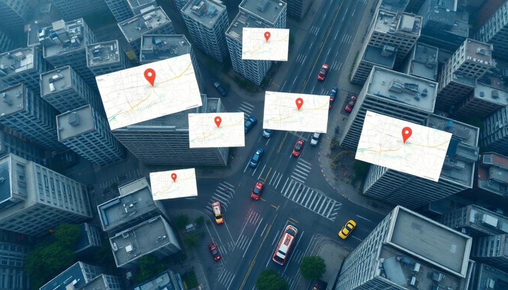
You'll find open-source mapping tools invaluable for disaster assessment, as they allow multiple users to contribute and update information simultaneously.
These platforms can integrate real-time data from various sources, including satellite imagery, ground reports, and sensor networks.
Open-Source Mapping Tools
Collaborative platforms have revolutionized disaster assessment mapping. Now, let's explore open-source mapping tools that complement these platforms. These tools offer accessibility, flexibility, and cost-effectiveness for disaster response teams and volunteers.
You'll find numerous open-source options available for creating, editing, and sharing maps. Some popular choices include:
- QGIS: A powerful desktop GIS software that allows you to analyze and visualize spatial data.
- OpenStreetMap: A crowdsourced mapping platform where you can contribute and use freely available geographic data.
- Ushahidi: A web-based platform that enables you to collect, visualize, and map crisis information from various sources.
These tools provide you with the ability to quickly generate maps, analyze data, and share information during disaster situations. You can easily integrate them with other software and customize them to fit your specific needs.
By leveraging open-source mapping tools, you'll enhance your disaster assessment capabilities while reducing costs and dependency on proprietary software.
Remember to familiarize yourself with these tools before a crisis occurs. Regular training and practice will guarantee you're prepared to utilize them effectively when disaster strikes.
Real-Time Data Integration
Real-time data integration is an important component of collaborative mapping platforms for disaster assessment. You'll find that these platforms can quickly incorporate information from various sources, including satellite imagery, social media feeds, and on-the-ground reports. This continuous influx of data allows for up-to-the-minute updates on disaster situations, helping emergency responders make informed decisions.
When you're using these platforms, you'll notice that they often employ APIs to connect with external data sources. This enables the automatic integration of weather forecasts, seismic activity reports, and other relevant information. You can also expect to see features that allow users to upload geotagged photos and videos, providing visual evidence of disaster impacts.
Machine learning algorithms play a vital role in processing this vast amount of data. They can identify patterns, detect anomalies, and prioritize information for human analysts. You'll find that these systems often include natural language processing capabilities to extract meaningful data from text-based sources like social media posts or SMS messages.
To guarantee data reliability, you'll need to implement verification mechanisms. These may include cross-referencing multiple sources and utilizing trusted networks of local volunteers.
Frequently Asked Questions
How Long Does It Take to Train Personnel in Disaster Mapping Techniques?
You'll find training time varies based on your experience and the specific techniques. It can take anywhere from a few days to several weeks. You'll need to dedicate time to learn software, data analysis, and field assessment skills.
What Are the Legal Considerations for Using Drones in Disaster-Affected Areas?
You'll need to take into account airspace regulations, privacy laws, and local restrictions. Obtain necessary permits, respect no-fly zones, and guarantee proper insurance coverage. Don't interfere with emergency operations. Be aware of liability issues when capturing sensitive data.
How Accurate Are Satellite-Based Mapping Techniques Compared to Ground Surveys?
You'll find satellite-based mapping techniques are generally less accurate than ground surveys. They're limited by resolution and can't capture fine details. However, they're faster and cover larger areas, making them valuable for rapid assessments.
What Are the Cost Implications of Implementing Advanced Disaster Mapping Technologies?
You'll find advanced disaster mapping tech isn't cheap. It's costly to acquire satellites, sensors, and software. You're looking at significant upfront expenses, but you'll save money long-term through quicker, more accurate assessments and better-targeted relief efforts.
How Do Weather Conditions Affect the Reliability of Various Mapping Strategies?
You'll find that weather conditions considerably impact mapping reliability. Heavy rain, snow, or fog can obstruct satellite and aerial imagery. Strong winds may affect drone operations. Cloud cover often limits optical sensors' effectiveness, while radar systems work better.
In Summary
You've explored seven powerful mapping strategies for rapid disaster assessment. By combining aerial imagery, multi-spectral data, 3D modeling, real-time transmission, thermal analysis, AI, and collaborative platforms, you're now equipped to gather essential information quickly. Remember, these tools work best when used together. As you implement these strategies, you'll enhance your ability to respond swiftly and effectively to disasters, potentially saving lives and minimizing damage. Stay prepared and keep refining your mapping skills.
As educators and advocates for responsible drone use, we’re committed to sharing our knowledge and expertise with aspiring aerial photographers.


Leave a Reply