To excel in aerial land survey mapping, you'll need to follow these five essential tips. First, choose the right drone equipment with a high-quality camera and reliable GPS. Next, carefully plan your flight path, considering terrain and regulations. Enhance your camera settings for clarity, using fast shutter speeds and appropriate aperture. Pay attention to weather and lighting conditions, scheduling flights during ideal times. Finally, process and analyze your collected data using specialized software to create accurate maps and 3D models. By mastering these key aspects, you'll be well-equipped to capture precise and valuable aerial survey data. Dive deeper to access the full potential of your mapping projects.
Key Takeaways
- Choose high-quality drone equipment with a good camera, long flight time, and reliable GPS for accurate mapping.
- Plan flight paths carefully, considering terrain, obstacles, and optimal camera settings for comprehensive coverage.
- Optimize camera settings for clarity, using fast shutter speeds and appropriate aperture and ISO settings.
- Consider weather and lighting conditions, scheduling flights during optimal times for consistent and clear imagery.
- Process and analyze collected data using photogrammetry software to create accurate maps and 3D models.
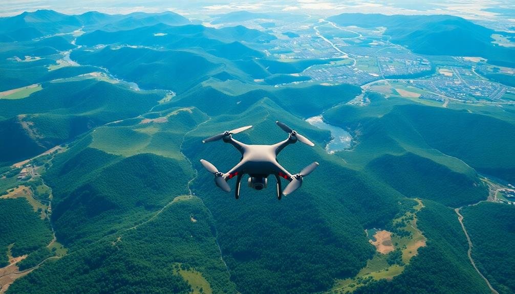
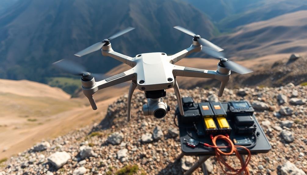
Choose the Right Drone Equipment
For successful aerial land survey mapping, selecting appropriate drone equipment is essential. You'll need a drone with a high-quality camera capable of capturing detailed images. Look for models with at least 12 megapixels and the ability to shoot in RAW format for better post-processing flexibility.
Consider drones with longer flight times and greater range to cover larger areas efficiently. Ensure your drone has a reliable GPS system for accurate positioning and stable flight. RTK (Real-Time Kinematic) GPS modules can provide centimeter-level accuracy, which is vital for precise mapping.
Choose a drone with obstacle avoidance technology to prevent crashes in challenging environments. Don't forget about the importance of payload capacity. You might need to attach additional sensors or equipment, so select a drone that can handle the extra weight.
Weather resistance is another key factor, as you'll often work in varying conditions. Lastly, invest in extra batteries and a portable charging station to extend your mapping sessions.
With the right equipment, you'll be well-prepared to tackle any aerial land survey mapping project efficiently and accurately.
Plan Your Flight Path Carefully

With your drone equipment ready, it's time to focus on planning your flight path. A well-planned route guarantees thorough coverage and efficient use of battery life. Start by identifying your survey area's boundaries and any obstacles or restricted zones. Consider factors like terrain, weather conditions, and local regulations when mapping out your flight path.
Use flight planning software to create an ideal route with appropriate altitude, speed, and overlap settings. Aim for at least 70% frontal overlap and 60% side overlap to guarantee accurate data collection. Set your flight altitude based on the desired ground sampling distance and camera specifications.
| Flight Parameter | Recommendation | Importance |
|---|---|---|
| Altitude | 100-400 ft | High |
| Speed | 10-15 mph | Medium |
| Overlap | 70% front, 60% side | High |
Don't forget to plan for multiple flights if your survey area is large or if you're using different sensors. Include waypoints for battery changes or data offloading. Always have a backup plan and emergency landing sites identified. By carefully planning your flight path, you'll maximize efficiency and data quality while minimizing risks during your aerial land survey mapping mission.
Optimize Camera Settings for Clarity

Achieving crystal-clear imagery is essential for successful aerial land survey mapping. To optimize your camera settings, start by selecting the appropriate shutter speed. You'll want to use a fast shutter speed, typically 1/1000 second or faster, to minimize motion blur caused by the aircraft's movement.
Adjust your aperture to balance depth of field with light sensitivity; an f-stop between f/5.6 and f/8 often works well for aerial surveys. Set your ISO as low as possible while maintaining proper exposure to reduce noise in your images. Use manual focus and set it to infinity to guarantee sharp results across your entire survey area.
Enable your camera's vibration reduction or image stabilization feature if available. Choose RAW format for maximum image quality and post-processing flexibility. If your camera has an intervalometer, use it to automate image capture at regular intervals.
Before takeoff, perform a test flight to fine-tune your settings. Check your images for sharpness, exposure, and coverage. Don't forget to clean your lens and sensor thoroughly before each flight to prevent dust spots on your images.
Consider Weather and Lighting Conditions

Weather and lighting conditions play an important role in aerial land survey mapping. You'll need to carefully consider these factors to guarantee high-quality results. Plan your flights for clear, calm days with minimal cloud cover and low wind speeds.
Overcast skies can create diffused light, reducing shadows and improving overall image consistency. However, avoid flying during heavy cloud cover or fog, as this can obscure ground features.
The sun's position is vital for ideal lighting. Early morning or late afternoon flights often provide the best lighting conditions, with longer shadows that can enhance terrain features. Avoid midday flights when possible, as harsh overhead sunlight can create glare and reduce image quality.
Be aware of seasonal changes in sun angle and daylight hours when scheduling your surveys. Monitor weather forecasts closely and be prepared to adjust your flight plans accordingly. Sudden changes in wind, precipitation, or cloud cover can impact your results.
Remember that different terrains may require specific lighting conditions. For example, snow-covered landscapes might benefit from overcast conditions to reduce glare, while forested areas may need stronger directional light to highlight canopy structure.
Process and Analyze Collected Data
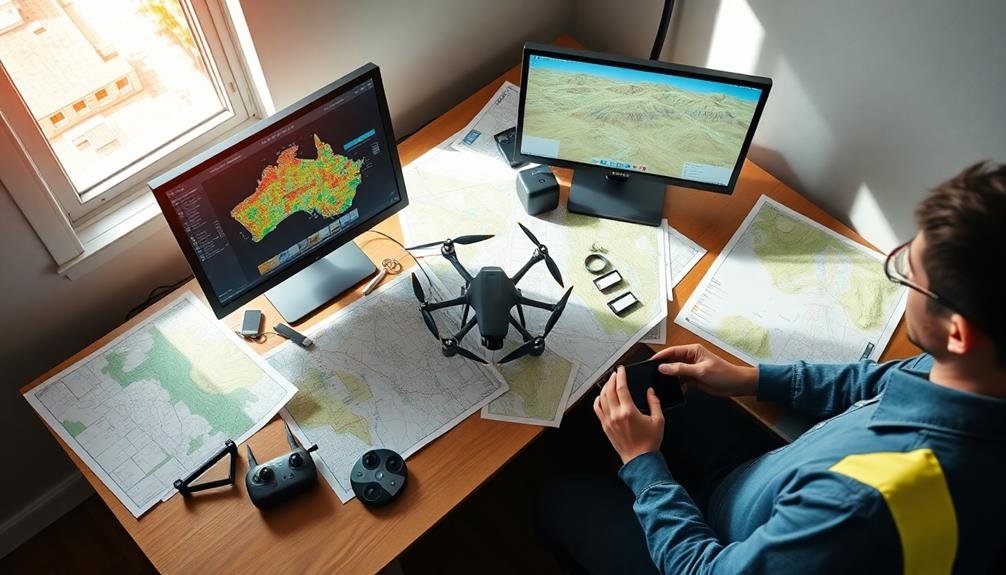
Once you've completed your aerial survey flights and gathered the necessary data, it's time to process and analyze the collected information. Begin by transferring all data from your aerial equipment to a secure computer system. Use specialized photogrammetry software to stitch together the individual images into a thorough orthomosaic map. Apply georeferencing techniques to guarantee accurate spatial alignment with real-world coordinates.
Next, focus on data cleaning and filtering. Remove any outliers, blurry images, or redundant information that might skew your results. Utilize point cloud processing tools to generate 3D models and digital elevation maps. Employ automated feature extraction algorithms to identify and classify specific land features, structures, or vegetation types.
Don't forget to validate your processed data against ground control points for accuracy. Perform quality checks and cross-reference with existing maps or satellite imagery. Use GIS software to overlay additional layers of information, such as property boundaries or infrastructure data.
Frequently Asked Questions
How Do I Obtain Necessary Permits for Aerial Land Survey Mapping?
You'll need to contact your local aviation authority and land management agencies. They'll guide you through required permits, such as flight clearances and property access permissions. Don't forget to check for any special restrictions in your area.
What Are the Legal Altitude Restrictions for Drone Flights in Different Areas?
You'll find drone altitude restrictions vary by location. Generally, you're limited to 400 feet above ground level in uncontrolled airspace. In controlled airspace, you'll need permission and may have lower limits. Always check local regulations before flying.
How Often Should I Calibrate My Drone's Sensors for Accurate Mapping?
You should calibrate your drone's sensors before every flight for ideal accuracy. If you're conducting multiple flights in a day, calibrate at least once daily. Don't skip calibration, as it's essential for reliable mapping results.
Are There Specific Insurance Requirements for Commercial Aerial Land Survey Operations?
You'll need specific insurance for commercial drone operations. It's crucial to have liability coverage and hull insurance. Check your local regulations, as requirements can vary. Don't forget to insure your equipment and consider professional indemnity coverage.
What Software Is Best for Creating 3D Models From Aerial Survey Data?
You'll find several excellent options for creating 3D models from aerial survey data. Popular choices include Pix4D, Agisoft Metashape, and DroneDeploy. These software packages offer powerful tools for processing and visualizing your aerial imagery into detailed 3D models.
In Summary
You've now got the essential tips for successful aerial land survey mapping. Remember to select appropriate drone equipment, meticulously plan your flight path, and optimize your camera settings. Don't forget to factor in weather and lighting conditions for the best results. Once you've collected your data, take the time to process and analyze it thoroughly. By following these guidelines, you'll be well-equipped to produce accurate and high-quality aerial maps for your projects.
As educators and advocates for responsible drone use, we’re committed to sharing our knowledge and expertise with aspiring aerial photographers.


Leave a Reply