
You're witnessing a revolution in public transit planning as aerial technology transforms the way cities map and optimize their transportation networks. Drones and satellite imagery provide extensive views of urban landscapes, allowing planners to identify major roads, residential areas, and natural barriers. This bird's-eye perspective helps create efficient bus routes, determine ideal stops, and analyze traffic patterns. By overlaying demographic data, cities can guarantee equitable service across diverse communities. Real-time monitoring capabilities enable dynamic schedule adjustments and informed decision-making for future improvements. As you explore this sky-high solution, you'll discover how it's shaping the future of urban mobility.
Aerial Insights for Transit Planning
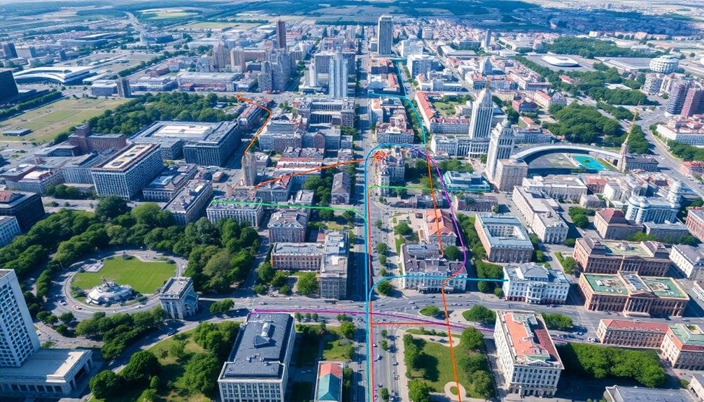
Through aerial photography and satellite imagery, transit planners gain a bird's-eye view of urban landscapes. This perspective allows you to identify key features that influence public transportation routes. You'll spot major roads, residential areas, commercial districts, and natural barriers like rivers or mountains.
These aerial insights help you visualize the city's layout and understand how different neighborhoods connect. You can use this information to plan efficient bus routes, determine ideal stops, and identify areas underserved by current transit options.
By analyzing traffic patterns from above, you'll pinpoint congestion hotspots and potential alternative routes. Aerial data also reveals population density, helping you prioritize high-demand areas for improved service.
With high-resolution imagery, you'll even detect informal paths or shortcuts pedestrians use, which can inform decisions about new bus stops or pedestrian infrastructure.
You can overlay demographic data onto these aerial views, ensuring your transit plans serve diverse communities equitably. By combining this bird's-eye perspective with ground-level data, you'll create more thorough and effective public transit systems that meet the needs of your city's residents.
Drones: Eyes in the Sky
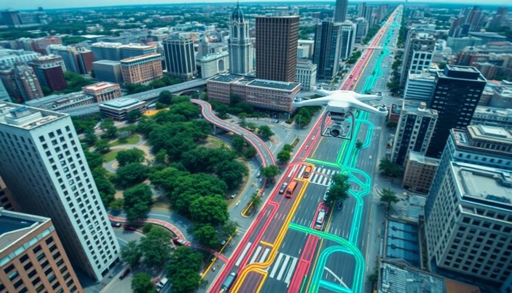
You'll find drones revolutionizing public transit planning through their aerial data collection capabilities.
These unmanned aircraft can capture high-resolution imagery and topographical information, providing transit authorities with detailed insights for route optimization.
Furthermore, drones equipped with real-time monitoring technology can offer up-to-the-minute traffic data, allowing for dynamic adjustments to bus and train schedules.
Aerial Data Collection
Drones' bird's-eye view has revolutionized public transit mapping. You'll find that aerial data collection using drones offers unparalleled accuracy and efficiency in surveying transit routes. These unmanned aerial vehicles can capture high-resolution images and videos, providing a thorough overview of the entire transit network.
With drones, you're able to collect data on route conditions, traffic patterns, and potential obstacles. This information is essential for optimizing routes and improving service reliability. You'll also be able to identify areas that need infrastructure improvements or maintenance.
Here's a quick comparison of traditional vs. drone-based data collection:
| Aspect | Traditional Methods | Drone-Based Collection |
|---|---|---|
| Speed | Slow | Rapid |
| Coverage | Limited | Extensive |
| Accuracy | Moderate | High |
| Cost | Expensive | Cost-effective |
Real-Time Traffic Monitoring
Nearly every major city now employs drones for real-time traffic monitoring, revolutionizing how we manage urban transit.
These aerial observers provide instant, accurate data on traffic flow, congestion, and incidents. You'll find that this technology has greatly improved response times to accidents and reduced overall traffic delays.
Drones equipped with high-resolution cameras and sensors can detect:
- Vehicle speed and density
- Accident locations and severity
- Road conditions and hazards
By utilizing this real-time information, traffic controllers can quickly adjust traffic light timings, reroute vehicles, and dispatch emergency services more efficiently.
You'll notice smoother traffic flow and fewer unexpected delays during your daily commute.
Moreover, the data collected by these drones helps city planners make informed decisions about future infrastructure improvements.
You'll benefit from better-designed roads, optimized public transit routes, and more effective urban planning overall.
As drone technology continues to advance, you can expect even more sophisticated traffic monitoring systems.
These improvements will lead to safer, more efficient urban transportation networks, ultimately enhancing your quality of life in the city.
Optimizing Bus and Rail Routes

Optimizing bus and rail routes is a critical step in creating an efficient public transit system. You'll find that well-designed routes can greatly reduce travel times, increase ridership, and improve overall service quality.
To achieve this, you need to analyze current travel patterns, population density, and major destinations within your city.
Start by collecting data on passenger flow, peak travel times, and common transfer points. Use this information to identify areas where routes overlap unnecessarily or where there are gaps in service.
You'll want to reflect on straightening out meandering routes and adding express services for high-demand corridors.
Don't forget to factor in intermodal connections. Verify that bus routes feed into rail stations effectively, creating a seamless network.
You should also look at adjusting schedules to minimize wait times between transfers.
Contemplate implementing dynamic routing during off-peak hours to serve areas with lower demand more efficiently. This approach can help you maintain service while reducing operational costs.
Overcoming Traditional Mapping Challenges

You've likely encountered outdated paper-based transit maps that fail to reflect current routes and schedules.
These traditional mapping methods often rely on limited ground-level perspectives, missing vital details about accessibility and real-world conditions.
Additionally, resource-intensive manual surveys can strain transit agencies' budgets and personnel, making it challenging to keep maps accurate and up-to-date.
Outdated Paper-Based Systems
For decades, transit agencies relied on cumbersome paper maps and schedules to guide riders through complex public transportation networks. These outdated systems often left you struggling to navigate unfamiliar routes, plan efficient transfers, and stay informed about service changes.
You've likely experienced the frustration of deciphering a crumpled, coffee-stained bus schedule or squinting at a faded subway map. These paper-based systems presented numerous challenges:
- Limited accessibility: You couldn't easily access route information on-the-go or make last-minute trip adjustments.
- Inaccurate information: Printed materials quickly became outdated, leading to missed connections and wasted time.
- Environmental impact: Constant reprinting of schedules and maps contributed to unnecessary paper waste.
Transit agencies faced their own set of hurdles with paper-based systems. They struggled to communicate real-time updates, track ridership patterns, and optimize routes based on changing demand.
The cost of printing and distributing physical materials also placed a significant burden on already strained budgets.
As cities grew and transportation networks became more complex, it became clear that a more dynamic, user-friendly solution was needed to meet the evolving needs of both riders and transit agencies.
Limited Ground-Level Perspectives
Traditional mapping techniques often fell short when it came to capturing the nuances of public transit routes. When you're relying solely on ground-level perspectives, you're missing out on vital information that can impact route planning and efficiency.
From the street, it's challenging to visualize the entire network and how different routes interconnect. You can't easily spot potential bottlenecks, areas of congestion, or opportunities for route optimization.
Ground-level mapping also makes it difficult to assess the surrounding infrastructure, such as parking lots, transfer points, and nearby amenities that could influence ridership.
Moreover, you're limited in your ability to capture accurate distance measurements and topographical features that might affect route planning. Hills, valleys, and other terrain variations aren't always apparent from street level, yet they play a significant role in determining the most efficient routes.
Resource-Intensive Manual Surveys
In light of the limitations of ground-level perspectives, transit authorities often turned to resource-intensive manual surveys to gather more detailed data. These surveys involved dispatching teams of workers to physically map routes, record stop locations, and document service frequencies.
While this approach provided more thorough information, it came with significant drawbacks.
You'll find that manual surveys are:
- Time-consuming: It can take weeks or months to map an entire transit network.
- Expensive: Hiring and equipping survey teams requires substantial financial investment.
- Prone to human error: Fatigue and distractions can lead to inaccuracies in data collection.
Despite these challenges, manual surveys remained a primary method for mapping transit routes for decades. They required careful planning and coordination to guarantee coverage of all routes and times of day.
Surveyors often used GPS devices, cameras, and specialized software to record data, but the process still relied heavily on human observation and input. As cities grew and transit networks expanded, the task of keeping maps up-to-date became increasingly overwhelming, prompting authorities to seek more efficient and cost-effective solutions for maintaining accurate transit information.
Real-Time Traffic Flow Analysis

Real-time traffic flow analysis forms the backbone of modern public transit mapping. You'll find this technology revolutionizing how transit agencies plan and optimize routes. By leveraging data from GPS-enabled vehicles, traffic cameras, and mobile devices, you can now monitor traffic patterns as they unfold.
This real-time information allows you to identify congestion hotspots, predict travel times, and adjust routes accordingly. You'll notice that transit agencies can respond swiftly to unexpected events, such as accidents or road closures, by rerouting buses or adjusting schedules. This dynamic approach guarantees that passengers receive the most up-to-date and efficient service possible.
You can also use this data to analyze long-term trends, helping you make informed decisions about future route planning and infrastructure investments. By understanding peak travel times and popular destinations, you'll be able to optimize your transit network to better serve your community's needs.
Moreover, you can integrate this information into passenger-facing apps, providing real-time updates on bus locations and estimated arrival times. This transparency improves the overall transit experience, encouraging more people to choose public transportation over private vehicles.
Future of Urban Transit Design
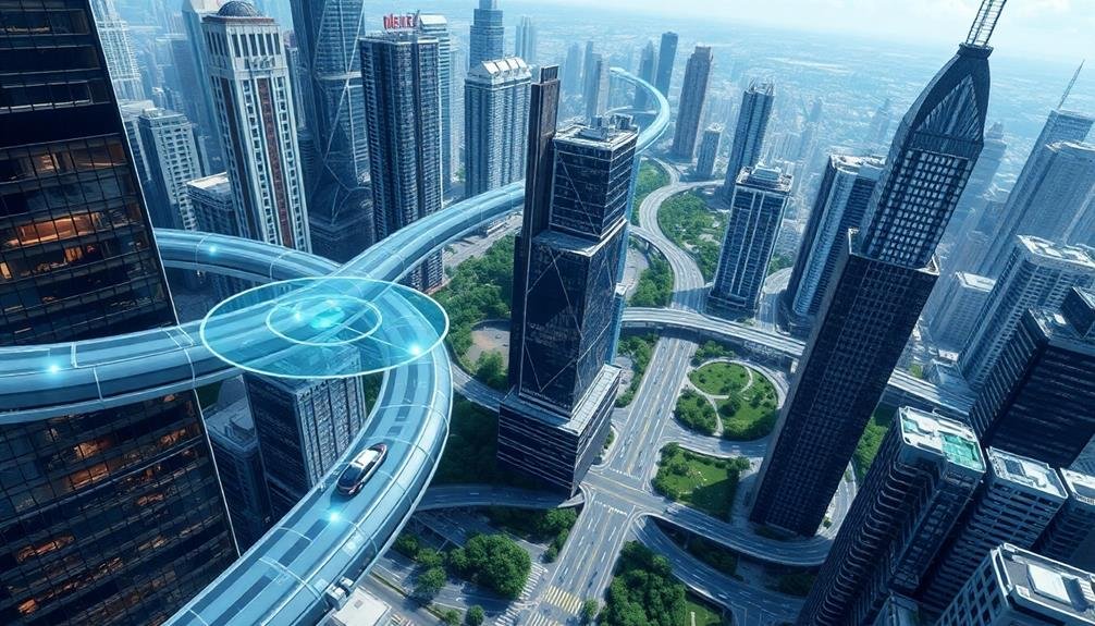
Looking ahead, urban transit design is poised for a revolutionary transformation. You'll see cities embracing innovative solutions to tackle congestion, pollution, and accessibility issues. Autonomous vehicles will play a significant role, seamlessly integrating with existing public transit systems to provide efficient, door-to-door services.
Smart infrastructure will become the backbone of urban transit. Intelligent traffic lights, adaptive road systems, and real-time data analysis will optimize traffic flow and reduce travel times. You'll experience a more connected and responsive transit network that adapts to your needs.
The future of urban transit design will prioritize sustainability and user experience. You can expect:
- Multi-modal hubs that seamlessly connect various transportation options
- Green corridors for cyclists and pedestrians, encouraging active mobility
- On-demand, electric microtransit services for last-mile connectivity
As cities grow vertically, you'll see innovative solutions like sky bridges, elevated walkways, and even flying taxis becoming a reality. These advancements will redefine urban mobility, creating a more efficient, sustainable, and enjoyable transit experience for you and future generations.
Frequently Asked Questions
How Much Does Aerial Transit Mapping Cost Compared to Traditional Methods?
You'll find aerial transit mapping often costs less than traditional methods. It's faster and more efficient, saving you time and labor expenses. However, exact cost comparisons depend on your project's scale and specific requirements.
Are There Privacy Concerns With Using Drones for Urban Transit Mapping?
You're right to contemplate privacy concerns with drone mapping. They can capture detailed imagery, potentially invading personal space. However, regulations often limit drone use in urban areas, and transit agencies typically blur sensitive information before publishing data.
Can This Technology Be Applied to Smaller Towns and Rural Areas?
Yes, you can apply this technology to smaller towns and rural areas. It's versatile and scalable. You'll find it useful for mapping less populated regions, helping improve transportation planning and connectivity in these communities too.
How Long Does It Take to Implement Changes Based on Aerial Mapping Data?
You'll find that implementing changes based on aerial mapping data can vary widely. It typically takes a few months to a year, depending on the scale of changes, available resources, and local decision-making processes.
What Qualifications Are Needed for Professionals Working in Aerial Transit Mapping?
You'll need a degree in GIS, urban planning, or transportation engineering. Expertise in remote sensing, data analysis, and mapping software is essential. You should also understand public transit systems and have strong problem-solving skills.
In Summary
You're witnessing a revolution in transit planning. With drones and aerial mapping, you'll soon see more efficient bus and rail routes in your city. These sky-high solutions are overcoming traditional challenges, giving planners real-time insights into traffic flow. As urban areas grow, you can expect smarter, more responsive public transportation networks. The future of transit design is looking up – literally. Embrace this aerial perspective for a smoother commute ahead.
As educators and advocates for responsible drone use, we’re committed to sharing our knowledge and expertise with aspiring aerial photographers.


Leave a Reply