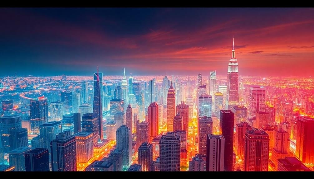
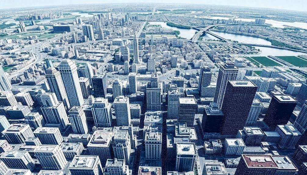
Urban mapping techniques have transformed architectural visualization, offering powerful tools for capturing and presenting complex urban environments. You'll find aerial photogrammetry and LiDAR scanning at the forefront, providing high-precision 3D modeling capabilities. Thermal imaging and multispectral mapping reveal hidden aspects of cities, while 3D point cloud generation creates detailed digital representations. Orthomosaic creation combines multiple aerial images for seamless views, and time-lapse urban development tracking visualizes growth over time. These seven techniques enable architects and urban planners to analyze, design, and communicate urban spaces with unprecedented accuracy and insight. Explore further to access the full potential of these innovative mapping methods.
Aerial Photogrammetry
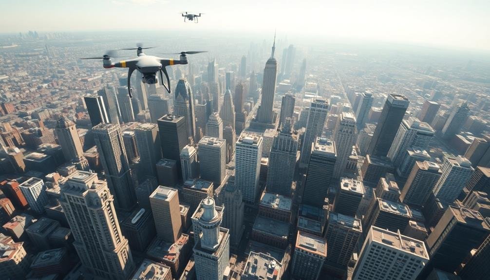
Three key components define aerial photogrammetry in urban mapping: aircraft, cameras, and software. You'll use specialized aircraft, often drones or small planes, to capture high-resolution images of urban areas from various angles. These aircraft are equipped with advanced cameras that take multiple overlapping photos as they fly over the city.
The real magic happens when you process these images using photogrammetry software. This software analyzes the overlapping photos, identifying common points to create a 3D model of the urban landscape. You'll be amazed at the level of detail you can achieve, from building facades to street layouts and vegetation.
You can use aerial photogrammetry to create accurate 3D models of entire cities, which are invaluable for urban planning, architecture, and virtual reality applications. It's faster and more cost-effective than traditional surveying methods, allowing you to map large areas quickly.
You'll also appreciate the ability to update your models regularly, tracking changes in the urban environment over time. With aerial photogrammetry, you're not just mapping cities; you're creating digital twins that architects and planners can use to visualize and shape the future of urban spaces.
LiDAR Scanning
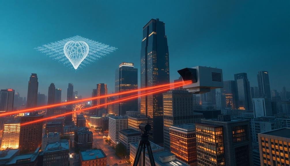
When you're looking for high-precision 3D modeling of urban environments, LiDAR scanning stands out as a powerful tool.
You'll find that LiDAR technology uses laser pulses to measure distances and create detailed point clouds, resulting in accurate 3D representations of buildings and landscapes.
With LiDAR, you can rapidly acquire vast amounts of spatial data, greatly reducing the time needed for thorough urban mapping projects.
High-Precision 3D Modeling
LiDAR scanning has revolutionized high-precision 3D modeling in urban mapping and architectural visualization. It's allowed you to capture intricate details of urban landscapes with unprecedented accuracy. You'll find that LiDAR technology emits laser pulses to measure distances and create point clouds, which form the basis of detailed 3D models.
When you're working on high-precision 3D modeling, you'll typically process the LiDAR data using specialized software. This software helps you clean up the point cloud, removing noise and outliers. You'll then transform the point cloud into a mesh, adding textures and materials to create a photorealistic 3D model.
One of the key advantages you'll notice is the ability to capture hard-to-reach areas and complex geometries. You can easily model intricate architectural features, vegetation, and even infrastructure elements like power lines. The resulting 3D models are highly accurate, often within centimeters of the real-world measurements.
You'll find these high-precision 3D models invaluable for various applications, including urban planning, heritage preservation, and virtual reality experiences. They provide a detailed digital twin of the urban environment, allowing you to analyze, simulate, and visualize complex urban scenarios with unprecedented realism and accuracy.
Rapid Data Acquisition
As you explore rapid data acquisition, you'll discover that LiDAR scanning stands out as a game-changer in urban mapping and architectural visualization. This technology uses laser pulses to measure distances and create highly detailed 3D point clouds of urban environments. You'll find that LiDAR scanners can capture millions of data points per second, allowing for swift and accurate mapping of large areas.
When you're working with LiDAR, you'll appreciate its ability to penetrate vegetation and capture ground-level details, even in densely built environments. This makes it invaluable for creating precise digital terrain models and identifying building footprints.
You'll also notice that LiDAR data can be easily integrated with other geospatial information, enhancing your overall urban analysis capabilities.
To make the most of LiDAR scanning, you'll need to take into account factors like scan resolution, point density, and data processing workflows. You'll find that mobile LiDAR systems mounted on vehicles or drones can greatly speed up data collection for large-scale urban projects.
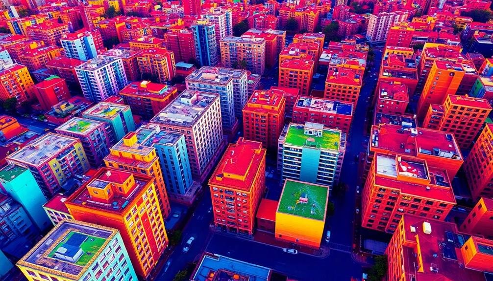
Thermal Imaging
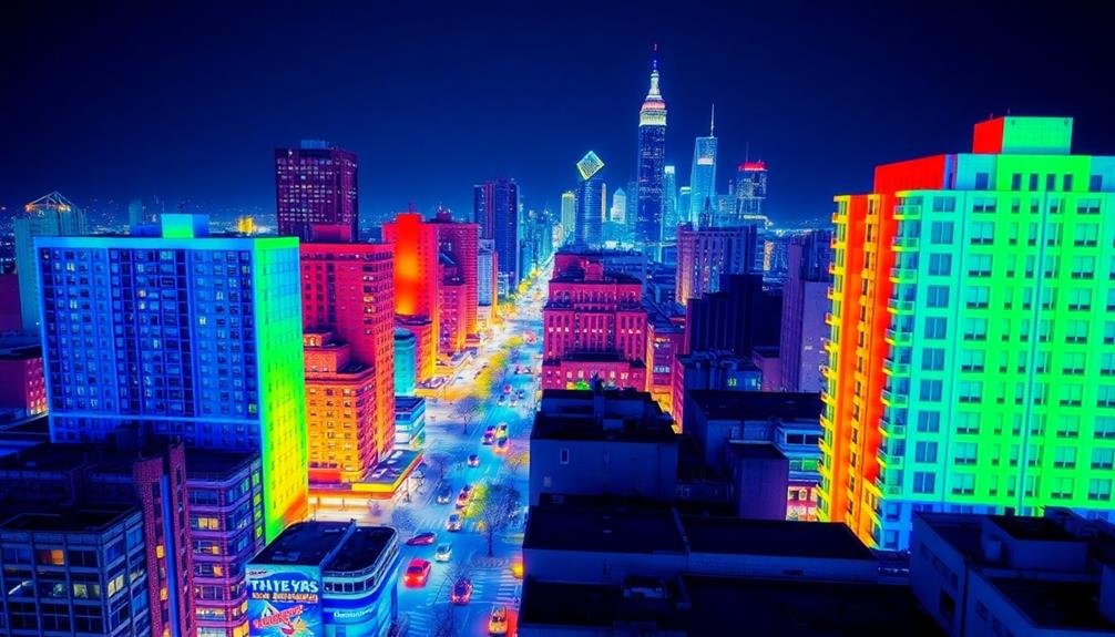
Thermal imaging revolutionizes urban mapping by providing valuable temperature data for architectural visualization. You'll find this technology incredibly useful for identifying heat patterns, energy inefficiencies, and thermal anomalies in urban environments.
By using infrared cameras, you can capture and visualize heat signatures emitted by buildings, infrastructure, and even vegetation. In architectural visualization, thermal imaging helps you understand how different materials and designs impact energy performance.
You can detect areas of heat loss, poor insulation, or excessive heat gain, allowing for more informed decisions in urban planning and building design. This data is essential for creating energy-efficient structures and optimizing urban microclimates.
You'll also benefit from thermal imaging in evaluating the urban heat island effect. By mapping temperature variations across city landscapes, you can identify hotspots and cool zones, informing strategies for mitigating heat-related issues.
This information is invaluable for designing green spaces, selecting appropriate building materials, and planning urban ventilation corridors. Integrating thermal imaging data into your 3D models and visualizations enhances your ability to communicate complex thermal information to stakeholders, ultimately leading to more sustainable and comfortable urban environments.
Multispectral Mapping
Immerse yourself in the world of multispectral mapping, a powerful technique that expands your urban visualization capabilities beyond visible light. You'll capture data across multiple spectral bands, revealing hidden aspects of urban environments. This method allows you to analyze vegetation health, detect material composition, and identify thermal anomalies in buildings and infrastructure.
To implement multispectral mapping, you'll need specialized sensors that capture data in specific wavelengths. Here's a breakdown of common spectral bands and their applications:
| Spectral Band | Wavelength Range | Urban Applications |
|---|---|---|
| Near-Infrared | 750-1400 nm | Vegetation analysis |
| Short-Wave IR | 1400-3000 nm | Moisture detection |
| Thermal IR | 3000-14000 nm | Heat mapping |
You'll process this data using specialized software to create composite images that highlight specific urban features. By combining multispectral data with traditional mapping techniques, you'll generate extensive visualizations that provide deeper insights into urban environments. This approach enables you to identify areas for green space development, assess building energy efficiency, and plan infrastructure improvements more effectively. Multispectral mapping is an invaluable tool for urban planners, architects, and environmental scientists seeking to create more sustainable and resilient cities.
3D Point Cloud Generation
Have you ever wondered how to capture the intricate details of urban landscapes in three dimensions? 3D point cloud generation is a cutting-edge technique that allows you to create highly accurate digital representations of cities and buildings.
To generate a 3D point cloud, you'll use specialized equipment like LiDAR scanners or photogrammetry techniques. These tools collect millions of data points, each containing spatial coordinates and sometimes color information. As you scan an urban area, you'll capture everything from building facades to street furniture and vegetation.
Once you've collected the raw data, you'll process it using specialized software. This step involves cleaning the data, removing noise, and aligning multiple scans. You can then use the resulting point cloud for various applications, such as creating detailed 3D models, performing structural analysis, or planning urban developments.
The advantages of 3D point cloud generation include its high accuracy, ability to capture complex geometries, and potential for repeated measurements over time.
However, you'll need to take into account factors like data storage, processing power, and the expertise required to interpret the results effectively.
Orthomosaic Creation

Orthomosaic creation is a powerful tool in urban mapping that combines multiple aerial images into a single, seamless view of an area. You'll find this technique invaluable for creating accurate, high-resolution maps of urban environments. To create an orthomosaic, you'll need to capture overlapping aerial images, process them using specialized software, and stitch them together.
The process involves several key steps:
- Image acquisition: Capture aerial photos with at least 60% overlap.
- Georeferencing: Assign geographic coordinates to each image.
- Image alignment: Match common points between overlapping photos.
- Orthorectification: Correct distortions caused by camera angle and terrain.
- Mosaicking: Blend images seamlessly into a single composite.
Here's a comparison of orthomosaic creation methods:
| Method | Pros | Cons |
|---|---|---|
| UAV | High resolution, flexible | Limited coverage area |
| Satellite | Large coverage area | Lower resolution, cloud interference |
| Manned aircraft | Balance of coverage and detail | Expensive, weather-dependent |
Time-Lapse Urban Development Tracking
How can you effectively track urban development over time? Time-lapse urban development tracking allows you to visualize and analyze the evolution of cityscapes over extended periods. This technique combines satellite imagery, aerial photography, and ground-level data to create a thorough view of urban growth and change.
To implement time-lapse urban development tracking, you'll need to:
- Collect historical imagery and data from various sources
- Align and georeference images from different time periods
- Create a consistent color palette for visual continuity
- Develop a timeline interface for easy navigation
You'll find this method particularly useful for urban planners, architects, and policymakers. It helps identify patterns in urban sprawl, changes in land use, and the impact of infrastructure projects. You can also use it to predict future development trends and assess the effectiveness of urban planning initiatives.
When creating your time-lapse visualization, focus on key areas of interest such as city centers, industrial zones, and residential neighborhoods.
You'll want to highlight significant changes like new construction, demolitions, and land reclamation projects. By incorporating additional data layers, such as population density or property values, you'll enhance the depth and utility of your urban development tracking tool.
Frequently Asked Questions
How Do Urban Mapping Techniques Impact Real Estate Valuation?
Urban mapping techniques can boost your property's value by highlighting its best features. They'll show potential buyers the neighborhood's amenities, future developments, and proximity to key locations, giving you a competitive edge in the real estate market.
What Are the Legal Considerations for Using Drones in Urban Mapping?
You'll need to take into account privacy laws, airspace regulations, and local ordinances. Obtain necessary permits and certifications. Don't fly over people or private property without consent. Be aware of no-fly zones and altitude restrictions in urban areas.
Can Urban Mapping Techniques Be Integrated With Virtual Reality for Immersive Experiences?
Yes, you can integrate urban mapping techniques with VR for immersive experiences. You'll create 3D models from mapping data, then import them into VR platforms. This allows you to explore and interact with virtual cityscapes.
How Do Weather Conditions Affect the Accuracy of Urban Mapping Data Collection?
Weather conditions greatly impact your urban mapping data collection. You'll find rain, snow, and fog can obscure visibility, affecting sensor accuracy. Strong winds might disrupt drone operations, while extreme temperatures can interfere with equipment performance. Always consider weather when planning data collection.
What Role Does Artificial Intelligence Play in Interpreting Urban Mapping Data?
AI plays an essential role in interpreting urban mapping data. You'll find it's used for pattern recognition, anomaly detection, and predictive analysis. It can quickly process vast amounts of data, identifying trends and insights humans might miss.
In Summary
You've now explored seven powerful urban mapping techniques that'll revolutionize your architectural visualization projects. By incorporating these methods, you'll gain unparalleled insights into cityscapes and structures. Remember, each technique offers unique advantages, so don't hesitate to combine them for thorough results. As technology advances, stay curious and keep experimenting with these tools. They'll help you create more accurate, detailed, and visually stunning representations of urban environments. Embrace these innovations to stay ahead in your field.
As educators and advocates for responsible drone use, we’re committed to sharing our knowledge and expertise with aspiring aerial photographers.


Leave a Reply