
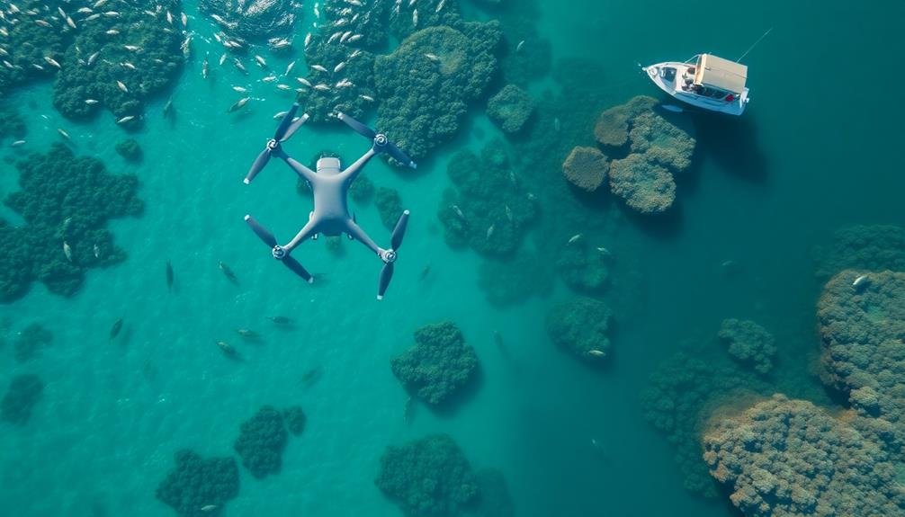
Drones can reveal a wealth of information about Marine Protected Areas (MPAs). They provide aerial mapping of ecosystems, track fish populations, and monitor coral reef health. You'll find drones detecting illegal fishing, evaluating coastal erosion, and surveying shoreline development impact. They're invaluable for analyzing water quality changes, measuring sea level rise, and monitoring MPA boundaries. These unmanned aerial vehicles offer cost-effective, efficient, and non-invasive ways to gather data on large marine areas quickly. From identifying pollution sources to observing marine mammal behavior, drones are transforming how we perceive and protect our oceans. Dive deeper to explore the full range of drone applications in marine conservation.
Aerial Mapping of Marine Ecosystems

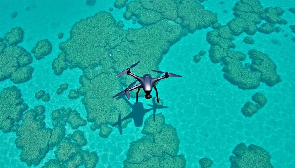
Mapping marine ecosystems from above has revolutionized our understanding of coastal and oceanic habitats. Drones equipped with high-resolution cameras and sensors allow you to capture detailed aerial imagery of vast marine areas quickly and efficiently.
You'll find that these unmanned aerial vehicles can cover large swaths of coastline, coral reefs, and seagrass beds in a fraction of the time it would take using traditional boat-based surveys.
With drone technology, you're able to create accurate, up-to-date maps of marine protected areas (MPAs) that reveal the distribution and health of key habitats. You can easily identify changes in coral cover, seagrass density, and mangrove extent over time. This information is essential for monitoring the effectiveness of conservation efforts and detecting potential threats to marine ecosystems.
Moreover, you'll discover that aerial mapping helps you spot illegal activities within MPAs, such as unauthorized fishing or coastal development. By providing a bird's-eye view of these protected areas, drones enable you to better enforce regulations and protect vulnerable marine species and habitats.
You'll find that this technology is an invaluable tool for marine conservation and management efforts.
Tracking Fish Population Movements

Beyond aerial mapping, drones are revolutionizing how you track fish population movements in marine protected areas. These unmanned aerial vehicles equipped with high-resolution cameras and sensors allow you to observe fish behavior and migration patterns from above, providing valuable data that was previously difficult to obtain.
You can now monitor large areas of ocean in real-time, identifying schools of fish and tracking their movements across different habitats. Drones enable you to detect seasonal changes in fish populations, helping you understand how environmental factors influence their distribution.
By using thermal imaging cameras, you're able to locate fish even when they're not visible from the surface. Drones also assist in tagging studies by guiding boats to specific locations where fish congregate. This improves the efficiency of tagging operations and reduces disturbance to marine life.
Additionally, you can use drones to assess the effectiveness of marine protected areas by comparing fish populations inside and outside these zones. This data helps you make informed decisions about conservation strategies and adjust protected area boundaries if necessary.
Monitoring Coral Reef Health
With the rise of drone technology, monitoring coral reef health has become more efficient and thorough than ever before. You can now deploy drones equipped with high-resolution cameras and sensors to capture detailed imagery of coral reefs without disturbing the delicate ecosystem.
These aerial surveys provide a complete view of reef conditions, allowing researchers to identify areas of concern and track changes over time.
Drones offer several advantages for coral reef monitoring:
- Cost-effective compared to traditional boat-based surveys
- Ability to cover large areas quickly
- Minimal environmental impact
- Consistent data collection for long-term studies
- Access to remote or dangerous locations
You'll find that drone-captured imagery can reveal significant information about coral bleaching, algal overgrowth, and other indicators of reef health.
By analyzing this data, you can assess the effectiveness of marine protected areas in preserving coral ecosystems. Additionally, you can use thermal imaging to detect temperature fluctuations that may stress corals, enabling early intervention strategies.
As drone technology continues to advance, you'll have access to even more sophisticated tools for monitoring and protecting these essential marine habitats.
Detecting Illegal Fishing Activities

You'll find drones increasingly useful for detecting illegal fishing activities in marine protected areas.
With their real-time surveillance capabilities, you can quickly identify unauthorized vessels entering restricted zones.
You're able to monitor vast areas more efficiently, enhancing your ability to protect marine ecosystems from illegal exploitation.
Real-Time Surveillance Capabilities
Drones' real-time surveillance capabilities have revolutionized the detection of illegal fishing activities in marine protected areas. You'll find that these unmanned aerial vehicles can cover vast expanses of ocean quickly and efficiently, providing authorities with up-to-the-minute information on vessel movements and fishing activities.
With high-resolution cameras and thermal imaging technology, drones can spot illegal fishing boats even in low-light conditions or when they're trying to conceal their presence. They're able to transmit live video feeds to control centers, allowing for immediate response to potential violations.
Drones offer several advantages over traditional surveillance methods:
- Continuous monitoring without human fatigue
- Access to remote or dangerous areas
- Cost-effective compared to manned patrols
- Ability to gather evidence for prosecution
- Minimal disruption to marine ecosystems
You'll appreciate how drones can be programmed to follow predetermined flight paths, ensuring consistent coverage of protected areas. They can also be quickly deployed in response to suspicious activity reported by other sources, such as satellite imagery or tip-offs from local communities.
This real-time surveillance capability greatly enhances the effectiveness of marine protection efforts, deterring potential violators and preserving crucial marine ecosystems.
Identifying Unauthorized Vessels
Frequently, identifying unauthorized vessels is a critical aspect of detecting illegal fishing activities in marine protected areas. Drones equipped with high-resolution cameras and advanced imaging technology can help you spot vessels that shouldn't be in protected waters. You'll be able to capture clear images of boat registration numbers, unique markings, and even crew activities from a safe distance.
Using drones, you can cover large areas quickly and efficiently, making it easier to identify patterns of unauthorized entry. They're particularly useful for monitoring remote or hard-to-reach areas where traditional patrols might struggle. You'll also benefit from the drone's ability to operate day or night, using thermal imaging to detect vessels trying to avoid detection.
Here's a comparison of drone capabilities for identifying unauthorized vessels:
| Feature | Standard Drone | Advanced Drone | Military-Grade Drone |
|---|---|---|---|
| Range | 5-10 km | 20-50 km | 100+ km |
| Flight Time | 30-60 min | 1-2 hours | 4-8 hours |
| Imaging | HD Video | 4K + Thermal | Multi-spectral + AI |
Monitoring Restricted Zones
Once unauthorized vessels are identified, the next step is monitoring restricted zones to detect illegal fishing activities. Drones equipped with high-resolution cameras and sensors can patrol these areas efficiently, covering vast stretches of water in a short time.
You'll find that these aerial vehicles can capture real-time footage and data, allowing authorities to respond quickly to potential violations.
When monitoring restricted zones, drones can:
- Detect fishing gear like nets and longlines
- Spot vessel movements indicative of fishing
- Identify species being caught
- Monitor catch transfers between vessels
- Observe fishing practices in sensitive habitats
By using drones, you're able to gather evidence of illegal fishing activities that might otherwise go unnoticed. They can operate at various altitudes, providing both wide-area surveillance and detailed close-up imagery.
This versatility allows for thorough monitoring of restricted zones, from coastal areas to offshore locations.
Drones also offer a cost-effective solution compared to traditional patrol vessels. You can deploy them more frequently and for longer durations, increasing the chances of detecting and deterring illegal fishing.
With this technology, you're better equipped to protect marine ecosystems and promote the sustainability of fish populations within protected areas.
Assessing Coastal Erosion Patterns

Coastal erosion patterns have come into sharper focus thanks to drone technology. You can now track shoreline changes over time with unprecedented accuracy. Drones equipped with high-resolution cameras and LiDAR sensors capture detailed imagery and topographical data, allowing you to create 3D models of coastlines.
These aerial surveys provide valuable insights into erosion rates, sediment transport, and the impact of storm events. You'll be able to identify vulnerable areas and prioritize conservation efforts more effectively. Here's a breakdown of how drones aid in evaluating coastal erosion:
| Aspect | Drone Capability | Benefit |
|---|---|---|
| Coverage | Large areas quickly | Extensive data |
| Frequency | Regular surveys | Temporal analysis |
| Resolution | High-detail imagery | Precise measurements |
| Safety | Remote operation | Access dangerous areas |
| Cost | Lower than traditional | More frequent surveys |
Identifying Marine Pollution Sources

You'll find drones incredibly useful for pinpointing marine pollution sources in protected areas.
These aerial tools can help you locate illegal dumping sites that might otherwise go unnoticed from the shore or boat patrols.
Additionally, you can use drones to track oil spill patterns, allowing for quicker response times and more effective cleanup efforts.
Locating Illegal Dumping Sites
Pollution detectives in the sky, drones are revolutionizing the way we locate illegal dumping sites in marine protected areas. These unmanned aerial vehicles provide a bird's-eye view of vast oceanic regions, allowing you to spot suspicious activities and environmental hazards that might otherwise go unnoticed.
With high-resolution cameras and thermal imaging technology, drones can identify potential dumping sites by detecting:
- Unusual discoloration in water
- Floating debris or oil slicks
- Abnormal patterns in marine life distribution
- Suspicious vessel activities
- Unnatural sediment plumes
You'll find that drones are particularly effective in monitoring remote or hard-to-reach areas where traditional surveillance methods fall short. They can cover large expanses of water quickly and efficiently, providing real-time data to authorities.
This rapid response capability is vital in catching perpetrators in the act and preventing further environmental damage.
Tracking Oil Spill Patterns
Drones' ability to track oil spill patterns has revolutionized the identification of marine pollution sources. These aerial devices provide a bird's-eye view of oil slicks, allowing you to map their spread and movement over time.
By deploying drones equipped with high-resolution cameras and infrared sensors, you can detect even small amounts of oil on the water's surface.
You'll find that drones offer several advantages in tracking oil spills. They can cover large areas quickly, operate in hazardous conditions, and provide real-time data to response teams.
With this information, you're able to predict the spill's trajectory and identify potential impact zones. Drones also help you pinpoint the origin of the spill by tracing the oil's path back to its source.
Studying Seagrass Bed Distribution

Seagrass beds, vital ecosystems in marine environments, are now being mapped more efficiently using drone technology. You'll find that drones equipped with high-resolution cameras and multispectral sensors can capture detailed images of large areas quickly. This allows researchers to assess seagrass distribution, density, and health with unprecedented accuracy.
By using drones, you're able to:
- Cover vast areas in a fraction of the time compared to traditional methods
- Minimize disturbance to marine life during surveys
- Obtain real-time data for immediate analysis
- Reduce costs associated with boat-based or diver surveys
- Access shallow or hard-to-reach areas easily
You'll appreciate how this technology enables frequent monitoring of seagrass beds, helping you track changes over time. It's particularly useful in Marine Protected Areas, where you need to assess the effectiveness of conservation efforts.
You can quickly identify areas of seagrass loss or expansion, allowing for timely intervention when needed. With drone-based mapping, you're better equipped to make informed decisions about seagrass management and protection in these significant marine habitats.
Observing Marine Mammal Behavior

When it comes to observing marine mammal behavior, drones have revolutionized research methods. You can now study these animals from a unique aerial perspective, minimizing disturbance to their natural habitat. Drones allow you to capture high-resolution images and videos of marine mammals in their environment, providing valuable insights into their social interactions, feeding patterns, and migration routes.
You'll find that drones are particularly useful for monitoring large cetaceans like whales. They enable you to assess body condition, identify individuals, and even collect exhaled breath samples for health analysis.
For smaller marine mammals like seals and sea lions, you can use drones to conduct population surveys and observe breeding behaviors on remote shorelines.
In protected areas, you'll appreciate how drones help you track the effectiveness of conservation measures. You can monitor changes in marine mammal populations over time, identify potential threats, and assess the impact of human activities.
Documenting Invasive Species Spread
Beyond observing marine mammals, you'll find drones incredibly useful for documenting the spread of invasive species in Marine Protected Areas.
These aerial tools allow you to cover vast stretches of marine ecosystems quickly and efficiently, capturing high-resolution imagery that can reveal the presence and distribution of non-native species.
You'll be able to track the movement of invasive plants and animals across different habitats, from shallow coral reefs to deep seagrass beds.
Drones equipped with multispectral cameras can even detect subtle changes in vegetation that might indicate the early stages of an invasion.
When using drones for invasive species monitoring, you'll benefit from:
- Real-time data collection
- Reduced disturbance to marine life
- Access to hard-to-reach areas
- Consistent and repeatable surveys
- Cost-effective monitoring over time
Evaluating Mangrove Forest Coverage

You'll find drones invaluable for evaluating mangrove forest coverage in marine protected areas.
By conducting aerial canopy density assessments, you can quickly estimate forest fragmentation patterns across large swaths of coastline.
Additionally, you're able to monitor shoreline erosion changes over time, providing essential data for conservation efforts and coastal management strategies.
Aerial Canopy Density Assessment
Evaluating mangrove forest coverage through aerial canopy density measurements has become an essential application of drone technology in marine protected areas. You'll find that drones equipped with high-resolution cameras and specialized sensors can capture detailed images of mangrove canopies from above.
These aerial surveys provide a thorough view of the forest structure, allowing researchers to assess the health and density of mangrove ecosystems quickly and accurately.
By analyzing the drone-captured imagery, you can determine:
- Canopy closure percentage
- Tree height variations
- Gaps in the forest cover
- Species distribution patterns
- Signs of stress or disturbance
This data helps you monitor changes in mangrove forests over time, identify areas that need conservation efforts, and evaluate the effectiveness of existing protection measures.
You'll appreciate how drones make it possible to cover large areas in a fraction of the time it would take using traditional ground-based methods.
With this aerial perspective, you're better equipped to make informed decisions about mangrove management and conservation strategies within marine protected areas, ultimately contributing to the preservation of these crucial coastal ecosystems.
Estimating Forest Fragmentation Patterns
Drones have revolutionized the way we estimate forest fragmentation patterns in mangrove ecosystems. You can now capture high-resolution aerial imagery of vast mangrove areas quickly and cost-effectively. These images provide a bird's-eye view of the forest structure, allowing you to identify gaps, clearings, and fragmented patches with unprecedented accuracy.
Using drone-captured data, you'll be able to quantify fragmentation metrics such as patch size, edge density, and connectivity. This information is vital for evaluating the health and resilience of mangrove forests. You can track changes over time by conducting regular drone surveys, enabling you to monitor the impact of natural disturbances or human activities on forest fragmentation.
Advanced image processing techniques let you analyze spectral signatures and texture patterns in the imagery. This helps you differentiate between healthy, stressed, and degraded mangrove areas. You'll also be able to identify invasive species that may be contributing to fragmentation.
Monitoring Shoreline Erosion Changes
Shoreline erosion poses a significant threat to mangrove ecosystems worldwide. You can use drones to monitor these changes effectively, providing valuable data for conservation efforts. By capturing high-resolution imagery over time, you'll track coastal alterations and assess the health of mangrove forests.
Drones offer several advantages for monitoring shoreline erosion:
- Cost-effective compared to traditional surveying methods
- Ability to access remote or dangerous areas
- Frequent data collection for timely interventions
- High-resolution imagery for detailed analysis
- Integration with other technologies like LiDAR for 3D mapping
You'll find that drones can help you identify areas of rapid erosion, measure the rate of change, and evaluate the effectiveness of restoration efforts. By analyzing drone-captured images, you can detect changes in mangrove coverage, sediment deposition, and coastal vegetation patterns.
This information is essential for developing targeted conservation strategies and predicting future erosion trends.
Additionally, you can use drones to assess the impact of human activities on shorelines, such as coastal development or resource extraction. This data will support evidence-based decision-making for marine protected area management, ensuring the long-term preservation of these significant ecosystems.
Surveying Shoreline Development Impact

As coastal areas face increasing pressure from urbanization, drones have become invaluable tools for evaluating the impact of shoreline development on marine protected areas. You'll find that these aerial devices can capture high-resolution imagery and data, allowing you to assess changes in land use, infrastructure, and habitat fragmentation along the coastline.
With drones, you can easily survey large stretches of shoreline in a fraction of the time it would take on foot or by boat. You'll be able to identify new construction projects, measure the expansion of existing structures, and detect unauthorized development within protected zones.
The aerial perspective also helps you spot subtle changes in vegetation patterns, which can indicate stress on coastal ecosystems. You can use drone-captured data to create detailed maps and 3D models of the shoreline, enabling you to quantify the extent of development and its proximity to sensitive habitats.
This information is essential for enforcing regulations, guiding conservation efforts, and making informed decisions about future coastal management. By regularly monitoring shoreline development with drones, you'll be better equipped to protect marine ecosystems from the encroachment of human activities.
Analyzing Water Quality Changes
Water quality is a key indicator of marine ecosystem health, and drones are revolutionizing how you can monitor it in protected areas.
These unmanned aerial vehicles equipped with specialized sensors allow you to collect data on various water quality parameters quickly and efficiently. You'll be able to cover large areas in a fraction of the time it would take using traditional boat-based methods.
With drones, you can analyze:
- Water temperature
- Salinity levels
- Turbidity
- Chlorophyll concentrations
- Dissolved oxygen levels
Measuring Sea Level Rise

Drones equipped with LiDAR and high-resolution cameras have become invaluable tools for measuring sea level rise in marine protected areas. You can use these advanced technologies to create detailed 3D maps of coastlines, tracking changes in shoreline position and elevation over time.
By comparing drone-captured data from different periods, you'll be able to quantify the rate of sea level rise with remarkable accuracy.
With drones, you can access remote or hazardous coastal areas that are difficult to survey using traditional methods. This allows for more thorough monitoring of marine protected areas, including vulnerable habitats like mangroves and salt marshes.
You'll also be able to assess the impact of sea level rise on coastal infrastructure and ecosystems.
Monitoring Marine Protected Area Boundaries

You'll find drones incredibly useful for monitoring Marine Protected Area boundaries.
They can detect boundary intrusions by capturing real-time footage of vessels entering restricted zones, while also precisely mapping the edges of protection areas.
Detecting Boundary Intrusions
Keeping tabs on the boundaries of Marine Protected Areas (MPAs) is an essential yet challenging task. Drones have revolutionized this process, offering a cost-effective and efficient way to detect boundary intrusions.
You'll find that these unmanned aerial vehicles can cover vast areas quickly, providing real-time data on potential violations.
Drones equipped with high-resolution cameras and GPS technology can identify vessels entering restricted zones. They're particularly useful in spotting:
- Small fishing boats
- Recreational vessels
- Commercial ships
- Illegal fishing gear
- Unauthorized research vessels
You'll appreciate how drones can operate in various weather conditions and at different times of day, ensuring constant vigilance.
They're able to transmit live footage to ground control stations, allowing for immediate response to intrusions.
Mapping Protection Zone Edges
Precise mapping of protection zone edges plays an essential role in effective MPA management. Drones equipped with high-resolution cameras and GPS technology can provide accurate, up-to-date information about MPA boundaries. You'll find that these aerial surveys are more cost-effective and less time-consuming than traditional boat-based methods.
By using drones, you can create detailed maps of coastlines, reefs, and other marine habitats that define MPA edges. These maps help you identify any discrepancies between official boundaries and actual geographical features. You'll also be able to detect changes in shorelines or underwater topography that may affect the MPA's borders over time.
Drones allow you to capture both aerial imagery and underwater data when equipped with specialized sensors. This thorough approach guarantees you're mapping the full extent of the protection zone, from sea surface to seafloor.
You can use this information to update official MPA documents, inform stakeholders, and guide enforcement efforts. Additionally, these detailed maps serve as valuable baselines for monitoring long-term changes in the marine environment and evaluating the effectiveness of conservation measures within the MPA.
Assessing Enforcement Effectiveness
Monitoring MPA boundaries is only half the battle; evaluating enforcement effectiveness is equally important. You'll need to assess how well the protected area's rules are being followed and enforced. Drones can play a significant role in this process by providing real-time data on human activities within and around the MPA.
You can use drones to:
- Detect illegal fishing vessels
- Identify unauthorized entry into restricted zones
- Monitor pollution and waste dumping
- Track wildlife populations and movements
- Observe changes in habitat conditions
By analyzing drone footage and data, you'll gain valuable insights into the effectiveness of your enforcement strategies. You can identify hotspots of illegal activity, track compliance rates over time, and adjust your patrol patterns accordingly.
This information helps you allocate resources more efficiently and target problem areas. You'll also be able to evaluate the impact of education and outreach programs on community behavior. By comparing drone observations before and after implementation, you can determine if these initiatives are successful in reducing violations.
This data-driven approach allows you to continuously improve your enforcement efforts and ultimately enhance the protection of marine ecosystems within the MPA.
Frequently Asked Questions
How Do Drones Compare to Satellite Imagery for Marine Research?
You'll find drones offer higher resolution and more flexibility than satellites for marine research. They're cheaper, can capture real-time data, and access hard-to-reach areas. However, satellites cover larger areas and provide long-term, consistent monitoring.
What Are the Legal Restrictions on Using Drones in Marine Protected Areas?
You'll need to check local regulations, as drone use in marine protected areas is often restricted. You may need permits, have altitude limits, or face no-fly zones. Always respect wildlife and privacy when operating drones.
Can Drones Be Used to Study Deep-Sea Ecosystems?
You can use drones to study deep-sea ecosystems, but they're limited. They'll need to be specially designed for underwater use, pressure resistance, and long-range capabilities. They're best for shallow waters or when paired with submersibles.
How Do Weather Conditions Affect Drone Performance in Marine Environments?
You'll find that weather conditions greatly impact drone performance at sea. Wind can affect stability and flight time. Rain or fog can interfere with sensors. Extreme temperatures may affect battery life. Salt spray can damage electronics.
What Training Is Required to Operate Drones for Marine Research Purposes?
You'll need training in drone piloting, marine ecology, and data collection. You should learn safety protocols, navigation skills, and local regulations. It's essential you understand camera operation and image analysis techniques for marine research purposes.
In Summary
You've seen how drones are revolutionizing marine protected area research. They're giving you unprecedented aerial views, tracking fish, monitoring reefs, and catching illegal fishing. You're now able to assess coastal changes, development impacts, and water quality with ease. Drones are helping you measure sea level rise and keep a watchful eye on protected boundaries. With these flying sentinels, you're gaining essential insights to better protect our oceans and manage marine conservation efforts.
As educators and advocates for responsible drone use, we’re committed to sharing our knowledge and expertise with aspiring aerial photographers.


Leave a Reply