Drones have transformed construction site monitoring with seven key techniques. You'll benefit from aerial mapping and surveying for accurate site models, and real-time progress tracking to spot issues quickly. 3D modeling allows precise comparison with project plans, while thermal imaging detects hidden structural problems. You can enhance safety and security through aerial surveillance, optimize equipment and material management with regular inventory checks, and assess environmental impact more effectively. These drone techniques streamline project management, improve efficiency, and reduce costs. Explore further to discover how each method can revolutionize your construction monitoring practices.
Aerial Mapping and Surveying
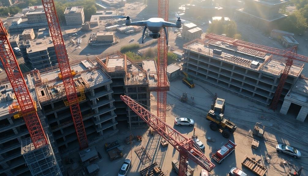
For construction monitoring, aerial mapping and surveying with drones have revolutionized the industry. You'll find that these unmanned aerial vehicles can quickly capture high-resolution images and data of your entire construction site.
This extensive view allows you to create accurate 3D models, topographic maps, and orthomosaic images.
To get started, you'll need a drone equipped with a high-quality camera and GPS capabilities. Plan your flight path to cover the entire site, ensuring ideal overlap between images for precise stitching.
You can use automated flight planning software to streamline this process.
Once you've collected the aerial data, you'll process it using specialized photogrammetry software. This will generate detailed 3D point clouds and digital surface models.
These outputs provide valuable insights into site progress, volumetric calculations, and terrain analysis.
Real-Time Progress Tracking
You'll find real-time progress tracking with drones revolutionizes construction monitoring.
Through automated site mapping, you can effortlessly document daily progress, keeping all stakeholders informed.
This instant visual feedback allows you to quickly identify issues, enabling prompt problem-solving and keeping your project on track.
Automated Site Mapping
One of the most powerful applications of drones in construction monitoring is automated site mapping for real-time progress tracking. You'll find that drones equipped with high-resolution cameras and LiDAR sensors can capture detailed aerial imagery and 3D data of your construction site. This data is then processed using photogrammetry software to create accurate, up-to-date site maps and 3D models.
With automated site mapping, you can:
| Benefit | Description | Impact |
|---|---|---|
| Track Progress | Compare current site conditions to project plans | Identify delays and deviations quickly |
| Improve Safety | Detect potential hazards and assess site conditions | Reduce accidents and enhance worker safety |
| Optimize Resources | Analyze material stockpiles and equipment locations | Improve logistics and resource allocation |
You'll appreciate how this technique allows for frequent, consistent mapping without disrupting ongoing work. It's particularly useful for large-scale projects where manual surveys are time-consuming and costly. By integrating automated site mapping into your workflow, you'll gain valuable insights into project progress, enabling better decision-making and more efficient project management. This technology empowers you to stay ahead of potential issues and guarantee your construction project remains on track and within budget.
Daily Progress Documentation
Daily progress documentation through drone technology has revolutionized real-time progress tracking in construction projects. You can now capture high-resolution images and videos of your entire site daily, providing an accurate and up-to-date visual record of construction progress. This allows you to compare actual progress against planned schedules, identify potential delays, and make informed decisions quickly.
By using drones for daily documentation, you'll create a thorough visual timeline of your project. This proves invaluable for stakeholder communication, dispute resolution, and quality control. You can easily share progress reports with clients, investors, and team members, keeping everyone aligned and informed.
To maximize the benefits of drone-based progress tracking, establish a consistent flight path and schedule. This guarantees comparable data collection over time. Use software that automatically processes and organizes your drone imagery, creating time-lapse videos and side-by-side comparisons. You can also integrate this data with Building Information Modeling (BIM) systems for even more detailed progress analysis.
Remember to comply with local regulations and obtain necessary permits for drone operations. With proper implementation, daily progress documentation via drones will greatly enhance your project management capabilities and overall construction efficiency.
Instant Issue Identification
A game-changer in construction monitoring, instant issue identification through drone technology enables real-time progress tracking and swift problem detection. You'll be able to spot potential problems before they escalate, saving time and resources.
By equipping drones with high-resolution cameras and thermal imaging sensors, you can quickly identify structural issues, material defects, or safety hazards. These aerial inspections allow you to detect cracks, water leaks, or thermal anomalies that might otherwise go unnoticed from ground level.
You'll also benefit from the drone's ability to transmit live video feeds to project managers and stakeholders. This real-time data allows for immediate decision-making and problem-solving, reducing delays and costly rework.
Moreover, you can use drones to monitor worker safety and compliance with regulations. They'll help you identify potential hazards, guarantee proper equipment usage, and maintain site security.
3D Modeling of Construction Sites
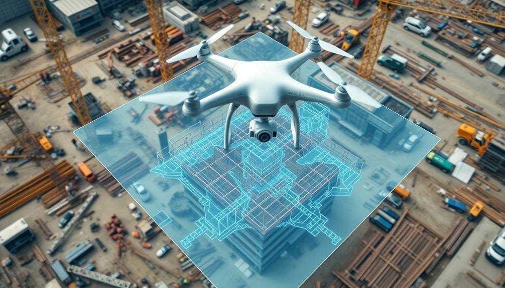
You'll find 3D modeling of construction sites to be a game-changer for accurate progress tracking and precise measurements.
With drone-captured data, you can create detailed 3D models that allow you to compare actual site conditions against design plans in real-time.
These models enable you to perform volumetric calculations for earthwork, stockpiles, and excavations, giving you unparalleled insight into your project's progress and resource management.
Accurate Site Progress Tracking
Precise site progress tracking is revolutionized by drone-based 3D modeling of construction sites. You can now monitor your project's advancement with unprecedented accuracy and efficiency. By capturing high-resolution aerial imagery and converting it into detailed 3D models, you'll gain an extensive view of your site's evolution over time.
These 3D models allow you to compare actual progress against your planned schedule, helping you identify delays or discrepancies quickly. You can measure volumes of materials, track equipment locations, and assess completed work with greater precision than ever before. This data-driven approach enables you to make informed decisions and adjustments to keep your project on track.
You'll also benefit from improved communication with stakeholders. By sharing these visually rich 3D models, you can easily convey complex information about site progress to clients, investors, and team members. This transparency fosters trust and collaboration among all parties involved.
Furthermore, you can use these models for quality control, ensuring that construction meets design specifications. By detecting issues early, you'll save time and resources, ultimately leading to smoother project execution and improved overall outcomes.
Precise Volumetric Measurements
How can you accurately measure volumes on your construction site? Drones equipped with LiDAR sensors and photogrammetry capabilities offer a powerful solution for precise volumetric measurements. By capturing high-resolution aerial imagery and 3D point clouds, you'll generate detailed digital terrain models of your site.
To start, plan your drone flight path to guarantee complete coverage of the area you're measuring. Fly at a consistent altitude and capture overlapping images for best results. Once you've collected the data, use specialized software to process the images and create a 3D model of your site.
With this model, you can easily calculate volumes of stockpiles, excavations, and fill areas. You'll get accurate measurements of cut and fill volumes, helping you track material movement and optimize resource allocation. This technique also allows you to monitor changes over time by comparing models from different dates.
For even greater precision, incorporate ground control points into your survey. These known reference points will help calibrate your model and improve overall accuracy.
Thermal Imaging for Inspections
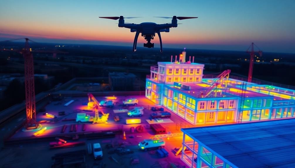
Thermal imaging has revolutionized construction site inspections, offering a powerful tool for identifying potential issues invisible to the naked eye. When you equip your drone with a thermal camera, you'll be able to detect heat signatures that reveal hidden problems in buildings, electrical systems, and structural components.
You can use thermal imaging to spot insulation gaps, moisture intrusion, and electrical hotspots. This technology allows you to identify potential fire hazards, energy inefficiencies, and structural weaknesses before they become major issues. By flying your drone around the construction site, you'll capture thorough thermal data quickly and safely.
To get the most out of thermal imaging, you'll need to understand how to interpret the results. Different colors on the thermal image represent varying temperatures, with warmer areas typically appearing brighter.
You'll want to look for unexpected temperature variations, which could indicate problems like air leaks, water damage, or overheating electrical components.
Remember to conduct thermal inspections at ideal times, such as early morning or late evening, when temperature differences are most pronounced.
Safety and Security Monitoring
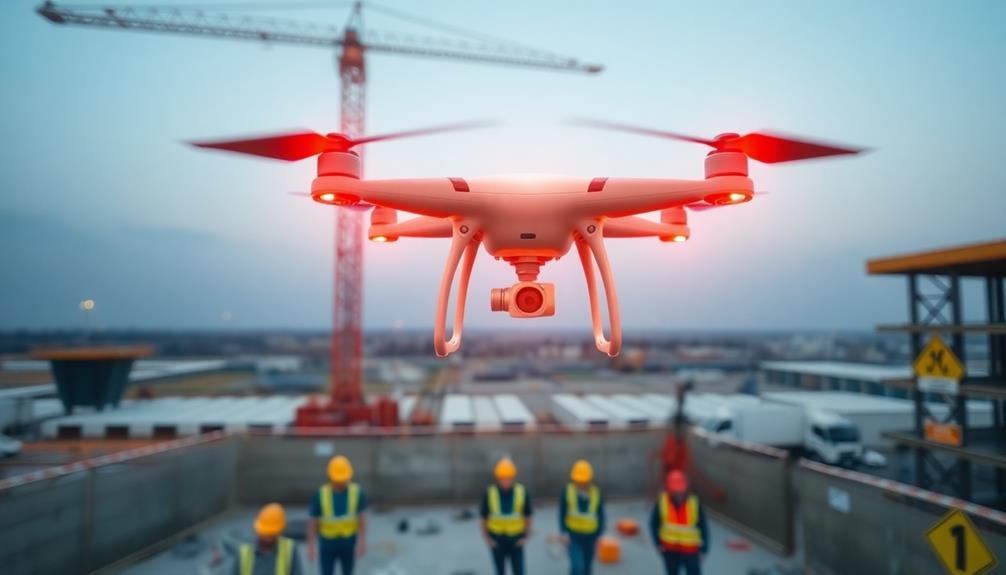
Drones have become invaluable tools for enhancing safety and security on construction sites. You can use them to monitor worker compliance with safety protocols, identify potential hazards, and conduct regular site inspections. By deploying drones equipped with high-resolution cameras, you'll get a bird's-eye view of the entire construction area, allowing you to spot issues that might go unnoticed from ground level.
To maximize your drone's safety and security monitoring capabilities, consider these key applications:
| Application | Benefits | Implementation |
|---|---|---|
| Perimeter surveillance | Deters trespassing, theft | Regular aerial patrols |
| Emergency response | Faster incident assessment | Real-time video feeds |
| Equipment tracking | Prevents loss, improves logistics | GPS-enabled drones |
You can also use drones to conduct safety briefings by capturing footage of potential hazards and incorporating it into your training materials. This visual approach helps workers better understand risks and proper procedures. Additionally, you'll find that drones are excellent for monitoring traffic flow and congestion around the site, enabling you to optimize vehicle movement and reduce accidents. By integrating drone technology into your safety and security protocols, you'll create a safer, more efficient construction environment.
Equipment and Material Management
Beyond safety monitoring, drones are revolutionizing equipment and material management on construction sites. You can use drones to conduct regular inventory checks, tracking the location and quantity of materials and equipment. This aerial perspective allows you to quickly identify misplaced items, reducing time spent searching and minimizing theft.
You'll find drones particularly useful for monitoring large stockpiles of materials like gravel, sand, or soil. By using photogrammetry techniques, you can accurately measure volumes and track usage rates, ensuring timely reordering and preventing project delays.
Drones can also help you optimize equipment utilization. By capturing aerial footage of your site, you'll spot idle machinery or inefficient placement of resources. This data enables you to make informed decisions about equipment allocation and scheduling.
For deliveries, you can use drones to guide trucks to specific drop-off points, streamlining the process and reducing on-site traffic. Additionally, drones can inspect newly arrived materials for damage or discrepancies, allowing for immediate reporting of issues to suppliers.
Environmental Impact Assessment
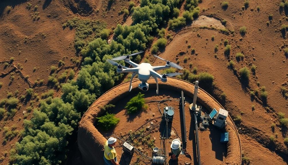
Environmental stewardship is increasingly essential in construction projects, and drones offer powerful tools for conducting thorough impact assessments. You can use drones to gather detailed data on the project's environmental footprint, helping you meet regulatory requirements and minimize ecological disruption.
With aerial imagery, you'll capture high-resolution photos and videos of the construction site and surrounding areas. This allows you to monitor changes in vegetation, wildlife habitats, and water bodies over time.
You can also use thermal imaging to detect heat signatures, helping identify potential impacts on local ecosystems.
Drones equipped with LiDAR technology enable you to create accurate 3D models of the terrain. These models help you assess erosion patterns, drainage issues, and potential flood risks.
You'll be able to plan mitigation strategies more effectively and demonstrate compliance with environmental regulations.
Frequently Asked Questions
What Are the Legal Requirements for Operating Drones on Construction Sites?
You'll need a remote pilot certificate from the FAA, register your drone, and follow Part 107 rules. Always obtain permission from the construction site owner, respect privacy laws, and check local regulations for specific requirements.
How Do Weather Conditions Affect Drone Performance in Construction Monitoring?
Weather conditions greatly impact your drone's performance. Wind can affect stability and flight time. Rain or snow may damage electronics. Extreme temperatures can reduce battery life. Always check forecasts and adjust your monitoring schedule accordingly.
What Type of Training Is Required for Construction Drone Operators?
You'll need to complete drone pilot training and obtain FAA certification. You should also learn construction-specific knowledge, safety protocols, and how to operate specialized software for data collection and analysis. Ongoing training is essential.
Can Drones Be Used for Night-Time Monitoring of Construction Sites?
Yes, you can use drones for night-time monitoring of construction sites. They're equipped with thermal cameras and LED lights for visibility. You'll need special permits and training to operate at night, following local regulations for drone flights.
How Do You Integrate Drone Data With Existing Construction Management Software?
You'll need to use API integrations to connect your drone data with construction management software. Export your drone imagery and data in compatible formats, then import them into your existing software for seamless analysis and project tracking.
In Summary
You've now explored seven powerful drone techniques for construction site monitoring. By incorporating these methods, you'll revolutionize your project management, improve safety, and boost efficiency. Remember, drones aren't just gadgets; they're invaluable tools that can transform your construction processes. As technology advances, don't hesitate to adapt and integrate new drone capabilities. Stay ahead of the curve, and you'll reap the benefits of enhanced monitoring, cost savings, and improved project outcomes.
As educators and advocates for responsible drone use, we’re committed to sharing our knowledge and expertise with aspiring aerial photographers.


Leave a Reply