To capture effective aerial construction site photos, start by selecting a drone with long flight time and high-resolution cameras. Plan your flight path carefully, considering obstacles and lighting conditions. Optimize camera settings for sharp, clear images and maintain a consistent altitude throughout. Use ground control points for accurate measurements and guarantee proper image overlap. Prioritize safety protocols and comply with local regulations. Process your data efficiently using specialized software, and interpret results with AI-powered tools for deeper insights. Present your findings using visual aids and tailored content. By following these tips, you'll elevate your aerial mapping skills to new heights.
Key Takeaways
- Choose a drone with high-resolution cameras, GPS, and sufficient flight time for efficient site mapping.
- Plan optimal flight paths considering obstacles, lighting, and consistent altitude for accurate mapping.
- Use proper camera settings, including fast shutter speeds and appropriate overlap, for clear and detailed images.
- Implement ground control points (GCPs) for improved accuracy and precise georeferencing of aerial imagery.
- Process and analyze data efficiently using AI tools and standardized workflows for actionable insights.
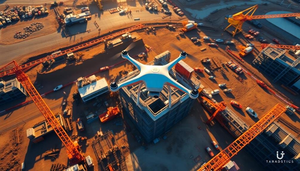
Choose the Right Drone

When it comes to aerial mapping for construction sites, selecting the right drone is essential. You'll want to take into account factors like flight time, camera quality, and payload capacity.
Opt for a drone with at least 25-30 minutes of flight time to cover large areas efficiently. Look for models with high-resolution cameras, preferably 4K or higher, to capture detailed images for accurate mapping.
Choose a drone with GPS functionality and obstacle avoidance systems for precise navigation and safety. Reflect on the drone's wind resistance, as construction sites can be windy environments. A drone with a robust build and good stability will guarantee smooth flights and clear images.
Pay attention to the drone's software compatibility. Ascertain it integrates well with popular mapping and photogrammetry software for seamless data processing. Some drones come with built-in mapping features, which can be a bonus.
Lastly, check local regulations regarding drone use in construction areas. Opt for a drone that meets these requirements, such as weight restrictions or registration needs.
Plan Your Flight Path

A well-planned flight path is the blueprint for successful aerial mapping. Before you launch your drone, carefully consider the layout of the construction site and identify key areas that need documentation.
Factor in obstacles like tall structures, trees, or power lines that could interfere with your flight. Determine the ideal altitude and speed for capturing high-quality images while covering the entire area efficiently.
Use your drone's software to create a pre-programmed flight path, ensuring consistent overlap between images for accurate stitching later.
Consider the time of day and lighting conditions, aiming for even illumination across the site. Don't forget to account for battery life and plan for multiple flights if necessary.
- Excitement: Visualize the bird's-eye view you'll capture
- Confidence: Know you're prepared for any site challenges
- Pride: Showcase your professional approach to clients
- Anticipation: Imagine the detailed maps you'll create
Optimize Camera Settings

To capture stunning aerial imagery, you'll need to dial in your camera settings. Start by setting your camera to manual mode for full control. Use a fast shutter speed, typically 1/1000s or higher, to minimize motion blur. Set your aperture between f/4 and f/8 for a balance of sharpness and depth of field. Keep your ISO as low as possible, ideally 100-400, to reduce noise.
For construction site photography, consider these specific settings:
| Setting | Sunny Day | Overcast Day |
|---|---|---|
| Shutter Speed | 1/2000s | 1/1000s |
| Aperture | f/5.6 | f/4 |
| ISO | 100 | 400 |
Enable RAW format for maximum post-processing flexibility. Use auto white balance, as it's generally reliable in daylight conditions. Activate your camera's grid overlay to help with composition and alignment. If your drone has a mechanical shutter, use it to avoid rolling shutter distortion.
Don't forget to adjust your gimbal settings. Set it to follow mode for smooth panning shots, or lock it for stable overhead views. Experiment with different camera angles to add variety to your aerial mapping portfolio. Remember, practice makes perfect, so test these settings before your actual flight to guarantee ideal results.
Consider Weather Conditions

You'll achieve the best aerial mapping results by flying during ideal weather conditions.
Aim for clear, calm days with moderate temperatures and minimal wind to guarantee sharp images and safe drone operation.
Be sure to check weather forecasts and avoid flying during rain, snow, or high winds, which can compromise both image quality and drone safety.
Best Times to Fly
Planning your flight times strategically can make or break your aerial mapping project. The best times to fly for construction site photography are typically during the "golden hours" – shortly after sunrise or before sunset. These periods offer soft, warm light that enhances details and reduces harsh shadows.
Mid-morning to early afternoon can also be suitable, especially on overcast days when diffused light creates even illumination across the site.
Consider the site's orientation and the sun's position to minimize glare and maximize visibility. Avoid flying during midday when the sun is directly overhead, as this can create unflattering shadows and reduce contrast. Early morning flights often benefit from calm winds and clear skies, ideal for stable drone operation and crisp imagery.
- Capture the site awakening with the first light of dawn
- Experience the thrill of golden hour's magical glow
- Feel the serenity of a calm, windless morning
- Embrace the challenge of racing against the setting sun
Seasonal changes affect lighting conditions, so adjust your flight times accordingly. In winter, the golden hours occur later in the morning and earlier in the evening.
Summer allows for extended daylight, offering more flexibility in scheduling. Always check local regulations and obtain necessary permissions before flying.
Avoiding Inclement Weather Hazards
While ideal lighting is key, weather conditions play an equally important role in aerial mapping success. You'll need to be vigilant about checking weather forecasts and avoiding inclement conditions that can compromise your flight and image quality.
Wind is your primary concern. Strong gusts can destabilize your drone, leading to blurry images or even accidents. Aim to fly when wind speeds are below 15 mph for best results.
Rain and snow are obvious no-fly conditions, as they can damage your equipment and obscure visibility. Even high humidity can fog your lens, so consider using a lens hood or dehumidifier.
Cloud cover isn't always a deal-breaker, but dense clouds can cast shadows and affect lighting consistency across your site. Opt for partly cloudy days when possible.
Extreme temperatures can also impact battery life and drone performance. In cold weather, keep spare batteries warm, and in hot conditions, avoid overheating your equipment.
Lastly, be wary of sudden weather changes. Always have a contingency plan and be prepared to abort your flight if conditions worsen.
Maintain Consistent Altitude

Maintaining a consistent altitude during your aerial mapping is essential for accurate site measurements and uniform image quality.
You'll want to set a specific flight height and stick to it throughout the entire mapping process.
Ensure Accurate Measurements
Precision is the cornerstone of accurate aerial mapping for construction sites. To guarantee your measurements are spot-on, you'll need to calibrate your drone's camera and sensors properly.
Use ground control points (GCPs) strategically placed around the site to provide reference points for your mapping software. These GCPs should be clearly visible and accurately surveyed to assure the best results.
When capturing images, maintain consistent overlap between shots, typically 70-80% front overlap and 60-70% side overlap. This redundancy allows for better 3D reconstruction and more accurate measurements.
Don't forget to include scale bars or known reference objects in your images to validate measurements during post-processing.
To maximize the accuracy of your aerial mapping:
- Fly in ideal weather conditions to minimize distortions
- Use a high-quality camera with a fixed focal length lens
- Perform regular equipment checks and calibrations
- Process your data with professional photogrammetry software
Maintain Uniform Image Quality
Consistent image quality is vital for successful aerial mapping of construction sites. To achieve this, you'll need to maintain a uniform altitude throughout your flight. Flying at a constant height guarantees that all images have the same scale and resolution, making it easier to stitch them together and create accurate maps.
Use your drone's built-in altimeter to monitor your height and make adjustments as needed. Keep in mind that changes in terrain elevation might require you to adjust your altitude to maintain a consistent distance from the ground. It's also essential to take into account weather conditions, as wind can affect your drone's stability and altitude.
| Altitude Considerations | Benefits | Challenges |
|---|---|---|
| Constant height | Uniform scale | Terrain variations |
| Weather awareness | Consistent resolution | Wind interference |
| Terrain adjustments | Easy image stitching | Equipment limitations |
To further enhance image quality, use a gimbal-stabilized camera and set your drone to capture images at regular intervals. This will help reduce motion blur and guarantee complete coverage of the construction site. By maintaining uniform image quality, you'll produce more accurate and professional-looking aerial maps that provide valuable insights for project managers and stakeholders.
Overlap Images Properly

Proper image overlap is essential for creating accurate aerial maps of construction sites. When capturing aerial photos, you'll want to verify each image overlaps with adjacent ones by 60-80% frontward and 20-40% sideways. This overlap allows photogrammetry software to stitch the images together seamlessly, creating a thorough and precise map of your construction site.
To achieve proper overlap, you'll need to plan your flight path carefully. Use a grid pattern, flying in straight lines across the site at a consistent altitude. Adjust your drone's speed and camera settings to capture images at regular intervals, verifying adequate overlap between shots.
Remember, it's better to have too much overlap than too little, as you can always remove excess images during processing.
- Imagine the frustration of incomplete maps due to gaps in coverage
- Feel the excitement of creating a perfect, seamless aerial view of your site
- Envision the time and resources saved by capturing all necessary data in one flight
- Picture the satisfaction of presenting a highly accurate, professional map to your team
Use Ground Control Points

While image overlap guarantees thorough coverage, ground control points (GCPs) take your aerial mapping to the next level. GCPs are precisely surveyed markers on the ground that serve as reference points for your aerial imagery. They're vital for improving the accuracy of your maps and 3D models.
To use GCPs effectively, place them strategically around your construction site before flying. Aim for at least five GCPs, with more for larger areas. Spread them evenly, including site corners and areas with elevation changes. When setting up GCPs, use high-contrast markers that are easily visible from the air.
Here's a quick guide to GCP placement:
| Site Size | Minimum GCPs | Ideal Spacing |
|---|---|---|
| Small | 5 | 50-100m |
| Medium | 8-10 | 100-200m |
| Large | 12+ | 200-300m |
After placing GCPs, survey their exact coordinates using GPS equipment. This data will be essential when processing your aerial imagery. When flying, confirm your drone captures clear images of each GCP. During post-processing, you'll use these surveyed points to georeference and correct your map, greatly enhancing its accuracy and reliability for construction planning and monitoring.
Prioritize Safety Protocols

Safety should be at the forefront of any aerial mapping operation for construction sites. You must adhere to strict protocols to protect yourself, your team, and those on the ground.
Always conduct a thorough pre-flight inspection of your drone, checking for any damage or loose components. Familiarize yourself with local regulations and obtain necessary permits before launching. Be aware of your surroundings, including power lines, trees, and buildings that could interfere with your flight path.
Maintain visual line of sight with your drone at all times and keep it within the designated flying area. Don't forget to monitor weather conditions, as wind, rain, or extreme temperatures can affect your drone's performance and safety.
Communicate clearly with ground personnel to guarantee they're aware of your flight plans and any potential hazards.
To emphasize the importance of safety, consider these emotional aspects:
- The thrill of capturing stunning aerial shots
- The pride in maintaining a spotless safety record
- The relief of completing each flight without incident
- The satisfaction of knowing you've protected your team and equipment
Process Data Efficiently

You'll streamline your aerial mapping workflow by automating data processing steps wherever possible.
Leverage cloud computing solutions to handle large datasets and complex calculations efficiently.
Implement AI-powered analysis tools to extract valuable insights from your aerial imagery, saving time and enhancing the accuracy of your construction site assessments.
Automate Data Processing Workflow
Efficiency is key when processing aerial mapping data from construction sites. To streamline your workflow, implement automated data processing solutions. These tools can considerably reduce the time and effort required to transform raw aerial imagery into actionable insights.
Start by selecting software that offers batch processing capabilities. This allows you to apply consistent settings across multiple images simultaneously. Look for programs that support automated orthomosaic generation, digital elevation model creation, and point cloud classification. Many modern software solutions also incorporate machine learning algorithms to enhance accuracy and speed.
Develop a standardized workflow that includes predefined processing steps. This guarantees consistency across projects and minimizes human error. Set up automated quality checks to flag potential issues, such as misaligned images or areas with insufficient overlap.
Consider cloud-based processing solutions to leverage additional computing power and enable collaboration among team members. These platforms often offer scalable resources to handle large datasets efficiently.
- Imagine the time you'll save with a fully automated workflow
- Picture yourself delivering results faster than ever before
- Envision the competitive edge you'll gain in the industry
- Feel the satisfaction of mastering cutting-edge technology
Utilize Cloud Computing Solutions
Building on the concept of automated data processing, cloud computing solutions offer a powerful way to handle large volumes of aerial mapping data from construction sites. By utilizing cloud-based platforms, you'll be able to process and store massive amounts of imagery and 3D data without the need for expensive on-site hardware.
Cloud computing allows you to scale your processing power as needed, guaranteeing you can handle peak workloads during busy periods. You'll also benefit from automatic software updates and enhanced security measures provided by cloud service providers.
To get started, consider platforms like Amazon Web Services (AWS), Microsoft Azure, or Google Cloud, which offer specialized tools for geospatial data processing.
When implementing cloud solutions, focus on optimizing your workflow. Use cloud-native applications designed for aerial mapping to streamline your data processing pipeline. These tools often include features like automatic orthorectification, mosaicking, and 3D model generation.
Don't forget to set up proper data management protocols to guarantee easy access and collaboration among team members. By leveraging cloud computing, you'll greatly reduce processing times and improve overall efficiency in your aerial mapping projects for construction sites.
Apply Ai-Powered Analysis Tools
With the advent of AI-powered analysis tools, processing aerial mapping data for construction sites has become markedly more efficient and accurate.
You'll find that these tools can quickly analyze vast amounts of data, identifying patterns and anomalies that might be missed by human eyes. They can detect changes in terrain, measure progress, and even predict potential issues before they arise.
To make the most of AI-powered analysis tools, you should first guarantee your data is properly organized and formatted.
Then, select a tool that aligns with your specific needs, whether it's volume calculations, progress tracking, or safety monitoring. As you implement these tools, you'll notice a significant reduction in manual data processing time, allowing you to focus on interpreting results and making informed decisions.
Here are some emotional benefits of using AI-powered analysis tools:
- Excitement: Discover insights you never thought possible
- Relief: Reduce human error and increase confidence in your data
- Empowerment: Make faster, more informed decisions
- Satisfaction: Achieve greater project efficiency and success
Interpret and Present Results

Once you've captured your aerial imagery, the next essential step is interpreting and presenting your results effectively. Start by organizing your data logically, grouping related images and information together. Create a clear narrative that explains your findings, highlighting key observations and trends.
When interpreting results, focus on quantifiable metrics like site progress, material stockpiles, and equipment placement. Compare current imagery with previous captures to track changes over time. Identify potential issues or areas of concern, such as safety hazards or workflow bottlenecks.
For presentation, use a mix of visual aids and written explanations. Create annotated maps, 3D models, and before-and-after comparisons to illustrate your points. Include relevant statistics and measurements to support your observations. Consider using interactive elements like clickable hotspots or layer toggles in digital presentations.
Tailor your presentation to your audience's needs and technical expertise. For project managers, emphasize progress tracking and resource allocation. For stakeholders, focus on overall project milestones and financial implications.
Always provide clear, actionable insights that can inform decision-making and improve site operations.
Frequently Asked Questions
How Often Should Aerial Mapping Be Conducted During a Construction Project?
You should conduct aerial mapping regularly throughout your construction project. It's best to map at key milestones or every 2-4 weeks, depending on the project's size and pace. This guarantees you're tracking progress effectively and catching issues early.
What Software Is Best for Processing Aerial Mapping Data?
You'll find several excellent options for processing aerial mapping data. Pix4D, DroneDeploy, and Agisoft Metashape are popular choices. They offer user-friendly interfaces, robust features, and reliable outputs. Choose based on your specific project needs and budget.
Are There Legal Restrictions on Drone Use for Construction Site Mapping?
Yes, there are legal restrictions on drone use for construction site mapping. You'll need to comply with FAA regulations, obtain necessary certifications, respect airspace rules, and get property owner permissions before flying your drone for mapping purposes.
How Can Aerial Mapping Integrate With Building Information Modeling (Bim)?
You can integrate aerial mapping with BIM by importing drone-captured data into your BIM software. This'll provide accurate site context, help track progress, and enhance visualization. It's a powerful tool for project planning and management.
What Are the Cost Differences Between Drone Mapping and Traditional Surveying Methods?
You'll find drone mapping is often more cost-effective than traditional surveying. It's faster, requires less manpower, and covers large areas quickly. However, initial equipment costs can be high, so consider your project's scale before deciding.
In Summary
You've now got the tools to capture stunning aerial imagery of your construction sites. Remember, practice makes perfect. As you apply these tips, you'll refine your skills and produce increasingly valuable data. Don't be afraid to experiment and find what works best for your specific projects. With aerial mapping, you're not just taking photos; you're creating powerful visual records that can transform project management and communication. Keep flying and innovating!
As educators and advocates for responsible drone use, we’re committed to sharing our knowledge and expertise with aspiring aerial photographers.


Leave a Reply