
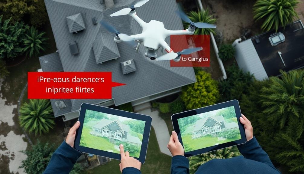
Drone imagery is transforming numerous insurance claim processes. You'll see its impact in property damage assessment, crop insurance, and natural disaster response. It's revolutionizing roof inspections, making them safer and more accurate. Drones excel at documenting accident scenes and evaluating environmental impacts like wildfires and floods. They're invaluable for monitoring construction progress and inspecting infrastructure. Importantly, drone technology enhances fraud detection in insurance claims. From providing extensive aerial views to accessing hazardous areas, drones offer faster, safer, and more cost-effective solutions. The potential applications of this technology in insurance are just beginning to unfold.
Property Damage Assessment

Three key advantages make drone imagery invaluable for property damage assessment in insurance claims.
First, you'll get a thorough aerial view of the affected property, allowing you to quickly identify and document damage that might be difficult to spot from the ground. This bird's-eye perspective helps you assess the full extent of the damage, including hard-to-reach areas like rooftops or large-scale destruction in natural disasters.
Second, drones can capture high-resolution images and videos, providing detailed visual evidence for your claim. You'll have clear, unambiguous documentation of the damage, which can streamline the claims process and reduce disputes between policyholders and insurers.
Lastly, drone imagery offers a safe and efficient way to assess dangerous or unstable areas. You won't need to put adjusters at risk by sending them into hazardous environments. Instead, drones can gather the necessary information quickly and safely.
Crop Insurance Claims

In light of the increasing frequency of extreme weather events, drone imagery has become a game-changer for crop insurance claims. You'll find that drones can quickly survey large areas of farmland, providing detailed, high-resolution images of crop damage. This technology allows insurers to assess losses more accurately and efficiently than traditional ground-based methods.
When you're dealing with crop insurance claims, time is of the essence. Drones can be deployed rapidly, capturing data on crop health, growth patterns, and damage extent within hours of an incident. You'll appreciate how this swift response helps expedite the claims process, ensuring you receive compensation more quickly.
Moreover, drone imagery offers you objective evidence of crop damage. The aerial perspective provides a thorough view of your fields, revealing patterns and anomalies that might be missed from ground level. You can use this data to support your claim and negotiate fair settlements with your insurer.
Drone technology also enables you to monitor your crops throughout the growing season, helping you identify potential issues early and take preventive measures. This proactive approach can reduce the likelihood of severe losses and subsequent claims.
Natural Disaster Response

While crop insurance claims benefit from drone technology, the impact of drones on natural disaster response is even more profound. When catastrophes strike, you'll find drones at the forefront of assessment and relief efforts. These unmanned aerial vehicles can quickly survey large areas affected by hurricanes, floods, or earthquakes, providing insurers with real-time data and imagery.
You'll see drones capturing high-resolution photos and videos of damaged properties, infrastructure, and landscapes. This information helps adjusters assess the extent of destruction without risking their safety in hazardous conditions. Drones can access hard-to-reach areas, allowing for a more thorough evaluation of damage.
Insurance companies can use drone-collected data to expedite claims processing, ensuring faster payouts for policyholders in need. You'll notice improved accuracy in damage estimates, as drones provide detailed, objective evidence. This technology also helps insurers detect potential fraud by comparing pre- and post-disaster imagery.
Moreover, you'll find drones assisting in search and rescue operations, delivering supplies to isolated areas, and monitoring ongoing risks like wildfires or landslides. This multifaceted approach to natural disaster response demonstrates how drone technology is revolutionizing the insurance industry's ability to serve communities in crisis.
Roof Inspection for Claims

Drones have revolutionized roof inspections for insurance claims, offering you improved accuracy and safety without the need for manual climbing.
You'll benefit from faster damage assessment as drones can quickly capture high-resolution images of entire roofs, including hard-to-reach areas.
This technology leads to more cost-effective claim processing, reducing the time and resources needed for traditional inspection methods.
Improved Accuracy and Safety
When it comes to roof inspections for insurance claims, drone imagery has revolutionized the process, enhancing both accuracy and safety. You'll find that drones can capture high-resolution images and videos of roofs from various angles, providing a thorough view that's often impossible to achieve through traditional methods.
With drone technology, you're able to:
- Detect subtle damage that might be missed by the naked eye
- Create 3D models of roofs for precise measurements
- Safely inspect hard-to-reach or dangerous areas
You'll appreciate how drones eliminate the need for adjusters to physically climb onto roofs, greatly reducing the risk of accidents and injuries. This improved safety not only protects personnel but also reduces liability for insurance companies.
Moreover, you'll notice that drone inspections are much faster than traditional methods. What once took hours can now be completed in minutes, allowing for quicker claim processing and increased customer satisfaction.
The detailed imagery and data collected by drones also provide irrefutable evidence for claims, reducing disputes and potential fraud. As a result, you'll find that drone technology is transforming the insurance industry, making roof inspections more efficient, accurate, and safe.
Faster Damage Assessment
Gone are the days of time-consuming manual roof inspections. With drone technology, you can now assess roof damage faster and more efficiently than ever before. Drones equipped with high-resolution cameras can capture detailed imagery of a roof's condition in a matter of minutes, drastically reducing the time needed for claims processing.
You'll find that drones can quickly identify and document various types of roof damage, including missing shingles, hail impacts, and water damage. This rapid assessment allows insurance adjusters to make prompt decisions and expedite the claims process. By utilizing drones, you can also reduce the need for multiple site visits, saving both time and resources.
The speed of drone-based roof inspections isn't just beneficial for insurance companies; it's a game-changer for policyholders too. You can provide faster claim resolutions, leading to increased customer satisfaction.
In disaster-stricken areas, where numerous properties require assessment, drones enable you to cover more ground quickly, ensuring timely assistance to those in need. This efficiency is particularly significant in the aftermath of large-scale events like hurricanes or severe storms, where rapid response is essential.
Cost-Effective Claim Processing
You'll find that implementing drone technology for roof inspections can greatly reduce the costs associated with processing insurance claims. By using drones, you're eliminating the need for manual inspections, which often require expensive equipment and pose safety risks for adjusters. Drones can quickly capture high-resolution images and videos of roofs, allowing for detailed assessments without the need for physical access.
The cost-effectiveness of drone-based roof inspections stems from several factors:
- Reduced labor costs: Fewer personnel are needed on-site, cutting down on labor expenses.
- Faster processing times: Quicker inspections lead to faster claim resolutions.
- Lower equipment costs: Drones are more affordable than traditional inspection tools.
You'll also notice improved accuracy in damage assessments. Drones can capture angles and details that might be missed during manual inspections, leading to more precise estimates. This accuracy can help prevent disputes and reduce the likelihood of claim rejections or appeals.
Additionally, you'll be able to store and analyze drone imagery digitally, making it easier to compare pre-and post-damage conditions, track repairs, and maintain thorough records for future reference.
Accident Scene Documentation

In the aftermath of an accident, drones have revolutionized the way insurers document crash scenes. You'll find that these unmanned aerial vehicles can quickly capture detailed imagery of the entire accident site, providing a bird's-eye view that was previously difficult to obtain.
Drones can access areas that might be unsafe or challenging for human adjusters to reach, ensuring a thorough documentation of the scene. They'll capture high-resolution photos and videos, allowing you to examine details that might be missed during ground-level inspections. This aerial perspective helps you piece together the sequence of events more accurately.
You'll appreciate how drones can create 3D models of the accident scene, enabling you to virtually revisit the site long after it's been cleared. This technology proves invaluable when dealing with complex claims or legal disputes.
Drones also expedite the documentation process, reducing traffic congestion and minimizing the risk of secondary accidents at the scene.
Environmental Impact Evaluation

You'll find drones increasingly useful in evaluating environmental impacts for insurance claims.
With aerial imagery, you can quickly assess wildfire damage, map flood extents, and monitor deforestation patterns.
These capabilities enable you to accurately determine claim values and identify potential risks in affected areas.
Wildfire Damage Assessment
Drones have revolutionized wildfire damage assessment, offering a powerful tool for evaluating environmental impact. You can now quickly and safely survey vast areas of burned land, capturing high-resolution images and thermal data. This technology allows you to assess the extent of fire damage, identify hotspots, and monitor ongoing fire activity with unprecedented accuracy.
With drone imagery, you'll gain valuable insights into:
- The severity of vegetation loss
- Soil erosion and potential landslide risks
- Wildlife habitat destruction
These assessments help you make informed decisions about recovery efforts and resource allocation. You can use the data to create detailed maps of affected areas, estimate economic losses, and plan reforestation initiatives.
Drones also enable you to monitor post-fire regrowth and ecosystem recovery over time, providing essential information for long-term environmental management.
Flood Extent Mapping
When floodwaters recede, the true extent of environmental damage becomes apparent. Drone imagery can revolutionize how you assess and map flood impacts, providing essential data for insurance claims and environmental remediation efforts.
You'll find that drones offer a bird's-eye view of affected areas, capturing high-resolution images and video footage that traditional methods can't match. These aerial surveys allow you to quickly identify and measure the scope of flood damage, from submerged structures to eroded landscapes.
With drones, you can create accurate, up-to-date flood extent maps that show the boundaries of inundated areas. This data helps you determine property damage, assess agricultural losses, and evaluate infrastructure impacts.
You'll also be able to track changes in water levels and flow patterns over time, aiding in future flood prevention strategies.
Moreover, drone imagery enables you to detect pollution sources and environmental hazards caused by flooding, such as chemical spills or sewage overflows. This information is essential for prioritizing cleanup efforts and mitigating long-term ecological impacts.
Deforestation Monitoring
Regularly monitoring deforestation has become an essential task in environmental impact evaluation.
Drone imagery can revolutionize this process by providing insurance companies with detailed, up-to-date information on forest cover changes. You'll find that drones offer a cost-effective and efficient method for evaluating deforestation rates, which is vital for analyzing environmental risks and potential claims.
By using drones, you can:
- Capture high-resolution images of large forested areas quickly and frequently
- Detect subtle changes in vegetation cover that might be missed by satellite imagery
- Access remote or hard-to-reach locations for more thorough monitoring
This technology allows you to track deforestation trends over time, helping to identify areas at risk of increased environmental damage.
You'll be able to evaluate the impact of logging activities, agricultural expansion, and urban development on forest ecosystems. With this information, you can make more informed decisions about insurance policies related to environmental protection and sustainability.
Drone-based deforestation monitoring also enables you to verify compliance with environmental regulations and conservation agreements.
This can be particularly valuable when analyzing claims related to carbon offset projects or sustainable land management practices.
Construction Progress Monitoring
Construction sites are dynamic environments where progress can be difficult to track accurately. Drone imagery can revolutionize how you monitor and assess construction progress for insurance claims. You'll get a bird's-eye view of the entire site, allowing you to track changes over time with high-resolution images and videos.
With drones, you can:
- Capture detailed imagery at regular intervals
- Create 3D models of the construction site
- Identify potential safety hazards
- Monitor material usage and inventory
- Verify contractor work and timelines
Here's a comparison of traditional vs. drone-based construction monitoring:
| Traditional Method | Drone-Based Method |
|---|---|
| Time-consuming | Rapid data collection |
| Limited perspective | extensive view |
| Safety risks | Improved safety |
| Infrequent updates | Regular documentation |
| Manual measurements | Accurate measurements |
Wildfire Damage Assessment

When evaluating wildfire damage for insurance claims, you'll find drones invaluable for rapid damage evaluation.
You can quickly survey large areas affected by wildfires, capturing detailed imagery that helps expedite the claims process.
Drones also allow you to access and document hard-to-reach or dangerous areas, providing an all-encompassing view of the damage without risking personal safety.
Rapid Damage Evaluation
Charred landscapes and smoldering remnants tell a grim tale in the aftermath of wildfires. You'll find that drone imagery can revolutionize the rapid damage evaluation process, providing insurers with a swift and thorough overview of affected areas.
By deploying drones equipped with high-resolution cameras and thermal sensors, you're able to assess the extent of wildfire damage quickly and accurately.
Drones offer several advantages in rapid damage evaluation:
- They can cover large areas in a fraction of the time it takes ground teams
- They provide access to dangerous or hard-to-reach locations
- They capture detailed imagery that can be analyzed immediately or stored for future reference
You'll appreciate how drone technology enables you to identify hotspots, assess structural damage, and estimate vegetation loss with unprecedented speed and precision.
This rapid evaluation allows you to expedite claims processing, allocate resources more effectively, and provide faster support to policyholders in their time of need.
Inaccessible Area Coverage
Wildfires often ravage areas that are difficult or dangerous for ground crews to access. In these situations, drones become invaluable tools for insurance companies to assess wildfire damage quickly and safely.
You'll find that drones can fly over vast expanses of scorched land, capturing high-resolution imagery and video footage of the affected areas. These unmanned aerial vehicles can navigate through smoke and debris, providing a clear view of the damage extent.
You'll appreciate how drones can reach remote locations, steep terrain, and unstable ground that would be risky for adjusters to explore on foot. They can also cover large areas in a fraction of the time it would take a ground team.
With drone imagery, you'll be able to identify destroyed structures, damaged vegetation, and potential hazards like fallen power lines or unstable slopes. This extensive view allows for more accurate damage assessments and faster claims processing.
You'll also benefit from the ability to create detailed maps and 3D models of the affected areas, which can be essential for planning recovery efforts and preventing future losses.
Flood Extent Mapping

In the wake of devastating floods, drone imagery has revolutionized the process of mapping flood extent. You can now quickly assess the scope of flood damage using high-resolution aerial photographs and videos captured by drones. This technology allows you to accurately determine the boundaries of flooded areas, identify affected properties, and estimate water depths.
Drone-based flood extent mapping offers several advantages over traditional methods:
- Speed: Drones can survey large areas in a fraction of the time it takes for ground-based assessments.
- Safety: You can gather data without putting personnel at risk in hazardous flood zones.
- Accuracy: High-resolution imagery provides precise measurements and detailed visual information.
You'll find that drone-captured data integrates seamlessly with Geographic Information Systems (GIS), enabling you to create detailed flood maps and analyze the impact on insured properties.
This information proves invaluable when processing claims, as it provides objective evidence of flood damage and helps you determine appropriate compensation.
Infrastructure Inspection

Drone-assisted infrastructure inspection has become a game-changer for insurance companies evaluating damage to buildings, bridges, and other structures.
You'll find that drones can access hard-to-reach areas quickly and safely, providing high-resolution imagery and 3D models of damaged infrastructure.
When you're evaluating storm damage to roofs, you can use drones to capture detailed images without risking adjuster safety.
These aerial views reveal issues like missing shingles, hail damage, or structural compromises that might be missed from ground level.
For large-scale structures like bridges or industrial facilities, drones equipped with thermal cameras can detect hidden issues such as water infiltration or structural weaknesses.
You'll get a thorough view of the damage, allowing for more accurate claims processing and faster payouts.
Drones also excel at monitoring ongoing repairs.
You can track progress, verify quality, and confirm completion without frequent site visits.
This efficiency saves time and reduces the risk of fraud.
Insurance Fraud Detection
Detecting insurance fraud has become markedly more effective with the integration of drone technology. Drones equipped with high-resolution cameras and sensors can capture detailed imagery of property damage, allowing insurers to verify claims with unprecedented accuracy.
You'll find that this technology is particularly useful in identifying discrepancies between reported damage and actual conditions.
Drones offer several advantages in fraud detection:
- Rapid deployment for timely evidence collection
- Access to hard-to-reach areas for thorough assessments
- Consistent documentation through standardized imaging protocols
By utilizing drone imagery, you can quickly spot signs of pre-existing damage, staged accidents, or exaggerated claims. For instance, in auto insurance, drones can survey accident scenes, providing a clear timeline of events and revealing any inconsistencies in driver statements.
In property insurance, they can assess roof damage claims, distinguishing between recent storm damage and long-term wear and tear.
You'll also find that drone technology enhances the efficiency of the claims process. By reducing the need for manual inspections, insurers can process claims faster and more accurately, leading to improved customer satisfaction and reduced operational costs.
This technological advancement is revolutionizing the fight against insurance fraud, making it harder for fraudsters to exploit the system.
Frequently Asked Questions
How Do Privacy Concerns Impact the Use of Drones in Insurance Claims?
You'll face privacy concerns when using drones for insurance claims. They can capture sensitive information, potentially violating people's privacy. You must follow regulations, obtain consent, and guarantee data security to address these issues effectively.
What Regulations Govern Drone Usage for Insurance Purposes Across Different Jurisdictions?
You'll find drone regulations for insurance vary by location. In the US, you must follow FAA rules, obtain proper licenses, and respect privacy laws. Other countries have their own specific guidelines you'll need to research.
Can Drone Imagery Be Used as Evidence in Insurance-Related Legal Disputes?
Yes, you can use drone imagery as evidence in insurance-related legal disputes. It's admissible in court if it's properly obtained and authenticated. You'll need to guarantee compliance with privacy laws and regulations when collecting drone footage.
How Does Weather Affect the Reliability of Drone-Captured Data for Claims?
You'll find that weather greatly impacts drone data reliability. Rain, snow, and high winds can disrupt flights and distort imagery. Extreme temperatures may affect battery life and sensor accuracy. Always consider weather conditions when evaluating drone-captured evidence for claims.
What Training Do Insurance Adjusters Need to Operate Drones Effectively?
You'll need training in drone piloting, FAA regulations, and insurance-specific applications. You should also learn data analysis, image interpretation, and safety protocols. Hands-on practice with different drone models and scenarios is essential for effective operation.
In Summary
You've seen how drone imagery is transforming insurance claims across various sectors. From property damage to natural disasters, these aerial tools are revolutionizing assessment processes. They're making claims faster, more accurate, and less risky for adjusters. As drone technology advances, you'll likely see even more innovative applications in insurance. Embrace this change – it's making claims more efficient and fair for everyone involved. The future of insurance is taking flight with drones.
As educators and advocates for responsible drone use, we’re committed to sharing our knowledge and expertise with aspiring aerial photographers.


Leave a Reply