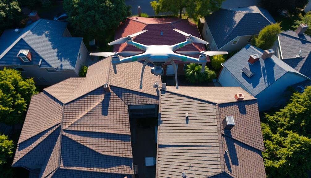
Aerial roof inspections offer you a safer, faster, and more thorough way to assess property conditions. You'll need a reliable drone with a high-quality camera, flight planning software, and data processing tools. Verify you have the necessary licenses and permissions before conducting inspections. Plan your flight carefully, considering weather and property details. Capture high-resolution images from consistent altitudes and multiple angles. When interpreting results, look for damage indicators and focus on common problem areas. Incorporate your findings into property reports with clear organization and visual aids. This guide will equip you with essential knowledge to elevate your real estate inspections.
Key Takeaways
- Aerial inspections provide detailed roof views without ladder use, enhancing safety and efficiency for real estate professionals.
- Drones with high-resolution cameras and thermal imaging capabilities are essential for capturing comprehensive roof data.
- Flight planning software enables pre-programmed routes for complete roof coverage and generates 3D models for analysis.
- Legal compliance requires proper licensing, property owner permissions, and adherence to FAA regulations for commercial drone operations.
- Interpreting results involves identifying damage, assessing problem areas, and incorporating findings into comprehensive property reports.
Benefits of Aerial Roof Inspections
With aerial roof inspections, you'll gain a detailed view of your property's condition without ever setting foot on a ladder. This innovative approach offers numerous advantages for real estate professionals and property owners alike.
Safety is paramount, and aerial inspections eliminate the risks associated with traditional roof assessments. You'll avoid potential falls and injuries while still obtaining extensive data.
Time efficiency is another key benefit, as drones can quickly survey large areas, reducing inspection duration from hours to minutes.
Aerial inspections provide unparalleled accuracy, capturing high-resolution images and videos that reveal even minor defects. You'll detect issues like missing shingles, water damage, or structural problems that might be overlooked during ground-level inspections.
This detailed information allows for more precise cost estimates and maintenance planning.
You'll also benefit from improved documentation. Drone footage serves as a valuable record for insurance claims, property valuations, and future comparisons.
It's particularly useful for monitoring roof conditions over time, helping you identify gradual deterioration or sudden changes.
Lastly, aerial inspections can enhance your professional image. By employing cutting-edge technology, you'll demonstrate your commitment to thorough, efficient, and safe property assessments, setting yourself apart in the competitive real estate market.
Necessary Equipment and Software

To conduct effective aerial roof inspections, you'll need essential equipment and software.
Start with a reliable drone and high-quality camera system to capture detailed imagery of roof conditions.
You'll also require flight planning software to map out your inspection routes and data processing tools to analyze and report on the collected information.
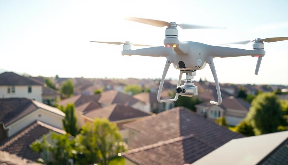
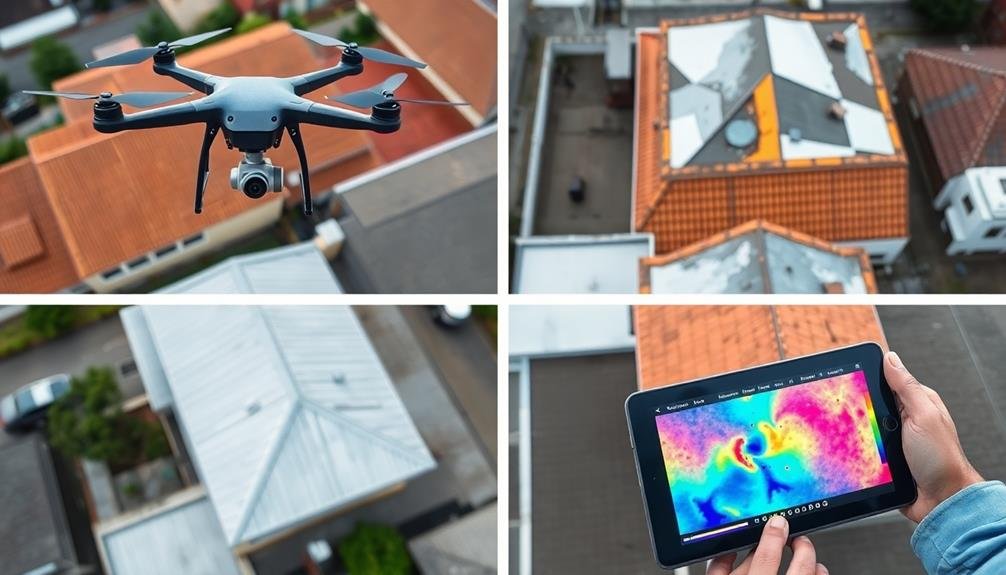
Drones and Camera Systems
Selecting the right drones and camera systems for aerial roof inspections is essential to achieving high-quality results.
You'll want to choose a drone that's stable, easy to maneuver, and capable of carrying the necessary camera equipment. Popular options include the DJI Phantom 4 Pro or Mavic 2 Pro, known for their reliability and advanced features.
For cameras, opt for high-resolution systems with at least 12 megapixels and 4K video capabilities. Look for models with adjustable settings, allowing you to control ISO, shutter speed, and aperture.
Thermal cameras are invaluable for detecting heat loss and moisture issues, so consider investing in a dual-camera setup or a separate thermal imaging drone.
Ensure your drone has obstacle avoidance technology and GPS positioning for safer, more precise flights.
You'll also need extra batteries, as most drones have limited flight times. Don't forget to invest in quality memory cards with fast write speeds to handle large image and video files.
Flight Planning Software
Flight planning software is an essential tool for conducting efficient and safe aerial roof inspections. It allows you to pre-program your drone's flight path, ensuring complete coverage of the roof and minimizing the risk of missed areas.
When choosing flight planning software, look for options that offer features like automatic obstacle avoidance, waypoint setting, and the ability to create custom flight patterns.
Popular flight planning apps include DroneDeploy, Pix4D, and DJI GS Pro. These applications often integrate with your drone's camera system, allowing you to capture high-resolution images at predetermined intervals.
You'll want software that can generate 3D models and orthomosaic maps, which are invaluable for detailed roof analysis.
Ensure your chosen software is compatible with your drone model and supports the specific requirements of roof inspections. Look for features like terrain awareness, which adjusts flight altitude based on roof pitch, and the ability to set multiple flight altitudes for capturing different angles of complex roof structures.
Some advanced software even offers AI-powered damage detection, streamlining your inspection process. Always keep your flight planning software updated to benefit from the latest features and safety improvements.
Data Processing Tools
Powerful data processing tools are essential for transforming raw aerial imagery into actionable roof inspection reports. You'll need specialized software to stitch together multiple images, create 3D models, and analyze roof conditions. Look for programs that offer automated feature detection, measurement tools, and report generation capabilities.
Popular options include Pix4D, DroneDeploy, and Agisoft Metashape. These tools can help you:
- Create high-resolution orthomosaic maps
- Generate detailed 3D point clouds and mesh models
- Perform automated damage detection and classification
When choosing data processing software, consider your specific needs and budget. Some platforms offer cloud-based processing, which can be faster and more convenient for large datasets. Others provide desktop applications for more control over the processing workflow.
You'll also want to invest in a powerful computer with a dedicated graphics card to handle the computational demands of processing aerial imagery. Consider factors like RAM, CPU, and storage capacity when selecting your hardware.
Don't forget about data management and storage solutions. You'll need a reliable system to organize, backup, and archive your inspection data. Cloud storage services or networked storage devices can help guarantee your valuable data is secure and accessible.
Legal Considerations and Regulations
Before conducting aerial roof inspections, you'll need to obtain proper drone licensing as required by your local aviation authority.
You must also secure permissions from property owners before flying over their premises.
Familiarize yourself with airspace restrictions and privacy laws to guarantee your inspections comply with all relevant regulations.
Drone Licensing Requirements
Maneuvering the legal landscape of drone operations is vital for aerial roof inspections. In the United States, the Federal Aviation Administration (FAA) requires commercial drone pilots to obtain a Remote Pilot Certificate. To achieve this, you'll need to pass the Part 107 exam, which tests your knowledge of airspace regulations, weather patterns, and drone operations.
Before conducting aerial roof inspections, confirm you're compliant with these key requirements:
- Register your drone with the FAA
- Obtain liability insurance for your drone operations
- Display your drone's registration number on the exterior
Keep in mind that local regulations may impose additional restrictions on drone usage. Some areas might require special permits or have no-fly zones, so it's imperative to research and adhere to these rules.
You'll also need to follow specific operational guidelines during inspections. Maintain visual line of sight with your drone at all times, fly below 400 feet, and avoid flying over people or moving vehicles.
Always prioritize safety and respect privacy concerns when conducting aerial roof inspections. By staying informed and compliant with licensing requirements, you'll protect yourself legally and maintain professionalism in your real estate drone operations.
Property Owner Permissions
While drone licensing is a key step, obtaining property owner permissions is equally important for aerial roof inspections. You'll need to secure consent from the property owner before flying over their premises. This isn't just a courtesy; it's often a legal requirement.
Begin by contacting the property owner or their representative. Explain the purpose of your inspection, the drone's capabilities, and how you'll protect their privacy. Obtain written permission, preferably through a standardized form that outlines the scope of your work.
| Permission Type | Details | Best Practice |
|---|---|---|
| Residential | Single-family homes | Contact homeowner directly |
| Commercial | Office buildings, warehouses | Reach out to property management |
| Multi-unit | Apartments, condos | Obtain approval from HOA or building manager |
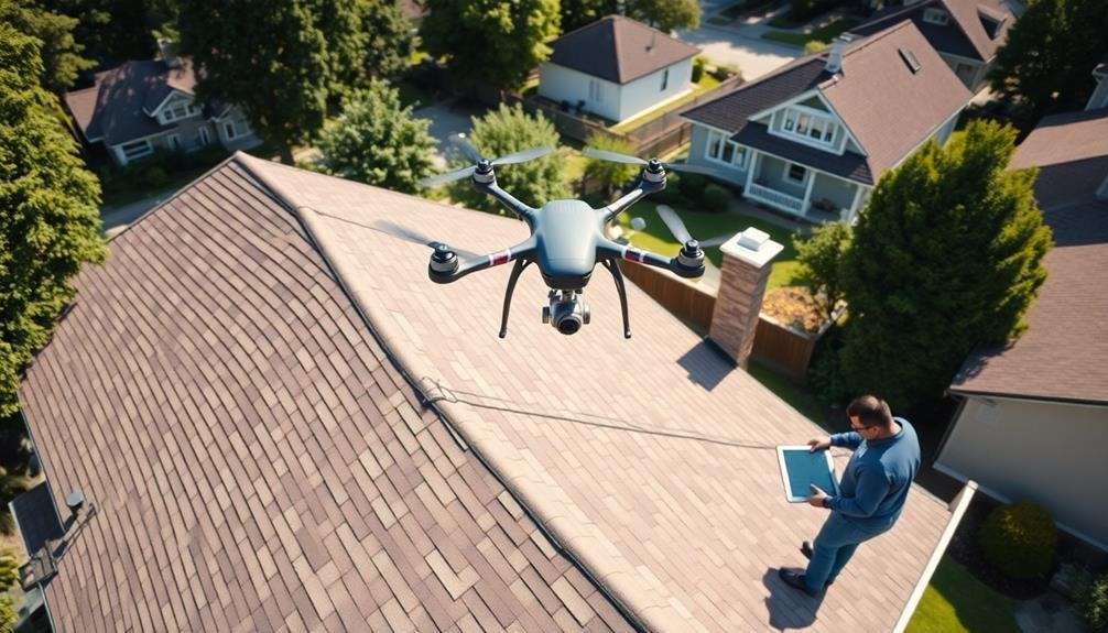
Planning the Inspection Flight
Preparation is key to a successful aerial roof inspection. Before launching your drone, you'll need to carefully plan your flight path and objectives. Start by reviewing property details, including the roof's size, shape, and any known problem areas. This information will help you determine the ideal flight altitude and camera angles needed to capture detailed imagery.
Next, consider the environmental factors that might affect your flight:
- Weather conditions: Check for wind, rain, or extreme temperatures
- Time of day: Plan for ideal lighting to avoid shadows
- Potential obstacles: Identify trees, power lines, or other hazards
Once you've assessed these factors, create a detailed flight plan. Map out your takeoff and landing zones, ensuring they're clear and level. Determine the best flight pattern to cover the entire roof systematically, typically using a grid or crosshatch pattern.
Don't forget to plan for multiple battery changes if needed for larger properties.
Lastly, prepare your equipment. Charge all batteries, format memory cards, and clean your drone's camera lens. By thoroughly planning your inspection flight, you'll maximize efficiency and capture high-quality imagery for your real estate clients.
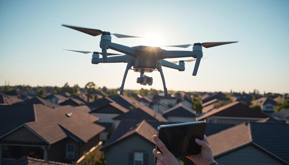
Capturing High-Quality Roof Images
Once you've launched your drone, capturing high-quality roof images becomes your primary focus. Start by flying at a consistent altitude, typically between 50-100 feet, to maintain uniform image resolution. Use a grid or lawn-mower pattern to systematically cover the entire roof surface, guaranteeing you don't miss any areas.
Set your camera to shoot in RAW format for maximum image quality and post-processing flexibility. Adjust your camera settings for best exposure, considering the lighting conditions and roof color. A slightly overexposed image can often reveal more detail in shadowed areas.
Capture both wide-angle shots of the entire roof and close-up images of specific problem areas. Use the drone's gimbal to maintain a perpendicular angle to the roof surface for accurate measurements.
When inspecting steep slopes or multi-level roofs, adjust your flight altitude and camera angle to capture clear images of all surfaces. Pay special attention to potential trouble spots like chimneys, vents, skylights, and areas where different roof planes meet.
Take multiple shots of these areas from different angles to guarantee you've documented all potential issues. Remember to capture images of the gutters and downspouts as well.
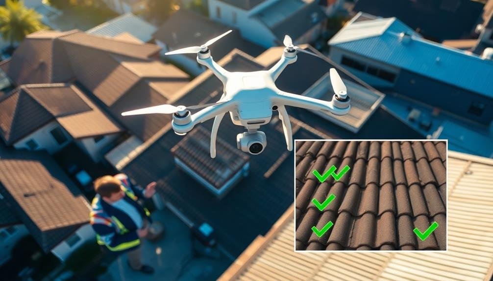
Interpreting Aerial Inspection Results
After capturing aerial images of the roof, the next vital step is interpreting the results. You'll need to analyze the photos carefully to identify any signs of damage or potential issues. Look for color variations, missing or damaged shingles, and areas of pooling water.
Pay close attention to the roof's edges, valleys, and areas around chimneys or vents, as these are common problem spots.
When interpreting your aerial inspection results, consider the following key points:
- Age of the roof: Older roofs may show more wear and tear, even if there's no visible damage.
- Recent weather events: Storms or heavy snowfall can cause damage that mightn't be immediately apparent.
- Surrounding vegetation: Overhanging trees can lead to debris accumulation and moisture retention.
Don't hesitate to consult with a roofing professional if you're unsure about any findings. They can provide expert insights and recommend necessary repairs or maintenance.
Incorporating Findings Into Property Reports

The findings from your aerial roof inspection should be seamlessly integrated into your property reports. Create a dedicated section for roof condition, highlighting key observations and potential issues. Include high-resolution images or video stills that clearly show problem areas, labeling them for easy reference. Guarantee you provide context for each finding, explaining its significance and potential impact on the property's value or maintenance needs.
Organize your report logically, starting with an overview of the roof's general condition, then delving into specific concerns. Use bullet points or numbered lists to outline individual issues, making the information easily digestible for clients. Don't forget to include positive aspects of the roof's condition as well.
If you've used thermal imaging, incorporate these results to show potential energy efficiency issues or moisture intrusion. Provide recommendations for further inspection or immediate repairs based on your findings. Include cost estimates for suggested repairs when possible, helping clients understand the financial implications of the roof's condition.
Frequently Asked Questions
How Long Does a Typical Aerial Roof Inspection Take?
You'll find that a typical aerial roof inspection takes about 15-30 minutes. However, the duration can vary depending on the size and complexity of the roof, as well as weather conditions and any specific requirements you have.
Can Aerial Inspections Detect All Types of Roof Damage?
While aerial inspections can detect many types of roof damage, they can't identify all issues. You'll spot obvious problems like missing shingles or large cracks, but some subtle damage may require a closer, hands-on inspection for full assessment.
What Weather Conditions Are Ideal for Aerial Roof Inspections?
You'll want clear, calm conditions for aerial roof inspections. Avoid rain, snow, or high winds. Overcast days can be good, reducing glare and shadows. Early morning or late afternoon light often provides the best visibility for inspections.
How Often Should Aerial Roof Inspections Be Conducted?
You should conduct aerial roof inspections annually for routine maintenance. However, you'll want to inspect more frequently if you've experienced severe weather events or if your roof is older. Don't forget to check after storms, too.
Are Aerial Roof Inspections More Expensive Than Traditional Methods?
You'll find aerial roof inspections are often more cost-effective than traditional methods. They're quicker, safer, and provide extensive data. While initial equipment costs may be higher, you'll save time and money in the long run.
In Summary
You've now got the tools to revolutionize your roof inspections. By embracing aerial technology, you'll save time, improve safety, and provide more thorough reports. Remember to stay up-to-date with regulations, invest in quality equipment, and hone your flight planning skills. As you interpret and present your findings, you'll offer clients unparalleled insights into their properties. Aerial roof inspections aren't just the future—they're your key to standing out in today's competitive real estate market.
As educators and advocates for responsible drone use, we’re committed to sharing our knowledge and expertise with aspiring aerial photographers.


Leave a Reply