You can master a wide range of surveying skills virtually, from the comfort of your home or office. Learn aerial photogrammetry basics, flight planning for drone missions, and data processing techniques using specialized software. Immerse yourself in terrain modeling, GIS analysis, and point cloud generation from aerial imagery. Explore 3D modeling for surveying applications and stay up-to-date on drone regulations and safety protocols. You'll also gain expertise in image georeferencing and calibration, essential for accurate mapping. These virtual learning opportunities allow you to build a strong foundation in modern surveying techniques without stepping foot in the field. There's much more to discover in this exciting field.
Aerial Photogrammetry Basics

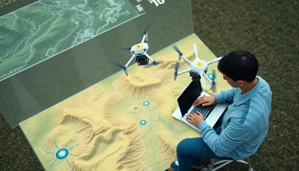
In light of the digital age, aerial photogrammetry has become an essential skill for modern surveyors. You'll find that this technique uses aerial photographs to create accurate maps and 3D models of terrain. It's a powerful tool that combines the principles of photography, mathematics, and computer science.
To master aerial photogrammetry virtually, you'll need to understand several key concepts. First, learn about camera calibration and how it affects image quality. You'll also need to grasp the principles of stereoscopic vision, which allows for depth perception in 2D images. Familiarize yourself with ground control points and their role in ensuring accuracy.
Next, investigate photogrammetric software. You'll learn how to process and align images, generate point clouds, and create digital elevation models. Understanding orthomosaic creation is vital for producing seamless, high-resolution maps.
As you progress, you'll explore advanced topics like feature extraction, classification, and 3D modeling. You'll also learn about integrating photogrammetry with other surveying techniques, such as LiDAR.
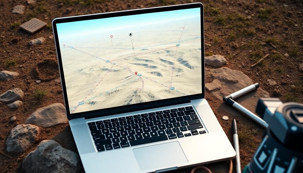
Flight Planning and Mission Design

With a solid foundation in aerial photogrammetry basics, you'll now focus on flight planning and mission design. This critical phase guarantees you capture the necessary data for accurate surveying results. You'll learn to assess project requirements, determine ideal flight parameters, and create efficient flight paths.
Virtual training will teach you how to use mission planning software to set flight altitude, speed, and image overlap. You'll practice calculating ground sample distance (GSD) and adjusting camera settings for various conditions.
You'll also learn to take into account factors like terrain, obstacles, and weather when planning flights. You'll discover how to create geofences, set waypoints, and program autonomous flight patterns.
The training will cover mission types such as grid, corridor, and circular flights, each suited for different survey needs. You'll gain experience in estimating flight duration, battery requirements, and data storage needs.
Virtual simulations will allow you to test your flight plans, identify potential issues, and refine your missions before real-world implementation. By mastering flight planning and mission design virtually, you'll be well-prepared to execute efficient and effective aerial surveys in the field.
Data Processing Software Techniques

After capturing aerial imagery, you'll immerse yourself in data processing software techniques. These skills are essential for transforming raw data into usable information.
You'll learn to import and organize large datasets from various sources, including drone-captured images and GPS coordinates.
You'll master image processing techniques like orthorectification, which corrects distortions in aerial photographs. You'll also explore photogrammetry software to create 3D models and digital elevation maps from overlapping images.
Point cloud generation and manipulation will become second nature as you work with LiDAR data.
Data cleaning and filtering techniques will help you remove noise and outliers from your datasets. You'll learn to apply coordinate system transformations and georeference your data accurately.
Advanced interpolation methods will allow you to fill gaps in your data and create smooth surfaces.
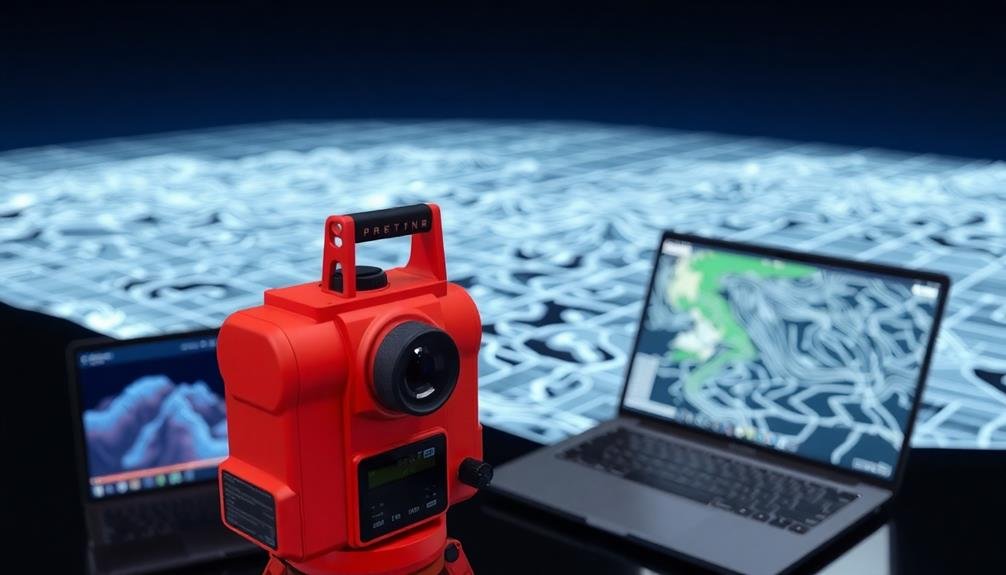
Terrain Modeling and Analysis
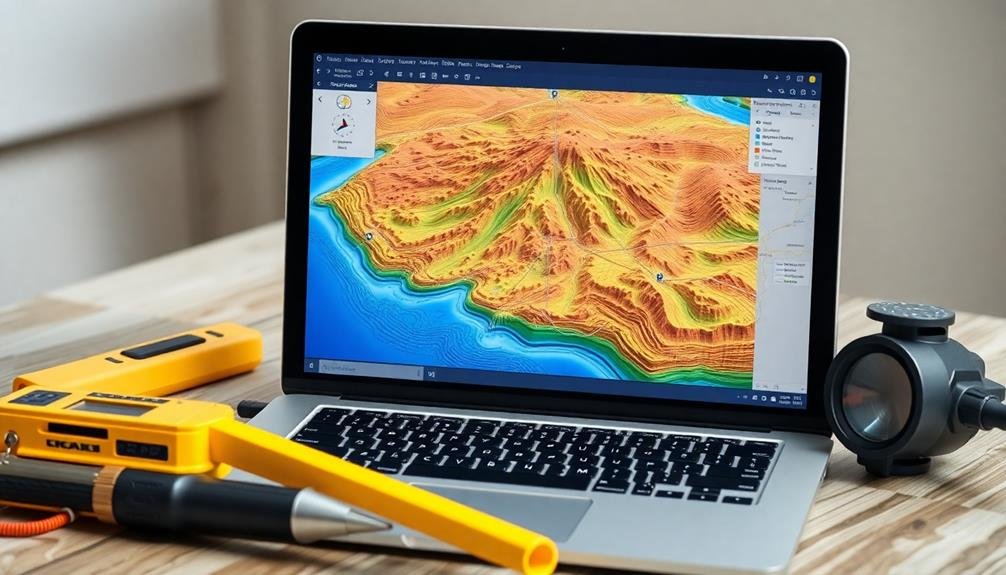
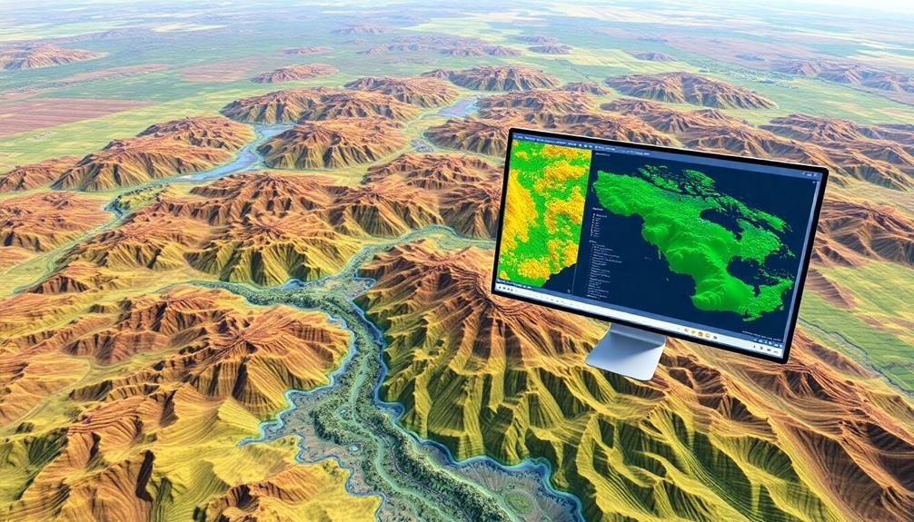
Terrain modeling and analysis form the cornerstone of modern surveying practices. Through virtual learning, you can master the techniques needed to create accurate 3D representations of land surfaces.
You'll learn to use specialized software that processes survey data to generate digital terrain models (DTMs) and digital elevation models (DEMs).
Virtual courses will teach you how to interpret these models, identifying key topographic features like ridges, valleys, and slopes. You'll discover methods for analyzing terrain data to calculate volumes, determine drainage patterns, and assess flood risks.
You'll also learn to create contour maps and cross-sections from your digital models.
Advanced virtual training can cover more complex terrain analysis, including viewshed analysis for determining line-of-sight visibility, and least-cost path analysis for ideal route planning.
You'll gain skills in integrating terrain models with other geospatial data, such as land use information or geological maps, to perform thorough site assessments.
Geographic Information Systems (GIS)
At the heart of modern surveying lies Geographic Information Systems (GIS), a powerful tool for managing, analyzing, and visualizing spatial data. Through virtual learning, you can master GIS software and techniques, enhancing your surveying capabilities considerably.
You'll learn to create and manipulate digital maps, integrate various data sources, and perform complex spatial analyses.
Virtual GIS courses often cover software like ArcGIS or QGIS, teaching you to input survey data, create topographic maps, and perform terrain analysis. You'll also learn to work with different coordinate systems and projections, vital for accurate mapping.
Advanced topics might include remote sensing integration, 3D modeling, and spatial statistics.
Online learning platforms offer hands-on experience with real-world datasets, allowing you to practice creating thematic maps, conducting site suitability analyses, and generating reports.
You'll discover how to use GIS for land-use planning, environmental assessments, and infrastructure design. Additionally, you'll learn to automate workflows using Python scripting, increasing your efficiency in handling large datasets.
Remote Sensing Principles
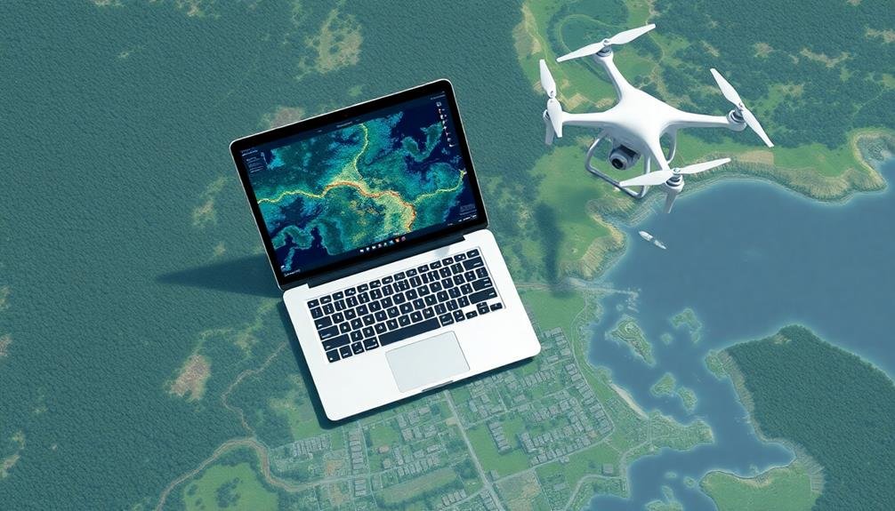
Remote sensing technologies have revolutionized the field of surveying, allowing you to gather detailed spatial information without physical contact. Through virtual learning platforms, you can master the principles of remote sensing and their applications in surveying.
You'll discover how to interpret data collected from satellites, aircraft, and drones, gaining insights into land use, vegetation health, and topography.
Virtual courses will teach you about different remote sensing techniques, including:
- LiDAR (Light Detection and Ranging)
- Multispectral and hyperspectral imaging
- Synthetic Aperture Radar (SAR)
You'll learn to process and analyze remote sensing data using specialized software, enhancing your ability to extract valuable information from imagery.
These skills will enable you to create accurate maps, monitor environmental changes, and support decision-making in various industries.
LiDAR Technology Applications

LiDAR technology has revolutionized 3D mapping capabilities, allowing you to create highly detailed and accurate digital terrain models.
You'll find its remote sensing applications extend to urban planning, forestry management, and archaeological surveys.
LiDAR's ability to penetrate vegetation and capture fine surface details makes it an invaluable tool in your surveying toolkit.
3D Mapping Capabilities
One of the most revolutionary advancements in surveying technology is the integration of LiDAR (Light Detection and Ranging) for 3D mapping capabilities.
You'll find that virtual learning platforms now offer extensive courses on LiDAR technology and its applications in surveying. These courses will teach you how to collect, process, and analyze point cloud data to create accurate 3D models of landscapes, buildings, and infrastructure.
You'll learn about the various types of LiDAR systems, including airborne, terrestrial, and mobile LiDAR, and how to choose the right system for different surveying projects.
Virtual labs and simulations will help you practice using LiDAR software to manipulate and visualize 3D data.
Here are three key skills you'll develop through virtual LiDAR training:
- Point cloud data processing and filtering
- 3D model creation and texturing
- Feature extraction and classification
Remote Sensing Applications
As technology continues to evolve, you'll find that LiDAR's applications in remote sensing have expanded dramatically. This powerful tool now plays a significant role in various industries, from urban planning to environmental conservation. You can learn to harness LiDAR's capabilities for tasks like creating high-resolution digital elevation models, mapping forest canopies, and evaluating flood risks.
Virtual learning platforms offer courses that'll teach you how to process and interpret LiDAR data, giving you valuable skills in demand across multiple sectors. You'll discover how to use specialized software to extract meaningful information from point clouds and create detailed 3D visualizations.
Here's a quick overview of LiDAR applications you can explore virtually:
| Industry | Applications |
|---|---|
| Forestry | Tree height measurement, biomass estimation |
| Archaeology | Site mapping, feature detection |
| Agriculture | Crop health monitoring, precision farming |
| Urban Planning | Building modeling, infrastructure evaluation |
| Geology | Landslide risk evaluation, fault line mapping |
Orthomosaic Creation and Editing

Creating and editing orthomosaics is an essential skill for modern surveyors. You'll learn how to stitch together multiple aerial images to create a single, large-scale, geometrically corrected image. This process involves using specialized software to align and blend overlapping images, accounting for camera distortions and terrain variations.
You'll discover how to import raw imagery, set ground control points, and adjust parameters to produce high-quality orthomosaics.
In virtual learning environments, you can practice:
- Preprocessing techniques to enhance image quality
- Georeferencing methods to guarantee spatial accuracy
- Advanced editing tools for seamless blending and color balancing
You'll also explore different software options, from open-source solutions to professional-grade applications.
As you progress, you'll learn to troubleshoot common issues like misalignments, artifacts, and resolution inconsistencies. Virtual labs will allow you to work with various datasets, simulating real-world scenarios you might encounter in the field.
Point Cloud Generation
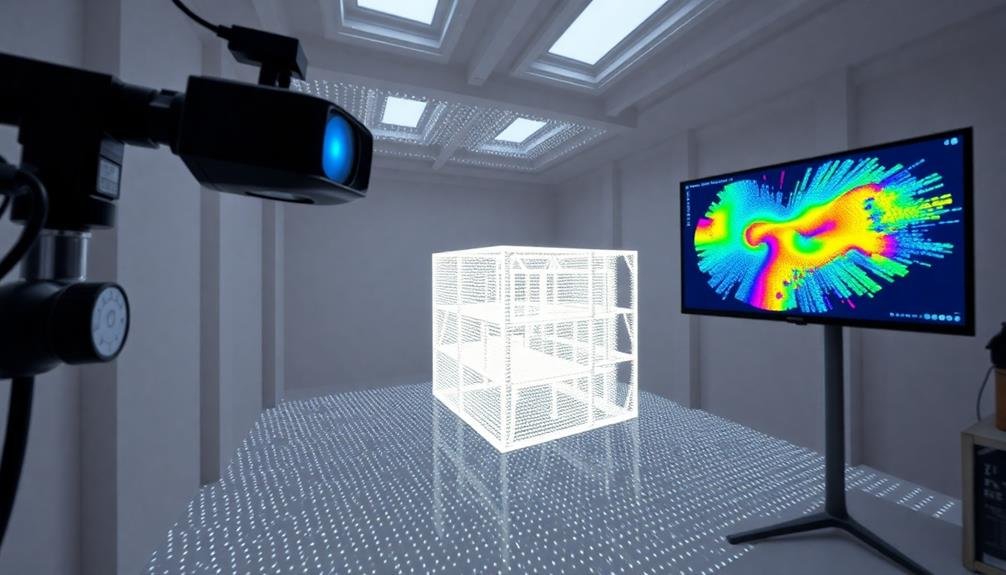
Point cloud generation builds upon the skills you've learned in orthomosaic creation, taking aerial imagery analysis to the next level. You'll discover how to transform 2D aerial images into 3D point clouds, creating highly detailed digital representations of surveyed areas.
In virtual learning environments, you'll master software tools that use photogrammetry techniques to process overlapping images. You'll learn to adjust parameters like point density and noise filtering to optimize your results. The process involves identifying common points across multiple images and calculating their 3D positions.
You'll also explore different types of point clouds, including LiDAR-generated and photogrammetric point clouds, understanding their strengths and limitations.
Virtual courses will teach you how to clean and classify point clouds, removing errors and categorizing points based on features like ground, vegetation, or buildings.
As you progress, you'll learn to extract valuable information from point clouds, such as terrain models, volumetric calculations, and feature extraction.
You'll gain skills in point cloud visualization techniques, allowing you to present your data effectively. These virtual lessons will prepare you to work with real-world point cloud data in various surveying applications.
3D Modeling for Surveying
3D modeling for surveying takes your virtual learning to new heights, building upon the foundation of point cloud generation.
You'll learn to transform raw point cloud data into detailed, interactive 3D models that accurately represent real-world environments. This skill is essential for modern surveyors, as it allows you to create visual representations of landscapes, buildings, and infrastructure that are easily understandable by clients and stakeholders.
Virtual courses will teach you to use specialized software for 3D modeling, such as AutoCAD Civil 3D or Bentley MicroStation.
You'll master techniques for:
- Cleaning and filtering point cloud data to remove noise and errors
- Creating surfaces and terrain models from point clouds
- Generating detailed 3D models of structures and objects within the surveyed area
As you progress, you'll learn to add textures, colors, and other visual elements to enhance the realism of your models.
You'll also discover how to integrate additional data sources, such as aerial imagery or GIS information, to create thorough 3D representations of surveyed areas.
These skills will enable you to produce high-quality deliverables for various surveying projects, from urban planning to construction monitoring.
Drone Regulations and Safety

As you expand your surveying skills to include drone operations, understanding drone regulations and safety becomes vital. You'll need to familiarize yourself with local and national laws governing drone use, including airspace restrictions and licensing requirements. Many countries require drone operators to pass a certification exam and register their drones.
Safety protocols are equally essential. You'll learn about pre-flight checklists, weather considerations, and maintaining visual line of sight. Understanding how to safely launch, operate, and land your drone is important to protect both people and property.
Virtual courses can teach you about:
| Regulation | Safety | Best Practices |
|---|---|---|
| FAA Part 107 | Pre-flight checks | Flight planning |
| No-fly zones | Battery management | Data security |
| Registration | Emergency procedures | Obstacle avoidance |
| Airspace classes | Weather limitations | Communication |
| Privacy laws | Maintenance | Insurance |
Image Georeferencing and Calibration
Accuracy in spatial data is paramount when working with drone imagery. Image georeferencing and calibration are essential skills you can learn virtually to guarantee your drone-captured data is precise and useful.
These processes involve aligning your imagery with known geographic coordinates and correcting for distortions caused by camera lenses or terrain.
You'll learn to use specialized software to add geographic information to your images, allowing them to be accurately overlaid on maps or combined with other spatial data.
Virtual courses will teach you how to:
- Identify and use ground control points (GCPs) to improve spatial accuracy
- Apply lens distortion corrections to enhance image quality
- Perform bundle adjustments to optimize camera positions and orientations
Frequently Asked Questions
How Long Does It Take to Become Proficient in Virtual Surveying Skills?
You can become proficient in virtual surveying skills within 3-6 months of dedicated practice. It'll depend on your learning pace, prior experience, and the specific skills you're focusing on. Consistent hands-on application accelerates your progress.
Can Virtual Surveying Skills Completely Replace Traditional Field Surveying Methods?
While virtual surveying skills offer significant advantages, they can't entirely replace traditional field methods. You'll find that some on-site work is still necessary for accuracy, especially in complex terrain or when dealing with underground features.
What Are the Career Prospects for Professionals With Virtual Surveying Skills?
You'll find excellent career prospects with virtual surveying skills. You're in demand for roles in GIS, remote sensing, and digital mapping. You can work in various industries, including construction, urban planning, and environmental management.
How Often Do Virtual Surveying Technologies and Software Get Updated?
You'll find virtual surveying technologies and software update frequently, often annually or semi-annually. It's essential to stay current, as new features and improvements are regularly introduced. Keep an eye on industry news and vendor announcements for the latest updates.
What Are the Hardware Requirements for Learning Virtual Surveying Skills?
You'll need a powerful computer with a dedicated graphics card, ample RAM, and a fast processor. Don't forget a high-resolution monitor and reliable internet connection. Consider investing in VR headsets for immersive experiences in virtual surveying environments.
In Summary
You've now got a solid foundation in virtual surveying skills. From aerial photogrammetry to 3D modeling, you're equipped to tackle modern surveying challenges. Don't forget to stay updated on drone regulations and safety practices. As technology evolves, keep honing your data processing and GIS skills. With these virtual tools at your disposal, you'll be well-prepared to excel in the field of surveying, whether you're working remotely or on-site.
As educators and advocates for responsible drone use, we’re committed to sharing our knowledge and expertise with aspiring aerial photographers.


Leave a Reply