Surveys have transformed historic site conservation, offering you powerful tools to protect our shared heritage. You'll find aerial mapping reveals hidden deterioration patterns, while 3D modeling enables virtual restoration planning. Structural monitoring helps you track integrity over time, and advanced techniques uncover concealed archaeological features. Remote sensing allows safe documentation of inaccessible areas, enhancing public engagement through interactive displays. You can streamline resource allocation, take precise measurements, and integrate data with GIS for thorough analysis. These revolutionary methods empower you to make informed decisions, ensuring the long-term preservation of cultural treasures. Discover how these innovations are reshaping conservation practices worldwide.
Aerial Mapping of Deterioration Patterns
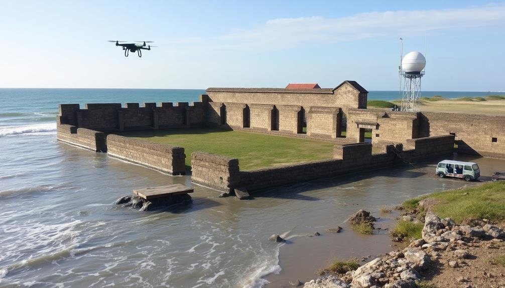
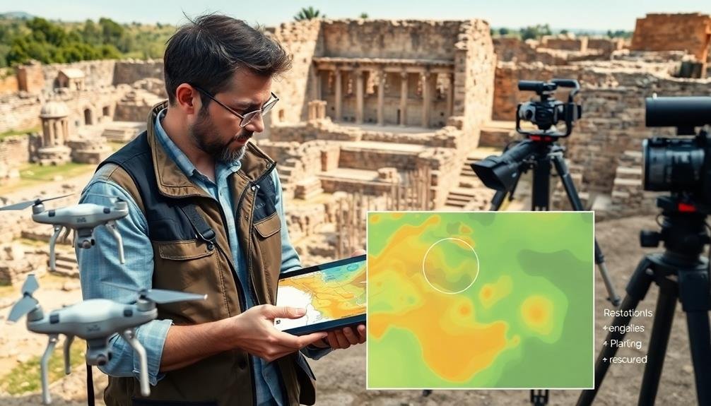
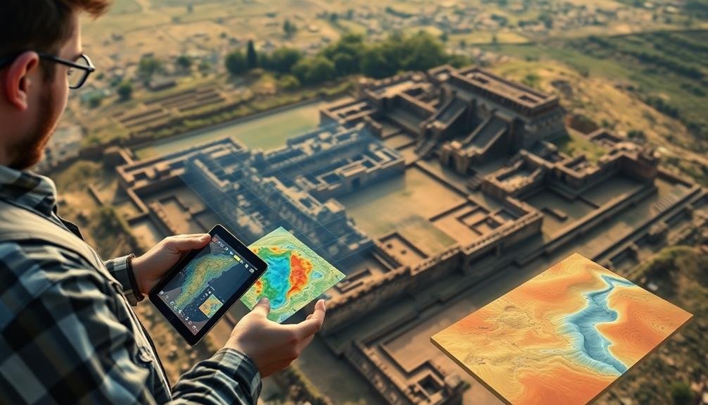
Drones and satellites have revolutionized aerial mapping of deterioration patterns in historic sites. You'll find these technologies offer unparalleled views of large-scale structures and landscapes, revealing issues invisible from the ground. They capture high-resolution imagery and use multispectral sensors to detect moisture, heat signatures, and material changes.
You can now identify structural weaknesses, water damage, and vegetation encroachment with remarkable accuracy. These aerial surveys provide extensive data on roof conditions, wall integrity, and landscape alterations. They're particularly useful for monitoring hard-to-reach areas like steeples, domes, and remote archaeological sites.
By comparing sequential aerial maps, you'll track deterioration rates and patterns over time. This information helps you prioritize conservation efforts and allocate resources effectively. You'll also use this data to create 3D models and detailed topographic maps, enhancing your understanding of the site's context and vulnerabilities.
Aerial mapping techniques have considerably reduced survey time and costs while increasing safety. You no longer need to risk personnel on dangerous scaffolding or in unstable structures. Instead, you'll gather more extensive data in less time, revolutionizing your approach to historic site conservation.
3D Modeling for Restoration Planning
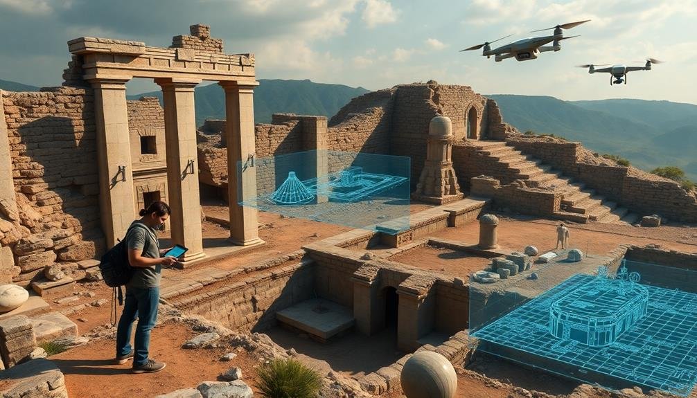
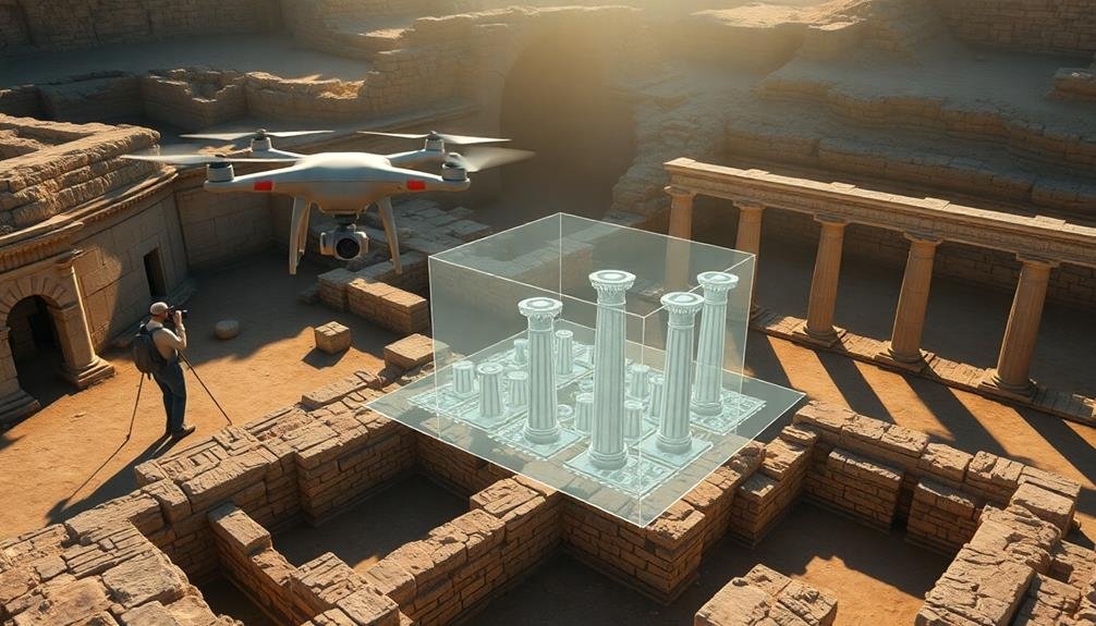
The advent of 3D modeling has transformed restoration planning for historic sites. You can now create highly accurate digital representations of structures, allowing for detailed analysis and planning without physical intervention.
These models provide an all-encompassing view of the site, including hidden areas that may be difficult to access in person.
With 3D modeling, you're able to simulate various restoration scenarios and their potential impacts. You can test different materials, structural modifications, and conservation techniques virtually before implementing them on-site.
This approach greatly reduces the risk of unintended consequences and helps preserve the site's integrity.
You'll find that 3D models also facilitate collaboration among experts from various fields. Architects, conservationists, and historians can work together more effectively, sharing insights and making informed decisions based on the digital representation.
Moreover, you can use these models for documentation purposes, creating a detailed record of the site's current state. This proves invaluable for future reference and monitoring changes over time.
Monitoring Structural Integrity Over Time
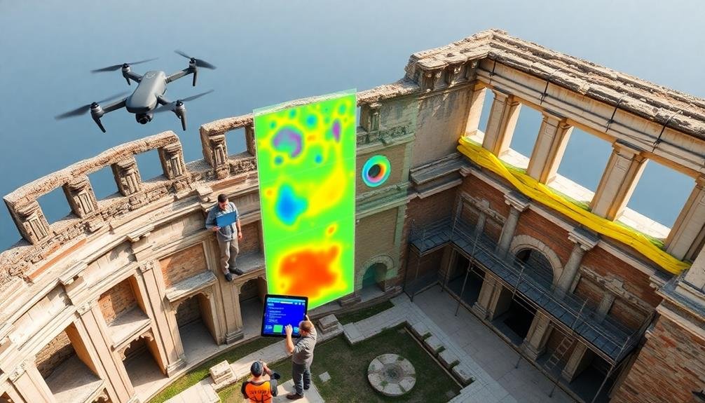
Numerous methods exist for monitoring the structural integrity of historic sites over time. You'll find that regular surveys play an essential role in preserving these valuable structures. By implementing consistent monitoring practices, you can detect early signs of deterioration and prevent catastrophic failures.
To effectively monitor structural integrity, you should:
- Conduct visual inspections: Regularly examine the site for cracks, deformations, or signs of water damage.
- Use non-destructive testing: Employ techniques like ground-penetrating radar or ultrasonic testing to assess internal structures without causing damage.
- Install sensors: Place strain gauges, tilt meters, or vibration sensors to continuously monitor structural movements and stresses.
- Analyze environmental data: Track temperature, humidity, and air pollution levels to understand their impact on the site's condition.
You'll need to establish a baseline for comparison by conducting thorough initial surveys. This allows you to track changes over time accurately.
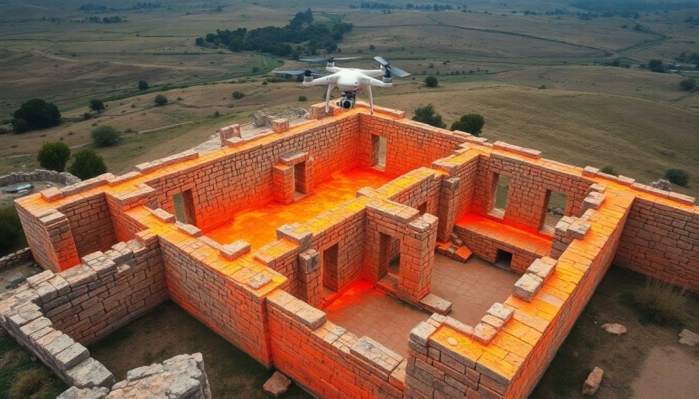
Identifying Hidden Archaeological Features
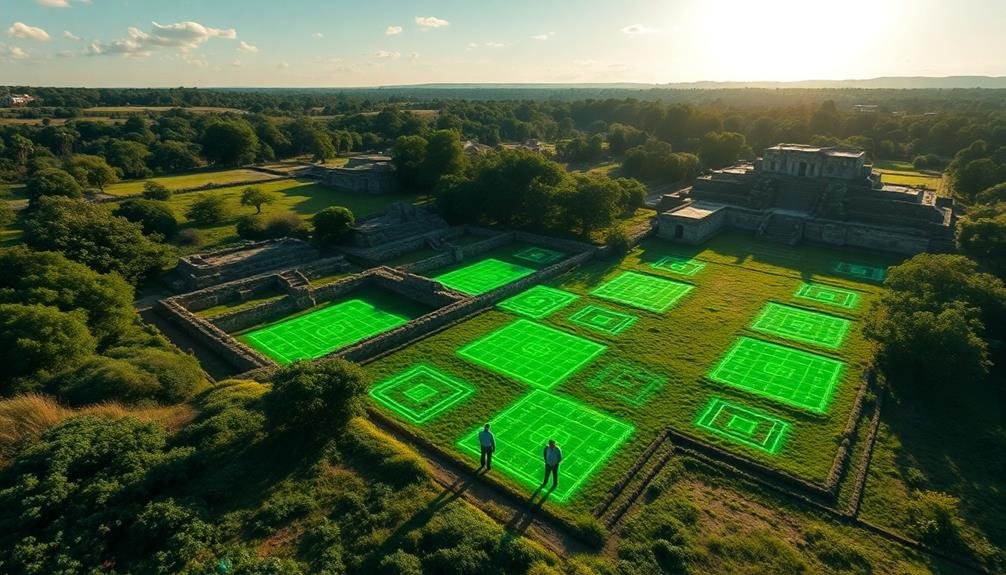
Hidden archaeological features often elude even the most experienced surveyors. However, advanced survey techniques have revolutionized the way you can identify these concealed treasures. Ground-penetrating radar (GPR) allows you to detect subsurface structures without disturbing the soil. You'll find this non-invasive method particularly useful for locating buried walls, foundations, and artifacts.
Another powerful tool at your disposal is LiDAR (Light Detection and Ranging). This remote sensing method uses laser pulses to create detailed 3D maps of the landscape, revealing subtle topographical changes that may indicate hidden structures or features. You'll be amazed at how LiDAR can disclose ancient roads, building foundations, and even entire lost cities beneath dense vegetation.
| Survey Method | Depth Range | Best for Detecting |
|---|---|---|
| GPR | 0-10m | Walls, artifacts |
| LiDAR | Surface | Landscape features |
| Magnetometry | 0-2m | Metal objects |
Don't overlook the value of magnetometry in your survey toolkit. This technique measures magnetic variations in the soil, helping you pinpoint buried metal objects and areas of past human activity. By combining these advanced survey methods, you'll reveal a wealth of hidden archaeological features, enriching your understanding of historic sites.
Documenting Inaccessible Areas Safely
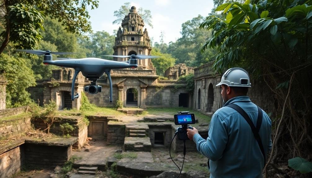
When it comes to documenting inaccessible areas safely, you'll need to think outside the box. Traditional survey methods often fall short when faced with hazardous or hard-to-reach locations.
Fortunately, modern technology offers innovative solutions to capture essential data without putting surveyors at risk.
You can employ remote sensing techniques to document inaccessible areas safely:
- LiDAR scanning: Use aerial or ground-based LiDAR to create detailed 3D models of structures and landscapes, even in dense vegetation or challenging terrain.
- Drone photography: Deploy drones equipped with high-resolution cameras to capture aerial imagery and video of hard-to-reach sites.
- Thermal imaging: Utilize infrared cameras to detect hidden features, structural issues, or moisture problems in buildings without direct access.
- Ground-penetrating radar: Employ GPR to map subsurface features and artifacts without excavation.
These methods not only guarantee surveyor safety but also provide thorough data for conservation efforts.
By combining multiple techniques, you'll gain a more complete understanding of the site's condition and historical significance.
Remember to consult local regulations and obtain necessary permits before using any of these technologies at a historic site.
Assessing Environmental Impact on Sites
You'll need to assess various environmental factors affecting historic sites to guarantee their long-term preservation.
Start by monitoring climate change effects, such as increased rainfall or temperature fluctuations, which can accelerate decay.
Next, evaluate pollution exposure and its impact on materials, while also tracking visitor footfall and behavior to manage wear and tear on the site.
Monitoring Climate Change Effects
Climate change poses a significant threat to historic sites worldwide, necessitating vigilant monitoring of its effects. You'll find that surveys play an essential role in tracking these impacts, allowing conservationists to develop targeted preservation strategies.
By employing advanced technologies and methodical approaches, you're able to gather critical data on how climate change is affecting historic structures and landscapes.
To effectively monitor climate change effects on historic sites, you'll need to focus on:
- Temperature and humidity fluctuations
- Extreme weather events and their frequency
- Sea level rise and coastal erosion
- Changes in vegetation and biodiversity
You'll use a combination of on-site measurements, remote sensing, and historical data analysis to build a thorough picture of climate-related changes.
This information helps you identify vulnerable areas and prioritize conservation efforts. You're also able to track the effectiveness of adaptation measures over time, ensuring that your strategies remain relevant and effective.
Pollution Exposure Assessment
Beyond climate change, pollution poses another significant threat to historic sites. You'll find that surveys play an essential role in evaluating pollution exposure and its impact on these irreplaceable treasures. By conducting regular pollution evaluations, you're able to identify potential risks and implement protective measures.
These surveys typically focus on three main types of pollutants:
| Pollutant Type | Sources | Effects |
|---|---|---|
| Air Pollution | Vehicle emissions, industrial activities | Stone erosion, discoloration |
| Water Pollution | Acid rain, contaminated groundwater | Foundation damage, material decay |
| Soil Pollution | Chemical spills, underground storage tanks | Structural instability, material degradation |
You'll use various techniques to measure pollution levels, including air quality monitors, water sampling, and soil analysis. These methods help you quantify the exposure and determine the potential long-term effects on historic structures and artifacts.
By conducting regular pollution exposure evaluations, you're able to:
- Identify pollution sources and trends
- Develop targeted conservation strategies
- Prioritize interventions based on risk levels
- Monitor the effectiveness of mitigation measures
Ultimately, these surveys enable you to make informed decisions about protecting historic sites from pollution-related damage, ensuring their preservation for future generations.
Visitor Impact Tracking
Footfall presents a double-edged sword for historic sites. While visitors bring revenue and appreciation, they also contribute to wear and tear. That's where visitor impact tracking comes in. By conducting surveys and analyzing data, you can effectively monitor and manage the environmental impact of tourism on your site.
To track visitor impact, you'll need to:
- Implement visitor counting systems at entry points
- Conduct regular surveys on visitor behavior and movement patterns
- Use technology like GPS tracking or mobile apps to map high-traffic areas
- Install environmental sensors to monitor air quality, humidity, and vibration levels
With this data, you'll be able to identify areas of concern and implement targeted conservation measures. You can adjust visitor routes, limit access to sensitive areas, or introduce timed entry systems to reduce congestion.
By understanding visitor behavior, you'll also be able to design more effective educational programs and interpretive materials.
Visitor impact tracking isn't just about preservation; it's about enhancing the visitor experience. By managing crowds and protecting the site, you're ensuring that future generations can enjoy and learn from these historic treasures.
Enhancing Public Engagement and Education
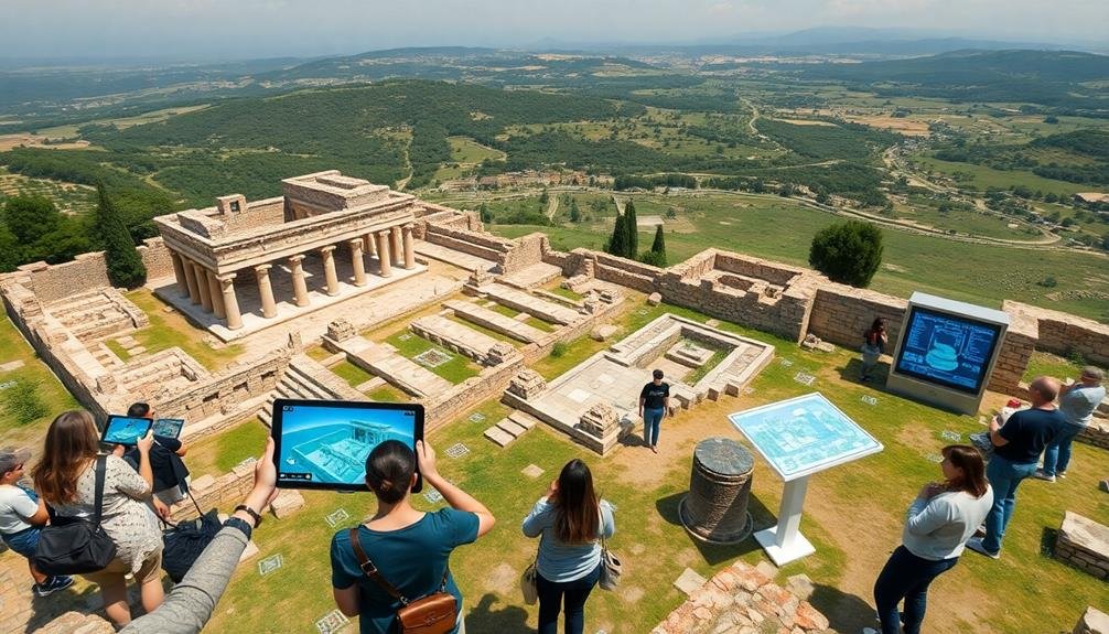
Engaging the public in historic site conservation is essential for its long-term success. Surveys play a vital role in enhancing public engagement and education at historic sites. You'll find that these tools help conservationists understand visitors' knowledge levels, interests, and learning preferences.
By conducting pre-visit surveys, you can gauge visitors' expectations and tailor educational programs accordingly. On-site questionnaires allow you to assess the effectiveness of current interpretive materials and guided tours. You'll gain insights into which aspects of the site resonate most with visitors and where there's room for improvement.
Post-visit surveys help you measure the impact of educational initiatives and track changes in visitors' understanding of the site's historical significance. You can use this data to refine your educational approach and create more engaging experiences.
Online surveys extend your reach beyond physical visitors, allowing you to gather input from a broader audience. You'll be able to test potential new programs, exhibits, or digital resources before implementation.
Streamlining Resource Allocation Decisions
Surveys can zero in on the most critical areas for resource allocation in historic site conservation. You'll find that these tools provide invaluable insights into where your limited resources will have the greatest impact. By collecting data on site conditions, visitor preferences, and preservation needs, you're able to make informed decisions about where to invest your time and money.
When you're prioritizing conservation efforts, surveys help you:
- Identify the most at-risk areas of a historic site
- Determine which restoration projects will resonate most with visitors
- Assess the potential return on investment for various conservation initiatives
- Gauge public interest in different aspects of the site's history
You'll discover that surveys enable you to allocate resources more efficiently, ensuring that every dollar spent contributes to the site's long-term preservation and relevance.
They'll help you balance immediate conservation needs with visitor expectations, allowing you to create a sustainable management plan. By using survey data to guide your decision-making process, you're not just preserving history; you're maximizing the impact of your conservation efforts and creating a more engaging experience for future generations.
Facilitating Accurate Measurements and Dimensions
Precision tools and techniques are vital for facilitating accurate measurements and dimensions in historic site conservation. You'll find that surveys provide invaluable data for creating detailed site plans, elevations, and 3D models. These tools help you capture the exact dimensions of buildings, structures, and landscape features with millimeter-level accuracy.
When you're working on a historic site, you'll use advanced surveying equipment like total stations, LiDAR scanners, and photogrammetry to collect extensive spatial data. These technologies allow you to record intricate architectural details, surface textures, and even hidden features that mightn't be visible to the naked eye.
You'll appreciate how modern survey methods can quickly generate point clouds and digital terrain models, giving you a precise representation of the site's topography and built environment. This data becomes essential for planning restoration work, monitoring structural changes over time, and creating accurate documentation for future reference.
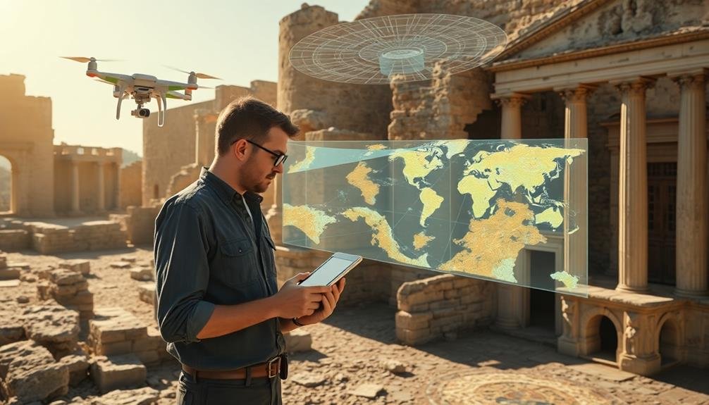
Integrating With GIS for Analysis
Geographic Information Systems (GIS) offer a powerful platform for analyzing survey data in historic site conservation. You'll find that integrating survey results with GIS enhances your ability to understand, manage, and preserve historic sites.
By combining spatial data with other information, you're able to create thorough, layered maps that reveal patterns and relationships not easily visible otherwise.
When you integrate survey data with GIS, you'll benefit from:
- Improved spatial analysis: You can overlay various data sets to identify correlations between site features, environmental factors, and degradation patterns.
- Enhanced visualization: You're able to create 3D models and interactive maps that make complex data more accessible and understandable.
- Efficient data management: You can store, update, and retrieve large amounts of survey data easily, ensuring your information stays current and organized.
- Better decision-making: You're equipped with tools to perform predictive modeling, helping you prioritize conservation efforts and allocate resources effectively.
Frequently Asked Questions
How Much Does a Typical Historic Site Conservation Survey Cost?
You'll find that historic site conservation survey costs vary widely. They can range from $5,000 to $50,000 or more, depending on the site's size, complexity, and the survey's scope. It's best to get quotes from multiple providers.
What Qualifications Are Required to Conduct Conservation Surveys?
To conduct conservation surveys, you'll need a degree in archaeology, conservation, or a related field. You should have experience in historic preservation, knowledge of survey techniques, and familiarity with relevant laws and regulations. Certification can be beneficial.
How Long Does a Comprehensive Survey of a Historic Site Usually Take?
You'll find that a thorough historic site survey can take anywhere from a few days to several months. It depends on the site's size, complexity, and accessibility. You're looking at longer timelines for larger, more intricate sites.
Are There International Standards for Historic Site Conservation Surveys?
Yes, there are international standards for historic site conservation surveys. You'll find guidelines from organizations like UNESCO and ICOMOS. They'll help you guarantee your survey methods are consistent with global best practices for heritage preservation.
Can Survey Data Be Used for Purposes Other Than Conservation?
You'll find survey data's versatile. It's not just for conservation. You can use it for research, education, tourism planning, and urban development. It'll give you insights into demographics, visitor preferences, and economic impact too.
In Summary
You've seen how surveys transform historic site conservation. They're not just tools; they're game-changers. From mapping decay to uncovering hidden treasures, these methods revolutionize preservation efforts. You'll find they enhance public engagement, streamline decision-making, and provide essential data for restoration. As technology advances, you can expect even more innovative survey techniques to emerge. Embrace these methods, and you'll be at the forefront of protecting our shared heritage for future generations.
As educators and advocates for responsible drone use, we’re committed to sharing our knowledge and expertise with aspiring aerial photographers.


Leave a Reply