
To conduct smart parking surveys using sky-high imagery, start by selecting a drone with high-resolution cameras and ideal flight time. Plan your flight path carefully, considering obstacles and coverage area. Choose the best time for surveys, typically early afternoon on clear days. Guarantee proper image resolution by adjusting altitude and using quality cameras. Leverage automated counting software for accurate vehicle detection. Identify illegal parking hotspots and map parking space dimensions precisely. Integrate your data with GIS for thorough analysis. Monitor seasonal trends to capture demand fluctuations. By following these tips, you'll reveal valuable insights to revolutionize urban parking management.
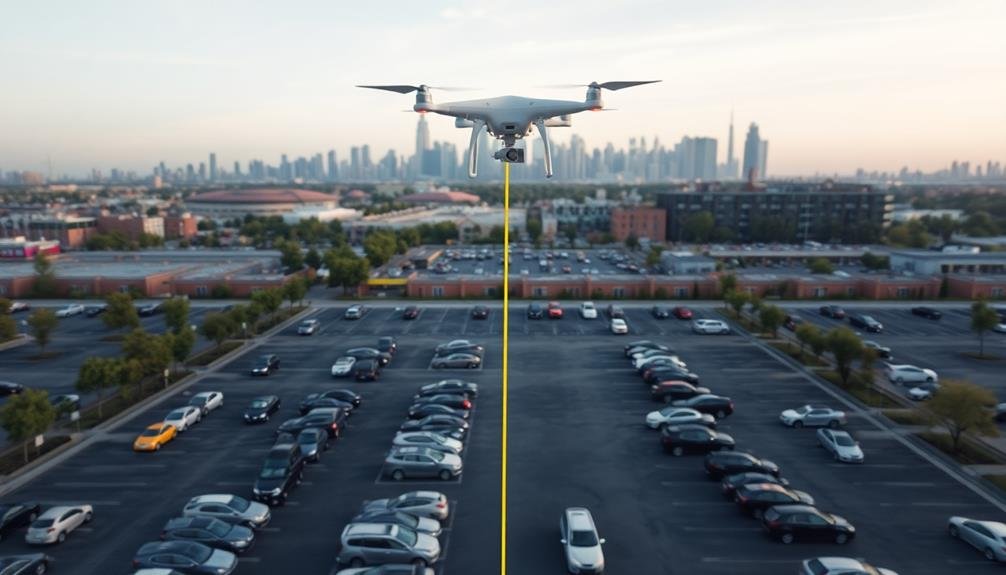
Choose the Right Drone

Three key factors come into play when choosing the right drone for smart parking surveys: image quality, flight time, and ease of use.
For optimal outcomes, select a drone with a high-resolution camera capable of capturing clear, detailed images of parking spaces and vehicles. Look for models offering at least 12MP resolution and 4K video capabilities.
Consider the drone's flight time, as longer battery life allows for more thorough surveys without frequent interruptions. Aim for drones with a minimum flight time of 25-30 minutes per battery charge. Some models offer extended flight times of up to 45 minutes, which can be particularly useful for larger parking areas.
Ease of use is vital, especially if you're new to drone operations. Choose a drone with intuitive controls, autonomous flight modes, and obstacle avoidance features. These elements will help you focus on capturing accurate parking data rather than struggling with piloting.
Additionally, verify your chosen drone complies with local regulations and has the necessary certifications. Some areas may require specific licenses or permits for commercial drone use.
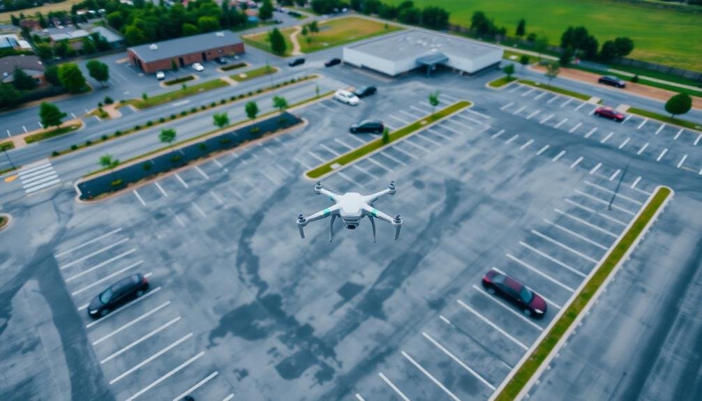
Plan Your Flight Path
When planning your drone flight path for a smart parking survey, you'll need to optimize aerial coverage to capture all relevant areas efficiently.
Consider your time constraints, as battery life and daylight hours may limit your survey duration.
Don't forget to account for obstacles like tall buildings, trees, or power lines that could interfere with your drone's path or block visibility of parking spaces.
Optimize Aerial Coverage
To maximize the efficiency of your smart parking survey, planning an ideal flight path is essential. When refining aerial coverage, you'll want to guarantee you capture all relevant parking areas while minimizing flight time and battery usage.
Start by identifying the boundaries of your survey area and marking key parking zones on your map.
Consider the following factors when planning your flight path:
- Altitude: Higher altitudes cover more ground but may sacrifice image resolution
- Overlap: Guarantee sufficient image overlap for accurate stitching and analysis
- Obstacles: Account for buildings, trees, and other obstructions that may interfere with your flight
Design a grid pattern that systematically covers the entire survey area, adjusting for parking lot shapes and sizes. You can use specialized flight planning software to automate this process and calculate the most efficient route.
Don't forget to factor in takeoff and landing locations, as well as any no-fly zones or restricted airspace.
If you're surveying a large area, consider dividing it into multiple flights to maintain battery life and image quality.
Remember to check weather conditions and schedule your flights during ideal lighting conditions for the best results.
Consider Time Constraints
Time is a critical factor when planning your smart parking survey flight path. You'll need to balance the need for thorough coverage with the limitations of your drone's battery life and legal flight time restrictions.
Consider the size of the area you're surveying and estimate how long it'll take to cover it completely. Factor in time for takeoff, landing, and any necessary battery changes.
Plan your flight during ideal lighting conditions, typically when the sun is high but not directly overhead to minimize shadows. Avoid rush hours or peak parking times that might skew your data.
If you're surveying multiple areas, prioritize them based on time sensitivity and schedule accordingly.
Remember to account for potential obstacles like tall buildings or trees that might require adjustments to your flight path. Weather conditions can also impact your timeline, so always check forecasts and have contingency plans.
If you're operating in controlled airspace, factor in time for obtaining necessary authorizations. By carefully considering these time constraints, you'll guarantee a more efficient and effective smart parking survey, maximizing the value of your sky-high imagery data collection efforts.
Account for Obstacles
Carefully plotting your flight path, you'll need to account for various obstacles that could interfere with your smart parking survey. Consider tall buildings, trees, power lines, and other structures that might obstruct your drone's view or pose a safety risk.
Map out these potential hazards beforehand to guarantee a smooth and efficient flight.
When planning your route, factor in the following:
- No-fly zones: Identify restricted areas, such as airports or government facilities, and adjust your path accordingly.
- Weather conditions: Wind, precipitation, and temperature can affect your drone's performance and image quality.
- Sun position: The angle of sunlight can create shadows or glare, impacting the accuracy of your parking space count.
Use satellite imagery or previous aerial photographs to identify potential problem areas. If possible, conduct a ground-level reconnaissance to spot any recent changes or temporary obstacles not visible in older images.
Remember to maintain visual line of sight with your drone at all times, as required by most regulations.
Optimal Time for Aerial Surveys

When conducting aerial surveys for smart parking solutions, selecting the right time is essential for accurate data collection. You'll want to choose a time when parking lots are at their peak occupancy to get the most representative data. Typically, this means conducting surveys during weekday business hours for urban areas or shopping centers.
Avoid rush hour periods, as moving traffic can obscure parking spaces and skew results. Early afternoon, between 1 PM and 3 PM, often provides the best window for surveying. This timeframe allows for stable lighting conditions and minimal shadows, which can interfere with image analysis.
Consider seasonal variations in parking patterns. Summer months may show different usage trends compared to winter, especially in tourist areas or near educational institutions.
You'll also need to account for weather conditions. Clear, sunny days offer ideal visibility for aerial imagery. Overcast skies can reduce contrast and make it harder to distinguish between parked vehicles and empty spaces.
For ongoing monitoring, conduct surveys at consistent times to guarantee comparable data across multiple collection periods. This approach will help you identify trends and make informed decisions about parking management strategies.
Ensure Proper Image Resolution
Having selected the ideal time for your aerial survey, you'll need to focus on image quality. Securing proper image resolution is essential for accurate parking space analysis. You'll want to capture clear, detailed images that allow you to distinguish individual vehicles and parking lines.
To achieve peak resolution, take into account these factors:
- Altitude: Lower altitudes generally provide higher resolution, but cover less area. Find the right balance for your needs.
- Camera specifications: Use a high-quality camera with appropriate megapixel count and sensor size.
- Image overlap: Guarantee sufficient overlap between images for accurate stitching and analysis.
Aim for a ground sampling distance (GSD) of 5 cm/pixel or better. This resolution allows for clear identification of vehicles and parking space markings.
You'll also want to reflect on the file format and compression settings. Capture images in RAW format if possible, as it provides more flexibility in post-processing.
Don't forget to test your setup before the actual survey. Perform a small-scale test flight to verify image quality and adjust settings as needed.
Use Automated Counting Software
After capturing high-quality aerial images, it's time to leverage automated counting software for efficient analysis. These powerful tools can considerably streamline your parking survey process, saving you time and reducing human error.
Look for software that uses machine learning algorithms to detect and count vehicles in your aerial imagery.
When selecting automated counting software, prioritize options with high accuracy rates and the ability to distinguish between different vehicle types. You'll want a program that can differentiate between cars, trucks, and motorcycles for thorough data collection.
Make sure the software can handle various parking layouts, including parallel, angled, and perpendicular spaces.
Many automated counting programs offer additional features like heat mapping and occupancy rate calculations. These can provide valuable insights into parking patterns and usage trends. Some software even allows you to mark specific areas of interest or exclude certain zones from the count.
Before fully relying on the software, validate its results by manually checking a sample of the counted areas. This will help you gauge the program's accuracy and make any necessary adjustments.
Analyze Peak vs. Off-Peak Hours

Analyze peak versus off-peak hours to gain valuable insights into your parking facility's usage patterns.
You'll want to compare occupancy rates during different times of the day and week, allowing you to identify high-demand periods and underutilized slots.
Compare Occupancy Rates
How do parking patterns shift throughout the day? By comparing occupancy rates across different time periods, you'll gain valuable insights into parking dynamics. Start by dividing your data into peak and off-peak hours, typically based on rush hour traffic or local business hours. Analyze these periods separately to identify trends and patterns.
When comparing occupancy rates, consider:
- Weekday vs. weekend differences
- Seasonal variations
- Special events or holidays
Look for patterns in how quickly lots fill up during peak hours and how long they remain at capacity. Pay attention to areas that consistently reach maximum occupancy, as these may indicate a need for expansion or improved management.
During off-peak hours, note which areas maintain higher occupancy rates, as they might benefit from adjusted pricing or time limits.
Don't forget to examine the correlation between occupancy rates and factors like weather, nearby attractions, or public transportation schedules. By understanding these relationships, you can better predict future parking needs and optimize your parking strategy.
Use your findings to inform decisions about pricing, enforcement, and infrastructure improvements, ensuring your parking facilities meet demand efficiently throughout the day.
Identify Traffic Patterns
Understanding traffic patterns is essential for effective smart parking management. By analyzing peak vs. off-peak hours using sky-high imagery, you'll gain valuable insights into parking demand fluctuations. Start by identifying key timeframes throughout the day and week when parking areas experience high occupancy.
Use time-lapse aerial footage to observe vehicle movements and parking patterns. You'll notice distinct differences between weekdays and weekends, as well as variations based on local events or seasonal changes. Pay attention to:
| Time Period | Typical Patterns |
|---|---|
| Morning | Commuter influx |
| Midday | Lunch hour turnover |
| Afternoon | School pickup, shift changes |
| Evening | Dining and entertainment surge |
| Late Night | Residential area saturation |
Armed with this information, you can optimize parking resource allocation and pricing strategies. Consider implementing dynamic pricing models that adjust rates based on demand during peak hours. You might also use this data to guide the installation of smart parking sensors or digital signage to direct drivers to available spaces efficiently. By understanding traffic patterns, you'll be better equipped to reduce congestion, improve user experience, and maximize parking revenue.
Identify Illegal Parking Hotspots

Pinpointing illegal parking hotspots is essential for effective smart parking management. By analyzing sky-high imagery, you can identify areas where drivers frequently park illegally, causing congestion and safety hazards.
Look for patterns of vehicles parked in no-parking zones, blocking driveways, or occupying spaces reserved for emergency vehicles.
To identify illegal parking hotspots, focus on:
- High-traffic areas near popular destinations
- Narrow streets with limited parking options
- Zones with unclear or poorly visible parking regulations
Once you've identified these hotspots, you can take targeted action to address the issue.
Consider implementing stricter enforcement measures, such as increased patrols or automated ticketing systems. You might also need to reassess parking regulations in these areas, potentially adding more legal parking spaces or improving signage to clarify restrictions.
Use the data collected from sky-high imagery to create heat maps of illegal parking incidents. This visual representation will help you prioritize problem areas and allocate resources effectively.
Map Parking Space Dimensions

In light of effective smart parking management, accurately mapping parking space dimensions is essential. You'll need to utilize high-resolution aerial imagery to measure and record the exact size of each parking spot. This data helps optimize space utilization and guarantees compliance with local regulations.
Start by identifying different types of parking spaces in your area, such as parallel, perpendicular, and angled spots. Use image analysis software to measure the length and width of each space. Don't forget to account for variations in dimensions for handicap, compact, and oversized vehicle spots.
Here's a quick reference guide for standard parking space dimensions:
| Parking Type | Length (ft) | Width (ft) |
|---|---|---|
| Parallel | 22-23 | 8-9 |
| Perpendicular | 18-20 | 9-10 |
| Angled (45°) | 19-21 | 9-10 |
| Handicap | 20-22 | 12-14 |
Remember to take into account factors like turning radii and aisle widths when mapping your parking layout. This thorough approach will help you maximize parking efficiency and improve overall user experience. By accurately mapping parking space dimensions, you'll lay the groundwork for implementing smart parking solutions and optimizing your parking infrastructure.
Integrate With GIS Data

Integrate your parking survey data with Geographic Information Systems (GIS) to enhance your analysis capabilities.
You'll be able to layer relevant mapping information, such as land use, population density, or traffic patterns, over your parking data.
This integration allows you to efficiently analyze spatial relationships and make data-driven decisions about parking management and infrastructure planning.
Layer Relevant Mapping Information
Geographic Information Systems (GIS) data can revolutionize your smart parking survey. By layering relevant mapping information, you'll gain an extensive understanding of your parking landscape.
Start by identifying the key data layers that'll enhance your survey's effectiveness. These may include street networks, land use zones, and points of interest.
Integrate these layers into your aerial imagery analysis to create a rich, multi-dimensional view of your parking ecosystem. You'll be able to:
- Visualize parking demand hotspots in relation to nearby attractions or businesses
- Identify potential areas for parking expansion based on current land use and zoning regulations
- Analyze traffic flow patterns and their impact on parking availability
Don't forget to evaluate temporal data as well. Layer time-based information, such as peak hours for different business types or event schedules, to capture the dynamic nature of parking demand.
By combining these diverse data sets, you'll uncover valuable insights that might otherwise remain hidden. Use this layered approach to inform your parking management strategies, optimize resource allocation, and improve overall urban mobility.
Analyze Spatial Relationships Efficiently
Efficient analysis of spatial relationships is essential for maximizing the value of your smart parking survey. By integrating your aerial imagery with Geographic Information System (GIS) data, you'll uncover valuable insights about parking patterns and infrastructure.
Start by overlaying your imagery with existing GIS layers, such as road networks, land use zones, and public transit routes. This combination will help you identify correlations between parking demand and surrounding urban features.
Use spatial analysis tools to calculate distances between parking areas and key points of interest, like shopping centers, offices, or entertainment venues. You can then create heat maps to visualize parking hotspots and areas of high demand.
Don't forget to incorporate temporal data to understand how parking patterns change throughout the day or week.
Consider employing cluster analysis to group similar parking areas based on their characteristics and usage patterns. This can help you identify trends and make informed decisions about parking management strategies.
Monitor Seasonal Parking Trends

Seasonal changes can considerably impact parking patterns in many areas. To effectively monitor these trends using sky-high imagery, you'll need to conduct regular surveys throughout the year. This approach allows you to capture fluctuations in parking demand and usage across different seasons.
When analyzing seasonal parking trends, focus on:
- Comparing occupancy rates during peak and off-peak seasons
- Identifying shifts in parking hotspots as weather conditions change
- Tracking changes in parking duration and turnover rates across seasons
By consistently collecting and analyzing this data, you'll gain valuable insights into how seasonal factors affect parking behavior. You can use this information to adjust parking strategies, such as implementing dynamic pricing models or temporary parking restrictions during high-demand periods.
Don't forget to take into account special events or holidays that might skew your data. Factor these into your analysis to ascertain you're accurately capturing true seasonal trends rather than one-off occurrences.
Additionally, look for patterns that repeat annually, as these can help you predict future parking needs and plan accordingly. With a thorough understanding of seasonal parking trends, you'll be better equipped to optimize your parking infrastructure and improve user experience year-round.
Frequently Asked Questions
How Do Weather Conditions Affect Drone-Based Parking Surveys?
Weather conditions greatly impact your drone-based parking surveys. You'll face challenges with wind, rain, and extreme temperatures. They can affect flight stability, image quality, and battery life. Always check forecasts and plan accordingly for ideal results.
What Legal Permissions Are Required for Conducting Aerial Parking Surveys?
You'll need to obtain FAA approval and local permits for aerial parking surveys. Don't forget to secure property owners' consent and adhere to privacy laws. It's essential you're aware of no-fly zones and airspace restrictions.
Can Smart Parking Surveys Detect Electric Vehicle Charging Stations?
Yes, you can detect electric vehicle charging stations through smart parking surveys. They'll use high-resolution imagery and AI to identify unique features like charging ports and signage. You'll get accurate data on the number and location of charging spots.
How Accurate Are Automated Counting Systems for Identifying Occupied Parking Spaces?
You'll find automated counting systems for occupied parking spaces are quite accurate, often exceeding 95% accuracy. They're not perfect, though. Factors like weather, lighting, and obstructions can impact results, so occasional manual verification is still recommended.
What Are the Privacy Concerns Associated With Aerial Parking Surveys?
You should be aware of privacy concerns with aerial parking surveys. They can capture personal information like license plates and individual movements. There's a risk of data misuse or unauthorized surveillance, so proper safeguards and regulations are essential.
In Summary
You've now got the tools to revolutionize your parking surveys. By using drones and high-resolution imagery, you'll gain invaluable insights into parking patterns, space utilization, and potential problem areas. Don't forget to integrate your findings with existing data systems for a thorough view. With these smart techniques, you're set to make data-driven decisions that'll improve parking management and urban planning in your area. Keep soaring to new heights in parking analysis!
As educators and advocates for responsible drone use, we’re committed to sharing our knowledge and expertise with aspiring aerial photographers.


Leave a Reply